Search This Blog

Sunday, May 27, 2018

Deep sea mining

From Wikipedia, the free encyclopedia

Deep sea mining is a relatively new mineral retrieval process that takes place on the ocean floor. Ocean mining sites are usually around large areas of polymetallic nodules or active and extinct hydrothermal vents at 1,400 to 3,700 metres (4,600 to 12,100 ft) below the ocean’s surface.[1] The vents create globular or massive sulfide deposits, which contain valuable metals such as silver, gold, copper, manganese, cobalt, and zinc.[2][3] The deposits are mined using either hydraulic pumps or bucket systems that take ore to the surface to be processed. As with all mining operations, deep sea mining raises questions about its potential environmental impact. Environmental advocacy groups such as Greenpeace and the Deep sea Mining Campaign[4] have argued that seabed mining should not be permitted in most of the world's oceans because of the potential for damage to deepsea ecosystems and pollution by heavy metal laden plumes.[2]

Brief history

In the 1960s the prospect of deep-sea mining was brought up by the publication of J. L. Mero's Mineral Resources of the Sea.[3] The book claimed that nearly limitless supplies of cobalt, nickel and other metals could be found throughout the planet's oceans. Mero stated that these metals occurred in deposits of manganese nodules, which appear as lumps of compressed flowers on the seafloor at depths of about 5,000 m. Some nations including France, Germany and the United States sent out research vessels in search of nodule deposits. One such vessel was the Glomar Explorer. Initial estimates of deep sea mining viability turned out to be much exaggerated. This overestimate, coupled with depressed metal prices, led to the near abandonment of nodule mining by 1982. From the 1960s to 1984 an estimated US $650 million had been spent on the venture, with little to no return.[3]

Over the past decade a new phase of deep-sea mining has begun. Rising demand for precious metals in Japan, China, Korea and India has pushed these countries in search of new sources. Interest has recently shifted toward hydrothermal vents as the source of metals instead of scattered nodules. The trend of transition towards an electricity-based information and transportation infrastructure currently seen in western societies further pushes demands for precious metals. The current revived interest in phosphorus nodule mining at the seafloor stems from phosphor-based artificial fertilizers being of significant importance for world food production. Growing world population pushes the need for artificial fertilizers or greater incorporation of organic systems within agricultural infrastructure.

Currently, the best potential deep sea site, the Solwara 1 Project, has been found in the waters off Papua New Guinea, a high grade copper-gold resource and the world's first Seafloor Massive Sulphide (SMS) resource.[5] The Solwara 1 Project is located at 1600 metres water depth in the Bismarck Sea, New Ireland Province.[5] Using ROV (remotely operated underwater vehicles) technology developed by UK-based Soil Machine Dynamics, Nautilus Minerals Inc. is first company of its kind to announce plans to begin full-scale undersea excavation of mineral deposits.[6] However a dispute with the government of Papua-New Guinea delayed production and its now scheduled to commence commercial operations in early 2018.[5]

Laws and regulations

The international law–based regulations on deep sea mining are contained in the United Nations Conventions on the Law of the Sea from 1973 to 1982, which came into force in 1994.[2][3] The convention set up the International Seabed Authority (ISA), which regulates nations’ deep sea mining ventures outside each nations’ Exclusive Economic Zone (a 200-nautical-mile (370 km) area surrounding coastal nations). The ISA requires nations interested in mining to explore two equal mining sites and turn one over to the ISA, along with a transfer of mining technology over a 10- to 20-year period. This seemed reasonable at the time because it was widely believed that nodule mining would be extremely profitable. However, these strict requirements led some industrialized countries to refuse to sign the initial treaty in 1982.[3][7]

Within the EEZ of nation states seabed mining comes under the jurisdiction of national laws. Despite extensive exploration both within and outside of EEZs, only a few countries, notably New Zealand, have established legal and institutional frameworks for the future development of deep seabed mining.

Papua New Guinea was the first country to approve a permit for the exploration of minerals in the deep seabed. Solwara 1 was awarded its licence and environmental permits despite three independent reviews of the environmental impact statement mine finding significant gaps and flaws in the underlying science.

The ISA has recently arranged a workshop in Australia where scientific experts, industry representatives, legal specialists and academics worked towards improving existing regulations and ensuring that development of seabed minerals does not cause serious and permanent damage to the marine environment.

Resources mined

The deep sea contains many different resources available for extraction, including silver, gold, copper, manganese, cobalt, and zinc. These raw materials are found in various forms on the sea floor, usually in higher concentrations than terrestrial mines.

Minerals and related depths[1]

Type of mineral deposit Average Depth Resources found
Polymetallic nodules 4,000 – 6,000 m Nickel, copper, cobalt, and manganese
Manganese crusts 800 – 2,400 m Mainly cobalt, some vanadium, molybdenum and platinum
Sulfide deposits 1,400 – 3,700 m Copper, lead and zinc some gold and silver

Diamonds are also mined from the seabed by De Beers and others. Nautilus Minerals Inc and Neptune Minerals are planning to mine the offshore waters of Papua New Guinea and New Zealand.[8]

Extraction methods

Recent technological advancements have given rise to the use remotely operated vehicles (ROVs) to collect mineral samples from prospective mine sites. Using drills and other cutting tools, the ROVs obtain samples to be analyzed for precious materials. Once a site has been located, a mining ship or station is set up to mine the area.[6]

There are two predominant forms of mineral extraction being considered for full scale operations: continuous-line bucket system (CLB) and the hydraulic suction system. The CLB system is the preferred method of nodule collection. It operates much like a conveyor-belt, running from the sea floor to the surface of the ocean where a ship or mining platform extracts the desired minerals, and returns the tailings to the ocean.[7] Hydraulic suction mining lowers a pipe to the seafloor which transfers nodules up to the mining ship. Another pipe from the ship to the seafloor returns the tailings to the area of the mining site.[7]

In recent years, the most promising mining areas have been the Central and Eastern Manus Basin around Papua New Guinea and the crater of Conical Seamount to the east. These locations have shown promising amounts of gold in the area's sulfide deposits (an average of 26 parts per million). The relatively shallow water depth of 1050 m, along with the close proximity of a gold processing plant makes for an excellent mining site.[3]

Deep sea mining project value chain can be differentiated using the criteria of the type of activities where the value is actually added. During prospecting, exploration and resource assessment phases the value is added to intangible assets, for the extraction, processing and distribution phases the value increases with relation to product processing. There is an intermediate phase – the pilot mining test which could be considered to be an inevitable step in the shift from “resources” to “reserves” classification, where the actual value starts.[9]

Exploration phase involves such operations as locating, sea bottom scanning and sampling using technologies such as echo-sounders, side scan sonars, deep-towed photography, ROVs, AUVs. The resource valuation incorporates the examination of data in the context of potential mining feasibility.

Value chain based on product processing involves such operations as actual mining (or extraction), vertical transport, storing, offloading, transport, metallurgical processing for final products. Unlike the exploration phase, the value increases after each operation on processed material eventually delivered to the metal market. Logistics involves technologies analogous to those applied in land mines. This is also the case for the metallurgical processing, although rich and polymetallic mineral composition which distinguishes marine minerals from its land analogs requires special treatment of the deposit. Environmental monitoring and impact assessment analysis relate to the temporal and spatial discharges of the mining system if they occur, sediment plumes, disturbance to the benthic environment and the analysis of the regions affected by seafloor machines. The step involves an examination of disturbances near the seafloor, as well as disturbances near the surface. Observations include baseline comparisons for the sake of quantitative impact assessments for ensuring the sustainability of the mining process.[9]

Environmental impacts

Research shows that polymetallic nodule fields are hotspots of abundance and diversity for a highly vulnerable abyssal fauna.[10] Because deep sea mining is a relatively new field, the complete consequences of full scale mining operations on this ecosystem are unknown. However, some researchers have said they believe that removal of parts of the sea floor will result in disturbances to the benthic layer, increased toxicity of the water column and sediment plumes from tailings.[2][10] Removing parts of the sea floor could disturb the habitat of benthic organisms, with unknown long-term effects.[1] Aside from the direct impact of mining the area, some researchers and environmental activists have raised concerns about leakage, spills and corrosion that could alter the mining area’s chemical makeup.

Among the impacts of deep sea mining, sediment plumes could have the greatest impact. Plumes are caused when the tailings from mining (usually fine particles) are dumped back into the ocean, creating a cloud of particles floating in the water. Two types of plumes occur: near bottom plumes and surface plumes.[1] Near bottom plumes occur when the tailings are pumped back down to the mining site. The floating particles increase the turbidity, or cloudiness, of the water, clogging filter-feeding apparatuses used by benthic organisms.[11] Surface plumes cause a more serious problem. Depending on the size of the particles and water currents the plumes could spread over vast areas.[1][7] The plumes could impact zooplankton and light penetration, in turn affecting the food web of the area.[1][7]

An article in the Harvard Environmental Law Review in April 2018 argued that "the 'new global gold rush' of deep sea mining shares many features with past resource scrambles – including a general disregard for environmental and social impacts, and the marginalisation of indigenous peoples and their rights".[12][13]

Seamount

From Wikipedia, the free encyclopedia
 
A seamount is a mountain rising from the ocean seafloor that does not reach to the water's surface (sea level), and thus is not an island, islet or cliff-rock. Seamounts are typically formed from extinct volcanoes that rise abruptly and are usually found rising from the seafloor to 1,000–4,000 m (3,300–13,100 ft) in height. They are defined by oceanographers as independent features that rise to at least 1,000 m (3,281 ft) above the seafloor, characteristically of conical form.[1] The peaks are often found hundreds to thousands of meters below the surface, and are therefore considered to be within the deep sea.[2] During their evolution over geologic time, the largest seamounts may reach the sea surface where wave action erodes the summit to form a flat surface. After they have subsided and sunk below the sea surface such flat-top seamounts are called "guyots" or "tablemounts."[1]

A total of 9,951 seamounts and 283 guyots, covering a total of 8,796,150 km2 (3,396,210 sq mi) have been mapped[3] but only a few have been studied in detail by scientists. Seamounts and guyots are most abundant in the North Pacific Ocean, and follow a distinctive evolutionary pattern of eruption, build-up, subsidence and erosion. In recent years, several active seamounts have been observed, for example Loihi in the Hawaiian Islands.

Because of their abundance, seamounts are one of the most common marine ecosystems in the world. Interactions between seamounts and underwater currents, as well as their elevated position in the water, attract plankton, corals, fish, and marine mammals alike. Their aggregational effect has been noted by the commercial fishing industry, and many seamounts support extensive fisheries. There are ongoing concerns on the negative impact of fishing on seamount ecosystems, and well-documented cases of stock decline, for example with the orange roughy (Hoplostethus atlanticus). 95% of ecological damage is done by bottom trawling, which scrapes whole ecosystems off seamounts.

Because of their large numbers, many seamounts remain to be properly studied, and even mapped. Bathymetry and satellite altimetry are two technologies working to close the gap. There have been instances where naval vessels have collided with uncharted seamounts; for example, Muirfield Seamount is named after the ship that struck it in 1973. However, the greatest danger from seamounts are flank collapses; as they get older, extrusions seeping in the seamounts put pressure on their sides, causing landslides that have the potential to generate massive tsunamis.

Geography

Seamounts can be found in every ocean basin in the world, distributed extremely widely both in space and in age. A seamount is technically defined as an isolated rise in elevation of 1,000 m (3,281 ft) or more from the surrounding seafloor, and with a limited summit area,[4] of conical form.[1] If small knolls, ridges and hills less than 1,000 m in height are included there are over 100,000 seamounts in the world ocean.[3]

Most seamounts are volcanic in origin, and thus tend to be found on oceanic crust near mid-ocean ridges, mantle plumes, and island arcs. Overall, seamount and guyot coverage is greatest as a proportion of seafloor area in the North Pacific Ocean, equal to 4.39% of that ocean region. The Arctic Ocean has only 16 seamounts and no guyots, and the Mediterranean and Black seas together have only 23 seamounts and 2 guyots. The 9,951 seamounts mapped cover an area of 8,088,550 km2 (3,123,010 sq mi). Seamounts have an average area of 790 km2 (310 sq mi), with the smallest seamounts found in the Arctic Ocean and the Mediterranean and Black Seas, whilst the largest mean seamount size occurs in the Indian Ocean 890 km2 (340 sq mi). The largest seamount has an area of 15,500 km2 (6,000 sq mi) and it occurs in the North Pacific. Guyots cover a total area of 707,600 km2 (273,200 sq mi) and have an average area of 2,500 km2 (970 sq mi), more than twice the average size of seamounts. Nearly 50% of guyot area and 42% of the number of guyots occur in the North Pacific Ocean, covering 342,070 km2 (132,070 sq mi). The largest three guyots are all in the North Pacific: the Kuko Guyot (estimated 24,600 km2 (9,500 sq mi)), Suiko Guyot (estimated 20,220 km2 (7,810 sq mi)) and the Pallada Guyot (estimated 13,680 km2 (5,280 sq mi)).[3]

Grouping

Seamounts are often found in groupings or submerged archipelagos, a classic example being the Emperor Seamounts, an extension of the Hawaiian Islands. Formed millions of years ago by volcanism, they have since subsided far below sea level. This long chain of islands and seamounts extends thousands of kilometers northwest from the island of Hawaii.

Distribution of seamounts and guyots in the North Pacific
 
Distribution of seamounts and guyots in the North Atlantic

There are more seamounts in the Pacific Ocean than in the Atlantic, and their distribution can be described as comprising several elongate chains of seamounts superimposed on a more or less random background distribution.[5] Seamount chains occur in all three major ocean basins, with the Pacific having the most number and most extensive seamount chains. These include the Hawaiian (Emperor), Mariana, Gilbert, Tuomotu and Austral Seamounts (and island groups) in the north Pacific and the Louisville and Sala y Gomez ridges in the southern Pacific Ocean. In the North Atlantic Ocean, the New England Seamounts extend from the eastern coast of the United States to the mid-ocean ridge. Craig and Sandwell[5] noted that clusters of larger Atlantic seamounts tend to be associated with other evidence of hotspot activity, such as on the Walvis Ridge, Bermuda Islands and Cape Verde Islands. The mid-Atlantic ridge and spreading ridges in the Indian Ocean are also associated with abundant seamounts.[6] Otherwise, seamounts tend not to form distinctive chains in the Indian and Southern Oceans, but rather their distribution appears to be more or less random.

Isolated seamounts and those without clear volcanic origins are less common; examples include Bollons Seamount, Eratosthenes Seamount, Axial Seamount and Gorringe Ridge.[7] If all known seamounts were collected into one area, they would make a landform the size of Europe.[8] Their overall abundance makes them one of the most common, and least understood, marine structures and biomes on Earth,[9] a sort of exploratory frontier.[10]

Geology

Geochemistry and evolution

Diagram of a submarine eruption. (key: 1. Water vapor cloud 2. Water 3. Stratum 4. Lava flow 5. Magma conduit 6. Magma chamber 7. Dike 8. Pillow lava) Click to enlarge.

Most seamounts are built by one of two volcanic processes, although some, such as the Christmas Island Seamount Province near Australia, are more enigmatic.[11] Volcanoes near plate boundaries and mid-ocean ridges are built by decompression melting of rock in the upper mantle. The lower density magma rises through the crust to the surface. Volcanoes formed near or above subducting zones are created because the subducting tectonic plate adds volatiles to the overriding plate that lowers its melting point. Which of these two process involved in the formation of a seamount has a profound effect on its eruptive materials. Lava flows from mid-ocean ridge and plate boundary seamounts are mostly basaltic (both tholeiitic and alkalic), whereas flows from subducting ridge volcanoes are mostly calc-alkaline lavas. Compared to mid-ocean ridge seamounts, subduction zone seamounts generally have more sodium, alkali, and volatile abundances, and less magnesium, resulting in more explosive, viscous eruptions.[10]

All volcanic seamounts follow a particular pattern of growth, activity, subsidence and eventual extinction. The first stage of a seamount's evolution is its early activity, building its flanks and core up from the sea floor. This is followed by a period of intense volcanism, during which the new volcano erupts almost all (e.g. 98%) of its total magmatic volume. The seamount may even grow above sea level to become an oceanic island (for example, the 2009 eruption of Hunga Tonga). After a period of explosive activity near the ocean surface, the eruptions slowly die away. With eruptions becoming infrequent and the seamount losing its ability to maintain itself, the volcano starts to erode. After finally becoming extinct (possibly after a brief rejuvenated period), they are ground back down by the waves. Seamounts are built in a far more dynamic oceanic setting than their land counterparts, resulting in horizontal subsidence as the seamount moves with the tectonic plate towards a subduction zone. Here it is subducted under the plate margin and ultimately destroyed, but it may leave evidence of its passage by carving an indentation into the opposing wall of the subduction trench. The majority of seamounts have already completed their eruptive cycle, so access to early flows by researchers is limited by late volcanic activity.[10]

Ocean-ridge volcanoes in particular have been observed to follow a certain pattern in terms of eruptive activity, first observed with Hawaiian seamounts but now shown to be the process followed by all seamounts of the ocean-ridge type. During the first stage the volcano erupts basalt of various types, caused by various degrees of mantle melting. In the second, most active stage of its life, ocean-ridge volcanoes erupt tholeiitic to mildly alkalic basalt as a result of a larger area melting in the mantle. This is finally capped by alkalic flows late in its eruptive history, as the link between the seamount and its source of volcanism is cut by crustal movement. Some seamounts also experience a brief "rejuvenated" period after a hiatus of 1.5 to 10 million years, the flows of which are highly alkalic and produce many xenoliths.[10]

In recent years, geologists have confirmed that a number of seamounts are active undersea volcanoes; two examples are Lo‘ihi in the Hawaiian Islands and Vailulu'u in the Manu'a Group (Samoa).[7]

Lava types

Pillow lava, a type of basalt flow that originates from lava-water interactions during submarine eruptions.[12]

The most apparent lava flows at a seamount are the eruptive flows that cover their flanks, however igneous intrusions, in the forms of dikes and sills, are also an important part of seamount growth. The most common type of flow is pillow lava, named so after its distinctive shape. Less common are sheet flows, which are glassy and marginal, and indicative of larger-scale flows. Volcaniclastic sedimentary rocks dominate shallow-water seamounts. They are the products of the explosive activity of seamounts that are near the water's surface, and can also form from mechanical wear of existing volcanic rock.[10]

Structure

Seamounts can form in a wide variety of tectonic settings, resulting in a very diverse structural bank. Seamounts come in a wide variety of structural shapes, from conical to flat-topped to complexly shaped.[10] Some are built very large and very low, such as Koko Guyot[13] and Detroit Seamount;[14] others are built more steeply, such as Loihi Seamount[15] and Bowie Seamount.[16] Some seamounts also have a carbonate or sediment cap.[10]

Many seamounts show signs of intrusive activity, which is likely to lead to inflation, steepening of volcanic slopes, and ultimately, flank collapse.[10] There are also several sub-classes of seamounts. The first are guyots, seamounts with a flat top. These tops must be 200 m (656 ft) or more below the surface of the sea; the diameters of these flat summits can be over 10 km (6.2 mi).[17] Knolls are isolated elevation spikes measuring less than 1,000 meters (3,281 ft). Lastly, pinnacles are small pillar-like seamounts.[4]

Ecology

Ecological role of seamounts

Seamounts are exceptionally important to their biome ecologically, but their role in their environment is poorly understood. Because they project out above the surrounding sea floor, they disturb standard water flow, causing eddies and associated hydrological phenomena that ultimately result in water movement in an otherwise still ocean bottom. Currents have been measured at up to 0.9 knots, or 48 centimeters per second. Because of this upwelling seamounts often carry above-average plankton populations, seamounts are thus centers where the fish that feed on them aggregate, in turn falling prey to further predation, making seamounts important biological hotspots.[4]

Seamounts provide habitats and spawning grounds for these larger animals, including numerous fish. Some species, including black oreo (Allocyttus niger) and blackstripe cardinalfish (Apogon nigrofasciatus), have been shown to occur more often on seamounts than anywhere else on the ocean floor. Marine mammals, sharks, tuna, and cephalopods all congregate over seamounts to feed, as well as some species of seabirds when the features are particularly shallow.[4]

Grenadier fish (Coryphaenoides sp.) and bubblegum coral (Paragorgia arborea) on the crest of Davidson Seamount. These are two species attracted to the seamount; Paragorgia arborea in particular grows in the surrounding area as well, but nowhere near as profusely.[18]

Seamounts often project upwards into shallower zones more hospitable to sea life, providing habitats for marine species that are not found on or around the surrounding deeper ocean bottom. Because seamounts are isolated from each other they form "undersea islands" creating the same biogeographical interest. As they are formed from volcanic rock, the substrate is much harder than the surrounding sedimentary deep sea floor. This causes a different type of fauna to exist than on the seafloor, and leads to a theoretically higher degree of endemism.[19] However, recent research especially centered at Davidson Seamount suggests that seamounts may not be especially endemic, and discussions are ongoing on the effect of seamounts on endemicity. They have, however, been confidently shown to provide a habitat to species that have difficulty surviving elsewhere.[20][21]

The volcanic rocks on the slopes of seamounts are heavily populated by suspension feeders, particularly corals, which capitalize on the strong currents around the seamount to supply them with food. This is in sharp contrast with the typical deep-sea habitat, where deposit-feeding animals rely on food they get off the ground.[4] In tropical zones extensive coral growth results in the formation of coral atolls late in the seamount's life.[21][22]

In addition soft sediments tend to accumulate on seamounts, which are typically populated by polychaetes (annelid marine worms) oligochaetes (microdrile worms), and gastropod mollusks (sea slugs). Xenophyophores have also been found. They tend to gather small particulates and thus form beds, which alters sediment deposition and creates a habitat for smaller animals.[4] Many seamounts also have hydrothermal vent communities, for example Suiyo[23] and Loihi seamounts.[24] This is helped by geochemical exchange between the seamounts and the ocean water.[10]

Seamounts may thus be vital stopping points for some migratory animals, specifically whales. Some recent research indicates whales may use such features as navigational aids throughout their migration.[25] For a long time it has been surmised that many pelagic animals visit seamounts as well, to gather food, but proof of this aggregating effect has been lacking. The first demonstration of this conjecture was published in 2008.[26]

Fishing

The effect that seamounts have on fish populations has not gone unnoticed by the commercial fishing industry. Seamounts were first extensively fished in the second half of the 20th century, due to poor management practices and increased fishing pressure seriously depleting stock numbers on the typical fishing ground, the continental shelf. Seamounts have been the site of targeted fishing since that time.[27]

Nearly 80 species of fish and shellfish are commercially harvested from seamounts, including spiny lobster (Palinuridae), mackerel (Scombridae and others), red king crab (Paralithodes camtschaticus), red snapper (Lutjanus campechanus), tuna (Scombridae), Orange roughy (Hoplostethus atlanticus), and perch (Percidae).[4]

Conservation

Because of overfishing at their seamount spawning grounds, stocks of orange roughy (Hoplostethus atlanticus) have plummeted; experts say that it could take decades for the species to restore itself to its former numbers.[27]

The ecological conservation of seamounts is hurt by the simple lack of information available. Seamounts are very poorly studied, with only 350 of the estimated 100,000 seamounts in the world having received sampling, and fewer than 100 in depth.[28] Much of this lack of information can be attributed to a lack of technology,[clarification needed] and to the daunting task of reaching these underwater structures; the technology to fully explore them has only been around the last few decades. Before consistent conservation efforts can begin, the seamounts of the world must first be mapped, a task that is still in progress.[4]

Overfishing is a serious threat to seamount ecological welfare. There are several well-documented cases of fishery exploitation, for example the orange roughy (Hoplostethus atlanticus) off the coasts of Australia and New Zealand and the pelagic armorhead (Pseudopentaceros richardsoni) near Japan and Russia.[4] The reason for this is that the fishes that are targeted over seamounts are typically long-lived, slow-growing, and slow-maturing. The problem is confounded by the dangers of trawling, which damages seamount surface communities, and the fact that many seamounts are located in international waters, making proper monitoring difficult.[27] Bottom trawling in particular is extremely devastating to seamount ecology, and is responsible for as much as 95% of ecological damage to seamounts.[29]

Coral earrings of this type are often made from coral harvested off seamounts.

Corals from seamounts are also vulnerable, as they are highly valued for making jewellery and decorative objects. Significant harvests have been produced from seamounts, often leaving coral beds depleted.[4]

Individual nations are beginning to note the effect of fishing on seamounts, and the European Commission has agreed to fund the OASIS project, a detailed study of the effects of fishing on seamount communities in the North Atlantic.[27] Another project working towards conservation is CenSeam, a Census of Marine Life project formed in 2005. CenSeam is intended to provide the framework needed to prioritise, integrate, expand and facilitate seamount research efforts in order to significantly reduce the unknown and build towards a global understanding of seamount ecosystems, and the roles they have in the biogeography, biodiversity, productivity and evolution of marine organisms.[28][30]

Possibly the best ecologically studied seamount in the world is Davidson Seamount, with six major expeditions recording over 60,000 species observations. The contrast between the seamount and the surrounding area was well-marked.[20] One of the primary ecological havens on the seamount is its deep sea coral garden, and many of the specimens noted were over a century old.[18] Following the expansion of knowledge on the seamount there was extensive support to make it a marine sanctuary, a motion that was granted in 2008 as part of the Monterey Bay National Marine Sanctuary.[31] Much of what is known about seamounts ecologically is based on observations from Davidson.[18][26] Another such seamount is Bowie Seamount, which has also been declared a marine protected area by Canada for its ecological richness.[32]

Exploration

Graph showing the rise in global sea level (in mm) as measured by the NASA/CNES oceanic satellite altimeter TOPEX/Poseidon (left) and its follow-on mission Jason-1.

The study of seamounts has been stymied for a long time by the lack of technology. Although seamounts have been sampled as far back as the 19th century, their depth and position meant that the technology to explore and sample seamounts in sufficient detail did not exist until the last few decades. Even with the right technology available,[clarification needed] only a scant 1% of the total number have been explored,[8] and sampling and information remains biased towards the top 500 m (1,640 ft).[4] New species are observed or collected and valuable information is obtained on almost every submersible dive at seamounts.[9]

Before seamounts and their oceanographic impact can be fully understood, they must be mapped, a daunting task due to their sheer number.[4] The most detailed seamount mappings are provided by multibeam echosounding (sonar), however after more than 5000 publicly held cruises, the amount of the sea floor that has been mapped remains minuscule. Satellite altimetry is a broader alternative, albeit not as detailed, with 13,000 catalogued seamounts; however this is still only a fraction of the total 100,000. The reason for this is that uncertainties in the technology limit recognition to features 1,500 m (4,921 ft) or larger. In the future, technological advances could allow for a larger and more detailed catalogue.[22]

Observations from CryoSat-2 combined with data from other satellites has shown thousands of previously uncharted seamounts, with more to come as data is interpreted.[33][34][35][36]

Deep-sea mining

Seamounts are a possible future source of economically important metals. Even though the ocean makes up 70% of Earth's surface area, technological challenges with deep sea mining have severely limited its extent. But with the constantly decreasing supply on land, many see oceanic mining as the destined future, and seamounts stand out as candidates.[37]

Seamounts are abundant, and all have metal resource potential because of various enrichment processes during the seamount's life. An example for epithermal gold mineralization on the seafloor is Conical Seamount, located about 8 km south of Lihir Island in Papua New Guinea. Conical Seamount has a basal diameter of about 2.8 km and rises about 600 m above the seafloor to a water depth of 1050 m. Grab samples from its summit contain the highest gold concentrations yet reported from the modern seafloor (max. 230 g/t Au, avg. 26 g/t, n=40).[38] Iron-manganese, hydrothermal iron oxide, sulfide, sulfate, sulfur, hydrothermal manganese oxide, and phosphorite[39] (the latter especially in parts of Micronesia) are all mineral resources that are deposited upon or within seamounts. However, only the first two have any potential of being targeted by mining in the next few decades.[37]

Dangers

USS San Francisco in dry dock in Guam in January 2005, following its collision with an uncharted seamount. The damage was extensive and the submarine was just barely salvaged.[40]

Some seamounts have not been mapped and thus pose a navigational danger. For instance, Muirfield Seamount is named after the ship that hit it in 1973.[41] More recently, the submarine USS San Francisco ran into an uncharted seamount in 2005 at a speed of 35 knots (40.3 mph; 64.8 km/h), sustaining serious damage and killing one seaman.[40]

One major seamount risk is that often, in the late of stages of their life, extrusions begin to seep in the seamount. This activity leads to inflation, over-extension of the volcano's flanks, and ultimately flank collapse, leading to submarine landslides with the potential to start major tsunamis, which can be among the largest natural disasters in the world. In an illustration of the potent power of flank collapses, a summit collapse on the northern edge of Vlinder Seamount resulted in a pronounced headwall scarp and a field of debris up to 6 km (4 mi) away.[10] A catastrophic collapse at Detroit Seamount flattened its whole structure extensively.[14] Lastly, in 2004, scientists found marine fossils 61 m (200 ft) up the flank of Kohala mountain in Hawaii (island). Subsidation analysis found that at the time of their deposition, this would have been 500 m (1,640 ft) up the flank of the volcano,[42] far too high for a normal wave to reach. The date corresponded with a massive flank collapse at the nearby Mauna Loa, and it was theorized that it was a massive tsunami, generated by the landslide, that deposited the fossils.[43]

Mountain

From Wikipedia, the free encyclopedia

A mountain is a large landform that stretches above the surrounding land in a limited area, usually in the form of a peak. A mountain is generally steeper than a hill. Mountains are formed through tectonic forces or volcanism. These forces can locally raise the surface of the earth. Mountains erode slowly through the action of rivers, weather conditions, and glaciers. A few mountains are isolated summits, but most occur in huge mountain ranges.

High elevations on mountains produce colder climates than at sea level. These colder climates strongly affect the ecosystems of mountains: different elevations have different plants and animals. Because of the less hospitable terrain and climate, mountains tend to be used less for agriculture and more for resource extraction and recreation, such as mountain climbing.

The highest mountain on Earth is Mount Everest in the Himalayas of Asia, whose summit is 8,850 m (29,035 ft) above mean sea level. The highest known mountain on any planet in the Solar System is Olympus Mons on Mars at 21,171 m (69,459 ft).

Definition

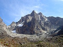
Peaks of Mount Kenya
 

There is no universally accepted definition of a mountain. Elevation, volume, relief, steepness, spacing and continuity have been used as criteria for defining a mountain.[1] In the Oxford English Dictionary a mountain is defined as "a natural elevation of the earth surface rising more or less abruptly from the surrounding level and attaining an altitude which, relatively to the adjacent elevation, is impressive or notable."[1]

Whether a landform is called a mountain may depend on local usage. Mount Scott outside Lawton, Oklahoma is only 251 m (823 ft) from its base to its highest point. Whittow's Dictionary of Physical Geography[2] states "Some authorities regard eminences above 600 metres (2,000 ft) as mountains, those below being referred to as hills."

In the United Kingdom and the Republic of Ireland, a mountain is usually defined as any summit at least 2,000 feet (or 610 metres) high,[3][4][5][6][7] whilst the official UK government's definition of a mountain, for the purposes of access, is a summit of 600 metres or higher.[8] In addition, some definitions also include a topographical prominence requirement, typically 100 or 500 feet (30 or 152 m).[9] For a while, the US defined a mountain as being 1,000 feet (300 m) or taller. Any similar landform lower than this height was considered a hill. However, today, the United States Geological Survey (USGS) concludes that these terms do not have technical definitions in the US.[10]

The UN Environmental Programme's definition of "mountainous environment" includes any of the following:[11]
  • Elevation of at least 2,500 m (8,200 ft);
  • Elevation of at least 1,500 m (4,900 ft), with a slope greater than 2 degrees;
  • Elevation of at least 1,000 m (3,300 ft), with a slope greater than 5 degrees;
  • Elevation of at least 300 m (980 ft), with a 300 m (980 ft) elevation range within 7 km (4.3 mi).
Using these definitions, mountains cover 33% of Eurasia, 19% of South America, 24% of North America, and 14% of Africa.[12] As a whole, 24% of the Earth's land mass is mountainous.[13]

Geology

There are three main types of mountains: volcanic, fold, and block.[14] All three types are formed from plate tectonics: when portions of the Earth's crust move, crumple, and dive. Compressional forces, isostatic uplift and intrusion of igneous matter forces surface rock upward, creating a landform higher than the surrounding features. The height of the feature makes it either a hill or, if higher and steeper, a mountain. Major mountains tend to occur in long linear arcs, indicating tectonic plate boundaries and activity.

Volcanoes

Geological cross-section of Fuji volcano

Volcanoes are formed when a plate is pushed below another plate, or at a mid-ocean ridge or hotspot.[15] At a depth of around 100 km, melting occurs in rock above the slab (due to the addition of water), and forms magma that reaches the surface. When the magma reaches the surface, it often builds a volcanic mountain, such as a shield volcano or a stratovolcano.[16] Examples of volcanoes include Mount Fuji in Japan and Mount Pinatubo in the Philippines. The magma does not have to reach the surface in order to create a mountain: magma that solidifies below ground can still form dome mountains, such as Navajo Mountain in the US.

Fold mountains

Illustration of mountains that developed on a fold that thrusted.

Fold mountains occur when two plates collide: shortening occurs along thrust faults and the crust is overthickened.[17] Since the less dense continental crust "floats" on the denser mantle rocks beneath, the weight of any crustal material forced upward to form hills, plateaus or mountains must be balanced by the buoyancy force of a much greater volume forced downward into the mantle. Thus the continental crust is normally much thicker under mountains, compared to lower lying areas.[18] Rock can fold either symmetrically or asymmetrically. The upfolds are anticlines and the downfolds are synclines: in asymmetric folding there may also be recumbent and overturned folds. The Jura Mountains are an example of fold mountains.

Block mountains

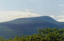
The Catskills in Upstate New York represent an eroded plateau.

Block mountains are caused by faults in the crust: a plane where rocks have moved past each other. When rocks on one side of a fault rise relative to the other, it can form a mountain.[19] The uplifted blocks are block mountains or horsts. The intervening dropped blocks are termed graben: these can be small or form extensive rift valley systems. This form of landscape can be seen in East Africa, the Vosges, the Basin and Range Province of Western North America and the Rhine valley. These areas often occur when the regional stress is extensional and the crust is thinned.

Erosion

1259 ft

During and following uplift, mountains are subjected to the agents of erosion (water, wind, ice, and gravity) which gradually wear the uplifted area down. Erosion causes the surface of mountains to be younger than the rocks that form the mountains themselves.[20] Glacial processes produce characteristic landforms, such as pyramidal peaks, knife-edge arêtes, and bowl-shaped cirques that can contain lakes. Plateau mountains, such as the Catskills, are formed from the erosion of an uplifted plateau.

In earth science, erosion is the action of surface processes (such as water flow or wind) that removes soil, rock, or dissolved material from one location on the Earth's crust, and then transport it away to another location (not to be confused with weathering which involves no movement). The particulate breakdown of rock or soil into clastic sediment is referred to as physical or mechanical erosion; this contrasts with chemical erosion, where soil or rock material is removed from an area by its dissolving into a solvent (typically water), followed by the flow away of that solution. Eroded sediment or solutes may be transported just a few millimeters, or for thousands of kilometers.

Climate

A combination of high latitude and high altitude makes the northern Urals in picture to have climatic conditions that make the ground barren.

Climate in the mountains becomes colder at high elevations, due an interaction between radiation and convection. Sunlight in the visible spectrum hits the ground and heats it. The ground then heats the air at the surface. If radiation were the only way to transfer heat from the ground to space, the greenhouse effect of gases in the atmosphere would keep the ground at roughly 333 K (60 °C; 140 °F), and the temperature would decay exponentially with height.[21]

However, when air is hot, it tends to expand, which lowers its density. Thus, hot air tends to rise and transfer heat upward. This is the process of convection. Convection comes to equilibrium when a parcel at air at a given altitude has the same density as its surroundings. Air is a poor conductor of heat, so a parcel of air will rise and fall without exchanging heat. This is known as an adiabatic process, which has a characteristic pressure-temperature dependence. As the pressure gets lower, the temperature decreases. The rate of decrease of temperature with elevation is known as the adiabatic lapse rate, which is approximately 9.8 °C per kilometer (or 5.4 °F per 1000 feet) of altitude.[21]

Note that the presence of water in the atmosphere complicates the process of convection. Water vapor contains latent heat of vaporization. As air rises and cools, it eventually becomes saturated and cannot hold its quantity of water vapor. The water vapor condenses (forming clouds), and releases heat, which changes the lapse rate from the dry adiabatic lapse rate to the moist adiabatic lapse rate (5.5 °C per kilometer or 3 °F per 1000 feet)[22] The actual lapse rate can vary by altitude and by location.

Therefore, moving up 100 meters on a mountain is roughly equivalent to moving 80 kilometers (45 miles or 0.75° of latitude) towards the nearest pole.[23] This relationship is only approximate, however, since local factors such as proximity to oceans (such as the Arctic Ocean) can drastically modify the climate.[24] As the altitude increases, the main form of precipitation becomes snow and the winds increase.[25]

The effect of the climate on the ecology at an elevation can be largely captured through a combination of amount of precipitation, and the biotemperature, as described by Leslie Holdridge in 1947.[26] Biotemperature is the mean temperature; all temperatures below 0 °C (32 °F) are considered to be 0 °C. When the temperature is below 0 °C, plants are dormant, so the exact temperature is unimportant. The peaks of mountains with permanent snow can have a biotemperature below 1.5 °C (34.7 °F).

Ecology

An alpine mire in the Swiss Alps

The colder climate on mountains affects the plants and animals residing on mountains. A particular set of plants and animals tend to be adapted to a relatively narrow range of climate. Thus, ecosystems tend to lie along elevation bands of roughly constant climate. This is called altitudinal zonation.[27] In regions with dry climates, the tendency of mountains to have higher precipitation as well as lower temperatures also provides for varying conditions, which enhances zonation.[28][29]

Some plants and animals found in altitudinal zones tend to become isolated since the conditions above and below a particular zone will be inhospitable and thus constrain their movements or dispersal. These isolated ecological systems are known as sky islands.[30]

Altitudinal zones tend to follow a typical pattern. At the highest elevations, trees cannot grow, and whatever life may be present will be of the alpine type, resembling tundra.[29] Just below the tree line, one may find subalpine forests of needleleaf trees, which can withstand cold, dry conditions.[31] Below that, montane forests grow. In the temperate portions of the earth, those forests tend to be needleleaf trees, while in the tropics, they can be broadleaf trees growing in a rain forest.

Mountains and humans

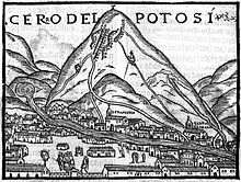
The silver-rich Cerro Rico in Potosí, Bolivia, was in colonial times an immerse source of wealth for the Spanish administration.

The highest known permanently tolerable altitude is at 5,950 metres (19,520 ft).[32] At very high altitudes, the decreasing atmospheric pressure means that less oxygen is available for breathing, and there is less protection against solar radiation (UV).[28] Above 8,000 metres (26,000 ft) elevation, there is not enough oxygen to support human life. This is known as the "death zone".[33] The summits of Mount Everest and K2 are in the death zone.

Mountain societies and economies

Mountains are generally less preferable for human habitation than lowlands, because of harsh weather and little level ground suitable for agriculture. While 7% of the land area of Earth is above 2,500 metres (8,200 ft),[12] only 140 million people live above that altitude[34] and only 20-30 million people above 3,000 metres (9,800 ft) elevation.[35] About half of mountain dwellers live in the Andes, Central Asia, and Africa.[13]

With limited access to infrastructure, only a handful of human communities exist above 4,000 metres (13,000 ft) of elevation. Many are small and have heavily specialized economies, often relying on industries such as agriculture, mining, and tourism.[citation needed] An example of such a specialized town is La Rinconada, Peru, a gold-mining town and the highest elevation human habitation at 5,100 metres (16,700 ft).[36] A counterexample is El Alto, Bolivia, at 4,150 metres (13,620 ft), which has a highly diverse service and manufacturing economy and a population of nearly 1 million.[37]

Traditional mountain societies rely on agriculture, with higher risk of crop failure than at lower elevations. Minerals often occur in mountains, with mining being an important component of the economics of some montane societies. More recently, tourism supports mountain communities, with some intensive development around attractions such as national parks or ski resorts.[38] About 80% of mountain people live below the poverty line.[13]

Most of the world's rivers are fed from mountain sources, with snow acting as a storage mechanism for downstream users.[39] More than half of humanity depends on mountains for water.[40][41]

In geopolitics mountains are often seen as preferable "natural boundaries" between polities.[42][43]

Mountaneering

Mountain climbers ascending Mount Rainier

Mountaineering, mountain climbing, or alpinism is the sport, hobby or profession of hiking, skiing, and climbing mountains. While mountaineering began as attempts to reach the highest point of unclimbed big mountains it has branched into specializations that address different aspects of the mountain and consists of three areas: rock-craft, snow-craft and skiing, depending on whether the route chosen is over rock, snow or ice. All require experience, athletic ability, and technical knowledge to maintain safety.[44]

Superlatives

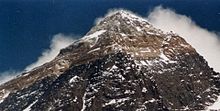
Mount Everest, the highest peak on Earth
 
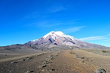
Chimborazo, Ecuador. The point on Earth's surface farthest from its center.[45]
 
Heights of mountains are typically measured above sea level. Using this metric, Mount Everest is the highest mountain on Earth, at 8,848 metres (29,029 ft).[46] There are at least 100 mountains with heights of over 7,200 metres (23,622 ft) above sea level, all of which are located in central and southern Asia. The highest mountains above sea level are generally not the highest above the surrounding terrain. There is no precise definition of surrounding base, but Denali,[47] Mount Kilimanjaro and Nanga Parbat are possible candidates for the tallest mountain on land by this measure. The bases of mountain islands are below sea level, and given this consideration Mauna Kea (4,207 m (13,802 ft) above sea level) is the world's tallest mountain and volcano, rising about 10,203 m (33,474 ft) from the Pacific Ocean floor.[48]

The highest mountains are not generally the most voluminous. Mauna Loa (4,169 m or 13,678 ft) is the largest mountain on Earth in terms of base area (about 2,000 sq mi or 5,200 km2) and volume (about 18,000 cu mi or 75,000 km3).[49] Mount Kilimanjaro is the largest non-shield volcano in terms of both base area (245 sq mi or 635 km2) and volume (1,150 cu mi or 4,793 km3). Mount Logan is the largest non-volcanic mountain in base area (120 sq mi or 311 km2).

The highest mountains above sea level are also not those with peaks farthest from the centre of the Earth, because the figure of the Earth is not spherical. Sea level closer to the equator is several miles farther from the centre of the Earth. The summit of Chimborazo, Ecuador's tallest mountain, is usually considered to be the farthest point from the Earth's centre, although the southern summit of Peru's tallest mountain, Huascarán, is another contender.[50] Both have elevations above sea level more than 2 kilometres (6,600 ft) less than that of Everest.

Social privilege

From Wikipedia, the free encyclopedia https://en.wikipedi...