Search This Blog

Monday, April 20, 2020

Lassen Volcanic National Park

From Wikipedia, the free encyclopedia
 
Lassen Volcanic National Park
IUCN category II (national park)
USA Lassen NP Lake Helen CA.jpg
Lake Helen in Lassen Volcanic National Park
Map showing the location of Lassen Volcanic National Park
LocationShasta, Lassen, Plumas, and Tehama Counties, California, United States
Nearest cityRedding and Susanville
Coordinates40°29′16″N 121°30′18″WCoordinates: 40°29′16″N 121°30′18″W
Area106,452 acres (430.80 km2)
EstablishedAugust 9, 1916
Visitors499,435 (in 2018)
Governing bodyNational Park Service
WebsiteOfficial website
Map of Lassen Volcanic National park
 
Mount Shasta from Lassen Peak
 
Lassen Volcanic National Park is an American national park in northeastern California. The dominant feature of the park is Lassen Peak, the largest plug dome volcano in the world and the southernmost volcano in the Cascade Range. Lassen Volcanic National Park started as two separate national monuments designated by President Theodore Roosevelt in 1907: Cinder Cone National Monument and Lassen Peak National Monument.

The source of heat for the volcanism in the Lassen area is subduction of the Gorda Plate diving below the North American Plate off the Northern California coast. The area surrounding Lassen Peak is still active with boiling mud pots, fumaroles, and hot springs. Lassen Volcanic National Park is one of the few areas in the world where all four types of volcano can be found—plug dome, shield, cinder cone, and stratovolcano.

The park is accessible via State Routes 89 and 44. SR 89 passes north-south through the park, beginning at SR 36 to the south and ending at SR 44 to the north. SR 89 passes immediately adjacent to the base of Lassen Peak. 

There are five vehicle entrances to the park: the north and south entrances on SR 89; and unpaved roads entering at Drakesbad and Juniper Lake in the south, and at Butte Lake in the northeast. The park can also be accessed by trails leading in from the Caribou Wilderness to the east, as well as the Pacific Crest Trail, and two smaller trails leading in from Willow Lake and Little Willow Lake to the south. 

The Lassen Chalet, a large lodge with concession facilities, was located near the southwest entrance, but was demolished in 2005. A new full-service visitor center in the same location opened to the public in 2008. The Lassen Ski Area was located near the lodge; it ceased operation in 1992 and all infrastructure has been removed.

History

Native Americans have inhabited the area since long before white settlers first saw Lassen. The natives knew that the peak was full of fire and water and thought it would one day blow itself apart.

European immigrants in the mid-19th century used Lassen Peak as a landmark on their trek to the fertile Sacramento Valley. One of the guides to these immigrants was a Danish blacksmith named Peter Lassen, who settled in Northern California in the 1830s. Lassen Peak was named after him. Nobles Emigrant Trail was later cut through the park area and passed Cinder Cone and the Fantastic Lava Beds.

Inconsistent newspaper accounts reported by witnesses from 1850 to 1851 described seeing "fire thrown to a terrible height" and "burning lava running down the sides" in the area of Cinder Cone. As late as 1859, a witness reported seeing fire in the sky from a distance, attributing it to an eruption. Early geologists and volcanologists who studied the Cinder Cone concluded the last eruption occurred between 1675 and 1700. After the 1980 eruption of Mount St. Helens, the United States Geological Survey (USGS) began reassessing the potential risk of other active volcanic areas in the Cascade Range. Further study of Cinder Cone estimated the last eruption occurred between 1630 and 1670. Recent tree-ring analysis has placed the date at 1666.

The Lassen area was first protected by being designated as the Lassen Peak Forest Preserve. Lassen Peak and Cinder Cone were later declared as U.S. National Monuments in May 1907 by President Theodore Roosevelt.

Starting in May 1914 and lasting until 1921, a series of minor to major eruptions occurred on Lassen. These events created a new crater, and released lava and a great deal of ash. Fortunately, because of warnings, no one was killed, but several houses along area creeks were destroyed. Because of the eruptive activity, which continued through 1917, and the area's stark volcanic beauty, Lassen Peak, Cinder Cone and the area surrounding were declared a National Park on August 9, 1916.

The 29-mile (47 km) Main Park Road was constructed between 1925 and 1931, just 10 years after Lassen Peak erupted. Near Lassen Peak the road reaches 8,512 feet (2,594 m), making it the highest road in the Cascade Mountains. It is not unusual for 40 ft (12 m) of snow to accumulate on the road near Lake Helen and for patches of snow to last into July.

In October 1972, a portion of the park was designated as Lassen Volcanic Wilderness by the US Congress (Public Law 92-511). The National Park Service seeks to manage the wilderness in keeping with the Wilderness Act of 1964, with minimal developed facilities, signage, and trails. The management plan of 2003 adds that, "The wilderness experience offers a moderate to high degree of challenge and adventure."

In 1974, the National Park Service took the advice of the USGS and closed the visitor center and accommodations at Manzanita Lake. The Survey stated that these buildings would be in the way of a rockslide from Chaos Crags if an earthquake or eruption occurred in the area. An aging seismograph station remains. However, a campground, store, and museum dedicated to Benjamin F. Loomis stands near Manzanita Lake, welcoming visitors who enter the park from the northwest entrance. 

After the Mount St. Helens eruption, the USGS intensified its monitoring of active and potentially active volcanoes in the Cascade Range. Monitoring of the Lassen area includes periodic measurements of ground deformation and volcanic-gas emissions and continuous transmission of data from a local network of nine seismometers to USGS offices in Menlo Park, California. Should indications of a significant increase in volcanic activity be detected, the USGS will immediately deploy scientists and specially designed portable monitoring instruments to evaluate the threat. In addition, the National Park Service (NPS) has developed an emergency response plan that would be activated to protect the public in the event of an impending eruption.

Visitors to Lassen National Park by year
Year Recreational visitors
2016 536,068
2015 468,092
2014 432,977
2013 427,409
2012 407,653
2011 351,269
2010 384,570
2009 365,639
2008 377,361
2007 395,057

The NPS tracks visitors by counting vehicles entering the park via in-road inductive loops at all vehicle entrances. Buses and other non-reportable vehicles are subtracted from the vehicle count, which is then multiplied by three, an estimate of the number of visitors per vehicle.

Geography and geology

Map of Lassen area showing hydrothermal features (red dots) and volcanic feature or remnant (yellow cones). Also shown is the outline of Brokeoff Volcano (Mount Tehama).

The park is located near the northern end of the Sacramento Valley. The western part of the park features great lava pinnacles (huge mountains created by lava flows), jagged craters, and steaming sulfur vents. It is cut by glaciated canyons and is dotted and threaded by lakes and rushing clear streams.

The eastern part of the park is a vast lava plateau more than one mile (1.6 km) above sea level. Here, small cinder cones are found. (Fairfield Peak, Hat Mountain, and Crater Butte). Forested with pine and fir, this area is studded with small lakes, but it boasts few streams. Warner Valley, marking the southern edge of the Lassen Plateau, features hot spring areas (Boiling Springs Lake, Devils Kitchen, and Terminal Geyser). This forested, steep valley also has large meadows that have wildflowers in spring. 

Lassen Peak is made of dacite, an igneous rock, and is one of the world's largest plug dome volcanoes. It is also the southernmost non-extinct volcano of the Cascade Range (specifically, the Shasta Cascade part of the range). 10,457-foot (3,187 m) tall volcano sits on the north-east flank of the remains of Mount Tehama, a stratovolcano that was a thousand feet (305 m) higher than Lassen and 11 to 15 miles (18 to 24 km) wide at its base. After emptying its throat and partially doing the same to its magma chamber in a series of eruptions, Tehama either collapsed into itself and formed a two-mile (3.2 km) wide caldera in the late Pleistocene or was simply eroded away with the help of acidic vapors that loosened and broke the rock, which was later carried away by glaciers.

View of Cinder Cone from the Cinder Cone Trail that leads to it. The trees are Jeffrey pines (Pinus jeffreyi).
 
Sulphur Works is a geothermal area in between Lassen Peak and Brokeoff Mountain that is thought to mark an area near the center of Tehama's now-gone cone. Other geothermal areas in the caldera are Little Hot Springs Valley, Diamond Point (an old lava conduit), and Bumpass Hell (see Geothermal areas in Lassen Volcanic National Park).

The magma that fuels the volcanoes in the park is derived from subduction off the coast of Northern California. Cinder Cone and the Fantastic Lava Beds, located about 10 miles (16 km) northeast of Lassen Peak, is a cinder cone volcano and associated lava flow field that last erupted about 1650. It created a series of basaltic andesite to andesite lava flows known as the Fantastic Lava Beds.

There are four shield volcanoes in the park; Mount Harkness (southwest corner of the park), Red Mountain (at south-central boundary), Prospect Peak (in northeast corner), and Raker Peak (north of Lassen Peak). All of these volcanoes are 7,000–8,400 feet (2,133–2,560 m) above sea level and each is topped by a cinder cone volcano.

During ice ages, glaciers have modified and helped to erode the older volcanoes in the park. The center of snow accumulation and therefore ice radiation was Lassen Peak, Red Mountain, and Raker Peak. These volcanoes thus show more glacial scarring than other volcanoes in the park.

Despite not having any glaciers currently, Lassen Peak does have 14 permanent snowfields.

Kings Creek with Lassen Peak on the horizon

Climate

According to the Köppen climate classification system, Lassen Volcanic National Park has a Mediterranean-influenced warm-summer Humid continental climate (Dsb). According to the United States Department of Agriculture, the Plant Hardiness zone at Kohm Yah-mah-nee Visitor Center at 6736 ft (2053 m) elevation is 6b with an average annual extreme minimum temperature of -0.2 °F (-17.9 °C).

Since the entire park is located at medium to high elevations, the park generally has cool-cold winters and warm summers below 7,500 feet (2,300 m). Above this elevation, the climate is harsh and cold, with cool summer temperatures. Precipitation within the park is high to very high due to a lack of a rain shadow from the Coast Ranges. The park gets more precipitation than anywhere else in the Cascades south of the Three Sisters. Snowfall at the new visitor center near the southwest entrance at 6,700 feet (2,040 m) is around 430 inches (1,100 cm) despite facing east. Up around Lake Helen, at 8,200 feet (2,500 m) the snowfall is around 600–700 inches (1,500–1,800 cm), making it probably the snowiest place in California. In addition, Lake Helen gets more average snow accumulation than any other recording station located near a volcano in the Cascade range, with a maximum of 178 inches (450 cm). Snowbanks persist year-round.

Plants

According to the A. W. Kuchler U.S. Potential natural vegetation Types, Lassen Volcanic National Park has a Red Fir, aka Abies magnifica (7) potential vegetation type with a California Conifer Forest (2) potential vegetation form.

Lying at the northern end of the Sierra Nevada forests ecoregion, Lassen Volcanic National Park preserves a landscape nearly as it existed before Euro-American settlement: its 27,130 acres (10,980 ha) of old growth include all of its major forest types.

At elevations below 6,500 feet the dominant vegetation community is the mixed conifer forest. Ponderosa and Jeffrey Pines, Sugar Pine, and White Fir form the forest canopy for this rich community that also includes species of manzanita, gooseberry, and ceanothus. Common wildflowers include iris, spotted coralroot, pyrola, violets, and lupin.

Above the mixed-conifer forest is the major community of the Red Fir forest. Between elevations of 6,500 and 8,000 feet, Red Fir, Western White Pine, Mountain Hemlock, and Lodgepole Pine dominate a community less diverse than the mixed-conifer forest. Common plants include satin lupine, woolly mule's-ears and pinemat manzanita.

Subalpine areas include the upper limit for the growth of standing trees. From 8,000 feet to treeline, plants are fewer in overall number with exposed patches of bare ground providing a harsh environment. Rock spirea, lupin, Indian paintbrush, and penstemon are a few of the rugged members of this community. Trees in this community include Whitebark Pine and Mountain Hemlock.

Wildlife

A golden-mantled ground squirrel enjoying a meal near the southern entrance
 
Species that are typically found in these forested areas are black bear, red fox, mule deer, marten, cougar, brown creeper, a variety of chipmunk species, raccoon, mountain chickadee, pika, a variety of squirrel species, white-headed woodpecker, coyote, bobcat, weasel, a variety of mouse species, long-toed salamander, skunk, and a wide variety of bat species.

Geology

Lassen Peak from the summit of Brokeoff Mountain. Photo shows 1915 tongue of lava and Vulcan's Eye.

Formation of basement rocks

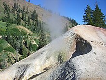
Thermal vents at Sulphur Works

In the Cenozoic, uplifting and westward tilting of the Sierra Nevada along with extensive volcanism generated huge lahars (volcanic-derived mud flows) in the Pliocene which became the Tuscan Formation. This formation is not exposed anywhere in the national park but it is just below the surface in many areas.

Also in the Pliocene, basaltic flows erupted from vents and fissures in the southern part of the park. These and later flows covered increasingly large areas and built a lava plateau. In the later Pliocene and into the Pleistocene, these basaltic flows were covered by successive thick and fluid flows of andesite lava, which geologists call the Juniper lavas and the Twin Lakes lavas. The Twin Lakes lava is black, porphyritic and has abundant xenocrysts of quartz (see Cinder Cone).

Another group of andesite lava flows called the Flatiron, erupted during this time and covered the southwestern part of the park's area. The park by this time was a relatively featureless and large lava plain. Subsequently, the Eastern basalt flows erupted along the eastern boundary of what is now the park, forming low hills that were later eroded into rugged terrain.

Volcanoes rise

Pyroclastic eruptions then started to pile tephra into cones in the northern area of the park. 

Mount Tehama (also known as Brokeoff Volcano) rose as a stratovolcano in the southwestern corner of the park during the Pleistocene. It was made of roughly alternating layers of andesitic lavas and tephra (volcanic ash, breccia, and pumice) with increasing amounts of tephra with elevation. At its height, Tehama was probably about 11,000 feet (3,400 m) high.

Approximately 350,000 years ago its cone collapsed into itself and formed a two-mile (3.2 km) wide caldera after it emptied its throat and partially did the same to its magma chamber in a series of eruptions. One of these eruptions occurred where Lassen Peak now stands, and consisted of fluid, black, glassy dacite, which formed a layer 1,500 feet (460 m) thick (outcroppings of which can be seen as columnar rock at Lassen's base).

During glacial periods (ice ages) of the present Wisconsinan glaciation, glaciers have modified and helped to erode the older volcanoes in the park, including the remains of Tehama. Many of these glacial features, deposits and scars, however, have been covered up by tephra and avalanches, or were destroyed by eruptions.

Roughly 27,000 years ago (older data gave an age of 18,000 years), Lassen Peak started to form as a dacite lava dome quickly pushed its way through Tehama's destroyed north-eastern flank. As the lava dome pushed its way up, it shattered overlaying rock, which formed a blanket of talus around the emerging volcano. Lassen rose and reached its present height in a relatively short time, probably in as little as a few years. Lassen Peak has also been partially eroded by Ice Age glaciers, at least one of which extended as much as 7 miles (11 km) from the volcano itself.

Since then, smaller dacite domes formed around Lassen. The largest of these, Chaos Crags, is just north of Lassen Peak. Phreatic (steam explosion) eruptions, dacite and andesite lava flows and cinder cone formation have persisted into modern times.

Bumpass Hell contains boiling springs, mudpots, and fumaroles

There are active hot springs and mud pots in the Lassen area. Some of these springs are the site of occurrence of certain extremophile micro-organisms, that are capable of surviving in extremely hot environments.

Hawaiʻi Volcanoes National Park

From Wikipedia, the free encyclopedia
 
Hawaiʻi Volcanoes National Park
IUCN category II (national park)
Pāhoehoe and Aa flows at Hawaii.jpg
Pāhoehoe and ʻaʻā lava flows
Map showing the location of Hawaiʻi Volcanoes National Park
Location in the Hawaiian Islands
LocationHawaii County, Hawaii, United States
Nearest cityHilo
Coordinates19°23′N 155°12′WCoordinates: 19°23′N 155°12′W
Area323,431 acres (1,308.88 km2)
EstablishedAugust 1, 1916
Visitors1,116,891 (in 2018)
Governing bodyNational Park Service
WebsiteOfficial website 

CriteriaNatural: viii
Reference409
Inscription1987 (11th session)

Hawaiʻi Volcanoes National Park, established on August 1, 1916, is an American national park located in the U.S. state of Hawaii on the island of Hawaii. The park encompasses two active volcanoes: Kīlauea, one of the world's most active volcanoes, and Mauna Loa, the world's most massive shield volcano. The park provides scientists with insight into the birth and development of the Hawaiian Islands, and ongoing studies into the processes of volcanism. For visitors, the park offers dramatic volcanic landscapes, as well as glimpses of rare flora and fauna.

In recognition of its outstanding natural values, Hawaiʻi Volcanoes National Park was designated as an International Biosphere Reserve in 1980 and a World Heritage Site in 1987. In 2012, the park was depicted on the 14th quarter of the America the Beautiful Quarters series.

On May 11, 2018, the park was closed to the public in the Kīlauea volcano summit area, including the visitor center and park headquarters, due to explosions and toxic ash clouds from Halemaʻumaʻu, as well as earthquakes and road damage. Portions of the park, including the visitor center, reopened to the public on September 22, 2018. As of 2020, most of the park is open; however, some road segments and trails as well as the Jaggar Museum of the Hawaiian Volcano Observatory remain closed to visitors.

Eruptive activity, ground collapses and explosions in the park ceased in early August of 2018, and the lull in eruptive activity at Kīlauea continues.

Environment

Lava erupting from the Puʻu ʻŌʻō vent in June 1983
 
The park includes 323,431 acres (505.36 sq mi; 1,308.88 km2) of land. Over half of the park (130,790 acres (529 km2)) was designated the Hawaii Volcanoes Wilderness area in 1978, providing solitude for hiking and camping. Wilderness designation covers the northwestern extension of the National Park, including Mokuaweoweo, the summit of the volcano Mauna Loa. In the southwestern portion of the park, a large chunk of wilderness includes several miles of coastline and a small portion southeast of the visitors center. The park encompasses diverse environments from sea level to the summit of the Earth's most massive active volcano, Mauna Loa, at 13,679 feet (4,169 m). Climates range from lush tropical rain forests, to the arid and barren Kaʻū Desert.

Recently eruptive sites include the main caldera of Kīlauea and a more active but remote vent called Puʻu ʻŌʻō.

The main entrance to the park is from the Hawaii Belt Road. The Chain of Craters Road leads to the coast, passing several craters from historic eruptions. The road had continued to another park entrance near the town of Kalapana, but that portion is covered by a lava flow. The park's Kahuku District is accessible via Kahuku Road off Highway 11 near mile marker 70.

History

Aerial view of Halemaʻumaʻu, September 2009
 
Kīlauea and its Halemaʻumaʻu caldera were traditionally considered the sacred home of the volcano goddess Pele, and Hawaiians visited the crater to offer gifts to the goddess.

In 1790, a party of warriors, along with women and children who were in the area, were caught in an unusually violent eruption. Many were killed and others left footprints in the lava that are still visible.

The first western visitors to the site, English missionary William Ellis and American Asa Thurston, went to Kīlauea in 1823. Ellis wrote of his reaction to the first sight of the erupting volcano:
A spectacle, sublime and even appalling, presented itself before us. 'We stopped and trembled.' Astonishment and awe for some moments rendered us mute, and, like statues, we stood fixed to the spot, with our eyes riveted on the abyss below.
The Volcano Art Center was the Volcano House Hotel from 1877 to 1921.

The volcano became a tourist attraction in the 1840s, and local businessmen such as Benjamin Pitman and George Lycurgus ran a series of hotels at the rim. Volcano House is the only hotel or restaurant located within the borders of the national park.

Lorrin A. Thurston, grandson of the American missionary Asa Thurston, was one of the driving forces behind the establishment of the park after investing in the hotel from 1891 to 1904. William R. Castle first proposed the idea in 1903. Thurston, who then owned The Honolulu Advertiser newspaper, printed editorials in favor of the park idea. In 1907, the territory of Hawaii paid for fifty members of Congress and their wives to visit Haleakalā and Kīlauea, including a dinner cooked over lava steam vents. In 1908, Thurston entertained Secretary of the Interior James Rudolph Garfield, and another congressional delegation the following year. Governor Walter F. Frear proposed a draft bill in 1911 to create Kilauea National Park for $50,000. Thurston and local landowner William Herbert Shipman proposed boundaries, but ran into some opposition from ranchers. Thurston printed endorsements from John Muir, Henry Cabot Lodge, and former President Theodore Roosevelt. After several attempts, the legislation introduced by delegate Jonah Kūhiō Kalanianaʻole finally passed to create the park. House Resolution 9525 was signed by Woodrow Wilson on August 1, 1916. Hawaii National Park became the eleventh national park in the United States, and the first in a territory.

Within a few weeks, the National Park Service Organic Act created the National Park Service to run the system.[17] The park was officially renamed Hawaiʻi Volcanoes National Park after being split from Haleakalā National Park on September 22, 1961.

An easily accessible lava tube was named for the Thurston family. An undeveloped stretch of the Thurston Lava Tube extends an additional 1,100 ft (340 m) beyond the developed area and dead-ends into the hillside, but it is closed to the general public.

Park map including the Kahuku District on left
 
In 2004, an additional 115,788 acres (468.58 km2) of the Kahuku Ranch were added to the park, the largest land acquisition in Hawaii's history. Now named the Kahuku District, the park was enlarged by 56% with the newly acquired land, which is west of the town of Waiʻōhinu and east of Ocean View. The land was purchased for $21.9 million from the estate of Samuel Mills Damon, with financing from The Nature Conservancy.

Superintendents

National park superintendents:

Historic places

Wilkes Campsite on Mauna Loa

Several of the National Register of Historic Places listings on the island of Hawaii are located within the park:

Visitor center and museums

Night view of Halemaʻumaʻu from Jaggar Museum in 2015
 
The main visitor center, located just within the park entrance at 19°25′46″N 155°15′25.5″W, includes displays and information about the features of the park. The nearby Volcano Art Center, located in the original 1877 Volcano House hotel, is listed on the National Register of Historic Places and houses historical displays and an art gallery.

The Thomas A. Jaggar Museum, now closed due to damage from the 2018 eruptive events, is located a few miles west on Crater Rim Drive. The museum featured more exhibits and a close view of Kīlauea's active vent Halemaʻumaʻu. The museum is named after scientist Thomas Jaggar, the first director of the Hawaiian Volcano Observatory, which adjoins the museum. The observatory itself is operated by the U.S. Geological Survey and is not open to the public.

The Kilauea Military Camp provides accommodations for U.S. military personnel. Volunteer groups also sponsor events in the park.

Painting of Pele


About 1929, D. Howard Hitchcock made an oil painting of Pele, the Hawaiian goddess of fire, lightning, wind, and volcanoes. In 1966, the artist's son, Harvey, donated the painting to the Hawaiʻi Volcanoes National Park, where it was displayed in the visitor center from 1966 to 2005. The painting was criticized for portraying the Hawaiian goddess as a Caucasian.

In 2003, the Volcano Art Center announced a competition for a "more modern and culturally authentic rendering" of the goddess. An anonymous judging panel of Native Hawaiian elders selected a painting by Arthur Johnsen of Puna, Hawaii from 140 entries. In Johnsen's painting, the goddess has distinctly Polynesian features. She is holding a digging stick (ʻōʻō) in her left hand and the egg that gave birth to her younger sister Hiʻiaka in her right hand. In 2005, the Hitchcock was replaced with Johnsen's painting.

Recent events

On March 19, 2008, there was a small explosion in Halemaʻumaʻu, the first explosive event since 1924 and the first eruption in the Kīlauea caldera since September 1982. Debris from the explosion was scattered over an area of 74 acres (300,000 m2). A small amount of ash was also reported at a nearby community. The explosion covered part of Crater Rim Drive and damaged Halemaʻumaʻu Overlook. The explosion did not release any lava, which suggests to scientists that it was driven by hydrothermal or gas sources.

Sulfur dioxide emissions from the Halemaʻumaʻu vent, April 2008
 
This explosion event followed the opening of a major sulfur dioxide gas vent, greatly increasing levels emitted from Halemaʻumaʻu. The dangerous increase of sulfur dioxide gas prompted closures of Crater Rim Drive between the Jaggar Museum south/southeast to Chain of Craters Road, Crater Rim Trail from Kīlauea Military Camp south/southeast to Chain of Craters Road, and all trails leading to Halemaʻumaʻu, including those from Byron Ledge, ʻIliahi (Sandalwood) Trail, and Kaʻū Desert Trail.

In mid-May 2018, the Kīlauea District of the park was closed due to explosive eruptions at Halemaʻumaʻu, though the Kahuku District remained open. The Kīlauea District, including the visitor center, reopened to the public on September 22, 2018. Eruptive activity, ground collapses and explosions in the park had ceased in early August. At the summit, seismicity and deformation are negligible. Sulfur dioxide emission rates at both the summit and the Lower East Rift Zone are drastically reduced; the combined rate is lower than at any time since late 2007. Earthquake and deformation data show no net accumulation, withdrawal, or significant movement of subsurface magma or pressurization as would be expected if the system was building toward a resumption of activity.

As of 2020, the lull in eruptive activity at Kīlauea continues and most of the park is open; however, some road segments and trails remain closed to visitors, while the Jaggar Museum of the Hawaiian Volcano Observatory is closed indefinitely. The Thurston Lava Tube (Nāhuku) was reopened to the public on February 21, 2020. Several large rockfalls were cleared and sensors were installed to monitor new cracks, along with improvements to water drainage and parking. The rockfalls and cracks had been caused by some of the 60,000 earthquakes recorded during the Kīlauea eruption.

Panorama of lava and ocean
Panoramic view of the lava at the end of the Chain of Craters Road

Sequoia National Park

From Wikipedia, the free encyclopedia
 
Sequoia National Park
IUCN category II (national park)
General Sherman tree looking up.jpg
The General Sherman Tree, the largest tree in the world.
Map showing the location of Sequoia National Park
Location in California
LocationTulare County, California, United States
Nearest cityVisalia, California
Coordinates36°33′53″N 118°46′24″WCoordinates: 36°33′53″N 118°46′24″W
Area404,064 acres (1,635.19 km2)
EstablishedSeptember 25, 1890
Visitors1,229,594 (in 2018)
Governing bodyNational Park Service
WebsiteOfficial website 

Sequoia National Park is an American national park in the southern Sierra Nevada east of Visalia, California. The park was established on September 25, 1890 to protect 404,064 acres (631 sq mi; 163,519 ha; 1,635 km2) of forested mountainous terrain. Encompassing a vertical relief of nearly 13,000 feet (4,000 m), the park contains the highest point in the contiguous United States, Mount Whitney, at 14,505 feet (4,421 m) above sea level. The park is south of, and contiguous with, Kings Canyon National Park; both parks are administered by the National Park Service together as the Sequoia and Kings Canyon National Parks. UNESCO designated the areas as Sequoia-Kings Canyon Biosphere Reserve in 1976.

The park is notable for its giant sequoia trees, including the General Sherman tree, the largest tree on Earth. The General Sherman tree grows in the Giant Forest, which contains five of the ten largest trees in the world. The Giant Forest is connected by the Generals Highway to Kings Canyon National Park's General Grant Grove, home of the General Grant tree among other giant sequoias. The park's giant sequoia forests are part of 202,430 acres (316 sq mi; 81,921 ha; 819 km2) of old-growth forests shared by Sequoia and Kings Canyon National Parks. The parks preserve a landscape that still resembles the southern Sierra Nevada before Euro-American settlement.

Front country

Many park visitors enter Sequoia National Park through its southern entrance near the town of Three Rivers at Ash Mountain at 1,700 ft (520 m) elevation. The lower elevations around Ash Mountain contain the only National Park Service-protected California Foothills ecosystem, consisting of blue oak woodlands, foothills chaparral, grasslands, yucca plants, and steep, mild river valleys. The region is also home to abundant wildlife: bobcats, foxes, ground squirrels, rattlesnakes, and mule deer are commonly seen in this area, and more rarely, reclusive mountain lions and the Pacific fisher are seen as well. The last California grizzly was killed in this park in 1922 (at Horse Corral Meadow). The California Black Oak is a key transition species between the chaparral and higher elevation conifer forest.

At higher elevations in the front country, between 5,500 and 9,000 feet (1,700 and 2,700 m) in elevation, the landscape becomes montane forest-dominated coniferous belt. Found here are Ponderosa, Jeffrey, sugar, and lodgepole pine trees, as well as abundant white and red fir. Found here too are the giant sequoia trees, the most massive living single-stem trees on earth. Between the trees, spring and summer snowmelts sometimes fan out to form lush, though delicate, meadows. In this region, visitors often see mule deer, Douglas squirrels, and American black bears, which sometimes break into unattended cars to eat food left by careless visitors. There are plans to reintroduce the bighorn sheep to this park.

Back country

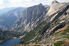
The High Sierra Trail above Hamilton Lake passes over the Great Western Divide
 
The vast majority of the park is roadless wilderness; no road crosses the Sierra Nevada within the park's boundaries. 84 percent of Sequoia and Kings Canyon National Parks is designated wilderness and is accessible only by foot or by horseback. The majority was designated Sequoia-Kings Canyon Wilderness in 1984 and the southwest portion was protected as John Krebs Wilderness in 2009.

Sequoia's backcountry offers a vast expanse of high-alpine wonders. Covering the highest-elevation region of the High Sierra, the backcountry includes Mount Whitney on the eastern border of the park, accessible from the Giant Forest via the High Sierra Trail. On a traveler's path along this 35-mile (56 km) backcountry trail, one passes through about 10 miles (16 km) of montane forest before reaching the backcountry resort of Bearpaw Meadow, just short of the Great Western Divide.

Continuing along the High Sierra Trail over the Great Western Divide via Kaweah Gap, one passes from the Kaweah River Drainage, with its characteristic V-shaped river valleys, and into the Kern River drainage, where an ancient fault line has aided glaciers in the last ice age to create a U-shaped canyon that is almost perfectly straight for nearly 20 miles (32 km). On the floor of this canyon, at least two days hike from the nearest road, is the Kern Canyon hot spring, a popular resting point for weary backpackers. From the floor of Kern Canyon, the trail ascends again over 8,000 ft (2,400 m) to the summit of Mount Whitney. At Mount Whitney, the High Sierra Trail meets with the John Muir Trail and the Pacific Crest Trail, which continue northward along the Sierra crest and into the backcountry of Kings Canyon National Park.

Human history

The area which now comprises Sequoia National Park was first home to "Monachee" (Western Mono) Native Americans, who resided mainly in the Kaweah River drainage in the Foothills region of the park, though evidence of seasonal habitation exists as high as the Giant Forest. In the summertime, Native Americans would travel over the high mountain passes to trade with tribes to the East. To this day, pictographs can be found at several sites within the park, notably at Hospital Rock and Potwisha, as well as bedrock mortars used to process acorns, a staple food for the Monachee people. 

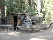
Tharp's Log, a cabin formed out of a hollowed-out giant sequoia log
 
By the time the first European settlers arrived in the area, smallpox had already spread to the region, decimating Native American populations. The first European settler to homestead in the area was Hale Tharp, who famously built a home out of a hollowed-out fallen giant sequoia log in the Giant Forest next to Log Meadow. Tharp allowed his cattle to graze the meadow, but at the same time had a respect for the grandeur of the forest and led early battles against logging in the area. From time to time, Tharp received visits from John Muir, who would stay at Tharp's log cabin. Tharp's Log can still be visited today in its original location in the Giant Forest.

However, Tharp's attempts to conserve the giant sequoias were at first met with only limited success. In the 1880s, white settlers seeking to create a utopian society founded the Kaweah Colony, which sought economic success in trading Sequoia timber. However, Giant Sequoia trees, unlike their coast redwood relatives, were later discovered to splinter easily and therefore were ill-suited to timber harvesting, though thousands of trees were felled before logging operations finally ceased.

The National Park Service incorporated the Giant Forest into Sequoia National Park in 1890, the year of its founding, promptly ceasing all logging operations in the Giant Forest. The park has expanded several times over the decades to its present size; one of the most recent expansions occurred in 1978, when grassroots efforts, spearheaded by the Sierra Club, fought off attempts by the Walt Disney Corporation to purchase a high-alpine former mining site south of the park for use as a ski resort. This site known as Mineral King was annexed to the park. Its name dates back to early 1873 when the miners in the area formed the Mineral King Mining District. Mineral King is the highest-elevation developed site within the park and a popular destination for backpackers.

Climate

According to the Köppen climate classification system, Sequoia National Park encompasses five climate types listed here from highest to lowest elevation; Tundra (ET), Mediterranean-influenced Subarctic climate (Dsc), Mediterranean-influenced warm-summer Humid continental climate (Dsb), Warm-summer Mediterranean climate (Csb), and Hot-summer Mediterranean climate (Csa). According to the United States Department of Agriculture, the Plant Hardiness zone at Giant Forest Visitor Center (6,444 ft (1,964 m)) is 8a with an average annual extreme minimum temperature of 12.0 °F (−11.1 °C).[13]

Climate data for Giant Forest Visitor Center, Sequoia National Park. Elev: 5646 ft (1721 m)
Month Jan Feb Mar Apr May Jun Jul Aug Sep Oct Nov Dec Year
Average high °F (°C) 47.2
(8.4)
47.7
(8.7)
50.5
(10.3)
55.0
(12.8)
63.8
(17.7)
72.4
(22.4)
80.1
(26.7)
80.3
(26.8)
74.5
(23.6)
64.3
(17.9)
53.0
(11.7)
45.9
(7.7)
61.3
(16.3)
Daily mean °F (°C) 38.0
(3.3)
38.2
(3.4)
40.7
(4.8)
44.6
(7.0)
52.5
(11.4)
60.6
(15.9)
68.4
(20.2)
67.7
(19.8)
62.3
(16.8)
53.5
(11.9)
43.8
(6.6)
37.9
(3.3)
50.8
(10.4)
Average low °F (°C) 28.9
(−1.7)
28.8
(−1.8)
31.0
(−0.6)
34.3
(1.3)
41.3
(5.2)
48.8
(9.3)
56.7
(13.7)
55.2
(12.9)
50.2
(10.1)
42.6
(5.9)
34.6
(1.4)
29.8
(−1.2)
40.2
(4.6)
Average precipitation inches (mm) 7.59
(193)
7.16
(182)
6.81
(173)
3.61
(92)
1.78
(45)
0.67
(17)
0.33
(8.4)
0.14
(3.6)
0.71
(18)
1.96
(50)
4.32
(110)
6.11
(155)
41.19
(1,046)
Average relative humidity (%) 48.3 61.7 64.9 61.5 56.5 47.3 41.7 38.6 38.1 42.6 49.3 50.4 50.0
Average dew point °F (°C) 20.2
(−6.6)
26.2
(−3.2)
29.8
(−1.2)
32.2
(0.1)
37.5
(3.1)
40.4
(4.7)
44.2
(6.8)
41.6
(5.3)
36.4
(2.4)
31.3
(−0.4)
26.0
(−3.3)
21.1
(−6.1)
32.3
(0.2)

Geology

Sequoia National Park contains a significant portion of the Sierra Nevada. The park's mountainous landscape includes the tallest mountain in the contiguous United States, Mount Whitney, which rises to 14,505 feet (4,421 m) above sea level. The Great Western Divide parallels the Sierran crest and is visible at various places in the park, for example, Mineral King, Moro Rock, and the Giant Forest. Peaks in the Great Western Divide rise to more than 12,000 feet (3,700 m). Deep canyons lie between the mountains, including Tokopah Valley above Lodgepole, Deep Canyon on the Marble Fork of the Kaweah River, and Kern Canyon in the park's backcountry, which is more than 5,000 feet (1,500 m) deep for 30 miles (48 km).

 
Most of the mountains and canyons in the Sierra Nevada are composed of granitic rocks. These rocks, such as granite, diorite and monzonite, formed when molten rock cooled far beneath the surface of the earth. The molten rock was the result of a geologic process known as subduction. Powerful forces in the earth forced the landmass under the waters of the Pacific Ocean beneath and below an advancing North American Continent. Super-hot water driven from the subducting ocean floor migrated upward and melted rock as it proceeded. This process took place during the Cretaceous Period, 100 million years ago. Granitic rocks have a speckled salt-and-pepper appearance because they contain various minerals including quartz, feldspars and micas. Valhalla, or the Angel Wings, are prominent granitic cliffs that rise above the headwaters of the Middle Fork of the Kaweah River.

The Sierra Nevada is a young mountain range, probably not more than 10 million years old. Forces in the earth, probably associated with the development of the Great Basin, forced the mountains to rise. During the last 10 million years, at least four ice ages have coated the mountains in a thick mantle of ice. Glaciers form and develop during long periods of cool and wet weather. Glaciers move very slowly through the mountains, carving deep valleys and craggy peaks. The extensive history of glaciation within the range and the erosion resistant nature of the granitic rocks that make up most of the Sierra Nevada have together created a landscape of hanging valleys, waterfalls, craggy peaks, alpine lakes and glacial canyons.

Calcite formations in Crystal Cave
 
Park caves, like most caves in the Sierra Nevada of California, are mostly solutional caves dissolved from marble. Marble rock is essentially limestone that was metamorphosed by the heat and pressure of the formation and uplift of the Sierra Nevada Batholith. The batholith's rapid uplift over the past 10 million years led to a rapid erosion of the metamorphic rocks in the higher elevations, exposing the granite beneath; therefore, most Sierra Nevada caves are found in the middle and lower elevations (below 7,000 ft or 2,100 m), though some caves are found in the park at elevations as high as 10,000 ft (3,000 m) such as the White Chief cave and Cirque Cave in Mineral King. These caves are carved out of the rock by the abundant seasonal streams in the park. Most of the larger park caves have, or have had, sinking streams running through them.

The park contains more than 270 known caves, including Lilburn Cave which is California's longest cave with nearly 17 miles (27 km) of surveyed passages. The only commercial cave open to park visitors is Crystal Cave, the park's second-longest cave at over 3.4 miles (5.5 km). Crystal Cave was discovered on April 28, 1918 by Alex Medley and Cassius Webster. The cave is a constant 48 °F (9 °C), and is only accessible by guided tour.

Caves are discovered every year in the park with the most recently discovered major cave being Ursa Minor in August 2006.

Flora and Fauna

According to the A. W. Kuchler U.S. Potential natural vegetation Types, Sequoia National Park encompasses five classifications listed here from highest to lowest elevation; Alpine tundra & barren vegetation type with an Alpine tundra vegetation form...Pinus contorta/ Subalpine zone vegetation type with a California Conifer Forest vegetation form...Abies magnifica vegetation type with a California Conifer Forest vegetation form...Mixed conifer vegetation type with a California Conifer Forest vegetation form...and Chaparral vegetation type with a California chaparral and woodlands vegetation form.

Animals that inhabit this park are coyote, badger, black bear, bighorn sheep, deer, fox, cougar, eleven species of woodpecker, various species of turtle, three species of owl, opossum, various species of snake, wolverine, beaver, various species of frog, and muskrat.

Park attractions

Tunnel Tree in 1940
 
Crescent Meadow in the Giant Forest, called the "Gem of the Sierra" by John Muir
 
In addition to hiking, camping, fishing, and backpacking, the following attractions are highlights with many park visitors:
  • Sherman Tree Trail An 0.8-mile roundtrip paved trail that descends from the parking lot to the base of the General Sherman tree and meanders through a grove of giant sequoia trees.
  • Tunnel Log is a fallen giant sequoia tree in Sequoia National Park. The tree, which measured 275 feet (84 m) tall and 21 feet (6.4 m) in diameter, fell across a park road in 1937 due to natural causes. The following year, a crew cut an 8-foot (2.4 m) tall, 17-foot (5.2 m) wide tunnel through the trunk, making the road passable again.
  • Tokopah Falls The trail to Tokopah Falls starts just beyond the Marble Fork Bridge in Lodgepole Campground. It is an easy 1.7 mile (one way) walk along the Marble Fork of the Kaweah River to the impressive granite cliffs and waterfall of Tokopah Canyon. Tokopah Falls is 1,200 feet (365.8 meters) high, and is most impressive in early summer.
  • Crescent Meadow is a small, sequoia-rimmed meadow in the Giant Forest region of Sequoia National Park. This sierran montane meadow marks the western terminus of the High Sierra Trail, which stretches from the meadow across the Great Western Divide to Mount Whitney. Pioneer Hale Tharp homesteaded in this and nearby Log Meadow. Conservationist John Muir visited this meadow many times and praised it highly calling it the "Gem of the Sierra". The meadow lies at the end of a three-mile paved road which leaves the Generals Highway near the Giant Forest Museum.
  • Moro Rock is a granite dome located in the center of the park, at the head of Moro Creek, between Giant Forest and Crescent Meadow. A 400-step stairway, built in the 1930s by the Civilian Conservation Corps, is cut into and poured onto the rock, so that visitors can hike to the top. The stairway is listed on the National Register of Historic Places. The view from the rock encompasses much of the Park, including the Great Western Divide. It has an elevation of 6,725 feet (2,050 m).
  • Campgrounds in the park include three in the foothills area: Potwisha (42 sites), Buckeye Flat (28 sites), and South Fork (10 sites). Four campgrounds are at higher, conifer-dominated elevations, ranging from 6,650 to 7,500 feet (2,000 to 2,300 m): Atwell Mill (21 sites), Cold Springs (40 sites), Lodgepole (214 sites), and Dorst Creek (204 sites).
  • Giant Forest Museum offers information about giant sequoias and human history in the forest. The historic museum was built in 1928 by architect Gilbert Stanley Underwood.

Personality theories of addiction

From Wikipedia, the free encyclopedia https://en.wikipedia.org/wiki/Personality_theories_of_addiction ...