Search This Blog

Sunday, June 27, 2021

Ice-sheet dynamics

From Wikipedia, the free encyclopedia
 
Glacial flow rate in the Antarctic ice sheet.
 
The motion of ice in Antarctica

Ice sheet dynamics describe the motion within large bodies of ice, such those currently on Greenland and Antarctica. Ice motion is dominated by the movement of glaciers, whose gravity-driven activity is controlled by two main variable factors: the temperature and the strength of their bases. A number of processes alter these two factors, resulting in cyclic surges of activity interspersed with longer periods of inactivity, on both hourly and centennial time scales. Ice-sheet dynamics are of interest in modelling future sea level rise.

Animation showing glacier changes.
 
This animation shows the average yearly change in mass, in cm of water, during 2003–2010, over the Indian subcontinent. The yellow circles mark locations of glaciers. There is significant mass loss in this region (denoted by the blue and purple colors), but it is concentrated over the plains south of the glaciers, and is caused by groundwater depletion. A color-bar overlay shows the range of values displayed.

General

Boundary conditions

The collapse of the Larsen B ice shelf had profound effects on the velocities of its feeder glaciers.

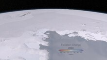
Ice shelves are thick layers of ice floating on the sea – can stabilise the glaciers that feed them. These tend to have accumulation on their tops, may experience melting on their bases, and calve icebergs at their periphery. The catastrophic collapse of the Larsen B ice shelf in the space of three weeks during February 2002 yielded some unexpected observations. The glaciers that had fed the ice sheet (Crane, Jorum, Green, Hektoria – see image) increased substantially in velocity. This cannot have been due to seasonal variability, as glaciers flowing into the remnants of the ice shelf (Flask, Leppard) did not accelerate.

Ice shelves exert a dominant control in Antarctica, but are less important in Greenland, where the ice sheet meets the sea in fjords. Here, melting is the dominant ice removal process, resulting in predominant mass loss occurring towards the edges of the ice sheet, where icebergs are calved in the fjords and surface meltwater runs into the ocean.

Tidal effects are also important; the influence of a 1 m tidal oscillation can be felt as much as 100 km from the sea. On an hour-to-hour basis, surges of ice motion can be modulated by tidal activity. During larger spring tides, an ice stream will remain almost stationary for hours at a time, before a surge of around a foot in under an hour, just after the peak high tide; a stationary period then takes hold until another surge towards the middle or end of the falling tide. At neap tides, this interaction is less pronounced, without tides surges would occur more randomly, approximately every 12 hours.

Ice shelves are also sensitive to basal melting. In Antarctica, this is driven by heat fed to the shelf by the circumpolar deep water current, which is 3 °C above the ice's melting point.

As well as heat, the sea can also exchange salt with the oceans. The effect of latent heat, resulting from melting of ice or freezing of sea water, also has a role to play. The effects of these, and variability in snowfall and base sea level combined, account for around 80 mm a−1 variability in ice shelf thickness.

Long-term changes

Over long time scales, ice sheet mass balance is governed by the amount of sunlight reaching the earth. This variation in sunlight reaching the earth, or insolation, over geologic time is in turn determined by the angle of the earth to the sun and shape of the Earth's orbit, as it is pulled on by neighboring planets; these variations occur in predictable patterns called Milankovitch cycles. Milankovitch cycles dominate climate on the glacial–interglacial timescale, but there exist variations in ice sheet extent that are not linked directly with insolation.

For instance, during at least the last 100,000 years, portions of the ice sheet covering much of North America, the Laurentide Ice Sheet broke apart sending large flotillas of icebergs into the North Atlantic. When these icebergs melted they dropped the boulders and other continental rocks they carried, leaving layers known as ice rafted debris. These so-called Heinrich events, named after their discoverer Hartmut Heinrich, appear to have a 7,000–10,000-year periodicity, and occur during cold periods within the last interglacial.

Internal ice sheet "binge-purge" cycles may be responsible for the observed effects, where the ice builds to unstable levels, then a portion of the ice sheet collapses. External factors might also play a role in forcing ice sheets. Dansgaard–Oeschger events are abrupt warmings of the northern hemisphere occurring over the space of perhaps 40 years. While these D–O events occur directly after each Heinrich event, they also occur more frequently – around every 1500 years; from this evidence, paleoclimatologists surmise that the same forcings may drive both Heinrich and D–O events.

Hemispheric asynchrony in ice sheet behavior has been observed by linking short-term spikes of methane in Greenland ice cores and Antarctic ice cores. During Dansgaard–Oeschger events, the northern hemisphere warmed considerably, dramatically increasing the release of methane from wetlands, that were otherwise tundra during glacial times. This methane quickly distributes evenly across the globe, becoming incorporated in Antarctic and Greenland ice. With this tie, paleoclimatologists have been able to say that the ice sheets on Greenland only began to warm after the Antarctic ice sheet had been warming for several thousand years. Why this pattern occurs is still open for debate.

Glaciers

Flow dynamics

Aerial photograph of the Gorner Glacier (left) and the Grenzgletscher (r.) both framing the Monte Rosa massif (middle) in the Swiss Alps
 
The stress–strain relationship of plastic flow (teal section): a small increase in stress creates an exponentially greater increase in strain, which equates to deformation speed.

The main cause of flow within glaciers can be attributed to an increase in the surface slope, brought upon by an imbalance between the amounts of accumulation vs. ablation. This imbalance increases the shear stress on a glacier until it begins to flow. The flow velocity and deformation will increase as the equilibrium line between these two processes is approached, but are also affected by the slope of the ice, the ice thickness and temperature.

When the amount of strain (deformation) is proportional to the stress being applied, ice will act as an elastic solid. Ice will not flow until it has reached a thickness of 30 meters (98 ft), but after 50 meters (164 ft), small amounts of stress can result in a large amount of strain, causing the deformation to become a plastic flow rather than elastic. At this point the glacier will begin to deform under its own weight and flow across the landscape. According to the Glen–Nye flow law, the relationship between stress and strain, and thus the rate of internal flow, can be modeled as follows:

where:

= shear strain (flow) rate
= stress
= a constant between 2–4 (typically 3 for most glaciers) that increases with lower temperature
= a temperature-dependent constant

The lowest velocities are near the base of the glacier and along valley sides where friction acts against flow, causing the most deformation. Velocity increases inward toward the center line and upward, as the amount of deformation decreases. The highest flow velocities are found at the surface, representing the sum of the velocities of all the layers below.

Glaciers may also move by basal sliding, where the base of the glacier is lubricated by meltwater, allowing the glacier to slide over the terrain on which it sits. Meltwater may be produced by pressure-induced melting, friction or geothermal heat. The more variable the amount of melting at surface of the glacier, the faster the ice will flow.

The top 50 meters of the glacier form the fracture zone, where ice moves as a single unit. Cracks form as the glacier moves over irregular terrain, which may penetrate the full depth of the fracture zone.

Subglacial processes

A cross-section through a glacier. The base of the glacier is more transparent as a result of melting.

Most of the important processes controlling glacial motion occur in the ice-bed contact—even though it is only a few meters thick. Glaciers will move by sliding when the basal shear stress drops below the shear resulting from the glacier's weight.

τD = ρgh sin α
where τD is the driving stress, and α the ice surface slope in radians.
τB is the basal shear stress, a function of bed temperature and softness.
τF, the shear stress, is the lower of τB and τD. It controls the rate of plastic flow, as per the figure (inset, right).

For a given glacier, the two variables are τD, which varies with h, the depth of the glacier, and τB, the basal shear stress.

Basal shear stress

The basal shear stress is a function of three factors: the bed's temperature, roughness and softness.

Whether a bed is hard or soft depends on the porosity and pore pressure; higher porosity decreases the sediment strength (thus increases the shear stress τB). If the sediment strength falls far below τD, movement of the glacier will be accommodated by motion in the sediments, as opposed to sliding. Porosity may vary through a range of methods.

  • Movement of the overlying glacier may cause the bed to undergo dilatancy; the resulting shape change reorganises blocks. This reorganises closely packed blocks (a little like neatly folded, tightly packed clothes in a suitcase) into a messy jumble (just as clothes never fit back in when thrown in in a disordered fashion). This increases the porosity. Unless water is added, this will necessarily reduce the pore pressure (as the pore fluids have more space to occupy).
  • Pressure may cause compaction and consolidation of underlying sediments. Since water is relatively incompressible, this is easier when the pore space is filled with vapour; any water must be removed to permit compression. In soils, this is an irreversible process.
  • Sediment degradation by abrasion and fracture decreases the size of particles, which tends to decrease pore space, although the motion of the particles may disorder the sediment, with the opposite effect. These processes also generate heat, whose importance will be discussed later.
Factors controlling the flow of ice

A soft bed, with high porosity and low pore fluid pressure, allows the glacier to move by sediment sliding: the base of the glacier may even remain frozen to the bed, where the underlying sediment slips underneath it like a tube of toothpaste. A hard bed cannot deform in this way; therefore the only way for hard-based glaciers to move is by basal sliding, where meltwater forms between the ice and the bed itself.

Bed softness may vary in space or time, and changes dramatically from glacier to glacier. An important factor is the underlying geology; glacial speeds tend to differ more when they change bedrock than when the gradient changes.

As well as affecting the sediment stress, fluid pressure (pw) can affect the friction between the glacier and the bed. High fluid pressure provides a buoyancy force upwards on the glacier, reducing the friction at its base. The fluid pressure is compared to the ice overburden pressure, pi, given by ρgh. Under fast-flowing ice streams, these two pressures will be approximately equal, with an effective pressure (pi – pw) of 30 kPa; i.e. all of the weight of the ice is supported by the underlying water, and the glacier is afloat.

Basal melt

A number of factors can affect bed temperature, which is intimately associated with basal meltwater. The melting point of water decreases under pressure, meaning that water melts at a lower temperature under thicker glaciers. This acts as a "double whammy", because thicker glaciers have a lower heat conductance, meaning that the basal temperature is also likely to be higher.

Bed temperature tends to vary in a cyclic fashion. A cool bed has a high strength, reducing the speed of the glacier. This increases the rate of accumulation, since newly fallen snow is not transported away. Consequently, the glacier thickens, with three consequences: firstly, the bed is better insulated, allowing greater retention of geothermal heat. Secondly, the increased pressure can facilitate melting. Most importantly, τD is increased. These factors will combine to accelerate the glacier. As friction increases with the square of velocity, faster motion will greatly increase frictional heating, with ensuing melting – which causes a positive feedback, increasing ice speed to a faster flow rate still: west Antarctic glaciers are known to reach velocities of up to a kilometre per year. Eventually, the ice will be surging fast enough that it begins to thin, as accumulation cannot keep up with the transport. This thinning will increase the conductive heat loss, slowing the glacier and causing freezing. This freezing will slow the glacier further, often until it is stationary, whence the cycle can begin again.

Supraglacial lakes represent another possible supply of liquid water to the base of glaciers, so they can play an important role in accelerating glacial motion. Lakes of a diameter greater than ~300 m are capable of creating a fluid-filled crevasse to the glacier/bed interface. When these crevasses form, the entirety of the lake's (relatively warm) contents can reach the base of the glacier in as little as 2–18 hours – lubricating the bed and causing the glacier to surge. Water that reaches the bed of a glacier may freeze there, increasing the thickness of the glacier by pushing it up from below.

Finally, bed roughness can act to slow glacial motion. The roughness of the bed is a measure of how many boulders and obstacles protrude into the overlying ice. Ice flows around these obstacles by melting under the high pressure on their lee sides; the resultant meltwater is then forced down a steep pressure gradient into the cavity arising in their stoss, where it re-freezes. Cavitation on the stoss side increases this pressure gradient, which assists flow.

Pipe and sheet flow

The flow of water under the glacial surface can have a large effect on the motion of the glacier itself. Subglacial lakes contain significant amounts of water, which can move fast: cubic kilometres can be transported between lakes over the course of a couple of years.

This motion is thought to occur in two main modes: pipe flow involves liquid water moving through pipe-like conduits, like a sub-glacial river; sheet flow involves motion of water in a thin layer. A switch between the two flow conditions may be associated with surging behaviour. Indeed, the loss of sub-glacial water supply has been linked with the shut-down of ice movement in the Kamb ice stream. The subglacial motion of water is expressed in the surface topography of ice sheets, which slump down into vacated subglacial lakes.

Effects

Climate change

Rates of ice-sheet thinning in Greenland (2003).

The implications of the current climate change on ice sheets are difficult to ascertain. It is clear that increasing temperatures are resulting in reduced ice volumes globally. (Due to increased precipitation, the mass of parts of the Antarctic ice sheet may currently be increasing, but the total mass balance is unclear.)

Rising sea levels will reduce the stability of ice shelves, which have a key role in reducing glacial motion. Some Antarctic ice shelves are currently thinning by tens of metres per year, and the collapse of the Larsen B shelf was preceded by thinning of just 1 metre per year. Further, increased ocean temperatures of 1 °C may lead to up to 10 metres per year of basal melting. Ice shelves are always stable under mean annual temperatures of −9 °C, but never stable above −5 °C; this places regional warming of 1.5 °C, as preceded the collapse of Larsen B, in context.

Increasing global air temperatures take around 10,000 years to directly propagate through the ice before they influence bed temperatures, but may have an effect through increased surfacal melting, producing more supraglacial lakes, which may feed warm water to glacial bases and facilitate glacial motion. In areas of increased precipitation, such as Antarctica, the addition of mass will increase rate of glacial motion, hence the turnover in the ice sheet. Observations, while currently limited in scope, do agree with these predictions of an increasing rate of ice loss from both Greenland and Antarctica. A possible positive feedback may result from shrinking ice caps, in volcanically active Iceland at least. Isostatic rebound may lead to increased volcanic activity, causing basal warming – and, through CO
2
release, further climate change.

Cold meltwater provides cooling of the ocean's surface layer, acting like a lid, and also affecting deeper waters by increasing subsurface ocean warming and thus facilitating ice melt.

Our "pure freshwater" experiments show that the low-density lid causes deep-ocean warming, especially at depths of ice shelf grounding lines that provide most of the restraining force limiting ice sheet discharge.

Erosion

Differential erosion enhances relief, as clear in this incredibly steep-sided Norwegian fjord.

Because ice can flow faster where it is thicker, the rate of glacier-induced erosion is directly proportional to the thickness of overlying ice. Consequently, pre-glacial low hollows will be deepened and pre-existing topography will be amplified by glacial action, while nunataks, which protrude above ice sheets, barely erode at all – erosion has been estimated as 5 m per 1.2 million years. This explains, for example, the deep profile of fjords, which can reach a kilometer in depth as ice is topographically steered into them. The extension of fjords inland increases the rate of ice sheet thinning since they are the principal conduits for draining ice sheets. It also makes the ice sheets more sensitive to changes in climate and the ocean.

Younger Dryas

From Wikipedia, the free encyclopedia
 
Evolution of temperatures in the postglacial period, after the Last Glacial Maximum (LGM), showing very low temperatures for the most part of the Younger Dryas, rapidly rising afterwards to reach the level of the warm Holocene, based on Greenland ice cores.

The Younger Dryas (around 12,900 to 11,700 years BP) was a return to glacial conditions after the Late Glacial Interstadial, which temporarily reversed the gradual climatic warming after the Last Glacial Maximum (LGM) started receding around 20,000 BP. It is named after an indicator genus, the alpine-tundra wildflower Dryas octopetala, as its leaves are occasionally abundant in late glacial, often minerogenic-rich sediments, such as the lake sediments of Scandinavia.

Physical evidence of a sharp decline in temperature over most of the Northern Hemisphere has been discovered by geological research. This temperature change occurred at the end of what the earth sciences refer to as the Pleistocene epoch and immediately before the current, warmer Holocene epoch. In archaeology, this time frame coincides with the final stages of the Upper Paleolithic in many areas.

The Younger Dryas was the most recent and longest of several interruptions to the gradual warming of the Earth's climate since the severe LGM, about 27,000 to 24,000 years BP. The change was relatively sudden, taking place in decades, and it resulted in a decline of temperatures in Greenland by 4 to 10 °C (7.2 to 18 °F), and advances of glaciers and drier conditions over much of the temperate Northern Hemisphere. It is thought to have been caused by a decline in the strength of the Atlantic meridional overturning circulation, which transports warm water from the Equator towards the North Pole, in turn thought to have been caused by an influx of fresh, cold water from North America to the Atlantic.

The Younger Dryas was a period of climatic change, but the effects were complex and variable. In the Southern Hemisphere and some areas of the Northern Hemisphere, such as southeastern North America, a slight warming occurred.

General description and context

This image shows temperature changes, determined as proxy temperatures, taken from the central region of Greenland's ice sheet during the Late Pleistocene and beginning of the Holocene.

The presence of a distinct cold period at the end of the LGM interval has been known for a long time. Paleobotanical and lithostratigraphic studies of Swedish and Danish bog and lake sites, as in the Allerød clay pit in Denmark, first recognized and described the Younger Dryas.

The Younger Dryas is the youngest and longest of three stadials, which resulted from typically abrupt climatic changes that took place over the last 16,000 years. Within the Blytt–Sernander classification of north European climatic phases, the prefix "Younger" refers to the recognition that this original "Dryas" period was preceded by a warmer stage, the Allerød oscillation, which, in turn, was preceded by the Older Dryas, around 14,000 calendar years BP. That is not securely dated, and estimates vary by 400 years, but it is generally accepted to have lasted around 200 years. In northern Scotland, the glaciers were thicker and more extensive than during the Younger Dryas. The Older Dryas, in turn, was preceded by another warmer stage, the Bølling oscillation, that separated it from a third and even older stadial, often known as the Oldest Dryas. The Oldest Dryas occurred about 1,770 calendar years before the Younger Dryas and lasted about 400 calendar years. According to the GISP2 ice core from Greenland, the Oldest Dryas occurred between about 15,070 and 14,670 calendar years BP.

In Ireland, the Younger Dryas has also been known as the Nahanagan Stadial, and in Great Britain it has been called the Loch Lomond Stadial. In the Greenland Summit ice core chronology, the Younger Dryas corresponds to Greenland Stadial 1 (GS-1). The preceding Allerød warm period (interstadial) is subdivided into three events: Greenland Interstadial-1c to 1a (GI-1c to GI-1a).

Abrupt climate change

Temperatures derived from EPICA Dome C Ice Core in Antarctica

Since 1916 and the onset and then the refinement of pollen analytical techniques and a steadily-growing number of pollen diagrams, palynologists have concluded that the Younger Dryas was a distinct period of vegetational change in large parts of Europe during which vegetation of a warmer climate was replaced by that of a generally cold climate, a glacial plant succession that often contained Dryas octopetala. The drastic change in vegetation is typically interpreted to be an effect of a sudden decrease in (annual) temperature, unfavorable for the forest vegetation that had been spreading northward rapidly. The cooling not only favored the expansion of cold-tolerant, light-demanding plants and associated steppe fauna, but also led to regional glacial advances in Scandinavia and a lowering of the regional snow line.

The change to glacial conditions at the onset of the Younger Dryas in the higher latitudes of the Northern Hemisphere, between 12,900 and 11,500 calendar years BP, has been argued to have been quite abrupt. It is in sharp contrast to the warming of the preceding Older Dryas interstadial. Its end has been inferred to have occurred over a period of a decade or so, but the onset may have even been faster. Thermally fractionated nitrogen and argon isotope data from Greenland ice core GISP2 indicate that its summit was around 15 °C (27 °F) colder during the Younger Dryas than today.

In Great Britain, beetle fossil evidence suggests that the mean annual temperature dropped to −5 °C (23 °F), and periglacial conditions prevailed in lowland areas, and icefields and glaciers formed in upland areas. Nothing of the period's size, extent, or rapidity of abrupt climate change has been experienced since its end.

In addition to the Younger, Older, and Oldest Dryases, a century-long period of colder climate, similar to the Younger Dryas in abruptness, has occurred within both the Bølling oscillation and the Allerød oscillation interstadials. The cold period that occurred within the Bølling oscillation is known as the intra-Bølling cold period, and the cold period that occurred within the Allerød oscillation is known as the intra-Allerød cold period. Both cold periods are comparable in duration and intensity with the Older Dryas and began and ended quite abruptly. The cold periods have been recognized in sequence and relative magnitude in paleoclimatic records from Greenland ice cores, European lacustrine sediments, Atlantic Ocean sediments, and the Cariaco Basin, Venezuela.

Examples of older Younger Dryas-like events have been reported from the ends (called terminations) of older glacial periods. Temperature-sensitive lipids, long chain alkenones, found in lake and marine sediments, are well-regarded as a powerful paleothermometer for the quantitative reconstruction of past continental climates. The application of alkenone paleothermometers to high-resolution paleotemperature reconstructions of older glacial terminations have found that very similar, Younger Dryas-like paleoclimatic oscillations occurred during Terminations II and IV. If so, the Younger Dryas is not the unique paleoclimatic event, in terms of size, extent, and rapidity, as it is often regarded to be. Furthermore, paleoclimatologists and Quaternary geologists reported finding what they characterized as well-expressed Younger Dryas events in the Chinese δ18
O
records of Termination III in stalagmites from high-altitude caves in Shennongjia area, Hubei Province, China. Various paleoclimatic records from ice cores, deep-sea sediments, speleothems, continental paleobotanical data, and loesses show similar abrupt climate events, which are consistent with Younger Dryas events, during the terminations of the last four glacial periods. They argue that Younger Dryas events might be an intrinsic feature of deglaciations that occur at the end of glacial periods.

Timing

Analyses of stable isotopes from Greenland ice cores provide estimates for the start and end of the Younger Dryas. The analysis of Greenland Summit ice cores, as part of the Greenland Ice Sheet Project-2 and Greenland Icecore Project, estimated that the Younger Dryas started about 12,800 ice (calendar) years BP. Depending on the specific ice core analysis consulted, the Younger Dryas is estimated to have lasted 1,150–1,300 years. Measurements of oxygen isotopes from the GISP2 ice core suggest the ending of the Younger Dryas took place over just 40 to 50 years in three discrete steps, each lasting five years. Other proxy data, such as dust concentration and snow accumulation, suggest an even more rapid transition, which would require about 7 °C (13 °F) of warming in just a few years. Total warming in Greenland was 10 ± 4 °C (18 ± 7 °F).

The end of the Younger Dryas has been dated to around 11,550 years ago, occurring at 10,000 BP (uncalibrated radiocarbon year), a "radiocarbon plateau" by a variety of methods, mostly with consistent results.

The International Commission on Stratigraphy put the start of the Greenlandian stage, and implicitly the end of the Younger Dryas, at 11,700 years before 2000.

Although the start of the Younger Dryas is regarded to be synchronous across the North Atlantic region, recent research concluded that the start of the Younger Dryas might be time-transgressive even within there. After an examination of laminated varve sequences, Muschitiello and Wohlfarth found that the environmental changes that define the beginning of the Younger Dryas are diachronous in their time of occurrence according to latitude. According to the changes, the Younger Dryas occurred as early as AROUND 12,900–13,100 calendar years ago along latitude 56–54°N. Further north, they found that the changes occurred at roughly 12,600–12,750 calendar years ago.

According to the analyses of varved sediments from Lake Suigetsu, Japan, and other paleoenvironmental records from Asia, a substantial delay occurred in the onset and the end of the Younger Dryas between Asia and the North Atlantic. For example, paleoenvironmental analysis of sediment cores from Lake Suigetsu in Japan found the Younger Dryas temperature decline of 2–4 °C between 12,300 and 11,250 varve (calendar) years BP, instead of about 12,900 calendar years BP in the North Atlantic region.

In contrast, the abrupt shift in the radiocarbon signal from apparent radiocarbon dates of 11,000 radiocarbon years to radiocarbon dates of 10,700–10,600 radiocarbon years BP in terrestrial macrofossils and tree rings in Europe over a 50-year period occurred at the same time in the varved sediments of Lake Suigetsu. However, this same shift in the radiocarbon signal antedates the start of Younger Dryas at Lake Suigetsu by a few hundred years. Interpretations of data from Chinese also confirm that the Younger Dryas East Asia lags the North Atlantic Younger Dryas cooling by at least 200 to 300 years. Although the interpretation of the data is more murky and ambiguous, the end of the Younger Dryas and the start of Holocene warming likely were similarly delayed in Japan and in other parts of East Asia.

Similarly, an analysis of a stalagmite growing from a cave in Puerto Princesa Subterranean River National Park, Palawan, the Philippines, found that the onset of the Younger Dryas was also delayed there. Proxy data recorded in the stalagmite indicate that more than 550 calendar years were needed for Younger Dryas drought conditions to reach their full extent in the region and about 450 calendar years to return to pre-Younger Dryas levels after it ended.

Global effects

In Western Europe and Greenland, the Younger Dryas is a well-defined synchronous cool period. Cooling in the tropical North Atlantic may, however, have preceded it by a few hundred years; South America shows a less well-defined initiation but a sharp termination. The Antarctic Cold Reversal appears to have started a thousand years before the Younger Dryas and has no clearly defined start or end; Peter Huybers has argued that there is a fair confidence in the absence of the Younger Dryas in Antarctica, New Zealand and parts of Oceania. Timing of the tropical counterpart to the Younger Dryas, the Deglaciation Climate Reversal (DCR), is difficult to establish as low latitude ice core records generally lack independent dating over the interval. An example of this is the Sajama ice core (Bolivia), for which the timing of the DCR has been pinned to that of the GISP2 ice core record (central Greenland). Climatic change in the central Andes during the DCR, however, was significant and was characterized by a shift to much wetter and likely colder conditions. The magnitude and abruptness of the changes would suggest that low latitude climate did not respond passively during the YD/DCR.

Effects of the Younger Dryas were of varying intensity throughout North America. In western North America, its effects were less intense than in Europe or northeast North America; however, evidence of a glacial re-advance indicates that Younger Dryas cooling occurred in the Pacific Northwest. Speleothems from the Oregon Caves National Monument and Preserve in southern Oregon's Klamath Mountains yield evidence of climatic cooling contemporaneous to the Younger Dryas.

Other features include the following:

  • Replacement of forest in Scandinavia with glacial tundra (which is the habitat of the plant Dryas octopetala)
  • Glaciation or increased snow in mountain ranges around the world
  • Formation of solifluction layers and loess deposits in Northern Europe
  • More dust in the atmosphere, originating from deserts in Asia
  • A decline in evidence for Natufian hunter gatherer permanent settlements in the Levant, suggesting a reversion to a more mobile way of life
  • The Huelmo–Mascardi Cold Reversal in the Southern Hemisphere ended at the same time
  • Decline of the Clovis culture; while no definitive cause for the extinction of many species in North America such as the Columbian mammoth, as well as the Dire wolf, Camelops, and other Rancholabrean megafauna during the Younger Dryas has been determined, climate change and human hunting activities have been suggested as contributing factors. Recently, it has been found that these megafauna populations collapsed 1000 years earlier

North America

East

The Younger Dryas is a period significant to the study of the response of biota to abrupt climate change and to the study of how humans coped with such rapid changes. The effects of sudden cooling in the North Atlantic had strongly regional effects in North America, with some areas experiencing more abrupt changes than others.

The effects of the Younger Dryas cooling impacted the area that is now New England and parts of maritime Canada more rapidly than the rest of the present day United States at the beginning and the end of the Younger Dryas chronozone. Proxy indicators show that summer temperature conditions in Maine decreased by up to 7.5°C. Cool summers, combined with cold winters and low precipitation, resulted in a treeless tundra up to the onset of the Holocene, when the boreal forests shifted north.

Vegetation in the central Appalachian Mountains east towards the Atlantic Ocean was dominated by spruce (Picea spp.) and tamarack (Larix laricina) boreal forests that later changed rapidly to temperate, more broad-leaf tree forest conditions at the end of the Younger Dryas period. Conversely, pollen and macrofossil evidence from near Lake Ontario indicates that cool, boreal forests persisted into the early Holocene. West of the Appalachians, in the Ohio River Valley and south to Florida rapid, no-analog vegetation responses seem to have been the result of rapid climate changes, but the area remained generally cool, with hardwood forest dominating. During the Younger Dryas, the Southeastern United States was warmer and wetter than the region had been during the Pleistocene because of trapped heat from the Caribbean within the North Atlantic Gyre caused by a weakened Atlantic meridional overturning circulation (AMOC).

Central

Also, a gradient of changing effects occurred from the Great Lakes region south to Texas and Louisiana. Climatic forcing moved cold air into the northern portion of the American interior, much as it did the Northeast. Although there was not as abrupt a delineation as seen on the Eastern Seaboard, the Midwest was significantly colder in the northern interior than it was south, towards the warmer climatic influence of the Gulf of Mexico. In the north, the Laurentide Ice Sheet re-advanced during the Younger Dryas, depositing a moraine from west Lake Superior to southeast Quebec. Along the southern margins of the Great Lakes, spruce dropped rapidly, while pine increased, and herbaceous prairie vegetation decreased in abundance, but increased west of the region.

Rocky Mountains

Effects in the Rocky Mountain region were varied. In the northern Rockies, a significant increase in pines and firs suggests warmer conditions than before and a shift to subalpine parkland in places. That is hypothesized to be the result of a northward shift in the jet stream, combined with an increase in summer insolation as well as a winter snow pack that was higher than today, with prolonged and wetter spring seasons. There were minor re-advancements of glaciers in place, particularly in the northern ranges, but several sites in the Rocky Mountain ranges show little to no changes in vegetation during the Younger Dryas. Evidence also indicates an increase in precipitation in New Mexico because of the same Gulf conditions that were influencing Texas.

West

The Pacific Northwest region experienced 2 to 3 °C of cooling and an increase in precipitation. Glacial re-advancement has been recorded in British Columbia as well as in the Cascade Range. An increase of pine pollen indicates cooler winters within the central Cascades. On the Olympic Peninsula, a mid-elevation site recorded a decrease in fire, though forest persisted and erosion increased during the Younger Dryas, suggesting cool and wet conditions. Speleothem records indicate an increase in precipitation in southern Oregon, the timing of which coincides with increased sizes of pluvial lakes in the northern Great Basin. Pollen record from the Siskiyou Mountains suggests a lag in timing of the Younger Dryas, indicating a greater influence of warmer Pacific conditions on that range, but the pollen record is less chronologically constrained than the aforementioned speleothem record. The Southwest appears to have seen an increase in precipitation, as well, also with an average 2° of cooling.

Effects on agriculture

The Younger Dryas is often linked to the Neolithic Revolution, the adoption of agriculture in the Levant. The cold and dry Younger Dryas arguably lowered the carrying capacity of the area and forced the sedentary early Natufian population into a more mobile subsistence pattern. Further climatic deterioration is thought to have brought about cereal cultivation. While relative consensus exists regarding the role of the Younger Dryas in the changing subsistence patterns during the Natufian, its connection to the beginning of agriculture at the end of the period is still being debated.

Sea level

Based upon solid geological evidence, consisting largely of the analysis of numerous deep cores from coral reefs, variations in the rates of sea level rise have been reconstructed for the postglacial period. For the early part of the sea level rise that is associated with deglaciation, three major periods of accelerated sea level rise, called meltwater pulses, occurred. They are commonly called meltwater pulse 1A0 for the pulse between 19,000 and 19,500 calendar years ago; meltwater pulse 1A for the pulse between 14,600 and 14,300 calendar years ago and meltwater pulse 1B for the pulse between 11,400 and 11,100 calendar years ago. The Younger Dryas occurred after meltwater pulse 1A, a 13.5 m rise over about 290 years, centered at about 14,200 calendar years ago, and before meltwater pulse 1B, a 7.5 m rise over about 160 years, centered at about 11,000 calendar years ago. Finally, not only did the Younger Dryas postdate both all of meltwater pulse 1A and predate all of meltwater pulse 1B, it was a period of significantly-reduced rate of sea level rise relative to the periods of time immediately before and after it.

Possible evidence of short-term sea level changes has been reported for the beginning of the Younger Dryas. First, the plotting of data by Bard and others suggests a small drop, less than 6 m, in sea level near the onset of the Younger Dryas. There is a possible corresponding change in the rate of change of sea level rise seen in the data from both Barbados and Tahiti. Given that this change is "within the overall uncertainty of the approach," it was concluded that a relatively smooth sea-level rise, with no significant accelerations, occurred then. Finally, research by Lohe and others in western Norway has reported a sea-level low-stand at 13,640 calendar years ago and a subsequent Younger Dryas transgression starting at 13,080 calendar years ago. They concluded that the timing of the Allerød low-stand and the subsequent transgression were the result of increased regional loading of the crust, and geoid changes were caused by an expanding ice sheet, which started growing and advancing in the early Allerød about 13,600 calendar years ago, well before the start of the Younger Dryas.

Causes

The current theory is that the Younger Dryas was caused by significant reduction or shutdown of the North Atlantic "Conveyor", which circulates warm tropical waters northward, in response to a sudden influx of fresh water from Lake Agassiz and deglaciation in North America. Geological evidence for such an event is not fully secure, but recent work has identified a pathway along the Mackenzie River that would have spilled fresh water into the Arctic and thence into the Atlantic. The global climate would then have become locked into the new state until freezing removed the fresh water "lid" from the North Atlantic. However, simulations indicated that a one-time-flood could not likely cause the new state to be locked for 1000 years. Once the flood ceased, the AMOC would recover and the Younger Dryas would stop in less than 100 years. Therefore, continuous freshwater input was necessary to maintain a weak AMOC for more than 1000 years. Recent study proposed that the snowfall could be a source of continuous freshwater resulting in a prolonged weakened state of the AMOC. An alternative theory suggests instead that the jet stream shifted northward in response to the changing topographic forcing of the melting North American ice sheet, which brought more rain to the North Atlantic, which freshened the ocean surface enough to slow the thermohaline circulation. There is also some evidence that a solar flare may have been responsible for the megafaunal extinction, but that cannot explain the apparent variability in the extinction across all continents.

Impact hypothesis

A hypothesized Younger Dryas impact event, presumed to have occurred in North America about 12,900 years ago, has been proposed as the mechanism that initiated the Younger Dryas cooling.

Among other things, findings of melt-glass material in sediments in Pennsylvania, South Carolina and Syria have been reported. The researchers argue that the material, which dates back nearly 13,000 years, was formed at temperatures of 1,700 to 2,200 °C (3,100 to 4,000 °F) as the result of a bolide impact. They argue that these findings support the controversial Younger Dryas Boundary (YDB) hypothesis that the bolide impact occurred at the onset of the Younger Dryas. The hypothesis has been questioned in research that concluded that most of the results cannot be confirmed by other scientists and that the authors misinterpreted the data.

After a review of the sediments found at the sites, new research has found that the sediments claimed by hypothesis proponents to be deposits resulting from a bolide impact date from much later or much earlier times than the proposed date of the cosmic impact. The researchers examined 29 sites commonly referenced to support the impact theory to determine if they can be geologically dated to around 13,000 years ago. Crucially, only three of those sites actually date from then.

Charles R. Kinzie, et al. looked at the distribution of nanodiamonds produced during extraterrestrial collisions: 50 million km2 of the Northern Hemisphere at the YDB were found to have the nanodiamonds. Only two layers exist showing these nanodiamonds: the YDB 12,800 calendar years ago and the Cretaceous-Tertiary boundary, 65 million years ago, which, in addition, is marked by mass extinctions.

New support for the cosmic-impact hypothesis of the origin of the YDB was published in 2018. It postulates Earth's collision with one or more fragments from a larger (over 100-km diameter) disintegrating comet (some remnants of which have persisted within the inner solar system to the present day). Evidence is presented consistent with large-scale biomass burning (wildfires) following the putative collision. The evidence is derived from analyses of ice cores, glaciers, lake- and marine-sediment cores, and terrestrial sequences.

Evidence that adds further to the credibility of this hypothesis includes extraterrestrial platinum, which has been found in meteorites. There are multiple sites around the world with spikes in levels of platinum that can be associated with the Impact Hypothesis, of which at least 25 are major. Although most of these sites are found in the Northern Hemisphere, a study conducted in October 2019 has found and confirmed another site with high platinum levels located in the Wonderkrater area north of Pretoria in South Africa. This coincides with the Pilauco site in southern Chile which also happens to contain high levels of platinum as well as rare metallic spherules, gold and high-temperature iron that is rarely found in nature and suspected of originating from airbursts or impacts. These Southern Hemisphere high platinum zones further add to the credibility of the Younger Dryas impact hypothesis.

Laacher See eruption hypothesis

The Laacher See volcano erupted at approximately the same time as the beginning of the Younger Dryas, and has historically been suggested as a possible cause. Laacher See is a maar lake, a lake within a broad low-relief volcanic crater about 2 km (1.2 mi) diameter. It is in Rhineland-Palatinate, Germany, about 24 km (15 mi) northwest of Koblenz and 37 km (23 mi) south of Bonn. The maar lake is within the Eifel mountain range, and is part of the East Eifel volcanic field within the larger Vulkaneifel This eruption was of sufficient size, VEI 6, with over 20 km3 (2.4 cu mi) tephra ejected, to have caused significant temperature change in the Northern Hemisphere.

Currently available evidence suggests that the hypothesis that the Laacher See eruption triggered the Younger Dryas has considerable merit. Earlier, the hypothesis was dismissed based on the timing of the Laacher See Tephra relative to the clearest signs of climate change associated with the Younger Dryas Event within various Central European varved lake deposits. This set the scene for the development of the Younger Dryas Impact Hypothesis and the meltwater pulse hypothesis. However, more recent research places the very large eruption of the Laacher See volcano at 12,880 years BP, coinciding with the initiation of North Atlantic cooling into the Younger Dryas. Although the eruption was about twice size as the 1991 eruption of Mount Pinatubo, it contained considerably more sulfur, potentially rivalling the climatologically very significant 1815 eruption of Mount Tambora in terms of amount of sulfur introduced into the atmosphere. Evidence exists that an eruption of this magnitude and sulfur content occurring during deglaciation could trigger a long-term positive feedback involving sea ice and oceanic circulation, resulting in a cascade of climate shifts across the North Atlantic and the globe. Further support for this hypothesis appears as a large volcanogenic sulfur spike within Greenland ice, coincident with both the date of the Laacher See eruption and the beginning of cooling into the Younger Dryas as recorded in Greenland. The mid-latitude westerly winds may have tracked sea ice growth southward across the North Atlantic as the cooling became more pronounced, resulting in time transgressive climate shifts across northern Europe and explaining the lag between the Laacher See Tephra and the clearest (wind-derived) evidence for the Younger Dryas in central European lake sediments.

Although the timing of the eruption appears to coincide with the beginning of the Younger Dryas, and the amount of sulfur contained would have been enough to result in substantial Northern Hemisphere cooling, the hypothesis has not yet been tested thoroughly, and no climate model simulations are currently available. The exact nature of the positive feedback is also unknown, and questions remain regarding the sensitivity to the deglacial climate to a volcanic forcing of the size and sulfur content of the Laacher See eruption. However, evidence exists that a similar feedback following other volcanic eruptions could also have triggered similar long-term cooling events during the last glacial period, the Little Ice Age, and the Holocene in general, suggesting that the proposed feedback is poorly constrained but potentially common.

It is possible that the Laacher See eruption was triggered by lithospheric unloading related to the removal of ice during the last deglaciation, a concept that is supported by the observation that three of the largest eruptions within the East Eifel Volcanic Field occurred during deglaciation. Because of this potential relationship to lithospheric unloading, the Laacher See eruption hypothesis suggests that eruptions such as the 12,880 year BP Laacher See eruption are not isolated in time and space, but instead are a fundamental part of deglaciation, thereby also explaining the presence of Younger Dryas-type events during other glacial terminations.

Vela supernova hypothesis

Models simulating the effects of a supernova on the Earth, most notably gamma-ray bursts and X-ray flashes, indicate that the Earth would experience depletion of the ozone layer, increased UV exposure, global cooling, and nitrogen changes on the Earth's surface and in the troposphere. In addition to evidence of global cooling during the Younger Dryas, the presence of carbon-rich “black mats” around 30 cm in thickness across faunal and paleoindian hunting sites suggests that an abrupt change to more aquatic conditions occurred in a small time window. Brakenridge also discusses pollen-core research that suggests global cooling conditions did not only occur in northern latitudes, but also latitudes reaching 41°S. Tree-ring evidence shows an increase in cosmogenic 14C in ice cores. The time frame of this increase also overlaps with the increase of another cosmogenic isotope, 10Be.

The only supernova known to have occurred at the beginning of the Younger Dryas, and in close enough proximity to the solar system to have affected the Earth, is the Vela supernova, of which only the Vela supernova remnant remains.

However, most geologists regard this hypothesis as an academic exercise by astronomers with little knowledge of earth system science.


Coastal migration (Americas)

From Wikipedia, the free encyclopedia
https://en.wikipedia.org/wiki/Coastal_migration_(Americas)

The coastal migration hypothesis is one of two possibilities in the settlement of the Americas at the time of the Last Glacial Maximum. It proposes a migration route involving watercraft, via the Kurile island chain, along the coast of Beringia and the archipelagos off the Alaskan-British Columbian coast, continuing down the coast to Central and South America.  The alternative is the "interior route," which assumes migration along an ice-free corridor between the Laurentide and Cordilleran ice sheets during the Last Glacial Maximum.

The coastal migration hypothesis has been bolstered by findings such as the report that the sediments in the Port Eliza caves on Vancouver Island indicate the possibility of a survivable climate as far back 16 ka (16,000 years) in the area, while the continental ice sheets were nearing their maximum extent. Despite such research, the hypothesis is still subject to considerable debate. Carlson, Erlandson, and others have argued for a coastal migration from Alaska to the Pacific Northwest pre-11ka (before ≈13,000 calendar years ago) that predates the hypothesized migration of Clovis people moving south through an ice-free corridor located near the continental divide. The coastal migrants may have been followed by the Clovis culture when the final retreat of the Cordilleran Ice Sheet opened migration routes between interior and coastal Alaska.

A 2017 discovery on Triquet Island by an archaeological team from the University of Victoria appears to verify local First Nation oral history traditions that the island was inhabited during the ice age. A hearth excavated at the site was determined by radiocarbon dating to be between 13,613 and 14,086 years old, making it one of the oldest settlements in North America.

While some archaeologists believe that the Clovis people moved south from Alaska through an ice-free corridor located between modern British Columbia and Alberta, recent dating of Clovis and similar Paleoindian sites in Alaska suggest that Clovis technology actually moved from the south into Alaska following the melting of the continental ice sheets at about 10.5 ka.

In North America, the earliest dog remains were found in Lawyer’s Cave on the Alaskan mainland east of Wrangell Island in the Alexander Archipelago of southeast Alaska, radiocarbon dating indicates it is 10,150 years old. A genetic-based estimate indicates that this dog's lineage had split from the Siberian Zhokhov Island dog lineage 16,700 years ago. This timing coincides with the suggested opening of the North Pacific coastal route into North America.

Sea levels

Dating the initial coastal migration is challenging because of the flooding of early settlement sites by the rise of the eustatic sea level accompanying deglaciation. Dates for sites such as ones at Ground Hog Bay in SE Alaska (10.2 ka) and Namu, about 800 km south of Ground Hog Bay near modern Bella Coola (9.7 ka) thus represent early mainland settlement above the present-day sea level after earlier waterborne migration while the sea level was lower and the coastal mainland was still glaciated. Full understanding of the initial migration requires careful reconstruction of the land and ecological resources available to the migrants in their contemporary environment.

Evidence from Southeast Alaska and Haida Gwaii (Queen Charlotte Islands) in British Columbia, provides some data about food and land resources during early settlement. Fedje and Christensen (1999:642) have identified several sites on Haida Gwaii that date to post 9ka. The oldest human yet found on the west coast of North America are from On Your Knees Cave, which is on Prince of Wales Island in Southeast Alaska. The individual, a young man in his early twenties when he died, has been dated to ≈10,000 cal BP and isotopic analyses indicate he was raised on a diet primarily of marine foods.

These data suggest human occupation when the sea level was lower than present, and that submerged archaeological sites could occur along the paleocoastline beyond the current shorelines of Haida Gwaii (Fedje & Christensen, 1999) and Southeast Alaska.

Between 13 and 10.5 ka, Haida Gwaii had more than double its current land area (Fedje & Christensen, 1999:638). This area was flooded with the a rapid rise in sea level between 11 and 9 ka. (Fedje & Christensen, 1999:638). Therefore, evidence of initial human occupation on the paleocoastline of Haida Gwaii would now be below sea level. Conversely, older sites that are located near modern shorelines would have been approximately 24 km (15 mi) from the coast (Fedje & Christensen, 1999:638).

The antiquity of the lithic scatters that Fedje and Christensen (1999) have found in intertidal zones along the Haida Gwaii coast suggests an early human occupation of the area.

Fedje and Christensen (1999) support Carlson (1990), and Fladmark's (1975, 1979 & 1989) initial coastal migration model rather than the ice-free corridor model through their investigations of intertidal zones on Haida Gwaii.

The Peopling of the Americas

The timing and route of human arrival to mid-latitude North America is highly contested and both the terrestrial and coastal routes suffer from a paucity of archaeological evidence. Beringia is very difficult to access in modern day because it is now below current sea level. However, hypotheses have been made based on mitochondrial DNA research to address the question of whether or not humans left Beringia and settled mid-latitude America during the LGM or stayed in Beringia throughout the LGM.

Three-wave Model

The Three-wave model is an older model that attempts to explain the peopling of the Americas suggested by Greenberg et al. (1986). Using linguistic and genetic data as well as dental anthropology, Greenberg et al. subdivided Native Americans into three groups: Amarind, Na-Dene, and Aleut-Inuit. They explained the linguistic, anatomical, and genetic differences they found in each group as a result of separate migrations or waves out of Northeast Asia to the Americas.

This model has been criticized by anthropologist Emőke J.E. Szathmáry who thought that Greenberg's study overstated biological difference. Szathmáry argued that the differences between each group could be better explained by isolation rather than the three migrations. In 1977, Bonatto and Szathámry (1997) concluded that the presence of glaciers isolated the populations from one another, causing them to settle in Beringia rather than use it as a bridge or corridor for migration to mid-latitude America. Bonatto and Szathmáry suggest that after the LGM, humans actually migrated out of Beringia rather than out of Asia.

Beringian "Standstill" Hypothesis

The Beringian "Standstill" Hypothesis proposed by Tamm et al. (2007) builds on Bonatto and Szathmáry's idea of migration out of Beringia after the LGM. Using mitochondrial DNA (mDNA) and computer modeling of ice sheets, Tamm et al. estimate an isolation period in Beringia of about ~10,000 years, concluding that the isolated Beringian populations spread throughout mid-latitude and South America after the LGM due to blocked access to North America before 15,000 cal BP.

At the turn of the 21st century, more research began to favor the coastal migration theory over terrestrial theories for the peopling of the Americas. Paleoecological evidence suggests that travel along the coast would have been possible between 13 and 11 ka as the ice sheets were retreating. The coastal region was quite hospitable by 13 ka to peoples with watercraft and a maritime adaptation.

Kelp Highway Hypothesis

This hypothesis addresses how humans could have colonized the Americas before the ice sheets retreated, allowing for terrestrial migration. Erlandson et al. (2007) suggest that coastal migrations and settlements happened in higher latitudes, such as 35-70°N, where coastal ecosystems would be more productive because of geography and upwelling in the Northern Pacific Rim. The different kelps of the Pacific Rim are major contributors to the areas of productivity and biodiversity and support a wide variety of life such as marine mammals, shellfish, fish, seabirds, and edible seaweeds that would also support a coastal community of hunter-gatherers.

While the benefits of kelp forests are very clear in the present day Pacific Rim, Erlandson et al. address the difficulties of understanding the ancient kelp forests as they would have existed at the end of the LGM. But, they were able to estimate where the kelp forests might have been distributed.

Archeological and Geological Evidence

Archaeological sites from the Pacific Northwest to Baja California have offered more evidence to suggest the coastal migration theory. Sites in the North Pacific have been discovered and researched to help develop a baseline of early coastal colonization data. The Arlington Springs Man is an excavation of 10,000-year-old human remains in the Channel Islands. Marine shellfish remains associated with Kelp Forests were recovered in the Channel Island sites and at other sites such as Daisy Cave and Cardwell Bluffs dated between 12,000 and 9000 cal BP.

In South America, evidence of human presence as early as 12,500 cal BP was discovered at the Monte Verde site pointing to coastal migration south over inland migration as the ice sheet would not yet be retreated.

Further evidence to support the coastal migration hypothesis has been found in the biological viability of regions after deglaciation. Lesnek et al. 2018 found that the deglaciation of the Pacific coastal corridor allowed for biological productivity, availability of food resources, and an accessible migration route for early colonization.

Zoo-archaeological Evidence

Further evidence of a coastal ecology sufficient to support early coastal migrants comes from zoo-archaeological finds along the Northwest coast. Goat remains as old as 12 ka have been found on Vancouver Island, British Columbia, as well as, bear remains dating to 12.5 ka in the Prince of Wales Archipelago, British Columbia. Even older remains of black and brown bear, caribou, sea birds, fish, and ringed seal have been dated from a number of caves in Southeast Alaska by paleontologist Timothy Heaton. This means that there were enough land and floral resources to support large land mammals and, theoretically, humans. Further intertidal and underwater investigations may produce sites older than 11 ka. Coastal occupation prior to 13 ka would allow for people to migrate further south and account for the early South American sites.

Watercraft

Fedje and Christensen (1999:648) also argue that the coast was likely colonized before 13 ka, largely based on watercraft evidence from Japan before 13 ka Dietary evidence from middens in Indonesia indicates the development of offshore fishing, requiring watercraft, between 35 and 40 ka. Sea-going cultures were mobile in the island-rich environment off the late Pleistocene coast of east Asia, facilitating the spread of marine technology and skills through the Philippines, up the Ryukyu chain, to Japan. Warming of the climate after about 16 ka (although glaciation would remain) could have provided an impetus for seaborne migration up the Kurile island chain towards North America, through some combination of a more hospitable climate and increased ocean productivity. Although no boats have been recovered from early Pacific Coast archaeological sites, this may be due to poor preservation of organic materials and the inundation of coastal areas mentioned above. We can still infer water travel based on the presence of artifacts made by humans found at island sites.

Anecdotal evidence comes from the surviving Bella Bella oral tradition, as recorded by Franz Boas in 1898. "In the beginning there was nothing but water and ice and a narrow strip of shoreline." Some believe this story describes the environment of the Northwest Coast during the last deglaciation.

Migration south

Further south, California's Channel Islands have also produced evidence for early seafaring by Paleoindian (or Paleocoastal) peoples. Santa Rosa and San Miguel islands, for instance, have produced 11 sites dating to the Terminal Pleistocene, including the Arlington Man site dated to ≈11 ka and Daisy Cave occupied about 10.7 ka.

Significantly, the Channel Islands were not connected to the mainland coast during the Quaternary, so maritime peoples contemporary with the Clovis and Folsom complexes in the interior had to have seaworthy boats to colonize them. The Channel Islands have also produced the earliest fishhooks yet found in the Americas, bone bipoints (gorges) that date between about 8.5 and 9 ka (10,000 and 9500 calendar years).

Even further south, the Monte Verde site in Chile has become accepted as the earliest settlement in South America, dating to at least 14,500 years ago. This is believed to indicate migration through northern coastal regions before that date. The Monte Verde site produced the remains of nine types of seaweeds, including kelp.

Western Stemmed Tradition

Paleocoastal Channel Islands settlers were equipped with finely made stemmed points, as well as chipped stone crescents generally similar to those found in Western Stemmed Tradition (WST) sites of western North America.

Such ancient stemmed point lithic technology is widely attested at many sites in North America. For example, at Buttermilk Creek, Texas (Debra L. Friedkin site) these artifacts are dated to ~13.5 to ~15.5 ka ago. At the nearby Gault site, stemmed projectile points dated to ~16 ka ago are also found; they are located below a Clovis stratigraphic horizon at this site.

At Paisley Caves, Oregon, these WST projectile points are dated to ~12.7 to ~13 ka ago—soon after the earliest occupation level here. At Cooper’s Ferry, Idaho, similar WST dates are reported.

At Meadowcroft Rockshelter, Pennsylvania, the Miller point (similar to WST) can be dated to ~14 ka ago.

In Mexico, a stemmed projectile point is associated with the bones of a mammoth buried at Santa Isabel Iztapan (Ixtapan). Four hundred meters away, two other stemmed points were associated with butchered mammoth bones. The dates are similar to the above.

In South America, there is also a long history of the use of stemmed points. Here they are known as 'El Jobo points', from which later developed 'Stemmed Fishtail points'. In particular, El Jobo points are found at Monte Verde, Chile in use as early as ~14.2 ka ago. El Jobo and Fishtail points became widespread across South America ~13 ka ago.

On Channel Islands, Jon Erlandson and his colleagues have identified several early shell middens located near sources of chert, which was used to make stone tools. These quarry/workshop sites have been dated between about 10 and 10.5 ka and contain crescents and finely made stemmed projectile points probably used to hunt birds and sea mammals, respectively.


Infanticide (zoology)

From Wikipedia, the free encyclopedia https://en.wikipedia.org/wiki/Infanticide_(zoology) Lion cubs may be...