Search This Blog

Thursday, August 27, 2020

Baby boom

From Wikipedia, the free encyclopedia

A baby boom is a period marked by a significant increase of birth rate. This demographic phenomenon is usually ascribed within certain geographical bounds of defined national and cultural populations. People born during these periods are often called baby boomers; however, some experts distinguish between those born during such demographic baby booms and those who identify with the overlapping cultural generations. The cause of baby booms involves various fertility factors. The most well-known baby boom occurred in the mid-twentieth century, beginning in the late 1930s or early 1940s and ending in the 1960s. It was a change of trend that was largely unexpected, because in most countries it occurred in the midst of a period of improving economies and rising living standards.

The baby boom occurred in countries that experienced tremendous damage from the war and were going through dramatic economic hardships. These countries include Germany and Poland. In the United States the baby boom was attributed to the number of veterans returning home after the war ended in 1945. It also was due to the strong post-war American economy. The U.S. Congress passed the G.I. Bill of Rights to encourage home ownership and higher levels of education by charging very low or no interest at all on loans for veterans. Getting settled in with a more comfortable economic position allowed families to have a place to live, be educated, and start having babies. "Now thriving on the American Dream, life was simple, jobs were plentiful, and a record number of babies were born."

The U.S. birthrate exploded after World War II. From 1941 to 1961, more than 65 million children were born in the United States. At the height of this baby boom, a child was born every seven seconds on average. Factors that contributed to the baby boom consisted of young couples who started families after putting off marriage during the War, government encouragement of growth of families through the aid of GI benefits, and popular culture that celebrated pregnancy, parenthood, and large families.

The baby boom was the result of couples holding off on having children due to the Great Depression and World War II. Once the baby boom began, the average woman started getting married around the age of 20 instead of 22. Couples were eager to have babies after the war ended because they knew that the world would be a safer place to start a family.

Another leading cause that led to the baby boom was that people were able to afford moving out to the suburbs to raise a family instead of living in the city. Additionally, the cost of living in the suburbs was very low, especially for those returning from the military. This was also the time period where women were encouraged to take on their "roles", meaning that they were encouraged to stay home as a housewife along with being a mother while the husband worked.

The market became a seller's market. Many families were adapting to popular culture changes that included purchasing TVs, opening credit card accounts, and buying mouse ears to wear while watching The Mickey Mouse Club. Once economists realized how many children were being born, concern arose about enough resources being available, especially when those born in the baby boom time period started having kids of their own.

The issues of the baby boom time period are that it could hugely impact the population change and cause social and economic impacts. One economic impact of the baby boom is the concern that when baby boomers get older and retire, the dependency ratio will increase. The Census Bureau estimates that the dependency ratio in the United States will be 65 by 2020 and reach a record-breaking high of 75, the highest it has been since the 1960s and 1970s when those baby boomers were children. The economics of an area or country could benefit from the baby boom: It could increase the demand of housing, transportation, facilities and more for the increasing population. With an increase in population, the demand for food also increased. If a country cannot keep up with a rapidly increasing population, it could cause a food shortage and insufficient health care facilities. Without the sufficient supplies needed for the population, it could cause poor health that could lead to deaths in the population.

Africa

"According to the new UNICEF report, almost 2 billion babies will be born in Africa between 2015 and 2050 and the 2 main driving forces behind this surge in births and children are continued high fertility rates and rising numbers of women able to have children of their own."

The HIV/AIDS crisis in Africa has contributed locally to a population boom. Aid money used for contraceptives has been diverted over the past two decades into fighting HIV, which lead the number of babies born far outstripping the deaths from AIDS.

France

After being in a lull of low birth rates, France experienced a baby boom after 1945. The sense that the population was too small, especially in regard to the more powerful Germany, was a common theme in the early 20th century. Pronatalist policies were proposed in the 1930s and implemented in the 1940s.

In addition, there was steady immigration, especially from former French colonies in North Africa. The population of France grew from 40.5 million in 1946 to nearly 50 million in 1968 and just under 60 million by 1999. The farm population declined sharply, from 35% of the workforce in 1945 to under 5% by 2000. By 2004, France had the second highest birthrate in Europe, behind only Ireland.

Japan

The number and the rate of births in Japan
The First Baby Boom
In Japan, the first baby boom occurred between 1947 and 1949. The number of births in the past three years exceeds 2.5 million every year, bringing the total number of births to about 8 million. The 2.69 million births in 1949 are the largest ever in postwar statistics. The people born in this period is called the "baby boom generation" (団塊の世代, dankai no sedai, means "the generation of nodule").
The Second Baby Boom
It often refers to a period of more than 2 million births from 1971 to 1974, with the number of births in 1973 peaking at 2.09 million. However, unlike the first baby boom, this increase in the number of births is an increase in the number of births not accompanied by an increase in the total fertility rate. The people born during this period is often called "baby boom junior" (団塊ジュニア, dankai junia, means "the juniors of the generation of nodule").

The rate of births has been declining since the second baby boom.

Romania

  • Decreţei: (1967–1989), A baby boom in Romania was caused by a ban on abortion and contraception, consequently, hospitals became overcrowded. From the Chicago Tribune on December 26, 1967, the article stated that a doctor had to beg a woman to have a home birth due to overcrowding at the hospital, "Please stay at home, we have no rooms". The column also stated how "pregnant women were having to share hospitals beds and sickly babies were being put into oxygen tents in groups". The baby boom in Romania caused problems that began affecting the health of its residents. Abortion before being banned in 1966 was the only form of birth control, leaving people without access to that form of family planning. Another set of policies from Romania's Leader at the time, Nicolae Ceausescu, contributed to the baby boom based upon ethno-nationalism. To encourage people to have more children from dominant ethnic groups, the Romanian Government created financial incentives to have children, specifically a tax for anyone over 25 without a child. This motivated a lot of people to have children at a younger age, and with ethnic Romanian partners. Which lead to an initial surge of babies being born but then began to decrease in the birth rate to 14.3 births per 1000 individuals by the 80's. In an effort to ramp up birth rates Ceausescu made new policies. Changing the legal age to marry to 15, social media campaigns and mandating monthly gynecological exams to all women of children bearing age. This caused a near 5x increase in spending for incentives, yet managed to decrease the birth rate by 40%.

United States

The term "baby boom" most often refers to the post–World War II baby boom (1941–1964) when the number of annual births exceeded 2 per 100 women (or approximately 1% of the total population size). There are an estimated 78.3 million Americans who were born during this period. The term is a general demographic and is also applicable to other similar population expansions.

United States birth rate (births per 1000 population per year). The United States Census Bureau defines the demographic birth boom as between 1946 and 1964 (red).
 
Recent baby boom periods include the following:
  • Post–World War I baby boom: (1918–1929)
  • Mid-twentieth century baby boom, commonly called post-World War II baby boom: Years of duration vary, depending on the source.
  • Echo Boomers (Millennials): (researchers and commentators use birth years typically ranging from the early 1980s to the mid 1990s) are mostly the children of baby boomers and a few members of the Silent Generation and Gen X.

Effects on dependency caused by the Baby boom (1941–1964)

During the baby boom the U.S. experienced after World War II, the dramatic rise in births led to a higher dependency ratio, which means that there is a large portion of the population under the age of 15 and over the age of 65 that relies on those in the work force (ages 15–64). The Cohort of this baby boom is expected to once again increase the dependency ratio once the majority is over the age of 65, as these people will no longer be part of the work force. Some of the 75 million baby boomers began to reach retirement age in 2011. In the year 2000, only 12.4% of the population was 65 or over and is predicted to rise to 18% by 2020, largely due to the baby boom. Currently the Government supports social security to the population over 65, which may lead the states increasing their budget to fund programs like Medicaid.

Israel

Israel has been in a constant baby boom since independence, with the highest fertility rate in the OECD at 3.1 children per woman. In addition to having the highest fertility rate among developed nations, it is the only developed country to have never had a sub-replacement fertility rate. Israel's baby boom began in 1947, a year before independence, when the fertility rate among the Yishuv, or Jewish population of what was then Mandatory Palestine, began to rise dramatically as a result of the aftereffects of the Holocaust and a expectations of Jewish independence.

Wednesday, August 26, 2020

Open border

From Wikipedia, the free encyclopedia
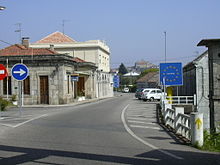
Border between Spain and Portugal, members of the Schengen Agreement. Their border is marked with a simple sign and no passport checks or customs controls.
An open border is a border that enables free movement of people (and often of goods) between jurisdictions with few or no restrictions on movement, that is lacking substantive border control. A border may be an open border due to intentional legislation allowing free movement of people across the border (de jure), or a border may be an open border due to a lack of legal controls, a lack of adequate enforcement or adequate supervision of the border (de facto). An example of the former is the Schengen Agreement between most members of the European Economic Area (EFTA and the EU). An example of the latter has been the border between Bangladesh and India, which is becoming controlled. The term "open borders" applies only to the flow of people, not the flow of goods and services, and only to borders between political jurisdictions, not to mere boundaries of privately owned property.

Open borders are the norm for borders between subdivisions within the boundaries of sovereign states, though some countries do have controlled borders within the boundaries of the state (for example in the People's Republic of China between the mainland and the special administrative regions of Hong Kong and Macau). Open borders are also usual between member states of federations (such as the United States of America), though again in some instances movement between member states may be controlled via an internal passport system. Federations and confederations typically maintain external border controls through a collective border control system, though they sometimes have open borders with other non-member states (particularly enclaves, such as Switzerland and the European Union) through special international agreements.

Pervasive international border control is a relatively recent phenomenon in world history. In the past, many states had open international borders either in practice or due to a lack of any legal restriction. Many authors, such as John Maynard Keynes, have identified the early 20th century and particularly World War I as the point when such controls became common.

There have been sporadic attempts to promote global open borders as a viable policy option. Open borders quickly became popular after 1889. The International Emigration Conference held in Rome in May 1924 stated that anybody has the right to immigrate to a different country if they wanted to. Before the 1880s, migration to the United States was not fully controlled. During World War I it became easier for people to migrate from their country of origin to foreign countries. After World War II, countries were looking for many new workers, and Germany issued a guest work program to attract more people to work. Later, in the 1970s to 1980s strict borders were reinstated in industrialized countries. Currently, immigration is more restricted and harder for low-skilled and low-income people.

Types of borders

There are multiple types of national borders in use around the world. Some of these are:

A conditionally open border is a border that allows movement of people across the border that meet a special set of conditions. This special set of conditions which limits the application of border controls that would normally otherwise apply could be defined by an international agreement or international law, or the special conditions could be defined by a regulation or law of the jurisdiction that the people are claiming the right to enter. Conditionally open borders generally requires a claim to be submitted from the people who are proposing to enter the new jurisdiction stating why they meet the special conditions which allow entry into the new jurisdiction. The new jurisdiction may detain the people until their claim is approved for entry into the new jurisdiction, or they may release them into the new jurisdiction while their claim is being processed. Whenever a conditionally open border is allowed, a considerable effort is often required to ensure that border controls do not break down to such an extent that it becomes an open border situation. An example of a conditionally open border is a border of any country which allows movement of asylum seekers due to application of either the 1951 Refugee Convention or international law which allows people to cross a border to escape a situation where their lives are directly threatened or in significant danger. Another example is the border between Ireland and the United Kingdom. The two countries allow unrestricted movement of their own citizens, but in order to enjoy such movement across the Irish Sea, those same citizens may be required to provide evidence at seaports and airports that they are UK or Irish nationals. These checks are by the police, not immigration officers. (As of October 2018, there are no such controls on the highly porous land border between them).

A controlled border is a border that allows movement of people between different jurisdictions but places restrictions and sometimes significant restrictions on this movement. This type of border may require a person crossing this border to obtain a visa or in some cases may allow a short period of visa free travel in the new jurisdiction. A controlled border always has some method of documenting and recording people movements across the border for later tracking and checking compliance with any conditions associated with the visa or any other border crossing conditions. A controlled border places limitations on what a person crossing the border can do in the new jurisdiction, this is usually manifested in limitations on employment and also it limits the length of time the person can legally remain in the new jurisdiction. A controlled border often requires some type of barrier, such as a river, ocean or fence to ensure that the border controls are not bypassed so that any people wishing to cross the border are directed to authorized border crossing points where any border crossing conditions can be properly monitored. Given the large scale movement of people today for work, holidays, study and other reasons a controlled border also requires internal checks and internal enforcement within the jurisdiction to ensure that any people who have entered the jurisdiction are in fact complying with any border crossing conditions and that they are not overstaying to reside illegally or as an undocumented resident. Most international borders are by legislative intent of the controlled border type. However, where there is a lack of adequate internal enforcement or where the borders are land borders, the border is often controlled only on part of the border, while other parts of the border may remain open to such an extent that it may be considered an open border due to lack of supervision and enforcement.

A closed border is a border that prevents movement of people between different jurisdictions with limited or no exceptions associated with this movement. These borders normally have fences or walls in which any gates or border crossings are closed and if these border gates are opened they generally only allow movement of people in exceptional circumstances. Perhaps the most famous example of an extant closed border is the Demilitarized Zone between North Korea and South Korea. The Berlin Wall could also have been called a closed border.

Borders can be open or and closed based on: entry status, entry duration, entry qualifications, entrant rights and obligations, and entry quotas. Entry status refers to the occupation of someone when and if they are allowed to cross a border, whether they are a student, worker, soldier, immigrant. One's status effects the chances of being permitted to cross a border. “Most states control border crossing by limiting the duration of any visit.” Entry qualifications are restrictions based on factors such as health, age, income, religion, race. “Many countries, including Canada and Singapore, will admit wealthy immigrants who can demonstrate an intention and capacity to invest in the country.” Entrants rights and obligations are the restrictions that will be placed on those who have already been permitted to cross a border: you must follow certain rules and regulations given by the government to be allowed to stay in that country. A government may allow you to take up residency but may not allow you to work, and those who are allowed to work may not be able to find work due to the restrictions and forms of employment allowed. Entry quotas are restrictions based on the number of immigrants allowed across a border within a certain frame of time: if you meet all of the qualifications to cross a border, but the country you want to enter has already met its quota for allowing immigrants inside, you may still not be allowed to enter.

As seen from the examples below, there are differing degrees of "openness" of a border, the nature of which depends on whether or not there are physical passport controls in place (and enforced). Passport control by police or immigration officers may be in place on some kinds of border but citizens of the destination territory or participating territories are permitted to cross using at most an identity card without any further approval, restrictions or conditions. Examples of the most open type of border include the Schengen zone or the [UK/Ireland] Common Travel Area, where transit across the inter-state frontiers are entirely uncontrolled, and third-country illegal immigration is controlled by internal policing as with any other kind of clandestine entry. Examples of near-open borders include the border between the Common Travel Area (on the one hand) and the Schengen Zone (on the other) which, despite having full passport control, is an internal EU border that EU citizens can pass freely without any conditions, other than an identity card. Non-EU nationals are subject to full passport and visa control measures at airports and some seaports. A hybrid of these two possibilities is the border between Russia and Belarus in the Union State which lacks any physical control but formally foreigners are not permitted to use an uncontrolled crossing.

Arguments for and against

Arguments for open borders

Open borders allow free migration between nations. Several arguments for open borders and against controlled borders are as follows:
  1. Open border advocates argue that free migration is the most effective way to reduce world poverty. Migrants from developing countries can earn higher wages after moving to a more developed country, usually lifting them from 'developing world poverty' to 'developed world poverty'. They also send remittances to relatives in their home country, the flow of remittances being estimated to be around three times the global foreign aid spending reported by the OECD.
  2. A literature summary by economist Michael Clemens leads to an estimate that open borders would result in an increase of 67-147% in GWP (gross world product), with a median estimate of a doubling of world GDP. One estimate placed the economic benefits at 78 trillion.
  3. From a human rights perspective, free migration may be seen to complement Article 13 of the Universal Declaration on Human Rights: (1) Everyone has the right to freedom of movement and residence within the borders of each state. (2) Everyone has the right to leave any country, including his own, and to return to his country.
  4. Professor Joseph Carens argues that the social inequality imposed by closed borders is so great it outweighs any challenges to their political or economic feasibility. He argues we should open borders based on the same reasons we reject the feudal system: both are legal systems which afford privilege based on the luck of birthright and maintain inequality by limiting the lower socioeconomic status groups' freedom to move.
  5. American bioethicist Jacob M. Appel has argued that "treating human beings differently, simply because they were born on the opposite side of a national boundary," is inherently unethical. According to Appel, such "birthrights" are only defensible if they serve "useful and meaningful social purposes" (such as inheritance rights, which encourage mothers and fathers to work and save for their children), but the "birthright of nationality" does not do so. Economist and writer Philippe Legrain argues that the countries of the world need migration to help global trade and reduce the occurrence of regional wars.
  6. Open borders cannot be dismissed as a utopian idea, argues Harald Bauder, because they do not propose an alternative way to organize human society but rather are a critique of closed or controlled borders. This critique, however, invites the search for practical as well as radical solutions to the problematic consequences of contemporary migration practices, including the deaths of migrants in the Mediterranean Sea, the US–Mexico border, and elsewhere.
  7. Restrictions on mobility can only be justified if it can be shown that those restrictions prevent significant harm. Since research indicates that open borders will be better for both the natives and the migrants, and at the very least have not been shown to cause major harm, those restrictions are unjustified. The remote control methods used to keep hopeful immigrants out of wealthy nations (such as visa programs, flood lights at borders, or barbed wire fencing for example) slow down the avenues of legal migration and make other avenues of seeking asylum a more perilous endeavor. 
  8. Immigrants are entrepreneurial with high labor force participation and have specialized skills giving them the opportunity to enter underserved markets and create businesses, increasing the number of jobs available in America. Author Thomas E. Lehman, has written articles on the controversial topic of opening Americas borders. In his article “The Benefits of Open Immigration” Lehman states that it is often thought that the policy of open immigration would lead to immigrants willing to work for less pay.
  9. Bryan Caplan has argued that in the U.S., which contains policies that favor high-skilled immigration, the overall long-run fiscal effect of immigrants is positive $58,000 for existing immigrants and positive $259,000 for new immigrants; thus, increasing immigration with the current ratio of high-and low-skilled workers could benefit social security programs and medicare. He states that a truly open borders policy would result in an altered ratio of low- and high-skilled workers where the productivity effect of immigration mitigates the negative fiscal impact of older low-skilled migrants. In addition to that, native-born populations also have a larger fiscal burden than comparable immigrants.
  10. Open borders would help save the lives of people who would otherwise have to wait for countries to decide the fate of refugees. As stated by author Sasha Polakow-Suransky, countries have enough to care for their citizens and others. Caplan has also shared that not doing anything and being a bystander is just as harmful to refugees. It is estimated that open borders would allow people to be safe and create a better world economy at the same time.
  11. Refugees who are in danger flee to Western countries which have provided safety and comfort. David Miliband argues that having open borders will rescue the lives of migrants who are constantly struggling to survive in inhabitable areas. According to him, accepting migrants into Western countries shows the acceptance for those in need and expresses that support and guidance is essential to saving the lives of innocent people.

Arguments against open borders

Controlled borders restrict migration by non-citizens. Several arguments for controlled borders and against open borders are as follows:
  1. That controlled borders encourage responsible policies in relation to population and birth rates for countries by preventing high population and high birth rate countries from disgorging their people onto other low population and low birth rate countries.
  2. Large-scale immigration from poorer countries into richer countries can create a "brain drain" in the source country, where educated professionals leave their home country to live elsewhere, depriving their home countries of an educated workforce. For example, in 2010 there were more Ethiopian doctors living in Chicago than there were in Ethiopia itself.
  3. The realism of open borders has been called into question, given that it could potentially require a world government.
  4. In the United States, it has been argued that it may cause increased backlash from the white population who carry 75 percent (but decreasing) of the political vote. This backlash includes preventing immigrants access to basic forms of governmental or community support as well as the creation of policies that specifically criminalize immigrants. This trend is based on studies demonstrating the more a political party shows positivity towards immigration, the more the white vote shifts towards conservative republicans who support more restrictive immigration policies.
  5. The influx of low-skill immigrant labor that open borders would bring into higher-skilled economies like the United States is feared to cause the standard for the average worker to decrease. Progressives such as Senator Bernie Sanders reject open borders as a loss for the American worker. Additionally, economic models that resemble the Nordic System operate in a way that rewards high-skilled work and seeks to avoid bolstering domestic and low-skill work that would make employment more accessible to refugees.
  6. It has been argued that an open border could cause a great replacement of traditional values and ideals of the receiving country, claiming that multiculturalism is not possible in certain countries. For example, the President of the National Front, Marine Le Pen, says that France should not cater to Muslim ways of life because they go against French liberal ideals. Others, such as Reihan Salam, have argued that low-skilled immigrants in the U.S, have formed a racialized class distinct from Americans, and that the implementation of open borders will create and deepen a cultural and economic clash in America due to differing ideals and values. Fear of losing traditional values has also been a contributing factor to the rise of the populist parties, which are greatly concerned with the social, cultural, and ethnic conservation of the majority, but the need to keep a certain ethnicity as the majority has spawned anti-immigrant beliefs within particular parties; thus, it has been observed that some populist party’s views depict immigration as a negative, even as widespread immigration causes the composition of the population to change, due to the ethnic differences that immigrants bring.

Political debate

The modern debate around open borders is not clearly delineated into the traditional left-right political spectrum and party identification can be quite mobile based on the issue of immigration, but in the United States, visible stances and differences between parties based solely on immigration and open borders became apparent after the Hart-Cellar Act of 1965. Some groups traditionally seen as right-wing, like Libertarians, support unrestricted immigration, while nativists like Donald Trump oppose them. Similarly, some figures on the left wing, like Democratic Socialist Bernie Sanders reject open border policies, while others support open borders (as shown by the slogan "no human is illegal"). In addition, the population of the democratic party has shifted from a massive white majority to almost an even split with non-white citizens since 1980, which has led some members of the democratic party to shift more towards the political right, and until then both political parties had been more or less aligned regarding immigration. The dividing line accords more closely with the libertarian-authoritarian political spectrum

It has been proposed that borders between the North American Free Trade Agreement (NAFTA) countries be opened. If goods and services and corporations can cross international boundaries without restraint, it is argued, then it does not make sense to restrain on the flow of people who work to make those goods and services. Some estimate that open borders where people are free to move and find work could result in 78 trillion dollars in economic gains.

Those in favor of a global migration policy advocate the adoption of a migratory regulatory system and new criteria to better guaranteed all rights (civil, social and political) for all immigrants. It is necessary to expand migration policy to create better management of global migratory system. Some propose a new meaning and understanding of global citizenship to establish a border global migration system. Migration is under the control and management of local governments and officials, but it is both a domestic political issue, and a global issue which needs joint efforts from different countries.

Variables informing the political debate

Attitudes toward immigrants

The Pew Research Center has indicated that there are generally more people who perceive immigrants’ effect on their country because of their work and talents as an advantage rather than a disadvantage across 18 countries (including the United States and several European countries with the largest migrant populations) containing a combined 51% of the world’s migrant population; there are generally more people in favor of deporting immigrants living in their country illegally across the same parameters. While there are more people on the ideological left who have a positive view of immigrants and more people on the ideological right who are in favor of deporting illegal immigrants, there is no necessary correspondence with what most people on each end of the political spectrum are inclined to support.

The media is a major influencing factor for attitudes towards immigrants. It is documented the more the media portrays immigration negatively, the less white Americans will vote in favor of open borders and the more likely they will continue believing in the immigrant threat narrative. This narrative claims the more immigrants there are, the bigger the threat there is to the native culture, language, homes, jobs, and even political offices. An analysis of three decades’ worth of articles in the New York Times found their coverage increased the negative lens of immigration far more than the positive by focusing their articles mostly on negative aspects and images of immigration. It is significant to note studies show white Americans largely do not distinguish between an American-born Latinx and an immigrant Latinx when thinking about immigration issues, voting, and choosing partisan ties. Native-born individuals report slightly more positive views when asked about impacts an immigrant may have on their country, especially when considering their contribution to cultural life. However, when it comes to the labour market, half of the native-born population hold no particular view when it comes to immigrants taking or creating jobs.

It should also be noted that attitudes towards immigrants shift over time, much like any political issue. Using California as a case study, Manuel Pastor found that the views of immigration in the state have been fluid at best. While many view California as a liberal haven that is accepting and tolerant of immigrants today, much of the state’s history has had less favorable views towards immigration. Pastor suggests there is a link between California's improved domestic economic stability over the past two decades and it's attitudes towards immigrants. He argues California has created an environment more accepting of diversity by reducing the economic disparity between cities and the predominantly white suburbs, along with reforming some of the racist economic and educational policies created in the late seventies and early eighties (such as Proposition 13). He suggests this shift towards an ethos which sees liberal social reform and economic prosperity as compatible has driven the State’s movement towards less punitive immigration reform. This view acknowledges the economic and social value of a well-integrated immigrant communities. Pastor makes the point that even in societies where immigration is viewed negatively, values are able to shift, and if the ultra-liberal thriving economic state of California can radically change the perception it has on immigration, then it is quite possible for other states or nations to shift their perceptions. 

Integration

Integration has been defined as the process of immigrant and native born populations changing to resemble one another as a result of the influx of people into a particular territory. There is a split on the degree to which individuals living in countries with the 18 largest migrant populations would want immigrants to integrate and the effects of integration on both immigrant and non-immigrant populations are varied. In the United States, for example, integration is successful in terms of education, employment and earnings, occupations, poverty, language, health, crime, and family patterns; however, successful integration does not necessarily entail improvement on well-being. Integration can even lead to further backlash against immigration by non-white populations who have assimilated successfully. It has been found that more than half of Hispanics support increased security among the border in order to reduce illegal crossings and that countries with a high share of immigrants may be more susceptible to favor right-wing policies such as strict immigration; thus, it has been suggested that successful integration does not guarantee continued patterns for future generations.

Examples of open borders

Svalbard

Uniquely, the Norwegian special territory of Svalbard is an entirely visa-free zone. No person requires a visa or residence permit and anyone may live and work in Svalbard indefinitely, regardless of citizenship. The Svalbard Treaty grants treaty nationals equal right of abode as Norwegian nationals. So far, non-treaty nationals have been admitted visa-free as well. "Regulations concerning rejection and expulsion from Svalbard" are in force on a non-discriminatory basis. Grounds for exclusion include lack of means of support, and violation of laws or regulations. Same-day visa-free transit at Oslo Airport is possible when travelling on non-stop flights to Svalbard.

Examples of controlled borders

  • The border between the United States and Mexico is controlled. This border is the most frequently crossed controlled international boundary in the world, with approximately 350 million legal crossings being made annually.
  • India and Bangladesh share a border—which India is in the process of turning into a controlled border by the completion of a full border fence between the two countries to control the flow of people and prevent illegal migration.
  • Entry into any of the U.S. minor outlying Islands requires permission from United States Armed Forces, and entry to the territory of American Samoa for US citizens requires a return ticket.

Examples of closed borders

The information in this section may not be complete or up to date. Prospective travellers should check with government sources for the most current information.

Monday, August 24, 2020

Svalbard

From Wikipedia, the free encyclopedia

Svalbard
A sign warning of polar bears on a road in Svalbard
Location of Svalbard in relation to Norway
Location of Svalbard (dark green)
– in Europe (green & dark grey)
– in Norway (green)
Sovereign state Norway
Svalbard Treaty9 February 1920
Svalbard Act17 July 1925
Administrative centre
and largest town
Longyearbyen
78°13′N 15°39′ECoordinates: 78°13′N 15°39′E
Ethnic groups
(2019)
56.9% Norwegian
43.1% other
GovernmentDevolved locally administered unincorporated area within a constitutional monarchy

• Monarch
Harald V
• Governor
Kjerstin Askholt
Area
• Total
61,022 km2 (23,561 sq mi) (not ranked)
Highest elevation1,717 m (5,633 ft)
Population
• 2020 estimate
2,939
• Density
0.044/km2 (0.1/sq mi) (248th)
CurrencyNorwegian krone (NOK)
Time zoneUTC+01:00 (CET)
 • Summer (DST)
UTC+02:00 (CEST)
Date formatdd.mm.yyyy
Driving sideright
Calling code+47
Postal code
917x
ISO 3166 code
Internet TLD
Svalbard (/ˈsvɑːlbɑːr/ SVAHL-bar, prior to 1925 known as Spitsbergen, or Spitzbergen, is a Norwegian archipelago in the Arctic Ocean. Situated north of mainland Europe, it is about midway between continental Norway and the North Pole. The islands of the group range from 74° to 81° north latitude, and from 10° to 35° east longitude. The largest island is Spitsbergen, followed by Nordaustlandet and Edgeøya. While part of the Kingdom of Norway since 1925, Svalbard is not part of geographical Norway proper; administratively, the archipelago is not part of any Norwegian county, but forms an unincorporated area administered by a governor appointed by the Norwegian government, and a special jurisdiction subject to the Svalbard Treaty that is, unlike Norway proper, outside of the Schengen Area, the Nordic Passport Union and the European Economic Area.
Since 2002, Svalbard's main settlement, Longyearbyen, has had an elected local government, somewhat similar to mainland municipalities. Other settlements include the Russian mining community of Barentsburg, the research station of Ny-Ålesund, and the mining outpost of Sveagruva. Other settlements are farther north, but are populated only by rotating groups of researchers.
The islands were first used as a whaling base by whalers who sailed far north in pursuit of whales for blubber in the 17th and 18th centuries, after which they were abandoned. Coal mining started at the beginning of the 20th century, and several permanent communities were established. The Svalbard Treaty of 1920 recognizes Norwegian sovereignty, and the 1925 Svalbard Act made Svalbard a full part of the Kingdom of Norway. They also established Svalbard as a free economic zone and a demilitarized zone. The Norwegian Store Norske and the Russian Arktikugol remain the only mining companies in place. Research and tourism have become important supplementary industries, with the University Centre in Svalbard (UNIS) and the Svalbard Global Seed Vault playing critical roles. No roads connect the settlements; instead snowmobiles, aircraft and boats serve inter-community transport. Svalbard Airport, Longyear serves as the main gateway.
The archipelago features an Arctic climate, although with significantly higher temperatures than other areas at the same latitude. The flora take advantage of the long period of midnight sun to compensate for the polar night. Svalbard is a breeding ground for many seabirds, and also features polar bears, reindeer, the Arctic fox, and certain marine mammals. Seven national parks and twenty-three nature reserves cover two-thirds of the archipelago, protecting the largely untouched, yet fragile, natural environment. Approximately 60% of the archipelago is covered with glaciers, and the islands feature many mountains and fjords.
Svalbard and Jan Mayen are collectively assigned the ISO 3166-1 alpha-2 country code "SJ". Both areas are administered by Norway, though they are separated by a distance of over 950 kilometres (590 miles; 510 nautical miles) and have very different administrative structures.

Etymology

The name Svalbard comes from an older native name for the archipelago, Svalbarð, composed of the well-attested Old Norse words svalr ("cold") and barð ("edge; ridge, turf, beard"). The name Spitsbergen originated with Dutch navigator and explorer Willem Barentsz, who described the "pointed mountains" or, in Dutch, spitse bergen that he saw on the west coast of the main island, Spitsbergen. Barentsz did not recognize that he had discovered an archipelago, and consequently the name Spitsbergen long remained in use both for the main island and for the archipelago as a whole.

Geography

The Svalbard Treaty of 1920 defines Svalbard as all islands, islets and skerries from 74° to 81° north latitude, and from 10° to 35° east longitude. The land area is 61,022 km2 (23,561 sq mi), and dominated by the island of Spitsbergen, which constitutes more than half the archipelago, followed by Nordaustlandet and Edgeøya. All settlements are located on Spitsbergen, except the meteorological outposts on Bjørnøya and Hopen. The Norwegian state took possession of all unclaimed land, or 95.2% of the archipelago, at the time the Svalbard Treaty entered into force; Store Norske, a Norwegian coal mining company, owns 4%, Arktikugol, a Russian coal mining company, owns 0.4%, while other private owners hold 0.4%.
Since Svalbard is located north of the Arctic Circle, it experiences midnight sun in summer and polar night in winter. At 74° north, the midnight sun lasts 99 days and polar night 84 days, while the respective figures at 81° are 141 and 128 days. In Longyearbyen, midnight sun lasts from 20 April until 23 August, and polar night lasts from 26 October to 15 February. In winter, the combination of full moon and reflective snow can give additional light. Due to the Earth's tilt and the high latitude, Svalbard has extensive twilights. Longyearbyen sees the first and last day of polar night having seven and a half hours of twilight, whereas the perpetual light lasts for two weeks longer than the midnight sun. On the summer solstice, the sun bottoms out at 12° sun angle in the middle of the night, being much higher during night than in mainland Norway's polar light areas. However, the daytime strength of the sun remains as low as 35°.
Glacial ice covers 36,502 km2 (14,094 sq mi) or 60% of Svalbard; 30% is barren rock while 10% is vegetated. The largest glacier is Austfonna (8,412 km2 or 3,248 sq mi) on Nordaustlandet, followed by Olav V Land and Vestfonna. During summer, it is possible to ski from Sørkapp in the south to the north of Spitsbergen, with only a short distance not being covered by snow or glacier. Kvitøya is 99.3% covered by glacier.
The landforms of Svalbard were created through repeated ice ages, when glaciers cut the former plateau into fjords, valleys, and mountains. The tallest peak is Newtontoppen (1,717 m or 5,633 ft), followed by Perriertoppen (1,712 m or 5,617 ft), Ceresfjellet (1,675 m or 5,495 ft), Chadwickryggen (1,640 m or 5,380 ft), and Galileotoppen (1,637 m or 5,371 ft). The longest fjord is Wijdefjorden (108 km or 67 mi), followed by Isfjorden (107 km or 66 mi), Van Mijenfjorden (83 km or 52 mi), Woodfjorden (64 km or 40 mi), and Wahlenbergfjorden (46 km or 29 mi). Svalbard is part of the High Arctic Large Igneous Province, and experienced Norway's strongest earthquake on 6 March 2009, which hit a magnitude of 6.5.

History

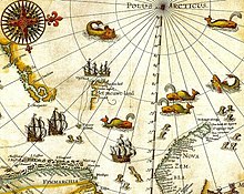
Svalbard, here mapped for the first time, is indicated as "Het Nieuwe Land" (Dutch for "the New Land"), center-left. Portion of 1599 map of Arctic exploration by Willem Barentsz.
In the Golden Age of Dutch exploration and discovery (c. 1590s–1720s), Dutch navigators were the first non-natives to undisputedly explore and map many largely unknown isolated areas of the world, including the Svalbard archipelago and Jan Mayen in the Arctic Ocean.

Dutch discovery, exploration, and mapping of a terra nullius

The Dutchman Willem Barentsz made the first discovery of the archipelago in 1596, when he sighted the coast of the island of Spitsbergen while searching for the Northern Sea Route.
The first recorded landing on the islands of Svalbard dates to 1604, when an English ship landed at Bjørnøya, or Bear Island, and started hunting walrus. Annual expeditions soon followed, and Spitsbergen became a base for hunting the bowhead whale from 1611. Because of the lawless nature of the area, English, Danish, Dutch, and French companies and authorities tried to use force to keep out other countries' fleets.

17th–18th centuries

The whaling station of the Amsterdam chamber of the Northern Company in Smeerenburg, by Cornelis de Man (1639), but based on a painting of a Dansk hvalfangststation (Danish whaling station) by A.B.R. Speeck (1634), which represented the Danish station in Copenhagen Bay (Kobbefjorden)
Smeerenburg was one of the first settlements, established by the Dutch in 1619. Smaller bases were also built by the English, Danish, and French. At first the outposts were merely summer camps, but from the early 1630s, a few individuals started to overwinter. Whaling at Spitsbergen lasted until the 1820s, when the Dutch, British, and Danish whalers moved elsewhere in the Arctic. By the late 17th century, Russian hunters arrived; they overwintered to a greater extent and hunted land mammals such as the polar bear and fox.

19th century

After the Anglo-Russian War in 1809, Russian activity on Svalbard diminished, and ceased by the 1820s. Norwegian hunting—mostly for walrus—started in the 1790s. The first Norwegian citizens to reach Spitsbergen proper were a number of Coast Sámi people from the Hammerfest region, who were hired as part of a Russian crew for an expedition in 1795. Norwegian whaling was abandoned about the same time as the Russians left, but whaling continued around Spitsbergen until the 1830s, and around Bjørnøya until the 1860s.

20th century

Svalbard Treaty and Norwegian sovereignty

By the 1890s, Svalbard had become a destination for Arctic tourism, coal deposits had been found and the islands were being used as a base for Arctic exploration. The first mining was along Isfjorden by Norwegians in 1899; by 1904, British interests had established themselves in Adventfjorden and started the first all-year operations. Production in Longyearbyen, by American interests, started in 1908; and Store Norske established itself in 1916, as did other Norwegian interests during the war, in part by buying American interests.
Discussions to establish the sovereignty of the archipelago commenced in the 1910s, but were interrupted by World War I. On 9 February 1920, following the Paris Peace Conference, the Svalbard Treaty was signed, granting full sovereignty to Norway. However, all signatory countries were granted non-discriminatory rights to fishing, hunting, and mineral resources. The treaty took effect on 14 August 1925, at the same time as the Svalbard Act regulated the archipelago and the first governor, Johannes Gerckens Bassøe, took office. The archipelago has traditionally been known as Spitsbergen, and the main island as West Spitsbergen. From the 1920s, Norway renamed the archipelago Svalbard, and the main island became Spitsbergen. Kvitøya, Kong Karls Land, Hopen, and Bjørnøya were not regarded as part of the Spitsbergen archipelago. Russians have traditionally called the archipelago Grumant (Грумант). The Soviet Union retained the name Spitsbergen (Шпицберген) to support undocumented claims that Russians were the first to discover the island. In 1928, Italian explorer Umberto Nobile and the crew of the airship Italia crashed on the icepack off the coast of Foyn Island. The subsequent rescue attempts were covered extensively in the press and Svalbard received short-lived fame as a result.

Second World War

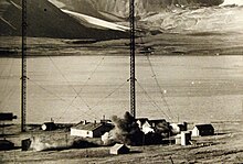
Demolition of the wireless station during Operation Gauntlet in 1941
Svalbard, known to both British and Germans as Spitsbergen, was little affected by the German invasion of Norway in April 1940. The settlements continued to operate as before, mining coal and monitoring the weather. In July 1941, following the German invasion of the Soviet Union, the Royal Navy reconnoitred the islands with a view to using them as a base of operations to facilitate sending supplies to north Russia, but the idea was rejected as too impractical. Instead, with the agreement of the Soviets and the Norwegian government in exile, in August 1941 the Norwegian and Soviet settlements on Svalbard were evacuated, and facilities there destroyed, in Operation Gauntlet. However the Norwegian government in exile decided it would be important politically to establish a garrison in the islands, which was done in May 1942 during Operation Fritham.
Meanwhile, the Germans had responded to the destruction of weather station by establishing a reporting station of their own, codenamed "Banso", in October 1941. This was chased away in November by a visit from four British warships, but later returned. A second station, "Knospel", was established at Ny Alesund in 1941, remaining until 1942. In May 1942, after the arrival of the Fritham force, the German unit at Banso was evacuated.
In September 1943 in Operation Zitronella a German task force, which included the battleship Tirpitz, was sent to attack the garrison and destroy the settlements at Longyearbyen and Barentsburg. This was achieved, but had little long-term effect: after their departure the Norwegians returned and re-established their presence.
In September 1944, the Germans set up their last weather station, Operation Haudegen in NordOstLand; this remained functioning until after the German surrender. On 4 September 1945, the soldiers were picked up by a Norwegian seal hunting vessel and surrendered to its captain. This group of men were the last German troops to surrender after the Second World War.
After the war, the Soviet Union proposed common Norwegian and Soviet administration and military defence of Svalbard. This was rejected in 1947 by Norway, which two years later joined NATO. The Soviet Union retained high civilian activity on Svalbard, in part to ensure that the archipelago was not used by NATO.

Post-war

Abandoned aerial tramway previously used for transporting coal
After the war, Norway re-established operations at Longyearbyen and Ny-Ålesund, while the Soviet Union established mining in Barentsburg, Pyramiden and Grumant. The mine at Ny-Ålesund had several fatal accidents, killing 71 people while it was in operation from 1945 to 1954 and from 1960 to 1963. The Kings Bay Affair, caused by the 1962 accident killing 21 workers, forced Gerhardsen's Third Cabinet to resign. From 1964, Ny-Ålesund became a research outpost, and a facility for the European Space Research Organisation. Petroleum test drilling was started in 1963 and continued until 1984, but no commercially viable fields were found. From 1960, regular charter flights were made from the mainland to a field at Hotellneset; in 1975, Svalbard Airport, Longyear opened, allowing year-round services.
During the Cold War, the Soviet Union comprised about two-thirds of the population on the islands (Norwegians making up the remaining third) with the population of the archipelago slightly under 4,000. Russian activity has diminished considerably since then, falling from 2,500 to 450 people from 1990 to 2010. Grumant was closed after it was depleted in 1962. Pyramiden was closed in 1998. Coal exports from Barentsburg ceased in 2006 because of a fire, but resumed in 2010. The Russian community has also experienced two air accidents, Vnukovo Airlines Flight 2801, which killed 141 people, and the Heerodden helicopter accident, which killed three people.
Longyearbyen remained purely a company town until 1989 when utilities, culture, and education was separated into Svalbard Samfunnsdrift. In 1993, it was sold to the national government and the University Centre was established. Through the 1990s, tourism increased and the town developed an economy independent of Store Norske and the mining. Longyearbyen was incorporated on 1 January 2002, receiving a community council.

Population

Demographics

The dock house in Barentsburg
In 2016, Svalbard had a population of 2,667, of which 423 were Russian and Ukrainian, 10 Polish, and 322 non-Norwegians living in Norwegian settlements. The largest non-Norwegian groups in Longyearbyen in 2005 were from Russia, Ukraine, Poland, Germany, Sweden, Denmark, and Thailand.

Settlements

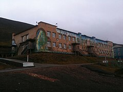
Company homes in Longyearbyen
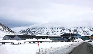
Longyearbyen is the largest settlement on the archipelago, the seat of the governor and the only town to be incorporated. The town features a hospital, primary and secondary school, university, sports center with a swimming pool, library, culture center, cinema, bus transport, hotels, a bank, and several museums. The newspaper Svalbardposten is published weekly. Only a small fraction of the mining activity remains at Longyearbyen; instead, workers commute to Sveagruva (or Svea) where Store Norske operates a mine. Sveagruva is a dormitory town, with workers commuting from Longyearbyen weekly.
Ny-Ålesund is a permanent settlement based entirely around research. Formerly a mining town, it is still a company town operated by the Norwegian state-owned Kings Bay. While there is some tourism there, Norwegian authorities limit access to the outpost to minimize impact on the scientific work. Ny-Ålesund has a winter population of 35 and a summer population of 180.  The Norwegian Meteorological Institute has outposts at Bjørnøya and Hopen, with respectively ten and four people stationed. Both outposts can also house temporary research staff. Poland operates the Polish Polar Station at Hornsund, with ten permanent residents.
The abandoned Soviet mining town of Pyramiden
Barentsburg is the only permanently inhabited Russian settlement after Pyramiden was abandoned in 1998. It is a company town: all facilities are owned by Arktikugol, which operates a coal mine. In addition to the mining facilities, Arktikugol has opened a hotel and souvenir shop, catering for tourists taking day trips or hikes from Longyearbyen. The village features facilities such as a school, library, sports center, community center, swimming pool, farm, and greenhouse. Pyramiden features similar facilities; both are built in typical post-World War II Soviet architectural and planning style and contain the world's two most northerly Lenin statues and other socialist realism artwork. As of 2013, a handful of workers are stationed in the largely abandoned Pyramiden to maintain the infrastructure and run the hotel, which has been re-opened for tourists.

Religion

Most of the population is Christian and affiliated with the Church of Norway. Catholics on the archipelago are pastorally served by the Territorial Prelature of Tromsø.

Politics

MS Nordsyssel, the Governor's vessel, docked at Ny-Ålesund
The Svalbard Treaty of 1920 established full Norwegian sovereignty over the archipelago. The islands are, unlike the Norwegian Antarctic Territory, a part of the Kingdom of Norway and not a dependency. The treaty came into effect in 1925, following the Svalbard Act. All forty signatory countries of the treaty have the right to conduct commercial activities on the archipelago without discrimination, although all activity is subject to Norwegian legislation. The treaty limits Norway's right to collect taxes to that of financing services on Svalbard. Therefore, Svalbard has a lower income tax than mainland Norway, and there is no value added tax. There is a separate budget for Svalbard to ensure compliance. Svalbard is a demilitarized zone, as the treaty prohibits the establishment of military installations. Norwegian military activity is limited to fishery surveillance by the Norwegian Coast Guard as the treaty requires Norway to protect the natural environment. There are no restrictions on foreigners migrating in, and hence no visa requirement.
The Svalbard Act established the institution of the Governor of Svalbard (Norwegian: Sysselmannen), who holds the responsibility as both county governor and chief of police, as well as holding other authority granted from the executive branch. Duties include environmental policy, family law, law enforcement, search and rescue, tourism management, information services, contact with foreign settlements, and judge in some areas of maritime inquiries and judicial examinations—albeit never in the same cases as acting as police. Since 2015, Kjerstin Askholt has been governor; she is assisted by a staff of 26 professionals. The institution is subordinate to the Ministry of Justice and the Police, but reports to other ministries in matters within their portfolio.
Since 2002, Longyearbyen Community Council has had many of the same responsibilities of a municipality, including utilities, education, cultural facilities, fire department, roads, and ports. No care or nursing services are available, nor is welfare payment available. Norwegian residents retain pension and medical rights through their mainland municipalities. The hospital is part of University Hospital of North Norway, while the airport is operated by state-owned Avinor. Ny-Ålesund and Barentsburg remain company towns with all infrastructure owned by Kings Bay and Arktikugol, respectively. Other public offices with presence on Svalbard are the Norwegian Directorate of Mining, the Norwegian Polar Institute, the Norwegian Tax Administration, and the Church of Norway. Svalbard is subordinate to Nord-Troms District Court and Hålogaland Court of Appeal, both located in Tromsø.
Although Norway is part of the European Economic Area (EEA) and the Schengen Agreement, Svalbard is not part of the Schengen Area or the EEA. Non-EU and non-Nordic Svalbard residents do not need Schengen visas, but are prohibited from reaching Svalbard from mainland Norway without such. People without a source of income can be rejected by the governor. No person is required to have a visa or residence permit for Svalbard. Everybody can live and work in Svalbard indefinitely regardless of citizenship. Svalbard Treaty grants treaty nationals equal right of abode as Norwegian nationals. So far, non-treaty nationals were admitted visa-free as well. "Regulations concerning rejection and expulsion from Svalbard" in force. Russia retains a consulate in Barentsburg.
In September 2010, a treaty was made between Russia and Norway fixing the boundary between the Svalbard archipelago and the Novaya Zemlya archipelago. Increased interest in petroleum exploration in the Arctic raised interest in a resolution of the dispute. The agreement takes into account the relative positions of the archipelagos, rather than being based simply on northward extension of the continental border of Norway and Russia.

Economy

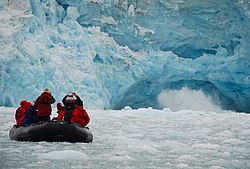
Tourists viewing a glacier
The three main industries on Svalbard are coal mining, tourism, and research. In 2007, there were 484 people working in the mining sector, 211 people working in the tourism sector, and 111 people working in the education sector. The same year, the mining gave a revenue of 2.008 billion Norwegian kroner (US$227,791,078), tourism 317 million kroner ($35,967,202), and research 142 million kroner ($16,098,404). In 2006, the average income for economically active people was 494,700 kroner; 23% higher than on the mainland. Almost all housing is owned by the various employers and institutions and rented to their employees; there are only a few privately owned houses, most of which are recreational cabins. Because of this, it is nearly impossible to live on Svalbard without working for an established institution.
Since the resettlement of Svalbard in the early 20th century, coal mining has been the dominant commercial activity. Store Norske Spitsbergen Kulkompani, a subsidiary of the Norwegian Ministry of Trade and Industry, operates Svea Nord in Sveagruva and Mine 7 in Longyearbyen. The former produced 3.4 million tonnes in 2008, while the latter uses 35% of its output to fuel the Longyearbyen Power Station. Since 2007, there has not been any significant mining by the Russian state-owned Arktikugol in Barentsburg. There have previously been performed test drilling for petroleum on land, but these did not give satisfactory results for permanent operation. The Norwegian authorities do not allow offshore petroleum activities for environmental reasons, and the land formerly test-drilled on have been protected as natural reserves or national parks. In 2011, a 20-year plan to develop offshore oil and gas resources around Svalbard was announced.
NASA research facility in Ny-Ålesund
Svalbard has historically been a base for both whaling and fishing. Norway claimed a 200-nautical-mile (370 km; 230 mi) exclusive economic zone (EEZ) around Svalbard in 1977, with 31,688 square kilometres (12,235 sq mi) of internal waters and 770,565 square kilometres (297,517 sq mi) of EEZ. Norway retains a restrictive fisheries policy in the zone, and the claims are disputed by Russia. Tourism is focused on the environment and is centered on Longyearbyen. Activities include hiking, kayaking, walks through glacier caves, and snowmobile and dog-sled safari. Cruise ships generate a significant portion of the traffic, including both stops by offshore vessels and expeditionary cruises starting and ending in Svalbard. Traffic is strongly concentrated between March and August; overnights have quintupled from 1991 to 2008, when there were 93,000 guest-nights.
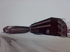
Research on Svalbard centers on Longyearbyen and Ny-Ålesund, the most accessible areas in the high Arctic. The treaty grants permission for any nation to conduct research on Svalbard, resulting in the Polish Polar Station and the Chinese Arctic Yellow River Station, plus Russian facilities in Barentsburg. The University Centre in Svalbard in Longyearbyen offers undergraduate, graduate, and postgraduate courses to 350 students in various arctic sciences, particularly biology, geology, and geophysics. Courses are provided to supplement studies at the mainland universities; there are no tuition fees and courses are held in English, with Norwegian and international students equally represented.
The Svalbard Global Seed Vault is a seedbank to store seeds from as many of the world's crop varieties and their botanical wild relatives as possible. A cooperation between the government of Norway and the Global Crop Diversity Trust, the vault is cut into rock near Longyearbyen, keeping it at a natural −6 °C (21 °F) and refrigerating the seeds to −18 °C (0 °F).
The Svalbard Undersea Cable System is a 1,440 km (890 mi) fibre optic line from Svalbard to Harstad, needed for communicating with polar orbiting satellites through Svalbard Satellite Station and installations in Ny-Ålesund.
The Arctic World Archive, a huge digital archiving concern run by Norwegian private company Piql and the state-owned coal-mining company Store Norske Spitsbergen Kulkompani, opened in March 2017. In mid-2020, it acquired its biggest customer in the form of GitHub, a subsidiary of Microsoft.
One source of income for the area was, until 2015, visiting cruise ships. The Norwegian government became concerned about large numbers of cruise ship passengers suddenly landing at small settlements such as Ny-Ålesund, which is conveniently close to the barren-yet-picturesque Magdalena Fjord. With the increasing size of the larger ships, up to 2,000 people can potentially appear in a community that normally numbers less than 40. As a result, the government severely restricted the size of cruise ships that may visit.
Unemployment is effectively banned, and there is no welfare system.

Transport

Snowmobiles are an important mode of transport in Svalbard, such as here at Longyearbyen.
Within Longyearbyen, Barentsburg, and Ny-Ålesund, there are road systems, but they do not connect with each other. Off-road motorized transport is prohibited on bare ground, but snowmobiles are used extensively during winter—both for commercial and recreational activities. Transport from Longyearbyen to Barentsburg (45 km or 28 mi) and Pyramiden (100 km or 62 mi) is possible by snowmobile in winter, or by ship all year round. All settlements have ports and Longyearbyen has a bus system.
Svalbard Airport, Longyear, located 3 kilometres (2 mi) from Longyearbyen, is the only airport offering air transport off the archipelago. Scandinavian Airlines has daily scheduled services to Tromsø and Oslo. Low-cost carrier Norwegian Air Shuttle also has a service between Oslo and Svalbard, operating three or four times a week; there are also irregular charter services to Russia. Finnair operated service from Helsinki, operating three times per week between June and August 2016, but Norwegian authorities did not allow this route, citing the 1978 bilateral agreement on air traffic between Finland and Norway. Lufttransport provides regular corporate charter services from Longyearbyen to Ny-Ålesund Airport and Svea Airport for Kings Bay and Store Norske; these flights are generally not available to the public. There are heliports in Barentsburg and Pyramiden, and helicopters are frequently used by the governor and to a lesser extent the mining company Arktikugol.

Climate

Spitsbergen during August
The climate of Svalbard is dominated by its high latitude, with the average summer temperature at 4 to 6 °C (39 to 43 °F) and January averages at −16 to −12 °C (3 to 10 °F). The West Spitsbergen Current, the northernmost branch of the North Atlantic Current system, moderates Svalbard's temperatures, particularly during winter. Winter temperatures in Svalbard are up to 2 °C (4 °F) higher than those at similar latitudes in Russia and Canada. The warm Atlantic water keeps the surrounding waters open and navigable most of the year. The interior fjord areas and valleys, sheltered by the mountains, have larger temperature differences than the coast, giving about 20 °C (36 °F) warmer summer temperatures and 3 °C (5 °F) colder winter temperatures. On the south of Spitsbergen, the temperature is slightly higher than further north and west. During winter, the temperature difference between south and north is typically 5 °C (9 °F), and about 3 °C (5 °F) in summer. Bear Island has average temperatures even higher than the rest of the archipelago.
Svalbard is where cold polar air from the north and mild, wet sea air from the south meet, creating low pressure, changeable weather and strong winds, particularly in winter; in January, a strong breeze is registered 17% of the time at Isfjord Radio, but only 1% of the time in July. In summer, particularly away from land, fog is common, with visibility under 1 kilometre (0.6 mi) registered 20% of the time in July and 1% of the time in January, at Hopen and Bjørnøya. Precipitation is frequent, but falls in small quantities, typically less than 400 millimetres (16 in) per year in western Spitsbergen. More rain falls on the uninhabited east side, where there can be more than 1,000 millimetres (39 in).
2016 was the warmest year on record at Svalbard Airport, with a remarkable mean temperature of 0.0 °C (32.0 °F), 7.5 °C (13.5 °F) above the 1961–90 average, and more comparable to a location at the arctic circle. The coldest temperature of the year was as high as −18 °C (0 °F), warmer than the mean minimum in a normal January, February or March. In the same year, the number of days when there was rainfall equalled the number of days when there was snowfall, a significant deviation from the usual pattern whereby there would be at least twice as many snow days.
Global warming has resulted in noticeable climatic changes on Svalbard. Between 1970 and 2020, the average temperature on Svalbard rose by 4 degrees Celsius, and in the winter months by 7 degrees. On July 25, 2020, a new record temperature of 21.7 degrees Celsius was measured for the Svalbard archipelago, which is also the highest temperature ever recorded in the European part of the Arctic; In addition, temperatures of over 20 degrees were measured four days in a row in July 2020. As in large parts of the Arctic, the ice–albedo feedback effects can also be noticed on Svalbard: Due to the substantial ice melt, ice surfaces are transformed into open water, the darker surface of which absorbs more solar energy instead of reflecting it back; as a result, these waters heat up and further ice in the area melts faster and faster, creating more open waters, etc. A temperature increase of between 7 and 10 degrees is expected on Svalbard by the end of the century.

Nature

In addition to humans, three primarily terrestrial mammalian species inhabit the archipelago: the Arctic fox, the Svalbard reindeer, and accidentally introduced southern voles, which are found only in Grumant. Attempts to introduce the Arctic hare and the muskox have both failed. There are 15 to 20 types of marine mammals, including whales, dolphins, seals, walruses, and polar bears.
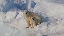
Polar bears are the iconic symbol of Svalbard, and one of the main tourist attractions. The animals are protected and people moving outside the settlements are required to have appropriate scare devices to ward off attacks. They are also advised to carry a firearm for use as a last resort. A British schoolboy was killed by a polar bear in 2011. In July 2018, a polar bear was shot dead after it attacked and injured a polar bear guard leading tourists off a cruise ship. Svalbard and Franz Joseph Land share a common population of 3,000 polar bears, with Kong Karls Land being the most important breeding ground.
Female polar bear with cub
The Svalbard reindeer (R. tarandus platyrhynchus) is a distinct subspecies; although it was previously almost extinct, it can be legally hunted (as can Arctic fox). There are limited numbers of domesticated animals in the Russian settlements.
Tundra at Bellsund
About eighty species of bird are found on Svalbard, most of which are migratory. The Barents Sea is among the areas in the world with most seabirds, with about 20 million individuals during late summer. The most common are little auk, northern fulmar, thick-billed murre, and black-legged kittiwake. Sixteen species are on the IUCN Red List. Particularly Bjørnøya, Storfjorden, Nordvest-Spitsbergen, and Hopen are important breeding ground for seabirds. The Arctic tern has the furthest migration, all the way to Antarctica.  Only two songbirds migrate to Svalbard to breed: the snow bunting and the wheatear. Rock ptarmigan is the only bird to overwinter. Remains of Predator X (Pliosaurus funkei) from the Jurassic period were discovered here; it is one of the largest dinosaur-era marine reptiles ever found.
Western coast of Bünsow Land. Located at Isfjorden in Spitsbergen
Svalbard has permafrost and tundra, with both low, middle, and high Arctic vegetation. 165 species of plants have been found on the archipelago. Only those areas which defrost in the summer have vegetations, which accounts for about 10% of the archipelago. Vegetation is most abundant in Nordenskiöld Land, around Isfjorden and where affected by guano. While there is little precipitation, giving the archipelago a steppe climate, plants still have good access to water because the cold climate reduces evaporation. The growing season is very short, and may last only a few weeks.
There are seven national parks in Svalbard: Forlandet, Indre Wijdefjorden, Nordenskiöld Land, Nordre Isfjorden Land, Nordvest-Spitsbergen, Sassen-Bünsow Land and Sør-Spitsbergen. The archipelago has fifteen bird sanctuaries, one geotopic protected area and six nature reserves—with Nordaust-Svalbard and Søraust-Svalbard both being larger than any of the national parks. Most of the nature reserves and three of the national parks were created in 1973, with the remaining areas gaining protection in the 2000s. All human traces dating from before 1946 are automatically protected. The protected areas make up 65% of the archipelago. Svalbard is on Norway's tentative list for nomination as a UNESCO World Heritage Site.
The total solar eclipse of 20 March 2015 included only Svalbard and the Faroe Islands in the band of totality. Many scientists and tourists observed it.

Education

Longyearbyen School serves ages 6–18. It is the primary/secondary school in the northernmost location on Earth. Once pupils reach ages 16 or 17, most families move to mainland Norway. Barentsburg has its own school serving the Russian community; by 2014 it had three teachers, and its welfare funds had declined. A primary school served the community of Pyramiden in the pre-1998 period.
There is a non-degree offering tertiary educational institution in Longyearbyen, University Centre in Svalbard (UNIS), the northernmost tertiary school on Earth.

Sports

Association football is the most popular sport in Svalbard. There are three football pitches (one at Barentsburg), but no stadiums because of the small population. There is also an indoor hall adopted for multiple sports including indoor football.

Social privilege

From Wikipedia, the free encyclopedia https://en.wikipedi...