Search This Blog

Saturday, April 11, 2020

Green belt

From Wikipedia, the free encyclopedia
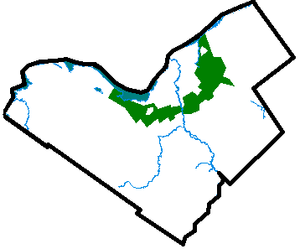
The central core of Ottawa, located in the middle of the map, is surrounded by the Ottawa Greenbelt
 
A greenbelt is a policy and land use zone designation used in land use planning to retain areas of largely undeveloped, wild, or agricultural land surrounding or neighboring urban areas. Similar concepts are greenways or green wedges which have a linear character and may run through an urban area instead of around it. In essence, a green belt is an invisible line designating a border around a certain area, preventing development of the area and allowing wildlife to return and be established.

Purposes

In those countries which have them, the stated objectives of green belt policy are to:
  • Protect natural or semi-natural environments;
  • Improve air quality within urban areas;
  • Ensure that urban dwellers have access to countryside, with consequent educational and recreational opportunities; and
  • Protect the unique character of rural communities that might otherwise be absorbed by expanding suburbs.
The green belt has many benefits for people:
  • Walking, camping, and biking areas close to the cities and towns.
  • Contiguous habitat network for wild plants, animals and wildlife.
  • Cleaner air and water
  • Better land use of areas within the bordering cities.
The effectiveness of green belts differs depending on location and country. They can often be eroded by urban rural fringe uses and sometimes, development 'jumps' over the green belt area, resulting in the creation of "satellite towns" which, although separated from the city by green belt, function more like suburbs than independent communities.

History

The Old Testament outlines a proposal for a green belt around the Levite towns in the Land of Israel. Moses Maimonides expounded that the greenbelt plan from the Old Testament referred to all towns in ancient Israel. In the 7th century, Muhammad established a green belt around Medina. He did this by prohibiting any further removal of trees in a 12-mile long strip around the city. In 1580 Elizabeth I of England banned new building in a 3-mile wide belt around the City of London in an attempt to stop the spread of plague. However, this was not widely enforced and it was possible to buy dispensations which reduced the effectiveness of the proclamation.

In modern times, the term emerged from continental Europe where broad boulevards were increasingly used to separate new development from the centre of historic towns; most notably the Ringstraße in Vienna. Green belt policy was then pioneered in the United Kingdom confronted with ongoing rural flight. Various proposals were put forward from 1890 onwards but the first to garner widespread support was put forward by the London Society in its "Development Plan of Greater London" 1919. Alongside the CPRE they lobbied for a continuous belt (of up to two miles wide) to prevent urban sprawl, beyond which new development could occur.

There are fourteen green belt areas in the UK covering 16,716 km² or 13% of England, and 164 km² of Scotland; for a detailed discussion of these, see Green belt (UK). Other notable examples are the Ottawa Greenbelt and Golden Horseshoe Greenbelt in Ontario, Canada. Ottawa's 20,350-hectare (78.6 sq mi) instance is managed by the National Capital Commission (NCC). The more general term in the United States is green space or greenspace, which may be a very small area such as a park

The dynamic Adelaide Park Lands, measuring approximately 7.6 km² surround, unbroken, the city centre of Adelaide. On the fringe of the eastern suburbs, an expansive natural greenbelt in the Adelaide Hills acts as a growth boundary for Adelaide and cools the city in the hottest months.

The concept of "green belt" has evolved in recent years to encompass not only "Greenspace" but also "Greenstructure" which comprises all urban and peri-urban greenspaces, an important aspect of sustainable development in the 21st century. The European Commission's COST Action C11 (COST – European Cooperation in Science and Technology) is undertaking "Case studies in Greenstructure Planning" involving 15 European countries.

An act of the Swedish parliament from 1994 has declared a series of parks in Stockholm and the adjacent municipality of Solna to its north a "national city park" called Royal National City Park.

Criticism

House prices

When paired with a city which is economically prospering, homes in a Green belt may have been motivated by or result in considerable premiums. They may also be more economically resilient as popular among the retired and less attractive for short-term renting of modest homes. Where in the city itself demand exceeds supply in housing, green belt homes compete directly with much city housing wherever such green belt homes are well-connected to the city. Further, they in all cases attract a future-guaranteed premium for protection of their views, recreational space and for the preservation/conservation value itself. Most also benefit from higher rates of urban gardening and farming, particularly when done in a community setting, which have positive effects on nutrition, fitness, self-esteem, and happiness, providing a benefit for both physical and mental health, in all cases easily provided or accessed in a green belt. Government planners also seek to protect the green belt as its local farmers are engaged in peri-urban agriculture which augments carbon sequestration, reduces the urban heat island effect, and provides a habitat for organisms. Peri-urban agriculture may also help recycle urban greywater and other products of wastewater, helping to conserve water and reduce waste.

The housing market contrasts with more uncertainty and economic liberalism inside and immediately outside of the belt: Green Belt homes have by definition nearby protected landscapes. Local residents in affluent parts of a Green Belt, as in parts of the city, can be assured of preserving any localised bourgeois status quo present and so assuming the Green Belt is not from the outset an area of more social housing proportionately than the city, it naturally tends toward greater economic wealth. In a protracted housing shortage, reduction of the Green Belt is one of the possible solutions. All such solutions may be resisted however by private landlords who profit from a scarcity of housing, for example by lobbying to restrain new housing across the city. The stated motivation and benefits of the green belt might be well-intentioned (public health, social gardening and agriculture, environment), but inadequately realised relative to other solutions.

Inherently partial critics include Mark Pennington and the economics-heavy think tanks such as the Institute of Economic Affairs who would see a reduction in many Green Belts. Such studies focus on widely inherent limitations of Green Belts. In most examples only a small fraction of the population uses the green belt for leisure purposes. The IEA study claims that a green belt is not strongly causally linked to clean air and water. Rather, they view the ultimate result of the decision to green-belt a city as one to prevent housing demand within the zone to be met with supply, thus exacerbating high housing prices and stifling competitive forces in general.

Increasing urban sprawl

Another area of criticism comes from the fact that, since a greenbelt does not extend indefinitely outside a city, it spurs the growth of areas much further away from the city core than if it had not existed, thereby actually increasing urban sprawl. Examples commonly cited are the Ottawa suburbs of Kanata and Orleans, both of which are outside the city's greenbelt, and are currently undergoing explosive growth (see Greenbelt (Ottawa)). This leads to other problems, as residents of these areas have a longer commute to work places in the city and worse access to public transport. It also means people have to commute through the green belt, an area not designed to cope with high levels of transportation. Not only is the merit of a green belt subverted, but the green belt may heighten the problem and make the city unsustainable.

There are many examples whereby the actual effect of green belts is to act as a land reserve for future freeways and other highways. Examples include sections of the 407 highway north of Toronto and the Hunt Club Rd./Richmond Rd. south of Ottawa. Whether they are originally planned as such, or the result of a newer administration taking advantage of land that was left available by its predecessors is debatable.

United Kingdom

Green belts were established in England from 1955 to simply prevent the physical growth of large built-up areas; to prevent neighboring cities and towns from merging. In the UK, greenbelt around the major conurbations has been criticized as one of the main protectionist bars to building housing, the others being other planning restrictions (Local Plans and restrictive covenants) and developers' land banking. Local Plans and land banking are to be relaxed for home building in the 2015-2030 period by law and the green belt will be reduced by some local authorities as each local authority must now consider it among the available shortlisted options in drawing development plans to meet higher housing targets. Critics argue that the greenbelts defeat their stated objective of saving the countryside and open spaces. Such criticism falls short when considering the other, broader benefits such as peri-urban agriculture which includes gardening and carries many benefits, especially to the retired. It also ignores the strategic aims of the Attlee Ministry in 1946, just as in France, of shifting capital away from the capital city (addressing regional disparity) and avoiding intra-urban gridlock. The restrictions of the Green Belt were particularly in the 1940s-1980s mitigated with planned, government-supported, new towns under the New Towns Act 1946 and New Towns Act 1981. These saw establishment beyond the greenbelts of new homes, infrastructure, businesses and other facilities. Without large scale sustainable development, infill development sees urban green space lost. A chronic housing shortage with inadequate new settlements and/or extension of those outside of the green belt and/or no green belt reduction has seen many brownfield sites, often well-suited to industry and commerce, lost in existing conurbations.

Notable examples

Australia

Brazil

  • The São Paulo City Green Belt Biosphere Reserve – GBBR, an integral part of the Atlantic Forest Biosphere Reserve, was created in 1994 stemming from a people's movement that collected 150 thousand signatures. It extends throughout 73 municipalities including São Paulo metro and the Santos area. With approximately 17,000 km², it is inhabited by about 23 million people, corresponding to more than 10% of the country's total population in an area equivalent to 0.2% of the Brazilian territory. There are over 6,000 km² of forests and other Atlantic Forest ecosystems at the Reserve, one of the planet's most threatened biomes. In addition to a spectacular biological diversity, the GBBR's ecosystems render valuable ecosystem services.

Canada

  • Ottawa Greenbelt, is Canada's oldest greenbelt. Created in 1956 to help curb urban sprawl, it surrounds the capital city of Ottawa. It is mostly owned and managed by the National Capital Commission (NCC).
  • Greenbelt (Golden Horseshoe), is a 7300 km² band of land that encompasses the rural and agricultural land surrounding the Greater Toronto Area and Niagara Peninsula, and parts of the Bruce Peninsula. Most of the land consists of the Oak Ridges Moraine, an environmentally sensitive land that is a major aquifer for the region, and the Niagara Escarpment, a UNESCO Biosphere Reserve. In an effort to restrain urban sprawl, the Ontario government created the Greenbelt Act in February 2005 to protect this greenspace from all future development, with the exception of limited agricultural use.
  • British Columbia – the Agricultural Land Reserve protects agricultural land throughout this mountainous province from urban development, including around Vancouver. This protection is strict and urban development of agricultural land is only allowed if no reasonable alternative exists. However, it does not protect non-agricultural land, particularly hillsides, leading to substantial, and highly visible, leapfrog-type hillside sprawl.
  • Quebec – The Commission de protection du territoire agricole du Québec asserts its mission, namely to keep a territory (the agricultural zones) that is favorable for the practice and the development of agricultural activities. In so doing, the commission safeguards the agricultural territory and helps make its protection a local priority. The agricultural zones cover an area of 63 000 square kilometres in 952 local municipalities.

Dominican Republic

  • The Greater Santo Domingo has a Greenbelt (Santo Domingo Greenbelt) project surrounding the whole Distrito Nacional. It is composed of the National botanical Garden, Mirador Del Norte, Mirador del Este, and other parks surrounding the area from its outer municipios. It has largely been affected by uncontrolled urbanization, but other parts remain unaffected.[16][17]

Iran

Afforestation beyond an expressway in Tehran, Iran
  • Green Belt in Tehran has always been a consequential matter due to the rapid increase of the city size, population, cars, factories, pollution and other expansions which hardened breathing. By a big project, the green belt of Tehran increased from 29 square kilometres in 1979 to 530 square kilometres in 2017 and the number of parks also increased from 75 in 1979 to 2,211 in 2017 in total urban and suburb areas. Such actions and afforestation increased the humidity level and precipitation chance in the city which cools the summer's temperatures down by up to 4 °C. Tehran municipality announced to increase the green belt by 10 square kilometres each year.

Mainland Europe

Rennes Green Belt

New Zealand

In New Zealand, the term Town Belt is most commonly used for an urban green belt.

Philippines

  • Makati City's green belt is very green yet full of malls and modern structures.

Thailand

  • Bangkok's Bang Krachao Green Area located inside the curve of Chao Phraya River is considered a green area with authority control over the urbanization. Today it is a popular spot for tourism and cycling. The area is located within the border of Bangkok Province and Samut Sakorn Province.

South Korea

  • It was first introduced as Limited Development Area in 1971 with City Planning Law to prevent urban sprawl around Seoul. Currently green belts are designated around Seoul, Busan and other metropolitan areas around the country.

United Kingdom

Designated areas of green belt in England; the Metropolitan Green Belt outlined in red

United States

Commuter town

From Wikipedia, the free encyclopedia

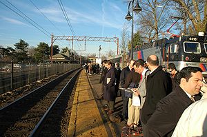
Mostly men wait at a train station with an empty track to their left and a train and leafless deciduous trees behind them.
Many municipalities in the US state of New Jersey can be considered commuter towns. Here, riders wait in Maplewood for a train bound for New York City during the morning rush hour.
 
A commuter town is a populated area that is primarily residential, rather than commercial or industrial. People who live in commuter towns usually work in other places. Routine travel from home to work and then from work to home is called commuting, which is where the term comes from. 

A commuter town may be called by many other terms: "bedroom community" (Canada and northeastern US), "bedroom town", "bedroom suburb" (US), "dormitory town", "dormitory suburb", or, less commonly, "dormitory village" (Britain/Commonwealth/Ireland). In Japan, a commuter town may be referred to with the wasei-eigo coinage "bed town" (ベッドタウン, beddotaun). The term "exurb" was also used starting in the 1950s for a commuter town, but especially since 2006, is generally used for areas beyond suburbs and specifically less densely built than the suburbs to which the exurbs' residents commute.

Distinction between suburbs and commuter towns

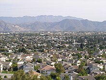
Camarillo, California, a typical U.S. bedroom community made up almost entirely of homes, schools and retail outlets
 
Suburbs and commuter towns often coincide, but are not synonymous. Similar to college town, resort town and mill town, the term commuter town describes the municipality's predominant economic function. A suburb, in contrast, is a community of lesser size, density, political power and/or commerce comparative to a nearby community that is usually of greater economic importance. A town's economic function may change, for example when improved transport brings commuters to industrial suburbs or railway towns in search of suburban living. Some suburbs, for example Teterboro, New Jersey and Emeryville, California, remained industrial when they became surrounded by commuter towns; many commuters work in such industrial suburbs but few reside in them; hence, they are not commuter towns.

As a general rule, suburbs are developed in areas adjacent to a main employment center, such as a town or a city, but may or may not have many jobs locally, whereas bedroom communities have few local businesses, and most residents who have jobs commute to employment centers some distance away. Commuter towns may be in rural or semi-rural areas, with a ring of green space separating them from the larger city or town. Where urban sprawl and conurbation have erased clear lines among towns and cities in large metropolitan areas, this is not the case.

Causes

Commuter towns can arise for a number of different reasons. Sometimes, as in Sleepy Hollow, New York or Tiburon, California, a town loses its main source of employment, leaving its residents to seek work elsewhere. In other cases, a pleasant small town, such as Warwick, New York, over time attracts more residents but not large businesses to employ them, requiring denizens to commute to employment centers. Another cause, particularly relevant in the American South and West, is the rapid growth of small cities. The earlier creation of the Interstate Highway System was one cause of the greatest growth was seen by the sprawling metropolitan areas of those cities. As a result, many small cities were absorbed into the suburbs of the larger cities.

Often, however, commuter towns form when workers in a region cannot afford to live where they work and must seek residency in another town with a lower cost of living. The late 20th century dot-com bubble and United States housing bubble drove housing costs in Californian metropolitan areas to historic highs, spawning exurban growth in adjacent counties. For example, most cities in western Riverside County, California can be considered exurbs of Orange County, California and Los Angeles County, California. As of 2003, over 80% of the workforce of Tracy, California was employed in the San Francisco Bay Area.

A related phenomenon is common in the resort towns of the American West that require large workforces, yet emphasize building larger single-family residences and other expensive housing. For example, the resort town of Jackson, Wyoming has spawned several nearby bedroom communities, including Victor, Idaho, Driggs, Idaho, and Alpine, Wyoming, where the majority of the Jackson workforce resides. On Long Island, New York, many of the workforce who serve The Hamptons also reside in communities more modest and more suburban than their workplace, giving rise to a daily reverse commuter flow from more dense to less dense areas.

In certain major European cities, such as Berlin and London, commuter towns were founded in response to bomb damage sustained during World War II. Residents were relocated to semi-rural areas within a 50-mile (80 km) radius, firstly because much inner city housing had been destroyed, and secondly in order to stimulate development away from cities as the industrial infrastructure shifted from rail to road. Around London, several towns – such as Basildon, Crawley, Harlow, and Stevenage – were built for this purpose by the Commission for New Towns.

In some cases, commuter towns can result from negative economic conditions. Steubenville, Ohio, for instance, had its own regional identity along with neighboring Weirton, West Virginia until the collapse of the steel industry in the 1980s. Combined with easier access to the much larger city of Pittsburgh via the Steubenville Pike and the Parkway West, Steubenville has shifted its marketing efforts to being a commuter town to Pittsburgh, as well as one with a lower cost of living in Ohio compared to tax-heavy Pennsylvania. In 2013, Jefferson County, Ohio (where Steubenville is located) was added to the Pittsburgh metropolitan area as part of its larger Combined Statistical Area.

Effects

Where commuters are wealthier and small town housing markets weaker than city housing markets, the development of a bedroom community may raise local housing prices and attract upscale service businesses in a process akin to gentrification. Long-time residents may be displaced by new commuter residents due to rising house prices. This can also be influenced by zoning restrictions in urbanized areas that prevent the construction of suitably cheap housing closer to places of employment.

The number of commuter towns increased in the US and the UK during the 20th century because of a trend for people to move out of the cities into the surrounding green belt. Historically, commuter towns were developed by railway companies to create demand for their lines. One 1920s pioneer of this form of development was the Metropolitan Railway (now part of London Underground) which marketed its Metro-land developments. This initiative encouraged many to move out of central and inner-city London to suburbs such as Harrow and out of London itself, to commuter villages in Buckinghamshire or Hertfordshire. Commuter towns have more recently been built ahead of adequate transportation infrastructure, thus spurring the development of roads and public transportation systems. These can take the form of light rail lines extending from the city centre to new streetcar suburbs and new or expanded highways, whose construction and traffic can lead to the community becoming part of a larger conurbation

In the United States, it is common for commuter towns to create disparities in municipal tax rates. When a commuter town collects few business taxes, residents must pay the brunt of the public operating budget in higher property or income taxes. Such municipalities may scramble to encourage commercial growth once an established residential base has been reached.

A 2014 study by the British Office for National Statistics found that commuting also affects wellbeing. Commuters are more likely to be anxious, dissatisfied and have the sense that their daily activities lack meaning than those who don’t have to travel to work even if they are paid more.

In Belgium, the development of traditional rural Flemish towns surrounding Brussels into commuter towns is causing major language tensions, as most of the newcoming commuters are French-speaking or even international English-speaking families with no attachment to the Flemish roots. The Flemish movement in the Brussels-Halle-Vilvoorde area, with demands such as the strict enforcement of the Dutch language (restaurants with bilingual menus have been assaulted by activists, etc.) can be analyzed as a reaction against gentrification caused by the arrival of those wealthier non-Dutch speakers working in international companies, national administration or the European Parliament.

Exurbs

The term "exurb" was also used in the United States and elsewhere, starting in 1955 for a commuter town, as the word exurb ( a portmanteau of "extra & urban") was coined by Auguste Comte Spectorsky, in his 1955 book The Exurbanites, to describe the ring of prosperous communities beyond the suburbs that are commuter towns for an urban area. However, especially since a landmark report by the Brookings Institution in 2006, the term is generally used for areas beyond suburbs and specifically less densely built than the suburbs to which the exurbs' residents commute.

Exurbs vary in wealth and education level. In the United States, exurban areas typically have much higher college education levels than closer-in suburbs, though this is not necessarily the case in other countries. They also typically have average incomes much higher than nearby rural counties, and some have some of the highest median household incomes in their respective metropolitan area. However, depending on local circumstances, some exurbs have higher poverty levels than suburbs nearer the city.

Then and now

Commuters from early exurbs, such as the end of Philadelphia's Main Line and the Northern Westchester region of Westchester County, New York, reached the city center via commuter rail and parkway systems

Today's exurbs are composed of small neighborhoods in otherwise lightly developed areas, towns, and (comparatively) small cities. Some lie in the outer suburbs of an urbanized area, but a few miles of rural, wooded, or agricultural land separates many exurbs from the suburbs. Exurbs may have originated independently of the major city to which many residents commute. Most consist almost exclusively of commuters and lack the historical and cultural traditions of more established cities. Many early 20th century exurbs were organized on the principles of the garden city movement

Yesterday's sprawling exurbs, such as Forest Hills and Garden City, New York, often become a later decade's suburbs, surrounded and absorbed into a belt of infill.

Planning

Many suburbs within a metropolitan city proper enjoyed their greatest growth in the post-World War II period, after which growth slowed for several decades; however, since the 1990s extensive development has occurred outside of cities. There have also been significant growth differences between inside and outside metro boundaries; many developments typical of exurbs, such as the proliferation of big box retailers, lie just on the outside, due to older suburbs' being restricted by inner-city land-use politics while communities outside are free to develop and grow. 

Some architects, environmentalists, and urban planners consider exurbs to be manifestations of poor or distorted planning. Comparatively low density towns – often featuring large lots and large homes – create heavy motor vehicle dependency.
"They begin as embryonic subdivisions of a few hundred homes at the far edge of beyond, surrounded by scrub. Then, they grow – first gradually, but soon with explosive force – attracting stores, creating jobs and struggling to keep pace with the need for more schools, more roads, more everything. And eventually, when no more land is available and home prices have skyrocketed, the whole cycle starts again, another 15 minutes down the turnpike."
— Rick Lyman, The New York Times
Others argue that exurban environments, such as those that have emerged in Oregon over the last 40 years as a result of the state's unique land use laws, have helped to protect local agriculture and local businesses by creating strict urban growth boundaries that encourage greater population densities in centralized towns, while slowing or greatly reducing urban and suburban sprawl into agricultural, timber land, and natural areas.

Metro-land

From Wikipedia, the free encyclopedia
 
A painting of a half-timbered house set behind a drive and flower garden. Below the painting the title "METRO-LAND" is in capitals and in smaller text is the price of two-pence.
The cover of the Metro-Land guide published in 1921
 
Metro-land (or Metroland) is a name given to the suburban areas that were built to the north-west of London in the counties of Buckinghamshire, Hertfordshire and Middlesex in the early part of the 20th century that were served by the Metropolitan Railway. The railway company was in the privileged position of being allowed to retain surplus land; from 1919 this was developed for housing by the nominally independent Metropolitan Railway Country Estates Limited (MRCE). The term "Metro-land" was coined by the Met's marketing department in 1915 when the Guide to the Extension Line became the Metro-land guide. It promoted a dream of a modern home in beautiful countryside with a fast railway service to central London until the Met was absorbed into the London Passenger Transport Board in 1933.

Metropolitan Railway

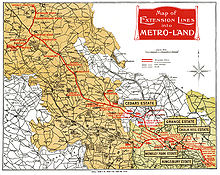
Map of "Metro-land", from the 1924 Metro-land booklet published by the Metropolitan Railway
 
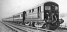
Metropolitan Railway electric locomotive and train (c.1928)
 
The Metropolitan Railway was a passenger and goods railway that served London from 1863 to 1933, its mainline heading north from the capital's financial heart in the City to what were to become the Middlesex suburbs. Its first line connected the mainline railway termini at Paddington, Euston and King's Cross to the City, and when, on 10 January 1863, this line opened with gas-lit wooden carriages hauled by steam locomotives, it was the world's first underground railway. When, in 1871 plans were presented for an underground railway in Paris, it was called the Métropolitain in imitation of the line in London. The modern word metro is a short form of the French word. The railway was soon extended from both ends and northwards via a branch from Baker Street. It reached Hammersmith in 1864, Richmond in 1877 and completed the Inner Circle in 1884, but the most important route became the line north into the Middlesex countryside, where it stimulated the development of new suburbs. Harrow was reached in 1880, and the line eventually extended as far as Verney Junction in Buckinghamshire, more than 50 miles (80 kilometres) from Baker Street and the centre of London. From the end of the 19th century, the railway shared tracks with the Great Central Railway route out of Marylebone.

Electric traction was introduced in 1905 with electric multiple units operating services between Uxbridge, Harrow-on-the-Hill and Baker Street. To remove steam and smoke from the tunnels in central London, the Metropolitan Railway purchased electric locomotives, and these were exchanged for steam locomotives on trains at Harrow from 1908. To improve services, more powerful electric and steam locomotives were purchased in the 1920s. A short branch opened from Rickmansworth to Watford in 1925. The 4-mile (6.4 km) long Stanmore branch from Wembley Park was completed in 1932.

Metro-land

A row of suburban houses with white gabled ends and black timber beams
Metro-Land was characterised by the construction of Tudor Revival suburban houses (pictured: North Wembley, top, and Kenton, bottom)
 
Unlike other railway companies, which were required to dispose of surplus land, the Met was in a privileged position with clauses in its acts allowing it to retain land that it believed was necessary for future railway use. Initially the surplus land was managed by the Land Committee, made up of Met directors. In the 1880s, at the same time as the railway was extending beyond Swiss Cottage and building the workers' estate at Neasden, roads and sewers were built at Willesden Park Estate, and the land was sold to builders. Similar developments followed at Cecil Park, near Pinner and, after the failure of the tower at Wembley, plots were sold at Wembley Park.

Robert Selbie, then General Manager, thought in 1912 that some professionalism was needed and suggested a company be formed to take over from the Surplus Lands Committee to develop estates near the railway. The First World War delayed these plans however, and it was 1919, with the expectation of a housing boom, before the MRCE was formed. Concerned that Parliament might reconsider the unique position the Met held, the railway company sought legal advice. The legal opinion was that although the Met had authority to hold land, it had none to develop it, so an independent company was created, although all but one of its directors were also directors of the railway company. The MRCE went on to develop estates at Kingsbury Garden Village near Neasden, Wembley Park, Cecil Park and Grange Estate at Pinner and the Cedars Estate at Rickmansworth and create places such as Harrow Garden Village.

The term Metro-land was coined by the Met's marketing department in 1915 when the Guide to the Extension Line became the Metro-land guide, priced at 1d. This promoted the land served by the Met for the walker, the visitor and later the house-hunter. Published annually until 1932, the last full year of independence for the Met, the guide extolled the benefits of "The good air of the Chilterns," using language such as "Each lover of Metroland may well have his own favourite wood beech and coppice – all tremulous green loveliness in Spring and russet and gold in October." The dream promoted was of a modern home in beautiful countryside with a fast railway service to central London.

From about 1914 the company had promoted itself as The Met, but after 1920 the commercial manager, John Wardle, ensured that timetables and other publicity material used the term Metro instead. Land development also occurred in central London when in 1929 a large, luxurious block of apartments called Chiltern Court opened at Baker Street, designed by the Met's architect Charles W. Clark, who was also responsible for the design of a number of station reconstructions in outer "Metro-land" at this time.

A few large houses had been built on parts of Wembley Park, south-west of the Metropolitan station, as early as the 1890s. In 1906, when Watkin’s Tower closed, the Tower Company had become the Wembley Park Estate Company (later Wembley Ltd.), with the aim of developing Wembley as a residential suburb.

Unlike other railways, from an early date the Metropolitan Railway had bought land alongside its line and then developed housing on it. In the 1880s and 1890s it had done so with the Willesden Park Estate near Willesden Green station, and in the early 1900s it developed on land in Pinner, as well as planning the expansion of Wembley Park.

In 1915 by the Metropolitan Railway’s publicity department had created the term Metro-land. It was used as the new name for the company’s annual guide to the places it served (known as Guide to the Extension Line prior to 1915). The Metro-land guide, although partly written to attract walkers and day trippers, was clearly primarily intended to encourage the building of suburban homes and create middle-class commuters who would use the Metropolitan Railway’s trains for all their needs. It was published annually until 1932, but when the Metropolitan became part of London Transport in 1933 the term and guide were abandoned. By then North-West London was well on the road to its reputation for suburbanisation.

The 1924 Metro-land guide describes Wembley Park as "rapidly developed of recent years as a residential district", pointing out that there are several golf courses within a few minutes journey of it.
Over the years during which the guide was published, large numbers of Londoners moved out to the new estates in North-West London. Some of these estates were developed by MRCE, a company that Robert H. Selbie, the Metropolitan Railway’s General Manager, set up in 1919. It would eventually build houses along the line, from Neasden reaching far out as Amersham.

One of the earliest of these MRCE developments was a 123-acre one at Chalkhill, within the bounds of what was Repton’s Wembley Park. MRCE acquired the land shortly after it was created and began selling plots in 1921. The railway even put in a siding to bring building materials to the estate.

The term ‘Metroland’ (usually seen now without the hyphen) has become shorthand for the suburban areas that were built in North-West London and in Buckinghamshire, Hertfordshire and Middlesex following the Metropolitan branches. It had become immortalised well before the guide stopped being published. A song called "My Little Metro-land Home" had been published in 1920, and Evelyn Waugh’s novel Decline and Fall (1928) has a character marrying a Viscount Metroland. She reappears, with the title Lady Metroland, in two more of Waugh’s novels; Vile Bodies (1930) and A Handful of Dust (1934). 

The British Empire Exhibition further encouraged the new phenomenon of suburban development. Wembley’s sewerage was improved, many roads in the area were straightened and widened and new bus services began operating. Visitors were steadily introduced to Wembley and some later moved to the area when houses had been built to accommodate them.

Between 1921 and 1928 season ticket sales at Wembley Park and neighbouring Metropolitan stations rose by over 700%. Like the rest of West London, most of Wembley Park and its environs was fully developed, largely with relatively low-density suburban housing, by 1939.

Absorption of the Met

On 1 July 1933 the Metropolitan Railway amalgamated with other Underground railways, tramway companies and bus operators to form the London Passenger Transport Board (LPTB), and the railway became the Metropolitan line of London Transport. The LPTB was not interested in running goods and freight services and the London and North Eastern Railway (LNER) took over all freight traffic. At the same time the LNER became responsible for hauling passenger trains with steam locomotives north of Rickmansworth. The lines north of Aylesbury to Verney Junction and Brill were closed; last train to Brill ran on 30 November 1935 and to Quainton Road and Verney Junction on 2 April 1936. Quainton Road continued to be served by the LNER. For a time, the LPTB used the "Metro-land" tag: "Cheap fares to Metro-land and the sea" were advertised in 1934 but the "Metro-land" brand was rapidly dropped. London Transport introduced new slogans such as "Away by Metropolitan" and "Good spot, the Chilterns".

Steam traction continued to be used on the outer sections of what had become the "Metropolitan line" until 1961. From that date Metropolitan trains ran only as far as Amersham, with main line services from Marylebone covering stations between Great Missenden and Aylesbury.

Defining Metro-land

The town of Harrow, referred to as the "capital city" of Metro-land
 
The Metro-land guide insisted that Metro-land was "a country with elastic borders that each visitor can draw for himself". Indeed, to the extent that the principal features of Metro-land were not unique to the Metropolitan, it has been invoked more generically: for example, by Kathryn Bradley-Hole writing about Gunnersbury Park, and by the London Evening Standard, which, in 2009, under the heading, "Down the line into Metroland", identified High Barnet (Northern line), Loughton (Central line) and two Metropolitan suburbs, Amersham and Rickmansworth, as "top locations with an easy commute". Even so, Metro-land was quite firm that, so far as the Buckinghamshire Chilterns were concerned, its "Grand Duchy" was confined to the hundred of Burnham: "the Chilterns round Marlow and the Wycombes are not in Metro-land". 

The architect Hugh Casson regarded Harrow as the "capital city" of Metro-land, while Arthur Mee's King's England described Wembley as its "epitome". In 2012 a writer for Country Life, referring to plans to build a new high-speed rail link ("HS2") through the Chilterns, dismissed the style of development around Aylesbury as not "so much suburban as just sub, there being no urbs. However, the spirits lift when, down the road, you reach Waddesdon. You hardly need to be told you're in Rothschildland", the latter tag an allusion to Waddesdon Manor, the estate managed by the Rothschild family and owned by the National Trust.

Slogans and references

The Metropolitan’s terminus at Baker Street was "the gateway to Metro-land" and Chiltern Court, which opened over the station in 1929 and was headquarters during the Second World War of the Special Operations Executive, was "at the gateway to Metro-land". In similar vein, Chorley Wood and Chenies, later described by John Betjeman as "the essential Metro-land", were "at the gateway" of the Chiltern Hills (of which Wendover was the "pearl").

Literature and songs

Croxley Green (now Croxley) station (C. W. Clark, 1925)
 
Before the end of the First World War George R. Sims had incorporated the term in verse: "I know a land where the wild flowers grow/Near, near at hand if by train you go,/Metroland, Metroland". 

By the 1920s, the word was so ingrained in the consciousness that, in Evelyn Waugh’s novel, Decline and Fall (1928), the Hon Margot Beste-Chetwynd took Viscount Metroland as her second husband. Lady Metroland's second appearance in Vile Bodies in 1930 and A Handful of Dust in 1934 further reinforces this.

Metro-land further entered the public psyche with the song My Little Metro-land Home (lyrics by Boyle Lawrence and music by Henry Thraile, 1920), while another ditty extolled the virtues of the Poplars estate at Ruislip with the assertion that "It's a very short distance by rail on the Met/And at the gate you'll find waiting, sweet Violet".

Queensbury and its local surroundings and characters were cited in the song "Queensbury Station" by the Berlin-based punk-jazz band The Magoo Brothers on their album "Beyond Believable", released on the Bouncing Corporation label in 1988. The song was written by Paul Bonin and Melanie Hickford, who both grew up and lived in the area.

In 1997, Metroland was the title and setting for a movie starring Christian Bale about the development of the relationship between a husband and wife living in the area. The movie was based on the novel of the same name written by Julian Barnes.

Orchestral Manoeuvres in the Dark recorded a song Metroland on the English Electric album. It was released as a single, with the video showing the singer dreamily gazing out from a train at an idealised sub-urban landscape.

"Live in Metro-land"

In 1903 the Metropolitan developed a housing estate at Cecil Park, Pinner, the first of many such enterprises over the next thirty years. Overseen by the Metropolitan's general manager from 1908 to 1930, Robert H Selbie, the railway formed its own Country Estates Company in 1919. The slogan, "Live in Metro-land", was even etched on the door handles of Metropolitan carriages. 

Some stations, such as Hillingdon (1923), were built specifically to serve the company's suburban developments. A number, including Wembley Park, Croxley Green (1925) and Stanmore (1932), were designed by Charles W. Clark (who was responsible also for Chiltern Court) in an Arts and crafts "villa" style. These were intended to blend with their surroundings, though, in retrospect, they arguably lacked the panache and vision of Charles Holden's striking, modern designs for the Underground group in the late 1920s and early 1930s.

Imitators

Nearly 70 years later the Chilterns Conservation Board was advertising "Chilterns Country – countryside walks from rail stations" (2004). Drawing no doubt on "Metro-land, a guide for ramblers", published by British Railways Southern Region shortly after the Second World War, it referred to the "Rambleland" stations of Surrey and Sussex.

Spirit of Metro-land

The sentimental and somewhat archaic prose of the Metro-land guide ("the Roman road aslant the eastern border ... the innumerable field-paths which mark the labourer's daily route from hamlet to farm") conjured up a rustic Eden – a Middle England, perhaps – similar to that invoked by Stanley Baldwin (Prime Minister three times between 1923 and 1937) who, though of manufacturing stock, famously donned the mantle of countryman ("the tinkle of the hammer on the anvil in the country smithy, the sound of the scythe against the whetstone"). As one historian of the London Underground put it wryly, "the world of Metroland is not cluttered with people: its suburban streets are empty ... There are, it seems, more farm animals than people."

A more cynical view, that sought to contrast illusion with changing times, was offered in 1934 by the composer and conductor Constant Lambert who "conjure[d] up the hideous faux bonhomie of the hiker, noisily wading his way through the petrol pumps of Metroland, singing obsolete sea chanties [sic] with the aid of the Week-End Book, imbibing chemically flavoured synthetic beer under the impression that he is tossing off a tankard of 'jolly good ale and old' ... and astonishing the local garage proprietor by slapping him on the back and offering him a pint of 'four 'alf'".

Town v. country

With similar ambiguity, Metro-land combined idyllic photographs of rural tranquillity with advertising spreads for new, though leafy, housing developments. Herein lay the contradictions well captured by Leslie Thomas in his novel, The Tropic of Ruislip (1974): "in the country but not of it. The fields seemed touchable and yet remote". Writer and historian A. N. Wilson reflected how suburban developments of the early 20th century that had been brought within easy reach of London by the railways, "merely ended up creating an endless ribbon ... not perhaps either town or country". In the process, despite Metro-land's promotion of rusticity, a number of outlying towns and villages were "swallowed up and lost their identity".

Influence of Country Life

Wilson noted that the magazine Country Life, which had been founded by Edward Hudson as Country Life Illustrated in 1897, had influenced this pattern with its advertisements for country houses: "If you were a stockbroker or a lawyer's wife ... you could perhaps afford a new Tudorbethan mansion, with an oak staircase and mullioned windows and half-timbered gables, in Godalming or Esher, or Amersham or Penn". Of the surrounding landscape, Country Life itself has observed that, in its early days, it offered
a rose-tinted view of the English countryside ... idyllic villages, vernacular buildings and already dying rural crafts. All were illustrated with hauntingly beautiful photographs. They portrayed a utopian never-never world of peace and plenty in a pre-industrial Britain.

Growth of Metro-land

By the 1930s the availability of mortgages with an average rate of interest of 4​14 per cent meant that private housing was well within the range of most middle class and many working-class pockets. This was a potent factor in the growth of Metro-land: for example, in the first three decades of the 20th century the population of Harrow Weald rose from 1,500 to 11,000 and that of Pinner from 3,000 to 23,000. In 1932 Northwick Park was said to have grown over the previous five years at the rate of 1,000 houses annually and Rayners Lane to "repay a visit at short intervals to see it grow".

Sir John Betjeman

In the mid-20th century the spirit of Metro-land was evoked in three "late chrysanthemums" by Sir John Betjeman (1906–1984), Poet Laureate from 1972 until his death: "Harrow-on-the-Hill" ("When melancholy autumn comes to Wembley / And electric trains are lighted after tea"), "Middlesex" ("Gaily into Ruislip Gardens / Runs the red electric train") and "The Metropolitan Railway" ("Early Electric! With what radiant hope / Men formed this many-branched electrolier"). In his autobiographical Summoned by Bells (1960) Betjeman recalled that "Metroland / Beckoned us out to lanes in beechy Bucks".

Betjeman centenary: commemorative plaque unveiled by Candida Lycett Green, Marylebone station, 2 September 2006
 
Described much later by The Times as the "hymnologist of Metroland", Betjeman reached a wider audience with his celebrated documentary for BBC Television, Metro-land, directed by Edward Mirzoeff, which was first broadcast on 26 February 1973 and was released as a DVD 33 years later. The critic Clive James, who judged the programme "an instant classic", observed that "it saw how the district had been destroyed by its own success".

To mark the centenary of Betjeman's birth his daughter Candida Lycett Green (born 1942) spearheaded a series of celebratory railway events, including an excursion on 2 September 2006 from Marylebone to Quainton Road, now home of the Buckinghamshire Railway Centre. Lycett Green noted of the planning of this trip that among the fine details considered were which filling to have in the baguettes on the train through Metro-land and how long it would stop on the track so that the poem "Middlesex" could be read over the tannoy. The event was in the tradition of earlier commemorations of "Metro-land", such as a centenary parade of rolling stock at Neasden in 1963 and celebrations in 2004 to mark the centenary of the Uxbridge branch.

Avengerland

Metro-land (notably west Hertfordshire) formed the backdrop for the 1960s ABC TV series The Avengers, whose popular imagery was deployed with a twist of fantasy. The archetypal Metro-land subjects (such as the railway station and the quiet suburb) became the settings for fiendish plots and treachery in this series and others, such as The Saint, The Baron and Randall and Hopkirk (Deceased), all of which made regular use of locations within easy reach of film studios at Borehamwood and Pinewood.

Escaping Metro-land

Some abhorred Metro-land for its predictability and sameness. A. N. Wilson observed that, although semi-detached dwellings of the kind built in the inner Metro-land suburbs in the 1930s "aped larger houses, the stockbroker Tudorbethan of Edwardian Surrey and Middlesex", they were in fact "pokey". He reflected that
as [the husband] went off to the nearest station every morning ... the wife, half liberated and half slave, stayed behind wondering how many of the newly invented domestic appliances they could afford to purchase, and how long the man would hold on to his job in the Slump. No wonder, when war came, that so many of these suburban prisoners felt a sense of release.

Post-war attitudes

By the end of the Second World War architects in general were turning their backs on suburbia; the very word tended to be used pejoratively, even contemptuously. In 1951 Michael Young, one of the architects of the Labour Party's electoral victory in 1945, observed that "one suburb is much like another in an atomised society. Rarely does community flourish", while the American Lewis Mumford, wrote in the New Yorker in 1953 that "monotony and suburbanism" were the result of the "unimaginative" design of Britain's post-war New Towns. When the editor of the Architectural Review, J. M. Richards, wrote in The Castles on the Ground (1946) that "for all the alleged deficiencies of suburban taste ... it holds for ninety out of a hundred Englishmen an appeal which cannot be explained away as some strange instance of mass aberration", he was, in his own words, "scorned by my contemporaries as either an irrelevant eccentricity or a betrayal of the forward looking views of the Modern Movement".

John Betjeman admired John Piper's illustrations for Castles on the Ground, describing the "fake half-timber, the leaded lights and bow windows of the Englishman's castle" as "the beauty of the despised, patronised suburb". However, as the historian David Kynaston observed sixty years later, "the time was far from ripe for Metroland nostalgia".

Julian Barnes: Metroland

Valerie Grove, who conceded that Metro-land was "a kinder word than 'suburbia'" and referred to the less spoilt areas beyond Rickmansworth as "Outer Metro-land", maintained that "suburbia had no visible history. Anyone with any spirit ... had to get out of Metro-land to make their mark".

Thus, the central character of Metroland (1980), a novel by Julian Barnes (born 1946) that was filmed in 1997, ended up in Paris during the disturbances of May 1968 – though, by the late 1970s, having thrown off the yearnings of his youth, he was back in Metro-land. Metroland recounted the essence of suburbia in the early 1960s and the features of daily travel by a schoolboy, Christopher Lloyd, on the Metropolitan line to and from London. During a French lesson, Christopher declared, "J’habite Metroland" ["I live in Metroland"], because it "sounds better than Eastwick [the fictional location of his home], stranger than Middlesex". 

In real life, some schoolboys had made similar journeys for more hedonistic reasons. Betjeman recalled that, between the wars, boys from Harrow School had used the Metropolitan for illicit excursions to night clubs in London: "Whenever the police raided the Hypocrites' Club or the Coconut Club, the '43 or the Blue Lantern there would always be Harrovians there".

Social mobility: Tropic of Ruislip

Between Metro-land’s heyday before the Second World War and the end of the 20th century, the proportion of owner-occupied dwellings in England, already rising fast from the mid-1920s, doubled from a third to two-thirds. In Tropic of Ruislip, Leslie Thomas’s humorous account of suburban sexual and social mores in the mid-1970s (adapted for television as Tropic, ATV 1979), the steady flow of families from council housing on one side of the railway to an executive estate on the other side served to illustrate what was becoming known as "upward mobility". Another sign was that, by the end of the book, "half the neighbourhood" of Plummers Park (probably based on Carpenders Park, on the outskirts of Watford) had moved south of the River Thames to Wimbledon or nearby Southfields. This was put down to the "attractions of Victoriana", which, like suburbia itself, championed at the time by Betjeman’s Metro-land, was coming back into fashion; however, it appeared to have just as much to do with couples following each other round in order to maintain extramarital affairs.

Another glimpse of Metro-land in the 1970s was provided by The Good Life, the BBC TV comedy series (1975-8) about suburban self sufficiency. Though set in Surbiton, the programme's location filming was carried out in Northwood, an area reached by the Metropolitan in 1885. A less benign view of Metro-land was offered in the mid noughties by the detective series, Murder in Suburbia (ITV 2004-6), which, though set in the fictional town of Middleford, was also filmed in Northwood and other parts of North West London.

Note on spelling

The form Metroland is now in common use, but the "brand" was hyphenated as Metro-land or METRO-LAND. Evelyn Waugh, John Betjeman (in "Summoned by Bells") and Julian Barnes all dispensed with the hyphen, though Betjeman's documentary of 1973 correctly used "Metro-land", as that was the form always employed by the Metropolitan Railway in its brochures and on the trains themselves.

Marriage in Islam

From Wikipedia, the free encyclopedia ...