Search This Blog

Friday, April 24, 2020

Virgin Islands National Park

From Wikipedia, the free encyclopedia
https://en.wikipedia.org/wiki/Virgin_Islands_National_Park

Virgin Islands National Park
IUCN category V (protected landscape/seascape)
St John Trunk Bay 3.jpg
Trunk Bay
Map showing the location of Virgin Islands National Park
LocationUnited States Virgin Islands
Nearest cityCharlotte Amalie
Coordinates18°20′0″N 64°44′0″WCoordinates: 18°20′0″N 64°44′0″W
Area14,737 acres (59.64 km2)
EstablishedAugust 2, 1956
Visitors112,287 (in 2018)
Governing bodyNational Park Service
WebsiteOfficial website Edit this at Wikidata

The Virgin Islands National Park is an American national park preserving about 60% of the land area of Saint John in the United States Virgin Islands, as well as more than 5,500 acres (2,226 ha; 9 sq mi) of adjacent ocean, and nearly all of Hassel Island, just off the Charlotte Amalie, Saint Thomas harbor.

The park is well-known for scuba diving and snorkeling, and has miles of hiking trails through the tropical rainforest.

Cruz Bay is the gateway port to the park. Ferries operate hourly from Red Hook, St. Thomas, thrice daily from Charlotte Amalie, St. Thomas and West End, Tortola, twice daily from Jost Van Dyke, and twice weekly from Virgin Gorda.

The Virgin Islands National Park visitor center is located in Cruz Bay.

Two category 5 hurricanes impacted the Virgin Islands in September 2017, Irma and Maria. The park received 112,287 visitors in 2018, after having received 304,408 visitors in 2017, and an average of more than 450,000 visitors per year in the preceding ten year period from 2007 to 2016. The park was reopened in December 2017 with all roads, trails and beaches declared accessible to visitors.

Park history

Park map (click on map to enlarge)
 
In 1956, Laurance Rockefeller's Jackson Hole Preserve donated its extensive lands on the island to the National Park Service, under the condition that the lands had to be protected from future development. The remaining portion, the Caneel Bay Resort, operates on a lease arrangement with the NPS, which owns the underlying land.

The boundaries of the Virgin Islands National Park include 75% of the island, but various in-holdings within the park boundary (e.g., Peter Bay, Maho Bay) reduce the park lands to 60% of the island acreage.

Much of the island's waters, coral reefs, and shoreline have been protected by being included in the national park. This protection was expanded in 2001, when the Virgin Islands Coral Reef National Monument was created. 

In 2006, The Trust for Public Land purchased the 415-acre (167.9 ha) Estate Maho Bay for preservation. The property includes beaches, undisturbed forest as well as historic Danish colonial and Taíno Indian artifacts. The trust intends to sell the property to the National Park Service as federal funds become available. In 2011, the trust donated 18 acres at Mamey's Peak to the National Park Service. In 2012, the National Park Service purchased 58 acres from the trust for $2.25 million, using money from the federal Land and Water Conservation Fund. In 2013, an additional 72 acres of the Estate Maho Bay property was sold to the National Park Service for $2.5 million, the largest addition to the park.

Hurricanes Irma and Maria, both category 5 hurricanes, impacted the Virgin Islands in September 2017. The park received 112,287 visitors in 2018, after having received 304,408 visitors in 2017, and an average of more than 450,000 visitors per year in the preceding ten year period from 2007 to 2016. The park was reopened in December 2017 with all roads, trails and beaches declared accessible to visitors.

Attractions

Caneel Bay

Beaches, coral reefs, hiking trails, and natural sites are the park's main attractions.

Visitors can stay in numerous resorts, hotels, and vacation villas near the park on St. John. Cinnamon Bay Campground is located inside the park, as is Caneel Bay Resort on the north shore which lies on Rockefeller's former personal estate. Overnight and day use mooring balls are available to boaters.

Beaches

The beaches of Virgin Islands National Park are regularly named some of the best in the world.

Trunk Bay


Trunk Bay is a body of water and the adjacent beach on Saint John. Trunk Bay has an underwater trail for snorkeling along its coral reef. The beach area is divided into two halves, the main Trunk Bay beach and swim area, and Burgesman Cove which is located on the west end of Trunk Bay near Jumbie Bay.

Cinnamon Bay

Cinnamon Bay beach is a long, wide stretch of sand on the north shore of St. John. The beach is popular for sunbathing, snorkeling, and water sports. The bay is also home to the Cinnamon Bay Campground and water sports rental.

Honeymoon Beach

Honeymoon Beach

Honeymoon Beach is on the north shore of St. John and can be accessed from Cruz Bay by hiking the 1 mile (1.6 km) long Lind Point Trail or from Caneel Bay Resort. The beach features soft white sand under tall palm trees. Kayaks and snorkel equipment are available for rent.

Maho Bay

Maho Bay is known for its soft sand and calm, shallow waters. The sand and seagrass sea floor make it a good place to see sea turtles and stingrays.

Salt Pond Bay

Located on St. John's south shore, Salt Pond Bay is a protected bay and beach. The beach can be reached by hiking a short trail from Route 107, about 4 miles (6.4 km) south of Coral Bay. The bay is a popular snorkeling spot and has fringing reefs on both sides of the bay, sea grass in the center, and a deep coral reef far out in the middle of the bay. Overnight and day use mooring balls are available for boaters. From Salt Pond Bay, hikers can access Drunk Bay and Ram Head Trail.

Hiking

The Cinnamon Bay Nature Trail passes sugar plantation ruins, while the Bordeaux Mountain Trail leads to the highest point on the island at 1,277 feet (389 m) above sea level.

Reef Bay Trail

The Reef Bay Trail offers views of forests, remnants of sugar mills, historical Taíno petroglyph rock carvings, a spring-fed waterfall and reflection pool, as well as snorkeling over the coral reef at Genti Bay. The hike is strenuous and the round trip from Centerline Road is more than 6 miles (9.7 km). A ranger-guided hike is offered, including a boat ride back to Cruz Bay from Reef Bay.

Bordeaux Mountain Trail

The Bordeaux Mountain Trail is a steep and rocky path leading from Little Lameshur Bay to the highest point of the island. The trail is unmaintained and although there are several overlooks along the way, there is no view from the top of this densely forested mountain. The trail gains almost 1,300 feet (396 m) in about 1 mile (1.6 km).

Lind Point Trail

The 1 mile (1.6 km) long Lind Point Trail begins in Cruz Bay, behind the Virgin Islands National Park Visitor Center. The trail leads up to Lind Point, overlooking Cruz Bay harbor, before continuing on to Honeymoon Beach.

Caneel Hill Trail

Starting in Cruz Bay, just north of Mongoose Junction, the Caneel Hill Trail leads up a steep incline to the top of Caneel Hill. A wooden observation platform is at the summit with views of St. John, St. Thomas, Jost Van Dyke, and many smaller islands. On a clear day, a hiker may see St. Croix and even Puerto Rico.

Ram Head Trail

Beginning at Salt Pond Bay, the Ram Head Trail travels about 1 mile (1.6 km) down a dry and rocky peninsula to the southernmost point on St. John.

Cinnamon Bay Nature Trail and accessible boardwalk

Across from the entrance to Cinnamon Bay Campground, the Cinnamon Bay Nature Trail is a 0.5-mile (0.8 km) loop winding through the ruins of a sugar factory. Signs along the path explain the history of the area. The trail is a mixture of boardwalks and paved paths with no steep hills.

Historic sites

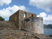
Fort Willoughby, Hassel Island

The park protects dozens of historic ruins from the colonial and plantation eras through the 1950s.

Annaberg Historic District

The Annaberg Historic District protects a partially restored sugar factory and windmill located just east of Mary's Point. National park signage guides visitors through the ruins and explains the process of turning sugar cane into molasses. Volunteers and park rangers are frequently in the area to answer questions. The bake house hosts cooking demonstrations and offers samples of dumb bread. The windmill is located on Annaberg Point, which offers views of Tortola, Great Thatch Island, and the Narrows.

Reef Bay Sugar Factory Historic District

The ruins of the Reef Bay Sugar Factory Historic District can be reached via Reef Bay Trail or L'Esperance trail.

Petroglyph site

The Reef Bay Trail petroglyphs are Taíno rock carvings located on rock pools near a waterfall. They can be reached via a 0.25-mile (0.4 km) long spur trail from Reef Bay Trail. The petroglyph site was added to the National Register of Historic Places in 1982.

Catherineberg Sugar Mill Ruins

The well-preserved Catherineberg Sugar Mill Ruins are among the most easily accessed in the park, and include a windmill tower and a horse mill.

Geography

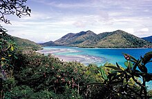
Mary Point as seen from Annaberg
 
Virgin Islands National Park encompasses 14,737 acres (5,964 ha; 23 sq mi) of land and ocean. The park covers almost 60 percent of St. John Island, adjacent ocean, and almost all of Hassel Island.

The main features are coral reefs, which almost completely surround the park, and the ocean waters, tropical forests and beaches. Wild donkeys, deer, mongoose, pigs, goats, birds, iguanas, skinks, tortoises, frogs, and crabs inhabit the park. Bats are the only native land mammal in the park.

Climate

According to the Köppen climate classification system, Virgin Islands National Park has a tropical savanna wet and dry climate (Aw). Class A tropical climates have an average temperature of 18 °C (64.4 °F) or higher in every month of the year, with significant annual precipitation. Class Aw climates have a pronounced dry season, with the driest month having precipitation less than 60 mm (2.36 in) and less than 1/25 of the total annual precipitation. 

The average rainfall per year is 55 inches (1,400 mm). In the winter, trade winds blow from 11 knots (13 mph; 20 km/h) to 21 knots (24 mph; 39 km/h). The average temperature for the park is 79 °F (26 °C). 

The park experiences very little temperature variation between summer and winter, while the sea is warm year-round. The main tourist season is from December to April, which are the driest months. During the remaining months (i.e., the Atlantic hurricane season), prices for accommodations are reduced considerably. Camping and rustic lodging are available in the park from November through August at Cinnamon Bay Campground. Caneel Bay Resort provides luxury accommodations along with upscale dining in the park from November through July.

Geology

Geologic map of St. John
 
Located at the east end of the Greater Antilles, St. John resides on the northeastern end of the Caribbean Plate. The island formed during the Cretaceous with the eruption of the Water Island Formation, consisting of keratophyres and pillow basalts. Igneous activity then changed to that of an island arc, characterized by the Louisenhoj Formation, consisting of andesite and basalt. Volcanism abated during the deposition of the Outer Brass Limestone. Volcanism resumed as evidenced by the Late Cretaceous Tutu Formation, consisting of volcaniclastic turbidites, basalt, and andesite. A diabase dike swarm followed and then compressive folding attributed to the Caribbean Plate colliding with the Bahama Platform. The Late Eocene saw the intrusion of Narrows pluton and Virgin Gorda batholith, associated with the Greater Antilles arc magmatism, and more compressive folding associated with the spreading of the Cayman Trough. This spreading is also tied to sinistral strike-slip faulting at 39 Ma.

Canyon de Chelly National Monument

 
Canyon de Chelly National Monument (/dəˈʃ/ də-SHAY) was established on April 1, 1931, as a unit of the National Park Service. Located in northeastern Arizona, it is within the boundaries of the Navajo Nation and lies in the Four Corners region. Reflecting one of the longest continuously inhabited landscapes of North America, it preserves ruins of the indigenous tribes that lived in the area, from the Ancestral Puebloans (formerly known as Anasazi) to the Navajo. The monument covers 83,840 acres (131 sq mi; 339 km2) and encompasses the floors and rims of the three major canyons: de Chelly, del Muerto, and Monument. These canyons were cut by streams with headwaters in the Chuska Mountains just to the east of the monument. None of the land is federally owned. Canyon de Chelly is one of the most visited national monuments in the United States.

Etymology

The name Chelly (or Chelley) is a Spanish borrowing of the Navajo word Tséyiʼ, which means "canyon" (literally "inside the rock" < tsé "rock" + -yiʼ "inside of, within"). The Navajo pronunciation is [tséɣiʔ]. The Spanish pronunciation of de Chelly [deˈtʃeʎi] was adapted into English, apparently through modelling after a French-like spelling pronunciation, and now /dəˈʃ/ də-SHAY.

History

Canyon de Chelly long served as a home for Navajo people before it was invaded by forces led by future New Mexico governor Lt. Antonio Narbona in 1805. In 1863, Col. Kit Carson sent troops through the canyon, killing 23 Indians, seizing 200 sheep, and destroying hogans, as well as peach orchards and other crops. The resulting demoralization led to the surrender of the Navajos and their removal to Bosque Redondo, New Mexico.

Description

Canyon de Chelly is entirely owned by the Navajo Tribal Trust of the Navajo Nation. It is the only National Park Service unit that is owned and cooperatively managed in this manner. About 40 Navajo families live in the park. Access to the canyon floor is restricted, and visitors are allowed to travel in the canyons only when accompanied by a park ranger or an authorized Navajo guide. The only exception to this rule is the White House Ruin Trail. 

Spider Rock
 
The park's distinctive geologic feature, Spider Rock, is a sandstone spire that rises 750 feet (229 m) from the canyon floor at the junction of Canyon de Chelly and Monument Canyon. Spider Rock can be seen from South Rim Drive. It has served as the scene of a number of television commercials. According to traditional Navajo beliefs, the taller of the two spires is the home of Spider Grandmother.

Most park visitors arrive by automobile and view Canyon de Chelly from the rim, following both North Rim Drive and South Rim Drive. Ancient ruins and geologic structures are visible, but in the distance, from turnoffs on each of these routes. Deep within the park is Mummy Cave. It features structures that have been built at various times in history. Private Navajo-owned companies offer tours of the canyon floor by horseback, hiking or four-wheel drive vehicle. The companies can be contacted directly for prices and arrangements. No entrance fee is charged to enter the park, apart from any charges imposed by tour companies.

Accommodations for visitors are located in the vicinity of the canyon, on the road leading to Chinle, which is the nearest town. 

The National Monument was listed on the National Register of Historic Places on August 25, 1970.

Climate

The data below were compiled starting in 1908 via the WRCC.

Canyon de Chelly National Monument
Canyon de Chelly, Navajo.jpg
Canyon de Chelly, 1904, by Edward S. Curtis
Map showing the location of Canyon de Chelly National Monument
Location in the United States
LocationApache County, Arizona
Nearest cityChinle
Coordinates36.1552818°N 109.5089952°W[1]Coordinates: 36.1552818°N 109.5089952°W
Area83,840 acres (339.3 km2)
CreatedApril 1, 1931
Visitors439,306 (in 2018)
Governing bodyBureau of Indian Affairs
WebsiteCanyon de Chelly National Monument


NRHP reference No.70000066
Added to NRHPAugust 25, 1970

Climate data for Canyon de Chelly, AZ
Month Jan Feb Mar Apr May Jun Jul Aug Sep Oct Nov Dec Year
Record high °F (°C) 68
(20)
72
(22)
82
(28)
90
(32)
101
(38)
105
(41)
105
(41)
102
(39)
99
(37)
90
(32)
79
(26)
67
(19)
105
(41)
Mean maximum °F (°C) 57.2
(14.0)
64.0
(17.8)
72.6
(22.6)
80.8
(27.1)
89.1
(31.7)
97.9
(36.6)
99.1
(37.3)
96.2
(35.7)
91.8
(33.2)
83.0
(28.3)
70.3
(21.3)
59.6
(15.3)
99.9
(37.7)
Average high °F (°C) 44.2
(6.8)
51.0
(10.6)
60.4
(15.8)
69.1
(20.6)
78.6
(25.9)
89.2
(31.8)
92.5
(33.6)
89.4
(31.9)
82.6
(28.1)
70.2
(21.2)
55.8
(13.2)
44.9
(7.2)
69.0
(20.6)
Average low °F (°C) 19.1
(−7.2)
23.6
(−4.7)
29.5
(−1.4)
35.7
(2.1)
43.8
(6.6)
52.0
(11.1)
59.9
(15.5)
58.7
(14.8)
49.6
(9.8)
37.6
(3.1)
27.1
(−2.7)
19.2
(−7.1)
38.0
(3.3)
Mean minimum °F (°C) −0.6
(−18.1)
7.3
(−13.7)
14.4
(−9.8)
20.9
(−6.2)
29.1
(−1.6)
37.7
(3.2)
49.4
(9.7)
48.6
(9.2)
35.0
(1.7)
23.2
(−4.9)
10.9
(−11.7)
1.9
(−16.7)
−4.2
(−20.1)
Record low °F (°C) −32
(−36)
−22
(−30)
1
(−17)
9
(−13)
10
(−12)
20
(−7)
38
(3)
38
(3)
23
(−5)
13
(−11)
−3
(−19)
−27
(−33)
−32
(−36)
Average precipitation inches (mm) 0.79
(20)
0.69
(18)
0.67
(17)
0.53
(13)
0.50
(13)
0.28
(7.1)
1.13
(29)
1.25
(32)
0.91
(23)
0.99
(25)
0.71
(18)
0.71
(18)
9.16
(233.1)
Average snowfall inches (cm) 1.6
(4.1)
1.2
(3.0)
0.9
(2.3)
0.1
(0.25)
0
(0)
0
(0)
0
(0)
0
(0)
0
(0)
0.1
(0.25)
0.4
(1.0)
1.5
(3.8)
5.8
(14.7)

Native American Heritage Sites (National Park Service)

From Wikipedia, the free encyclopedia
 
Many National Park Sites in the United States commemorate the contribution of the Native American culture(s). The term ‘Native American’ includes all cultural groups that predate the arrival of either western European explorers/settlers or east coast explorers and settlers. In this sense, Native Alaskans of both arctic and sub-arctic cultures are included with the American Indians of the continental United States. Native Hawaiians are included as the traditional cultures of the islands.

Many sites were created specifically to preserve the remains of cultures that no longer exist, such as Mesa Verde National Park or Russell Cave National Monument. Some tell the story of a vibrant culture that continues to contribute to the American culture, as with Canyon de Chelly National Monument. Yet others commemorate American Indian cultures that contributed to the development of an area, as Cape Cod National Seashore, or were a part of greater events in American history, such as Pea Ridge National Military Park. The largest number preserve the historical contributions of the Native Cultures throughout time; included in these are Devils Tower National Monument, Pipestone National Monument, and Kaloko-Honokohau National Historical Park.

Parks

Park State Tribal Affiliation(s)
Agate Fossil Beds National Monument NE Lakota
Alibates Flint Quarries National Monument TX Pueblo
Arkansas Post National Memorial AR Quapaw, Osage, Caddo
Aztec Ruins National Monument NM Ancestral Pueblo
Badlands National Park SD Lakotea
Bandelier National Monument NM Ancestral Pueblo
Bent's Old Fort National Historic Site CO Southern Cheyenne, Southern Arapaho, Kiowa, Comanche
Big Bend National Park TX Jumano, Comanche, Kiowa, Apache
Big Hole National Battlefield MT Nez Perce
Bighorn Canyon National Recreation Area MT & WY Crow
Big Thicket National Preserve TX Alabama-Coushatta, Caddo, Atakapa
Buffalo National River AR Paleo-Indians, Archaic, Woodland/Mississippian
Cabrillo National Monument CA Kumeyaay
Canaveral National Seashore FL Timucuan
Canyon de Chelly National Monument AZ Ancestral Pueblo, Navajo
Cape Cod National Seashore MA Wampanoag
Capitol Reef National Park UT Ancestral Pueblo, Fremont culture
Casa Grande Ruins National Monument AZ Hohokam
Castillo de San Marcos National Monument FL Seminole
Chaco Culture National Historical Park NM Ancestral Pueblo, Pueblo, Navajo
Chiricahua National Monument AZ Apache
Colonial National Historical Park (Jamestown), VA 17th-century Powhatans
Coronado National Memorial AZ Zuni
Cuyahoga Valley National Park OH Paleo, Archaic, Adena, Hopewell, Whittlessey
Delaware Water Gap National Recreation Area, PA/NJ Munsee
De Soto National Memorial, FL Timucuan
Devils Tower National Monument, WY Northern Plains cultures including: Lakota Sioux, Northern Cheyenne, Kiowa, Crow, Arapaho, Shoshone, among others
Effigy Mounds National Monument IA Red Ocher, Hopewell, Effigy Mounds Builders
El Malpais National Monument NM Acoma, Laguna, and Zuni Pueblos; Ramah Navajos
El Morro National Monument NM Ancestral Pueblo, Navajo, Zuni
Everglades National Park FL Seminole
Fort Bowie National Historic Site AZ Apache
Fort Caroline National Memorial FL Timucuan
Fort Clatsop National Memorial OR Clatsop, Chinook
Fort Raleigh National Historic Site NC Algonquian
Fort Smith National Historic Site AR Cherokee, Muscogee Creek, Seminole, Choctaw, Chickasaw
Fort Stanwix National Monument NY Mohawk, Oneida, Onondaga, Cayuga, Seneca, Tuscarora
Fort Sumter National Monument SC Seminole at Fort Moultrie
Gates of the Arctic National Park and Preserve AK Nunamiut, Kobuk Eskimo, Koyukon Athabascan
Gateway National Recreation Area NY Lenape, including Canarsie, Nyak
Glacier National Park MT Blackfeet, Salish-Kootenai, Flathead
Glen Canyon National Recreation Area AZ Ancestral Pueblo
Golden Gate National Recreation Area CA Ohlone (Presidio of San Francisco)
Coast Miwok (Marin Headlands)
Grand Canyon National Park AZ Ancestral Pueblo/Hopi, Navajo, Zuni, Southern Paiutes, Havasupai, Hualapai
Grand Portage National Monument MN Ojibwa
Grand Teton National Park WY Plains Indians, Shoshone, Blackfeet
Great Sand Dunes National Monument CO Ute
Great Smoky Mountains National Park TN Cherokee
Guadalupe Mountains National Park TX Mescalero Apache
Haleakala National Park HI Ancient Hawaii
Hawaii Volcanoes National Park HI Ancient Hawaii
Homestead National Monument of America NE Great Plains nations, among others
Kaloko-Honokohau National Historical Park HI Ancient Hawaii
Hopewell Culture National Historical Park OH Ohio Hopewell
Horseshoe Bend National Military Park AL Muscogee Creek, Cherokee
Hovenweep National Monument CO Ancestral Pueblo
Hubbell Trading Post National Historic Site AZ Navajo
Isle Royale National Park MI Ojibwa
Jean Lafitte National Historical Park and Preserve LA Choctaw, Chitimacha, Tunica, Houma, Koasati/Coushatta
Gateway Arch National Park MO Plains Indian people including Lakota, Osage, and Illini
Katmai National Park and Preserve AK Yupik/Aleuts
Knife River Indian Villages National Historic Site ND Hidatsa, Mandan, Arikara
Lake Mead National Recreation Area NV Virgin River Ancestral Pueblo; Mohave, Hualapai, Southern Paiute
Lake Roosevelt National Recreation Area WA Colville Confederated Tribes, Spokane, Nez Perce
Lava Beds National Monument CA Modoc
Little Bighorn Battlefield National Monument MT Lakota, Cheyenne, Arapaho, Crow, Arikara
Mammoth Cave National Park KY Early Woodland prehistoric culture
Mesa Verde National Park CO Ancestral Pueblo and 23 affiliated Native American groups
Mojave National Preserve CA Paiute, Chemehuevi, Mohave
Montezuma Castle National Monument AZ Sinagua
Natchez Trace Parkway MS/AL/TN Natchez, Choctaw, Chickasaw, Muscogee Creek, Cherokee
National Capital Parks East, Kenilworth Aquatic Gardens, DC Algonquian
Natural Bridges National Monument UT Ancestral Pueblo
Navajo National Monument AZ Ancestral Pueblo, Navajo
Nez Perce National Historical Park ID Nez Perce
North Cascades National Park WA Coast Salish/Upper Skagit, Chelan
Ocmulgee National Monument GA Mississippian, Lamar phase, Muscogee Creek
Olympic National Park WA Elwha Klallam, Hoh, Jamestown S'Klallam, Makah, Port Gamble S'Klallam, Quileute, Quinault, Skokomish
Organ Pipe Cactus National Monument AZ Hohokam, O'odham
Pea Ridge National Military Park AR Cherokee, Choctaw, Chickasaw
Pecos National Historical Park NM Pueblo people
Petroglyph National Monument NM Rio Grande Pueblo, Hopi, and Zuni
Pipe Spring National Monument AZ Ancestral Pueblo, Southern Paiute, and Navajo
Pipestone National Monument MN Siouan groups
Point Reyes National Seashore CA Miwok
Puʻukohola Heiau National Historic Site HI Ancient Hawaii
Pu'uhonua o Honaunau National Historical Park HI Ancient Hawaii
Rainbow Bridge National Monument AZ Navajo Nation, Hopi, Kaibab Paiute, San Juan Southern Paiute, Ute Mountain Ute
Redwood National Park CA Tolowa, Yurok, Chilula
Roger Williams National Memorial RI Narragansett, Wampanoag
Russell Cave National Monument AL Transitional Paleo to Mississippian cultural
Salinas Pueblo Missions National Monument NM Pueblo
San Antonio Missions National Historical Park TX Coahuiltecan/South Texans
San Juan National Historic Site PR Taino
Santa Fe National Historic Trail NM Historic Plains and Pueblo cultures
Santa Monica Mountains National Recreation Area CA Chumash, Tongva
Shiloh National Military Park TN at Shiloh Indian Mounds
Sitka National Historical Park AK Tlingit
Sunset Crater Volcano National Monument AZ Ancestral Pueblo, Navajo
Timucuan Ecological and Historic Preserve FL Timucuan
Tonto National Monument AZ Salado
Trail of Tears National Historic Trail NM Cherokee, Muscogee Creek, Seminole, Choctaw, Chickasaw
Tumacacori National Historical Park AZ Pima
Tuzigoot National Monument AZ Sinagua
Upper Delaware Scenic and Recreational River NY Lenape
Voyageurs National Park MN Ojibwa
Walnut Canyon National Monument AZ Sinagua, Ancestral Pueblo, Hopi
Whiskeytown-Shasta-Trinity National Recreation Area CA Wintu at Whiskeytown
Whitman Mission National Historic Site WA Cayuse
Women's Rights National Historical Park NY Iroquois Confederacy, Seneca, Cayuga
Wupatki National Monument AZ Ancestral Pueblo, Navajo
Yellowstone National Park WY Nez Perce, Shoshone-Bannock, Sheepeaters, Crow, Blackfeet
Yosemite National Park CA Southern and Central Sierra Miwok, Mono Lake Paiute

NPS units proposed but not confirmed as interpreting Native American culture(s) as a primary theme:

Sexuality in Islam

From Wikipedia, the free encyclopedia https://en.wikipedia.org/wiki/Sexuality_in_Islam   A mufti advises a ...