The Deep Earth Carbon Degassing (DECADE) project is an
initiative to unite scientists around the world to make tangible
advances towards quantifying the amount of carbon
outgassed from the Earth's deep interior (core, mantle, crust) into the
surface environment (e.g. biosphere, hydrosphere, cryosphere,
atmosphere) through naturally occurring processes. DECADE is an
initiative within the Deep Carbon Observatory (DCO).
Volcanoes are the main pathway in which deeply sourced volatiles, including carbon, are transferred from the Earth's interior to the surface environment. An additional, though less well understood, pathway includes along faults and fractures within the Earth's crust,
often referred to as tectonic degassing. When the DCO was first formed
in 2009 estimates of global carbon flux from volcanic regions ranged
from 65 to 540 Mt/yr, and constraints on global tectonic degassing were virtually unknown.
The order of magnitude uncertainty in current volcanic/tectonic carbon
outgassing makes answering fundamental questions about the global carbon budget virtually impossible. In particular, one fundamental unknown is if carbon transferred to the Earth's interior via subduction is efficiently recycled back to the Earth's mantle lithosphere,
crust and surface environment through volcanic and tectonic degassing,
or if significant quantities of carbon are being subducted into the deep
mantle. Because significant quantities of mantle carbon are also released through mid-ocean ridge
volcanism, if carbon inputs and outputs at subduction zone settings are
in balance, then the net effect will be an imbalance in the global
carbon budget, with carbon being preferentially removed from the Earth's
deep interior and redistributed to more shallow reservoirs including
the mantle lithosphere, crust, hydrosphere and atmosphere.
The implications of this may mean that carbon concentrations in the
surface environment are increasing over Earth's history, which has
significant implications for climate change.
Findings from the DECADE project will increase our understanding
of the way carbon cycles through deep Earth, and patterns in volcanic
emissions data could potentially alert scientists to an impending
eruption.
Project goals
The
main goal of the DECADE project is to refine estimates of global carbon
outgassing using a multipronged approach. Specifically, the DECADE
initiative unites scientists with expertise in geochemistry, petrology and volcanology
to provide constraints on the global volcanic carbon flux by 1)
establishing a database of volcanic and hydrothermal gas compositions
and fluxes linked to EarthChem/PetDB and the Smithsonian Global Volcanism Program,
2) building a global monitoring network to continuously measure the
volcanic carbon flux of 20 active volcanoes, 3) measure the carbon flux
of remote volcanoes, for which no or only sparse data are currently
available, 4) develop new field and analytical instrumentation for
carbon measurements and flux monitoring, and 5) establish formal
collaborations with volcano observatories around the world to support volcanic gas measurement and monitoring activities.
History
The DECADE initiative was conceived in September 2011 by the International Association of Volcanology and Chemistry of the Earth's Interior Commission on the Chemistry of Volcanic Gases during its 11th field workshop.[6]
Here the charge of the initiative was broadly defined and the
governance structure established. The DECADE receives financial support
from Deep Carbon Observatory to meet the project goals, with support
distributed to DECADE members based on project proposal submission and
external review and/or consensus by the Board of Directors. All projects
are significantly matched by funding sources from the individual
investigators or other funding agencies. The initiative is led by a
Board of Directors that has nine members including one chair and two
co-vice chairs. Currently the DECADE initiative has around 80 members
from 13 countries.
Achievements
As of 2020, major achievements supported or partially supported by the DECADE initiative include:
Modification of the IEDA EarthChem database to include volcanic gas composition and gas flux data.
Prediction of volcanic activity, or volcanic eruption forecasting, is an interdisciplinary monitoring and research effort to predict the time and severity of a volcano's eruption.
Of particular importance is the prediction of hazardous eruptions that
could lead to catastrophic loss of life, property, and disruption of
human activities.
Mount St. Helens erupted explosively on May 18, 1980, at 8:32 a.m. PDT
Seismic waves (seismicity)
General principles of volcano seismology
Seismic
activity (earthquakes and tremors) always occurs as volcanoes awaken
and prepare to erupt and are a very important link to eruptions. Some
volcanoes normally have continuing low-level seismic activity, but an
increase may signal a greater likelihood of an eruption. The types of
earthquakes that occur and where they start and end are also key signs.
Volcanic seismicity has three major forms: short-period earthquake, long-period earthquake, and harmonic tremor.
Short-period earthquakes are like normal fault-generated
earthquakes. They are caused by the fracturing of brittle rock as magma
forces its way upward. These short-period earthquakes signify the growth
of a magma body near the surface and are known as 'A' waves. These type
of seismic events are often also referred to as Volcano-Tectonic (or
VT) events or earthquakes.
Long-period earthquakes are believed to indicate increased gas
pressure in a volcano's plumbing system. They are similar to the
clanging sometimes heard in a house's plumbing system, which is known as
"water hammer".
These oscillations are the equivalent of acoustic vibrations in a
chamber, in the context of magma chambers within the volcanic dome and
are known as 'B' waves. These are also known as resonance waves and long period resonance events.
Harmonic tremors are often the result of magma pushing against the
overlying rock below the surface. They can sometimes be strong enough to
be felt as humming or buzzing by people and animals, hence the name.
Patterns of seismicity are complex and often difficult to interpret;
however, increasing seismic activity is a good indicator of increasing
eruption risk, especially if long-period events become dominant and
episodes of harmonic tremor appear.
Using a similar method, researchers can detect volcanic eruptions
by monitoring infra-sound—sub-audible sound below 20 Hz. The IMS Global
Infrasound Network, originally set up to verify compliance with nuclear
test ban treaties, has 60 stations around the world that work to detect
and locate erupting volcanoes.
Seismic case studies
A
relation between long-period events and imminent volcanic eruptions was
first observed in the seismic records of the 1985 eruption of Nevado del Ruiz in Colombia. The occurrence of long-period events were then used to predict the 1989 eruption of Mount Redoubt in Alaska and the 1993 eruption of Galeras in Colombia. In December 2000, scientists at the National Center for Prevention of Disasters in Mexico City predicted an eruption within two days at Popocatépetl, on the outskirts of Mexico City. Their prediction used research that had been done by Bernard Chouet, a Swiss volcanologist who was working at the United States Geological Survey and who first observed a relation between long-period events and an imminent eruption.
The government evacuated tens of thousands of people; 48 hours later,
the volcano erupted as predicted. It was Popocatépetl's largest eruption
for a thousand years, yet no one was hurt.
Iceberg tremors
Similarities between icebergtremors, which occur when they run aground, and volcanic tremors may help experts develop a better method for predicting volcanic eruptions.
Although icebergs have much simpler structures than volcanoes, they are
physically easier to work with. The similarities between volcanic and
iceberg tremors include long durations and amplitudes, as well as common shifts in frequencies.
Gas emissions
Gas and ash plume erupted from Mount Pinatubo, Philippines.
As magma nears the surface and its pressure decreases, gases escape.
This process is much like what happens when you open a bottle of fizzy
drink and carbon dioxide escapes. Sulfur dioxide
is one of the main components of volcanic gases, and increasing amounts
of it herald the arrival of increasing amounts of magma near the
surface. For example, on May 13, 1991, an increasing amount of sulfur
dioxide was released from Mount Pinatubo in the Philippines.
On May 28, just two weeks later, sulfur dioxide emissions had increased
to 5,000 tonnes, ten times the earlier amount. Mount Pinatubo later
erupted on June 12, 1991. On several occasions, such as before the Mount
Pinatubo eruption and the 1993 Galeras, Colombia
eruption, sulfur dioxide emissions have dropped to low levels prior to
eruptions. Most scientists believe that this drop in gas levels is
caused by the sealing of gas passages by hardened magma. Such an event
leads to increased pressure in the volcano's plumbing system and an
increased chance of an explosive eruption. A multi-component gas analyzer system (Multi-GAS) is an instrument package used to take real-time high-resolution measurements of volcanic gas plumes. Multi-GAS measurements of CO2/SO2 ratios can allow detection of the pre-eruptive degassing of rising magmas, improving prediction of volcanic activity.
Swelling of a volcano signals that magma has accumulated near the
surface. Scientists monitoring an active volcano will often measure the
tilt of the slope and track changes in the rate of swelling. An
increased rate of swelling, especially if accompanied by an increase in
sulfur dioxide emissions and harmonic tremors is a high probability sign
of an impending event. The deformation of Mount St. Helens
prior to the May 18, 1980 eruption was a classic example of
deformation, as the north side of the volcano was bulging upwards as
magma was building up underneath. Most cases of ground deformation are
usually detectable only by sophisticated equipment used by scientists,
but they can still predict future eruptions this way.
The Hawaiian volcanoes show significant ground deformation; there is
inflation of the ground prior to an eruption and then an obvious
deflation post-eruption. This is due to the shallow magma chamber of the
Hawaiian volcanoes; movement of the magma is easily noticed on the
ground above.
Thermal monitoring
Both
magma movement, changes in gas release and hydrothermal activity can
lead to thermal emissivity changes at the volcano's surface. These can
be measured using several techniques:
There are 4 main methods that can be used to predict a volcanic eruption through the use of hydrology:
Borehole and well hydrologic and hydraulic measurements are
increasingly used to monitor changes in a volcanoes subsurface gas
pressure and thermal regime. Increased gas pressure will make water
levels rise and suddenly drop right before an eruption, and thermal
focusing (increased local heat flow) can reduce or dry out aquifers.
Detection of lahars and other debris flows close to their sources.
USGS scientists have developed an inexpensive, durable, portable and
easily installed system to detect and continuously monitor the arrival
and passage of debris flows and floods in river valleys that drain
active volcanoes.
Pre-eruption sediment may be picked up by a river channel
surrounding the volcano that shows that the actual eruption may be
imminent. Most sediment is transported from volcanically disturbed
watersheds during periods of heavy rainfall. This can be an indication
of morphological changes and increased hydrothermal activity in absence
of instrumental monitoring techniques.
Volcanic deposit that may be placed on a river bank can easily be
eroded which will dramatically widen or deepen the river channel.
Therefore, monitoring of the river channels width and depth can be used
to assess the likelihood of a future volcanic eruption.
Remote sensing
Remote sensing
is the detection by a satellite's sensors of electromagnetic energy
that is absorbed, reflected, radiated or scattered from the surface of a
volcano or from its erupted material in an eruption cloud.
'Cloud sensing: Scientists can monitor the unusually cold
eruption clouds from volcanoes using data from two different thermal
wavelengths to enhance the visibility of eruption clouds and
discriminate them from meteorological clouds
'Gas sensing: Sulfur dioxide can also be measured by remote sensing at some of the same wavelengths as ozone. Total Ozone Mapping Spectrometers
(TOMS) can measure the amount of sulfur dioxide gas released by
volcanoes in eruptions. Carbon dioxide emissions from volcanoes have
been detected in the short-wave infrared using NASA'sOrbiting Carbon Observatory 2.
Thermal sensing: The presence of new significant thermal
signatures or 'hot spots' may indicate new heating of the ground before
an eruption, represent an eruption in progress or the presence of a very
recent volcanic deposit, including lava flows or pyroclastic flows.
Deformation sensing: Satellite-borne spatial radar data can
be used to detect long-term geometric changes in the volcanic edifice,
such as uplift and depression. In this method, interferometric synthetic aperture radar (InSAR), digital elevation models
generated from radar imagery are subtracted from each other to yield a
differential image, displaying rates of topographic change.
Forest monitoring: Recently, it has been demonstrated that
the location of eruptive fractures could be predicted, months to years
before the eruptions, by the monitoring of forest growth. This tool
based on the monitoring of the trees growth has been validated at both
Mt. Niyragongo and Mt. Etna during the 2002–2003 volcano eruptive
events.
Infrasound sensing: A relatively new approach to detecting
volcanic eruptions involves using infrasound sensors from the
International Monitoring System (IMS) infrasound network. This method of
detection takes signals from multiple sensors and uses triangulation to determine the location of the eruption.
Mass movements and mass failures
Monitoring
mass movements and failures uses techniques lending from seismology
(geophones), deformation, and meteorology. Landslides, rock falls,
pyroclastic flows, and mud flows (lahars) are example of mass failures
of volcanic material before, during, and after eruptions.
The most famous volcanic landslide
was probably the failure of a bulge that built up from intruding magma
before the Mt. St. Helens eruption in 1980, this landslide "uncorked"
the shallow magmatic intrusion causing catastrophic failure and an
unexpected lateral eruption blast.
Rock falls often occur during periods of increased deformation
and can be a sign of increased activity in absence of instrumental
monitoring.
Mud flows (lahars)
are remobilized hydrated ash deposits from pyroclastic flows and ash
fall deposits, moving downslope even at very shallow angles at high
speed. Because of their high density they are capable of moving large
objects such as loaded logging trucks, houses, bridges, and boulders.
Their deposits usually form a second ring of debris fans around volcanic
edifices, the inner fan being primary ash deposits. Downstream of the
deposition of their finest load, lahars can still pose a sheet flood
hazard from the residual water. Lahar deposits can take many months to
dry out, until they can be walked on. The hazards derived from lahar
activity can exist several years after a large explosive eruption.
A team of US scientists developed a method of predicting lahars. Their method was developed by analyzing rocks on Mount Rainier in Washington.
The warning system depends on noting the differences between fresh
rocks and older ones. Fresh rocks are poor conductors of electricity
and become hydrothermically altered by water and heat. Therefore, if
they know the age of the rocks, and therefore the strength of them, they
can predict the pathways of a lahar. A system of Acoustic Flow Monitors (AFM) has also been emplaced on Mount Rainier to analyze ground tremors that could result in a lahar, providing an earlier warning.
Local case studies
Nyiragongo
The eruption of Mount Nyiragongo
on January 17, 2002, was predicted a week earlier by a local expert who
had been studying the volcanoes for years. He informed the local
authorities and a UN
survey team was dispatched to the area; however, it was declared safe.
Unfortunately, when the volcano erupted, 40% of the city of Goma
was destroyed along with many people's livelihoods. The expert claimed
that he had noticed small changes in the local relief and had monitored
the eruption of a much smaller volcano two years earlier. Since he knew
that these two volcanoes were connected by a small fissure, he knew
that Mount Nyiragongo would erupt soon.
Mount Etna
British geologists have developed a method of predicting future eruptions of Mount Etna.
They have discovered that there is a time lag of 25 years between
events. Monitoring of deep crust events can help predict accurately what
will happen in the years to come. So far they have predicted that
between 2007 and 2015, volcanic activity will be half of what it was in
1972.Other methods of predicting volcanic activity is by examining the increase of CO2/SO2
ratios. These ratios will indicate pre-eruptive degassing of magma
chambers. A team of researchers used Mount Etna for this research by
observing gases such as H2O, CO2, and SO2. The team did a real-time monitoring of Mount Etna before it experienced eruptions in July and December 2006. These CO2/SO2
ratios are useful in that the increase of these ratios are a
predecessor to upcoming eruptions due to the acceleration of gas-rich
magmas and replenishes the magma chamber. In the two years of
observations that the team conducted, the increase of these ratios are a
precursor to upcoming eruptions. It was recorded that in the months
prior before an eruption, the ratios increased and led to an eruption
after it had reached its peak amount. It was concluded that measuring H2O, CO2, and SO2 can be a useful method to predict volcanic activity, especially at Mount Etna.
Mount Etna's prediction of volcanic activity can also be used with 4D
microgravity analysis. This type of analysis uses GPS and synthetic
aperture radar interferometry (InSAR). It can measure the changes in
density, and afterwards, can retrieve a model to show magma movements
and spatial scales that are occurring within a volcanic system. Back in
2001, gravity models detected that there was a decrease in the mass of
Mount Etna of 2.5×10¹¹ kg. Eventually, there was a sudden
increase in the mass two weeks prior to an eruption. The volcano made up
for this decrease in magma by retrieving more magma from its storage
zone to bring up to the upper levels of the plumbing system. Due to this
retrieval, it led to an eruption. The microgravity studies that were
performed by this team shows the migration of magma and gas within a
magma chamber prior to any eruption, which can be a useful method to any
prediction of volcanic activity.
Sakurajima, Japan
Sakurajima is possibly one of the most monitored areas on earth. The Sakurajima Volcano lies near Kagoshima City, which has a population of over 500,000 people. Both the Japanese Meteorological Agency (JMA) and Kyoto University's
Sakurajima Volcanological Observatory (SVO) monitors the volcano's
activity. Since 1995, Sakurajima has only erupted from its summit with
no release of lava.
Monitoring techniques at Sakurajima:
Likely activity is signalled by swelling of the land around the
volcano as magma below begins to build up. At Sakurajima, this is
marked by a rise in the seabed in Kagoshima Bay – tide levels rise as a
result.
As magma begins to flow, melting and splitting base rock can be
detected as volcanic earthquakes. At Sakurajima, they occur two to five
kilometres beneath the surface. An underground observation tunnel is
used to detect volcanic earthquakes more reliably.
Groundwater levels begin to change, the temperature of hot springs
may rise and the chemical composition and amount of gases released may
alter. Temperature sensors are placed in bore holes which are used to
detect ground water temp. Remote sensing is used on Sakurajima since
the gases are highly toxic – the ratio of HCl gas to SO2 gas increases significantly shortly before an eruption.
As an eruption approaches, tiltmeter systems measure minute
movements of the mountain. Data is relayed in real-time to monitoring
systems at SVO.
Seismometers detect earthquakes which occur immediately beneath the
crater, signaling the onset of the eruption. They occur 1 to 1.5
seconds before the explosion.
With the passing of an explosion, the tiltmeter system records the settling of the volcano.
Ecuador
The Geophysics Institute at the National Polytechnic School in Quito houses an international team of seismologists and volcanologists whose responsibility is to monitor Ecuadors numerous active volcanoes in the Andes Mountains of Ecuador and in the Galápagos Islands. Ecuador is located in the Ring of Fire where about 90% of the world's earthquakes and 81% of the world's largest earthquakes occur. The geologists study the eruptive activity for the volcanoes in the country, especially Tungurahua whose volcanic activity restarted on 19 August 1999, and several major eruptions since that period, the last starting on 1 February 2014.
Mitigations
Going
beyond predicting volcanic activity, there are highly speculative
proposals to prevent explosive volcanic activity by cooling the magma chambers using geothermal power generation techniques.
A supervolcano is a volcano that has had an eruption with a volcanic explosivity index (VEI) of 8,
the largest recorded value on the index. This means the volume of
deposits for such an eruption is greater than 1,000 cubic kilometers
(240 cubic miles).
Location of Yellowstone hotspot over time. Numbers indicate millions of years before the present.Satellite image of Lake Toba, the site of a VEI 8 eruption c. 75,000 years agoCross-section through Long Valley Caldera
Supervolcanoes occur when magma in the mantle rises into the crust
but is unable to break through it. Pressure builds in a large and
growing magma pool until the crust is unable to contain the pressure and
ruptures. This can occur at hotspots (for example, Yellowstone Caldera) or at subduction zones (for example, Toba).
The term "supervolcano" was first used in a volcanic context in 1949. Its origins lie in an early 20th-century scientific debate about the geological history and features of the Three Sisters volcanic region of Oregon in the United States. In 1925, Edwin T. Hodge suggested that a very large volcano, which he named Mount Multnomah, had existed in that region. He believed that several peaks
in the Three Sisters area were remnants of Mount Multnomah after it had
been largely destroyed by violent volcanic explosions, similarly to Mount Mazama. In his 1948 book The Ancient Volcanoes of Oregon, volcanologist Howel Williams
ignored the possible existence of Mount Multnomah, but in 1949 another
volcanologist, F. M. Byers Jr., reviewed the book, and in the review,
Byers refers to Mount Multnomah as a "supervolcano".
More than fifty years after Byers' review was published, the term supervolcano was popularised by the BBC popular science television program Horizon in 2000, referring to eruptions that produce extremely large amounts of ejecta.
Though there is no well-defined minimum explosive size for a
"supervolcano", there are at least two types of volcanic eruptions that
have been identified as supervolcanoes: large igneous provinces and massive eruptions.
Large igneous provinces
Map of large flood basalt igneous provinces worldwide
Large igneous provinces, such as Iceland, the Siberian Traps, Deccan Traps, and the Ontong Java Plateau, are extensive regions of basalts on a continental scale resulting from flood basalt
eruptions. When created, these regions often occupy several thousand
square kilometres and have volumes on the order of millions of cubic
kilometers. In most cases, the lavas are normally laid down over several
million years. They release large amounts of gases.
The Réunion hotspot produced the Deccan Traps about 66 million years ago, coincident with the Cretaceous–Paleogene extinction event. The scientific consensus is that an asteroid impact
was the cause of the extinction event, but the volcanic activity may
have caused environmental stresses on extant species up to the Cretaceous–Paleogene boundary.
Additionally, the largest flood basalt event (the Siberian Traps)
occurred around 250 million years ago and was coincident with the
largest mass extinction in history, the Permian–Triassic extinction event, although it is unknown whether it was solely responsible for the extinction event.
Such outpourings are not explosive, though lava fountains may occur. Many volcanologists consider Iceland to be a large igneous province that is currently being formed. The last major outpouring occurred in 1783–84 from the Laki fissure, which is approximately 40 km (25 mi) long. An estimated 14 km3 (3.4 cu mi) of basaltic lava was poured out during the eruption (VEI 4).
The Ontong Java Plateau has an area of about 2,000,000 km2 (770,000 sq mi), and the province was at least 50% larger before the Manihiki and Hikurangi Plateaus broke away.
Volcanic eruptions are classified using the volcanic explosivity index. It is a logarithmic scale,
and an increase of one in VEI number is equivalent to a tenfold
increase in volume of erupted material. VEI 7 or VEI 8 eruptions are so
powerful that they often form circular calderas rather than cones because the downward withdrawal of magma causes the overlying rock mass to collapse into the empty magma chamber beneath it.
Known super eruptions
Based on incomplete statistics, at least 60 VEI 8 eruptions have been identified.
Possibly the largest known supereruption. Existence as a single
eruption is controversial, and it could have been a multiple 2,000+ km³
event that spanned less than a million years
The largest of the Indian Peak-Caliente Caldera Complex eruptions,
preserved as the Wah Wah Springs Tuff; includes pyroclastic flows more
than 500 meters (1,600 ft) thick
Lava Creek Tuff; consisted of two distinct eruptions separated by years
640,000
1,000 km3
Media portrayal
Nova featured an episode "Mystery of the Megavolcano" in September 2006 examining such eruptions in the last 100,000 years.
Supervolcano
is the title of a British-Canadian television disaster film, first
released in 2005. It tells a fictional story of a supereruption at
Yellowstone.
In the 2009 disaster film 2012, a supereruption of Yellowstone is one of the events that contributes to a global cataclysm.
Metamorphic rocks arise from the transformation of existing rock to new types of rock in a process called metamorphism. The original rock (protolith) is subjected to temperatures greater than 150 to 200 °C (300 to 400 °F) and, often, elevated pressure of 100 megapascals (1,000 bar)
or more, causing profound physical or chemical changes. During this
process, the rock remains mostly in the solid state, but gradually
recrystallizes to a new texture or mineral composition. The protolith may be an igneous, sedimentary, or existing metamorphic rock.
Metamorphic rocks make up a large part of the Earth's crust and form 12% of the Earth's land surface. They are classified by their protolith, their chemical and mineral makeup, and their texture.
They may be formed simply by being deeply buried beneath the Earth's
surface, where they are subject to high temperatures and the great
pressure of the rock layers above. They can also form from tectonic
processes such as continental collisions, which cause horizontal
pressure, friction, and distortion. Metamorphic rock can be formed
locally when rock is heated by the intrusion of hot molten rock called magma
from the Earth's interior. The study of metamorphic rocks (now exposed
at the Earth's surface following erosion and uplift) provides
information about the temperatures and pressures that occur at great
depths within the Earth's crust.
Some examples of metamorphic rocks are gneiss, slate, marble, schist, and quartzite. Slate and quartzite tiles are used in building construction. Marble is also prized for building construction and as a medium for sculpture. On the other hand, schist bedrock can pose a challenge for civil engineering because of its pronounced planes of weakness.
Metamorphic rocks form one of the three great divisions of rock types. They are distinguished from igneous rocks, which form from molten magma, and sedimentary rocks, which form from sediments eroded from existing rock or precipitated chemically from bodies of water.
Metamorphic rocks are formed when existing rock is transformed
physically or chemically at elevated temperature, without actually
melting to any great degree. The importance of heating in the formation
of metamorphic rock was first noted by the pioneering Scottish
naturalist, James Hutton,
who is often described as the father of modern geology. Hutton wrote in
1795 that some rock beds of the Scottish Highlands had originally been
sedimentary rock but had been transformed by great heat.
Hutton also speculated that pressure was important in metamorphism. This hypothesis was tested by his friend, James Hall, who sealed chalk into a makeshift pressure vessel
constructed from a cannon barrel and heated it in an iron foundry
furnace. Hall found that this produced a material strongly resembling marble, rather than the usual quicklime produced by heating of chalk in the open air. French geologists subsequently added metasomatism,
the circulation of fluids through buried rock, to the list of processes
that help bring about metamorphism. However, metamorphism can take
place without metasomatism (isochemical metamorphism) or at depths of just a few hundred meters where pressures are relatively low (for example, in contact metamorphism).
Metamorphic processes change the texture or mineral composition of the metamorphosed rock.
Mineralogical changes
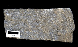
Basalt hand-sized sample showing fine-grained textureAmphibolite formed by metamorphism of basalt
Metasomatism
can change the bulk composition of a rock. Hot fluids circulating
through pore space in the rock can dissolve existing minerals and
precipitate new minerals. Dissolved substances are transported out of
the rock by the fluids while new substances are brought in by fresh
fluids. This can obviously change the mineral makeup of the rock.
However, changes in the mineral composition can take place even
when the bulk composition of the rock does not change. This is possible
because all minerals are stable only within certain limits of
temperature, pressure, and chemical environment. For example, at
atmospheric pressure, the mineral kyanite transforms to andalusite at a temperature of about 190 °C (374 °F). Andalusite, in turn, transforms to sillimanite when the temperature reaches about 800 °C (1,470 °F). All three have the identical composition, Al2SiO5. Likewise, forsterite is stable over a broad range of pressure and temperature in marble, but is converted to pyroxene at elevated pressure and temperature in more silicate-rich rock containing plagioclase, with which the forsterite reacts chemically.
Many complex high-temperature reactions may take place between
minerals without them melting, and each mineral assemblage produced
indicates the temperatures and pressures at the time of metamorphism.
These reactions are possible because of rapid diffusion of atoms at
elevated temperature. Pore fluid between mineral grains can be an
important medium through which atoms are exchanged.
Textural changes
The change in the particle size of the rock during the process of metamorphism is called recrystallization. For instance, the small calcite crystals in the sedimentary rock limestone and chalk change into larger crystals in the metamorphic rock marble.
In metamorphosed sandstone, recrystallization of the original quartz
sand grains results in very compact quartzite, also known as
metaquartzite, in which the often larger quartz crystals are
interlocked. Both high temperatures and pressures contribute to recrystallization. High temperatures allow the atoms and ions
in solid crystals to migrate, thus reorganizing the crystals, while
high pressures cause solution of the crystals within the rock at their
point of contact.
Description
Metamorphic rock containing staurolite and almandine garnet
Metamorphic rocks are characterized by their distinctive mineral composition and texture.
Metamorphic minerals
Because every mineral is stable only within certain limits, the
presence of certain minerals in metamorphic rocks indicates the
approximate temperatures and pressures at which the rock underwent
metamorphism. These minerals are known as index minerals. Examples include sillimanite, kyanite, staurolite, andalusite, and some garnet.
Other minerals, such as olivines, pyroxenes, hornblende, micas, feldspars, and quartz,
may be found in metamorphic rocks but are not necessarily the result of
the process of metamorphism. These minerals can also form during the crystallization
of igneous rocks. They are stable at high temperatures and pressures
and may remain chemically unchanged during the metamorphic process.
Metamorphic rocks are typically more coarsely crystalline than the
protolith from which they formed. Atoms in the interior of a crystal are
surrounded by a stable arrangement of neighboring atoms. This is
partially missing at the surface of the crystal, producing a surface energy
that makes the surface thermodynamically unstable. Recrystallization to
coarser crystals reduces the surface area and so minimizes the surface
energy.
Although grain coarsening is a common result of metamorphism, rock that is intensely deformed may eliminate strain energy by recrystallizing as a fine-grained rock called mylonite. Certain kinds of rock, such as those rich in quartz, carbonate minerals, or olivine, are particularly prone to form mylonites, while feldspar and garnet are resistant to mylonitization.
Foliation
Folded foliation in a metamorphic rock from near Geirangerfjord, Norway
Many kinds of metamorphic rocks show a distinctive layering called foliation (derived from the Latin word folia,
meaning "leaves"). Foliation develops when a rock is being shortened
along one axis during recrystallization. This causes crystals of platy
minerals, such as mica and chlorite,
to become rotated such that their short axes are parallel to the
direction of shortening. This results in a banded, or foliated, rock,
with the bands showing the colors of the minerals that formed them.
Foliated rock often develops planes of cleavage. Slate is an example of a foliated metamorphic rock, originating from shale, and it typically shows well-developed cleavage that allows slate to be split into thin plates.
The type of foliation that develops depends on the metamorphic grade. For instance, starting with a mudstone,
the following sequence develops with increasing temperature: The
mudstone is first converted to slate, which is a very fine-grained,
foliated metamorphic rock, characteristic of very low grade
metamorphism. Slate in turn is converted to phyllite, which is fine-grained and found in areas of low grade metamorphism. Schist is medium to coarse-grained and found in areas of medium grade metamorphism. High-grade metamorphism transforms the rock to gneiss, which is coarse to very coarse-grained.
Rocks that were subjected to uniform pressure from all sides, or
those that lack minerals with distinctive growth habits, will not be
foliated. Marble lacks platy minerals and is generally not foliated,
which allows its use as a material for sculpture and architecture.
Metamorphic rocks are one of the three great divisions of all rock
types, and so there is a great variety of metamorphic rock types. In
general, if the protolith of a metamorphic rock can be determined, the
rock is described by adding the prefix meta- to the protolith rock name. For example, if the protolith is known to be basalt, the rock will be described as a metabasalt. Likewise, a metamorphic rock whose protolith is known to be a conglomerate will be described as a metaconglomerate.
For a metamorphic rock to be classified in this manner, the protolith
should be identifiable from the characteristics of the metamorphic rock
itself, and not inferred from other information.
Under the British Geological Survey's
classification system, if all that can be determined about the
protolith is its general type, such as sedimentary or volcanic, the
classification is based on the mineral mode (the volume percentages of
different minerals in the rock). Metasedimentary rocks are divided into
carbonate-rich rock (metacarbonates or calcsilicate-rocks) or
carbonate-poor rocks, and the latter are further classified by the
relative abundance of mica in their composition. This ranges from
low-mica psammite through semipelite to high-mica pelite.
Psammites composed mostly of quartz are classified as quartzite.
Metaigneous rocks are classified similarly to igneous rocks, by silica content, from meta-ultramafic-rock (which is very low in silica) to metafelsic-rock (with a high silica content).
Where the mineral mode cannot be determined, as is often the case when rock is first examined in the field, then classification must be based on texture. The textural types are:
Schists, which are medium-grained strongly foliated rocks.
These show the most well-developed schistosity, defined as the extent
to which platy minerals are present and are aligned in a single
direction, so that the rock easily splits into plates less than a
centimeter (0.4 inches) thick.
Gneisses, which are more coarse grained and show thicker foliation that schists, with layers over 5mm thick. These show less well-developed schistosity.
Granofels, which show no obvious foliation or schistosity.
A hornfels is a granofels that is known to result from contact metamorphism. A slate
is a fine-grained metamorphic rock that easily splits into thin plates
but shows no obvious compositional layering. The term is used only when
very little else is known about the rock that would allow a more
definite classification. Textural classifications may be prefixed to
indicate a sedimentary protolith (para-, such as paraschist) or igneous protolith (ortho-,
such as orthogneiss). When nothing is known about the protolith, the
textural name is used without a prefix. For example, a schist is a rock
with schistose texture whose protolith is uncertain.
Special classifications exist for metamorphic rocks with a volcaniclastic protolith or formed along a fault or through hydrothermal circulation. A few special names are used for rocks of unknown protolith but known modal composition, such as marble, eclogite, or amphibolite.
Special names may also be applied more generally to rocks dominated by a
single mineral, or with a distinctive composition or mode or origin.
Special names still in wide use include amphibolite, greenschist, phyllite, marble, serpentinite, eclogite, migmatite, skarn, granulite, mylonite, and slate.
The basic classification can be supplemented by terms describing
mineral content or texture. For example, a metabasalt showing weak
schistosity might be described as a gneissic metabasalt, and a pelite
containing abundant staurolite might be described as a staurolite
pelite.
Figure 1. Diagram showing metamorphic facies in pressure-temperature space. The domain of the graph corresponds to conditions within the Earth's crust and upper mantle.
A metamorphic facies is a set of distinctive assemblages of minerals
that are found in metamorphic rock that formed under a specific
combination of pressure and temperature. The particular assemblage is
somewhat dependent on the composition of that protolith, so that (for
example) the amphibolite facies of a marble will not be identical with
the amphibolite facies of a pelite. However, the facies are defined such
that metamorphic rock with as broad a range of compositions as is
practical can be assigned to a particular facies. The present definition
of metamorphic facies is largely based on the work of the Finnish
geologist, Pentti Eskola,
with refinements based on subsequent experimental work. Eskola drew
upon the zonal schemes, based on index minerals, that were pioneered by
the British geologist, George Barrow.
The metamorphic facies is not usually considered when classifying
metamorphic rock based on protolith, mineral mode, or texture. However,
a few metamorphic facies produce rock of such distinctive character
that the facies name is used for the rock when more precise
classification is not possible. The chief examples are amphibolite and eclogite. The British Geological Survey strongly discourages the use of granulite as a classification for rock metamorphosed to the granulite facies. Instead, such rock will often be classified as a granofels. However, this approach is not universally accepted.
Metamorphic rocks make up a large part of the Earth's crust and form 12% of the Earth's land surface. The lower continental crust is mostly metamafic-rock and pelite which have reached the granulite facies. The middle continental crust is dominated by metamorphic rock that has reached the amphibolite facies. Within the upper crust, which is the only part of the Earth's crust geologists can directly sample, metamorphic rock forms only from processes that can occur at shallow depth. These are contact (thermal) metamorphism, dynamic (cataclastic) metamorphism, hydrothermal metamorphism, and impact metamorphism. These processes are relatively local in occurrence and usually reach only the low-pressure facies, such as the hornfels and sanidinite facies. Most metamorphic rock is formed by regional metamorphism
in the middle and lower crust, where the rock reaches the
higher-pressure metamorphic facies. This rock is found at the surface
only where extensive uplift and erosion has exhumed rock that was formerly much deeper in the crust.
Metamorphic rock is extensively exposed in orogenic belts produced by the collision of tectonic plates at convergent boundaries. Here formerly deeply buried rock has been brought to the surface by uplift and erosion.
The metamorphic rock exposed in orogenic belts may have been
metamorphosed simply by being at great depths below the Earth's surface,
subjected to high temperatures and the great pressure caused by the
immense weight of the rock layers above. This kind of regional
metamorphism is known as burial metamorphism. This tends to produced low-grade metamorphic rock. Much more common is metamorphic rock formed during the collision process itself. The collision of plates causes high temperatures, pressures and deformation in the rocks along these belts. Metamorphic rock formed in these settings tends to shown well-developed schistosity.
Metamorphic rock of orogenic belts shows a variety of metamorphic facies. Where subduction
is taking place, the basalt of the subducting slab is metamorphosed to
high-pressure metamorphic facies. It initially undergoes low-grade
metamorphism to metabasalt of the zeolite and prehnite-pumpellyite facies, but as the basalt subducts to greater depths, it is metamorphosed to the blueschist facies and then the eclogite facies. Metamorphism to the eclogite facies releases a great deal of water vapor from the rock, which drives volcanism in the overlying volcanic arc. Eclogite is also significantly denser than blueschist, which drives further subduction of the slab deep into the Earth's mantle.
Metabasalt and blueschist may be preserved in blueschist metamorphic
belts formed by collisions between continents. They may also be
preserved by obduction onto the overriding plate as part of ophiolites.
Eclogites are occasionally found at sites of continental collision,
where the subducted rock is rapidly brought back to the surface, before
it can be converted to the granulite facies in the hot upper mantle.
Many samples of eclogite are xenoliths brought to the surface by volcanic activity.
Many orogenic belts contain higher-temperature, lower-pressure
metamorphic belts. These may form through heating of the rock by
ascending magmas of volcanic arcs, but on a regional scale. Deformation
and crustal thickening in an orogenic belt may also produce these kinds
of metamorphic rocks. These rocks reach the greenschist,
amphibolite, or granulite facies and are the most common of metamorphic
rocks produced by regional metamorphosis. The association of an outer
high-pressure, low-temperature metamorphic zone with an inner zone of
low-pressure, high-temperature metamorphic rocks is called a paired metamorphic belt. The main islands of Japan show three distinct paired metamorphic belts, corresponding to different episodes of subduction.
Metamorphic rock is also exposed in metamorphic core complexes,
which form in region of crustal extension. They are characterized by
low-angle faulting that exposes domes of middle or lower crust
metamorphic rock. These were first recognized and studied in the Basin and Range Province of southwestern North America, but are also found in southern Aegean Sea, in the D'Entrecasteaux Islands, and in other areas of extension.
Granite-greenstone belts
Continental shields
are regions of exposed ancient rock that make up the stable cores of
continents. The rock exposed in the oldest regions of shields, which is
of Archean age (over 2500 million years old), mostly belong to granite-greenstone belts. The greenstone belts
contain metavolcanic and metasedimentary rock that has undergone a
relatively mild grade of metamorphism, at temperatures of 350–500 °C
(662–932 °F) and pressures of 200–500 MPa (2,000–5,000 bar). They can be
divided into a lower group of metabasalts, including rare metakomatiites; a middle group of meta-intermediate-rock and meta-felsic-rock; and an upper group of metasedimentary rock.
The greenstone belts are surrounded by high-grade gneiss terrains
showing highly deformed low-pressure, high-temperature (over 500 °C
(932 °F)) metamorphism to the amphibolite or granulite facies. These
form most of the exposed rock in Archean cratons.
The granite-greenstone belts are intruded by a distinctive group of granitic rocks called the tonalite-trondhjemite-granodiorite
or TTG suite. These are the most voluminous rocks in the craton and may
represent an important early phase in the formation of continental
crust.
Mid-ocean ridges
Mid-ocean ridges are where new oceanic crust
is formed as tectonic plates move apart. Hydrothermal metamorphism is
extensive here. This is characterized by metasomatism by hot fluids
circulating through the rock. This produces metamorphic rock of the
greenschist facies. The metamorphic rock, serpentinite,
is particularly characteristic of these settings, and represents
chemical transformation of olivine and pyroxene in ultramafic rock to serpentine group minerals.
Contact metamorphism takes place when magma is injected into the surrounding solid rock (country rock).
The changes that occur are greatest wherever the magma comes into
contact with the rock because the temperatures are highest at this
boundary and decrease with distance from it. Around the igneous rock
that forms from the cooling magma is a metamorphosed zone called a contact aureole.
Aureoles may show all degrees of metamorphism from the contact area to
unmetamorphosed (unchanged) country rock some distance away. The
formation of important ore minerals may occur by the process of metasomatism at or near the contact zone. Contact aureoles around large plutons may be as much as several kilometers wide.
The term hornfels is often used by geologists to signify those fine grained, compact, non-foliated products of contact metamorphism.
The contact aureole typically shows little deformation, and so hornfels
is usually devoid of schistosity and forms a tough, equigranular rock.
If the rock was originally banded or foliated (as, for example, a laminated sandstone or a foliated calc-schist) this character may not be obliterated, and a banded hornfels is the product. Contact metamorphism close to the surface produces distinctive low-pressure metamorphic minerals, such as spinel, andalusite, vesuvianite, or wollastonite.
Similar changes may be induced in shales by the burning of coal seams. This produces a rock type named clinker.
There is also a tendency for metasomatism
between the igneous magma and sedimentary country rock, whereby the
chemicals in each are exchanged or introduced into the other. In that
case, hybrid rocks called skarn arise.
Other occurrences
Dynamic (cataclastic) metamorphism takes place locally along faults. Here intense shearing of the rock typically forms mylonites.
Impact metamorphism is unlike other forms of metamorphism in that it takes place during impact events by extraterrestrial bodies. It produces rare ultrahigh pressure metamorphic minerals, such as coesite and stishovite. Coesite is rarely found in eclogite brought to the surface in kimberlite pipes, but the presence of stishovite is unique to impact structures.
Uses
Slate tiles are used in construction, particularly as roof shingle.
Quartzite is sufficiently hard and dense that it is difficult to quarry. However, some quartzite is used as dimension stone, often as slabs for flooring, walls, or stair steps. About 6% of crushed stone, used mostly for road aggregate, is quartzite.
Marble is also prized for building construction and as a medium for sculpture.
Hazards
Schistose bedrock can pose a challenge for civil engineering because of its pronounced planes of weakness. A hazard may exist even in undisturbed terrain. On August 17, 1959, a magnitude 7.2 earthquake destabilized a mountain slope near Hebgen Lake, Montana, composed of schist. This caused a massive landslide that killed 26 people camping in the area.
Metamorphosed ultramafic rock contains serpentine group minerals, which includes varieties of asbestos that pose a hazard to human health.


_1_(45574881922).jpg)