Search This Blog

Sunday, February 6, 2022

Top Ten Myths about Neanderthals

Neanderthal Reconstruction

Top Ten Myths about Neanderthals

Neanderthals are generally classified by palaeontologists as the species Homo neanderthalensis , but some consider them to be a subspecies of Homo sapiens ( Homo sapiens neanderthalensis ). The first humans with proto-Neanderthal traits are believed to have existed in Europe as early as 600,000–350,000 years ago, and they died out around 30,000 years ago.

When it comes to behaviors, Neanderthals tend to get a pretty bad rap. However, a plethora of research over the last several years has been breaking down many of the myths associated with this ancient species.

Once depicted as barbaric, grunting, sub-humans, Neanderthals are now known to have had the same or similar levels of intelligence as modern humans. They also had their own distinct culture. Here we examine 10 myths about Neanderthals which have now been proven false.

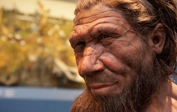
The belief in the barbaric, grunting, primitive Neanderthal is changing. ( anibal /Adobe Stock)

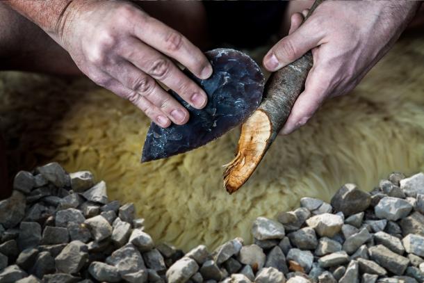
Myth 1: Neanderthal Tools were not as Good as Tools Made by Modern Humans

The predominant belief in mainstream archaeology over a decade ago was that Neanderthals only utilized very simplistic tools, like sharpened stones. However, research conducted over the last 10 years has revised this perspective based on new archaeological evidence.

An investigation conducted in France , for example, analyzed artifacts unearthed from an archaeological site known as Abri du Maras, in the Middle Rhône Valley. The researchers found Levalloise flakes, which are associated with Neanderthal stone tool technology, traces of twisted fiber, suggesting the manufacture of cordage or string, and six lithic points that appear to be related to complex projectile technology, a development usually only associated with early modern humans.

A second study suggested that Neanderthals even passed on some of their tool-making abilities to humans . Dutch scientists discovered 50,000-year-old tools made from deer ribs in south-west France, which are similar to bone lissoirs or smoothers, still used by leather workers today, and contain a polished tip which creates softer and more water resistant leather when scraped against a hide. The excavated tools are similar to others found at sites occupied by early modern humans around 10,000 years later.

Neanderthal may have taught Homo sapiens new tool making technologies. ( Andy Ilmberger / Adobe Stock)

Modern humans ( Homo sapiens ) appear to have entered Europe with only pointed bone tools but soon after their arrival they started to make lissoirs, providing the first possible evidence that Neanderthals invented the specialized bone tools and passed their know-how on to Homo sapiens.

Myth 2: Neanderthals Spoke through Grunts and Animal Sounds

It was long believed that Neanderthals lacked the necessary cognitive capacity and vocal hardware for speech and language, rendering them incapable of little more than a series of grunts. However, recent research has revealed that Neanderthals most likely had a sophisticated form of speech and language not dissimilar to Homo sapiens .

Researchers utilized the latest 3D X-ray imaging technology to examine a 60,000-year-old Neanderthal hyoid bone discovered in the Kebara Cave in Israel in 1989. The hyoid bone is situated centrally in the upper part of the neck, beneath the mandible but above the larynx and is the foundation of speech. So far, it has only been found to exist in humans and Neanderthals. The results showed that in terms of mechanical behavior, the Neanderthal hyoid was basically indistinguishable from our own, strongly suggesting that this key part of the vocal tract was used in exactly the same way.

Myth 3: Neanderthals Did Not Bury their Dead

It was not so long ago that Neanderthals were considered to be little more than primitive cavemen, and they certainly weren’t considered cultured enough to bury their dead. But that belief has been upended by the discovery of a number of Neanderthal burials over the years. The finding of a 50,000-year-old Neanderthal skeleton in a cave in La Chappele-aux Saints, France revealed that the individual had been carefully placed in a grave and great care had been taken to protect his body from scavengers.

One of the most famous Neanderthal child burials was uncovered in 1961 at Roc de Marsal. The grave was in a remarkable state of preservation, considering its age of 70,000 years. It consisted of the body of a child, approximately three years of age, who had been deposited in a natural depression in the ground, and apparently placed into the form of an arc, lying on its stomach, with a hand to its head and legs bent at 90 degrees, then covered with soil. The idea that Neanderthals buried their dead fits with recent findings that they were capable of developing rich cultural practices.

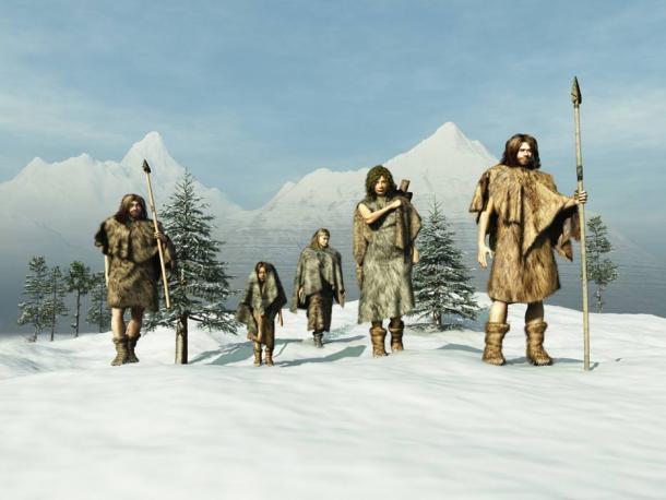
Myth 4: Neanderthals Did Not Have Homes

There has been this idea that Neanderthals did not have an organized use of space, something that has always been attributed to humans. But archaeologists in Italy have found a collapsed rock shelter which has revealed that Neanderthals kept an organized and tidy home with separate spaces for preparing food, sleeping, making tools, and socializing.

The top level appears to have been used for butchering animals because it contained a high concentration of animal remains. The middle level contained the most traces of human occupation and seems to have been a long-term sleeping area. Artifacts were distributed to avoid clutter around the hearth at the back of the cave.

Finally, the bottom level was a place for shorter stays. Animal bones and stone tools were concentrated at the front rather than the rear of the shelter, suggesting that tool production took place there to take advantage of available sunlight.

Myth 5: Neanderthals were Carnivores who Only Ate Raw Meat

Neanderthals were once depicted as ape-like hominids tearing into the raw flesh of freshly hunted animals. However, recent research conducted by the Catalan Institute for Research and Advanced Studies in Barcelona discovered calcified plaque on Neanderthal fossil teeth found in El Sidrón cave in Spain, which suggested that this extinct human species cooked vegetables and consumed bitter-tasting medicinal plants such as chamomile and yarrow.

Sadly, the prejudiced view of Neanderthal inferiority still persists, as reflected in a statement countering that study by researcher Laura Buck from London’s Natural History Museum:  “The mistake is to think that because you find plant fragments in teeth that they must have got there because these carnivores – in this case Neanderthals – had consumed them as part of a carefully constructed diet or were taken because it was realised that certain herbs and grasses had health-promoting properties. In fact, they may have got there purely because Neanderthals liked to eat the stomach contents of some of the animals they killed.”

According to Buck, Neanderthals simply weren’t intelligent enough to provide themselves with balanced diets or of treating themselves with health-restoring herbs. However, Buck was unable to present any evidence to support her claims and more recent research shows that Neanderthals ate meat, but obviously included plants in their diet as well.

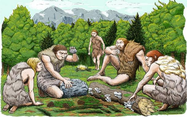
Neanderthals hunted but also gathered their food. ( CSIC Spain )

Neanderthal Myth 6: They were Bad Parents

Until recently, the traditional view saw Neanderthal childhood as harsh, difficult, and dangerous. This perspective was based on preconceptions about Neanderthal inferiority and their inability to protect their children. However, recent research has shown this was not the case.

In a study published in 2014 , a team of archaeologists from the Centre for Human Palaeoecology and Evolutionary Origins at the University of York challenged the traditional perspective and claimed that Neanderthal children experienced strong emotional attachments with their immediate social group, Neanderthals would care for sick children for years, and children played a key role in society, particularly in symbolic expression.

The research team drew upon cultural and social evidence to explore the experience of Neanderthal children. They found, for example, that Neanderthal child burials were more elaborate than those of adults, suggesting strong emotional bonds and the important role that children played in the social group.

Myth 7: Neanderthals had no Cultural Expression

It is often cited in academic literature that cultural expression emerged in the Palaeolithic era, around 30,000 years ago, which rules out Neanderthal artisans since this was around the time they died out. However, evidence suggests that culture flourished much earlier, during the time in which Neanderthals roamed the planet.

Rock art in El Castillo cave in Spain, for example, has been dated to around 40,800 years old, which raises the possibility that some of the paintings could have been made by Neanderthals.  In addition, evidence suggests that the Neanderthals also had music. The oldest musical instrument ever discovered is believed to be the Divje Babe flute, discovered in a cave in Slovenia in 1995, though this has been disputed.

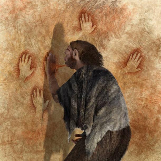
Some prehistoric cave paintings could have been made by Neanderthals. ( nicolasprimola /Adobe Stock)

The item is a fragment of the femur of a cave bear which had been pierced with spaced holes and has been dated at 60,000-43,000 years old. Scientists who could not accept the possibility that Neanderthals were playing music rejected the claim and said that the perfectly spaced and neatly carved holes are the result of the bone fragment having been chewed by an animal. However, the general consensus that the Divje Babe flute is actually a musical instrument has been growing as the view of the Neanderthals from subhuman brutes to more sophisticated hominids is changing.

Myth 8: Neanderthals were Incapable of Showing Care and Empathy

Far from being self-centered individuals incapable of looking after anyone but themselves, there is actually much evidence to show that Neanderthals cared for the sick and old in their communities. The "Old Man of La Chapelle" is the name given to the remains of a Neanderthal male found buried in the limestone bedrock of a small cave near La Chapelle-aux-Saints, in France in 1908. He lived 56,000 years ago and was the first relatively complete skeleton of a Neanderthal ever found.

Scientists estimate he was relatively old by the time he died, as bone had re-grown along the gums where he had lost several teeth, perhaps decades before. He lacked so many teeth that he would have needed his food ground down before he was able to eat it. The old man's skeleton indicates that he also suffered from a number of afflictions, including arthritis, and had numerous broken bones, which would have made movement difficult without assistance. The other members of his group would have had to have taken care of him before his death.

Other Neanderthal remains have shown potentially life-threatening injuries which were completely healed, indicating that the individual who suffered the injuries was nursed back to health by another member of his group.

Myth 9: Neanderthals and Humans Did Not Mix

It was once believed that Neanderthals died out before the emergence of Homo sapiens. However, this was revised when archaeological evidence revealed that there was a cross-over of at least several thousand years, if not longer, during which Neanderthals and modern humans walked the Earth together.

But the idea of interbreeding between the two species was still considered almost blasphemous, and it was not thought to have even been biologically possible. However, in recent years, with the development of techniques to analyze ancient DNA, a number of studies have revealed that Neanderthals and humans did interbreed and up to 20 per cent of Neanderthal DNA lives on in modern humans .

Myth 10: Neanderthals were our Direct Ancestors

There is a common misconception, often propagated by mistaken media reporting, that Neanderthals were the direct ancestors of Homo sapiens . In fact, Neanderthals and modern humans existed side by side as two separate groups.

DNA studies have found that the Neanderthals came from a distinct evolutionary line, and are therefore often referred to as the ‘distant cousins’ of humans. Nevertheless, the genetic mixing between the two species which came about as a result of interbreeding undoubtedly contributed to who we are today.

Top Image: An artist’s reconstruction of a Neanderthal, displayed in the exhibition ‘Britain: One Million Years of the Human Story’. Source: The Trustees of the Natural History Museum, London

By Joanna Gillan

Saturday, February 5, 2022

Metropolitan area

From Wikipedia, the free encyclopedia
Satellite imagery showing the New York metropolitan area at night. Long Island extends to the east of the central core of Manhattan.
 

A metropolitan area or metro is a region consisting of a densely populated urban core and its less-populated surrounding territories sharing industries, commercial areas, transport network, infrastructures and housing. A metro area usually comprises multiple jurisdictions and municipalities: neighborhoods, townships, boroughs, cities, towns, exurbs, suburbs, counties, districts, and even states and nations like the eurodistricts. As social, economic and political institutions have changed, metropolitan areas have become key economic and political regions.

Metropolitan areas include satellite cities, towns and intervening rural areas that are socioeconomically tied to the urban core, typically measured by commuting patterns. Most metropolitan areas are anchored by one core city such as Paris metropolitan area (Paris), Mumbai Metropolitan Region (Mumbai (Bombay)), and New York metropolitan area (New York City). In some cases metropolitan areas have multiple centers of close to equal importance, such as Dallas–Fort Worth metropolitan area (Dallas and Fort Worth), Islamabad–Rawalpindi metropolitan area (Islamabad and Rawalpindi), the Rhine-Ruhr in Germany and the Randstad in the Netherlands.

In the United States, the concept of the metropolitan statistical area has gained prominence. Metropolitan areas may themselves be part of larger megalopolises. For urban centres outside metropolitan areas, that generate a similar attraction at smaller scale for their region, the concept of the regiopolis and respectively regiopolitan area or regio was introduced by German professors in 2006. In the United States, the term micropolitan statistical area is used.

General definition

A metropolitan area combines an urban agglomeration (the contiguous, built-up area) with zones not necessarily urban in character, but closely bound to the center by employment or other commerce. These outlying zones are sometimes known as a commuter belt, and may extend well beyond the urban zone, to other political entities. For example, Islip, New York on Long Island is considered part of the New York metropolitan area.

In practice, the parameters of metropolitan areas, in both official and unofficial usage, are not consistent. Sometimes they are little different from an urban area, and in other cases they cover broad regions that have little relation to a single urban settlement; comparative statistics for metropolitan area should take this into account. The term "Metropolitan" can also refer to a county-level municipal government structure, with some shared services between a central city and its suburbs, which may or may not include the entirety of a metropolitan area. Population figures given for one metro area can vary by millions.

There has been no significant change in the basic concept of metropolitan areas since its adoption in 1950, although significant changes in geographic distributions have occurred since then, and more are expected. Because of the fluidity of the term "metropolitan statistical area," the term used colloquially is more often "metro service area," "metro area," or "MSA" taken to include not only a city, but also surrounding suburban, exurban and sometimes rural areas, all which it is presumed to influence. A polycentric metropolitan area contains multiple urban agglomerations not connected by continuous development. In defining a metropolitan area, it is sufficient that a city or cities form a nucleus with which other areas have a high degree of integration.

See also the many lists of metropolitan areas itemized at § Lists of metropolitan areas.

History

Australia

The Australian Bureau of Statistics uses Greater Capital City Statistical Areas (GCCSAs), which are geographical areas designed to represent the functional extent of each of the eight State and Territory capital cities. They were designed to reflect labour markets, using the 2011 Census "travel to work" data. Labour markets are sometimes used as proxy measures of the functional extent of a city as it contains the majority of the commuting population. GCCSAs replaced "Statistical Divisions" used until 2011.

Other Metropolitan areas in Australia include cross border cities or continuous built-up areas between two or more cities that are connected by an extensive public transport network that allows for commuting for work or services. The following are such conurbations:

Albury-Wodonga

Canberra-Queanbeyan

Newcastle-Sydney-Wollongong

Perth Metropolitan Region-City of Mandurah-Pinjarra

South East Queensland

Melbourne-Geelong

Bangladesh

In Bangladesh, the large population centers which have significant Financial, political and administrative Importance are considered to be as Metropolitan cities, which are governed by City Corporations. In total, there are 12 City Corporations in Bangladesh. 4 of them (Dhaka North City Corporation, Dhaka South City Corporation, Narayanganj City Corporation, Gazipur City Corporation) are part of Greater Dhaka Conurbation .

Brazil

In Brazil, "Metropolitan Regions", "Integrated Development Areas", and "Urban Agglomerations" are created by statute. Each state defines its own legislation for the creation, definition and organization of a metropolitan region. The creation of a metropolitan region is not for any statistical purpose, although the Brazilian Institute of Geography and Statistics (IBGE) uses them in reports. Their main purpose is to improve management of public policies of common interest to all municipalities included within. They do not have any political, electoral or jurisdictional power whatsoever, so citizens do not elect representatives for them.

The IBGE defines also "Immediate Geographic Areas" (formerly termed microregions) which capture the region "surrounding urban centers for the supply of immediate needs of the population". Intended for policy planning purposes, as of March 2021 census data is not tabulated on the level of these Areas, but instead at the municipality or state level.

Canada

Statistics Canada defines a census metropolitan area (CMA) as an area consisting of one or more adjacent municipalities situated around a major urban core. To form a CMA, the metropolitan area must have a population of at least 100,000, at least half within the urban core. To be included in the CMA, adjacent municipalities must have a high degree of integration with the core, as measured by commuter flows derived from census data.

China

In Chinese, there used to be no clear distinction between "megalopolis" (城市群, lit. city cluster) and "metropolitan area" (都市圈) until National Development and Reform Commission issued Guidelines on the Cultivation and Development of Modern Metropolitan Areas (关于培育发展现代化都市圈的指导意见) on Feb 19, 2019, in which a metropolitan area was defined as "an urbanized spatial form in a megalopolis dominated by (a) supercity(-ies) or megacity(-ies), or a large metropolis playing a leading part, and within the basic range of 1-hour commute area."

European Union

The European Union's statistical agency, Eurostat, has created a concept named "larger urban zone" (LUZ). The LUZ represents an attempt at a harmonised definition of the metropolitan area, and the goal was to have an area from which a significant share of the residents commute into the city, a concept known as the "functional urban region".

France

France's national statistics institute, the INSEE, names an urban core and its surrounding area of commuter influence an aire urbaine (official translation: "urban area"). This statistical method applies to agglomerations of all sizes, but the INSEE sometimes uses the term aire métropolitaine (metropolitan area) to refer to France's largest aires urbaines.

Germany

In German definition, metropolitan areas are eleven most densely populated areas in the Federal Republic of Germany. They comprise the major German cities and their surrounding catchment areas and form the political, commercial and cultural centres of the country.

For urban centres outside metropolitan areas, that generate a similar attraction at smaller scale for their region, the concept of the Regiopolis and respectively regiopolitan area or regio was introduced by German professors in 2006.

India

In India, a metropolitan city is defined as one with a population more than 1 million.

Indonesia

In Indonesia, the government of Indonesia defines a metropolitan area as an urban agglomeration where its spatial planning is prioritised due to its highly important influence on the country. Currently, there are 10 metropolitan cities in Indonesia that have been recognized by the government.

Italy

In 2001, Italy transformed 14 provinces of some of the country's largest cities into Metropolitan Cities. Therefore the territory of the Metropolitan City corresponds to that of a normal Italian province.

Japan

In Japan, a metropolitan area (都市圏) is a division set separately from administrative areas in order to define wide urban areas used in the Census conducted by the Statistics Bureau of the Ministry of Internal Affairs and Communications.

The Greater Tokyo Area is the most populous metropolitan area in the world.

If the central cities are next to each other, the areas are integrated into one large area.

  • Surrounding Municipality (周辺市町村, lit. 'surrounding cities, towns and villages')
    • Those are municipalities with ratios of the number of people commuting to the central city over 15 years old being 1.5% or more of the permanent population of and close to the central cities.

If a municipality is surrounded by the surrounding municipalities, it will be a surrounding municipality.

Mexico

Metropolitan areas are known as zonas metropolitanas in Mexico. The National Population Council (CONAPO) defines them as:

  • a set of two or more municipalities where a city with a population of at least 100,000 is located, and whose urban area, functions and activities exceed the limits of the municipality.
  • municipalities with a city of more than 500,000 inhabitants, or a city of more than 200,000 inhabitants located in the northern and southern border areas and in the coastal zone.
  • municipalities where state capitals are located, if they are not already included in a metropolitan zone.

As of 2018, there are 74 zonas metropolitanas in Mexico. 75.1 million people, 62.8% of the country population, live within a metropolitan area.

Pakistan

Pakistan has nine metropolitan areas with populations greater than a million. Seven of these are entirely in Punjab including Lahore, Faisalabad, Gujranwala, Multan, Bahawalpur, Sargodha, and Sialkot; one (Islamabad-Rawalpindi is split between Punjab and the Islamabad Capital Territory; two are located in Sindh, including Karachi, the largest metropolitan area in the country, and Hyderabad; one in Khyber Pakhtunkhwa: Peshawar; and the final in Balochistan: Quetta.

Philippines

The Philippines currently has three metropolitan areas defined by the National Economic and Development Authority (NEDA). These metropolitan areas are separated into three main geographical areas; Metro Manila (which is located in Luzon), Metro Cebu (which is located in Visayas), and Metro Davao (which is located in Mindanao). The official definition of each area does not necessarily follow the actual extent of continuous urbanization. For example, the built-up area of Metro Manila has long spilled out of its officially defined borders into the adjacent provinces of Bulacan, Rizal, Laguna, and Cavite. The number of metropolitan areas in the Philippines was reduced from 13 in 2007 to the current three based from the 2017–2022 Philippine Development Plan by NEDA. The other 10 metropolitan areas were Metro Angeles, Metro Bacolod, Metro Baguio, Metro Batangas, Metro Cagayan de Oro, Metro Dagupan, Metro Iloilo–Guimaras, Metro Butuan, Metro Naga, and Metro Olongapo.

South Africa

The Greater Johannesburg metropolitan area is the largest metropolitan area in South Africa. Its population was over 9.6 million as of the 2011 South Africa Census, in contrast to its urban area, which consisted of approximately 7.9 million inhabitants as of 2011. Conversely, metropolitan municipalities in South Africa are defined as commonly governed areas of a metropolitan area. The largest such metropolitan municipal government entity in South Africa is the City of Johannesburg Metropolitan Municipality, which presided over nearly 5 million people as of 2016. However, the Greater Johannesburg metropolitan area houses roughly ten times the population of its core municipal city of Johannesburg, which contained 957,441 people as of the 2011 census.

Sweden

Sweden defines a metropolitan area as a group of municipalities, based on statistics of commuting between central municipalities and surrounding municipalities and taking into account existing planning cooperation in the country's three geographic regions. They were defined around 1965. In 2005, a number of further municipalities were added to the defined areas.

Turkey

The word metropolitan describes a major city in Turkey like Istanbul, a city that is dominant to others both financially and socially. There are 30 officially defined "state metropolitan areas" in Turkey, for governing purposes.

United Kingdom

The United Kingdom government's Office for National Statistics defines "travel to work areas" as areas where "at least 75% of an area's resident workforce work in the area and at least 75% of the people who work in the area also live in the area".

United States

As of February 28, 2013, the United States Office of Management and Budget (OMB) defined 1,098 statistical areas for the metropolitan areas of the United States and Puerto Rico. These 1,098 statistical areas comprise 929 Core-Based Statistical Areas (CBSAs) and 169 Combined Statistical Areas (CSAs). The 929 Core-Based Statistical Areas are divided into 388 Metropolitan Statistical Areas (MSAs – 381 for the U.S. and seven for Puerto Rico) and 541 Micropolitan Statistical Areas (μSAs – 536 for the U.S. and five for Puerto Rico). The 169 Combined Statistical Areas (166 for the U.S. and three for Puerto Rico) each comprise two or more adjacent Core Based Statistical Areas.

The Office of Management and Budget defines a Metropolitan Statistical Area as one or more adjacent counties or county equivalents that have at least one urban area of at least 50,000 population, plus adjacent territory that has a high degree of economic and social integration with the core as measured by commuting ties. The OMB then defines a Combined Statistical Area as consisting of various combinations of adjacent metropolitan and micropolitan statistical areas with economic ties measured by commuting patterns. The Office of Management and Budget further defines a core-based statistical area (CBSA) to be a geographical area that consists of one or more counties (or equivalents) anchored by an urban center of at least 10,000 people plus adjacent counties that are socioeconomically tied to the urban center by commuting.

Marine ecosystem

From Wikipedia, the free encyclopedia
 
Coral reefs form complex marine ecosystems with tremendous biodiversity

Marine ecosystems are the largest of Earth's aquatic ecosystems and exist in waters that have a high salt content. These systems contrast with freshwater ecosystems, which have a lower salt content. Marine waters cover more than 70% of the surface of the Earth and account for more than 97% of Earth's water supply and 90% of habitable space on Earth. Seawater has an average salinity of 35 parts per thousand of water. Actual salinity varies among different marine ecosystems. Marine ecosystems can be divided into many zones depending upon water depth and shoreline features. The oceanic zone is the vast open part of the ocean where animals such as whales, sharks, and tuna live. The benthic zone consists of substrates below water where many invertebrates live. The intertidal zone is the area between high and low tides. Other near-shore (neritic) zones can include mudflats, seagrass meadows, mangroves, rocky intertidal systems, salt marshes, coral reefs, lagoons. In the deep water, hydrothermal vents may occur where chemosynthetic sulfur bacteria form the base of the food web.

Marine ecosystems are characterized by the biological community of organisms that they are associated with and their physical environment. Classes of organisms found in marine ecosystems include brown algae, dinoflagellates, corals, cephalopods, echinoderms, and sharks.

Marine ecosystems are important sources of ecosystem services and food and jobs for significant portions of the global population. Human uses of marine ecosystems and pollution in marine ecosystems are significantly threats to the stability of these ecosystems. Environmental problems concerning marine ecosystems include unsustainable exploitation of marine resources (for example overfishing of certain species), marine pollution, climate change, and building on coastal areas. Moreover, much of the carbon dioxide causing global warming and heat captured by global warming are absorbed by the ocean, ocean chemistry is changing through processes like ocean acidification which in turn threatens marine ecosystems. Because of these opportunities in marine ecosystems for humans and the threats created by humans, the international community has prioritized "Life below water" as Sustainable Development Goal 14 to "Conserve and sustainably use the oceans, seas and marine resources for sustainable development".

Coastal ecosystems

Global distribution of coral, mangrove, and seagrass diversity
 

International attention to address the threats of coasts has been captured in Sustainable Development Goal 14 "Life Below Water" which sets goals for international policy focused on preserving coastal ecosystems and supporting more sustainable economic practices for coastal communities. Likewise, the United Nations has declared 2021-2030 the UN Decade on Ecosystem Restoration, but restoration of coastal ecosystems has received insufficient attention.

Coral reefs

Coral reef
 

Coral reefs are one of the most well-known marine ecosystems in the world, with the largest being the Great Barrier Reef. These reefs are composed of large coral colonies of a variety of species living together. The corals from multiple symbiotic relationships with the organisms around them.

Mangroves

Mangrove forests
 

Mangroves are trees or shrubs that grow in low-oxygen soil near coastlines in tropical or subtropical latitudes. They are an extremely productive and complex ecosystem that connects the land and sea. Mangroves consist of species that are not necessarily related to each other and are often grouped for the characteristics they share rather than genetic similarity. Because of their proximity to the coast, they have all developed adaptions such as salt excretion and root aeration to live in salty, oxygen-depleted water. Mangroves can often be recognized by their dense tangle of roots that act to protect the coast by reducing erosion from storm surges, currents, wave, and tides. The mangrove ecosystem is also an important source of food for many species as well as excellent at sequestering carbon dioxide from the atmosphere with global mangrove carbon storage is estimated at 34 million metric tons per year.

Seagrass meadows

Seagrass meadow
 

Seagrasses form dense underwater meadows which are among the most productive ecosystems in the world. They provide habitats and food for a diversity of marine life comparable to coral reefs. This includes invertebrates like shrimp and crabs, cod and flatfish, marine mammals and birds. They provide refuges for endangered species such as seahorses, turtles, and dugongs. They function as nursery habitats for shrimps, scallops and many commercial fish species. Seagrass meadows provide coastal storm protection by the way their leaves absorb energy from waves as they hit the coast. They keep coastal waters healthy by absorbing bacteria and nutrients, and slow the speed of climate change by sequestering carbon dioxide into the sediment of the ocean floor.

Seagrasses evolved from marine algae which colonized land and became land plants, and then returned to the ocean about 100 million years ago. However, today seagrass meadows are being damaged by human activities such as pollution from land runoff, fishing boats that drag dredges or trawls across the meadows uprooting the grass, and overfishing which unbalances the ecosystem. Seagrass meadows are currently being destroyed at a rate of about two football fields every hour.

Kelp forests

thumb Kelp forest

Kelp forests occur worldwide throughout temperate and polar coastal oceans. In 2007, kelp forests were also discovered in tropical waters near Ecuador.

Physically formed by brown macroalgae, kelp forests provide a unique habitat for marine organisms and are a source for understanding many ecological processes. Over the last century, they have been the focus of extensive research, particularly in trophic ecology, and continue to provoke important ideas that are relevant beyond this unique ecosystem. For example, kelp forests can influence coastal oceanographic patterns and provide many ecosystem services.

However, the influence of humans has often contributed to kelp forest degradation. Of particular concern are the effects of overfishing nearshore ecosystems, which can release herbivores from their normal population regulation and result in the overgrazing of kelp and other algae. This can rapidly result in transitions to barren landscapes where relatively few species persist. Already due to the combined effects of overfishing and climate change, kelp forests have all but disappeared in many especially vulnerable places, such as Tasmania's east coast and the coast of Northern California. The implementation of marine protected areas is one management strategy useful for addressing such issues, since it may limit the impacts of fishing and buffer the ecosystem from additive effects of other environmental stressors.

Estuaries

Estuaries
 

Estuaries occur where there is a noticeable change in salinity between saltwater and freshwater sources. This is typically found where rivers meet the ocean or sea. The wildlife found within estuaries is unique as the water in these areas is brackish - a mix of freshwater flowing to the ocean and salty seawater. Other types of estuaries also exist and have similar characteristics as traditional brackish estuaries. The Great Lakes are a prime example. There, river water mixes with lake water and creates freshwater estuaries. Estuaries are extremely productive ecosystems that many humans and animal species rely on for various activities. This can be seen as, of the 32 largest cities in the world, 22 are located on estuaries as they provide many environmental and economic benefits such as crucial habitat for many species, and being economic hubs for many coastal communities. Estuaries also provide essential ecosystem services such as water filtration, habitat protection, erosion control, gas regulation nutrient cycling, and it even gives education, recreation and tourism opportunities to people.

Lagoon

Lagoons

Lagoons are areas that are separated from larger water by natural barriers such as coral reefs or sandbars. There are two types of lagoons, coastal and oceanic/atoll lagoons. A coastal lagoon is, as the definition above, simply a body of water that is separated from the ocean by a barrier. An atoll lagoon is a circular coral reef or several coral islands that surround a lagoon. Atoll lagoons are often much deeper than coastal lagoons. Most lagoons are very shallow meaning that they are greatly affected by changed in precipitation, evaporation and wind. This means that salinity and temperature are widely varied in lagoons and that they can have water that ranges from fresh to hypersaline. Lagoons can be found in on coasts all over the world, on every continent except Antarctica and is an extremely diverse habitat being home to a wide array of species including birds, fish, crabs, plankton and more. Lagoons are also important to the economy as they provide a wide array of ecosystem services in addition to being the home of so many different species. Some of these services include fisheries, nutrient cycling, flood protection, water filtration, and even human tradition.

Salt marsh

Salt marshes
 

Salt marshes are a transition from the ocean to the land, where fresh and saltwater mix. The soil in these marshes is often made up of mud and a layer of organic material called peat. Peat is characterized as waterlogged and root-filled decomposing plant matter that often causes low oxygen levels (hypoxia). These hypoxic conditions causes growth of the bacteria that also gives salt marshes the sulfurous smell they are often known for. Salt marshes exist around the world and are needed for healthy ecosystems and a healthy economy. They are extremely productive ecosystems and they provide essential services for more than 75 percent of fishery species and protect shorelines from erosion and flooding. Salt marshes can be generally divided into the high marsh, low marsh, and the upland border. The low marsh is closer to the ocean, with it being flooded at nearly every tide except low tide. The high marsh is located between the low marsh and the upland border and it usually only flooded when higher than usual tides are present. The upland border is the freshwater edge of the marsh and is usually located at elevations slightly higher than the high marsh. This region is usually only flooded under extreme weather conditions and experiences much less waterlogged conditions and salt stress than other areas of the marsh.

Intertidal zones

Intertidal zones
 

Intertidal zones are the areas that are visible and exposed to air during low tide and covered up by saltwater during high tide. There are four physical divisions of the intertidal zone with each one having its distinct characteristics and wildlife. These divisions are the Spray zone, High intertidal zone, Middle Intertidal zone, and Low intertidal zone. The Spray zone is a damp area that is usually only reached by the ocean and submerged only under high tides or storms. The high intertidal zone is submerged at high tide but remains dry for long periods between high tides. Due to the large variance of conditions possible in this region, it is inhabited by resilient wildlife that can withstand these changes such as barnacles, marine snails, mussels and hermit crabs. Tides flow over the middle intertidal zone two times a day and this zone has a larger variety of wildlife. The low intertidal zone is submerged nearly all the time except during the lowest tides and life is more abundant here due to the protection that the water gives.

Ocean surface

Sea spray containing marine microorganisms can be swept high into the atmosphere, where it becomes part of the aeroplankton and may travel the globe before falling back to earth.
 

Organisms that live freely at the surface, termed neuston, include keystone organisms like the golden seaweed Sargassum that makes up the Sargasso Sea, floating barnacles, marine snails, nudibranchs, and cnidarians. Many ecologically and economically important fish species live as or rely upon neuston. Species at the surface are not distributed uniformly; the ocean's surface harbours unique neustonic communities and ecoregions found at only certain latitudes and only in specific ocean basins. But the surface is also on the front line of climate change and pollution. Life on the ocean's surface connects worlds. From shallow waters to the deep sea, the open ocean to rivers and lakes, numerous terrestrial and marine species depend on the surface ecosystem and the organisms found there.

The ocean's surface acts like a skin between the atmosphere above and the water below, and harbours an ecosystem unique to this environment. This sun-drenched habitat can be defined as roughly one metre in depth, as nearly half of UV-B is attenuated within this first meter. Organisms here must contend with wave action and unique chemical and physical properties. The surface is utilised by a wide range of species, from various fish and cetaceans, to species that ride on ocean debris (termed rafters). Most prominently, the surface is home to a unique community of free-living organisms, termed neuston (from the Greek word, υεω, which means both to swim and to float. Floating organisms are also sometimes referred to as pleuston, though neuston is more commonly used). Despite the diversity and importance of the ocean's surface in connecting disparate habitats, and the risks it faces, not a lot is known about neustonic life.

A stream of airborne microorganisms circles the planet above weather systems but below commercial air lanes. Some peripatetic microorganisms are swept up from terrestrial dust storms, but most originate from marine microorganisms in sea spray. In 2018, scientists reported that hundreds of millions of viruses and tens of millions of bacteria are deposited daily on every square meter around the planet.

Deep sea and sea floor

The deep sea contains up to 95% of the space occupied by living organisms. Combined with the sea floor (or benthic zone), these two areas have yet to be fully explored and have their organisms documented.

Ecosystem services

Ecosystem services delivered by epibenthic bivalve reefs
Reefs provide coastal protection through erosion control and shoreline stabilization, and modify the physical landscape by ecosystem engineering, thereby providing habitat for species by facilitative interactions with other habitats such as tidal flat benthic communities, seagrasses and marshes.

In addition to providing many benefits to the natural world, marine ecosystems also provide social, economic, and biological ecosystem services to humans. Pelagic marine systems regulate the global climate, contribute to the water cycle, maintain biodiversity, provide food and energy resources, and create opportunities for recreation and tourism. Economically, marine systems support billions of dollars worth of capture fisheries, aquaculture, offshore oil and gas, and trade and shipping.

Ecosystem services fall into multiple categories, including supporting services, provisioning services, regulating services, and cultural services.

Threats

Drivers of change in marine ecosystems 
 
Global cumulative human impact on the ocean

Human activities affect marine life and marine habitats through overfishing, habitat loss, the introduction of invasive species, ocean pollution, ocean acidification and ocean warming. These impact marine ecosystems and food webs and may result in consequences as yet unrecognised for the biodiversity and continuation of marine life forms.

According to the IPCC (2019), since 1950 "many marine species across various groups have undergone shifts in geographical range and seasonal activities in response to ocean warming, sea ice change and biogeochemical changes, such as oxygen loss, to their habitats."

It has been estimated only 13% of the ocean area remains as wilderness, mostly in open ocean areas rather than along the coast.

Human exploitation and development

Coastal marine ecosystems experience growing population pressures with nearly 40% of people in the world living within 100 km of the coast. Humans often aggregate near coastal habitats to take advantage of ecosystem services. For example, coastal capture fisheries from mangroves and coral reef habitats are estimated to be worth a minimum of $34 billion per year. Yet, many of these habitats are either marginally protected or not protected. Mangrove area has declined worldwide by more than one-third since 1950, and 60% of the world's coral reefs are now immediately or directly threatened. Human development, aquaculture, and industrialization often lead to the destruction, replacement, or degradation of coastal habitats.

Moving offshore, pelagic marine systems are directly threatened by overfishing. Global fisheries landings peaked in the late 1980s, but are now declining, despite increasing fishing effort. Fish biomass and average trophic level of fisheries landing are decreasing, leading to declines in marine biodiversity. In particular, local extinctions have led to declines in large, long-lived, slow-growing species, and those that have narrow geographic ranges. Biodiversity declines can lead to associated declines in ecosystem services. A long-term study reports the decline of 74–92% of catch per unit effort of sharks in Australian coastline from the 1960s to 2010s.

Pollution

Marine pollution occurs when substances used or spread by humans, such as industrial, agricultural and residential waste, particles, noise, excess carbon dioxide or invasive organisms enter the ocean and cause harmful effects there. The majority of this waste (80%) comes from land-based activity, although marine transportation significantly contributes as well. Since most inputs come from land, either via the rivers, sewage or the atmosphere, it means that continental shelves are more vulnerable to pollution. Air pollution is also a contributing factor by carrying off iron, carbonic acid, nitrogen, silicon, sulfur, pesticides or dust particles into the ocean. The pollution often comes from nonpoint sources such as agricultural runoff, wind-blown debris, and dust. These nonpoint sources are largely due to runoff that enters the ocean through rivers, but wind-blown debris and dust can also play a role, as these pollutants can settle into waterways and oceans. Pathways of pollution include direct discharge, land runoff, ship pollution, atmospheric pollution and, potentially, deep sea mining.

The types of marine pollution can be grouped as pollution from marine debris, plastic pollution, including microplastics, ocean acidification, nutrient pollution, toxins and underwater noise. Plastic pollution in the ocean is a type of marine pollution by plastics, ranging in size from large original material such as bottles and bags, down to microplastics formed from the fragmentation of plastic material. Marine debris is mainly discarded human rubbish which floats on, or is suspended in the ocean. Plastic pollution is harmful to marine life.

Invasive species

  • Global aquarium trade
  • Ballast water transport
  • Aquaculture

Climate change

Butane

From Wikipedia, the free encyclopedia ...