Search This Blog

Monday, November 28, 2022

Mont Blanc

From Wikipedia, the free encyclopedia

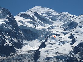
Mont-Blanc from Planpraz station.jpg
Summit of Mont Blanc and the Bosses ridge
Highest point
Elevation4,807.81 m (15,773.7 ft)
Prominence4696 m ↓ by Lake Kubenskoye
Ranked 11th
Parent peakMount Everest[note 1]
Isolation2,812 km → Kukurtlu Dome [de]
ListingCountry high point
Ultra
Seven Summits
Coordinates45°50′0″N 6°52′2″ECoordinates: 45°50′0″N 6°52′2″E
Geography
Mont Blanc is located in Alps
LocationAosta Valley, Italy
Auvergne-Rhône-Alpes, France
CountriesFrance and Italy
Parent rangeGraian Alps
Climbing
First ascent8 August 1786 by

Mont Blanc (French: Mont Blanc [mɔ̃ blɑ̃]; Italian: Monte Bianco [ˈmonte ˈbjaŋko], both meaning "white mountain") is the highest mountain in the Alps and Western Europe, rising 4,807.81 m (15,774 ft) above sea level. It is the second-most prominent mountain in Europe, after Mount Elbrus, and it is the eleventh most prominent mountain summit in the world.

It gives its name to the Mont Blanc massif which straddles parts of France, Italy and Switzerland. Mont Blanc's summit lies on the watershed line between the valleys of Ferret and Veny in Italy, and the valleys of Montjoie, and Arve in France. Ownership of the summit area has long been a subject of dispute between France and Italy.

The Mont Blanc massif is popular for outdoor activities like hiking, climbing, trail running and winter sports like skiing, and snowboarding. The most popular climbing route to the summit of Mont Blanc is the Goûter Route, which typically takes two days.

The three towns and their communes which surround Mont Blanc are Courmayeur in Aosta Valley, Italy; and Saint-Gervais-les-Bains and Chamonix in Haute-Savoie, France. The latter town was the site of the first Winter Olympics. A cable car ascends and crosses the mountain range from Courmayeur to Chamonix, through the Col du Géant. The 11.6 km (7+14-mile) Mont Blanc Tunnel, constructed between 1957 and 1965, runs beneath the mountain and is a major transalpine transport route.

Geology

Mont Blanc and adjacent mountains in the massif are predominately formed from a large intrusion of granite (termed a batholith) which was forced up through a basement layer of gneiss and mica schists during the Variscan mountain-forming event of the late Palaeozoic period. The summit of Mont Blanc is located at the point of contact of these two rock types. To the south west, the granite contact is of a more intrusive nature, whereas to the north east it changes to being more tectonic. The granites are mostly very-coarse grained, ranging in type from microgranites to porphyroid granites. The massif is tilted in a north-westerly direction and was cut by near-vertical recurrent faults lying in a north–south direction during the Variscan orogeny. Further faulting with shear zones subsequently occurred during the later Alpine orogeny. Repeated tectonic phases have caused breakup of the rock in multiple directions and in overlapping planes. Finally, past and current glaciation caused significant sculpting of the landscape into its present-day form.

The first systematic account of the minerals of the Mont Blanc area was published in 1873 by Venance Payot. His list, entitled "Statistique minéralogique des environs du Mt-Blanc", catalogued 90 mineral types although it also included those present only as very small components of rocks. If these are excluded, it is known today that at least 68 separate mineral species occur across the wider range of the Mont Blanc massif.

Climate

Located on the watershed between the Rhône and the Po, the massif of Mont Blanc is also situated between the two different climatic regions of the northern and western Alps, and that of the southern Alps. Climatic conditions on the Mer de Glace are similar to those found on the northern side of the Swiss Alps.

The climate is cold and temperate (Köppen climate classification Cfb), and is greatly influenced by altitude. Being the highest part of the Alps, Mont Blanc and surrounding mountains can create their own weather patterns. Temperatures drop as the mountains gain in height, and the summit of Mont Blanc is a permanent ice cap, with temperatures around −20 °C (−4 °F). The summit is also prone to strong winds and sudden weather changes. Because of its great overall height, a considerable proportion is permanently glaciated or snow-covered and is exposed to extremely cold conditions.

There is, however, significant variation in precipitation with altitude. For example, the village of Chamonix below Mont Blanc is at an elevation of approximately 1,030 metres (3,380 ft) and receives around 1,020 mm (40 in) of annual precipitation, whilst the Col du Midi, which is at 3,500 metres (11,500 ft) above sea level, receives significantly more, totalling 3,100 mm (122 in). However, at an even higher altitude (near to the summit of Mont Blanc) precipitation is considerably less, with only around 1,100 mm (43 in) recorded, despite the latter measurements being taken at a height of 4,300 metres (14,100 ft).

History

Mont Blanc as seen from Valdigne in Aosta Valley, Italy.

Since 1760 Swiss naturalist Horace-Bénédict de Saussure began to go to Chamonix to observe Mont Blanc. He tried with the Courmayeur mountain guide Jean-Laurent Jordaney, a native of Pré-Saint-Didier, who accompanied De Saussure since 1774 on the Miage Glacier and on Mont Crammont.

The first recorded ascent of Mont Blanc (at the time neither within Italy nor France) was on 8 August 1786 by Jacques Balmat and the doctor Michel Paccard. This climb, initiated by Horace-Bénédict de Saussure, who gave a reward for the successful ascent, traditionally marks the start of modern mountaineering. The first woman to reach the summit was Marie Paradis in 1808.

Mont Blanc from the TMB

Ownership of the summit

At the scale of the Mont Blanc massif, the border between Italy and France passes along most of the main Alpine watershed, from the Aiguille des Glaciers to Mont Dolent, where it reaches the border with Switzerland. However, its precise location near the summits of Mont Blanc and nearby Dôme du Goûter has been disputed since the 18th century. Italian officials claim the border follows the watershed, splitting both summits between Italy and France, while French officials claim the border avoids the two summits, placing both of them entirely with France. The size of these two (distinct) disputed areas is approximately 65 ha on Mont Blanc and 10 ha on Dôme du Goûter.

Since the French Revolution, the issue of the ownership of the summit has been debated. From 1416 to 1792, the entire mountain was within the Duchy of Savoy. In 1723, the Duke of Savoy, Victor Amadeus II, acquired the Kingdom of Sardinia. The resulting state of Sardinia was to become preeminent in the Italian unification. In September 1792, the French Revolutionary Army of the Alps under Anne-Pierre de Montesquiou-Fézensac seized Savoy without much resistance and created a department of the Mont Blanc. In a treaty of 15 May 1796, Victor Amadeus III of Sardinia was forced to cede Savoy and Nice to France. In article 4 of this treaty, it says: "The border between the Sardinian kingdom and the departments of the French Republic will be established on a line determined by the most advanced points on the Piedmont side, of the summits, peaks of mountains and other locations subsequently mentioned, as well as the intermediary peaks, knowing: starting from the point where the borders of Faucigny, the Duchy of Aoust and the Valais, to the extremity of the glaciers or Monts-Maudits: first the peaks or plateaus of the Alps, to the rising edge of the Col-Mayor". This act further states that the border should be visible from the town of Chamonix and Courmayeur. However, neither is the peak of the Mont Blanc visible from Courmayeur nor is the peak of the Mont Blanc de Courmayeur visible from Chamonix because part of the mountains lower down obscure them.

After the Napoleonic Wars, the Congress of Vienna restored the King of Sardinia in Savoy, Nice, and Piedmont, his traditional territories, overruling the 1796 Treaty of Paris. Forty-five years later, after the Second Italian War of Independence, it was replaced by a new legal act. This act was signed in Turin on 24 March 1860 by Napoleon III and Victor Emmanuel II of Savoy, and deals with the annexation of Savoy (following the French neutrality for the plebiscites held in Tuscany, Modena, Parma and Romagna to join the Kingdom of Sardinia, against the Pope's will). A demarcation agreement, signed on 7 March 1861, defined the new border. With the formation of Italy, for the first time Mont Blanc was located on the border of France and Italy, along the old border on the watershed between the department of Savoy and that of Piedmont formerly belonging to the Kingdom of Savoy.

The 1860 act and attached maps are still legally valid for both the French and Italian governments. In the second half of the nineteenth century, on surveys carried out by a cartographer of the French army, Captain JJ Mieulet, a topographic map was published in France, which incorporated the summit into French territory, making the state border deviate from the watershed line, and giving rise to the differences with the maps published in Italy in the same period.

Modern Swiss mapping, published by the Federal Office of Topography, plots a region of disputed territory (statut de territoire contesté) around the summits of both Mont Blanc and the Dôme du Goûter. One of its interpretations of the French-Italian border places both summits straddling a line running directly along the geographic ridgeline (watershed) between France and Italy, thus sharing their summits equally between both states. However, a second interpretation places both summits, as well as that of Mont Blanc de Courmayeur (although much less clearly in the latter case), solely within France.

NATO maps take data from the Italian national mapping agency, the Istituto Geografico Militare, which is based upon past treaties in force.

As of 2021, the border dispute between the two countries is ongoing.

1832 Map of the Kingdom of Sardinia showing an administrative border passing through the summit of Mont Blanc. This was the same map annexed to the 1860 treaty to determine the current border between France and Italy.
Captain Mieulet map of 1865 placing the international border south of the watershed
A Sardinian Atlas map of 1869 showing the international border on the watershed.
1:50'000 Swiss National Map, with both disputed areas marked

Vallot

The original Vallot refuge (now rebuilt) near Mont Blanc summit, at an altitude of 4,362 m

The first professional scientific investigations on the summit were conducted by the botanistmeteorologist Joseph Vallot at the end of the 19th century. He wanted to stay near the top of the summit to undertake detailed research, so he built his permanent cabin.

Janssen observatory

In 1890, Pierre Janssen, an astronomer and the director of the Meudon astrophysical observatory, considered the construction of an observatory at the summit of Mont Blanc. Gustave Eiffel agreed to take on the project, provided he could build on a rock foundation, if found at a depth of less than 12 m (39 ft) below the ice. In 1891, the Swiss surveyor Imfeld dug two 23-metre-long (75 ft) horizontal tunnels 12 metres (39 ft) below the ice summit but found nothing solid. Consequently, the Eiffel project was abandoned.

Despite this, the observatory was built in 1893. During the cold wave of January 1893, a temperature of −43 °C (−45 °F) was recorded on Mont Blanc, being the lowest ever recorded there.

Levers attached to the ice supported the observatory. This worked to some extent until 1906 when the building started leaning heavily. The movement of the levers corrected the lean slightly, but three years later (two years after Janssen's death), a crevasse started opening under the observatory. It was abandoned. Eventually the building fell, and only the tower could be saved in extremis.

Air crashes

The mountain was the scene of two fatal air crashes; Air India Flight 245 in 1950 and Air India Flight 101 in 1966. Both planes were approaching Geneva Airport and the pilots miscalculated their descent; 48 and 117 people, respectively, died. The latter passengers included nuclear scientist Homi J. Bhabha, known as the "father" of India's nuclear programme.

Tunnel

Entrance of the Mont Blanc Tunnel in Italy.

In 1946, a drilling project was initiated to carve a tunnel through the mountain. The Mont Blanc tunnel would connect Chamonix, France, and Courmayeur, Italy, and become one of the major transalpine transport routes between the two countries. In 1965, the tunnel opened to vehicle traffic with a length of 11,611 metres (7.215 mi).

1999 disaster

In 1999, a transport truck caught fire in the tunnel beneath the mountain. In total 39 people were killed when the fire raged out of control. The tunnel was renovated in the aftermath to increase driver safety. Renovations include computerised detection equipment, extra security bays, a parallel escape shaft, and a fire station in the middle of the tunnel. The escape shafts also have clean air flowing through them via vents. Any people in the security bays now have live video contact to communicate with the control centre. A remote site for cargo safety inspection was created on each side: Aosta in Italy and Passy-Le Fayet in France. Here all trucks are inspected before entering the tunnel. These remote sites are also used as staging areas to control commercial traffic during peak hours. The renovated tunnel reopened three years after the disaster.

Elevation

Mont Blanc summit

The summit of Mont Blanc is a thick, perennial ice-and-snow dome whose thickness varies. No exact and permanent summit elevation can therefore be determined, though accurate measurements have been made on specific dates. For a long time, its official elevation was 4,807 m (15,771 ft). In 2002, the IGN and expert surveyors, with the aid of GPS technology, measured it to be 4,807.40 m (15,772 ft 4 in).

View from the Glacier des Bossons, May 2021

After the 2003 heatwave in Europe, a team of scientists remeasured the height on 6 and 7 September. The team was made up of the glaciologist Luc Moreau, two surveyors from the GPS Company, three people from the IGN, seven expert surveyors, four mountain guides from Chamonix and Saint-Gervais and four students from various institutes in France. This team noted that the elevation was 4,808.45 m (15,775 ft 9 in), and the peak was 75 cm (30 in) away from where it had been in 2002.

After these results were published, more than 500 points were measured to assess the effects of climate change and the fluctuations in the height of the mountain at different points. Since then, the elevation of the mountain has been measured every two years.

The summit was measured again in 2005, and the results were published on 16 December 2005. The height was found to be 4,808.75 m (15,776 ft 9 in), 30 cm (12 in) more than the previous recorded height. The rock summit was found to be at 4,792 m (15,722 ft), some 40 m (130 ft) west of the ice-covered summit.

In 2007, the summit was measured at 4,807.9 m (15,774 ft) and in 2009 at 4,807.45 m (15,772 ft). In 2013, the summit was measured at 4,810.02 m (15,781 ft) and in 2015 at 4,808.73 m (15,777 ft). From the summit of Mont Blanc on a clear day, the Jura, the Vosges, the Black Forest and the Massif Central mountain ranges can be seen, as well as the principal summits of the Alps.

Mont Blanc seen from the Rébuffat platform on Aiguille du Midi
 
View from Vallee Blanche of Glacier du Géant and Dent du Géant, looking down Glacier du Tacul towards the Mer de Glace, with Aiguille du Moine, les Drus and Aiguille Verte in centre-left

Climbing routes

Mont Blanc 3D

Several classic climbing routes lead to the summit of Mont Blanc:

  • The most popular route is the Goûter Route, also known as the Voie Des Cristalliers or the Voie Royale. Starting from Saint-Gervais-les-Bains, the Tramway du Mont-Blanc (TMB) is taken to get to the Gare du Nid d'Aigle. The ascent begins in the direction of the Refuge de Tête Rousse, crossing the Grand Couloir or Goûter Corridor, considered dangerous because of frequent rockfalls, leading to the Goûter Hut for night shelter. The next day the route leads to the Dôme du Goûter, past the emergency Vallot cabin and L'arrête des Bosses.
  • La Voie des 3 Monts is also known as La Traversée. Starting from Chamonix, the Téléphérique de l'Aiguille du Midi is taken towards the Col du Midi. The Cosmiques Hut is used to spend the night. The next day the ascent continues over Mont Blanc du Tacul and Mont Maudit.
  • The historic itinerary via the Grands Mulets Hut, or old normal route on the French side, which is most frequently traversed in winter by ski, or in summer to descend to Chamonix.
  • The normal Italian itinerary is also known as La route des Aiguilles Grises. After crossing the Miage Glacier, climbers spend the night at the Gonella refuge. The next day, one proceeds through the Col des Aiguilles Grises and the Dôme du Goûter, concluding at L'arête des Bosses (Bosses ridge).
  • The Miage – Bionnassay – Mont Blanc crossing is usually done in three days, and has been described as a truly magical expedition of ice and snow arêtes at great altitude.[36]: 199  The route begins from Contamines-Montjoie, with the night spent in the Conscrits Hut. The following day, the Dômes de Miages is crossed and the night is spent at the Durier cabin. The third day proceeds over l'Aiguille de Bionnassay and the Dôme du Goûter, finally reaching the summit of Mont Blanc via the Bosses ridge.
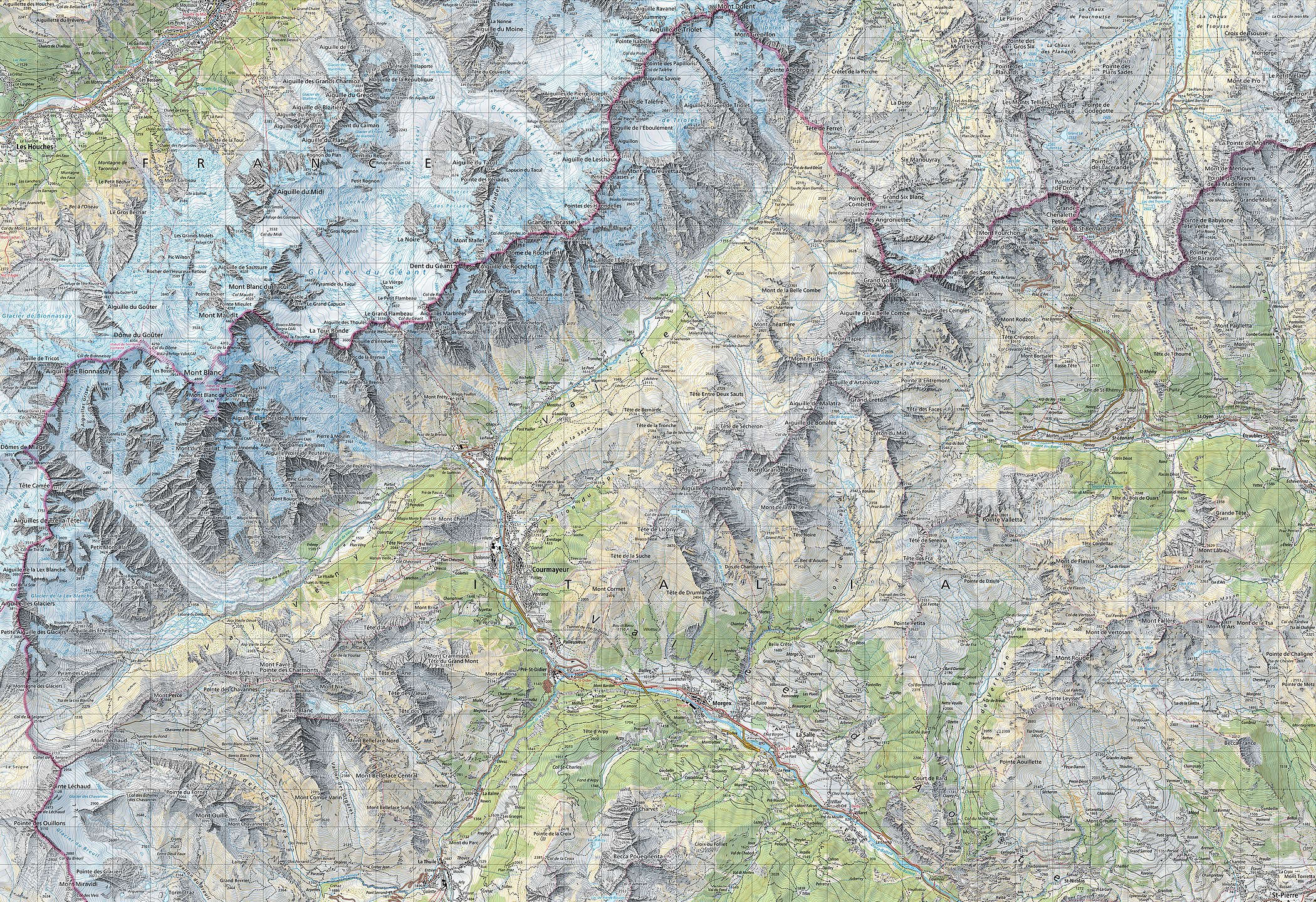
Aerial view of Mont Blanc from 9,000 meters above sea level, picture taken by Thomas Vautrin.
Aerial view of Mont Blanc from 9,000 meters above sea level.

Nowadays the summit is ascended by an average of 20,000 mountaineer tourists each year. It could be considered a technically easy, yet arduous ascent for someone well-trained and acclimatised to the altitude. From l'Aiguille du Midi (where the cable car stops), Mont Blanc seems quite close, being 1,000 m (3,300 ft) higher. But while the peak seems deceptively close, the La Voie des 3 Monts route (known to be more technical and challenging than other more commonly used routes) requires more ascent over two other 4,000 metres (13,000 ft) mountains, Mont Blanc du Tacul and Mont Maudit, before the final section of the climb is reached and the last 1,000 metres (3,300 ft) push to the summit is undertaken.

Each year climbing deaths occur on Mont Blanc, and on the busiest weekends, normally around August, the local rescue service performs an average of 12 missions, mostly directed to aid people in trouble on one of the normal routes of the mountain. Some routes require knowledge of high-altitude mountaineering, a guide (or at least an experienced mountaineer), and all require proper equipment. All routes are long and arduous, involving delicate passages and the hazard of rockfall or avalanche. Climbers may also suffer altitude sickness, occasionally life-threatening, particularly if they are not properly acclimatised.

Fatalities

A 1994 estimate suggests there had been 6,000 to 8,000 alpinist fatalities in total, more than on any other mountain. These numbers exclude the fatalities of Air India Flight 245 and Air India Flight 101, two planes that crashed into Mont Blanc. Despite unsubstantiated claims recurring in media that "some estimates put the fatality rate at an average of 100 hikers a year", actual reported annual numbers at least since the 1990s are between 10 and 20: in 2017, fourteen people died out of 20,000 summit attempts and two remained missing; with 15 in 2018 as of August.

A French study on the especially risky "Goûter couloir, on the normal route on Mont Blanc" and necessary rescue operations found that, between 1990 and 2011, there were 74 deaths "between the Tête Rousse refuge (3,187 m) and the Goûter refuge (3,830 m)". There were 17 more in 2012–15, none in 2016, and 11 in 2017.

Refuges

  • Refuge Vallot, 4362 m
  • Bivouac Giuseppe Lampugnani, 3860 m
  • Bivouac Marco Crippa, 3840 m
  • Refuge Goûter, 3817 m
  • Bivouac Corrado Alberico – Luigi Borgna, 3684 m
  • Refuge Cosmiques, 3613 m
  • Refuge Tête Rousse, 3167 m
  • Refuge Francesco Gonella, 3071 m
  • Refuge Grands Mulets, 3050 m

Impacts of climate change

Recent temperature rises and heatwaves, such as those of the summers of 2015 and 2018, have had significant impacts on many climbing routes across the Alps, including those on Mont Blanc. For example, in 2015, the Grand Mulets route, previously popular in the 20th century, was blocked by virtually impenetrable crevasse fields, and the Gouter Hut was closed by municipal decree for some days because of a very high rockfall danger, with some stranded climbers evacuated by helicopter.

In 2016 a crevasse opened at high altitude, also indicating previously unobserved glacial movements. The new crevasse forms an obstacle to be scaled by climbing parties on the final part of the itinerary to the top shared by the popular Goûter Route and the Grand Mulets Route.

Exploits and incidents

Aerial view of the south-eastern side of Mont Blanc, taken on a commercial flight
  • 1786: The first ascent, by Michel-Gabriel Paccard and Jacques Balmat; see Exploration of the High Alps.
  • 1787: The fourth ascent, by Englishman Mark Beaufoy, with at least six guides and a servant.
  • July 1808: The first ascent by a woman, Maria Paradis, with Balmat as her guide.
  • July 1838: The second ascent by a woman, Henriette d'Angeville.
  • 1890: Giovanni Bonin, Luigi Grasselli and Fr. Achille Ratti (later Pope Pius XI) discovered the normal Italian route (West Face Direct) on descent.
  • 1950: Air India Flight 245 crashes into Mont Blanc.
  • 1966: Air India Flight 101 crashes into Mont Blanc.
  • 1960: The airplane pilot Henri Giraud landed on the summit, which is only 30 m (98 ft) long.
  • 1990: The Swiss Pierre-André Gobet, leaving from Chamonix, completed the ascent and descent in 5 hours, 10 minutes and 14 seconds.
  • 30 May 2003: Stéphane Brosse and Pierre Gignoux tried to beat the record by ski-walking. They went up in 4 hours and 7 minutes and came back down in 1 hour and 8 minutes. In total, they did the ascent and descent in 5 hours and 15 minutes.
  • 13 August 2003: Seven French paraglider pilots landed on the summit. They reached a peak altitude of 5,200 m (17,100 ft), thanks to the hot weather conditions, which provided strong hot air currents. Five had left from Planpraz, one from Rochebrune at Megève and the last one from Samoëns.
  • 8 June 2007: Danish artist Marco Evaristti draped the peak of Mont Blanc with red fabric, along with a 20-foot (6.1 m) pole with a flag reading "Pink State". He had been arrested and detained earlier on 6 June for attempting to paint a pass leading up to the summit red. He aimed to raise awareness of environmental degradation.
  • 13 September 2007: A group of 20 people set up a hot tub at the summit.
  • 19 August 2012: Fifty paraglider pilots landed on the summit, beating the previous record of seven top landing pilots, set in 2003. This included the second ever tandem landing on the summit.
  • 11 July 2013: Kilian Jornet beat the fastest overall time for ascent and descent with 4 hours 57 minutes and 40 seconds.
  • 21 June 2018: Emelie Forsberg set a women's fastest known time up and down from Chamonix with 7 hours 53 minutes and 12 seconds, improving her previous record of 8 hours 10 minutes from 2013.

Incidents involving children

In July 2014, an American entrepreneur and traveller Patrick Sweeney attempted to break the record with his nine-year-old son and 11-year-old daughter. They were caught in an avalanche, escaped death and decided not to pursue their attempt.

In August 2014, an unknown Austrian climber with his 5-year-old son were intercepted by mountain gendarmes at 3,200 metres (10,500 ft) and forced to turn back.

On 5 August 2017, 9-year-old Hungarian twins and their mother were rescued from 3,800 metres (12,500 ft) by helicopter while their father and family friend continued their summit attempt.

Cultural references

Cinema and television

  • La Terre, son visage, is a documentary by Jean-Luc Prévost and published by Édition Société national de télévision française, released in 1984. It is part of the Haroun Tazieff raconte sa terre, vol. 1 series. In it he talks about the west–east crossing of Mont Blanc.
  • The film Malabar Princess.
  • The television-film Premier de cordée.
  • Storm over Mont Blanc (Stürme über dem Mont Blanc, 1930) with Leni Riefenstahl and directed by Arnold Fanck
  • La Roue (The Wheel, 1923) is a 273-minute film by Abel Gance depicting rail operations, workers, and families in south-eastern France, including the Mont Blanc area.

Literature

Protection

The Mont Blanc massif is being put forward as a potential World Heritage Site because of its uniqueness and its cultural importance, considered the birthplace and symbol of modern mountaineering. It would require the three governments of Italy, France and Switzerland to request UNESCO for it to be listed.

Mont Blanc is one of the most visited tourist destinations in the world, and for this reason, some view it as threatened. Pro-Mont Blanc (an international collective of associations for the protection of Mont Blanc) published in 2002 the book Le versant noir du mont Blanc (The black hillside of Mont Blanc), which exposes current and future problems in conserving the site.

In 2007, Europe's two highest toilets (at a height of 4,260 metres, 13,976 feet) were taken by helicopter to the top of Mont Blanc. They are also serviced by helicopter. They will serve 30,000 skiers and hikers annually, helping to alleviate the discharge of urine and faeces that spreads down the mountain face with the spring thaw, and turns it into 'Mont Marron'.

Global warming has begun to melt glaciers and cause avalanches on Mont Blanc, creating more dangerous climbing conditions.

Panorama

Panorama of Mont Blanc
360° panorama from Mont Blanc
 
Spherical panorama from Mont Blanc
(view as a 360° interactive panorama)
 

Mountaineering

From Wikipedia, the free encyclopedia
https://en.wikipedia.org/wiki/Mountaineering

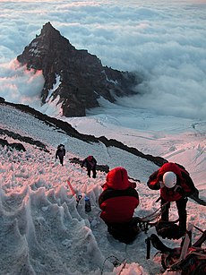
Mountain climbers ascending Mount Rainier looking at Little Tahoma Peak
 
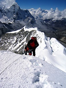
A climber taking the final few steps onto the 6,160 m (20,210 ft) summit of Imja Tse (Island Peak) in Nepal, 2004

Mountaineering or alpinism, is a set of outdoor activities that involves ascending tall mountains. Mountaineering-related activities include traditional outdoor climbing, skiing, and traversing via ferratas. Indoor climbing, sport climbing, and bouldering are also considered variants of mountaineering by some.

Unlike most sports, mountaineering lacks widely applied formal rules, regulations, and governance; mountaineers adhere to a large variety of techniques and philosophies when climbing mountains.Numerous local alpine clubs support mountaineers by hosting resources and social activities. A federation of alpine clubs, the International Climbing and Mountaineering Federation (UIAA), is the International Olympic Committee-recognized world organization for mountaineering and climbing. The consequences of mountaineering on the natural environment can be seen in terms of individual components of the environment (land relief, soil, vegetation, fauna, and landscape) and location/zone of mountaineering activity (hiking, trekking, or climbing zone). Mountaineering impacts communities on economic, political, social and cultural levels, often leading to changes in people's worldviews influenced by globalization, specifically foreign cultures and lifestyles.

History

Early mountaineering

Humans have been present in mountains since prehistory. The remains of Ötzi, who lived in the 4th millennium BC, were found in a glacier in the Ötztal Alps. However, the highest mountains were rarely visited early on, and were often associated with supernatural or religious concepts. Nonetheless, there are many documented examples of people climbing mountains prior to the formal development of the sport in the 19th century, although many of these stories are sometimes considered fictional or legendary.

The famous poet Petrarch describes his 26 April 1336 ascent of Mount Ventoux (1,912 m (6,273 ft)) in one of his epistolae familiares, claiming to be inspired by Philip V of Macedon's ascent of Mount Haemo.

For most of antiquity, climbing mountains was a practical or symbolic activity, usually undertaken for economic, political, or religious purposes. A commonly cited example is the 1492 ascent of Mont Aiguille (2,085 m (6,841 ft)) by Antoine de Ville, a French military officer and lord of Domjulien and Beaupré.

In the Andes, around the late 1400s and early 1500s many ascents were made of extremely high peaks by the Incas and their subjects. The highest they are known for certain to have climbed is 6739 m at the summit of Volcan Llullaillaco.

The Enlightenment and the Golden Age of Alpinism

Edward Whymper (1840–1911), painting by Lance Calkin

The Age of Enlightenment and the Romantic era marked a change of attitudes towards high mountains. In 1757 Swiss scientist Horace-Bénédict de Saussure made the first of several unsuccessful attempts on Mont Blanc in France. He then offered a reward to anyone who could climb the mountain, which was claimed in 1786 by Jacques Balmat and Michel-Gabriel Paccard. The climb is usually considered an epochal event in the history of mountaineering, a symbolic mark of the birth of the sport.

By the early 19th century, many of the alpine peaks were reached, including the Grossglockner in 1800, the Ortler in 1804, the Jungfrau in 1811, the Finsteraarhorn in 1812, and the Breithorn in 1813. In 1808, Marie Paradis became the first woman to climb Mont Blanc, followed in 1838 by Henriette d'Angeville.

The beginning of mountaineering as a sport in the UK is generally dated to the ascent of the Wetterhorn in 1854 by English mountaineer Sir Alfred Wills, who made mountaineering fashionable in Britain. This inaugurated what became known as the Golden Age of Alpinism, with the first mountaineering club – the Alpine Club – being founded in 1857.

One of the most dramatic events was the spectacular first ascent of the Matterhorn in 1865 by a party led by English illustrator Edward Whymper, in which four of the party members fell to their deaths. By this point the sport of mountaineering had largely reached its modern form, with a large body of professional guides, equipment, and methodologies.

Edelweiss, a plant associated with mountain sports

In the early years of the "golden age", scientific pursuits were intermixed with the sport, such as by the physicist John Tyndall. In the later years, it shifted to a more competitive orientation as pure sportsmen came to dominate the London-based Alpine Club and alpine mountaineering overall. The first president of the Alpine Club, John Ball, is considered to be the discoverer of the Dolomites, which for decades were the focus of climbers like Paul Grohmann and Angelo Dibona. At that time, the edelweiss also established itself as a symbol of alpinists and mountaineers.

Expansion around the world

In the 19th century, the focus of mountaineering turned towards mountains beyond the Alps, and by the turn of the 20th century, mountaineering had acquired a more international flavour.

In 1897 Mount Saint Elias (18,008 ft (5,489 m)) on the Alaska-Yukon border was summitted by the Duke of the Abruzzi and party. In 1879–1880 the exploration of the highest Andes in South America began when English mountaineer Edward Whymper climbed Chimborazo (20,549 ft (6,263 m)) and explored the mountains of Ecuador. It took until the late 19th century for European explorers to penetrate Africa. Mount Kilimanjaro in Africa was climbed in 1889 by Austrian mountaineer Ludwig Purtscheller and German geologist Hans Meyer, Mount Kenya in 1899 by Halford Mackinder.

The last frontier: The Himalayas

Mountaineers, circa 1900

The last and greatest mountain range was the Himalayas in South Asia. They had initially been surveyed by the British Empire for military and strategic reasons. In 1892 Sir William Martin Conway explored the Karakoram Himalayas, and climbed a peak of 23,000 ft (7,000 m). In 1895 Albert F. Mummery died while attempting Nanga Parbat, while in 1899 Douglas Freshfield took an expedition to the snowy regions of Sikkim.

In 1899, 1903, 1906, and 1908 American mountaineer Fanny Bullock Workman (one of the first professional female mountaineers) made ascents in the Himalayas, including one of the Nun Kun peaks (23,300 ft (7,100 m)). A number of Gurkha sepoys were trained as expert mountaineers by Charles Granville Bruce, and a good deal of exploration was accomplished by them.

In 1902 the Eckenstein–Crowley Expedition, led by English mountaineer Oscar Eckenstein and English occultist Aleister Crowley was the first to attempt to scale K2. They reached 22,000 feet (6,700 m) before turning back due to weather and other mishaps. Undaunted, in 1905 Crowley led the first expedition to Kangchenjunga, the third highest mountain in the world, in an attempt described as "misguided" and "lamentable".

Eckenstein was also a pioneer in developing new equipment and climbing methods. He started using shorter ice axes which could be used single-handed, designed the modern crampons and improved on the nail patterns used for the climbing boots.

By the 1950s, all the eight-thousanders but two had been climbed starting with Annapurna in 1950 by Maurice Herzog and Louis Lachenal on the 1950 French Annapurna expedition. The highest of these peaks Mount Everest was climbed in 1953 after the British had made several attempts in the 1920s; the 1922 expedition reached 8,320 metres (27,300 ft) before being aborted on the third summit attempt after an avalanche killed seven porters. The 1924 expedition saw another height record achieved but still failed to reach the summit with confirmation when George Mallory and Andrew Irvine disappeared on the final attempt. The summit was finally reached on 29 May 1953 by Sir Edmund Hillary and Tenzing Norgay from the south side in Nepal.

Just a few months later, Hermann Buhl made the first ascent of Nanga Parbat (8,125 m), on the 1953 German–Austrian Nanga Parbat expedition, a siege-style expedition culminating in a last 1,300 meters walking alone, being under the influence of drugs: pervitin (based on the stimulant methamphetamine used by soldiers during World War II), padutin and tea from coca leaves. K2 (8,611 m), the second-highest peak in the world, was first scaled in 1954 by Lino Lacedelli and Achille Compagnoni. In 1964, the final eight-thousander to be climbed was Shishapangma (8,013 m), the lowest of all the 8,000-metre peaks.Reinhold Messner from the Dolomites mountain range (Italy) was then the first to climb all eight-thousanders up to 1986, in addition to be the first without supplemental oxygen. In 1978 he climbed Mount Everest with Peter Habeler without supplemental oxygen, the first men to do so.

Today

Long the domain of the wealthy elite and their agents, the emergence of the middle-class in the 19th and 20th centuries resulted in mass interest in mountaineering. It became a popular pastime and hobby of many people. Some have come to criticize the sport as becoming too much of a tourist activity.

Organization

Activities

There are different activities associated with the sport.

  • Traditional mountaineering involves identifying a specific mountain and route to climb, and executing the plan by whatever means appropriate. A mountain summit is almost always the goal. This activity is strongly associated with aid climbing and free climbing, as well as the use of ice axe and crampons on glaciers and similar terrain.
  • Ski mountaineering involves skiing on mountainous terrain, usually in terrain much more rugged than typical cross-country skiing. Unlike traditional mountaineering, routes are less well-defined and summiting may not be the main goal.
  • Peak bagging is the general activity of ascending peaks that are on a list of notable mountains, such as the 4000m peaks of the Alps.
  • Enchainment is climbing more than one significant summit in one outing, usually on the same day.
  • Climbing via ferratas involves traversing ladder-like paths on highly exposed terrain.
  • Ice climbing which involves proceeding on steep sections of blank ice with crampons and ice axes. This activity often requires progressing on steep and blank sections of ice. Most mountaineers have to rely on ice climbing skills to climb upon the higher peaks in the European Alps, Himalayas and Canadian ranges.

Rules and governance

Mountaineering lacks formal rules; in theory, any person may climb a mountain and call themself a mountaineer. In practice, the sport is defined by the safe and necessary use of technical skills in mountainous terrain: in particular, roped climbing and snow travel abilities. A variety of techniques have been developed to help people climb mountains that are widely applied among practitioners of the sport.

Despite its lack of defined rules and non-competitive nature, mountaineering has much of the trappings of an organized sport, with recognition by the International Olympic Committee and a prominent international sport federation, the UIAA, which counts numerous national alpine clubs as its members. There are also many notable mountaineering/alpine clubs unassociated with the UIAA, such as The Mountaineers and the French Federation of Mountaineering and Climbing.

The premier award in mountaineering is the Piolet d'Or. There are no "world championships" or other similar competitions for mountaineering.

Terrain and techniques

Antique climbing tools

Mountaineering techniques vary greatly depending on location, season, and the particular route a mountaineer chooses to climb. Mountaineers train to climb on all types of terrain whether it be level ground, rock, snow, or ice. Each type of terrain presents its own hazards. Mountaineers must possess adequate food, water, information, equipment and stamina to complete their tasks.

See also: Grade (climbing)

Walk-up terrain

The term "walk-up" or "trek" is used to describe terrain in which no technical equipment is needed. To traverse this terrain, mountaineers hike long distances to a base camp or the beginning of rough terrain, either following trails or using navigation techniques to travel cross-country. Hiking may be a strenuous activity, and adequate physical fitness and familiarity with the wilderness is necessary to complete a hike; it is also a prerequisite of success in all aspects of mountaineering.

Rock

Alpine rock climbing involves technical skills including the ability to place anchors into the rock to safely ascend a mountain. In some cases, climbers may have to climb multiple pitches of rock to reach the top. Typically, for any one pitch, there is a belayer who is stationary and creates tension on the rope to catch a climber should he or she fall, and a climber who ascends the rock. The first climber, called the leader, will reach a point on the rock and then build an anchor, which will secure subsequent climbers. Anchors could be created by using slings around a tree or boulder, or by using protection devices like cams and nuts.

Once anchored, the leader will then belay the climber coming up from below. Once the follower reaches the leader, the leader will often transfer all necessary protection devices (known as a rack) to the follower. The follower then becomes the leader and will ascend the next pitch. This process will continue until the climbers either reach the top, or run into different terrain.

For extremely vertical rocks, or to overcome certain logistical challenges, climbers may use aid climbing techniques. This involves the use of equipment, such as ladders, fixed lines, and ascenders to help the climber push themself up the rock.

In alpine climbing, it is common for climbers to see routes of mixed terrain. This means climbers may need to move efficiently from climbing glacier, to rock, to ice, back and forth in a number of variations.

Snow and ice

Mountaineers proceed across snow fields on South Tyrol; other climbers are visible further up the slopes.

Compacted snow conditions allow mountaineers to progress on foot. Frequently crampons are required to travel efficiently and safely over snow and ice. Crampons attach to the bottom of a mountaineer's boots and provide additional traction on hard snow and ice. For loose snow, crampons are less suitable, and snowshoes or skis may be preferred. Using various techniques from alpine skiing to ascend/descend a mountain is a form of the sport by itself, called ski mountaineering.

Ascending and descending a steep snow slope safely requires the use of an ice axe and different footwork techniques that have been developed over the past century, such as the French technique and German technique. Teams of climbers may choose to attach everyone together with a rope, to form a rope team. The team may then secure themselves by attaching the rope to anchors. These anchors are sometimes unreliable, and include snow stakes or pickets, deadman devices called flukes, or buried equipment or rocks. Bollards, which are simply carved out of consolidated snow or ice, also sometimes serve as anchors. Alternatively, a roped team may choose not to use anchors; instead all members of the team will prepare to use their ice axes to self-arrest in the event should a team member fall.

It is not always wise for climbers to form a rope team, since one falling climber may pull the entire team off the mountain. However, the risks of individual, unprotected travel are often so great that groups have no choice but to form a rope team.

For example, when travelling over glaciers, crevasses pose a grave danger to a climber who is not roped in. These giant cracks in the ice are not always visible as snow can be blown and freeze over the top to make a snowbridge. At times snowbridges can be as thin as a few inches, and may collapse from people walking over them. Should a climber fall, being protected by a rope greatly reduces the risk of injury or death. The other members of the rope team may proceed with a crevasse rescue to pull the fallen climber from the crevasse.

For extremely slippery or steep snow, ice, and mixed rock and ice terrain climbers must use more advanced techniques, called ice climbing or mixed climbing. Specialized tools such as ice screws and ice picks help climbers build anchors and move up the ice, as well as traditional rock climbing equipment for anchoring in mixed terrain. Often, mountaineers climbing steep snow or mixed snowy rock terrain will not use a fixed belay. Instead each climber on the team will climb at the same time while attached to anchors, in groups of two. This allows for safety should the entire team be taken off their feet which also allowing for greater speed than the traditional technique of belaying one climber at a time. This technique is known as simul-climbing or a running belay and is sometimes also used on ice, however the risk of dropping frequently displaced ice on the lower team member(s) limits its usefulness on ice. Traditional belays are also used; in this case, this is sometimes necessary due to ice fall hazard, steepness, or other factors.

Shelter

Climbers use a few different forms of shelter depending on the situation and conditions; alpine shelters or arctic shelters. Shelter is a very important aspect of safety for the climber as weather in the mountains may be very unpredictable. Tall mountains may require many days of camping.

Short trips lasting less than a day generally do not require shelter, although for safety, most mountaineers will carry an emergency shelter, such a light bivouac sack.

Camping

Typical shelters used for camping include tents and bivouac sacks. The ability of these shelters to provide protection from the elements is dependent on their design. Mountaineers who climb in areas with cold weather or snow and ice will use more heavy-duty shelters than those who climb in more forgiving environments.

In remote locations, mountaineers will set up a "base camp", which is an area used for staging attempts at nearby summits. Base camps are positioned to be relatively safe from harsh terrain and weather. Where the summit cannot be reached from base camp in a single day, a mountain will have additional camps above base camp. For popular mountains, base camps may be at a fixed location and become famous. The Everest base camps and Camp Muir are among the most famous base camps.

Hut

Granite Park Chalet in Glacier National Park, US

Camping is not always an option, or may not be suitable if a mountain is close to civilization. Some regions may legally prohibit primitive camping due to concern for the environment, or due to issues with crowds. In lieu of camping, mountaineers may choose to stay in mountain huts.

The European alpine regions, in particular, have a large network of huts. Such huts exist at many different heights, including in the high mountains themselves – in extremely remote areas, more rudimentary shelters may exist. The mountain huts are of varying size and quality, but each is typically centred on a communal dining room and have dormitories equipped with mattresses, blankets or duvets, and pillows; guests are expected to bring and use their own sleeping bag liners. The facilities are usually rudimentary, but, given their locations, huts offer vital shelter, make routes more widely accessible (by allowing journeys to be broken and reducing the weight of equipment needing to be carried), and offer good value. In Europe, all huts are staffed during the summer (mid-June to mid-September) and some are staffed in the spring (mid-March to mid-May). Elsewhere, huts may also be open in the fall. Huts also may have a part that is always open, but unmanned, a so-called winter hut.

When open and manned, the huts are generally run by full-time employees, but some are staffed on a voluntary basis by members of alpine clubs. The manager of the hut, termed a guardian or warden in Europe, will usually also sell refreshments and meals, both to those visiting only for the day and to those staying overnight. The offering is surprisingly wide, given that most supplies, often including fresh water, must be flown in by helicopter, and may include glucose-based snacks (such as candy bars) on which climbers and walkers wish to stock up, cakes and pastries made at the hut, a variety of hot and cold drinks (including beer and wine), and high carbohydrate dinners in the evenings. Not all huts offer a catered service, though, and visitors may need to provide for themselves. Some huts offer facilities for both, enabling visitors wishing to keep costs down to bring their own food and cooking equipment and to cater using the facilities provided. Booking for overnight stays at huts is deemed obligatory, and in many cases is essential as some popular huts, even with more than 100 bed spaces, may be full during good weather and at weekends. Once made, the cancellation of a reservation is advised as a matter of courtesy – and, indeed, potentially of safety, as many huts keep a record of where climbers and walkers state they plan to walk to next. Most huts may be contacted by telephone and most take credit cards as a means of payment.

In the UK the term "hut" is used for any cottage or cabin used as a base for walkers or climbers. These are mostly owned by mountaineering clubs for use by members or visiting clubs and generally do not have wardens or permanent staff, but have cooking and washing facilities and heating. In the Scottish Highlands small simple unmanned shelters without cooking facilities known as "bothies" are maintained to break up cross country long routes and act as base camps to certain mountains.

Snow cave

Where conditions permit, snow caves are another way to shelter high on the mountain. Some climbers do not use tents at high altitudes unless the snow conditions do not allow for snow caving, since snow caves are silent and much warmer than tents. They can be built relatively easily, given sufficient time, using a snow shovel. The temperature of a correctly made snow cave will hover around freezing, which relative to outside temperatures can be very warm. They can be dug anywhere where there is at least four feet of snow. The addition of a good quality bivouac bag and closed cell foam sleeping mat will also increase the warmth of the snow cave. Another shelter that works well is a quinzee, which is excavated from a pile of snow that has been work hardened or sintered (typically by stomping). Igloos are used by some climbers, but are deceptively difficult to build and require specific snow conditions.

Safety and Hazards

Mountaineers face a variety of hazards. When climbing mountains, there are two types of hazards, objective (mountain-based) and subjective (human-based). Objective hazards relate to the environment, and may include inclement weather conditions, dangerous terrain, duration of exposure, and other environmental conditions. Subjective hazards relate to a climber's poor judgement, poor planning, lack of skills, faulty analysis and conclusions, or inadequate conditioning.

In terms of objective hazards, the dangers mountaineers face include loose or falling rocks, falling ice, snow-avalanches, the climber falling, falls from ice slopes, falls down snow slopes, falls into crevasses, and the dangers from altitude and weather.

From 1947 to 2018 in the United States "2,799 people were reported to be involved in mountaineering accidents and 43% of these accidents resulted in death." Climbers themselves are responsible for nearly all climbing accidents.

When planning and preparing for a trip, safe climbers know what hazards to look for and how to recognize them. In situations where hazards are not able to be avoided, the climber must use their decision making skills to mitigate those hazards. Climbers improve upon their abilitiy to become a safe decision maker and reconize hazards by receiving proper education, training, practice, and experience as well as learning how to spot personal bias.

Altitude

Rapid ascent can lead to altitude sickness. The best treatment is to descend immediately. The climber's motto at high altitude is "climb high, sleep low", referring to the regimen of climbing higher to acclimatise but returning to lower elevation to sleep. In the Andes, the chewing of coca leaves has been traditionally used to treat altitude sickness symptoms.

Common symptoms of altitude sickness include severe headache, sleep problems, nausea, lack of appetite, lethargy and body ache. Mountain sickness may progress to HACE (High altitude cerebral edema) and HAPE (High altitude pulmonary edema), both of which can be fatal within 24 hours.

In high mountains, atmospheric pressure is lower and this means that less oxygen is available to breathe. This is the underlying cause of altitude sickness. Everyone needs to acclimatise, even exceptional mountaineers that have been to high altitude before. Generally speaking, mountaineers start using bottled oxygen when they climb above 7,000 m. Exceptional mountaineers have climbed 8000-metre peaks (including Everest) without oxygen, almost always with a carefully planned program of acclimatisation.

Heat Related Conditions

Exposure to hot environments or activities involving exertion cause heat to build up in the body. A heat related illness can occur when the body is unable to lose that built up heat through the skin.

Problems that can arise from this type of exposure include heat cramps, heat exhaustion, and heat stroke. Common symptoms of heat exhaustion include headaches, cool and clammy skin, dizziness, fatigue, nausea, thirst, and rapid pulse. The best treatment is resting with feet elevated, replenishing fluids, and removing excess clothing.

Common symptoms of heat stroke can be an altered state of mind, rapid pulse and respiratory rate, headache, hot skin, loss of coordination, and possible seizures. This is a life threatening illness that must be dealt with right away. While mountaineering, snow and ice can be used to cool the body and head.

Cold Related Conditions

In certain environmental conditions body heat can be lost due to evaporation, radiation, convection, and conduction. A cold related illness can occur when that body heat is lost.

Problems that can arise from the cold include windchill, hypothermia, frost nip, frost bite, or immersion foot.

The best treatment for hypothermia is to deal with it before it occurs, using preventative measures instead of waiting for symptoms to appear. Mountaineering requires a slower pace to avoid sweating and fatigue that could lead to these dangerous conditions. Other tips for preventing hypothermia include staying well fed and hydrated, putting on more clothes when feeling cold, and wearing adequate equipment to keep warm and dry.

Styles of mountaineering

Fixed lines and ladders are distinguishing characteristics of expedition style mountaineering.

There are two main styles of mountaineering: expedition style and alpine style.

Expedition style

The alpine style contrasts with "expedition style". With this style, climbers will carry large amounts of equipment and provisions up and down the mountain, slowly making upward progress. Climbing in an expedition style is preferred if the summit is very high or distant from civilization. Mountaineers who use this style are usually, but not always, part of a large team of climbers and support staff (such as porters and guides). To cover large distances with their massive amounts of gear, sleds and pack animals are commonly used. Climbers will set up multiple camps along the mountain, and will haul their gear up the mountain multiple times, returning to a lower camp after each haul until all the gear is at a higher camp; and repeating this procedure until they reach the summit. This technique is also helpful for acclimatization. While it is the original style in which high mountains were climbed, expedition style is rare these days as more mountains have become accessible to the general public with air travel and the penetration of highways into mountainous regions. It is still common in ranges such as the Alaska Range and the Himalayas.

  • Uses multiple trips between camps to carry supplies up to higher camps
  • Group sizes are often larger than alpine style climbs because more supplies are carried between camps.
  • Fixed lines are often used to minimize the danger involved in continually moving between camps.
  • For the highest mountains, supplemental oxygen is frequently used.
  • There is a higher margin of safety in relation to equipment, food, time, and ability to wait out storms at high camps.
  • Avoidance of being trapped in storms at high altitudes and being forced to descend in treacherous avalanche conditions
  • Possible higher exposure to objective hazards such as avalanches or rockfall, due to slower travel times between camps
  • Higher capital expenditures and a longer time scale

Alpine style

Alpine style, or informal variations of it, is the most common form of mountaineering today. It involves a single, straightforward climb of the mountain, with no backtracking. This style is most suited for medium-sized mountain areas close to civilization with elevations of 2,000–5,000 m (6,600–16,400 ft), such as the Alps or the Rocky Mountains. Alpine style ascents have been done throughout history on extreme altitude (above 5,000 m) peaks also, albeit in lower volume to expedition style ascents. Climbers generally carry their loads between camps without backtracking, in a single push for the summit. If the summit is reachable from the base camp or trailhead within one day, then alpine-style mountaineers will not change camps at all, and only carry the slightest of loads (necessary nourishment and equipment) up to the summit. "Light and fast" is the mantra of the alpine mountaineer.

  • Climbers climb the route only once because they do not continually climb up and down to stock camps with supplies.
  • Fewer supplies are used on the climb, therefore fewer personnel are needed.
  • Alpine-style ascents do not leave the climber exposed to objective hazards as long as an expedition-style climb does; however, because of the speed of the ascent relative to an expedition-style climb there is less time for acclimatization.
  • For the highest mountains, supplemental oxygen is rarely used, or used more sparingly.
  • Danger of being trapped at high altitude due to storms, potentially being exposed to HAPE or HACE
  • Lower capital expenditures and a shorter time scale

Property is theft!

From Wikipedia, the free encyclopedia https://en.wikipedia.org/wiki/Property_is_theft! " Property is theft! " ( French : La propri...