From Wikipedia, the free encyclopedia
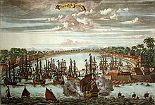
European political power, commerce, and culture in Asia gave rise to growing trade in commodities—a key development in the rise of today's modern world free market economy. In the 16th century, the Portuguese broke the (overland) monopoly of the Arabs and Italians in trade between Asia and Europe by the discovery of the sea route to India around the Cape of Good Hope. The ensuing rise of the rival Dutch East India Company gradually eclipsed Portuguese influence in Asia.[note 1] Dutch forces first established independent bases in the East (most significantly Batavia, the heavily fortified headquarters of the Dutch East India Company) and then between 1640 and 1660 wrested Malacca, Ceylon, some southern Indian ports, and the lucrative Japan trade from the Portuguese. Later, the English and the French established settlements in India and trade with China and their acquisitions would gradually surpass those of the Dutch. Following the end of the Seven Years' War in 1763, the British eliminated French influence in India and established the British East India Company (founded in 1600) as the most important political force on the Indian subcontinent.
Before the Industrial Revolution in the mid-to-late 19th century, demand for oriental goods such as porcelain, silk, spices and tea
remained the driving force behind European imperialism. The Western
European stake in Asia remained confined largely to trading stations and
strategic outposts necessary to protect trade. Industrialization,
however, dramatically increased European demand for Asian raw materials;
with the severe Long Depression
of the 1870s provoking a scramble for new markets for European
industrial products and financial services in Africa, the Americas,
Eastern Europe, and especially in Asia. This scramble coincided with a
new era in global colonial expansion known as "the New Imperialism", which saw a shift in focus from trade and indirect rule
to formal colonial control of vast overseas territories ruled as
political extensions of their mother countries. Between the 1870s and
the beginning of World War I in 1914, the United Kingdom, France, and the Netherlands—the established colonial powers in Asia—added to their empires vast expanses of territory in the Middle East, the Indian Subcontinent, and Southeast Asia. In the same period, the Empire of Japan, following the Meiji Restoration; the German Empire, following the end of the Franco-Prussian War in 1871; Tsarist Russia; and the United States, following the Spanish–American War in 1898, quickly emerged as new imperial powers in East Asia and in the Pacific Ocean area.
In Asia, World War I and World War II
were played out as struggles among several key imperial power, with
conflicts involving the European powers along with Russia and the rising
American and Japanese. None of the colonial powers, however, possessed
the resources to withstand the strains of both World Wars and maintain
their direct rule in Asia. Although nationalist movements throughout the
colonial world led to the political independence of nearly all of
Asia's remaining colonies, decolonization was intercepted by the Cold War. South East Asia, South Asia,
the Middle East, and East Asia remained embedded in a world economic,
financial, and military system in which the great powers compete to
extend their influence. However, the rapid post-war economic development
and rise of the industrialized developed countries of Taiwan, Singapore, South Korea, Japan and the developing countries of India, the People's Republic of China and its autonomous territory of Hong Kong, along with the collapse of the Soviet Union, have greatly diminished Western European influence in Asia. The United States remains influential with trade and military bases in Asia.
Early European exploration of Asia
European exploration of Asia started in ancient Roman times along the Silk Road. Knowledge of lands as distant as China were held by the Romans. Trade with India through the Roman Egyptian Red Sea ports was significant in the first centuries of the Common Era.
Medieval European exploration of Asia
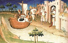
In the 13th and 14th centuries, a number of Europeans, many of them Christian missionaries, had sought to penetrate into China. The most famous of these travelers was Marco Polo.
But these journeys had little permanent effect on east–west trade
because of a series of political developments in Asia in the last
decades of the 14th century, which put an end to further European
exploration of Asia. The Yuan dynasty in China, which had been receptive to European missionaries and merchants, was overthrown, and the new Ming rulers were found to be unreceptive of religious proselytism. Meanwhile, the Turks consolidated control over the eastern Mediterranean,
closing off key overland trade routes. Thus, until the 15th century,
only minor trade and cultural exchanges between Europe and Asia
continued at certain terminals controlled by Muslim traders.
Oceanic voyages to Asia
Western
European rulers determined to find new trade routes of their own. The
Portuguese spearheaded the drive to find oceanic routes that would
provide cheaper and easier access to South and East Asian goods. This
chartering of oceanic routes between East and West began with the
unprecedented voyages of Portuguese and Spanish sea captains. Their
voyages were influenced by medieval European adventurers, who had
journeyed overland to the Far East and contributed to geographical
knowledge of parts of Asia upon their return.
In 1488, Bartolomeu Dias rounded the southern tip of Africa under the sponsorship of Portugal's John II, from which point he noticed that the coast swung northeast (Cape of Good Hope). While Dias' crew forced him to turn back, by 1497, Portuguese navigator Vasco da Gama made the first open voyage from Europe to India. In 1520, Ferdinand Magellan, a Portuguese navigator in the service of the Crown of Castile ('Spain'), found a sea route into the Pacific Ocean.
Portuguese and Spanish trade and colonization in Asia
Portuguese monopoly over trade in the Indian Ocean and Asia
In 1509, the Portuguese under Francisco de Almeida won the decisive battle of Diu against a joint Mamluk
and Arab fleet sent to expel the Portuguese of the Arabian Sea. The
victory enabled Portugal to implement its strategy of controlling the
Indian Ocean.
Early in the 16th century, Afonso de Albuquerque
emerged as the Portuguese colonial viceroy most instrumental in
consolidating Portugal's holdings in Africa and in Asia. He understood
that Portugal could wrest commercial supremacy from the Arabs only by
force, and therefore devised a plan to establish forts at strategic
sites which would dominate the trade routes and also protect Portuguese
interests on land. In 1510, he conquered Goa
in India, which enabled him to gradually consolidate control of most of
the commercial traffic between Europe and Asia, largely through trade;
Europeans started to carry on trade from forts, acting as foreign
merchants rather than as settlers. In contrast, early European expansion
in the "West Indies", (later known to Europeans as a separate continent from Asia that they would call the "Americas") following the 1492 voyage of Christopher Columbus, involved heavy settlement in colonies that were treated as political extensions of the mother countries.
Lured by the potential of high profits from another expedition, the Portuguese established a permanent base in Cochin, south of the Indian trade port of Calicut in the early 16th century. In 1510, the Portuguese, led by Afonso de Albuquerque, seized Goa on the coast of India, which Portugal held until 1961, along with Diu and Daman
(the remaining territory and enclaves in India from a former network of
coastal towns and smaller fortified trading ports added and abandoned
or lost centuries before). The Portuguese soon acquired a monopoly over
trade in the Indian Ocean.
Portuguese viceroy Albuquerque (1509–1515) resolved to
consolidate Portuguese holdings in Africa and Asia, and secure control
of trade with the East Indies and China. His first objective was Malacca, which controlled the narrow strait through which most Far Eastern trade moved. Captured in 1511, Malacca became the springboard for further eastward penetration, starting with the voyage of António de Abreu and Francisco Serrão in 1512, ordered by Albuquerque, to the Moluccas. Years later the first trading posts were established in the Moluccas, or "Spice Islands", which was the source for some of the world's most hotly demanded spices, and from there, in Makassar and some others, but smaller, in the Lesser Sunda Islands. By 1513–1516, the first Portuguese ships had reached Canton on the southern coasts of China.
In 1513, after the failed attempt to conquer Aden, Albuquerque entered with an armada, for the first time for Europeans by the ocean via, on the Red Sea; and in 1515, Albuquerque consolidated the Portuguese hegemony in the Persian Gulf gates, already begun by him in 1507, with the domain of Muscat and Ormuz.
Shortly after, other fortified bases and forts were annexed and built
along the Gulf, and in 1521, through a military campaign, the Portuguese
annexed Bahrain.
The Portuguese conquest of Malacca triggered the Malayan–Portuguese war. In 1521, Ming dynasty China defeated the Portuguese at the Battle of Tunmen and then defeated the Portuguese again at the Battle of Xicaowan. The Portuguese tried to establish trade with China by illegally smuggling with the pirates on the offshore islands off the coast of Zhejiang and Fujian, but they were driven away by the Ming navy in the 1530s-1540s.
In 1557, China decided to lease Macau
to the Portuguese as a place where they could dry goods they
transported on their ships, which they held until 1999. The Portuguese,
based at Goa and Malacca, had now established a lucrative maritime
empire in the Indian Ocean meant to monopolize the spice trade.
The Portuguese also began a channel of trade with the Japanese,
becoming the first recorded Westerners to have visited Japan. This
contact introduced Christianity and firearms into Japan.
In 1505, (also possibly before, in 1501), the Portuguese, through Lourenço de Almeida, the son of Francisco de Almeida, reached Ceylon. The Portuguese founded a fort at the city of Colombo
in 1517 and gradually extended their control over the coastal areas and
inland. In a series of military conflicts and political maneuvers, the
Portuguese extended their control over the Sinhalese kingdoms, including Jaffna (1591), Raigama (1593), Sitawaka (1593), and Kotte (1594)- However, the aim of unifying the entire island under Portuguese control faced the Kingdom of Kandy`s fierce resistance. The Portuguese, led by Pedro Lopes de Sousa, launched a full-scale military invasion of the kingdom of Kandy in the Campaign of Danture of 1594. The invasion was a disaster for the Portuguese, with their entire army wiped out by Kandyan guerrilla warfare. Constantino de Sá,
romantically celebrated in the 17th century Sinhalese Epic (also for
its greater humanism and tolerance compared to other governors) led the
last military operation that also ended in disaster. He died in the Battle of Randeniwela, refusing to abandon his troops in the face of total annihilation.
The energies of Castile (later, the unified Spain), the
other major colonial power of the 16th century, were largely
concentrated on the Americas, not South and East Asia, but the Spanish
did establish a footing in the Far East in the Philippines. After
fighting with the Portuguese by the Spice Islands since 1522 and the
agreement between the two powers in 1529 (in the treaty of Zaragoza),
the Spanish, led by Miguel López de Legazpi, settled and conquered gradually the Philippines since 1564. After the discovery of the return voyage to the Americas by Andres de Urdaneta in 1565, cargoes of Chinese goods were transported from the Philippines to Mexico and from there to Spain.
By this long route, Spain reaped some of the profits of Far Eastern
commerce. Spanish officials converted the islands to Christianity and
established some settlements, permanently establishing the Philippines
as the area of East Asia most oriented toward the West in terms of
culture and commerce. The Moro Muslims fought against the Spanish for
over three centuries in the Spanish–Moro conflict.
Decline of Portugal's Asian empire since the 17th century
The lucrative trade was vastly expanded when the Portuguese began to export slaves
from Africa in 1541; however, over time, the rise of the slave trade
left Portugal over-extended, and vulnerable to competition from other
Western European powers. Envious of Portugal's control of trade routes,
other Western European nations—mainly the Netherlands, France, and England—began to send in rival expeditions to Asia. In 1642, the Dutch drove the Portuguese out of the Gold Coast
in Africa, the source of the bulk of Portuguese slave laborers, leaving
this rich slaving area to other Europeans, especially the Dutch and the
English.
Rival European powers began to make inroads in Asia as the
Portuguese and Spanish trade in the Indian Ocean declined primarily
because they had become hugely over-stretched financially due to the
limitations on their investment capacity and contemporary naval
technology. Both of these factors worked in tandem, making control over
Indian Ocean trade extremely expensive.
The existing Portuguese interests in Asia proved sufficient to
finance further colonial expansion and entrenchment in areas regarded as
of greater strategic importance in Africa and Brazil.
Portuguese maritime supremacy was lost to the Dutch in the 17th
century, and with this came serious challenges for the Portuguese.
However, they still clung to Macau and settled a new colony on the
island of Timor.
It was as recent as the 1960s and 1970s that the Portuguese began to
relinquish their colonies in Asia. Goa was invaded by India in 1961 and
became an Indian state in 1987; Portuguese Timor was abandoned in 1975 and was then invaded by Indonesia. It became an independent country in 2002, and Macau was handed back to the Chinese as per a treaty in 1999.
Holy wars
The arrival of the Portuguese and Spanish and their holy wars against Muslim states in the Malayan–Portuguese war, Spanish–Moro conflict and Castilian War
inflamed religious tensions and turned Southeast Asia into an arena of
conflict between Muslims and Christians. The Brunei Sultanate's capital
at Kota Batu was assaulted by Governor Sande who led the 1578 Spanish
attack.
The word "savages" in Spanish, cafres, was from the word
"infidel" in Arabic - Kafir, and was used by the Spanish to refer to
their own "Christian savages" who were arrested in Brunei. It was said Castilians are kafir, men who have no souls, who are condemned by fire when they die, and that too because they eat pork by the Brunei Sultan after the term accursed doctrine
was used to attack Islam by the Spaniards which fed into hatred between
Muslims and Christians sparked by their 1571 war against Brunei.
The Sultan's words were in response to insults coming from the Spanish
at Manila in 1578, other Muslims from Champa, Java, Borneo, Luzon,
Pahang, Demak, Aceh, and the Malays echoed the rhetoric of holy war
against the Spanish and Iberian Portuguese, calling them kafir enemies
which was a contrast to their earlier nuanced views of the Portuguese in
the Hikayat Tanah Hitu and Sejarah Melayu. The war by Spain against Brunei was defended in an apologia written by Doctor De Sande.
The British eventually partitioned and took over Brunei while Sulu was
attacked by the British, Americans, and Spanish which caused its
breakdown and downfall after both of them thrived from 1500 to 1900 for
four centuries.
Dar al-Islam was seen as under invasion by "kafirs" by the Atjehnese
led by Zayn al-din and by Muslims in the Philippines as they saw the
Spanish invasion, since the Spanish brought the idea of a crusader holy
war against Muslim Moros just as the Portuguese did in Indonesia and
India against what they called "Moors" in their political and commercial
conquests which they saw through the lens of religion in the 16th
century.
In 1578, an attack was launched by the Spanish against Jolo, and
in 1875 it was destroyed at their hands, and once again in 1974 it was
destroyed by the Philippines. The Spanish first set foot on Borneo in Brunei.
The Spanish war against Brunei failed to conquer Brunei but it
totally cut off the Philippines from Brunei's influence, the Spanish
then started colonizing Mindanao and building fortresses. In response,
the Bisayas, where Spanish forces were stationed, were subjected to
retaliatory attacks by the Magindanao in 1599-1600 due to the Spanish
attacks on Mindanao.
The Brunei royal family was related to the Muslim Rajahs who in ruled the principality in 1570 of Manila (Kingdom of Maynila)
and this was what the Spaniards came across on their initial arrival to
Manila, Spain uprooted Islam out of areas where it was shallow after
they began to force Christianity on the Philippines in their conquests
after 1521 while Islam was already widespread in the 16th century
Philippines.
In the Philippines in the Cebu islands the natives killed the Spanish
fleet leader Magellan. Borneo's western coastal areas at Landak,
Sukadana, and Sambas saw the growth of Muslim states in the sixteenth
century, in the 15th century at Nanking, the capital of China, the death
and burial of the Borneo Bruneian king Maharaja Kama took place upon
his visit to China with Zheng He's fleet.
The Spanish were expelled from Brunei in 1579 after they attacked in 1578. There were fifty thousand inhabitants before the 1597 attack by the Spanish in Brunei.
During first contact with China, numerous aggressions and provocations were undertaken by the Portuguese. They believed they could mistreat the non-Christians because they
themselves were Christians and acted in the name of their religion in
committing crimes and atrocities. This resulted in the Battle of Xicaowan where the local Chinese navy defeated and captured a fleet of Portuguese caravels.
Dutch trade and colonization in Asia
Rise of Dutch control over Asian trade in the 17th century
The Portuguese decline in Asia was accelerated by attacks on their
commercial empire by the Dutch and the English, which began a global
struggle over the empire in Asia that lasted until the end of the Seven Years' War in 1763. The Netherlands revolt against Spanish rule
facilitated Dutch encroachment on the Portuguese monopoly over South
and East Asian trade. The Dutch looked on Spain's trade and colonies as
potential spoils of war. When the two crowns of the Iberian peninsula
were joined in 1581, the Dutch felt free to attack Portuguese
territories in Asia.
By the 1590s, a number of Dutch companies were formed to finance
trading expeditions in Asia. Because competition lowered their profits,
and because of the doctrines of mercantilism, in 1602 the companies united into a cartel and formed the Dutch East India Company, and received from the government the right to trade and colonize territory in the area stretching from the Cape of Good Hope eastward to the Strait of Magellan.
In 1605, armed Dutch merchants captured the Portuguese fort at Amboyna
in the Moluccas, which was developed into the company's first secure
base. Over time, the Dutch gradually consolidated control over the great
trading ports of the East Indies. This control allowed the company to
monopolise the world spice trade for decades. Their monopoly over the spice trade became complete after they drove the Portuguese from Malacca in 1641 and Ceylon in 1658.
Dutch East India Company colonies or outposts were later established in Atjeh (Aceh), 1667; Macassar, 1669; and Bantam, 1682. The company established its headquarters at Batavia (today Jakarta) on the island of Java. Outside the East Indies, the Dutch East India Company colonies or outposts were also established in Persia (Iran), Bengal (now Bangladesh and part of India), Mauritius (1638-1658/1664-1710), Siam (now Thailand), Guangzhou (Canton, China), Taiwan (1624–1662), and southern India (1616–1795).
Ming dynasty China defeated the Dutch East India Company in the Sino-Dutch conflicts. The Chinese first defeated and drove the Dutch out of the Pescadores in 1624. The Ming navy under Zheng Zhilong defeated the Dutch East India Company's fleet at the 1633 Battle of Liaoluo Bay. In 1662, Zheng Zhilong's son Zheng Chenggong (also known as Koxinga) expelled the Dutch from Taiwan after defeating them in the siege of Fort Zeelandia. (see History of Taiwan) Further, the Dutch East India Company trade post on Dejima (1641–1857), an artificial island off the coast of Nagasaki, was for a long time the only place where Europeans could trade with Japan.
The Vietnamese Nguyễn lords defeated the Dutch in a naval battle in 1643.
The Cambodians defeated the Dutch in the Cambodian–Dutch War in 1644.
In 1652, Jan van Riebeeck established an outpost at the Cape of Good Hope (the southwestern tip of Africa, currently in South Africa) to restock company ships on their journey to East Asia. This post later became a fully-fledged colony, the Cape Colony (1652–1806). As Cape Colony attracted increasing Dutch and European settlement, the Dutch founded the city of Kaapstad (Cape Town).
By 1669, the Dutch East India Company was the richest private
company in history, with a huge fleet of merchant ships and warships,
tens of thousands of employees, a private army consisting of thousands
of soldiers, and a reputation on the part of its stockholders for high
dividend payments.
Dutch New Imperialism in Asia
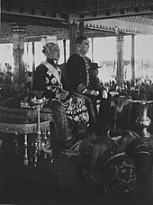
The Dutch Governor-General, highest authority in the colony and the Sultan of Jogjakarta.
The company was in almost constant conflict with the English; relations were particularly tense following the Amboyna Massacre in 1623. During the 18th century, Dutch East India Company possessions were increasingly focused on the East Indies. After the fourth war between the United Provinces
and England (1780–1784), the company suffered increasing financial
difficulties. In 1799, the company was dissolved, commencing official
colonisation of the East Indies.
During the era of New Imperialism the territorial claims of the Dutch
East India Company (VOC) expanded into a fully fledged colony named the Dutch East Indies.
Partly driven by re-newed colonial aspirations of fellow European
nation states the Dutch strived to establish unchallenged control of the
archipelago now known as Indonesia.
Six years into formal colonisation of the East Indies, in Europe the Dutch Republic was occupied by the French forces of Napoleon.
The Dutch government went into exile in England and formally ceded its
colonial possessions to Great Britain. The pro-French Governor General
of Java Jan Willem Janssens, resisted a British invasion force in 1811 until forced to surrender. British Governor Raffles, who the later founded the city of Singapore, ruled the colony the following 10 years of the British interregnum (1806–1816).
After the defeat of Napoleon and the Anglo-Dutch Treaty of 1814
colonial government of the East Indies was ceded back to the Dutch in
1817. The loss of South Africa and the continued scramble for Africa
stimulated the Dutch to secure unchallenged dominion over its colony in
the East Indies. The Dutch started to consolidate its power base through
extensive military campaigns and elaborate diplomatic alliances with
indigenous rulers ensuring the Dutch tricolor was firmly planted in all corners of the Archipelago. These military campaigns included: the Padri War (1821–1837), the Java War (1825–1830) and the Aceh War (1873–1904). This raised the need for a considerable military buildup of the colonial army (KNIL). From all over Europe soldiers were recruited to join the KNIL.
The Dutch concentrated their colonial enterprise in the Dutch East Indies
(Indonesia) throughout the 19th century. The Dutch lost control over
the East Indies to the Japanese during much of World War II.
Following the war, the Dutch fought Indonesian independence forces
after Japan surrendered to the Allies in 1945. In 1949, most of what was
known as the Dutch East Indies was ceded to the independent Republic of
Indonesia. In 1962, also Dutch New Guinea was annexed by Indonesia de facto ending Dutch imperialism in Asia.
British in India
Portuguese, French, and British competition in India (1600–1763)
Robert Clive, 1st Baron Clive
The English sought to stake out claims in India at the expense of the Portuguese dating back to the Elizabethan era. In 1600, Queen Elizabeth I incorporated the English East India Company
(later the British East India Company), granting it a monopoly of trade
from the Cape of Good Hope eastward to the Strait of Magellan. In 1639,
it acquired Madras
on the east coast of India, where it quickly surpassed Portuguese Goa
as the principal European trading centre on the Indian Subcontinent.
Through bribes, diplomacy, and manipulation of weak native
rulers, the company prospered in India, where it became the most
powerful political force, and outrivaled its Portuguese and French
competitors. For more than one hundred years, English and French trading
companies had fought one another for supremacy, and, by the middle of
the 18th century, competition between the British and the French had
heated up. French defeat by the British under the command of Robert Clive during the Seven Years' War (1756–1763) marked the end of the French stake in India.
Collapse of Mughal India
The British East India Company, although still in direct competition
with French and Dutch interests until 1763, was able to extend its
control over almost the whole of India in the century following the
subjugation of Bengal at the 1757 Battle of Plassey. The British East India Company made great advances at the expense of the Mughal Empire.
The reign of Aurangzeb had marked the height of Mughal power. By
1690 Mughal territorial expansion reached its greatest extent
encompassing the entire Indian Subcontinent. But this period of power
was followed by one of decline. Fifty years after the death of
Aurangzeb, the great Mughal empire had crumbled. Meanwhile, marauding
warlords, nobles, and others bent on gaining power left the Subcontinent
increasingly anarchic. Although the Mughals kept the imperial title
until 1858, the central government had collapsed, creating a power
vacuum.
From Company to Crown
Aside from defeating the French during the Seven Years' War, Robert Clive, the leader of the Company in India, defeated Siraj ud-Daulah, a key Indian ruler of Bengal, at the decisive Battle of Plassey
(1757), a victory that ushered in the beginning of a new period in
Indian history, that of informal British rule. While still nominally the
sovereign, the Mughal Indian emperor became more and more of a puppet
ruler, and anarchy spread until the company stepped into the role of
policeman of India. The transition to formal imperialism, characterised
by Queen Victoria
being crowned "Empress of India" in the 1870s was a gradual process.
The first step toward cementing formal British control extended back to
the late 18th century. The British Parliament, disturbed by the idea
that a great business concern, interested primarily in profit, was
controlling the destinies of millions of people, passed acts in 1773 and
1784 that gave itself the power to control company policies and to
appoint the highest company official in India, the Governor-General.
(This system of dual control lasted until 1858.) By 1818, the East
India Company was master of all of India. Some local rulers were forced
to accept its overlordship; others were deprived of their territories.
Some portions of India were administered by the British directly; in
others native dynasties were retained under British supervision.
Until 1858, however, much of India was still officially the dominion
of the Mughal emperor. Anger among some social groups, however, was
seething under the governor-generalship of James Dalhousie (1847–1856), who annexed the Punjab (1849) after victory in the Second Sikh War, annexed seven princely states using the doctrine of lapse, annexed the key state of Oudh on the basis of misgovernment, and upset cultural sensibilities by banning Hindu practices such as sati.
The 1857 Indian Rebellion,
an uprising initiated by Indian troops, called sepoys, who formed the
bulk of the company's armed forces, was the key turning point. Rumour
had spread among them that their bullet cartridges were lubricated with
pig and cow fat. The cartridges had to be bit open, so this upset the Hindu and Muslim soldiers. The Hindu religion held cows sacred, and for Muslims pork was considered haraam.
In one camp, 85 out of 90 sepoys would not accept the cartridges from
their garrison officer. The British harshly punished those who would not
by jailing them. The Indian people were outraged, and on May 10, 1857,
sepoys marched to Delhi,
and, with the help of soldiers stationed there, captured it.
Fortunately for the British, many areas remained loyal and quiescent,
allowing the revolt to be crushed after fierce fighting. One important
consequence of the revolt was the final collapse of the Mughal dynasty.
The mutiny also ended the system of dual control under which the British
government and the British East India Company shared authority. The
government relieved the company of its political responsibilities, and
in 1858, after 258 years of existence, the company relinquished its
role. Trained civil servants were recruited from graduates of British
universities, and these men set out to rule India. Lord Canning (created
earl in 1859), appointed Governor-General of India in 1856, became
known as "Clemency Canning" as a term of derision for his efforts to
restrain revenge against the Indians during the Indian Mutiny. When the
Government of India was transferred from the company to the Crown,
Canning became the first viceroy of India.
The Company initiated the first of the Anglo-Burmese Wars in 1824, which led to total annexation of Burma by the Crown in 1885. The British ruled Burma as a province of British India until 1937, then administered her separately under the Burma Office except during the Japanese occupation of Burma, 1942–1945, until granted independence on 4 January 1948. (Unlike India, Burma opted not to join the Commonwealth of Nations.)
Rise of Indian nationalism
The denial of equal status to Indians was the immediate stimulus for the formation in 1885 of the Indian National Congress,
initially loyal to the Empire but committed from 1905 to increased
self-government and by 1930 to outright independence. The "Home
charges", payments transferred from India for administrative costs, were
a lasting source of nationalist grievance, though the flow declined in
relative importance over the decades to independence in 1947.
Although majority Hindu and minority Muslim
political leaders were able to collaborate closely in their criticism
of British policy into the 1920s, British support for a distinct Muslim
political organisation, the Muslim League
from 1906 and insistence from the 1920s on separate electorates for
religious minorities, is seen by many in India as having contributed to
Hindu-Muslim discord and the country's eventual Partition.
France in Indochina
France, which had lost its empire to the British
by the end of the 18th century, had little geographical or commercial
basis for expansion in Southeast Asia. After the 1850s, French
imperialism was initially impelled by a nationalistic
need to rival the United Kingdom and was supported intellectually by
the notion that French culture was superior to that of the people of Annam (Vietnam), and its mission civilisatrice—or
its "civilizing mission" of the Annamese through their assimilation to
French culture and the Catholic religion. The pretext for French
expansionism in Indochina was the protection of French religious missions in the area, coupled with a desire to find a southern route to China through Tonkin, the European name for a region of northern Vietnam.
French religious and commercial interests were established in
Indochina as early as the 17th century, but no concerted effort at
stabilizing the French position was possible in the face of British
strength in the Indian Ocean and French defeat in Europe at the beginning of the 19th century. A mid-19th century religious revival under the Second Empire
provided the atmosphere within which interest in Indochina grew.
Anti-Christian persecutions in the Far East provided the pretext for the
bombardment of Tourane (Danang) in 1847, and invasion and occupation of
Danang in 1857 and Saigon in 1858. Under Napoleon III,
France decided that French trade with China would be surpassed by the
British, and accordingly the French joined the British against China in
the Second Opium War from 1857 to 1860, and occupied parts of Vietnam as its gateway to China.
By the Treaty of Saigon in 1862, on June 5, the Vietnamese emperor ceded France three provinces of southern Vietnam to form the French colony of Cochinchina;
France also secured trade and religious privileges in the rest of
Vietnam and a protectorate over Vietnam's foreign relations. Gradually
French power spread through exploration, the establishment of
protectorates, and outright annexations. Their seizure of Hanoi
in 1882 led directly to war with China (1883–1885), and the French
victory confirmed French supremacy in the region. France governed Cochinchina as a direct colony, and central and northern Vietnam under the protectorates of Annam and Tonkin, and Cambodia as protectorates in one degree or another. Laos too was soon brought under French "protection".
By the beginning of the 20th century, France had created an empire in Indochina nearly 50 percent larger than the mother country. A Governor-General in Hanoi ruled Cochinchina
directly and the other regions through a system of residents.
Theoretically, the French maintained the precolonial rulers and
administrative structures in Annam, Tonkin, Cochinchina, Cambodia, and Laos,
but in fact the governor-generalship was a centralised fiscal and
administrative regime ruling the entire region. Although the surviving
native institutions were preserved in order to make French rule more
acceptable, they were almost completely deprived of any independence of
action. The ethnocentric French colonial administrators sought to
assimilate the upper classes into France's "superior culture." While the
French improved public services and provided commercial stability, the
native standard of living declined and precolonial social structures
eroded. Indochina, which had a population of over eighteen million in
1914, was important to France for its tin, pepper, coal, cotton, and rice. It is still a matter of debate, however, whether the colony was commercially profitable.
Russia and "The Great Game"
Tsarist Russia
is not often regarded as a colonial power such as the United Kingdom or
France because of the manner of Russian expansions: unlike the United
Kingdom, which expanded overseas, the Russian Empire grew from the
centre outward by a process of accretion, like the United States. In the
19th century, Russian expansion took the form of a struggle of an
effectively landlocked country for access to a warm-water port.
Historian Michael Khodarkovsky describes Tsarist Russia as a
"hybrid empire" that combined elements of continental and colonial
empires.
While the British were consolidating their hold on India, Russian
expansion had moved steadily eastward to the Pacific, then toward the Caucasus and Central Asia. In the early 19th century, it succeeded in conquering the South Caucasus and Dagestan from Qajar Iran following the Russo-Persian War (1804–1813), the Russo-Persian War (1826–1828) and the out coming treaties of Gulistan and Turkmenchay, giving Russia direct borders with both Persia's as well as Ottoman Turkey's heartlands. Later, they eventually reached the frontiers of Afghanistan
as well (which had the largest foreign border adjacent to British
holdings in India). In response to Russian expansion, the defense of
India's land frontiers and the control of all sea approaches to the subcontinent via the Suez Canal, the Red Sea, and the Persian Gulf became preoccupations of British foreign policy in the 19th century. This was called the Great Game.
According to Kazakh scholar Kereihan Amanzholov, Russian
colonialism had "no essential difference with the colonialist policies
of Britain, France, and other European powers".
Anglo-Russian rivalry in the Middle East and Central Asia led to a
brief confrontation over Afghanistan in the 1870s. In Persian, both
nations set up banks to extend their economic influence. The United
Kingdom went so far as to invade Tibet, a land subordinate to the Chinese Qing Empire,
in 1904, but withdrew when it became clear that Russian influence was
insignificant and when Chinese and Tibetan resistance proved tougher
than expected.
Qing China defeated Russia in the early Sino-Russian border conflicts, although the Russian Empire later acquired Outer Manchuria in the Amur Annexation. During the Boxer Rebellion, the Russian Empire invaded Manchuria in 1900, and the Blagoveshchensk massacre occurred against Chinese residents on the Russian side of the border.
In 1907, the United Kingdom and Russia signed an agreement that, on the surface, ended their rivalry in Central Asia. (see Anglo-Russian Convention)
As part of the entente, Russia agreed to deal with the sovereign of
Afghanistan only through British intermediaries. In turn, the United
Kingdom would not annex or occupy Afghanistan. Chinese suzerainty over
Tibet also was recognised by both Russia and the United Kingdom, since
nominal control by a weak China was preferable to control by either
power. Persia was divided into Russian and British spheres of influence
and an intervening "neutral" zone. The United Kingdom and Russia chose
to reach these uneasy compromises because of growing concern on the part
of both powers over German expansion in strategic areas of China and
Africa.
Following the entente, Russia increasingly intervened in Persian
domestic politics and suppressed nationalist movements that threatened
both Saint Petersburg and London. After the Russian Revolution, Russia gave up its claim to a sphere of influence, though Soviet involvement persisted alongside the United Kingdom's until the 1940s.
In the Middle East, in Persia and the Ottoman Empire, a German company built a railroad from Constantinople to Baghdad and the Persian Gulf in the latter, while it built a railroad from the north of the country to the south, connecting the Caucasus with the Persian Gulf in the former. Germany
wanted to gain economic influence in the region and then, perhaps, move
on to India. This was met with bitter resistance by the United Kingdom,
Russia, and France who divided the region among themselves.
Western European and Russian intrusions into China
The 16th century brought many Jesuit missionaries to China, such as Matteo Ricci,
who established missions where Western science was introduced, and
where Europeans gathered knowledge of Chinese society, history, culture,
and science. During the 18th century, merchants from Western Europe
came to China in increasing numbers. However, merchants were confined to
Guangzhou and the Portuguese colony of Macau, as they had been since
the 16th century. European traders were increasingly irritated by what
they saw as the relatively high customs duties they had to pay and by
the attempts to curb the growing import trade in opium. By 1800, its importation was forbidden by the imperial government. However, the opium trade continued to boom.
Early in the 19th century, serious internal weaknesses developed in the Qing dynasty that left China vulnerable to Western, Meiji period Japanese, and Russian imperialism. In 1839, China found itself fighting the First Opium War with Britain. China was defeated, and in 1842, signed the provisions of the Treaty of Nanking which were first of the unequal treaties signed during the Qing Dynasty. Hong Kong Island was ceded to Britain, and certain ports, including Shanghai and Guangzhou, were opened to British trade and residence. In 1856, the Second Opium War broke out. The Chinese were again defeated, and now forced to the terms of the 1858 Treaty of Tientsin.
The treaty opened new ports to trade and allowed foreigners to travel
in the interior. In addition, Christians gained the right to propagate
their religion. The United States Treaty of Wanghia and Russia later obtained the same prerogatives in separate treaties.
Toward the end of the 19th century, China appeared on the way to
territorial dismemberment and economic vassalage—the fate of India's
rulers that played out much earlier. Several provisions of these
treaties caused long-standing bitterness and humiliation among the
Chinese: extraterritoriality (meaning that in a dispute with a Chinese
person, a Westerner had the right to be tried in a court under the laws
of his own country), customs regulation, and the right to station
foreign warships in Chinese waters, including its navigable rivers.
Jane E. Elliott criticized the allegation that China refused to
modernize or was unable to defeat Western armies as simplistic, noting
that China embarked on a massive military modernization in the late
1800s after several defeats, buying weapons from Western countries and
manufacturing their own at arsenals, such as the Hanyang Arsenal during the Boxer Rebellion.
In addition, Elliott questioned the claim that Chinese society was
traumatized by the Western victories, as many Chinese peasants (90% of
the population at that time) living outside the concessions continued
about their daily lives, uninterrupted and without any feeling of
"humiliation".
Historians have judged the Qing dynasty's vulnerability and
weakness to foreign imperialism in the 19th century to be based mainly
on its maritime naval weakness while it achieved military success
against westerners on land, the historian Edward L. Dreyer said that
"China’s nineteenth-century humiliations were strongly related to her
weakness and failure at sea. At the start of the Opium War, China had no
unified navy and no sense of how vulnerable she was to attack from the
sea; British forces sailed and steamed wherever they wanted to
go......In the Arrow War (1856-1860), the Chinese had no way to prevent
the Anglo-French expedition of 1860 from sailing into the Gulf of Zhili
and landing as near as possible to Beijing. Meanwhile, new but not
exactly modern Chinese armies suppressed the midcentury rebellions, bluffed Russia into a peaceful settlement of disputed frontiers in Central Asia, and defeated the French forces on land in the Sino-French War (1884-1885).
But the defeat of the fleet, and the resulting threat to steamship
traffic to Taiwan, forced China to conclude peace on unfavorable terms."
During the Sino-French War, Vietnamese forces defeated the French at the Battle of Cầu Giấy (Paper Bridge), Bắc Lệ ambush, Battle of Phu Lam Tao, Battle of Zhenhai, the Battle of Tamsui in the Keelung Campaign and in the last battle which ended the war, the Battle of Bang Bo (Zhennan Pass), which triggered the French Retreat from Lạng Sơn and resulted in the collapse of the French Jules Ferry government in the Tonkin Affair.
The Qing dynasty forced Russia to hand over disputed territory in Ili in the Treaty of Saint Petersburg (1881), in what was widely seen by the west as a diplomatic victory for the Qing. Russia acknowledged that Qing China potentially posed a serious military threat.
Mass media in the west during this era portrayed China as a rising
military power due to its modernization programs and as a major threat
to the western world, invoking fears that China would successfully
conquer western colonies like Australia.
The British observer Demetrius Charles de Kavanagh Boulger
suggested a British-Chinese alliance to check Russian expansion in
Central Asia.
During the Ili crisis when Qing China threatened to go to war
against Russia over the Russian occupation of Ili, the British officer Charles George Gordon
was sent to China by Britain to advise China on military options
against Russia should a potential war break out between China and
Russia.
The Russians observed the Chinese building up their arsenal of
modern weapons during the Ili crisis, the Chinese bought thousands of
rifles from Germany.
In 1880, massive amounts of military equipment and rifles were shipped
via boats to China from Antwerp as China purchased torpedoes, artillery,
and 260,260 modern rifles from Europe.
The Russian military observer D. V. Putiatia visited China in
1888 and found that in Northeastern China (Manchuria) along the
Chinese-Russian border, the Chinese soldiers were potentially able to
become adept at "European tactics" under certain circumstances, and the
Chinese soldiers were armed with modern weapons like Krupp artillery,
Winchester carbines, and Mauser rifles.
Compared to Russian controlled areas, more benefits were given to
the Muslim Kirghiz on the Chinese controlled areas. Russian settlers
fought against the Muslim nomadic Kirghiz, which led the Russians to
believe that the Kirghiz would be a liability in any conflict against
China. The Muslim Kirghiz were sure that in an upcoming war, that China
would defeat Russia.
Russian sinologists, the Russian media, threat of internal
rebellion, the pariah status inflicted by the Congress of Berlin, the
negative state of the Russian economy all led Russia to concede and
negotiate with China in St Petersburg, and return most of Ili to China.
The rise of Japan since the Meiji Restoration as an imperial power led to further subjugation of China. In a dispute over China's longstanding claim of suzerainty in Korea, war broke out between China and Japan, resulting in humiliating defeat for the Chinese. By the Treaty of Shimonoseki
(1895), China was forced to recognize effective Japanese rule of Korea
and Taiwan was ceded to Japan until its recovery in 1945 at the end of
the WWII by the Republic of China.
China's defeat at the hands of Japan was another trigger for future aggressive actions by Western powers. In 1897, Germany demanded and was given a set of exclusive mining and railroad rights in Shandong province. Russia obtained access to Dairen and Port Arthur
and the right to build a railroad across Manchuria, thereby achieving
complete domination over a large portion of northwestern China. The
United Kingdom and France also received a number of concessions. At this time, much of China was divided up into "spheres of influence": Germany had influence in Jiaozhou (Kiaochow) Bay, Shandong, and the Yellow River valley; Russia had influence in the Liaodong Peninsula and Manchuria; the United Kingdom had influence in Weihaiwei and the Yangtze Valley; and France had influence in the Guangzhou Bay and the provinces of Yunnan, Guizhou and Guangxi
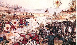
British and Japanese forces engage
Boxers in battle, 1900
China continued to be divided up into these spheres until the United
States, which had no sphere of influence, grew alarmed at the
possibility of its businessmen being excluded from Chinese markets. In
1899, Secretary of State John Hay
asked the major powers to agree to a policy of equal trading
privileges. In 1900, several powers agreed to the U.S.-backed scheme,
giving rise to the "Open Door"
policy, denoting freedom of commercial access and non-annexation of
Chinese territory. In any event, it was in the European powers' interest
to have a weak but independent Chinese government. The privileges of
the Europeans in China were guaranteed in the form of treaties with the
Qing government. In the event that the Qing government totally
collapsed, each power risked losing the privileges that it already had
negotiated.
The erosion of Chinese sovereignty and seizures of land from
Chinese by foreigners contributed to a spectacular anti-foreign outbreak
in June 1900, when the "Boxers" (properly the society of the "righteous and harmonious fists") attacked foreigners around Beijing. The Imperial Court was divided into anti-foreign and pro-foreign factions, with the pro-foreign faction led by Ronglu and Prince Qing hampering any military effort by the anti-foreign faction led by Prince Duan and Dong Fuxiang.
The Qing Empress Dowager ordered all diplomatic ties to be cut off and
all foreigners to leave the legations in Beijing to go to Tianjin. The foreigners refused to leave. Fueled by entirely false reports that the foreigners in the legations were massacred, the Eight-Nation Alliance
decided to launch an expedition on Beijing to reach the legations but
they underestimated the Qing military. The Qing and Boxers defeated the
foreigners at the Seymour Expedition, forcing them to turn back at the Battle of Langfang. In response to the foreign attack on the Taku Forts the Qing responded by declaring war against the foreigners. the Qing forces and foreigners fought a fierce battle at the Battle of Tientsin before the foreigners could launch a second expedition. On their second try Gaselee Expedition, with a much larger force, the foreigners managed to reach Beijing and fight the Battle of Peking. British and French forces looted, plundered and burned the Old Summer Palace
to the ground for the second time (the first time being in 1860,
following the Second Opium War). German forces were particularly severe
in exacting revenge for the killing of their ambassador due to the
orders of Kaiser Wilhelm II, who held anti-Asian sentiments, while
Russia tightened its hold on Manchuria in the northeast until its
crushing defeat by Japan in the war of 1904–1905. The Qing court
evacuated to Xi'an and threatened to continue the war against foreigners, until the foreigners tempered their demands in the Boxer Protocol,
promising that China would not have to give up any land and gave up the
demands for the execution of Dong Fuxiang and Prince Duan.
The correspondent Douglas Story observed Chinese troops in 1907 and praised their abilities and military skill.
Extraterritorial jurisdiction was abandoned by the United Kingdom and the United States in 1943. Chiang Kai-shek forced the French to hand over
all their concessions back to China control after World War II. Foreign
political control over leased parts of China ended with the
incorporation of Hong Kong and the small Portuguese territory of Macau
into the People's Republic of China in 1997 and 1999 respectively.
U.S. imperialism in Asia
Some Americans in the 19th century advocated for the annexation of Taiwan from China. Taiwanese aborigines often attacked and massacred shipwrecked western sailors. In 1867, during the Rover incident, Taiwanese aborigines attacked shipwrecked American sailors, killing the entire crew. They subsequently defeated a retaliatory expedition by the American military and killed another American during the battle.
As the United States emerged as a new imperial power in the
Pacific and Asia, one of the two oldest Western imperialist powers in
the regions, Spain,
was finding it increasingly difficult to maintain control of
territories it had held in the regions since the 16th century. In 1896, a
widespread revolt against Spanish rule broke out in the Philippines.
Meanwhile, the recent string of U.S. territorial gains in the Pacific
posed an even greater threat to Spain's remaining colonial holdings.
As the U.S. continued to expand its economic and military power
in the Pacific, it declared war against Spain in 1898. During the Spanish–American War, U.S. Admiral Dewey destroyed the Spanish fleet at Manila and U.S. troops landed in the Philippines. Spain later agreed by treaty to cede the Philippines in Asia and Guam in the Pacific. In the Caribbean, Spain ceded Puerto Rico
to the U.S. The war also marked the end of Spanish rule in Cuba, which
was to be granted nominal independence but remained heavily influenced
by the U.S. government and U.S. business interests. One year following
its treaty with Spain, the U.S. occupied the small Pacific outpost of Wake Island.
The Filipinos, who assisted U.S. troops in fighting the Spanish,
wished to establish an independent state and, on June 12, 1898, declared independence
from Spain. In 1899, fighting between the Filipino nationalists and the
U.S. broke out; it took the U.S. almost fifteen years to fully subdue
the insurgency.
The U.S. sent 70,000 troops and suffered thousands of casualties. The
Filipinos insurgents, however, suffered considerably higher casualties
than the Americans. Most casualties in the war were civilians dying
primarily from disease and famine.
U.S. counter-insurgency operations in rural areas often included
scorched earth tactics which involved burning down villages and
concentrating civilians into camps known as "protected zones". The
execution of U.S. soldiers taken prisoner by the Filipinos led to
disproportionate reprisals by American forces.
The Moro Muslims fought against the Americans in the Moro Rebellion.
In 1914, Dean C. Worcester,
U.S. Secretary of the Interior for the Philippines (1901–1913)
described "the regime of civilisation and improvement which started with
American occupation and resulted in developing naked savages into
cultivated and educated men". Nevertheless, some Americans, such as Mark Twain,
deeply opposed American involvement/imperialism in the Philippines,
leading to the abandonment of attempts to construct a permanent U.S.
naval base and using it as an entry point to the Chinese market. In
1916, Congress guaranteed the independence of the Philippines by 1945.
World War I: Changes in Imperialism
World War I brought about the fall of several empires in Europe. This had repercussions around the world. The defeated Central Powers included Germany and the Turkish Ottoman Empire. Germany lost all of its colonies in Asia. German New Guinea, a part of Papua New Guinea, became administered by Australia. German possessions and concessions in China, including Qingdao, became the subject of a controversy during the Paris Peace Conference when the Beiyang government in China agreed to cede these interests to Japan,
to the anger of many Chinese people. Although the Chinese diplomats
refused to sign the agreement, these interests were ceded to Japan with the support of the United States and the United Kingdom.
Turkey gave up her provinces; Syria, Palestine, and Mesopotamia (now Iraq) came under French and British control as League of Nations Mandates. The discovery of petroleum first in Iran
and then in the Arab lands in the interbellum provided a new focus for
activity on the part of the United Kingdom, France, and the United
States.
Japan
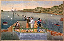
Europeans in
Dejima, the Dutch trading colony in the harbor of Nagasaki, early 19th century.
In 1641, all Westerners were thrown out of Japan. For the next two
centuries, Japan was free from Western contact, except for at the port
of Nagasaki, which Japan allowed Dutch merchant vessels to enter on a limited basis.
Japan's freedom from Western contact ended on 8 July 1853, when Commodore Matthew Perry of the U.S. Navy sailed a squadron of black-hulled warships into Edo (modern Tokyo) harbor. The Japanese told Perry to sail to Nagasaki but he refused. Perry sought to present a letter from U.S. President Millard Fillmore
to the emperor which demanded concessions from Japan. Japanese
authorities responded by stating that they could not present the letter
directly to the emperor, but scheduled a meeting on 14 July with a
representative of the emperor. On 14 July, the squadron sailed towards
the shore, giving a demonstration of their cannon's firepower thirteen
times. Perry landed with a large detachment of Marines and presented the
emperor's representative with Fillmore's letter. Perry said he would
return, and did so, this time with even more war ships. The U.S. show of
force led to Japan's concession to the Convention of Kanagawa
on 31 March 1854. This treaty conferred extraterritoriality on American
nationals, as well as, opening up further treaty ports beyond Nagasaki.
This treaty was followed up by similar treaties with the United
Kingdom, the Netherlands, Russia and France. These events made Japanese
authorities aware that the country was lacking technologically and
needed the strength of industrialism in order to keep their power. This
realisation eventually led to a civil war and political reform known the
Meiji Restoration.
The Meiji Restoration
of 1868 led to administrative overhaul, deflation and subsequent rapid
economic development. Japan had limited natural resources of her own and
sought both overseas markets and sources of raw materials, fuelling a
drive for imperial conquest which began with the defeat of China in
1895.
Taiwan, ceded by Qing dynasty China, became the first Japanese colony. In 1899, Japan won agreements from the great powers'
to abandon extraterritoriality for their citizens, and an alliance with
the United Kingdom established it in 1902 as an international power.
Its spectacular defeat of Russia's navy in 1905 gave it the southern
half of the island of Sakhalin; exclusive Japanese influence over Korea (propinquity); the former Russian lease of the Liaodong Peninsula with Port Arthur (Lüshunkou); and extensive rights in Manchuria (see the Russo-Japanese War).
Three
Koreans shot for pulling up rails as a protest against seizure of land without payment by Japanese.
The Empire of Japan and the Joseon Dynasty
in Korea formed bilateral diplomatic relations in 1876. China lost its
suzerainty of Korea after defeat in the Sino-Japanese War in 1894.
Russia also lost influence on the Korean peninsula with the Treaty of Portsmouth as a result of the Russo-Japanese war in 1904. The Joseon Dynasty became increasingly dependent on Japan. Korea became a protectorate of Japan with the Japan–Korea Treaty of 1905. Korea was then de jure annexed to Japan with the Japan–Korea Treaty of 1910.
Japan was now one of the most powerful forces in the Far East, and in 1914, it entered World War I on the side of the Allies, seizing German-occupied Kiaochow and subsequently demanding Chinese acceptance of Japanese political influence and territorial acquisitions (Twenty-One Demands, 1915). Mass protests in Peking
in 1919 which sparked widespread Chinese nationalism, coupled with
Allied (and particularly U.S.) opinion led to Japan's abandonment of
most of the demands and Kiaochow's 1922 return to China. Japan received
the German territory from the Treaty of Versailles.
Tensions with China increased over the 1920s, and in 1931 Japanese Kwantung Army
based in Manchuria seized control of the region without admission from
Tokyo. Intermittent conflict with China led to full-scale war in
mid-1937, drawing Japan toward an overambitious bid for Asian hegemony (Greater East Asia Co-Prosperity Sphere), which ultimately led to defeat and the loss of all its overseas territories after World War II (see Japanese expansionism and Japanese nationalism).
After World War II
Decolonisation and the rise of nationalism in Asia
In
the aftermath of World War II, European colonies, controlling more than
one billion people throughout the world, still ruled most of the Middle
East, South East Asia, and the Indian Subcontinent. However, the image
of European pre-eminence was shattered by the wartime Japanese
occupations of large portions of British, French, and Dutch territories
in the Pacific. The destabilisation of European rule led to the rapid
growth of nationalist movements in Asia—especially in Indonesia, Malaya, Burma, and French Indochina (Vietnam, Cambodia, and Laos).
The war, however, only accelerated forces already in existence
undermining Western imperialism in Asia. Throughout the colonial world,
the processes of urbanisation and capitalist investment created
professional merchant classes that emerged as new Westernised elites.
While imbued with Western political and economic ideas, these classes
increasingly grew to resent their unequal status under European rule.
British in India and the Middle East
In India, the westward movement of Japanese forces towards Bengal during
World War II had led to major concessions on the part of British
authorities to Indian nationalist leaders. In 1947, the United Kingdom,
devastated by war and embroiled in an economic crisis at home, granted British India its independence as two nations: India and Pakistan. Myanmar (Burma) and Sri Lanka (Ceylon),
which is also part of British India, also gained their independence
from the United Kingdom the following year, in 1948. In the Middle East,
the United Kingdom granted independence to Jordan in 1946 and two years later, in 1948, ended its mandate of Palestine becoming the independent nation of Israel.
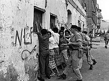
Dutch soldiers control the papers of
Javanese women, 1946
Following the end of the war, nationalists in Indonesia demanded
complete independence from the Netherlands. A brutal conflict ensued,
and finally, in 1949, through United Nations
mediation, the Dutch East Indies achieved independence, becoming the
new nation of Indonesia. Dutch imperialism moulded this new multi-ethnic
state comprising roughly 3,000 islands of the Indonesian archipelago
with a population at the time of over 100 million.
The end of Dutch rule opened up latent tensions between the
roughly 300 distinct ethnic groups of the islands, with the major ethnic
fault line being between the Javanese and the non-Javanese.
Dutch New Guinea was under the Dutch administration until 1962 (see also West New Guinea dispute).
United States in Asia
In
the Philippines, the U.S. remained committed to its previous pledges to
grant the islands their independence, and the Philippines became the
first of the Western-controlled Asian colonies to be granted
independence post-World War II. However, the Philippines remained under
pressure to adopt a political and economic system similar to the U.S.
This aim was greatly complicated by the rise of new political forces. During the war, the Hukbalahap (People's Army), which had strong ties to the Communist Party of the Philippines
(PKP), fought against the Japanese occupation of the Philippines and
won strong popularity among many sectors of the Filipino working class
and peasantry. In 1946, the PKP participated in elections as part of the
Democratic Alliance. However, with the onset of the Cold War,
its growing political strength drew a reaction from the ruling
government and the United States, resulting in the repression of the PKP
and its associated organizations. In 1948, the PKP began organizing an
armed struggle against the government and continued U.S. military
presence. In 1950, the PKP created the People's Liberation Army (Hukbong Mapagpalaya ng Bayan),
which mobilized thousands of troops throughout the islands. The
insurgency lasted until 1956 when the PKP gave up armed struggle.
In 1968, the PKP underwent a split, and in 1969 the Maoist faction of the PKP created the New People's Army.
Maoist rebels re-launched an armed struggle against the government and
the U.S. military presence in the Philippines, which continues to this
day.
France in Indochina
Post-war resistance to French rule
French Marine commandos wade ashore off the
Annam coast in July 1950
France remained determined to retain its control of Indochina. However, in Hanoi, in 1945, a broad front of nationalists and communists led by Ho Chi Minh declared an independent Democratic Republic of Vietnam, commonly referred to as the Viet Minh
regime by Western outsiders. France, seeking to regain control of
Vietnam, countered with a vague offer of self-government under French
rule. France's offers were unacceptable to Vietnamese nationalists; and
in December 1946 the Việt Minh launched a rebellion against the French
authority governing the colonies of French Indochina. The first few
years of the war involved a low-level rural insurgency against French
authority. However, after the Chinese communists reached the Northern
border of Vietnam in 1949, the conflict turned into a conventional war
between two armies equipped with modern weapons supplied by the United
States and the Soviet Union. Meanwhile, the France granted the State of Vietnam based in Saigon independence in 1949 while Laos and Cambodia
received independence in 1953. The US recognized the regime in Saigon,
and provided the French military effort with military aid.
Meanwhile, in Vietnam, the French war against the Viet Minh
continued for nearly eight years. The French were gradually worn down by
guerrilla and jungle fighting. The turning point for France occurred at
Dien Bien Phu in 1954, which resulted in the surrender of ten thousand French troops. Paris was forced to accept a political settlement that year at the Geneva Conference, which led to a precarious set of agreements regarding the future political status of Laos, Cambodia, and Vietnam.
