Search This Blog

Friday, May 5, 2023

Mason–Dixon line

From Wikipedia, the free encyclopedia
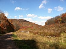
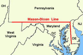
Map of the original Mason–Dixon line
 
Illustration of Charles Mason and Jeremiah Dixon surveying the line
 

The Mason–Dixon line, also called the Mason and Dixon line or Mason's and Dixon's line, is a demarcation line separating four U.S. states, forming part of the borders of Pennsylvania, Maryland, Delaware, and West Virginia (part of Virginia until 1863). It was surveyed between 1763 and 1767 by Charles Mason and Jeremiah Dixon as part of the resolution of a border dispute involving Maryland, Pennsylvania, and Delaware in colonial America. The dispute had its origins almost a century earlier in the somewhat confusing proprietary grants by King Charles I to Lord Baltimore (Maryland) and by King Charles II to William Penn (Pennsylvania and Delaware).

The largest portion of the Mason–Dixon line, along the southern Pennsylvania border, later became informally known as the boundary between the Southern slave states and Northern free states. This usage came to prominence during the debate around the Missouri Compromise of 1820, when drawing boundaries between slave and free territory was an issue, and resurfaced during the American Civil War, with border states also coming into play. The Confederate States of America claimed the Virginia portion of the line as part of its northern border, although it never exercised meaningful control that far north – especially after West Virginia separated from Virginia and joined the Union as a separate state in 1863. It is still used today in the figurative sense of a line that separates the Northeast and South culturally, politically, and socially (see Dixie).

Background

Historical marker at Front and South Sts., Philadelphia, Pennsylvania, the starting point for the survey
 

Maryland's charter of 1632 granted Cecil Calvert land north of the entire length of the Potomac River up to the 40th parallel. A problem arose when Charles II granted a charter for Pennsylvania in 1681. The grant defined Pennsylvania's southern border as identical to Maryland's northern border, but described it differently, as Charles relied on an inaccurate map. The terms of the grant clearly indicate that Charles II and William Penn believed the 40th parallel would intersect the Twelve-Mile Circle around New Castle, Delaware, when in fact it falls north of the original boundaries of the City of Philadelphia, the site of which Penn had already selected for his colony's capital city. Negotiations ensued after the problem was discovered in 1681. A compromise proposed by Charles II in 1682, which might have resolved the issue, was undermined by Penn receiving the additional grant of the "Three Lower Counties" along Delaware Bay, which later became the Delaware Colony, a satellite of Pennsylvania. Maryland considered these lands part of its original grant.

The conflict became more of an issue when settlement extended into the interior of the colonies. In 1732 the Proprietary Governor of Maryland, Charles Calvert, 5th Baron Baltimore, signed a provisional agreement with William Penn's sons, which drew a line somewhere in between and renounced the Calvert claim to Delaware. But later, Lord Baltimore claimed that the document he had signed did not contain the terms he had agreed to, and refused to put the agreement into effect. Beginning in the mid-1730s, violence erupted between settlers claiming various loyalties to Maryland and Pennsylvania. The border conflict would be known as Cresap's War.

Progress was made after a Court of Chancery ruling affirming the 1732 agreement, but the issue remained unresolved until Frederick Calvert, 6th Baron Baltimore ceased contesting the claims on the Maryland side and accepted the earlier agreements. Maryland's border with Delaware was to be based on the Transpeninsular Line and the Twelve-Mile Circle around New Castle. The Pennsylvania–Maryland border was defined as the line of latitude 15 miles (24 km) south of the southernmost house in Philadelphia (on what is today South Street). As part of the settlement, the Penns and Calverts commissioned the English team of Charles Mason and Jeremiah Dixon to survey the newly established boundaries between the Province of Pennsylvania, the Province of Maryland, and Delaware Colony.

In 1779, Pennsylvania and Virginia agreed "To extend Mason's and Dixon's line, due west, five degrees of longitude, to be computed from the river Delaware, for the southern boundary of Pennsylvania, and that a meridian, drawn from the western extremity thereof to the northern limit of the said state, be the western boundary of Pennsylvania for ever."

After Pennsylvania abolished slavery in 1781, the east-west part of this line and the Ohio River became a border between slave and free states, with Delaware retaining slavery until the 13th Amendment was ratified in 1865.

Geography of the line

Diagram of the survey lines creating the Mason–Dixon line and "The Wedge"
 
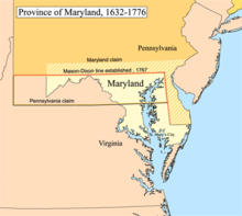
Province of Maryland, 1632–1776

Mason and Dixon's actual survey line began to the south of Philadelphia, Pennsylvania, and extended from a benchmark east to the Delaware River and west to what was then the boundary with western Virginia.

The surveyors also fixed the boundary between Delaware and Pennsylvania and the approximately north–south portion of the boundary between Delaware and Maryland. Most of the Delaware–Pennsylvania boundary is an arc, and the Delaware–Maryland boundary does not run truly north–south because it was intended to bisect the Delmarva Peninsula rather than follow a meridian.

The Maryland–Pennsylvania boundary is an east–west line with an approximate mean latitude of 39°43′20″ N (Datum WGS 84). In reality, the east-west Mason–Dixon line is not a true straight line in the geometric sense, but is instead a series of many adjoining line segments, following a path between latitude 39°43′15″ N and 39°43′23″ N.

The surveyors also extended the boundary line 40 miles (64 km) west of Maryland's western boundary, into territory that was still in dispute between Pennsylvania and Virginia, though this was contrary to their original charter. Mason and Dixon's survey was finished on October 9, 1767, about 31 miles (50 km) east of what is now Pennsylvania's southwest corner.

In 1774, commissioners from Pennsylvania and Virginia met to negotiate their boundary, which at the time involved Pennsylvania's southern border west of Maryland and its entire western border. Both sides agreed that Pennsylvania's grant made its western border a tracing of the course of the Delaware River, displaced five degrees (approximately 265 miles) to the west. And both sides thought this would place Fort Pitt in Virginia territory (in fact it would not have). With that in mind, the governor of Pennsylvania argued that, despite the agreement reached with Maryland, Pennsylvania's southern border west of Maryland was still the 39th parallel, about 50 miles (80 km) south of the Mason–Dixon line. Negotiations continued for five years, with a series of proposed lines. In the end, a compromise was reached: the Mason–Dixon line would be extended west to a point five degrees west of the Delaware River. To compensate Pennsylvania for the claimed territory lost, its western boundary would be run due north rather than copying the course of the Delaware River.

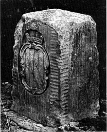
The Mason–Dixon line was marked by stones every mile 1 mile (1.6 km) and "crownstones" every 5 miles (8.0 km), using stone shipped from England. The Maryland side says "(M)" and the Delaware and Pennsylvania sides say "(P)". Crownstones include the two coats of arms. Today, while a number of the original stones are missing or buried, many are still visible, resting on public land and protected by iron cages.

Mason and Dixon confirmed earlier survey work, which delineated Delaware's southern boundary from the Atlantic Ocean to the "Middle Point" stone (along what is today known as the Transpeninsular Line). They proceeded nearly due north from this to the Pennsylvania border.

Later, the line was marked in places by additional benchmarks and survey markers. The lines have been resurveyed several times over the centuries without substantive changes to Mason's and Dixon's work. The stones may be a few, to a few hundred, feet east or west of the point Mason and Dixon thought they were: in any event, the line drawn from stone to stone forms the legal boundary.

History

A "crownstone" boundary monument on the Mason–Dixon line. These markers were originally placed at every 5th mile (8.0 km) along the line, ornamented with family coats of arms facing the state that they represented. The coat of arms of Maryland's founding Calvert family is shown. On the other side are the arms of William Penn.

The line was established to end a boundary dispute between the British colonies of Maryland and Pennsylvania/Delaware. Maryland had been granted the territory north of the Potomac River up to the 40th parallel. Pennsylvania's grant defined the colony's southern boundary as following a 12-mile (radius) circle (19 km) counter-clockwise from the Delaware River until it hit "the beginning of the fortieth degree of Northern latitude." From there the boundary was to follow the 40th parallel due west for five degrees of longitude. But the 40th parallel does not, in fact, intersect the 12-mile circle, instead lying significantly farther north. Thus Pennsylvania's southern boundary as defined in its charter was contradictory and unclear. The most serious problem was that the Maryland claim would put Philadelphia, the major city in Pennsylvania, within Maryland.

The dispute was peacefully resolved in 1767 when the boundary was fixed as follows:

  • Between Pennsylvania and Maryland:
    • The parallel (latitude line) 15 miles (24 km) south of the then southernmost point in Philadelphia, measured to be at about 39°43′ N and agreed upon as the Maryland–Pennsylvania line.
  • Between Delaware and Maryland:
    • The existing east–west transpeninsular line from the Atlantic Ocean to the Chesapeake Bay, as far as its midpoint from the Atlantic.
    • A 12-mile (radius) circle (12 mi (19 km)) around the city of New Castle, Delaware.
    • A "tangent line" connecting the midpoint of the transpeninsular line to the western side of the 12-mile circle.
    • A "north line" along the meridian (line of longitude) from the tangent point to the Maryland-Pennsylvania border.
    • Should any land within the 12-mile circle fall west of the north line, it would remain part of Delaware. (This was indeed the case, and this border is the "arc line".)
"A Plan of the West Line or Parallel of Latitude" by Charles Mason, 1768

The disputants engaged an expert British team, astronomer Charles Mason and surveyor Jeremiah Dixon, to survey what became known as the Mason–Dixon line. It cost the Calverts of Maryland and the Penns of Pennsylvania £3,512 9/ (equivalent to £481,520 in 2021) to have 244 miles (393 km) surveyed with such accuracy. To them the money was well spent, for in a new country there was no other way of establishing ownership.

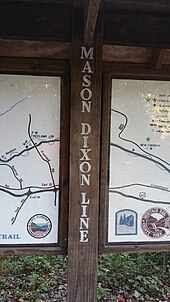
"Mason Dixon Line Trail" The Mason Dixon Trail stretches from Pennsylvania to Delaware and is a popular attraction to tourists.

The Mason–Dixon line is made up of four segments corresponding to the terms of the settlement:

  • the tangent line
  • the north line
  • the arc line
  • the 39°43′ N parallel

The most difficult task was fixing the tangent line, as they had to confirm the accuracy of the transpeninsular line midpoint and the 12-mile circle, determine the tangent point along the circle, and then actually survey and monument the border. They then surveyed the north and arc lines. They did this work between 1763 and 1767. This actually left a small wedge of land in dispute between Delaware and Pennsylvania until 1921.

In April 1765, Mason and Dixon began their survey of the more famous Maryland–Pennsylvania line. They were commissioned to run it for a distance of five degrees of longitude west from the Delaware River, fixing the western boundary of Pennsylvania (see the entry for Yohogania County). However, in October 1767, at Dunkard Creek near Mount Morris, Pennsylvania, nearly 244 miles (393 km) west of the Delaware, their Iroquois guides refused to go any further, having reached the border of their lands with the Lenape, with whom they were engaged in hostilities. As a result, the group was forced to quit, and on October 11, they made their final observations, 233 miles (375 km) from their starting point.

In 1784, surveyors David Rittenhouse and Andrew Ellicott and their crew completed the survey of the Mason–Dixon line to the southwest corner of Pennsylvania, five degrees from the Delaware River. Other surveyors continued west to the Ohio River. The section of the line between the southwestern corner of Pennsylvania and the river is the county line between Marshall and Wetzel counties, West Virginia.

As the 20th century moved along and modern roadways came to northeastern Maryland and Delaware, the old boundary line was noted by construction crews, newspaper columnists, and the traveling public. When contractors started working on a section of Route 40, a modern dual highway between Elkton and Glasgow, they discovered a time and weather battered original Mason Dixon Marker. It was relocated to northside of the highway and when the governors of Delaware and Maryland dedicated the highway on June 26, 1941, newspaper reporters took note of the ancient old relic.

Although greatly mangled by traffic in the second half of the twentieth century, it still stands today. But long before bulldozers and other heavy equipment started moving earth for the dual highway before World War II, there were concerns about the preservation of this monument. In 1885, the Cecil Democrat reported that after 119-years, the stone on the road from Elkton to Glasgow had "yielded to the action of the elements and fell over." The editor urged the Cecil County Commissioners, Commissioner of the Land Office, Governor or some public minded citizen to preserve this "old time-honored, moss-covered relic of a generation, which has passed away. . . "

On November 14, 1963, during the bicentennial of the Mason–Dixon line, U.S. President John F. Kennedy opened a newly completed section of Interstate 95 where it crossed the Maryland–Delaware border. After the president, flanked by the governors of Delaware and Maryland, cut a ribbon opening the Interstate, they moved to the grassy median strip where a replica Mason and Dixon Marker had been placed for the bicentennial. There President Kennedy and the governors unveiled a limestone replica. It was one of his last public appearances before his assassination in Dallas, Texas. The Delaware Turnpike and the Maryland portion of the new road were later designated as the John F. Kennedy Memorial Highway.

The Mason–Dixon line has been resurveyed three times: in 1849, 1900, and in the 1960s.

Systematic errors and experiments to weigh the Earth

Mason and Dixon could only do the work as accurately as they did due to the work of Nevil Maskelyne, some of whose instruments they used. There was keen interest in their work and much communication between the surveyors, Maskelyne and other members of the British Scientific establishment in the Royal Society in Britain, notably Henry Cavendish.

During such survey work, it is normal to survey from point to point along the line and then survey back to the starting point, where if there were no errors the origin and re-surveyed position would coincide. Normally the return errors would be random – i.e. the return survey errors compared to the intermediate points back to the start point would be spatially randomly distributed around the start point. Mason and Dixon found that there were larger than expected systematic errors, i.e. non-random errors, that led the return survey consistently being in one direction away from the starting point.

When this information got back to the Royal Society members, Henry Cavendish realised that this may have been due to the gravitational pull of the Allegheny Mountains deflecting the theodolite plumb-bobs and spirit levels. Maskelyne then proposed measuring the gravitational force causing this deflection induced by the pull of a nearby mountain upon a plumb-bob in 1772 and sent Mason (who had returned to Britain) on a site survey through central England and Scotland to find a suitable location during the summer of 1773. Mason selected Schiehallion at which to conduct what became known as the Schiehallion experiment, which was carried out primarily by Maskelyne and determined the density of the Scottish mountain. Several years later Cavendish used a very sensitive torsion balance to carry out the Cavendish experiment and determine the average density of Earth.

In culture

Name

It is unlikely that Mason and Dixon ever heard the phrase "Mason–Dixon line". The official report on the survey, issued in 1768, did not even mention their names. While the term was used occasionally in the decades following the survey, it came into popular use when the Missouri Compromise of 1820 named "Mason and Dixon's line" as part of the boundary between slave territory and free territory.

Symbolism

In popular usage to people from the United States, the Mason–Dixon line symbolizes a cultural boundary between the North and the South (Dixie). Originally "Mason and Dixon's Line" simply referred to the border between Pennsylvania (including "the Delaware Counties") and Maryland. However, it has been used metaphorically to describe the entire boundary between slave and free states during the 19th-century. After Pennsylvania abolished slavery, it served as a demarcation line for the legality of slavery. Technically speaking, that demarcation did not extend beyond Pennsylvania where Virginia, Maryland, and Delaware, all slave states, lay south and east of the boundary. Also lying north and east of the boundary was New Jersey, where slavery was formally abolished in 1846, but former slaves continued to be "apprenticed" to their masters until the passage of the Thirteenth Amendment to the United States Constitution in 1865.

The Missouri Compromise line (Parallel 36°30′ north) had a much clearer geographic connection to slavery in the United States leading up to the Civil War.

In popular culture

Popular culture contains a multitude of references to the Mason–Dixon line as a general geographic division, or character names evoking it, although a minority of those specifically relate to the line itself.

Film

Cartoons

  • The line makes several appearances in the 1953 Bugs Bunny cartoon "Southern Fried Rabbit". The line separates the drought-affected North from which the "Yankee" Bugs leaves in search of carrots in the green lands of the "Dixie" South, the latter being guarded by Yosemite Sam, who thinks the Civil War is still ongoing.

Literature

Music

Sports

  • In the regional baseball rivalry between the New York Yankees and the Boston Red Sox, the theoretical border that separates population centers that are majority-Red Sox fans from majority-Yankees fans in Connecticut is sometimes called the "Munson-Nixon Line", in a (somewhat parodial) reference to the Mason–Dixon line. Credited to Steve Rushin of Sports Illustrated, the line is named for famed Yankee catcher Thurman Munson and Red Sox right fielder Trot Nixon. In the book The Nine Nations of North America, this line is mentioned (but not named) as the true marker of whether a given location in Connecticut is socially part of New England or the rust belt region the author calls The Foundry. This line has moved over the years, but it's still there.
Centralia mine fire

From Wikipedia, the free encyclopedia
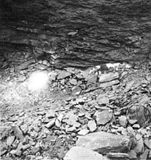
A small part of the Centralia mine fire after being exposed during excavation in 1969
 
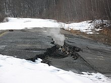
View of smoke rising through a fissure in the ground in the closed-off area of former Pennsylvania Route 61. The melted snow, which covered the ground around it, shows areas where heat is escaping from the ground below.

The Centralia mine fire is a coal-seam fire that has been burning in the labyrinth of abandoned coal mines underneath the borough of Centralia, Pennsylvania, United States, since at least May 27, 1962. Its original cause and start date are still a matter of debate. It is burning in underground coal mines at depths of up to 300 ft (90 m) over an 8 mi (13 km) stretch of 3,700 acres (15 km2). At its current rate, it could continue to burn for over 250 years. It has caused most of the town to be abandoned: by 2017, the population had dwindled to 5 residents from around 1,500 at the time the fire is believed to have started, and most of the buildings have been razed.

Background

On May 7, 1962, the Centralia Council met to discuss the approaching Memorial Day and how the town would go about cleaning up the Centralia landfill, which was introduced earlier that year. The 300-foot-wide, 75-foot-long (91 m × 23 m) pit was made up of a 50-foot-deep (15 m) strip mine that had been cleared by Edward Whitney in 1935, and came very close to the northeast corner of Odd Fellows Cemetery. There were eight illegal dumps spread about Centralia, and the council's intention in creating the landfill was to stop the illegal dumping, as new state regulations had forced the town to close an earlier dump west of St. Ignatius Cemetery. Trustees at the cemetery were opposed to the landfill's proximity to the cemetery, but recognized the illegal dumping elsewhere as a serious problem and envisioned that the new pit would resolve it.

Pennsylvania had passed a precautionary law in 1956 to regulate landfill use in strip mines, as landfills were known to cause destructive mine fires. The law required a permit and regular inspection for a municipality to use such a pit. George Segaritus, a regional landfill inspector who worked for the Department of Mines and Mineral Industries (DMMI), became concerned about the pit when he noticed holes in the walls and floor, as such mines often cut through older mines underneath. Segaritus informed Joseph Tighe, a Centralia councilman, that the pit would require filling with an incombustible material.

Fire

The Buck Vein Outcrop
 
A plume of smoke wafts from the ground.
 
A DEP monitoring hole
 
A DEP underground reading of 187 °F (86 °C)

This was a world where no human could live, hotter than the planet Mercury, its atmosphere as poisonous as Saturn's. At the heart of the fire, temperatures easily exceeded 1,000 degrees Fahrenheit [540 degrees Celsius]. Lethal clouds of carbon monoxide and other gases swirled through the rock chambers.

— David DeKok, Unseen Danger: A Tragedy of People, Government, and the Centralia Mine Fire (University of Pennsylvania Press, 1986)

Plan and execution

The town council arranged for cleanup of the strip mine dump, but council minutes do not describe the proposed procedure. DeKok surmises that the process—setting it on fire—was not specified because state law prohibited dump fires. Nonetheless, the Centralia council set a date and hired five members of the volunteer firefighter company to clean up the landfill.

A fire was ignited to clean the dump on May 27, 1962, and water was used to douse the visible flames that night. However, flames were seen once more on May 29. Using hoses hooked up from Locust Avenue, another attempt was made to douse the fire that night. Another flare-up in the following week (June 4) caused the Centralia Fire Company to once again douse it with hoses. A bulldozer stirred up the garbage so that firemen could douse concealed layers of the burning waste. A few days later, a hole as wide as 15 ft (4.6 m) and several feet high was found in the base of the north wall of the pit. Garbage had concealed the hole and prevented it from being filled with incombustible material. It is possible that this hole led to the mine fire, as it provided a pathway to the labyrinth of old mines under the borough. Evidence indicates that, despite these efforts to douse the fire, the landfill continued to burn; on July 2, Monsignor William J. Burke complained about foul odors from the smoldering trash and coal reaching St. Ignatius Church. Even then, the Centralia council still allowed the dumping of garbage into the pit.

Clarence "Mooch" Kashner, the president of the Independent Miners, Breakermen, and Truckers union, came at the invitation of a council member to inspect the situation in Centralia. Kashner evaluated the events and called Gordon Smith, an engineer of the Department of Mines and Mineral Industries (DMMI) office in Pottsville. Smith told the town that he could dig out the smoldering material using a steam shovel for $175. A call was placed to Art Joyce, a mine inspector from Mount Carmel, who brought gas detection equipment for use on the swirling wisps of smoke now emanating from ground fissures in the north wall of the landfill pit. Tests concluded that the gases seeping from the large hole in the pit wall and from cracks in the north wall contained carbon monoxide concentrations typical of coal-mine fires.

Escalation

The Centralia Council sent a letter to the Lehigh Valley Coal Company (LVCC) as formal notice of the fire. It is speculated that the town council decided that hiding the true origin of the fire would serve better than alerting the LVCC of the truth, which would most likely end in receiving no help from them. In the letter, the borough described the starting of a fire "of unknown origin during a period of unusually hot weather".

Preceding an August 6 meeting at the fire site which would include officials from the LVCC and the Susquehanna Coal Company, Deputy Secretary of Mines James Shober Sr. expected that the representatives would inform him they could not afford mounting a project that would stop the mine fire. Therefore, Shober announced that he expected the state to finance the cost of digging out the fire, which was at that time around $30,000 (roughly equivalent to $269,000 in 2021). Another offer was made at the meeting, proposed by Centralia strip mine operator Alonzo Sanchez, who told members of council that he would dig out the mine fire free of charge as long as he could claim any coal he recovered without paying royalties to the Lehigh Valley Coal Company. Part of Sanchez's plan was to do exploratory drilling to estimate the scope of the mine fire, which was most likely why Sanchez's offer was rejected at the meeting. The drilling would have delayed the project, not to mention the legal problems with mining rights.

At the time, state mine inspectors were in the Centralia-area mines almost daily to check for lethal levels of carbon monoxide. Lethal levels were found on August 9, and all Centralia-area mines were closed the next day.

Early remediation attempts

First excavation project

Pressed at an August 12 meeting of the United Mine Works of America in Centralia, Secretary of Mines Lewis Evans sent a letter to the group on August 15 that claimed he had authorized a project to deal with the mine fire, and that bids for the project would be opened on August 17. Two days later, the contract was awarded to Bridy, Inc., a company near Mount Carmel, for an estimated $20,000 (roughly equivalent to $179,000 in 2021). Work on the project began August 22.

The Department of Mines and Mineral Industries (DMMI), who originally believed Bridy would need only to excavate 24,000 cu yd (18,000 m3) of earth, informed them that they were forbidden from doing any exploratory drilling in order to find the perimeter of the fire or how deep it was, and that they were to strictly follow plans drawn up by the engineers who did not believe that the fire was very big or active. The size and location of the fire was, instead, estimated based on the amount of steam issuing from the landfill rock.

Bridy, following the engineering team plan, began by digging on the northern perimeter of the dump pit rim and excavated about 200 ft (61 m) outward to expand the perimeter. However, the project was ultimately ineffective due to multiple factors. Intentional breaching of the subterranean mine chambers allowed large amounts of oxygen to rush in, greatly worsening the fire. Steve Kisela, a bulldozer operator in Bridy's project, said that the project was ineffective because the inrush of air helped the fire to move ahead of the excavation point by the time the section was drilled and blasted. Bridy was also using a 2.5 cu yd (1.9 m3) shovel, which was considered small for the project.

Furthermore, the state only permitted Bridy's team to work weekday shifts which were eight hours long and only occurred during the day time; commonly referred to as "first shift" in the mining industry. At one point, work was at a standstill for five days during the Labor Day weekend in early September. Finally, the fire was traveling in a northward direction which caused the fire to move deeper into the coal seam. This, combined with the work restrictions and inadequate equipment, greatly increased the excavation cost. Bridy had excavated 58,580 cu yd (44,790 m3) of earth by the time the project ran out of money and ended on October 29, 1962.

Second excavation project

On October 29, just prior to the termination of the Bridy project, a new project was proposed that involved flushing the mine fire. Crushed rock would be mixed with water and pumped into Centralia's mines ahead of the expected fire expansion. The project was estimated to cost $40,000 (roughly equivalent to $358,000 in 2021). Bids were opened on November 1, and the project was awarded to K&H Excavating with a low bid of $28,400 (roughly equivalent to $254,000 in 2021).

Drilling was conducted through holes spaced 20 ft (6.1 m) apart in a semicircular pattern along the edge of the landfill. However, this project was also ineffective due to multiple factors. Centralia experienced an unusually heavy period of snowfall and unseasonably low temperatures during the project. Winter weather caused the water supply lines to freeze. Furthermore, the rock-grinding machine froze during a windy blizzard. Both problems inhibited timely mixture and administration of the crushed-rock slurry. The DMMI also worried that the 10,000 cu yd (7,600 m3) of flushing material would not be enough to fill the mines, thus preventing the bore holes from filling completely. Partially filled boreholes would provide an escape route for the fire, rendering the project ineffective.

These problems quickly depleted funds. In response, Secretary Evans approved an additional $14,000 (roughly equivalent to $125,000 in 2021) to fund this project. Funding for the project ran out on March 15, 1963, with a total cost of $42,420 (roughly equivalent to $380,000 in 2021).

On April 11, steam issuing from additional openings in the ground indicated that the fire had spread eastward as far as 700 ft (210 m), and that the project had failed.

Third project

A three-option proposal was drawn up soon after that, although the project would be delayed until after the new fiscal year beginning July 1, 1963. The first option, costing $277,490, consisted of entrenching the fire and back-filling the trench with incombustible material. The second, costing $151,714, offered a smaller trench in an incomplete circle, followed by the completion of the circle with a flush barrier. The third plan was a "total and concerted flushing project" larger than the second project's flushing and costing $82,300. The state abandoned this project in 1963.

Later remediation projects

David DeKok began reporting on the mine fire for The News-Item in Shamokin beginning in late 1976. Between 1976 and 1986, he wrote over 500 articles about the mine fire. In 1979, locals became aware of the scale of the problem when a gas-station owner, then-mayor John Coddington, inserted a dipstick into one of his underground tanks to check the fuel level. When he withdrew it, it seemed hot. He lowered a thermometer into the tank on a string and was shocked to discover that the temperature of the gasoline in the tank was 172 °F (77.8 °C).

Beginning in 1980, adverse health effects were reported by several people due to byproducts of the fire: carbon monoxide, carbon dioxide, and low oxygen levels. Statewide attention to the fire began to increase, culminating in 1981 when a 12-year-old resident named Todd Domboski fell into a sinkhole 4 ft (1.2 m) wide by 150 ft (46 m) deep that suddenly opened beneath his feet in a backyard. He clung to a tree root until his cousin, 14-year-old Eric Wolfgang, saved his life by pulling him out of the hole. The plume of hot steam billowing from the hole was measured as containing a lethal level of carbon monoxide.

Possible origins

A number of competing hypotheses have arisen about the source of the Centralia mine fire. Some of them claim that the mine fire started before May 27, 1962. David DeKok says that the borough's deliberate burning of trash on May 27 to clean up the landfill in the former strip mine ignited a coal seam via an unsealed opening in the trash pit, which allowed the fire to enter the labyrinth of abandoned coal mines beneath Centralia.

Joan Quigley argues in her 2007 book The Day the Earth Caved In that the fire had in fact started the previous day, when a trash hauler dumped hot ash or coal discarded from coal burners into the open trash pit. She noted that borough council minutes from June 4, 1962, referred to two fires at the dump, and that five firefighters had submitted bills for "fighting the fire at the landfill area". The borough, by law, was responsible for installing a fire-resistant clay barrier between each layer of trash in the landfill, but fell behind schedule, leaving the barrier incomplete. This allowed the hot coals to penetrate the vein of coal underneath the pit and light the subsequent subterranean fire. In addition to the council minutes, Quigley cites "interviews with volunteer firemen, the former fire chief, borough officials, and several eyewitnesses" as her sources.

Another hypothesis is that the fire was burning long before the alleged trash dump fire. According to local legend, the Bast Colliery coal fire of 1932, set alight by an explosion, was never fully extinguished. In 1962, it reached the landfill area. Those who adhere to the Bast Theory believe that the dump fire is a separate fire unrelated to the Centralia mine fire. One man who disagrees is Frank Jurgill Sr., who claims he operated a bootleg mine with his brother in the vicinity of the landfill between 1960 and 1962. He says that if the Bast Colliery fire had never been put out, he and his brother would have been in it and killed by the gases. Based on this and due to contrary evidence, few hold this position, and it is given little credibility.

Centralia councilman Joseph Tighe proposed a different hypothesis: that Centralia's coal fire was actually started by an adjacent coal-seam fire that had been burning west of Centralia's. His belief is that the adjacent fire was at one time partially excavated, but it nonetheless set alight the landfill on May 27.

Another hypothesis arose from the letter sent to the Lehigh Valley Coal Company by the Centralia Council in the days after the mine fire was noticed. The letter describes "a fire of unknown origin [starting] on or about June 25, 1962, during a period of unusually hot weather". This may make a reference to the hypothesis of spontaneous combustion being the reason for the start of the landfill fire, a hypothesis accepted for many years by state and federal officials.

Aftermath

The location at which the former roadbed of Pennsylvania Route 61 terminates due to the mine fire.
 
As the joining row homes were demolished, the buttresses were constructed to support the walls of the remaining homes.

In 1984, Wilkes-Barre Representative Frank Harrison proposed legislation, which was approved by Congress which allocated more than $42 million for relocation efforts (equivalent to $110 million in 2021) Most of the residents accepted buyout offers and dispersed far away from the area. (Data from the 1990 United States Census shows that the nearby towns continued to lose population at the same rate as previous decades, suggesting the Centralians did not locate there.) A few families opted to stay despite urgings from Pennsylvania officials.

In 1992, Pennsylvania governor Bob Casey invoked eminent domain on all properties in the borough, condemning all the buildings within. A subsequent legal effort by residents to have the decision reversed failed. In 2002, the U.S. Postal Service revoked Centralia's ZIP code, 17927.

In 2009, Governor Ed Rendell began the formal eviction of Centralia residents. By early 2010, only 5 occupied homes remained, with the residents determined to stay. In lawsuits, the remaining residents alleged that they were victims of "massive fraud", "motivated primarily by interests in what is conservatively estimated at hundreds of millions of dollars of some of the best anthracite coal in the world". In July 2012, the last handful of residents in Centralia lost their appeal of a court decision upholding eminent domain proceedings and was ordered again to leave. State and local officials reached an agreement with the seven remaining residents on October 29, 2013, allowing them to live out their lives there, after which the rights of their properties will be taken through eminent domain.

The Centralia mine fire also extended beneath the town of Byrnesville, a few miles to the south. The town had to be abandoned and leveled.

The Centralia area has now grown to be a tourist attraction. Visitors come to see the smoke and/or steam on Centralia's empty streets and the abandoned portion of PA Route 61, popularly referred to as the Graffiti Highway.

As of April 2020, efforts began to cover up Graffiti Highway by the private owner of the road. The abandoned highway was covered with dirt in April 2020, generally blocking public access to the road.

Increased air pressure induced by the heat from the mine fires has interacted with heavy rainfalls in the area that rush into the abandoned mines to form Pennsylvania's only geyser, the Big Mine Run Geyser, which erupts on private property in nearby Ashland. The geyser has been kept open as a means of flood control.

The fire and its effects were featured in 2013 on America Declassified on the Travel Channel, and on Radiolab's Cities episode.

The Silent Hill video game series draws on these events, although the film is based in West Virginia.

Smelting

From Wikipedia, the free encyclopedia
 
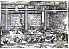
Electric phosphate smelting furnace in a TVA chemical plant (1942)

Smelting is a process of applying heat to an ore, to extract a base metal. It is a form of extractive metallurgy. It is used to extract many metals from their ores, including silver, iron, copper, and other base metals. Smelting uses heat and a chemical- reducing agent to decompose the ore, driving off other elements as gases or slag and leaving the metal base behind. The reducing agent is commonly a fossil fuel source of carbon, such as coke—or, in earlier times, charcoal. The oxygen in the ore binds to carbon at high temperatures as the chemical potential energy of the bonds in carbon dioxide (CO2) is lower than the bonds in the ore.

The carbon source acts as a chemical reactant to remove oxygen from the ore, yielding the purified metal element as a product. The carbon source is oxidized in two stages. First, carbon (C) combusts with oxygen (O2) in the air to produce carbon monoxide (CO). Second, the carbon monoxide reacts with the ore (e.g. Fe2O3) and removes one of its oxygen atoms, releasing carbon dioxide (CO2). After successive interactions with carbon monoxide, all of the oxygen in the ore will be removed, leaving the raw metal element (e.g. Fe). As most ores are impure, it is often necessary to use flux, such as limestone (or dolomite), to remove the accompanying rock gangue as slag. This calcination reaction also frequently emits carbon dioxide.

Smelting most prominently takes place in a blast furnace to produce pig iron, which is converted into steel.

Plants for the electrolytic reduction of aluminium are also referred to as aluminium smelters.

Process

Copper smelter, Chelyabinsk Oblast, Russia
 
Electrolytic cells at an aluminum smelter in Saint-Jean-de-Maurienne, France

Smelting involves more than just melting the metal out of its ore. Most ores are the chemical compound of the metal and other elements, such as oxygen (as an oxide), sulfur (as a sulfide), or carbon and oxygen together (as a carbonate). To extract the metal, workers must make these compounds undergo a chemical reaction. Smelting, therefore, consists of using suitable reducing substances that combine with those oxidizing elements to free the metal.

Roasting

In the case of sulfides and carbonates, a process called "roasting" removes the unwanted carbon or sulfur, leaving an oxide, which can be directly reduced. Roasting is usually carried out in an oxidizing environment. A few practical examples:

  • Malachite, a common ore of copper is primarily copper carbonate hydroxide Cu2(CO3)(OH)2. This mineral undergoes thermal decomposition to 2CuO, CO2, and H2O in several stages between 250 °C and 350 °C. The carbon dioxide and water are expelled into the atmosphere, leaving copper(II) oxide, which can be directly reduced to copper as described in the following section titled Reduction.
  • Galena, the most common mineral of lead, is primarily lead sulfide (PbS). The sulfide is oxidized to a sulfite (PbSO3), which thermally decomposes into lead oxide and sulfur dioxide gas (PbO and SO2). The sulfur dioxide is expelled (like the carbon dioxide in the previous example), and the lead oxide is reduced as below.

Reduction

Reduction is the final, high-temperature step in smelting, in which the oxide becomes the elemental metal. A reducing environment (often provided by carbon monoxide, made by incomplete combustion in an air-starved furnace) pulls the final oxygen atoms from the raw metal. The required temperature varies both in absolute terms and in terms of the melting point of the base metal. Examples:

  • Iron oxide becomes metallic iron at roughly 1250 °C (2282 °F or 1523.15 K), almost 300 degrees below iron's melting point of 1538 °C (2800.4 °F or 1811.15 K).
  • Mercuric oxide becomes vaporous mercury near 550 °C (1022 °F or 823.15 K), almost 600 degrees above mercury's melting point of -38 °C (-36.4 °F or 235.15 K). Flux and slag can provide a secondary service after the reduction step is complete: they provide a molten cover on the purified metal, preventing contact with oxygen while still hot enough to readily oxidize. This prevents impurities from forming in the metal.

Fluxes

Metal workers use fluxes in smelting for several purposes, chief among them catalyzing the desired reactions and chemically binding to unwanted impurities or reaction products. Calcium oxide, in the form of lime, was often used for this purpose, since it could react with the carbon dioxide and sulfur dioxide produced during roasting and smelting to keep them out of the working environment.

History

Of the seven metals known in antiquity, only gold occurs regularly in its native form in the natural environment. The others – copper, lead, silver, tin, iron, and mercury – occur primarily as minerals, though copper is occasionally found in its native state in commercially significant quantities. These minerals are primarily carbonates, sulfides, or oxides of the metal, mixed with other components such as silica and alumina. Roasting the carbonate and sulfide minerals in the air converts them to oxides. The oxides, in turn, are smelted into the metal. Carbon monoxide was (and is) the reducing agent of choice for smelting. It is easily produced during the heating process, and as a gas comes into intimate contact with the ore.

In the Old World, humans learned to smelt metals in prehistoric times, more than 8000 years ago. The discovery and use of the "useful" metals – copper and bronze at first, then iron a few millennia later – had an enormous impact on human society. The impact was so pervasive that scholars traditionally divide ancient history into Stone Age, Bronze Age, and Iron Age.

In the Americas, pre-Inca civilizations of the central Andes in Peru had mastered the smelting of copper and silver at least six centuries before the first Europeans arrived in the 16th century, while never mastering the smelting of metals such as iron for use with weapon craft.

Tin and lead

In the Old World, the first metals smelted were tin and lead. The earliest known cast lead beads were found in the Çatalhöyük site in Anatolia (Turkey), and dated from about 6500 BC, but the metal may have been known earlier.

Since the discovery happened several millennia before the invention of writing, there is no written record of how it was made. However, tin and lead can be smelted by placing the ores in a wood fire, leaving the possibility that the discovery may have occurred by accident.

Lead is a common metal, but its discovery had relatively little impact in the ancient world. It is too soft to use for structural elements or weapons, though its high density relative to other metals makes it ideal for sling projectiles. However, since it was easy to cast and shape, workers in the classical world of Ancient Greece and Ancient Rome used it extensively to pipe and store water. They also used it as a mortar in stone buildings.

Tin was much less common than lead and is only marginally harder, and had even less impact by itself.

Copper and bronze

Casting bronze ding-tripods, from the Chinese Tiangong Kaiwu encyclopedia of Song Yingxing, published in 1637.

After tin and lead, the next metal smelted appears to have been copper. How the discovery came about is debated. Campfires are about 200 °C short of the temperature needed, so some propose that the first smelting of copper may have occurred in pottery kilns. (The development of copper smelting in the Andes, which is believed to have occurred independently of the Old World, may have occurred in the same way.)

The earliest current evidence of copper smelting, dating from between 5500 BC and 5000 BC, has been found in Pločnik and Belovode, Serbia. A mace head found in Turkey and dated to 5000 BC, once thought to be the oldest evidence, now appears to be hammered, native copper.

Combining copper with tin and/or arsenic in the right proportions produces bronze, an alloy that is significantly harder than copper. The first copper/arsenic bronzes date from 4200 BC from Asia Minor. The Inca bronze alloys were also of this type. Arsenic is often an impurity in copper ores, so the discovery could have been made by accident. Eventually, arsenic-bearing minerals were intentionally added during smelting.

Copper–tin bronzes, harder and more durable, were developed around 3500 BC, also in Asia Minor.

How smiths learned to produce copper/tin bronzes is unknown. The first such bronzes may have been a lucky accident from tin-contaminated copper ores. However, by 2000 BC, people were mining tin on purpose to produce bronze—which is remarkable as tin is a semi-rare metal, and even a rich cassiterite ore only has 5% tin. However early peoples learned about tin, they understood how to use it to make bronze by 2000 BC.

The discovery of copper and bronze manufacture had a significant impact on the history of the Old World. Metals were hard enough to make weapons that were heavier, stronger, and more resistant to impact damage than wood, bone, or stone equivalents. For several millennia, bronze was the material of choice for weapons such as swords, daggers, battle axes, and spear and arrow points, as well as protective gear such as shields, helmets, greaves (metal shin guards), and other body armor. Bronze also supplanted stone, wood, and organic materials in tools and household utensils—such as chisels, saws, adzes, nails, blade shears, knives, sewing needles and pins, jugs, cooking pots and cauldrons, mirrors, and horse harnesses. Tin and copper also contributed to the establishment of trade networks that spanned large areas of Europe and Asia and had a major effect on the distribution of wealth among individuals and nations.

Early iron smelting

The earlist Iron smelting was in Lejja, Nigeria. They have carbon-dated slag blocks to 2000 BCE. In a village square in Lejja, located about 15 kilometers south of the university town of Nsukka in southeastern Nigeria, lies what appears to be the oldest iron-smelting site in the world. Arranged in crescent shapes with mounds in the middle across a wide sitting area at Otobo Ejuona, as the arena is known, are hundreds of bits of smelting debris, or slags, recently carbon-dated to about 2000 BCE by a team of archaeologists and other experts from the University of Nigeria, Nsukka and Oxford University in the United Kingdom.

Evidence of iron smelting in Lejja Intensive smelting of iron took place at the site of Lejja, in south east Nigeria during prehistoric periods. This statement is substantiated by the extensive iron smelting debris left behind in Lejja. The debris could point not only to an extensive iron smelting period in the history of the site, but could even represent the remains of a once thriving industry. Iron smelting often involved the community as a whole, and its effects were usually far reaching; from changing the status and living standards of the smelters to the actual development of some African cultures 

The earliest evidence for iron-making is a small number of iron fragments with the appropriate amounts of carbon admixture found in the Proto-Hittite layers at Kaman-Kalehöyük and dated to 2200–2000 BCE. Souckova-Siegolová (2001) shows that iron implements were made in Central Anatolia in very limited quantities around 1800 BCE and were in general use by elites, though not by commoners, during the New Hittite Empire (∼1400–1200 BCE).

Archaeologists have found indications of iron working in Ancient Egypt, somewhere between the Third Intermediate Period and 23rd Dynasty (ca. 1100–750 BCE). Significantly though, they have found no evidence of iron ore smelting in any (pre-modern) period. In addition, very early instances of carbon steel were in production around 2000 years ago (around the first-century CE.) in northwest Tanzania, based on complex preheating principles. These discoveries are significant for the history of metallurgy.

Most early processes in Europe and Africa involved smelting iron ore in a bloomery, where the temperature is kept low enough so that the iron does not melt. This produces a spongy mass of iron called a bloom, which then must be consolidated with a hammer to produce wrought iron. The earliest evidence to date for the bloomery smelting of iron is found at Tell Hammeh, Jordan, and dates to 930 BCE (C14 dating).

Later iron smelting

From the medieval period, an indirect process began to replace the direct reduction in bloomeries. This used a blast furnace to make pig iron, which then had to undergo a further process to make forgeable bar iron. Processes for the second stage include fining in a finery forge. In the 13th century duringHigh Middle Ages the blast furnace was introduced by China who had been using it since as early as 200 b.c during the Qin dynasty. Puddling was also Introduced in the Industrial Revolution.

Both processes are now obsolete, and wrought iron is now rarely made. Instead, mild steel is produced from a Bessemer converter or by other means including smelting reduction processes such as the Corex Process.

Base metals

Cowles Syndicate of Ohio in Stoke-upon-Trent England, late 1880s. British Aluminium used the process of Paul Héroult about this time.

The ores of base metals are often sulfides. In recent centuries, reverberatory furnaces have been used to keep the charge being smelted separately from the fuel. Traditionally, they were used for the first step of smelting: forming two liquids, one an oxide slag containing most of the impurities, and the other a sulfide matte containing the valuable metal sulfide and some impurities. Such "reverb" furnaces are today about 40 meters long, 3 meters high, and 10 meters wide. Fuel is burned at one end to melt the dry sulfide concentrates (usually after partial roasting) which are fed through openings in the roof of the furnace. The slag floats over the heavier matte and is removed and discarded or recycled. The sulfide matte is then sent to the converter. The precise details of the process vary from one furnace to another depending on the mineralogy of the ore body.

While reverberatory furnaces produced slags containing very little copper, they were relatively energy inefficient and off-gassed a low concentration of sulfur dioxide that was difficult to capture; a new generation of copper smelting technologies has supplanted them. More recent furnaces exploit bath smelting, top-jetting lance smelting, flash smelting, and blast furnaces. Some examples of bath smelters include the Noranda furnace, the Isasmelt furnace, the Teniente reactor, the Vunyukov smelter, and the SKS technology. Top-jetting lance smelters include the Mitsubishi smelting reactor. Flash smelters account for over 50% of the world's copper smelters. There are many more varieties of smelting processes, including the Kivset, Ausmelt, Tamano, EAF, and BF.

Environmental and occupational health impacts

Smelting has serious effects on the environment, producing wastewater and slag and releasing such toxic metals as copper, silver, iron, cobalt, and selenium into the atmosphere. Smelters also release gaseous sulfur dioxide, contributing to acid rain, which acidifies soil and water.

The smelter in Flin Flon, Canada was one of the largest point sources of mercury in North America in the 20th century. Even after smelter releases were drastically reduced, landscape re-emission continued to be a major regional source of mercury. Lakes will likely receive mercury contamination from the smelter for decades, from both re-emissions returning as rainwater and leaching of metals from the soil.

Air pollution

Air pollutants generated by aluminium smelters include carbonyl sulfide, hydrogen fluoride, polycyclic compounds, lead, nickel, manganese, polychlorinated biphenyls, and mercury. Copper smelter emissions include arsenic, beryllium, cadmium, chromium, lead, manganese, and nickel. Lead smelters typically emit arsenic, antimony, cadmium and various lead compounds.

Wastewater

Wastewater pollutants discharged by iron and steel mills includes gasification products such as benzene, naphthalene, anthracene, cyanide, ammonia, phenols and cresols, together with a range of more complex organic compounds known collectively as polycyclic aromatic hydrocarbons (PAH). Treatment technologies include recycling of wastewater; settling basins, clarifiers and filtration systems for solids removal; oil skimmers and filtration; chemical precipitation and filtration for dissolved metals; carbon adsorption and biological oxidation for organic pollutants; and evaporation.

Pollutants generated by other types of smelters varies with the base metal ore. For example, aluminum smelters typically generate fluoride, benzo(a)pyrene, antimony and nickel, as well as aluminum. Copper smelters typically discharge cadmium, lead, zinc, arsenic and nickel, in addition to copper. Lead smelters may discharge antimony, asbestos, cadmium, copper and zinc, in addition to lead.

Health impacts

Labourers working in the smelting industry have reported respiratory illnesses inhibiting their ability to perform the physical tasks demanded by their jobs.

Regulations

In the United States, the Environmental Protection Agency has published pollution control regulations for smelters.

Agricultural education

From Wikipedia, the free encyclopedia https://en.wikipedia.org/wiki/Agr...