Search This Blog

Saturday, September 23, 2023

Superfund

From Wikipedia, the free encyclopedia
https://en.wikipedia.org/wiki/Superfund

Comprehensive Environmental Response, Compensation, and Liability Act of 1980
Great Seal of the United States
Long titleAn act to provide for liability, compensation, cleanup, and emergency response for hazardous substances released into the environment and the cleanup of inactive hazardous waste disposal sites.
Acronyms (colloquial)CERCLA
NicknamesSuperfund
Enacted bythe 96th United States Congress
Citations
Public lawP.L. 96-510
Statutes at Large94 Stat. 2767
Codification
Titles amended42 (Public Health)
U.S.C. sections created42 U.S.C. § 9601 et seq.
Legislative history
Major amendments
United States Supreme Court cases

Superfund is a United States federal environmental remediation program established by the Comprehensive Environmental Response, Compensation, and Liability Act of 1980 (CERCLA). The program is administered by the Environmental Protection Agency (EPA). The program is designed to investigate and cleanup sites contaminated with hazardous substances. Sites managed under this program are referred to as Superfund sites. There are 40,000 federal Superfund sites across the country, and approximately 1,300 of those sites have been listed on the National Priorities List (NPL). Sites on the NPL are considered the most highly contaminated and undergo longer-term remedial investigation and remedial action (cleanups).

The EPA seeks to identify parties responsible for hazardous substances released to the environment (polluters) and either compel them to clean up the sites, or it may undertake the cleanup on its own using the Superfund (a trust fund) and seek to recover those costs from the responsible parties through settlements or other legal means.

Approximately 70% of Superfund cleanup activities historically have been paid for by the potentially responsible parties (PRPs), reflecting the polluter pays principle. However, 30% of the time the responsible party either cannot be found or is unable to pay for the cleanup. In these circumstances, taxpayers had been paying for the cleanup operations. Through the 1980s, most of the funding came from an excise tax on petroleum and chemical manufacturers. However, in 1995, Congress chose not to renew this tax and the burden of the cost was shifted to taxpayers in the general public. Since 2001, most of the cleanup of hazardous waste sites has been funded through taxpayers generally. Despite its name, the program suffered from under-funding, and by 2014 Superfund NPL cleanups had decreased to only 8 sites, out of over 1,200. In November 2021, the Infrastructure Investment and Jobs Act reauthorized an excise tax on chemical manufacturers, for ten years starting in July 2022.

The EPA and state agencies use the Hazard Ranking System (HRS) to calculate a site score (ranging from 0 to 100) based on the actual or potential release of hazardous substances from a site. A score of 28.5 places a site on the National Priorities List, eligible for long-term, remedial action (i.e., cleanup) under the Superfund program. As of March 23, 2022, there were 1,333 sites listed; an additional 448 had been delisted, and 43 new sites have been proposed.

The Superfund law also authorizes federal natural resource agencies, primarily EPA, states and Native American tribes to recover natural resource damages caused by hazardous substances, though most states have and most often use their own versions of a state Superfund law. CERCLA created the Agency for Toxic Substances and Disease Registry (ATSDR).

The primary goal of a Superfund cleanup is to reduce the risks to human health through a combination of cleanup, engineered controls like caps and site restrictions such as groundwater use restrictions. A secondary goal is to return the site to productive use as a business, recreation or as a natural ecosystem. Identifying the intended reuse early in the cleanup often results in faster and less expensive cleanups. EPA's Superfund Redevelopment Program provides tools and support for site redevelopment.

History
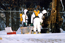
Workers in hazmat suits check the status of a cleanup site

CERCLA was enacted by Congress in 1980 in response to the threat of hazardous waste sites, typified by the Love Canal disaster in New York, and the Valley of the Drums in Kentucky. It was recognized that funding would be difficult, since the responsible parties were not easily found, and so the Superfund was established to provide funding through a taxing mechanism on certain industries and to create a comprehensive liability framework to be able to hold a broader range of parties responsible. The initial Superfund trust fund to clean up sites where a polluter could not be identified, could not or would not pay (bankruptcy or refusal), consisted of about $1.6 billion and then increased to $8.5 billion. Initially, the framework for implementing the program came from the oil and hazardous substances National Contingency Plan.

The EPA published the first Hazard Ranking System in 1981, and the first National Priorities List in 1983. Implementation of the program in early years, during the Ronald Reagan administration, was ineffective, with only 16 of the 799 Superfund sites cleaned up and only $40 million of $700 million in recoverable funds from responsible parties collected. The mismanagement of the program under Anne Gorsuch Burford, Reagan's first chosen Administrator of the agency, led to a congressional investigation and the reauthorization of the program in 1986 through an act amending CERCLA.

1986 amendments

The Superfund Amendments and Reauthorization Act of 1986 (SARA) added minimum cleanup requirements in Section 121 and required that most cleanup agreements with polluters be entered in federal court as a consent decree subject to public comment (section 122). This was to address sweetheart deals between industry and the Reagan-era EPA that Congress had discovered.

Environmental justice initiative

In 1994 President Bill Clinton issued Executive Order 12898, which called for federal agencies to make achieving environmental justice a requirement by addressing low income populations and minority populations that have experienced disproportionate adverse health and environmental effects as a result of their programs, policies, and activities. The EPA regional offices had to apply required guidelines for its Superfund managers to take into consideration data analysis, managed public participation, and economic opportunity when considering the geography of toxic waste site remediation. Some environmentalists and industry lobbyists saw the Clinton administration's environmental justice policy as an improvement, but the order did not receive bipartisan support. The newly elected Republican Congress made numerous unsuccessful efforts to significantly weaken the program. The Clinton administration then adopted some industry favored reforms as policy and blocked most major changes.

Decline of excise tax

Until the mid-1990s, most of the funding came from an excise tax on the petroleum and chemical industries, reflecting the polluter pays principle. Even though by 1995 the Superfund balance had decreased to about $4 billion, Congress chose not to reauthorize collection of the tax, and by 2003 the fund was empty. Since 2001, most of the funding for cleanups of hazardous waste sites has come from taxpayers. State governments pay 10 percent of cleanup costs in general, and at least 50 percent of cleanup costs if the state operated the facility responsible for contamination. By 2013 federal funding for the program had decreased from $2 billion in 1999 to less than $1.1 billion (in constant dollars).

In 2001 EPA used funds from the Superfund program to institute the cleanup of anthrax on Capitol Hill after the 2001 Anthrax Attacks. It was the first time the agency dealt with a biological release rather than a chemical or oil spill.

From 2000 to 2015, Congress allocated about $1.26 billion of general revenue to the Superfund program each year. Consequently, less than half the number of sites were cleaned up from 2001 to 2008, compared to before. The decrease continued during the Obama administration, and since under the direction of EPA Administrator Gina McCarthy Superfund cleanups decreased even more from 20 in 2009 to a mere 8 in 2014.

Reauthorization of excise tax

In November 2021 Congress reauthorized an excise tax on chemical manufacturers, under the Infrastructure Investment and Jobs Act. The new chemical excise tax is effective July 1, 2022, and is double the rate of the previous Superfund tax. The 2021 law also authorized $3.5 billion in emergency appropriations from the U.S. government general fund for hazardous site cleanups in the immediate future.

Provisions

PCB dredging operations on the Hudson River
Cleanup of the Housatonic River in Pittsfield, Massachusetts

CERCLA authorizes two kinds of response actions:

  1. Removal actions. These are typically short-term response actions, where actions may be taken to address releases or threatened releases requiring prompt response. Removal actions are classified as: (1) emergency; (2) time-critical; and (3) non-time critical. Removal responses are generally used to address localized risks such as abandoned drums containing hazardous substances, and contaminated surface soils posing acute risks to human health or the environment.
  2. Remedial actions. These are usually long-term response actions. Remedial actions seek to permanently and significantly reduce the risks associated with releases or threats of releases of hazardous substances, and are generally larger, more expensive actions. They can include measures such as using containment to prevent pollutants from migrating, and combinations of removing, treating, or neutralizing toxic substances. These actions can be conducted with federal funding only at sites listed on the EPA National Priorities List (NPL) in the United States and the territories. Remedial action by responsible parties under consent decrees or unilateral administrative orders with EPA oversight may be performed at both NPL and non-NPL sites, commonly called Superfund Alternative Sites in published EPA guidance and policy documents.

A potentially responsible party (PRP) is a possible polluter who may eventually be held liable under CERCLA for the contamination or misuse of a particular property or resource. Four classes of PRPs may be liable for contamination at a Superfund site:

  1. the current owner or operator of the site;
  2. the owner or operator of a site at the time that disposal of a hazardous substance, pollutant or contaminant occurred;
  3. a person who arranged for the disposal of a hazardous substance, pollutant or contaminant at a site; and
  4. a person who transported a hazardous substance, pollutant or contaminant to a site, who also has selected that site for the disposal of the hazardous substances, pollutants or contaminants.

The liability scheme of CERCLA changed commercial and industrial real estate, making sellers liable for contamination from past activities, meaning they can't pass liability onto unknowing buyers without any responsibility. Buyers also have to be aware of future liabilities.

The CERCLA also required the revision of the National Oil and Hazardous Substances Pollution Contingency Plan 9605(a)(NCP). The NCP guides how to respond to releases and threatened releases of hazardous substances, pollutants, or contaminants. The NCP established the National Priorities List, which appears as Appendix B to the NCP, and serves as EPA's information and management tool. The NPL is updated periodically by federal rulemaking.

The identification of a site for the NPL is intended primarily to guide the EPA in:

  • Determining which sites warrant further investigation to assess the nature and extent of risks to human health and the environment
  • Identifying what CERCLA-financed remedial actions may be appropriate
  • Notifying the public of sites, the EPA believes warrant further investigation
  • Notifying PRPs that the EPA may initiate CERCLA-financed remedial action.

Despite the name, the Superfund trust fund has lacked sufficient funds to clean up even a small number of the sites on the NPL. As a result, the EPA typically negotiates consent orders with PRPs to study sites and develop cleanup alternatives, subject to EPA oversight and approval of all such activities. The EPA then issues a Proposed Plans for remedial action for a site on which it takes public comment, after which it makes a cleanup decision in a Record of Decision (ROD). RODs are typically implemented under consent decrees by PRPs or under unilateral orders if consent cannot be reached. If a party fails to comply with such an order, it may be fined up to $37,500 for each day that non-compliance continues. A party that spends money to clean up a site may sue other PRPs in a contribution action under the CERCLA. CERCLA liability has generally been judicially established as joint and several among PRPs to the government for cleanup costs (i.e., each PRP is hypothetically responsible for all costs subject to contribution), but CERCLA liability is allocable among PRPs in contribution based on comparative fault. An "orphan share" is the share of costs at a Superfund site that is attributable to a PRP that is either unidentifiable or insolvent. The EPA tries to treat all PRPs equitably and fairly. Budgetary cuts and constraints can make more equitable treatment of PRPs more difficult.

Procedures

A national map of Superfund sites. Red indicates currently on final National Priority List, yellow is proposed, green is deleted (usually meaning having been cleaned up). This map is as of October 2013.
Superfund site assessment process

Upon notification of a potentially hazardous waste site, the EPA conducts a Preliminary Assessment/Site Inspection (PA/SI), which involves records reviews, interviews, visual inspections, and limited field sampling. Information from the PA/SI is used by the EPA to develop a Hazard Ranking System (HRS) score to determine the CERCLA status of the site. Sites that score high enough to be listed typically proceed to a Remedial Investigation/Feasibility Study (RI/FS).

The RI includes an extensive sampling program and risk assessment that defines the nature and extent of the site contamination and risks. The FS is used to develop and evaluate various remediation alternatives. The preferred alternative is presented in a Proposed Plan for public review and comment, followed by a selected alternative in a ROD. The site then enters into a Remedial Design phase and then the Remedial Action phase. Many sites include long-term monitoring. Once the Remedial Action has been completed, reviews are required every five years, whenever hazardous substances are left onsite above levels safe for unrestricted use.

  • The CERCLA information system (CERCLIS) is a database maintained by the EPA and the states that lists sites where releases may have occurred, must be addressed, or have been addressed. CERCLIS consists of three inventories: the CERCLIS Removal Inventory, the CERCLIS Remedial Inventory, and the CERCLIS Enforcement Inventory.
  • The Superfund Innovative Technology Evaluation (SITE) program supports development of technologies for assessing and treating waste at Superfund sites. The EPA evaluates the technology and provides an assessment of its potential for future use in Superfund remediation actions. The SITE program consists of four related components: the Demonstration Program, the Emerging Technologies Program, the Monitoring and Measurement Technologies Program, and Technology Transfer activities.
  • A reportable quantity (RQ) is the minimum quantity of a hazardous substance which, if released, must be reported.
  • A source control action represents the construction or installation and start-up of those actions necessary to prevent the continued release of hazardous substances (primarily from a source on top of or within the ground, or in buildings or other structures) into the environment.
  • A section 104(e) letter is a request by the government for information about a site. It may include general notice to a potentially responsible party that CERCLA-related action may be undertaken at a site for which the recipient may be responsible. This section also authorizes the EPA to enter facilities and obtain information relating to PRPs, hazardous substances releases, and liability, and to order access for CERCLA activities. The 104(e) letter information-gathering resembles written interrogatories in civil litigation.
  • A section 106 order is a unilateral administrative order issued by EPA to PRP(s) to perform remedial actions at a Superfund site when the EPA determines there may be an imminent and substantial endangerment to the public health or welfare or the environment because of an actual or threatened release of a hazardous substance from a facility, subject to treble damages and daily fines if the order is not obeyed.
  • A remedial response is a long-term action that stops or substantially reduces a release of a hazardous substance that could affect public health or the environment. The term remediation, or cleanup, is sometimes used interchangeably with the terms remedial action, removal action, response action, remedy, or corrective action.
    • A nonbinding allocation of responsibility (NBAR) is a device, established in the Superfund Amendments and Reauthorization Act, that allows the EPA to make a nonbinding estimate of the proportional share that each of the various responsible parties at a Superfund site should pay toward the costs of cleanup.
  • Relevant and appropriate requirements are those United States federal or state cleanup requirements that, while not "applicable," address problems sufficiently similar to those encountered at the CERCLA site that their use is appropriate. Requirements may be relevant and appropriate if they would be "applicable" except for jurisdictional restrictions associated with the requirement.

Implementation

Polluted Martin's Creek on the Kin-Buc Landfill Superfund site in Edison, New Jersey

As of December 9, 2021, there were 1,322 sites listed; an additional 447 had been delisted, and 51 new sites have been proposed.

Historically about 70 percent of Superfund cleanup activities have been paid for by potentially responsible party (PRPs). When the party either cannot be found or is unable to pay for the cleanup, the Superfund law originally paid for site cleanups through an excise tax on petroleum and chemical manufacturers.

The last full fiscal year (FY) in which the Department of the Treasury collected the excise tax was 1995. At the end of FY 1996, the invested trust fund balance was $6.0 billion. This fund was exhausted by the end of FY 2003. Since that time Superfund sites for which the PRPs could not pay have been paid for from the general fund. Under the 2021 authorization by Congress, collection of excise taxes from chemical manufacturers will resume in 2022.

Hazard Ranking System

The Hazard Ranking System is a scoring system used to evaluate potential relative risks to public health and the environment from releases or threatened releases of hazardous wastes at uncontrolled waste sites. Under the Superfund program, the EPA and state agencies use the HRS to calculate a site score (ranging from 0 to 100) based on the actual or potential release of hazardous substances from a site through air, surface water or groundwater. A score of 28.5 places the site on the National Priorities List, making the site eligible for long-term remedial action (i.e., cleanup) under the Superfund program.

Environmental discrimination

Federal actions to address the disproportionate health and environmental disparities that minority and low-income populations face through Executive Order 12898 required federal agencies to make environmental justice central to their programs and policies. Superfund sites have been shown to impact minority communities the most. Despite legislation specifically designed to ensure equity in Superfund listing, marginalized populations still experience a lesser chance of successful listing and cleanup than areas with higher income levels. After the executive order had been put in place, there persisted a discrepancy between the demographics of the communities living near toxic waste sites and their listing as Superfund sites, which would otherwise grant them federally funded cleanup projects. Communities with both increased minority and low-income populations were found to have lowered their chances of site listing after the executive order, while on the other hand, increases in income led to greater chances of site listing. Of the populations living within 1 mile radius of a Superfund site, 44% of those are minorities despite only being around 37% of the nation's population.

As of January 2021, more than 9,000 federally subsidized properties, including ones with hundreds of dwellings, were less than a mile from a Superfund site.

Case studies in African American communities

In 1978, residents of the rural black community of Triana, Alabama were found to be contaminated with DDT and PCB, some of whom had the highest levels of DDT ever recorded in human history. The DDT was found in high levels in Indian Creek, which many residents relied on for sustenance fishing. Although this major health threat to residents of Triana was discovered in 1978, the federal government did not act until 5 years later after the mayor of Triana filed a class-action lawsuit in 1980.

In West Dallas, Texas, a mostly African American and Latino community, a lead smelter poisoned the surrounding neighborhood, elementary school, and day cares for more than five decades. Dallas city officials were informed in 1972 that children in the proximity of the smelter were being exposed to lead contamination. The city sued the lead smelters in 1974, then reduced its lead regulations in 1976. It wasn't until 1981 that the EPA commissioned a study on the lead contamination in this neighborhood and found the same results that had been found a decade earlier. In 1983, the surrounding day cares had to close due to the lead exposure while the lead smelter remained operating. It was later revealed that EPA Deputy Administrator John Hernandez had deliberately stalled the cleanup of the lead-contaminated hot spots. It wasn't until 1993 that the site was declared a Superfund site, and at the time it was one of the largest ones. However, it was not until 2004 when the EPA completed the clean-up efforts and eliminated the lead pollutant sources from the site.

The Afton community of Warren County, North Carolina is one of the most prominent environmental injustice cases and is often pointed to as the roots of the environmental justice movement. PCBs were illegally dumped into the community and then it eventually became a PCB landfill. Community leaders pressed the state for the site to be cleaned up for an entire decade until it was finally detoxified. However, this decontamination did not return the site to its pre-1982 conditions. There has been a call for reparations to the community which has not yet been met.

Bayview-Hunters Point, San Francisco, a historically African American community, has faced persistent environmental discrimination due to the poor remediation efforts of the San Francisco Naval Shipyard, a federally declared Superfund site. The negligence of multiple agencies to adequately clean this site has led Bayview residents to be subject to high rates of pollution and has been tied to high rates of cancer, asthma, and overall higher health hazards than other regions of San Francisco.

Case studies in Native American communities

One example is the Church Rock uranium mill spill on the Navajo Nation. It was the largest radioactive spill in the US but received a long delay in government response and cleanup after being placed as a lower priority site. Two sets of five-year cleanup plans have been put in place by US Congress, but contamination from the Church Rock incident has still not been completely cleaned up. Today, uranium contamination from mining during the Cold War era remains throughout the Navajo Nation, posing health risks to the Navajo community.

Accessing data

The data in the Superfund Program are available to the public.

  • Superfund Site Search
  • Superfund Policy, Reports and Other Documents
  • TOXMAP was a Geographic Information System (GIS) from the Division of Specialized Information Services of the United States National Library of Medicine (NLM) that was deprecated on December 16, 2019. The application used maps of the United States to help users visually explore data from the EPA Toxics Release Inventory (TRI) and Superfund programs. TOXMAP was a resource funded by the US Federal Government. TOXMAP's chemical and environmental health information is taken from NLM's Toxicology Data Network (TOXNET), PubMed, and other authoritative sources.

Future challenges

While the simple and relatively easy sites have been cleaned up, EPA is now addressing a residual number of difficult and massive sites such as large-area mining and sediment sites, which is tying up a significant amount of funding. Also, while the federal government has reserved funding for cleanup of federal facility sites, this clean-up is going much more slowly. The delay is due to a number of reasons, including EPA's limited ability to require performance, difficulty of dealing with Department of Energy radioactive wastes, and the sheer number of federal facility sites.

Land recycling

From Wikipedia, the free encyclopedia
Remediation process in Marlbrook at a former landfill site

Land recycling is the reuse of abandoned, vacant, or underused properties for redevelopment or repurposing.

Land recycling aims to ensure the reuse of developed land as part of: new developments; cleaning up contaminated properties; reuse and/or making use of used land surrounded by development or nearby infrastructure. End-uses from land recycling may include: mixed-use, residential, commercial, or industrial developments; and/or public open space such as urban open space used by urban parks, community gardens; or larger open space reserves such as regional parks.

Since many abandoned and underutilized properties lie within economically distressed and disadvantaged communities, land recycling often benefits and stimulates re-investment in historically under-served areas. However, due to the previous use of these sites, there can be many health hazards when dealing with the land, such as metals, plastics, asbestos, glass shards, gas generation, and radioactive substances. Such environmentally distressed properties, with site clean-up and mitigation considerations, are commonly referred to as brownfields.

Types

Adaptive building

The most common form of land recycling is the redevelopment of abandoned or unused building properties. Adaptive building is the development of an old abandoned building to repurpose it into a new building design and/or new purpose. Saving the old buildings and reusing the materials within the buildings is considered more environmentally sustainable than building all new structure with new materials. This repurposing of materials in the existing adaption or to a different building site could include wood, metals, roofing, brick, etc. and would provide products for new projects to prevent excessive waste. Site disruptions are also decreased due to less destruction and building.

The adaptive process also provides a more sustainable way to promote environmentally friendly infrastructure. It also reduces the amount of pollutants that can contaminate the soil and water around the abandoned building. This can be particularly beneficial when repurposing buildings which are near schools, residential neighborhoods, or other workplaces by mitigating occupational hazards from such contaminants commonly found in construction. This is considered more economically friendly, when accounting for direct and indirect cost savings to the construction company and to the building owner. The cost of producing new materials and the services that come with manufacturing these products are much more costly than repurposing existing buildings.

Brownfield redevelopment

The EPA classifies a brownfield as "A brownfield is a property, the expansion, redevelopment, or reuse of which may be complicated by the presence or potential presence of a hazardous substance, pollutant, or contaminant." Currently in the United States there are more than 450,000 brownfields, which when improved have been shown to improve the surrounding environmental stress. Funding for these hazardous sites may be obtained through the EPA's Brownfields and Land Revitalization Program which empowers municipalities, landholders, and land developers to safely clean up and repurpose the land.

Non-infrastructure redevelopment

Land recycling can also include those spaces that are not within urbanized environments are involve a building. Agricultural reuse is a very important part of land reuse where an existing field might have been abandoned due to nutrient depletion, and can be developed into something else. In addition to this the redevelopment of underutilized land into parks, community gardens and open space reservoirs are also prominent.

Other terms

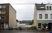
Example of a potential site for urban infill development

Other commonly used terms can relate to or serve as synonyms of land recycling:

Benefits

Social and economic revitalization

Land recycling helps clean up and revitalize inner cities by returning abandoned, idle, or underused sites to productive use, bolstering community spirit, creating jobs and boosting local tax-revenues.

The re-use of land revitalizes communities and renews economic activity, particularly in under-served urban areas. Abandoned, idled, and vacant properties often lie in former industrial and commercial areas, typically in urban and historically disadvantaged areas. These sites can be community eyesores, negatively impacting social and economic development, and often human and environmental health. The failure to redevelop brownfields in particular translates into potentially more exposure to toxins and the loss of economic and housing benefits that can come from appropriate redevelopment.

By putting these properties to new and productive use, land recycling encourages growth of businesses and services in such areas, helping to break up concentrations of poverty, creating jobs, and stimulating additional private investment and local tax-revenue. An abandoned, well-situated, factory site can be cleaned up and redeveloped into a much-needed mixed-use development with a grocery store, senior housing, and access to public transportation. The addition of neighborhood-serving retail, affordable housing, or a clean public park in a disadvantaged community can boost local spirit and improve overall quality of life.

Alternative to sprawl

Land recycling increases density in urban areas, by reducing urban sprawl and unplanned, low-density, automobile-dependent developments.

Sprawl development scatters housing, public transit, jobs and other amenities farther apart, demanding more frequent use of cars for travel. The increase in miles travelled by vehicles causes a range of health and environmental problems, including air pollution, increased greenhouse gas emissions, a larger occurrence of traffic jams, and asthma. This results in a lower quality of life for residents, ever-increasing commute times, and the health implications of smog.

By moving new jobs, economic opportunities and community amenities farther from established populations, sprawl development can cripple once-thriving cities. This trend takes a toll on the socio-economic health of urban communities as growth retreats from the urban center.

Rather than take advantage of existing infrastructure such as roads, public transit, and public works, building sprawl projects abandons these resources and demands further consumption of land and resources.

Land recycling offers an alternative to sprawl development. It reuses vital infrastructure and public resources and creates compact, full-service neighborhoods that reduce vehicle use and carbon dependence. Rebuilding in urban neighborhoods generates reinvestment in vibrant economic and cultural centers, rather than drawing away much-needed resources. As daily commute times decrease due to proximity to urban centres, quality of life can also be increased.

Directing development to urban cores

Redirecting population growth and growth of businesses to already urbanized areas can help in the fostering of sustainable communities, as buildings are already near existing infrastructure and amenities, not requiring new infrastructure to be built as would be the case in greenfield development. Applying sustainable principles to land use and growth management requires that growth be redirected from scattered fringe areas back to our urban cores, where people, services and infrastructure already exist. Building up urban areas positively increases population density, providing the critical mass to support local services from coffee shops to grocery stores, public transit to libraries and symphony halls. Land recycling can also assist in the creation of affordable housing, as it increases housing stocks due to its use of land previously unused for residential purposes.

Addressing climate change

Land recycling effectively curbs greenhouse-gas emissions by encouraging smart, compact growth that reduces vehicle dependence. Redevelopment within an urban core reduces commuting distances and therefore average vehicle miles traveled (VMTs) by creating residential, office, and other amenities within close proximity. Since transportation alone accounts for a third of greenhouse gases (GHGs) emitted in the United States, land recycling offers a key tool in any fight against climate change. A recent Urban Land Institute study found that compact urban developments reduce the number of vehicle miles traveled (VMTs) by 20 to 40 percent because users are closer to amenities and can more easily rely on public transportation. Smart urban planning is therefore crucial to maximizing energy savings and overall reduction of greenhouse gases.

Leaders in Energy and Environmental Design Certification

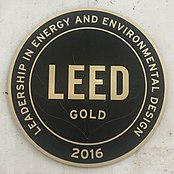
LEED Gold Plaque in a Certified Building

As of 2009 the green movement has started to emphasize the Leadership in Energy and Environmental Design (LEED) Green Building Rating System, a certification system that rewards the design, construction and operation of high-performance green buildings. LEED certification signifies incorporation of smart building design and technology to reduce energy use and minimize waste. However, even if a building is energy-efficient, the energy required to travel to and from a LEED certified site may well exceed the energy saved through energy-efficient features. LEED certified buildings and other developments best benefit climate change when they reuse infill sites and access existing resources.

LEED Certification can also benefit the occupant of the reused building. As sustainability becomes more prioritized within the building movement, having a LEED certified building becomes more desirable This certification may persuade public opinion and encourage more of the population to seek services by a company that prioritizes sustainability. In addition to this, some governmental bodies provide monetary benefits for prioritizing a sustainable cite such as tax breaks and stipends.

Sustainability

Sustainability involves meeting the needs of the present without compromising the ability of future generations to meet their own needs.

By encouraging the recycling rather than the consumption of land, land recycling promotes smart growth and responsible, sustainable patterns of development. A 2001 study by George Washington University shows that for every acre of brownfield redeveloped, 4.5 acres (18,000 m2) of undeveloped land is conserved. Public Policies and Private Decisions Affecting the Redevelopment of Brownfields: An Analysis of Critical Factors, Relative Weights and Areal Differentials. As most brownfields and other abandoned sites are typically situated in urban areas, they tap into existing nearby infrastructure, limiting the need to build new roads, gridlines, and amenities, thereby reducing further land consumption. Each infill development prevents sprawl into open space, forests and agricultural land, preserving acres of undeveloped land.

Sustainable Land Remediation and Planning

ZETOR building before demolition

Land development is an aspect of land recycling which involves urbanization and development of land, by reusing previously abandoned and unused land in commercial areas of larger cities. Sustainable Remediation is an aspect of land development where there is an increased focus the costs and benefits of certain aspects of land recycling. It aims to look at land remediation holistically considering not just the current environmental implications but also the long term social and economic implications. Co-design, is much more intentional and focuses on a multitude solutions by completing cost-benefit analyses, engaging in more inclusive conversations with stakeholders along with environmental impacts like energy and resources which may be consumed during land recycling projects. The Society of American Military Engineers have focused on using policy implemented by the American department of defense to ensure more sustainable practices. Looking more specifically some efforts being implemented by the S.A.M.E include composition of a sustainability remediation tool which allows for estimates of specific technologies to be considered when analyzing land remediation. Planning and design for land development and transformation by using co-design has resulted in better shared information on systems. These have worked well on sustainable land development as well as improved communication and handling of barriers, ultimately creating a better integrated program on a global scale.

It has been used in cities in Australia as part of global urban research programs to create land remediation solutions. The overall process involves four phases which included co-design which resulted in outcomes for policy and practice, research and knowledge and solution development. In this case, the sustainable remediation framework was created and used to create better co-design processes starting small scale locally and extending out to global scales. The process was split into three components starting with assisting in creating urban goals on each level of the scale which align with world views and influence, the policies which are in place and finally, to local technology and knowledge. Then shifting to look at how the urban goals affect urban systems like finances, environmental, and social capital as well as more physical systems like energy and water. Allowing better understanding of the costs and benefits of different land remediation goals. Then the process then looks more long term and focuses on the outcomes over time to understand the overarching effects of the implemented land remediation goals. Finally, the process looks at the major parts of the framework which need to be improved or need more focus.

Striving for sustainable development goals to create more sustainable cities

A push for sustainable land remediation can be seen all over the world, when looking at urban planning and can also be connected to large public health scares or changes in social norms. In the UK after cholera outbreaks in the 19th century, people started to pay more attention to the way homes were being built and where they were being built. Now as urbanization has increased, the push is for using land which has already been partially or completely developed and transforming it into something different. The inclusion of garden cities, which are cities built with the intention of avoiding disrupting previously present natural ecosystems. An example is the Hampstead Garden Suburb which began formulating plans that focused on preservation of natural beauty in the area by avoiding the removal of plant life that was already there and working to build around it. This also spread to other countries in Europe with Germany building its first garden city in 1909 and Canberra in Australia where the main goal was to reestablish and maintain forest cover around the city. Later, Design with Nature written by Ian McHarg, influenced a lot of the sustainable development goals which were implemented all over the world.

In the US, a city beautification movement started in the early 20th century, many cities were redeveloped as part of the movement but Chicago was the most influenced. As the city was being physical improved they found that there was a need for more focus on development and its social implications. As time went on there were also more conversations about the influence that people have on their environment with more literature about the effects of environmental degradation became more mainstream. This allowed more intersectional land development goals to be implemented when looking at the different needs of people in different countries.

Challenges

While land recycling has great economic and environmental benefits, without the right tools, skills, and knowledge, reusing land can produce certain challenges. Obstacles to redevelopment may include lack of funding and increased scrutiny. These can particularly impede projects on brownfields, which carry the stigma of contamination.

Market factors

Because idled and underused infill sites are often located in distressed urban areas concerns arise about crime, safety, and access to quality education and services. These and other market factors frequently pull development to open land near traditionally desirable communities and away from urban infill sites.

Greenfields competition

Brownfields and infill sites must compete with attractive, undeveloped suburban and rural land, also called greenfield land. When considering the real or perceived risks and costs of land recycling, a greenfield development may seem more economically sensible as the immediate costs are typically less than developing on an infill or brownfield site. However, it is important to consider the long-term economic gain of land recycling and the added social and environmental rewards of sustainable development.

Brownfields

As defined by the US Environmental Protection Agency, a brownfield site is “real property, the expansion, redevelopment, or reuse of which may be complicated by the presence or potential presence of a hazardous substance, pollutant, or contaminant”. In other words, brownfield sites comprise abandoned, idled, or underused industrial and commercial facilities where expansion or redevelopment is complicated by real or perceived environmental contamination.

Brownfield Remediation

Due to differences in regulation, production techniques, and heavy industrial use in the past, it is difficult to attract those willing to tackle the uncertainty and obstacles associated with potential clean up. Sites that are contaminated can cause public health risks, including physical risks like uncovered holes, unsafe structures, and sharp objects. Past industrial activities can leave behind chemical contamination, and people may become exposed to these chemicals when entering the properties. Sites that have high levels of land contamination have a high cost of remediation. Nature-based solutions is an idea being talked about to produce a more environmental space. Nature-based solutions can be looked at as policies and approaches to environmental issues that are in benefit to human health and biodiversity. An example would include developing a permeable green area, from these brownfield sites. Phytoremediation is another environmentally friendly approach for brownfield remediation. Phytoremediation programs reduce contaminants in the soil, water and air through planting different types of plants. Important metals that are harmful to human health, such as selenium, zinc, nickel and iron, are removed from contaminated soil through this process. These procedures are inexpensive because the plants rely on sunlight and the recycled nutrients in the ground. Although, phytoremediation cannot be used the same way in every destination due to different types of plants being nurtured differently in different types of environments. It depends on the soil, where the plant is placed, if it is getting enough nutrients to thrive, etc. The plants end up being so greatly polluted from heavy metals that they need to be disposed of. Thermal treatment is used as a disposal option. Thermal treatment implicates the combustion of the waste materials through machines that produce high enough temperatures, which decomposes the organic molecules within the plant. This treatment is typically used in the residential and industrial scale, making it useful for brownfield sites.

Uncertainty and costs

Assessing whether or not a site is contaminated can be a costly process that deters land reuse. Potential purchasers are often unwilling or unable to risk an investment in a site assessment for a property that may require cleanup they cannot afford. Even if a site has been purchased, concerns over cleanup costs may further stall redevelopment. Uncertainty over time, cost or a high price for cleanup leaves many brownfield sites in development limbo.

Project financing

Obtaining private front-end financing for brownfield cleanup can be a difficult process. Since financing is more readily available for development on greenfields, infill and brownfield sites are often passed over.

Environmental Justice

The concern for contamination of new occupants of a redeveloped brownfield is a concern. Communities of color and low income are disproportionately affected by pollution and brownfield sites offer a higher risk to the communities surrounding them. Many suggest that brownfield programs are a good alternative to the Superfund Act, but the standards of cleanup need to be highly considered in order to avoid future contamination.

Environmental-liability risks

Although recent changes in some country's federal laws provide some liability relief to new purchasers of contaminated properties, the law remains very complex and many state laws still have strict liability covering real property. Thus, in many cases, any current or past property owner can potentially be legally and financially liable regardless of who is responsible for contamination. This liability web continues to throw a chill on many brownfield projects even in the presence of regulatory reforms designed to encourage redevelopment. A common belief among many brownfield owners is that it is less risky and cheaper to abandon or “mothball” a facility than to conduct a site assessment that could trigger large cleanup costs and potential liability.

Regulatory requirements

The potentially complex process of successfully redeveloping an infill site, particularly a brownfield, can challenge land recycling interest and proposals. Understanding and complying with federal, state, and local legal and regulatory requirements can be daunting for some property owners and developers. Guidance from legal specialists and environmental cleanup consultants is often needed to design, develop, and guide a project through the process of regulatory requirements and permitting approvals.

Gentrification

Because most communities with underutilized buildings are those in poverty, an existing company coming in and investing in reimagining it can raise a concern of gentrification. The new building can lead to wealthier people coming in and causing displacement of existing residents. Depending on the building occupancy, such as a new apartment complex charging a higher rent, this can drive for higher priced services to come in and eventually push out existing residents who can no longer afford to live in the area.

Implementations

Land Recycling in the EU

An in-depth examination of land recycling in different countries shows many different perspectives on implementations of land recycling. The general European focus looked at land use in the EU and the importance of reducing new land use as well as reducing addition of impervious surface which disrupts natural ecosystems. Beginning with research, a database maintained by the Copernicus Programme is used in the EU to monitor land use changes, its main components are Corine Land Cover (CLC) and Urban Atlas (UA). Each of these has its own indicators for measuring increasing land use and increasing urbanization, for Corine Land Cover the flows of land recycling are split based on previously developed and undeveloped land because they each have different potential to produce green urban infrastructure. For the Urban Atlas database, the focus is the same but more geographically and theme specific accuracy so it used to test more of the land recycling indicators. The indicators were tested in all the countries in Europe from 1990 to 2002 in three sections, the tests were used to compare projections and determine the meaningfulness of land recycling using data from the CLC and UA datasets. The results of the data analysis showed little to no trends in land recycling and more variation in between the different European countries. The approach of the EU then focused more on the large scale environmental impacts of land recycling by quantification and identification of places where land use could be improved.

Land Recycling in Germany

On a smaller scale, Germany focused on limiting the amount of land conversion specifically for settling and traffic to 30 ha per day starting in 2002 as a part of the National Sustainability Strategy. They also incentivized urban development and improvement by making it easier for contractors to obtain permits to develop urban areas. Studies were done to see the effectiveness of the implementation of this policy by looking at Stralsund. The city was chosen for its ability to be developed as a mostly rural part of Germany as well as for its appeal for not only younger families looking for in expensive places to settle but also for companies looking for places to develop. The land development of Stralsund was then monitored from 1992 to 2018, the focus of development started with industrialization of the outskirts of the town, then brownfield transformation and finally, residential development. Cost benefit also played a big role in the conversion of pieces of land which hadn't been in use for a long period of time like, a military property. As development continued, there was also compensation for interference with ecosystems and natural spaces by addition of green spaces and by planting trees. When comparing both the old land use plan and the new land use plan, they found that the cost of the new had the potential to save 55% of costs, but ultimately there wasn't much change between the results of the old and the new land use plans. The application of an accelerated inner urban development plan was neither advantageous nor non-advantageous, for Stralsund, Germany, because of the previous structure of the policy. The country of Germany also had goals to reach land degradation neutrality by 2030 by reaching its sustainable development goals specifically based on soil improvement.

Germany has focused a lot on brownfield development as much of Europe with that including not just contaminated land but also land which was previously developed. The push for target amounts of recycled land stems from status quo influence with other countries development of brownfield mitigation work. In Leipzig, Germany improvement of land and community quality was done by creating more urban forestry. With increased research of the people’s response to the improved brownfields generally quality of life was improved. Some research shows that the greenspaces though positive needed to be made more usable for improvement of quality of life. Mainly stakeholders have a say in the way greenspace is allocated in Germany, so there is more of a push to ensure policy matches with what is beneficial for the people who would be using greenspaces not just in Germany but in other European countries.

Land Recycling Programs in the United States

Pennsylvania

In Pennsylvania a land recycling program was established to promote the voluntary clean up and reuse of contaminated sites. This program was established in 1995 and is also known as the Voluntary Cleanup Program. This program aims to set four main standards, the first is to set structured standards. This allows for public knowledge of the cost of cleaning up a site, and ensures the protection of the present and future use of the site. The second standard is granted liability relief. The third standard promotes transparency by giving specific time frames for clean ups and routine reporting of what is being done on the site. Lastly, the fourth standard for this land recycling program is providing financial assistance for cleanups.

Examples

Ghirardelli Square

Ghirardelli Square is in San Francisco, California and is the center of many examples of land recycling and building reuse. Designed by Lawrence Halprin and William Wurster opening in 1964, this was one of the first examples of major land recycling in the United States. Surrounding this square is many buildings and waterfront properties that were originally used for production of local goods as well as transportation through the bay. No longer needed for their original uses, these buildings have been transformed and retrofitted to accommodate the needs of the community and attract tourism.

The inclusion of new retail spaces, offices, and residential properties in these existing abandoned buildings not only put to use otherwise empty spaces but also prevent the erection of new structures and therefore use less materials, energy, and land. In addition to this, Ghirardelli Square also shows the change of building use to reflect the needs of the residents. Churches specifically have changed from predominantly Christian to other religious uses or convert into secular uses such as housing and businesses.

Foundation Hotel

The Foundation Hotel in Detroit, Michigan is an Adaptive reuse project designed by local firm McIntosh Poris Associates (MPA) with collaboration with Simone Deary Design group. This project actually combined two adjacent buildings that were not in use. The main building was built in 1929 and originally housed the city’s oldest fire department. The additional building was once home to Pontchartrain Wine Cellars. In 2013 the fire department moved out and the building was left unoccupied for over a year until bought by Aparium Hotel Group.

This project focused on the new needs of the community while still preserving the aesthetic and incorporated Historic preservation in their work. This is significant because as stated above, gentrification can be a major negative effect during land recycling and the attempt to maintain the existing exterior of the building counteracts this.

Wonder Bread Factory

Washington, D.C.’s Wonder Bread Factory sat in Shaw neighborhood from early 1913 to the mid 1980s in full production. After the company moved out of the space the building was abandoned and vacant for almost 20 years until Douglas Development, founded by Douglas Jemal, bought it in 1997. The building sat vacant for another 15 years until it was redeveloped and converted it into offices in 2013.

This building also pulled on Historic preservation by minimizing the level of exterior renovation as much as possible while still creating a new use for a space that was highly needed in the community. This building is 98,000 square feet and is now Loft styles offices available to the public.

Spacecraft attitude control

From Wikipedia, the free encyclopedia

Spacecraft attitude control is the process of controlling the orientation of a spacecraft (vehicle or satellite) with respect to an inertial frame of reference or another entity such as the celestial sphere, certain fields, and nearby objects, etc.

Controlling vehicle attitude requires sensors to measure vehicle orientation, actuators to apply the torques needed to orient the vehicle to a desired attitude, and algorithms to command the actuators based on (1) sensor measurements of the current attitude and (2) specification of a desired attitude. The integrated field that studies the combination of sensors, actuators and algorithms is called guidance, navigation and control (GNC).

Overview

A spacecraft's attitude must typically be stabilized and controlled for a variety of reasons. It is often needed so that the spacecraft high-gain antenna may be accurately pointed to Earth for communications, so that onboard experiments may accomplish precise pointing for accurate collection and subsequent interpretation of data, so that the heating and cooling effects of sunlight and shadow may be used intelligently for thermal control, and also for guidance: short propulsive maneuvers must be executed in the right direction.

Types of stabilization

Attiude control of spacecraft is maintained using one of two principal approaches:

  • Spin stabilization Spin stabilization is accomplished by setting the spacecraft spinning, using the gyroscopic action of the rotating spacecraft mass as the stabilizing mechanism. Propulsion system thrusters are fired only occasionally to make desired changes in spin rate, or in the spin-stabilized attitude. If desired, the spinning may be stopped through the use of thrusters or by yo-yo de-spin. The Pioneer 10 and Pioneer 11 probes in the outer Solar System are examples of spin-stabilized spacecraft.
  • Three-axis stabilization is an alternative method of spacecraft attitude control in which the spacecraft is held fixed in the desired orientation without any rotation.
    • One method is to use small thrusters to continually nudge the spacecraft back and forth within a deadband of allowed attitude error. Thrusters may also be referred to as mass-expulsion control (MEC) systems, or reaction control systems (RCS). The space probes Voyager 1 and Voyager 2 employ this method, and have used up about three quarters of their 100 kg of propellant as of July 2015.
    • Another method for achieving three-axis stabilization is to use electrically powered reaction wheels, also called momentum wheels, which are mounted on three orthogonal axes aboard the spacecraft. They provide a means to trade angular momentum back and forth between spacecraft and wheels. To rotate the vehicle on a given axis, the reaction wheel on that axis is accelerated in the opposite direction. To rotate the vehicle back, the wheel is slowed. Excess momentum that builds up in the system due to external torques from, for example, solar photon pressure or gravity gradients, must be occasionally removed from the system by applying controlled torque to the spacecraft to allowing the wheels to return to a desired speed under computer control. This is done during maneuvers called momentum desaturation or momentum unload maneuvers. Most spacecraft use a system of thrusters to apply the torque for desaturation maneuvers. A different approach was used by the Hubble Space Telescope, which had sensitive optics that could be contaminated by thruster exhaust, and instead used magnetic torquers for desaturation maneuvers.

There are advantages and disadvantages to both spin stabilization and three-axis stabilization. Spin-stabilized craft provide a continuous sweeping motion that is desirable for fields and particles instruments, as well as some optical scanning instruments, but they may require complicated systems to de-spin antennas or optical instruments that must be pointed at targets for science observations or communications with Earth. Three-axis controlled craft can point optical instruments and antennas without having to de-spin them, but they may have to carry out special rotating maneuvers to best utilize their fields and particle instruments. If thrusters are used for routine stabilization, optical observations such as imaging must be designed knowing that the spacecraft is always slowly rocking back and forth, and not always exactly predictably. Reaction wheels provide a much steadier spacecraft from which to make observations, but they add mass to the spacecraft, they have a limited mechanical lifetime, and they require frequent momentum desaturation maneuvers, which can perturb navigation solutions because of accelerations imparted by the use of thrusters.

Articulation

Many spacecraft have components that require articulation. Voyager and Galileo, for example, were designed with scan platforms for pointing optical instruments at their targets largely independently of spacecraft orientation. Many spacecraft, such as Mars orbiters, have solar panels that must track the Sun so they can provide electrical power to the spacecraft. Cassini's main engine nozzles were steerable. Knowing where to point a solar panel, or scan platform, or a nozzle — that is, how to articulate it — requires knowledge of the spacecraft's attitude. Because a single subsystem keeps track of the spacecraft's attitude, the Sun's location, and Earth's location, it can compute the proper direction to point the appendages. It logically falls to the same subsystem – the Attitude and Articulation Control Subsystem (AACS), then, to manage both attitude and articulation. The name AACS may even be carried over to a spacecraft even if it has no appendages to articulate.

Geometry

Attitude is part of the description of how an object is placed in the space it occupies. Attitude and position fully describe how an object is placed in space. (For some applications such as in robotics and computer vision, it is customary to combine position and attitude together into a single description known as Pose.)

Attitude can be described using a variety of methods; however, the most common are Rotation matrices, Quaternions, and Euler angles. While Euler angles are oftentimes the most straightforward representation to visualize, they can cause problems for highly-maneuverable systems because of a phenomenon known as Gimbal lock. A rotation matrix, on the other hand, provides a full description of the attitude at the expense of requiring nine values instead of three. The use of a rotation matrix can lead to increased computational expense and they can be more difficult to work with. Quaternions offer a decent compromise in that they do not suffer from gimbal lock and only require four values to fully describe the attitude.

Changing orientation of a rigid body is the same as rotating the axes of a reference frame attached to it.

Attitude determination

Before attitude control can be performed, the current attitude must be determined. Attitude cannot be measured directly by any single measurement, and so must be calculated (or estimated) from a set of measurements (often using different sensors). This can be done either statically (calculating the attitude using only the measurements currently available), or through the use of a statistical filter (most commonly, the Kalman filter) that statistically combine previous attitude estimates with current sensor measurements to obtain an optimal estimate of the current attitude.

Position/location

For some sensors and applications (such as spacecraft using magnetometers) the precise location must also be known. While pose estimation can be employed, for spacecraft it is usually sufficient to estimate the position (via Orbit determination) separate from the attitude estimation. For terrestrial vehicles and spacecraft operating near the Earth, the advent of Satellite navigation systems allows for precise position knowledge to be obtained easily. This problem becomes more complicated for deep space vehicles, or terrestrial vehicles operating in Global Navigation Satellite System (GNSS) denied environments (see Navigation).

Static attitude estimation methods

Static attitude estimation methods are solutions to Wahba's problem. Many solutions have been proposed, notably Davenport's q-method, QUEST, TRIAD, and singular value decomposition.

Crassidis, John L., and John L. Junkins.. Chapman and Hall/CRC, 2004.

Sequential estimation methods

Kalman filtering can be used to sequentially estimate the attitude, as well as the angular rate. Because attitude dynamics (combination of rigid body dynamics and attitude kinematics) are non-linear, a linear Kalman filter is not sufficient. Because attitude dynamics is not very non-linear, the Extended Kalman filter is usually sufficient (however Crassidis and Markely demonstrated that the Unscented Kalman filter could be used, and can provide benefits in cases where the initial estimate is poor). Multiple methods have been proposed, however the Multiplicative Extended Kalman Filter (MEKF) is by far the most common approach. This approach utilizes the multiplicative formulation of the error quaternion, which allows for the unity constraint on the quaternion to be better handled. It is also common to use a technique known as dynamic model replacement, where the angular rate is not estimated directly, but rather the measured angular rate from the gyro is used directly to propagate the rotational dynamics forward in time. This is valid for most applications as gyros are typically far more precise than one's knowledge of disturbance torques acting on the system (which is required for precise estimation of the angular rate).

Attitude control algorithms

Control algorithms are computer programs that receive data from vehicle sensors and derive the appropriate commands to the actuators to rotate the vehicle to the desired attitude. The algorithms range from very simple, e.g. proportional control, to complex nonlinear estimators or many in-between types, depending on mission requirements. Typically, the attitude control algorithms are part of the software running on the computer hardware, which receives commands from the ground and formats vehicle data telemetry for transmission to a ground station.

The attitude control algorithms are written and implemented based on requirement for a particular attitude maneuver. Asides the implementation of passive attitude control such as the gravity-gradient stabilization, most spacecraft make use of active control which exhibits a typical attitude control loop. The design of the control algorithm depends on the actuator to be used for the specific attitude maneuver although using a simple proportional–integral–derivative controller (PID controller) satisfies most control needs.

The appropriate commands to the actuators are obtained based on error signals described as the difference between the measured and desired attitude. The error signals are commonly measured as euler angles (Φ, θ, Ψ), however an alternative to this could be described in terms of direction cosine matrix or error quaternions. The PID controller which is most common reacts to an error signal (deviation) based on attitude as follows

where is the control torque, is the attitude deviation signal, and are the PID controller parameters.

A simple implementation of this can be the application of the proportional control for nadir pointing making use of either momentum or reaction wheels as actuators. Based on the change in momentum of the wheels, the control law can be defined in 3-axes x, y, z as

This control algorithm also affects momentum dumping.

Another important and common control algorithm involves the concept of detumbling, which is attenuating the angular momentum of the spacecraft. The need to detumble the spacecraft arises from the uncontrollable state after release from the launch vehicle. Most spacecraft in low Earth orbit (LEO) makes use of magnetic detumbling concept which utilizes the effect of the Earth's magnetic field. The control algorithm is called the B-Dot controller and relies on magnetic coils or torque rods as control actuators. The control law is based on the measurement of the rate of change of body-fixed magnetometer signals.

where is the commanded magnetic dipole moment of the magnetic torquer and is the proportional gain and is the rate of change of the Earth's magnetic field.

Sensors

Relative attitude sensors

Many sensors generate outputs that reflect the rate of change in attitude. These require a known initial attitude, or external information to use them to determine attitude. Many of this class of sensor have some noise, leading to inaccuracies if not corrected by absolute attitude sensors.

Gyroscopes

Gyroscopes are devices that sense rotation in three-dimensional space without reliance on the observation of external objects. Classically, a gyroscope consists of a spinning mass, but there are also "ring laser gyros" utilizing coherent light reflected around a closed path. Another type of "gyro" is a hemispherical resonator gyro where a crystal cup shaped like a wine glass can be driven into oscillation just as a wine glass "sings" as a finger is rubbed around its rim. The orientation of the oscillation is fixed in inertial space, so measuring the orientation of the oscillation relative to the spacecraft can be used to sense the motion of the spacecraft with respect to inertial space.

Motion reference units

Motion reference units are a kind of inertial measurement unit with single- or multi-axis motion sensors. They utilize MEMS gyroscopes. Some multi-axis MRUs are capable of measuring roll, pitch, yaw and heave. They have applications outside the aeronautical field, such as:

Absolute attitude sensors

This class of sensors sense the position or orientation of fields, objects or other phenomena outside the spacecraft.

Horizon sensor

A horizon sensor is an optical instrument that detects light from the 'limb' of Earth's atmosphere, i.e., at the horizon. Thermal infrared sensing is often used, which senses the comparative warmth of the atmosphere, compared to the much colder cosmic background. This sensor provides orientation with respect to Earth about two orthogonal axes. It tends to be less precise than sensors based on stellar observation. Sometimes referred to as an Earth sensor.

Orbital gyrocompass

Similar to the way that a terrestrial gyrocompass uses a pendulum to sense local gravity and force its gyro into alignment with Earth's spin vector, and therefore point north, an orbital gyrocompass uses a horizon sensor to sense the direction to Earth's center, and a gyro to sense rotation about an axis normal to the orbit plane. Thus, the horizon sensor provides pitch and roll measurements, and the gyro provides yaw. See Tait-Bryan angles.

Sun sensor

A Sun sensor is a device that senses the direction to the Sun. This can be as simple as some solar cells and shades, or as complex as a steerable telescope, depending on mission requirements.

Earth sensor

An Earth sensor is a device that senses the direction to Earth. It is usually an infrared camera; nowadays the main method to detect attitude is the star tracker, but Earth sensors are still integrated in satellites for their low cost and reliability.

Star tracker

The STARS real-time star tracking software operates on an image from EBEX 2012, a high-altitude balloon-borne cosmology experiment launched from Antarctica on 2012-12-29

A star tracker is an optical device that measures the position(s) of star(s) using photocell(s) or a camera. It uses magnitude of brightness and spectral type to identify and then calculate the relative position of stars around it.

Magnetometer

A magnetometer is a device that senses magnetic field strength and, when used in a three-axis triad, magnetic field direction. As a spacecraft navigational aid, sensed field strength and direction is compared to a map of Earth's magnetic field stored in the memory of an on-board or ground-based guidance computer. If spacecraft position is known then attitude can be inferred.

Actuators

Attitude control can be obtained by several mechanisms, including:

Thrusters

Vernier thrusters are the most common actuators, as they may be used for station keeping as well. Thrusters must be organized as a system to provide stabilization about all three axes, and at least two thrusters are generally used in each axis to provide torque as a couple in order to prevent imparting a translation to the vehicle. Their limitations are fuel usage, engine wear, and cycles of the control valves. The fuel efficiency of an attitude control system is determined by its specific impulse (proportional to exhaust velocity) and the smallest torque impulse it can provide (which determines how often the thrusters must fire to provide precise control). Thrusters must be fired in one direction to start rotation, and again in the opposing direction if a new orientation is to be held. Thruster systems have been used on most crewed space vehicles, including Vostok, Mercury, Gemini, Apollo, Soyuz, and the Space Shuttle.

To minimize the fuel limitation on mission duration, auxiliary attitude control systems may be used to reduce vehicle rotation to lower levels, such as small ion thrusters that accelerate ionized gases electrically to extreme velocities, using power from solar cells.

Reaction/momentum wheels

Momentum wheels are electric motor driven rotors made to spin in the direction opposite to that required to re-orient the vehicle. Because momentum wheels make up a small fraction of the spacecraft's mass and are computer controlled, they give precise control. Momentum wheels are generally suspended on magnetic bearings to avoid bearing friction and breakdown problems. Spacecraft Reaction wheels often use mechanical ball bearings.

To maintain orientation in three dimensional space a minimum of three reaction wheels must be used, with additional units providing single failure protection. See Euler angles.

Control moment gyros

These are rotors spun at constant speed, mounted on gimbals to provide attitude control. Although a CMG provides control about the two axes orthogonal to the gyro spin axis, triaxial control still requires two units. A CMG is a bit more expensive in terms of cost and mass, because gimbals and their drive motors must be provided. The maximum torque (but not the maximum angular momentum change) exerted by a CMG is greater than for a momentum wheel, making it better suited to large spacecraft. A major drawback is the additional complexity, which increases the number of failure points. For this reason, the International Space Station uses a set of four CMGs to provide dual failure tolerance.

Solar sails

Small solar sails (devices that produce thrust as a reaction force induced by reflecting incident light) may be used to make small attitude control and velocity adjustments. This application can save large amounts of fuel on a long-duration mission by producing control moments without fuel expenditure. For example, Mariner 10 adjusted its attitude using its solar cells and antennas as small solar sails.

Gravity-gradient stabilization

In orbit, a spacecraft with one axis much longer than the other two will spontaneously orient so that its long axis points at the planet's center of mass. This system has the virtue of needing no active control system or expenditure of fuel. The effect is caused by a tidal force. The upper end of the vehicle feels less gravitational pull than the lower end. This provides a restoring torque whenever the long axis is not co-linear with the direction of gravity. Unless some means of damping is provided, the spacecraft will oscillate about the local vertical. Sometimes tethers are used to connect two parts of a satellite, to increase the stabilizing torque. A problem with such tethers is that meteoroids as small as a grain of sand can part them.

Magnetic torquers

Coils or (on very small satellites) permanent magnets exert a moment against the local magnetic field. This method works only where there is a magnetic field against which to react. One classic field "coil" is actually in the form of a conductive tether in a planetary magnetic field. Such a conductive tether can also generate electrical power, at the expense of orbital decay. Conversely, by inducing a counter-current, using solar cell power, the orbit may be raised. Due to massive variability in Earth's magnetic field from an ideal radial field, control laws based on torques coupling to this field will be highly non-linear. Moreover, only two-axis control is available at any given time meaning that a vehicle reorient may be necessary to null all rates.

Passive attitude control

Three main types of passive attitude control exist for satellites. The first one uses gravity gradient, and it leads to four stable states with the long axis (axis with smallest moment of inertia) pointing towards Earth. As this system has four stable states, if the satellite has a preferred orientation, e.g. a camera pointed at the planet, some way to flip the satellite and its tether end-for-end is needed.

The second passive system orients the satellite along Earth's magnetic field thanks to a magnet. These purely passive attitude control systems have limited pointing accuracy, because the spacecraft will oscillate around energy minima. This drawback is overcome by adding damper, which can be hysteretic materials or a viscous damper. The viscous damper is a small can or tank of fluid mounted in the spacecraft, possibly with internal baffles to increase internal friction. Friction within the damper will gradually convert oscillation energy into heat dissipated within the viscous damper.

A third form of passive attitude control is aerodynamic stabilization. This is achieved using a drag gradient, as demonstrated on the Get Away Special Passive Attitude Control Satellite (GASPACS) technology demonstration. In low Earth orbit, the force due to drag is many orders of magnitude more dominant than the force imparted due to gravity gradients When a satellite is utilizing aerodynamic passive attitude control, air molecules from the Earth's upper atmosphere strike the satellite in such a way that the center of pressure remains behind the center of mass, similar to how the feathers on an arrow stabilize the arrow. GASPACS utilized a 1 m inflatable 'AeroBoom', which extended behind the satellite, creating a stabilizing torque along the satellite's velocity vector.

Inhalant

From Wikipedia, the free encyclopedia https://en.wikipedia.org/w...