| Agency overview | |
|---|---|
| Formed | 1966 |
| Annual budget | $16.8 million (2018) |
| Agency executive |
|
| Parent department | National Park Service |
| Website | National Register of Historic Places |
Old Slater Mill, a historic district in Pawtucket, Rhode Island, was the first property listed in the National Register, on November 13, 1966.
The National Register of Historic Places (NRHP) is the United States federal government's official list of districts,
sites, buildings, structures and objects deemed worthy of preservation
for their historical significance. A property listed in the National
Register, or located within a National Register Historic District, may
qualify for tax incentives derived from the total value of expenses
incurred in preserving the property.
The passage of the National Historic Preservation Act
(NHPA) in 1966 established the National Register and the process for
adding properties to it. Of the more than one million properties on the
National Register, 80,000 are listed individually. The remainder are contributing resources within historic districts.
For most of its history, the National Register has been administered by the National Park Service (NPS), an agency within the United States Department of the Interior. Its goals are to help property owners and interest groups, such as the National Trust for Historic Preservation,
as well as coordinate, identify and protect historic sites in the
United States. While National Register listings are mostly symbolic,
their recognition of significance provides some financial incentive to
owners of listed properties. Protection of the property is not
guaranteed. During the nomination process, the property is evaluated in
terms of the four criteria for inclusion on the National Register of
Historic Places. The application of those criteria has been the subject
of criticism by academics of history and preservation, as well as the
public and politicians.
Occasionally, historic sites outside the country proper, but associated with the United States (such as the American Embassy in Tangiers)
are also listed. Properties can be nominated in a variety of forms,
including individual properties, historic districts and multiple
property submissions (MPS). The Register categorizes general listings
into one of five types of properties: district, site, structure,
building or object. National Register Historic Districts are
defined geographical areas consisting of contributing and
non-contributing properties. Some properties are added automatically to
the National Register when they become administered by the National Park
Service. These include National Historic Landmarks (NHL), National Historic Sites (NHS), National Historical Parks, National Military Parks, National Memorials and some National Monuments. (Federal properties can be proclaimed National Monuments under the Antiquities Act
because of either their historical or natural significance. They are
managed by multiple agencies. Only monuments that are historic in
character and managed by the National Park Service are listed
administratively in the National Register.)
History
George B. Hartzog Jr., director of the National Park Service from January 8, 1964, until December 31, 1972
On October 15, 1966, the Historic Preservation Act created the National Register of Historic Places and the corresponding State Historic Preservation Offices (SHPO). Initially, the National Register consisted of the National Historic Landmarks designated before the Register's creation, as well as any other historic sites in the National Park system.
Approval of the act, which was amended in 1980 and 1992, represented
the first time the United States had a broad-based historic preservation
policy. The 1966 act required those agencies to work in conjunction with the SHPO and an independent federal agency, the Advisory Council on Historic Preservation (ACHP), to confront adverse effects of federal activities on historic preservation.
U.S. Secretary of the Interior (1977–1981) Cecil Andrus removed the National Register from the jurisdiction of the National Park Service in 1978
To administer the newly created National Register of Historic Places,
the National Park Service of the U.S. Department of the Interior, with
director George B. Hartzog Jr., established an administrative division named the Office of Archeology and Historic Preservation (OAHP).
Hartzog charged OAHP with creating the National Register program
mandated by the 1966 law. Ernest Connally was the Office's first
director. Within OAHP new divisions were created to deal with the
National Register. The division administered several existing programs, including the Historic Sites Survey and the Historic American Buildings Survey, as well as the new National Register and Historic Preservation Fund.
The first official Keeper of the Register was William J. Murtagh, an architectural historian.
During the Register's earliest years in the late 1960s and early 1970s,
organization was lax and SHPOs were small, understaffed and
underfunded. However, funds were still being supplied for the Historic Preservation Fund to provide matching grants-in-aid to listed property owners, first for house museums and institutional buildings, but later for commercial structures as well.
A few years later in 1979, the NPS history programs affiliated with both the U.S. National Parks
system and the National Register were categorized formally into two
"Assistant Directorates." Established were the Assistant Directorate for
Archeology and Historic Preservation and the Assistant Directorate for
Park Historic Preservation. From 1978 until 1981, the main agency for the National Register was the Heritage Conservation and Recreation Service (HCRS) of the United States Department of the Interior.
In February 1983, the two assistant directorates were merged to
promote efficiency and recognize the interdependency of their programs.
Jerry L. Rogers was selected to direct this newly merged associate
directorate. He was described as a skilled administrator, who was
sensitive to the need for the NPS to work with SHPOs, academia and local
governments.
Although not described in detail in the 1966 act, SHPOs
eventually became integral to the process of listing properties on the
National Register. The 1980 amendments of the 1966 law further defined
the responsibilities of SHPOs concerning the National Register.
Several 1992 amendments of the NHPA added a category to the National
Register, known as Traditional Cultural Properties: those properties
associated with Native American or Hawaiian groups.
The National Register of Historic Places has grown considerably
from its legislative origins in 1966. In 1986, citizens and groups
nominated 3,623 separate properties, sites and districts for inclusion
on the National Register, a total of 75,000 separate properties. Of the more than one million properties on the National Register, 80,000 are listed individually. Others are listed as contributing members within historic districts.
Nomination process
| “ | It is hereby declared to be theIt is hereby declared to be the policy of the United States Government that special effort should be made to preserve the natural beauty of the countryside and public park and recreation lands, wildlife and waterfowl refuges, and historic sites. policy of the United States Government that special effort should be made to preserve the natural beauty of the countryside and public park and recreation lands, wildlife and waterfowl refuges, and historic sites. | ” |
| — (49 USC 303) | ||
Any individual can prepare a National Register nomination, although historians and historic preservation
consultants often are employed for this work. The nomination consists
of a standard nomination form and contains basic information about a
property's physical appearance and the type of significance embodied in
the building, structure, object, site, or district.[12] The State Historic Preservation Office
(SHPO) receives National Register nominations and provides feedback to
the nominating individual or group. After preliminary review, the SHPO
sends each nomination to the state's historic review commission, which
then recommends whether the State Historic Preservation Officer
should send the nomination to the Keeper of the National Register. For
any non-Federally owned property, only the State Historic Preservation
Officer may officially nominate a property for inclusion in the National
Register. After the nomination is recommended for listing in the
National Register by the SHPO, the nomination is sent to the National
Park Service, which approves or denies the nomination. If approved, the
property is entered officially by the Keeper of the National Register
into the National Register of Historic Places.
Property owners are notified of the nomination during the review by the
SHPO and state's historic review commission. If an owner objects to a
nomination of private property, or in the case of a historic district, a
majority of owners, then the property cannot be listed in the National
Register of Historic Places.
Criteria
The Robie House, designed by Frank Lloyd Wright, is an example of a property listed by means of criterion C.
For a property to be eligible for the National Register, it must meet at least one of the four National Register main criteria. Information about architectural styles, association with various aspects of social history
and commerce and ownership are all integral parts of the nomination.
Each nomination contains a narrative section that provides a detailed
physical description of the property and justifies why it is significant
historically with regard either to local, state, or national history.
The four National Register of Historic Places criteria are the
following.
- Criterion A, "Event", the property must make a contribution to the major pattern of American history.
- Criterion B, "Person", is associated with significant people of the American past.
- Criterion C, "Design/Construction", concerns the distinctive characteristics of the building by its architecture and construction, including having great artistic value or being the work of a master.
- Criterion D, "Information potential", is satisfied if the property has yielded or may be likely to yield information important to prehistory or history.
The criteria are applied differently for different types of
properties; for instance, maritime properties have application
guidelines different from those of buildings.
Exclusions
There
are specific instances where properties usually do not merit listing in
the National Register. As a general rule, cemeteries, birthplaces,
graves of historical figures, properties owned by religious institutions
or used for religious purposes, moved structures, reconstructed
historic buildings, commemorative properties and properties that have
achieved significance during the last fifty years are not qualified for
listing on the Register.
There are, however, exceptions to all the preceding; mitigating
circumstances allow properties classified in one of those groups to be
included.
Properties listed
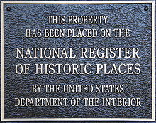
A typical plaque found on properties listed in the National Register of Historic Places.
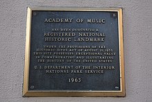
An alternate series of plaques. Buildings on the National Register are often listed in local historic societies as well.
A listing on the National Register of Historic Places is governmental
acknowledgment of a historic district, site, building, or property.
However, the Register is mostly "an honorary status with some federal
financial incentives." The National Register of Historic Places automatically includes all National Historic Landmarks as well as all historic areas administered by the National Park Service. Landmarks such as these include National Historic Sites (NHS), National Historical Parks, National Military Parks/Battlefields, National Memorials and some National Monuments. Occasionally, historic sites outside the country's borders, but associated with the United States, such as the American Legation in Tangiers, also are listed.
Listing in the National Register does not restrict private property owners from the use of their property.
Some states and municipalities, however, may have laws that become
effective when a property is listed in the National Register. If federal
money or a federal permitting process is involved, Section 106 of the
National Historic Preservation Act of 1966 is invoked. Section 106
requires the federal agency involved to assess the effect of its actions
on historic resources.[3] Statutorily, the Advisory Council on Historic Preservation
(ACHP) has the most significant role by Section 106 of the National
Historic Preservation Act. The section requires that the director of any
federal agency with direct or indirect jurisdiction of a project that
may affect a property listed or determined eligible for listing in the
National Register of Historic Places, must first report to the Advisory
Council. The director of said agency is required to "take into account
the effect of the undertaking" on the National Register property, as
well as to afford the ACHP a reasonable opportunity to comment.
While Section 106 does not mandate explicitly that any federal
agency director accept the advice of the ACHP, their advice has
practical influence, especially given the statutory obligations of the
NHPA that require federal agencies to "take into account the effect of
the undertaking."
In cases where the ACHP determines federal action will have an
"adverse effect" on historic properties, mitigation is sought.
Typically, a Memorandum of Agreement (MOA) is created by which the involved parties agree to a particular plan. Many states have laws similar to Section 106.
In contrast to conditions relating to a federally designated historic
district, municipal ordinances governing local historic districts often
restrict certain kinds of changes to properties. Thus, they may protect
the property more than a National Register listing does.
The Department of Transportation Act,
passed on October 15, 1966, the same day as the National Historic
Preservation Act, included provisions that addressed historic
preservation. The DOT Act is much more general than Section 106 NHPA in
that it refers to properties other than those listed in the Register.
The more general language has allowed more properties and parklands to enjoy status as protected areas by this legislation, a policy developed early in its history. The United States Supreme Court ruled in the 1971 case Citizens to Preserve Overton Park v. Volpe that parklands could have the same protected status as "historic sites."
- Chichester Friends Meetinghouse (1688 and 1769) near Boothwyn, in Upper Chichester Township, Delaware County, Pennsylvania, added in 1973.
- Lake Mohonk Mountain House (1869–1910) on the Shawangunk Ridge in Ulster County, New York, added in 1973.
- 16th Street Baptist Church (1911) in Birmingham, Alabama, added in 1980, received in 2006 a Save America's Treasures Grant.
- Log Cabin (c. 1795) within Green Valley Historic District, in parts of East Marlborough Township and Newlin Township, Pennsylvania, added in 1985.
Multiple property submission
The lodge and cabins at White Pines Forest State Park, in Illinois, are part of a multiple property submission.
A multiple property submission (MPS) is a thematic group listing of
the National Register of Historic Places that consists of related
properties that share a common theme and can be submitted as a group.
Multiple property submissions must satisfy certain basic criteria for
the group of properties to be included in the National Register.
The process begins with the multiple property documentation
forms, which acts as a cover document rather than the nomination to the
National Register of Historic Places. The purpose of the documentation
form is to establish the basis of eligibility for related properties.
The information of the multiple property documentation form can be used
to nominate and register related historic properties simultaneously, or
to establish criteria for properties that may be nominated in the
future. Thus, additions to an MPS can occur over time.
The nomination of individual properties in an MPS is accomplished
in the same manner as other nominations. The name of the "thematic
group" denotes the historical theme of the properties. It is considered
the "multiple property listing." Once an individual property or a group
of properties is nominated and listed in the National Register, the
multiple property documentation form, combined with the individual
National Register of Historic Places nomination forms, constitute a
multiple property submission. Examples of MPS include the Lee County Multiple Property Submission, the Warehouses in Omaha, the Boundary Markers of the Original District of Columbia and the Illinois Carnegie Libraries.
Before the term "Multiple Property Submission" was introduced in 1984,
such listings were known as "Thematic Resources", such as the Operating Passenger Railroad Stations Thematic Resource, or "Multiple Resource Areas."
Types of properties
Listed properties are generally in one of five broad categories,
although there are special considerations for other types of properties
that in any one, or into more specialized subcategories. The five
general categories for National Register properties are: building,
structure, site, district and object. In addition, historic districts consist of contributing and non-contributing properties.
The Liberty Ship SS Jeremiah O'Brien, an example of a ship listed in the National Register. This ship is also a National Historic Landmark.
Buildings, as defined by the National Register, are distinguished in
the traditional sense. Examples include a house, barn, hotel, church, or
similar construction. They are created primarily to shelter human
activity. The term building, as in outbuilding, can be used to refer to
historically and functionally related units, such as a courthouse and a
jail or a barn and a house.
Structures differ from buildings in that they are functional
constructions meant to be used for purposes other than sheltering human
activity. Examples include an aircraft, a grain elevator, a gazebo and a bridge.
Objects are usually artistic in nature, or small in scale
compared to structures and buildings. Although objects may be movable,
they are generally associated with a specific setting or environment.
Examples of objects include monuments, sculptures and fountains.
Sites are the locations of significant events, which can be
prehistoric or historic in nature and represent activities or buildings
(standing, ruined, or vanished). When sites are listed, it is the
locations themselves that are of historical interest. They possess
cultural or archaeological value regardless of the value of any
structures that currently exist at the locations. Examples of types of
sites include shipwrecks, battlefields, campsites, natural features and rock shelters.
Historic districts possess a concentration, association, or
continuity of the other four types of properties. Objects, structures,
buildings and sites in a historic district are united historically or
aesthetically, either by choice or by the nature of their development.
There are several other different types of historic preservation
associated with the properties of the National Register of Historic
Places that cannot be classified as either simple buildings and historic
districts. Through the National Park Service, the National Register of
Historic Places publishes a series of bulletins designed to aid in
evaluating and applying the criteria for evaluation of different types
of properties.
Although the criteria are always the same, the manner they are applied
may differ slightly, depending upon the type of property involved. The
National Register bulletins describe application of the criteria for
aids to navigation, historic battlefields, archaeological sites,
aviation properties, cemeteries and burial places, historic designed landscapes,
mining sites, post offices, properties associated with significant
persons, properties achieving significance within the last fifty years,
rural historic landscapes, traditional cultural properties and vessels and shipwrecks.
Property owner incentives
NRHP marker
Properties are not protected in any strict sense by the Federal
listing. States and local zoning bodies may or may choose to not protect
listed historic places. Indirect protection is possible, by state and
local regulations on development of National Register properties and by
tax incentives.
Until 1976, federal tax incentives were virtually non-existent for buildings on the National Register. Before 1976 the federal tax code favored new construction rather than the reuse of existing, sometimes historical, structures.
In 1976, the tax code was altered to provide tax incentives that
promote preservation of income-producing historic properties. The
National Park Service was given the responsibility to ensure that only
rehabilitations that preserved the historic character of a building
would qualify for federal tax incentives. A qualifying rehabilitation is
one that the NPS deems consistent with the Secretary of the Interior's
Standards for Rehabilitation.
Properties and sites listed in the Register, as well as those located
in and contributing to the period of significance of National Register
Historic Districts, became eligible for the federal tax benefits.
Owners of income-producing properties listed individually in the
National Register of Historic Places or of properties that are
contributing resources within a National Register Historic District may
be eligible for a 20% investment tax credit for the rehabilitation of
the historic structure. The rehabilitation may be of a commercial,
industrial, or residential property, for rentals.
The tax incentives program is operated by the Federal Historic
Preservation Tax Incentives program, which is managed jointly by the
National Park Service, individual State Historic Preservation Offices
and the Internal Revenue Service. Aside from the 20% tax credit,
the tax incentive program offers a 10% tax credit for rehabilitation to
owners of non-historic, non-residential buildings constructed before
1936.
Some property owners may also qualify for grants, like the now-defunct Save America's Treasures
grants, which apply specifically to properties entered in the Register
with national significance or designated as National Historic Landmarks.
The NHPA did not distinguish between properties listed in the
National Register of Historic Places and those designated as National
Historic Landmarks concerning qualification for tax incentives or
grants. This was deliberate, as the authors of the act had learned from
experience that distinguishing between categories of significance for
such incentives caused the lowest category to become expendable.
Essentially, this made the Landmarks a kind of "honor roll" of the most
significant properties of the National Register of Historic Places.
Recent past
The plaque at the Palace Amusements in Asbury Park, NJ (demolished 2004)
In American historic preservation, the 50-year rule
is the generally held belief that a property must be at least 50 years
old to be listed in the National Register of Historic Places.
Actually, there is no hard rule. As stated by John H. Sprinkle, Jr.,
Deputy Director of the Federal Preservation Institute, "this 'rule' is
only an exception to the criteria that shape listings within the
National Register of Historic Places. Of the eight 'exceptions' [or
criteria considerations], Consideration G, for properties that have
achieved significance within the past fifty years, is probably the
best-known, yet also misunderstood preservation principle in America."
Each year, a new group of resources crosses the 50-year
threshold. The preservation of these "underage" resources has gained
attention in recent years.
Limitations
As of 1999, there have been 982 properties removed from the Register, most often due to being destroyed. Among the properties that were demolished or otherwise destroyed after their listing are the Jobbers Canyon Historic District in Omaha, Nebraska (listed in 1979, demolished in 1989), Pan-Pacific Auditorium in Los Angeles, California (listed in 1978, destroyed in a fire in 1989), Palace Amusements in Asbury Park, New Jersey (listed in 2000, demolished in 2004), The Balinese Room in Galveston, Texas (listed in 1997, destroyed by Hurricane Ike in 2008),[38] and seven of the nine buildings included in the University of Connecticut Historic District in Storrs, Connecticut (listed in 1989, demolished in 2017).


