Search This Blog

Saturday, May 26, 2018

Hawaii hotspot

From Wikipedia, the free encyclopedia
Hawaii hotspot
Raised-relief map of the Pacific basin, showing seamounts and islands trailing the Hawaii hotspot in a long line terminating near the Russian island of Kamchatka Peninsula in Russia.
Bathymetry of the Hawaiian – Emperor seamount chain, showing the long volcanic chain generated by the Hawaii hotspot, starting in Hawaiʻi and ending at the Aleutian Trench.
A diagram illustrates the hotspot area of the crust in cross-section and states that the motion of the overtopping Pacific Plate in the lithosphere expands the plume head in the asthenosphere by dragging it.
A diagram demonstrating the migration of the Earth's crust over the hotspot
Country United States
State Hawaii
Region North Pacific Ocean
Coordinates 18.92°N 155.27°WCoordinates: 18.92°N 155.27°WLoihi Seamount, actual hotspot lies about 40 km (25 mi) southeast

The Hawaii hotspot is a volcanic hotspot located near the namesake Hawaiian Islands, in the northern Pacific Ocean. One of the most well-known and heavily studied hotspots in the world,[1][2] the Hawaii plume is responsible for the creation of the Hawaiian – Emperor seamount chain, a chain of volcanoes over 5,800 kilometres (3,600 mi) long. Four of these volcanoes are active, two are dormant, and more than 123 are extinct, many having since been ground beneath the waves by erosion as seamounts and atolls. The chain extends from south of the island of Hawaiʻi to the edge of the Aleutian Trench, near the eastern edge of Russia. While most volcanoes are created by geological activity at tectonic plate boundaries, the Hawaii hotspot is located far from plate boundaries. The classic hotspot theory, first proposed in 1963 by John Tuzo Wilson, proposes that a single, fixed mantle plume builds volcanoes that then, cut off from their source by the movement of the Pacific Plate, become increasingly inactive and eventually erode below sea level over millions of years. According to this theory, the nearly 60° bend where the Emperor and Hawaiian segments of the chain meet was caused by a sudden shift in the movement of the Pacific Plate. In 2003, fresh investigations of this irregularity led to the proposal of a mobile hotspot theory, suggesting that hotspots are mobile, not fixed, and that the 47-million-year-old bend was caused by a shift in the hotspot's motion rather than the plate's.

Ancient Hawaiians were the first to recognize the increasing age and weathered state of the volcanoes to the north as they progressed on fishing expeditions along the islands. The volatile state of the Hawaiian volcanoes and their constant battle with the sea was a major element in Hawaiian mythology, embodied in Pele, the deity of volcanoes. After the arrival of Europeans on the island, in 1880–1881 James Dwight Dana directed the first formal geological study of the hotspot's volcanics, confirming the relationship long observed by the natives. 1912 marked the founding of the Hawaiian Volcano Observatory by volcanologist Thomas Jaggar, initiating continuous scientific observation of the islands. In the 1970s, a mapping project was initiated to gain more information about the complex geology of Hawaii's seafloor.

The hotspot has since been tomographically imaged, showing it to be 500 to 600 km (310 to 370 mi) wide and up to 2,000 km (1,200 mi) deep, and olivine and garnet-based studies have shown its magma chamber is approximately 1,500 °C (2,730 °F). In its at least 85 million years of activity the hotspot has produced an estimated 750,000 km3 (180,000 cu mi) of rock. The chain's rate of drift has slowly increased over time, causing the amount of time each individual volcano is active to decrease, from 18 million years for the 76-million-year-old Detroit Seamount, to just under 900,000 for the one-million-year-old Kohala; on the other hand, eruptive volume has increased from 0.01 km3 (0.002 cu mi) per year to about 0.21 km3 (0.050 cu mi). Overall, this has caused a trend towards more active but quickly-silenced, closely spaced volcanoes—whereas volcanoes on the near side of the hotspot overlap each other (forming such superstructures as Hawaiʻi island and the ancient Maui Nui), the oldest of the Emperor seamounts are spaced as far as 200 km (120 mi) apart.

Theories

Tectonic plates generally focus deformation and volcanism at plate boundaries. However, the Hawaii hotspot is more than 3,200 kilometers (1,988 mi) from the nearest plate boundary;[1] while studying it in 1963, Canadian geophysicist J. Tuzo Wilson proposed the hotspot theory to explain these zones of volcanism so far from regular conditions,[3] a theory that has since come into wide acceptance.[4]

Wilson's stationary hotspot theory

Global map labeled Crustal Age with callouts for specific areas of interest. There is an overall pattern of younger crust in the East Pacific and younger in the West.
Map, color-coded from red to blue to indicate the age of crust built by seafloor spreading. 2 indicates the position of the bend in the hotspot trail, and 3 points to the present location of the Hawaii hotspot.

Wilson proposed that mantle convection produces small, hot buoyant upwellings under the Earth's surface; these thermally active mantle plumes supply magma which in turn sustains long-lasting volcanic activity. This "mid-plate" volcanism builds peaks that rise from relatively featureless sea floor, initially as seamounts and later as fully-fledged volcanic islands. The local tectonic plate (in the case of the Hawaii hotspot, the Pacific Plate) slowly slides over the hotspot, carrying its volcanoes with it without affecting the plume. Over hundreds of thousands of years, the magma supply for the volcano is slowly cut off, eventually going extinct. No longer active enough to overpower erosion, the volcano slowly sinks beneath the waves, becoming a seamount once again. As the cycle continues, a new volcanic center manifests, and a volcanic island arises anew. The process continues until the mantle plume itself collapses.[1]

This cycle of growth and dormancy strings together volcanoes over millions of years, leaving a trail of volcanic islands and seamounts across the ocean floor. According to Wilson's theory, the Hawaiian volcanoes should be progressively older and increasingly eroded the further they are from the hotspot, and this is easily observable; the oldest rock in the main Hawaiian islands, that of Kauaʻi, is about 5.5 million years old and deeply eroded, while the rock on Hawaiʻi island is a comparatively young 0.7 million years of age or less, with new lava constantly erupting at Kīlauea, the hotspot's present center.[1][5] Another consequence of his theory is that the chain's length and orientation serves to record the direction and speed of the Pacific Plate's movement. A major feature of the Hawaiian trail is a sudden 60° bend at a 40- to 50-million-year-old section of its length, and according to Wilson's theory, this is evidence of a major change in plate direction, one that would have initiated subduction along much of the Pacific Plate's western boundary.[6] This part of the theory has recently been challenged, and the bend might be attributed to the movement of the hotspot itself.[7]

Geophysicists believe that hotspots originate at one of two major boundaries deep in the Earth, either a shallow interface in the lower mantle between an upper convecting layer and a lower non-convecting layer, or a deeper D'' ("D double-prime") layer, approximately 200 kilometres (120 mi) thick and immediately above the core-mantle boundary.[8] A mantle plume would initiate at the interface when the warmer lower layer heats a portion of the cooler upper layer. This heated, buoyant, and less-viscous portion of the upper layer would become less dense due to thermal expansion, and rise towards the surface as a Rayleigh-Taylor instability.[8] When the mantle plume reaches the base of the lithosphere, the plume heats it and produces melt. This magma then makes its way to the surface, where it is erupted as lava.[9]

Arguments for the validity of the hotspot theory generally center on the steady age progression of the Hawaiian islands and nearby features:[10] a similar bend in the trail of the Macdonald hotspot, the Austral–Marshall Islands seamount chain, located just south;[11] other Pacific hotspots following the same age-progressed trend from southeast to northwest in fixed relative positions;[12][13] and seismologic studies of Hawaii which show increased temperatures at the core–mantle boundary, evidencing a mantle plume.[14]

Shallow hotspot hypothesis


Cutaway diagram of Earth's internal structure

Another hypothesis is that melting anomalies form as a result of lithospheric extension, which allows pre-existing melt to rise to the surface. These melting anomalies are normally called "hotspots", but under the shallow-source hypothesis the mantle underlying them is not anomalously hot. In the case of the Emperor-Hawaiian seamount chain, the Pacific plate boundary system was very different at ~ 80 Ma, when the Emperor seamount chain began to form. There is evidence that the chain started on a spreading ridge (the Pacific-Kula Ridge) that has now been subducted at the Aleutian trench.[15] The locus of melt extraction may have migrated off the ridge and into the plate interior, leaving a trail of volcanism behind it. This migration may have occurred because this part of the plate was extending in order to accommodate intraplate stress. Thus, a long-lived region of melt escape could have been sustained. Supporters of this hypothesis argue that the wavespeed anomalies seen in seismic tomographic studies cannot be reliably interpreted as hot upwellings originating in the lower mantle.[16][17]

Moving hotspot theory

The most heavily challenged element of Wilson's theory is whether or not hotspots are indeed fixed relative to the overlying tectonic plates. Drill samples, collected by scientists as far back as 1963, suggest that the hotspot may have drifted over time, at the relatively rapid pace of about 4 centimeters (1.6 in) per year during the late Cretaceous and early Paleogene eras (81-47 Mya);[18] in comparison, the Mid-Atlantic Ridge spreads at a rate of 2.5 cm (1.0 in) per year.[1] In 1987, a study published by Peter Molnar and Joann Stock found that the hotspot does move relative to the Atlantic Ocean; however, they interpreted this as the result of the relative motions of the North American and Pacific plates rather than that of the hotspot itself.[19]

In 2001 the Ocean Drilling Program (since merged into the Integrated Ocean Drilling Program), an international research effort to study the world's seafloors, funded a two-month expedition aboard the research vessel JOIDES Resolution to collect lava samples from four submerged Emperor seamounts. The project drilled Detroit, Nintoku, and Koko seamounts, all of which are in the far northwest end of the chain, the oldest section.[20][21] These lava samples were then tested in 2003, suggested a mobile Hawaiian hotspot and a shift in its motion as the cause of the bend.[7][22] Lead scientist John Tarduno told National Geographic:
The Hawaii bend was used as a classic example of how a large plate can change motion quickly. You can find a diagram of the Hawaii – Emperor bend entered into just about every introductory geological textbook out there. It really is something that catches your eye."[22]
Despite the large shift, the change in direction was never recorded by magnetic declinations, fracture zone orientations or plate reconstructions; nor could a continental collision have occurred fast enough to produce such a pronounced bend in the chain.[23] To test whether or not the bend was a result of a change in direction of the Pacific Plate, scientists analyzed the lava samples' geochemistry to determine where and when they formed. Age was determined by the radiometric dating of radioactive isotopes of potassium and argon. Researchers estimated that the volcanoes formed during a period 81 million to 45 million years ago. Tarduno and his team determined where the volcanoes formed by analyzing the rock for the magnetic mineral magnetite. While hot lava from a volcanic eruption cools, tiny grains within the magnetite align with the Earth's magnetic field, and lock in place once the rock solidifies. Researchers were able to verify the latitudes at which the volcanoes formed by measuring the grains' orientation within the magnetite. Paleomagnetists concluded that the Hawaiian hotspot had drifted southward sometime in its history, and that, 47 million years ago, the hotspot's southward motion greatly slowed, perhaps even stopping entirely.[20][22]

History of study

Ancient Hawaiian

The possibility that the Hawaiian islands became older as one moved to the northwest was suspected by ancient Hawaiians long before Europeans arrived. During their voyages, seafaring Hawaiians noticed differences in erosion, soil formation, and vegetation, allowing them to deduce that the islands to the northwest (Niʻihau and Kauaʻi) were older than those to the southeast (Maui and Hawaii).[1] The idea was handed down the generations through the legend of Pele, the fiery Hawaiian Goddess of Volcanoes.

Pele was born to the female spirit Haumea, or Hina, who, like all Hawaiian gods and goddesses, descended from the supreme beings, Papa, or Earth Mother, and Wakea, or Sky Father.[24]:63[25] According to the myth, Pele originally lived on Kauai, when her older sister Nāmaka, the Goddess of the Sea, attacked her for seducing her husband. Pele fled southeast to the island of Oahu. When forced by Nāmaka to flee again, Pele moved southeast to Maui and finally to Hawaii, where she still lives in the Halemaumau Crater at the summit of Kīlauea. There she was safe, because the slopes of the volcano are so high that even Nāmaka's mighty waves could not reach her. Pele's mythical flight, which alludes to an eternal struggle between volcanic islands and ocean waves, is consistent with geologic evidence about the ages of the islands decreasing to the southeast.[1][18]

Modern studies

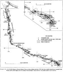
The Hawaiian islands with attention called to topographic highs, Bouguer gravity anomalies, locus of shield volcanoes, and areas of closed low. Two and sometimes three parallel paths of volcanic loci are shown trailing the hotspot for thousands of miles.
The Loa and Kea volcanic trends follow meandering parallel paths for thousands of miles.

Three of the earliest recorded observers of the volcanoes were the Scottish scientists Archibald Menzies in 1794,[26] James Macrae in 1825,[27] and David Douglas in 1834. Just reaching the summits proved daunting: Menzies took three attempts to ascend Mauna Loa, and Douglas died on the slopes of Mauna Kea. The United States Exploring Expedition spent several months studying the islands in 1840–1841.[28] American geologist James Dwight Dana was on that expedition, as was Lieutenant Charles Wilkes, who spent most of the time leading a team of hundreds that hauled a pendulum to the summit of Mauna Loa to measure gravity. Dana stayed with missionary Titus Coan, who would provide decades of first-hand observations.[29] Dana published a short paper in 1852.[30]

Dana remained interested in the origin of the Hawaiian Islands, and directed a more in-depth study in 1880 and 1881. He confirmed that the islands' age increased with their distance from the southeastern-most island by observing differences in their degree of erosion. He also suggested that many other island chains in the Pacific showed a similar general increase in age from southeast to northwest. Dana concluded that the Hawaiian chain consisted of two volcanic strands, located along distinct but parallel curving pathways. He coined the terms "Loa" and "Kea" for the two prominent trends. The Kea trend includes the volcanoes of Kīlauea, Mauna Kea, Kohala, Haleakalā, and West Maui. The Loa trend includes Lōiʻhi, Mauna Loa, Hualālai, Kahoʻolawe, Lānaʻi, and West Molokaʻi. Dana proposed that the alignment of the Hawaiian Islands reflected localized volcanic activity along a major fissure zone. Dana's "great fissure" theory served as the working hypothesis for subsequent studies until the mid-20th century.[23]

Dana's work was followed up by geologist C. E. Dutton's 1884 expedition, who refined and expanded Dana's ideas. Most notably, Dutton established that the island of Hawaii actually harbored five volcanoes, whereas Dana counted three. This is because Dana had originally regarded Kīlauea as a flank vent of Mauna Loa, and Kohala as part of Mauna Kea. Dutton also refined others of Dana's observations, and is credited with the naming of 'a'ā and pāhoehoe-type lavas, although Dana had noted a distinction. Stimulated by Dutton's expedition, Dana returned in 1887, and published many accounts of his expedition in the American Journal of Science. In 1890 he published the most detailed manuscript of its day, and remained the definitive guide to Hawaiian volcanism for decades. 1909 saw the publication of two large volumes which extensively quoted from earlier works now out of circulation.[31]:154–155

In 1912 geologist Thomas Jaggar founded the Hawaiian Volcano Observatory. The facility was taken over in 1919 by the National Oceanic and Atmospheric Administration and in 1924 by the United States Geological Survey (USGS), which marked the start of continuous volcano observation on Hawaii island. The next century was a period of thorough investigation, marked by contributions from many top scientists. The first complete evolutionary model was first formulated in 1946, by USGS geologist and hydrologist Harold T. Stearns. Since that time, advances have enabled the study of previously limited areas of observation (e.g. improved rock dating methods and submarine volcanic stages).[31]:157[32]

In the 1970s, the Hawaiian seafloor was mapped using ship-based sonar. Computed SYNBAPS (Synthetic Bathymetric Profiling System)[33] data filled holes between the ship-based sonar bathymetric measurements.[19][34] From 1994 to 1998[35] the Japan Agency for Marine-Earth Science and Technology (JAMSTEC) mapped Hawaii in detail and studied its ocean floor, making it one of the world's best-studied marine features. The JAMSTEC project, a collaboration with USGS and other agencies, utilized manned submersibles, remotely operated underwater vehicles, dredge samples, and core samples.[36] The Simrad EM300 multibeam side-scanning sonar system collected bathymetry and backscatter data.[35]

Characteristics

Position

The Hawaii hotspot has been imaged through seismic tomography, and is estimated to be 500–600 km (310–370 mi) wide.[37][38] Tomographic images show a thin low-velocity zone extending to a depth of 1,500 km (930 mi), connecting with a large low-velocity zone extending from a depth of 2,000 km (1,200 mi) to the core-mantle boundary. These low seismic velocity zones often indicate hotter and more buoyant mantle material, consistent with a plume originating in the lower mantle and a pond of plume material in the upper mantle. The low-velocity zone associated with the source of the plume is north of Hawaiʻi, showing that the plume is tilted to a certain degree, deflected toward the south by mantle flow.[39] Uranium decay-series disequilibria data has shown that the actively flowing region of the melt zone is 220 ± 40 km (137 ± 25 mi) km wide at its base and 280 ± 40 km (174 ± 25 mi) at the upper mantle upwelling, consistent with tomographic measurements.[40]

Temperature

Indirect studies found that the magma chamber is located about 90–100 kilometers (56–62 mi) underground, which matches the estimated depth of the Cretaceous Period rock in the oceanic lithosphere; this may indicate that the lithosphere acts as a lid on melting by arresting the magma's ascent. The magma's original temperature was found in two ways, by testing garnet's melting point in lava and by adjusting the lava for olivine deterioration. Both USGS tests seem to confirm the temperature at about 1,500 °C (2,730 °F); in comparison, the estimated temperature for mid-ocean ridge basalt is about 1,325 °C (2,417 °F).[41]

The surface heat flow anomaly around the Hawaiian Swell is only of the order of 10 mW/m2,[42][43] far less than the continental United States range of 25 to 150 mW/m2.[44] This is unexpected for the classic model of a hot, buoyant plume in the mantle. However, it has been shown that other plumes display highly variable surface heat fluxes and that this variability may be due to variable hydrothermal fluid flow in the Earth's crust above the hotspots. This fluid flow advectively removes heat from the crust, and the measured conductive heat flow is therefore lower than the true total surface heat flux.[43] The low heat across the Hawaiian Swell indicates that it is not supported by a buoyant crust or upper lithosphere, but is rather propped up by the upwelling hot (and therefore less-dense) mantle plume that causes the surface to rise[42] through a mechanism known as "dynamic topography".

Movement

Hawaiian volcanoes drift northwest from the hotspot at a rate of about 5–10 centimeters (2.0–3.9 in) a year.[18] The hotspot has migrated south by about 800 kilometers (497 mi) relative to the Emperor chain.[23] Paleomagnetic studies support this conclusion based on changes in Earth's magnetic field, a picture of which was engrained in the rocks at the time of their solidification,[45] showing that these seamounts formed at higher latitudes than present-day Hawaii. Prior to the bend, the hotspot migrated an estimated 7 centimeters (2.8 in) per year; the rate of movement changed at the time of the bend to about 9 centimeters (3.5 in) per year.[23] The Ocean Drilling Program provided most of the current knowledge about the drift. The 2001[46] expedition drilled six seamounts and tested the samples to determine their original latitude, and thus the characteristics and speed of the hotspot's drift pattern in total.[47]

Each successive volcano spends less time actively attached to the plume. The large difference between the youngest and oldest lavas between Emperor and Hawaiian volcanoes indicates that the hotspot's velocity is increasing. For example, Kohala, the oldest volcano on Hawaii island, is one million years old and last erupted 120,000 years ago, a period of just under 900,000 years; whereas one of the oldest, Detroit Seamount, experienced 18 million or more years of volcanic activity.[21]

The oldest volcano in the chain, Meiji Seamount, perched on the edge of the Aleutian Trench, formed 85 million years ago.[48] At its current velocity, the seamount will be destroyed within a few million years, as the Pacific Plate slides under the Eurasian Plate. It is unknown whether the seamount chain has been subducting under the Eurasian Plate, and whether the hotspot is older than Meiji Seamount, as any older seamounts have since been destroyed by the plate margin. It is also possible that a collision near the Aleutian Trench had changed the velocity of the Pacific Plate, explaining the hotspot chain's bend; the relationship between these features is still being investigated.[23][49]

Magma


A lava fountain at Pu'u 'O'o, a volcanic cone on the flank of Kilauea. Pu'u 'O'o is one of the most active volcanoes in the world, and has been continuously erupting since January 3, 1983.

The composition of the volcanoes' magma has changed significantly according to analysis of the strontiumniobiumpalladium elemental ratios. The Emperor Seamounts were active for at least 46 million years, with the oldest lava dated to the Cretaceous Period, followed by another 39 million years of activity along the Hawaiian segment of the chain, totaling 85 million years. Data demonstrate vertical variability in the amount of strontium present in both the alkalic (early stages) and tholeitic (later stages) lavas. The systematic increase slows drastically at the time of the bend.[48]

Almost all magma created by the hotspot is igneous basalt; the volcanoes are constructed almost entirely of this or the similar in composition but coarser-grained gabbro and diabase. Other igneous rocks such as nephelinite are present in small quantities; these occur often on the older volcanoes, most prominently Detroit Seamount.[48] Most eruptions are runny because basaltic magma is less viscous than magmas characteristic of more explosive eruptions such as the andesitic magmas that produce spectacular and dangerous eruptions around Pacific Basin margins.[7] Volcanoes fall into several eruptive categories. Hawaiian volcanoes are called "Hawaiian-type". Hawaiian lava spills out of craters and forms long streams of glowing molten rock, flowing down the slope, covering acres of land and replacing ocean with new land.[50]

Eruption frequency and scale

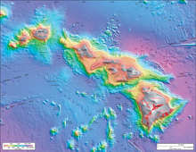
Bathymetric rendering of the Hawaiian island chain showing greater depths as blue, shallower depths as red, and exposed land as gray. The main island is the tallest, the ones in the middle sit on a raised plateau, and three more islands sit separately at the west end of the chain. A series of small elevation bumps (seamounts) sit south of the main landmass.
Bathymetry and topography of the southeastern Hawaiian Islands, with historic lava flows shown in red

There is significant evidence that lava flow rates have been increasing. Over the last six million years they have been far higher than ever before, at over 0.095 km3 (0.023 cu mi) per year. The average for the last million years is even higher, at about 0.21 km3 (0.050 cu mi). In comparison, the average production rate at a mid-ocean ridge is about 0.02 km3 (0.0048 cu mi) for every 1,000 kilometers (621 mi) of ridge. The rate along the Emperor seamount chain averaged about 0.01 cubic kilometers (0.0024 cu mi) per year. The rate was almost zero for the initial five million or so years in the hotspot's life. The average lava production rate along the Hawaiian chain has been greater, at 0.017 km3 (0.0041 cu mi) per year.[23] In total, the hotspot has produced an estimated 750,000 cubic kilometers (180,000 cu mi) of lava, enough to cover California with a layer about 1.5 kilometers (1 mi) thick.[5][18][51][52][53]

The distance between individual volcanoes has shrunk. Although volcanoes have been drifting north faster and spending less time active, the far greater modern eruptive volume of the hotspot has generated more closely spaced volcanoes, and many of them overlap, forming such superstructures as Hawaiʻi island and the ancient Maui Nui. Meanwhile, many of the volcanoes in the Emperor seamounts are separated by 100 kilometers (62 mi) or even as much as 200 kilometers (124 mi).[52][53]

Topography and geoid

A detailed topographic analysis of the Hawaiian – Emperor seamount chain reveals the hotspot as the center of a topographic high, and that elevation falls with distance from the hotspot. The most rapid decrease in elevation and the highest ratio between the topography and geoid height are over the southeastern part of the chain, falling with distance from the hotspot, particularly at the intersection of the Molokai and Murray fracture zones. The most likely explanation is that the region between the two zones is more susceptible to reheating than most of the chain. Another possible explanation is that the hotspot strength swells and subsides over time.[34]

In 1953, Robert S. Dietz and his colleagues first identified the swell behavior. It was suggested that the cause was mantle upwelling. Later work pointed to tectonic uplift, caused by reheating within the lower lithosphere. However, normal seismic activity beneath the swell, as well as lack of detected heat flow, caused scientists to suggest dynamic topography as the cause, in which the motion of the hot and buoyant mantle plume supports the high surface topography around the islands.[42] Understanding the Hawaiian swell has important implications for hotspot study, island formation, and inner Earth.[34]

Volcanoes

Over its 85 million year history, the Hawaii hotspot has created at least 129 volcanoes, more than 123 of which are extinct volcanoes, seamounts, and atolls, four of which are active volcanoes, and two of which are dormant volcanoes.[21][47][54] They can be organized into three general categories: the Hawaiian archipelago, which comprises most of the U.S. state of Hawaii and is the location of all modern volcanic activity; the Northwestern Hawaiian Islands, which consist of coral atolls, extinct islands, and atoll islands; and the Emperor Seamounts, all of which have since eroded and subsided to the sea and become seamounts and guyots (flat-topped seamounts).[55]

Volcanic characteristics


Kīlauea's eastern rift zone

Hawaiian volcanoes are characterized by frequent rift eruptions, their large size (thousands of cubic kilometers in volume), and their rough, decentralized shape. Rift zones are a prominent feature on these volcanoes, and account for their seemingly random volcanic structure.[56] The tallest mountain in the Hawaii chain, Mauna Kea, rises 4,205 meters (13,796 ft) above mean sea level. Measured from its base on the seafloor, it is the world's tallest mountain, at 10,203 meters (33,474 ft); Mount Everest rises 8,848 meters (29,029 ft) above sea level.[57] Hawaii is surrounded by a myriad of seamounts; however, they were found to be unconnected to the hotspot and its volcanism.[36] Kīlauea has erupted continuously since 1983 through Puʻu ʻŌʻō, a minor volcanic cone, which has become an attraction for volcanologists and tourists alike.[58]

Landslides

The Hawaiian islands are carpeted by a large number of landslides sourced from volcanic collapse. Bathymetric mapping has revealed at least 70 large landslides on the island flanks over 20 km (12 mi) in length, and the longest are 200 km (120 mi) long and over 5,000 km3 (1,200 cu mi) in volume. These debris flows can be sorted into two broad categories: slumps, mass movement over slopes which slowly flatten their originators, and more catastrophic debris avalanches, which fragment volcanic slopes and scatter volcanic debris past their slopes. These slides have caused massive tsunamis and earthquakes, fractured volcanic massifs, and scattered debris hundreds of miles away from their source.[59]

Slumps tend to be deeply rooted in their originators, moving rock up to 10 km (6 mi) deep inside the volcano. Forced forward by the mass of newly ejected volcanic material, slumps may creep forward slowly, or surge forward in spasms that have caused the largest of Hawaii's historical earthquakes, in 1868 and 1975. Debris avalanches, meanwhile, are thinner and longer, and are defined by volcanic amphitheaters at their head and hummocky terrain at their base. Rapidly moving avalanches carried 10 km (6 mi) blocks tens of kilometers away, disturbing the local water column and causing a tsunami. Evidence of these events exists in the form of marine deposits high on the slopes of many Hawaiian volcanoes,[59] and has marred the slopes of several Emperor seamounts, such as Daikakuji Guyot and Detroit Seamount.[21]

Evolution and construction
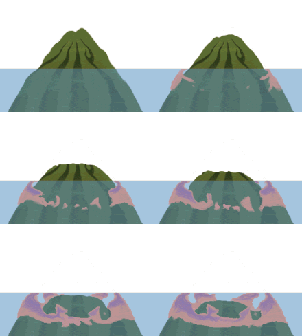
Animation showing an intact volcano that gradually shrinks in size with some of the lava around its perimeter replaced by coral
An animated sequence showing the erosion and subsidence of a volcano, and the formation of a coral reef around it—eventually resulting in an atoll

Hawaiian volcanoes follow a well-established life cycle of growth and erosion. After a new volcano forms, its lava output gradually increases. Height and activity both peak when the volcano is around 500,000 years old and then rapidly decline. Eventually it goes dormant, and eventually extinct. Erosion then weathers the volcano until it again becomes a seamount.[55]

This life cycle consists of several stages. The first stage is the submarine preshield stage, currently represented solely by Lōʻihi Seamount. During this stage, the volcano builds height through increasingly frequent eruptions. The sea's pressure prevents explosive eruptions. The cold water quickly solidifies the lava, producing the pillow lava that is typical of underwater volcanic activity.[55][60]

As the seamount slowly grows, it goes through the shield stages. It forms many mature features, such as a caldera, while submerged. The summit eventually breaches the surface, and the lava and ocean water "battle" for control as the volcano enters the explosive subphase. This stage of development is exemplified by explosive steam vents. This stage produces mostly volcanic ash, a result of the waves dampening the lava.[55] This conflict between lava and sea influences Hawaiian mythology.[24]:8–11

The volcano enters the subaerial subphase once it is tall enough to escape the water. Now the volcano puts on 95% of its above-water height over roughly 500,000 years. Thereafter eruptions become much less explosive. The lava released in this stage often includes both pāhoehoe and ʻaʻā, and the currently active Hawaiian volcanoes, Mauna Loa and Kīlauea, are in this phase. Hawaiian lava is often runny, blocky, slow, and relatively easy to predict; the USGS tracks where it is most likely to run, and maintains a tourist site for viewing the lava.[55][61]

After the subaerial phase the volcano enters a series of postshield stages involving subsidence and erosion, becoming an atoll and eventually a seamount. Once the Pacific Plate moves it out of the 20 °C (68 °F) tropics, the reef mostly dies away, and the extinct volcano becomes one of an estimated 10,000 barren seamounts worldwide.[55][62] Every Emperor seamount is a dead volcano.

Mount St. Helens

From Wikipedia, the free encyclopedia
Mount St. Helens
Louwala-Clough
MSH82 st helens plume from harrys ridge 05-19-82.jpg
3,000 ft (1 km) high steam plume on May 19, 1982, two years after its major eruption
Highest point
Elevation 8,363 ft (2,549 m)
Prominence 4,605 ft (1,404 m)
Listing
Coordinates 46°11′28″N 122°11′40″WCoordinates: 46°11′28″N 122°11′40″W[1]
Geography
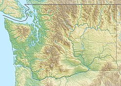
Mount St. Helens is located in Washington (state)
Mount St. Helens
Mount St. Helens
Parent range Cascade Range
Topo map USGS Mount St. Helens
Geology
Age of rock < 40,000 yrs
Mountain type Active stratovolcano (Subduction zone)
Volcanic arc Cascade Volcanic Arc
Last eruption July 10, 2008
Climbing
First ascent 1853 by Thomas J. Dryer
Easiest route Hike via south slope of volcano (closest area near eruption site)

Mount St. Helens or Louwala-Clough (known as Lawetlat'la to the indigenous Cowlitz people, and Loowit to the Klickitat) is an active stratovolcano located in Skamania County, Washington, in the Pacific Northwest region of the United States. It is 50 miles (80 km) northeast of Portland, Oregon and 96 miles (154 km) south of Seattle, Washington. Mount St. Helens takes its English name from the British diplomat Lord St Helens, a friend of explorer George Vancouver who made a survey of the area in the late 18th century.[1] The volcano is located in the Cascade Range and is part of the Cascade Volcanic Arc, a segment of the Pacific Ring of Fire that includes over 160 active volcanoes. This volcano is well known for its ash explosions and pyroclastic flows.

Mount St. Helens is most notorious for its major 1980 eruption, the deadliest and most economically destructive volcanic event in the history of the United States.[2] Fifty-seven people were killed; 250 homes, 47 bridges, 15 miles (24 km) of railways, and 185 miles (298 km) of highway were destroyed. A massive debris avalanche triggered by an earthquake measuring 5.1 on the Richter scale caused an eruption[3] that reduced the elevation of the mountain's summit from 9,677 ft (2,950 m) to 8,363 ft (2,549 m), leaving a 1 mile (1.6 km) wide horseshoe-shaped crater.[4] The debris avalanche was up to 0.7 cubic miles (2.9 km3) in volume. The Mount St. Helens National Volcanic Monument was created to preserve the volcano and allow for its aftermath to be scientifically studied.

As with most other volcanoes in the Cascade Range, Mount St. Helens is a large eruptive cone consisting of lava rock interlayered with ash, pumice, and other deposits. The mountain includes layers of basalt and andesite through which several domes of dacite lava have erupted. The largest of the dacite domes formed the previous summit, and off its northern flank sat the smaller Goat Rocks dome. Both were destroyed in the 1980 eruption.

Geographic setting and description

General

Landscape with a large open volcano
A view of St. Helens and the nearby area from space
 
A large conical volcano.
Mount St. Helens the day before the 1980 eruption, which removed much of the northern face of the mountain, leaving a large crater
 
3-D perspective view of Mount St. Helens

Mount St. Helens is 34 miles (55 km) west of Mount Adams, in the western part of the Cascade Range. These "sister and brother" volcanic mountains are approximately 50 miles (80 km) from Mount Rainier, the highest of Cascade volcanoes. Mount Hood, the nearest major volcanic peak in Oregon, is 60 miles (100 km) southeast of Mount St. Helens.

Mount St. Helens is geologically young compared with the other major Cascade volcanoes. It formed only within the past 40,000 years, and the pre-1980 summit cone began rising about 2,200 years ago.[5] The volcano is considered the most active in the Cascades within the Holocene epoch (the last 10,000 or so years).[6]

Prior to the 1980 eruption, Mount St. Helens was the fifth-highest peak in Washington. It stood out prominently from surrounding hills because of the symmetry and extensive snow and ice cover of the pre-1980 summit cone, earning it the nickname "Fuji-san of America".[7] The peak rose more than 5,000 feet (1,500 m) above its base, where the lower flanks merge with adjacent ridges. The mountain is 6 miles (9.7 km) across at its base, which is at an elevation of 4,400 feet (1,300 m) on the northeastern side and 4,000 feet (1,200 m) elsewhere. At the pre-eruption tree line, the width of the cone was 4 miles (6.4 km).

View of Mt. St. Helens from a commercial airliner, July 2007

Streams that originate on the volcano enter three main river systems: the Toutle River on the north and northwest, the Kalama River on the west, and the Lewis River on the south and east. The streams are fed by abundant rain and snow. The average annual rainfall is 140 inches (3,600 mm), and the snow pack on the mountain's upper slopes can reach 16 feet (4.9 m).[8] The Lewis River is impounded by three dams for hydroelectric power generation. The southern and eastern sides of the volcano drain into an upstream impoundment, the Swift Reservoir, which is directly south of the volcano's peak.

April 30, 2015 Mount St Helens[9]

Although Mount St. Helens is in Skamania County, Washington, access routes to the mountain run through Cowlitz County to the west. State Route 504, locally known as the Spirit Lake Memorial Highway, connects with Interstate 5 at Exit 49, 34 miles (55 km) to the west of the mountain. That north–south highway skirts the low-lying cities of Castle Rock, Longview and Kelso along the Cowlitz River, and passes through the Vancouver, WashingtonPortland, Oregon metropolitan area less than 50 miles (80 km) to the southwest. The community nearest the volcano is Cougar, Washington, in the Lewis River valley 11 miles (18 km) south-southwest of the peak. Gifford Pinchot National Forest surrounds Mount St. Helens.

Crater Glacier and other new rock glaciers

Summit rim of Mount St. Helens

During the winter of 1980–1981, a new glacier appeared. Now officially named Crater Glacier, it was formerly known as the Tulutson Glacier. Shadowed by the crater walls and fed by heavy snowfall and repeated snow avalanches, it grew rapidly (14 feet (4.3 m) per year in thickness). By 2004, it covered about 0.36 square miles (0.93 km2), and was divided by the dome into a western and eastern lobe. Typically, by late summer, the glacier looks dark from rockfall from the crater walls and ash from eruptions. As of 2006, the ice had an average thickness of 300 feet (100 m) and a maximum of 650 feet (200 m), nearly as deep as the much older and larger Carbon Glacier of Mount Rainier. The ice is all post–1980, making the glacier very young geologically. However, the volume of the new glacier is about the same as all the pre–1980 glaciers combined.[10][11][12][13][14]

With the recent volcanic activity starting in 2004, the glacier lobes were pushed aside and upward by the growth of new volcanic domes. The surface of the glacier, once mostly without crevasses, turned into a chaotic jumble of icefalls heavily criss-crossed with crevasses and seracs caused by movement of the crater floor.[15] The new domes have almost separated the Crater Glacier into an eastern and western lobe. Despite the volcanic activity, the termini of the glacier have still advanced, with a slight advance on the western lobe and a more considerable advance on the more shaded eastern lobe. Due to the advance, two lobes of the glacier joined together in late May 2008 and thus the glacier completely surrounds the lava domes.[15][16][17] In addition, since 2004, new glaciers have formed on the crater wall above Crater Glacier feeding rock and ice onto its surface below; there are two rock glaciers to the north of the eastern lobe of Crater Glacier.[18] Crater Glacier is the only known advancing glacier in the contiguous United States.[19]

Geologic history

Ancestral stages of eruptive activity

Map of the west coast of United States with dark lines in the ocean and location of Cascade Volcanoes.

The early eruptive stages of Mount St. Helens are known as the "Ape Canyon Stage" (around 40,000–35,000 years ago), the "Cougar Stage" (ca. 20,000–18,000 years ago), and the "Swift Creek Stage" (roughly 13,000–8,000 years ago).[20] The modern period, since about 2500 BCE, is called the "Spirit Lake Stage". Collectively, the pre–Spirit Lake stages are known as the "ancestral stages". The ancestral and modern stages differ primarily in the composition of the erupted lavas; ancestral lavas consisted of a characteristic mixture of dacite and andesite, while modern lava is very diverse (ranging from olivine basalt to andesite and dacite).[21]

St. Helens started its growth in the Pleistocene 37,600 years ago, during the Ape Canyon stage, with dacite and andesite eruptions of hot pumice and ash.[21] Thirty-six thousand years ago a large mudflow cascaded down the volcano;[21] mudflows were significant forces in all of St. Helens' eruptive cycles. The Ape Canyon eruptive period ended around 35,000 years ago and was followed by 17,000 years of relative quiet. Parts of this ancestral cone were fragmented and transported by glaciers 14,000 to 18,000 years ago during the last glacial period of the current ice age.[21]

The second eruptive period, the Cougar Stage, started 20,000 years ago and lasted for 2,000 years.[21] Pyroclastic flows of hot pumice and ash along with dome growth occurred during this period. Another 5,000 years of dormancy followed, only to be upset by the beginning of the Swift Creek eruptive period, typified by pyroclastic flows, dome growth and blanketing of the countryside with tephra. Swift Creek ended 8,000 years ago.

Smith Creek and Pine Creek eruptive periods

A dormancy of about 4,000 years was broken around 2500 BCE with the start of the Smith Creek eruptive period, when eruptions of large amounts of ash and yellowish-brown pumice covered thousands of square miles. An eruption in 1900 BCE was the largest known eruption from St. Helens during the Holocene epoch, judged by the volume of one of the tephra layers from that period. This eruptive period lasted until about 1600 BCE and left 18 inches (46 cm) deep deposits of material 50 miles (80 km) distant in what is now Mt. Rainier National Park. Trace deposits have been found as far northeast as Banff National Park in Alberta, and as far southeast as eastern Oregon.[22] All told there may have been up to 2.5 cubic miles (10 km3) of material ejected in this cycle.[22] Some 400 years of dormancy followed.

St. Helens came alive again around 1200 BCE — the Pine Creek eruptive period.[22] This lasted until about 800 BCE and was characterized by smaller-volume eruptions. Numerous dense, nearly red hot pyroclastic flows sped down St. Helens' flanks and came to rest in nearby valleys. A large mudflow partly filled 40 miles (64 km) of the Lewis River valley sometime between 1000 BCE and 500 BCE.

Castle Creek and Sugar Bowl eruptive periods

The next eruptive period, the Castle Creek period, began about 400 BCE, and is characterized by a change in composition of St. Helens' lava, with the addition of olivine and basalt.[23] The pre-1980 summit cone started to form during the Castle Creek period. Significant lava flows in addition to the previously much more common fragmented and pulverized lavas and rocks (tephra) distinguished this period. Large lava flows of andesite and basalt covered parts of the mountain, including one around the year 100 BCE that traveled all the way into the Lewis and Kalama river valleys.[23] Others, such as Cave Basalt (known for its system of lava tubes), flowed up to 9 miles (14 km) from their vents.[23] During the first century, mudflows moved 30 miles (50 km) down the Toutle and Kalama river valleys and may have reached the Columbia River. Another 400 years of dormancy ensued.

The Sugar Bowl eruptive period was short and markedly different from other periods in Mount St. Helens history. It produced the only unequivocal laterally directed blast known from Mount St. Helens before the 1980 eruptions.[24] During Sugar Bowl time, the volcano first erupted quietly to produce a dome, then erupted violently at least twice producing a small volume of tephra, directed-blast deposits, pyroclastic flows, and lahars.[24]

Kalama and Goat Rocks eruptive periods

Painting of a rolling landscape with a conical mountain in background.
The symmetrical appearance of St. Helens prior to the 1980 eruption earned it the nickname "Mount Fuji of America". The once familiar shape was formed out of the Kalama and Goat Rocks eruptive periods.

Roughly 700 years of dormancy were broken in about 1480, when large amounts of pale gray dacite pumice and ash started to erupt, beginning the Kalama period. The eruption in 1480 was several times larger than the May 18, 1980, eruption.[24] In 1482, another large eruption rivaling the 1980 eruption in volume is known to have occurred.[24] Ash and pumice piled 6 miles (9.7 km) northeast of the volcano to a thickness of 3 feet (0.9 m); 50 miles (80 km) away, the ash was 2 inches (5 cm) deep. Large pyroclastic flows and mudflows subsequently rushed down St. Helens' west flanks and into the Kalama River drainage system.

This 150-year period next saw the eruption of less silica-rich lava in the form of andesitic ash that formed at least eight alternating light- and dark-colored layers.[23] Blocky andesite lava then flowed from St. Helens' summit crater down the volcano's southeast flank.[23] Later, pyroclastic flows raced down over the andesite lava and into the Kalama River valley. It ended with the emplacement of a dacite dome several hundred feet (~200 m) high at the volcano's summit, which filled and overtopped an explosion crater already at the summit.[25] Large parts of the dome's sides broke away and mantled parts of the volcano's cone with talus. Lateral explosions excavated a notch in the southeast crater wall. St. Helens reached its greatest height and achieved its highly symmetrical form by the time the Kalama eruptive cycle ended, about 1647.[25] The volcano remained quiet for the next 150 years.

The 57-year eruptive period that started in 1800 was named after the Goat Rocks dome, and is the first time that both oral and written records exist.[25] Like the Kalama period, the Goat Rocks period started with an explosion of dacite tephra, followed by an andesite lava flow, and culminated with the emplacement of a dacite dome. The 1800 eruption probably rivalled the 1980 eruption in size, although it did not result in massive destruction of the cone. The ash drifted northeast over central and eastern Washington, northern Idaho, and western Montana. There were at least a dozen reported small eruptions of ash from 1831 to 1857, including a fairly large one in 1842. The vent was apparently at or near Goat Rocks on the northeast flank.[25] Goat Rocks dome was the site of the bulge in the 1980 eruption, and it was obliterated in the major eruption event on May 18, 1980 that destroyed the entire north face and top 1,300 feet (400 m) of the mountain.

Modern eruptive period

1980 to 2001 activity

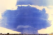
This composite photograph of the May 18 eruption was taken from 35 miles (60 km) west in Toledo, Washington. The ash-cloud stem is 10 miles (16 km) wide, and the mushroom top is 40 miles (64 km) wide and 15 miles (24 km) high. The footprint of the cloud stem is roughly the same as the devastated area north of the mountain where the forest was knocked down and which three decades later is still relatively barren.

On March 20, 1980, Mount St. Helens experienced a magnitude 4.2 earthquake;[2] and, on March 27, steam venting started.[26] By the end of April, the north side of the mountain had started to bulge.[27] On May 18, a second earthquake, of magnitude 5.1, triggered a massive collapse of the north face of the mountain. It was the largest known debris avalanche in recorded history. The magma in St. Helens burst forth into a large-scale pyroclastic flow that flattened vegetation and buildings over 230 square miles (600 km2). More than 1.5 million metric tons of sulfur dioxide was released into the atmosphere.[28] On the Volcanic Explosivity Index scale, the eruption was rated a five, and categorized as a Plinian eruption.

Mount St. Helens erupted on May 18, 1980, at 08:32 Pacific Daylight Time

The collapse of the northern flank of St. Helens mixed with ice, snow, and water to create lahars (volcanic mudflows). The lahars flowed many miles down the Toutle and Cowlitz Rivers, destroying bridges and lumber camps. A total of 3,900,000 cubic yards (3,000,000 m3) of material was transported 17 miles (27 km) south into the Columbia River by the mudflows.[29]

For more than nine hours, a vigorous plume of ash erupted, eventually reaching 12 to 16 miles (20 to 27 km) above sea level.[30] The plume moved eastward at an average speed of 60 miles per hour (100 km/h) with ash reaching Idaho by noon. Ashes from the eruption were found collecting on top of cars and roofs next morning, as far as the city of Edmonton in Alberta, Canada.

Diagram with different colored layers.
Lava dome growth profile from 1980–1986

By about 5:30 p.m. on May 18, the vertical ash column declined in stature, and less severe outbursts continued through the night and for the next several days. The St. Helens May 18 eruption released 24 megatons of thermal energy;[3][31] it ejected more than 0.67 cubic miles (2.79 km3) of material.[3] The removal of the north side of the mountain reduced St. Helens' height by about 1,300 feet (400 m) and left a crater 1 mile (1.6 km) to 2 miles (3.2 km) wide and 0.5 miles (800 m) deep, with its north end open in a huge breach. The eruption killed 57 people, nearly 7,000 big game animals (deer, elk, and bear), and an estimated 12 million fish from a hatchery.[8] It destroyed or extensively damaged over 200 homes, 185 miles (298 km) of highway and 15 miles (24 km) of railways.[8]

Between 1980 and 1986, activity continued at Mount St. Helens, with a new lava dome forming in the crater. Numerous small explosions and dome-building eruptions occurred. From December 7, 1989, to January 6, 1990, and from November 5, 1990, to February 14, 1991, the mountain erupted with sometimes huge clouds of ash.[32]

2004 to 2008 activity

Magma reached the surface of the volcano about October 11, 2004, resulting in the building of a new lava dome on the existing dome's south side. This new dome continued to grow throughout 2005 and into 2006. Several transient features were observed, such as a lava spine nicknamed the "whaleback," which comprised long shafts of solidified magma being extruded by the pressure of magma beneath. These features were fragile and broke down soon after they were formed. On July 2, 2005, the tip of the whaleback broke off, causing a rockfall that sent ash and dust several hundred meters into the air.[33]
 
Large fairly smooth rock structure inside a crater
Appearance of the "Whaleback" in February 2005

Mount St. Helens showed significant activity on March 8, 2005, when a 36,000-foot (11,000 m) plume of steam and ash emerged—visible from Seattle.[34] This relatively minor eruption was a release of pressure consistent with ongoing dome building. The release was accompanied by a magnitude 2.5 earthquake.

Another feature to emerge from the dome was called the "fin" or "slab." Approximately half the size of a football field, the large, cooled volcanic rock was being forced upward as quickly as 6 ft (2 m) per day.[35][36] In mid-June 2006, the slab was crumbling in frequent rockfalls, although it was still being extruded. The height of the dome was 7,550 feet (2,300 m), still below the height reached in July 2005 when the whaleback collapsed.

Microscopic view of a rock
Thin section of dacite from a dome created in 2004

On October 22, 2006, at 3:13 p.m. PST, a magnitude 3.5 earthquake broke loose Spine 7. The collapse and avalanche of the lava dome sent an ash plume 2,000 feet (600 m) over the western rim of the crater; the ash plume then rapidly dissipated.

On December 19, 2006, a large white plume of condensing steam was observed, leading some media people to assume there had been a small eruption. However, the Cascades Volcano Observatory of the USGS did not mention any significant ash plume.[37] The volcano was in continuous eruption from October 2004, but this eruption consisted in large part of a gradual extrusion of lava forming a dome in the crater.

On January 16, 2008, steam began seeping from a fracture on top of the lava dome. Associated seismic activity was the most noteworthy since 2004. Scientists suspended activities in the crater and the mountain flanks, but the risk of a major eruption was deemed low.[38] By the end of January, the eruption paused; no more lava was being extruded from the lava dome. On July 10, 2008, it was determined that the eruption had ended, after more than six months of no volcanic activity.[39]

360° panorama from the summit of Mount St. Helens as seen in October 2009. In the foreground is the ice-covered crater rim. Visible in the lower center is the lava dome. Steam rises from several dome vents. Above the dome, in the upper center, lies Mount Rainier and Spirit Lake. Mount Adams appears to the right of Rainier on the horizon as well as Mount Hood and Mount Jefferson on the far right. Also on the far right are glimpses of the Swift Reservoir, Yale Lake, Lake Merwin and the Lewis River. Climbers stand on the crater rim and are visible along the Monitor Ridge climbing route.

Human history

Importance to Native Americans

Mt St Helens before the 1980 eruption (taken from Spirit Lake)
Indigenous American legends were inspired by the volcano's beauty.
American Indian lore contains numerous legends to explain the eruptions of Mount St. Helens and other Cascade volcanoes. The most famous of these is the Bridge of the Gods legend told by the Klickitat people. In their tale, the chief of all the gods and his two sons, Pahto (also called Klickitat) and Wy'east, traveled down the Columbia River from the Far North in search for a suitable area to settle.[40]

They came upon an area that is now called The Dalles and thought they had never seen a land so beautiful. The sons quarreled over the land, so to solve the dispute their father shot two arrows from his mighty bow — one to the north and the other to the south. Pahto followed the arrow to the north and settled there while Wy'east did the same for the arrow to the south. The chief of the gods then built the Bridge of the Gods, so his family could meet periodically.[40]

When the two sons of the chief of the gods fell in love with a beautiful maiden named Loowit, she could not choose between them. The two young chiefs fought over her, burying villages and forests in the process. The area was devastated and the earth shook so violently that the huge bridge fell into the river, creating the cascades of the Columbia River Gorge.[41]

For punishment, the chief of the gods struck down each of the lovers and transformed them into great mountains where they fell. Wy'east, with his head lifted in pride, became the volcano known today as Mount Hood. Pahto, with his head bent toward his fallen love, was turned into Mount Adams. The fair Loowit became Mount St. Helens, known to the Klickitats as Louwala-Clough, which means "smoking or fire mountain" in their language (the Sahaptin called the mountain Loowit).[42]

The mountain is also of sacred importance to the Cowlitz and Yakama tribes that also historically lived in the area. They find the area above its tree line to be of exceptional spiritual significance, and the mountain (which they call "Lawetlat'la", roughly translated as "the smoker") features prominently in their creation myth, and in some of their songs and rituals. In recognition of this cultural significance, over 12,000 acres (4,900 ha) of the mountain (roughly bounded by the Loowit Trail) have been listed on the National Register of Historic Places.[43]

Other area tribal names for the mountain include "nšh´ák´" ("water coming out") from the Upper Chehalis, and "aka akn" ("snow mountain"), a Kiksht term.[43]

Exploration by Europeans

Royal Navy Commander George Vancouver and the officers of HMS Discovery made the Europeans' first recorded sighting of Mount St. Helens on May 19, 1792, while surveying the northern Pacific Ocean coast. Vancouver named the mountain for British diplomat Alleyne Fitzherbert, 1st Baron St Helens on October 20, 1792,[42][44] as it came into view when the Discovery passed into the mouth of the Columbia River.

Years later, explorers, traders, and missionaries heard reports of an erupting volcano in the area. Geologists and historians determined much later that the eruption took place in 1800, marking the beginning of the 57-year-long Goat Rocks Eruptive Period (see geology section).[25] Alarmed by the "dry snow," the Nespelem tribe of northeastern Washington danced and prayed rather than collecting food and suffered during that winter from starvation.[25]

In late 1805 and early 1806, members of the Lewis and Clark Expedition spotted Mount St. Helens from the Columbia River but did not report either an ongoing eruption or recent evidence of one.[45] They did however report the presence of quicksand and clogged channel conditions at the mouth of the Sandy River near Portland, suggesting an eruption by Mount Hood sometime in the previous decades.

In 1829 Hall J. Kelley led a campaign to rename the Cascade Range as the President's Range and also to rename each major Cascade mountain after a former President of the United States. In his scheme Mount St. Helens was to be renamed Mount Washington.[46]

European settlement and use of the area

Man by wooden building that has six fur pelts on it.
19th-century photo of a fur trapper working in the Mount St. Helens area

The first authenticated eyewitness report of a volcanic eruption was made in March 1835 by Meredith Gairdner, while working for the Hudson's Bay Company stationed at Fort Vancouver.[47] He sent an account to the Edinburgh New Philosophical Journal, which published his letter in January 1836. James Dwight Dana of Yale University, while sailing with the United States Exploring Expedition, saw the quiescent peak from off the mouth of the Columbia River in 1841. Another member of the expedition later described "cellular basaltic lavas" at the mountain's base.[48]

Painting of a conical volcano erupting at night from the side.
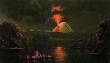
Painting by Paul Kane Mount St. Helens erupting at night after his 1847 visit to the area

In late fall or early winter of 1842, nearby settlers and missionaries witnessed the so-called "Great Eruption". This small-volume outburst created large ash clouds, and mild explosions followed for 15 years.[49] The eruptions of this period were likely phreatic (steam explosions). Josiah Parrish in Champoeg, Oregon witnessed Mount St. Helens in eruption on November 22, 1842. Ash from this eruption may have reached The Dalles, Oregon, 48 miles (80 km) southeast of the volcano.[6]

In October 1843, future California governor Peter H. Burnett recounted a story of an aboriginal American man who badly burned his foot and leg in lava or hot ash while hunting for deer. The likely apocryphal story went that the injured man sought treatment at Fort Vancouver, but the contemporary fort commissary steward, Napoleon McGilvery, disclaimed knowledge of the incident.[50] British lieutenant Henry J. Warre sketched the eruption in 1845, and two years later Canadian painter Paul Kane created watercolors of the gently smoking mountain. Warre's work showed erupting material from a vent about a third of the way down from the summit on the mountain's west or northwest side (possibly at Goat Rocks), and one of Kane's field sketches shows smoke emanating from about the same location.[51]

On April 17, 1857, the Republican, a Steilacoom, Washington, newspaper, reported that "Mount St. Helens, or some other mount to the southward, is seen ... to be in a state of eruption".[52] The lack of a significant ash layer associated with this event indicates that it was a small eruption. This was the first reported volcanic activity since 1854.[52]

Before the 1980 eruption, Spirit Lake offered year-round recreational activities. In the summer there was boating, swimming, and camping, while in the winter there was skiing.

Human impact from the 1980 eruption

Man sitting at a campsite
David A. Johnston hours before he was killed by the eruption

Fifty-seven people were killed during the eruption.[53] Had the eruption occurred one day later, when loggers would have been at work, rather than on a Sunday, the death toll could have been much higher.[8]

83-year-old Harry R. Truman, who had lived near the mountain for 54 years, became famous when he decided not to evacuate before the impending eruption, despite repeated pleas by local authorities. His body was never found after the eruption.

Another victim of the eruption was 30-year-old volcanologist David A. Johnston, who was stationed on the nearby Coldwater Ridge. Moments before his position was hit by the pyroclastic flow, Johnston radioed his famous last words: "Vancouver! Vancouver! This is it!"[54] Johnston's body was never found.

U.S. President Jimmy Carter surveyed the damage and said, "Someone said this area looked like a moonscape. But the moon looks more like a golf course compared to what's up there."[55] A film crew, led by Seattle filmmaker Otto Seiber, was dropped by helicopter on St. Helens on May 23 to document the destruction. Their compasses, however, spun in circles and they quickly became lost. A second eruption occurred on May 25, but the crew survived and was rescued two days later by National Guard helicopter pilots. Their film, The Eruption of Mount St. Helens, later became a popular documentary.

Protection and later history

View of the hillside at the Johnston Ridge Observatory (named for David A. Johnston), 25 years after the eruption
 
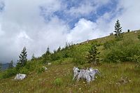
Johnston Ridge from a proximate location in July 2016, showing continued plant growth

In 1982, President Ronald Reagan and the U.S. Congress established the Mount St. Helens National Volcanic Monument, a 110,000 acres (45,000 ha) area around the mountain and within the Gifford Pinchot National Forest.[56]

Following the 1980 eruption, the area was left to gradually return to its natural state. In 1987, the U.S. Forest Service reopened the mountain to climbing. It remained open until 2004 when renewed activity caused the closure of the area around the mountain (see Geological history section above for more details).

Most notable was the closure of the Monitor Ridge trail, which previously let up to 100 permitted hikers per day climb to the summit. On July 21, 2006, the mountain was again opened to climbers.[57] In February 2010, a climber died after falling from the rim into the crater.[58]

The mountain is now circled by the Loowit Trail at elevations of 4000–4900 feet (1,200-1,500 m). The northern segment of the trail from the South Fork Toutle River on the west to Windy Pass on the east is a restricted zone where camping, biking, pets, fires, and off-trail excursions are all prohibited.[59][60]

Climbing and recreation

Mount St. Helens is a popular climbing destination for both beginning and experienced mountaineers. The peak is climbed year-round, although it is more often climbed from late spring through early fall. All routes include sections of steep, rugged terrain.[61] A permit system has been in place for climbers since 1987. A climbing permit is required year-round for anyone who will be above 4,800 feet (1,500 m) on the slopes of Mount St. Helens.[62]

The standard hiking/mountaineering route in the warmer months is the Monitor Ridge Route, which starts at the Climbers Bivouac. This is the most popular and crowded route to the summit in the summer and gains about 4,600 feet (1,400 m) in approximately 5 miles (8 km) to reach the crater rim.[63] Although strenuous, it is considered non-technical climb that involves some scrambling. Most climbers complete the round trip in 7 to 12 hours.[64]

The Worm Flows Route is considered the standard winter route on Mount St. Helens, as it is the most direct route to the summit. The route gains about 5,700 feet (1,700 m) in elevation over about 6 miles (10 km) from trailhead to summit but does not demand the technical climbing that some other Cascade peaks like Mount Rainier do. The "Worm Flows" part of the route name refers to the rocky lava flows that surround the route.[65] This route can be accessed via the Marble Mountain Sno-Park and the Swift Ski Trail.[66]

Cousin marriage in the Middle East

From Wikipedia, the free encyclopedia https://en.wikipedia.org/wiki/Cou...