Search This Blog

Wednesday, July 24, 2019

Savanna

From Wikipedia, the free encyclopedia

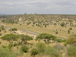
Typical tropical savanna in Northern Australia demonstrating the high tree density and regular spacing characteristic of many savannas
 
A savanna or savannah is a mixed woodland grassland ecosystem characterised by the trees being sufficiently widely spaced so that the canopy does not close. The open canopy allows sufficient light to reach the ground to support an unbroken herbaceous layer consisting primarily of grasses.

Savannas maintain an open canopy despite a high tree density. It is often believed that savannas feature widely spaced, scattered trees. However, in many savannas, tree densities are higher and trees are more regularly spaced than in forests. The South American savanna types cerrado sensu stricto and cerrado dense typically have densities of trees similar to or higher than that found in South American tropical forests, with savanna ranging from 800–3300 trees per hectare (trees/ha) and adjacent forests with 800–2000 trees/ha. Similarly Guinean savanna has 129 trees/ha, compared to 103 for riparian forest, while Eastern Australian sclerophyll forests have average tree densities of approximately 100 per hectare, comparable to savannas in the same region.

Savannas are also characterised by seasonal water availability, with the majority of rainfall confined to one season; they are associated with several types of biomes, and are frequently in a transitional zone between forest and desert or grassland. Savanna covers approximately 20% of the Earth's land area.

Etymology

The word originally entered English in 1555 as the Latin Zauana, equivalent in the orthography of the times to zavana (see history of V). Peter Martyr reported it as the local name for the plain around Comagre, the court of the cacique Carlos in present-day Panama. The accounts are inexact, but this is usually placed in present-day Madugandí or at points on the nearby Guna Yala coast opposite Ustupo or on Point Mosquitos. These areas are now either given over to modern cropland or jungle.

Distribution

 
Many grassy landscapes and mixed communities of trees, shrubs, and grasses were described as savanna before the middle of the 19th century, when the concept of a tropical savanna climate became established. The Köppen climate classification system was strongly influenced by effects of temperature and precipitation upon tree growth, and his oversimplified assumptions resulted in a tropical savanna classification concept which resulted in it being considered as a "climatic climax" formation. The common usage meaning to describe vegetation now conflicts with a simplified yet widespread climatic concept meaning. The divergence has sometimes caused areas such as extensive savannas north and south of the Congo and Amazon Rivers to be excluded from mapped savanna categories.

"Barrens" has been used almost interchangeably with savanna in different parts of North America. Sometimes midwestern savanna were described as "grassland with trees". Different authors have defined the lower limits of savanna tree coverage as 5–10% and upper limits range as 25–80% of an area.

Two factors common to all savanna environments are rainfall variations from year to year, and dry season wildfires. In the Americas, e.g. in Belize, Central America, savanna vegetation is similar from Mexico to South America and to the Caribbean.

Over many large tropical areas, the dominant biome (forest, savanna or grassland) can not be predicted only by the climate, as historical events plays also a key role, for example, fire activity. In some areas, indeed, it is possible the occurrence of multiple stable biomes.

Threats

Changes in fire management

Savannas are subject to regular wildfires and the ecosystem appears to be the result of human use of fire. For example, Native Americans created the Pre-Columbian savannas of North America by periodically burning where fire-resistant plants were the dominant species. Pine barrens in scattered locations from New Jersey to coastal New England are remnants of these savannas. Aboriginal burning appears to have been responsible for the widespread occurrence of savanna in tropical Australia and New Guinea, and savannas in India are a result of human fire use. The maquis shrub savannas of the Mediterranean region were likewise created and maintained by anthropogenic fire.

Prescribed burn; Wisconsin bur oak savanna
 
These fires are usually confined to the herbaceous layer and do little long term damage to mature trees. However, these fires either kill or suppress tree seedlings, thus preventing the establishment of a continuous tree canopy which would prevent further grass growth. Prior to European settlement aboriginal land use practices, including fire, influenced vegetation and may have maintained and modified savanna flora. It has been suggested by many authors that aboriginal burning created a structurally more open savanna landscape. Aboriginal burning certainly created a habitat mosaic that probably increased biodiversity and changed the structure of woodlands and geographic range of numerous woodland species. It has been suggested by many authors that with the removal or alteration of traditional burning regimes many savannas are being replaced by forest and shrub thickets with little herbaceous layer. 

The consumption of herbage by introduced grazers in savanna woodlands has led to a reduction in the amount of fuel available for burning and resulted in fewer and cooler fires. The introduction of exotic pasture legumes has also led to a reduction in the need to burn to produce a flush of green growth because legumes retain high nutrient levels throughout the year, and because fires can have a negative impact on legume populations which causes a reluctance to burn.

Grazing and browsing animals

The closed forest types such as broadleaf forests and rainforests are usually not grazed owing to the closed structure precluding grass growth, and hence offering little opportunity for grazing. In contrast the open structure of savannas allows the growth of a herbaceous layer and are commonly used for grazing domestic livestock. As a result, much of the world's savannas have undergone change as a result of grazing by sheep, goats and cattle, ranging from changes in pasture composition to woody weed encroachment.

The removal of grass by grazing affects the woody plant component of woodland systems in two major ways. Grasses compete with woody plants for water in the topsoil and removal by grazing reduces this competitive effect, potentially boosting tree growth. In addition to this effect, the removal of fuel reduces both the intensity and the frequency of fires which may control woody plant species. Grazing animals can have a more direct effect on woody plants by the browsing of palatable woody species. There is evidence that unpalatable woody plants have increased under grazing in savannas. Grazing also promotes the spread of weeds in savannas by the removal or reduction of the plants which would normally compete with potential weeds and hinder establishment. In addition to this, cattle and horses are implicated in the spread of the seeds of weed species such as Prickly Acacia (Acacia nilotica) and Stylo (Stylosanthes spp.). Alterations in savanna species composition brought about by grazing can alter ecosystem function, and are exacerbated by overgrazing and poor land management practices.

Introduced grazing animals can also affect soil condition through physical compaction and break-up of the soil caused by the hooves of animals and through the erosion effects caused by the removal of protective plant cover. Such effects are most likely to occur on land subjected to repeated and heavy grazing. The effects of overstocking are often worst on soils of low fertility and in low rainfall areas below 500 mm, as most soil nutrients in these areas tend to be concentrated in the surface so any movement of soils can lead to severe degradation. Alteration in soil structure and nutrient levels affects the establishment, growth and survival of plant species and in turn can lead to a change in woodland structure and composition.

Tree clearing

Large areas of Australian and South American savannas have been cleared of trees, and this clearing is continuing today. For example, until recently 480,000 ha of savanna were cleared annually in Australia alone primarily to improve pasture production. Substantial savanna areas have been cleared of woody vegetation and much of the area that remains today is vegetation that has been disturbed by either clearing or thinning at some point in the past. 

Clearing is carried out by the grazing industry in an attempt to increase the quality and quantity of feed available for stock and to improve the management of livestock. The removal of trees from savanna land removes the competition for water from the grasses present, and can lead to a two to fourfold increase in pasture production, as well as improving the quality of the feed available. Since stock carrying capacity is strongly correlated with herbage yield, there can be major financial benefits from the removal of trees, such as assisting with grazing management: regions of dense tree and shrub cover harbors predators, leading to increased stock losses, for example, while woody plant cover hinders mustering in both sheep and cattle areas.

A number of techniques have been employed to clear or kill woody plants in savannas. Early pastoralists used felling and girdling, the removal of a ring of bark and sapwood, as a means of clearing land. In the 1950s arboricides suitable for stem injection were developed. War-surplus heavy machinery was made available, and these were used for either pushing timber, or for pulling using a chain and ball strung between two machines. These two new methods of timber control, along with the introduction and widespread adoption of several new pasture grasses and legumes promoted a resurgence in tree clearing. The 1980s also saw the release of soil-applied arboricides, notably tebuthiuron, that could be utilised without cutting and injecting each individual tree.

In many ways "artificial" clearing, particularly pulling, mimics the effects of fire and, in savannas adapted to regeneration after fire as most Queensland savannas are, there is a similar response to that after fire. Tree clearing in many savanna communities, although causing a dramatic reduction in basal area and canopy cover, often leaves a high percentage of woody plants alive either as seedlings too small to be affected or as plants capable of re-sprouting from lignotubers and broken stumps. A population of woody plants equal to half or more of the original number often remains following pulling of eucalypt communities, even if all the trees over 5 metres are uprooted completely.

Exotic plant species

 
A number of exotic plants species have been introduced to the savannas around the world. Amongst the woody plant species are serious environmental weeds such as Prickly Acacia (Acacia nilotica), Rubbervine (Cryptostegia grandiflora), Mesquite (Prosopis spp.), Lantana (Lantana camara and L. montevidensis) and Prickly Pear (Opuntia spp.) A range of herbaceous species have also been introduced to these woodlands, either deliberately or accidentally including Rhodes grass and other Chloris species, Buffel grass (Cenchrus ciliaris), Giant rat's tail grass (Sporobolus pyramidalis) parthenium (Parthenium hysterophorus) and stylos (Stylosanthes spp.) and other legumes. These introductions have the potential to significantly alter the structure and composition of savannas worldwide, and have already done so in many areas through a number of processes including altering the fire regime, increasing grazing pressure, competing with native vegetation and occupying previously vacant ecological niches. Other plant species include: white sage, spotted cactus, cotton seed, rosemary.

Climate change

Human induced climate change resulting from the greenhouse effect may result in an alteration of the structure and function of savannas. Some authors have suggested that savannas and grasslands may become even more susceptible to woody plant encroachment as a result of greenhouse induced climate change. However, a recent case described a savanna increasing its range at the expense of forest in response to climate variation, and potential exists for similar rapid, dramatic shifts in vegetation distribution as a result of global climate change, particularly at ecotones such as savannas so often represent.

Savanna ecoregions

Mediterranean savanna in Alentejo region, Portugal
 
Savanna ecoregions are of several different types:

Rainforest

From Wikipedia, the free encyclopedia

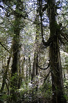
A view of Kitlope Lake in the Kitlope Heritage Conservancy.
 
Rainforests are forests characterized by high rainfall, with annual rainfall in the case of tropical rainforests between 250 and 450 centimetres (98 and 177 in), and definitions varying by region for temperate rainforests. The monsoon trough, alternatively known as the intertropical convergence zone, plays a significant role in creating the climatic conditions necessary for the Earth's tropical rainforests. 

Around 40% to 75% of all biotic species are indigenous to the rainforests. There may be many millions of species of plants, insects and microorganisms still undiscovered in tropical rainforests. Tropical rainforests have been called the "jewels of the Earth" and the "world's largest pharmacy", because over one quarter of natural medicines have been discovered there. Rainforests are also responsible for 28% of the world's oxygen turnover, sometimes misnamed oxygen production, processing it through photosynthesis from carbon dioxide and consuming it through respiration.
The undergrowth in some areas of a rainforest can be restricted by poor penetration of sunlight to ground level. If the leaf canopy is destroyed or thinned, the ground beneath is soon colonized by a dense, tangled growth of vines, shrubs and small trees, called a jungle. The term jungle is also sometimes applied to tropical rainforests generally. 

Rainforests as well as endemic rainforest species are rapidly disappearing due to deforestation, the resulting habitat loss and pollution of the atmosphere.

Tropical

Worldwide tropical rainforest climate zones.
 
Tropical rainforests are characterized by a warm and wet climate with no substantial dry season: typically found within 10 degrees north and south of the equator. Mean monthly temperatures exceed 18 °C (64 °F) during all months of the year. Average annual rainfall is no less than 168 cm (66 in) and can exceed 1,000 cm (390 in) although it typically lies between 175 cm (69 in) and 200 cm (79 in).

Many of the world's tropical forests are associated with the location of the monsoon trough, also known as the intertropical convergence zone. The broader category of tropical moist forests are located in the equatorial zone between the Tropic of Cancer and Tropic of Capricorn. Tropical rainforests exist in Southeast Asia (from Myanmar (Burma)) to the Philippines, Malaysia, Indonesia, Papua New Guinea and Sri Lanka; also in Sub-Saharan Africa from the Cameroon to the Congo (Congo Rainforest), South America (e.g. the Amazon rainforest), Central America (e.g. Bosawás, the southern Yucatán Peninsula-El Peten-Belize-Calakmul), Australia, and on Pacific Islands (such as Hawaiʻi). Tropical forests have been called the "Earth's lungs", although it is now known that rainforests contribute little net oxygen addition to the atmosphere through photosynthesis.

Temperate

General distribution of temperate rainforests
 
Tropical forests cover a large part of the globe, but temperate rainforests only occur in few regions around the world. Temperate rainforests are rainforests in temperate regions. They occur in North America (in the Pacific Northwest in Alaska, British Columbia, Washington, Oregon and California), in Europe (parts of the British Isles such as the coastal areas of Ireland and Scotland, southern Norway, parts of the western Balkans along the Adriatic coast, as well as in Galicia and coastal areas of the eastern Black Sea, including Georgia and coastal Turkey), in East Asia (in southern China, Highlands of Taiwan, much of Japan and Korea, and on Sakhalin Island and the adjacent Russian Far East coast), in South America (southern Chile) and also in Australia and New Zealand.

Layers

A tropical rainforest typically has a number of layers, each with different plants and animals adapted for life in that particular area. Examples include the emergent, canopy, understory and forest floor layers.

Emergent layer

The emergent layer contains a small number of very large trees called emergents, which grow above the general canopy, reaching heights of 45–55 m, although on occasion a few species will grow to 70–80 m tall. They need to be able to withstand the hot temperatures and strong winds that occur above the canopy in some areas. Eagles, butterflies, bats and certain monkeys inhabit this layer. 

Canopy layer

The canopy layer contains the majority of the largest trees, typically 30 metres (98 ft) to 45 metres (148 ft) tall. The densest areas of biodiversity are found in the forest canopy, a more or less continuous cover of foliage formed by adjacent treetops. The canopy, by some estimates, is home to 50 percent of all plant species. Epiphytic plants attach to trunks and branches, and obtain water and minerals from rain and debris that collects on the supporting plants. The fauna is similar to that found in the emergent layer, but more diverse. A quarter of all insect species are believed to exist in the rainforest canopy. Scientists have long suspected the richness of the canopy as a habitat, but have only recently developed practical methods of exploring it. As long ago as 1917, naturalist William Beebe declared that "another continent of life remains to be discovered, not upon the Earth, but one to two hundred feet above it, extending over thousands of square miles." True exploration of this habitat only began in the 1980s, when scientists developed methods to reach the canopy, such as firing ropes into the trees using crossbows. Exploration of the canopy is still in its infancy, but other methods include the use of balloons and airships to float above the highest branches and the building of cranes and walkways planted on the forest floor. The science of accessing tropical forest canopy using airships or similar aerial platforms is called dendronautics.

Understory layer

The understory or understorey layer lies between the canopy and the forest floor. It is home to a number of birds, snakes and lizards, as well as predators such as jaguars, boa constrictors and leopards. The leaves are much larger at this level and insect life is abundant. Many seedlings that will grow to the canopy level are present in the understory. Only about 5% of the sunlight shining on the rainforest canopy reaches the understory. This layer can be called a shrub layer, although the shrub layer may also be considered a separate layer.

Forest floor

Rainforest in the Blue Mountains, Australia
 
The forest floor, the bottom-most layer, receives only 2% of the sunlight. Only plants adapted to low light can grow in this region. Away from riverbanks, swamps and clearings, where dense undergrowth is found, the forest floor is relatively clear of vegetation because of the low sunlight penetration. It also contains decaying plant and animal matter, which disappears quickly, because the warm, humid conditions promote rapid decay. Many forms of fungi growing here help decay the animal and plant waste.

Flora and fauna

More than half of the world's species of plants and animals are found in the rainforest. Rainforests support a very broad array of fauna, including mammals, reptiles, birds and invertebrates. Mammals may include primates, felids and other families. Reptiles include snakes, turtles, chameleons and other families; while birds include such families as vangidae and Cuculidae. Dozens of families of invertebrates are found in rainforests. Fungi are also very common in rainforest areas as they can feed on the decomposing remains of plants and animals.

The great diversity in rainforest species is in large part the result of diverse and numerous physical refuges, i.e. places in which plants are inaccessible to many herbivores, or in which animals can hide from predators. Having numerous refuges available also results in much higher total biomass than would otherwise be possible.

Soils

Despite the growth of vegetation in a tropical rainforest, soil quality is often quite poor. Rapid bacterial decay prevents the accumulation of humus. The concentration of iron and aluminium oxides by the laterization process gives the oxisols a bright red colour and sometimes produces mineral deposits such as bauxite. Most trees have roots near the surface, because there are insufficient nutrients below the surface; most of the trees' minerals come from the top layer of decomposing leaves and animals. On younger substrates, especially of volcanic origin, tropical soils may be quite fertile. If rainforest trees are cleared, rain can accumulate on the exposed soil surfaces, creating run-off and beginning a process of soil erosion. Eventually streams and rivers form and flooding becomes possible. There are several reasons for the poor soil quality: First is that the soil is highly acidic. The roots of plants rely on an acidity difference between the roots and the soil in order to absorb nutrients. When the soil is acidic, there is little difference, and therefore little absorption of nutrients from the soil. Second, The type of clay particles present in tropical rainforest soil has a poor ability to trap nutrients and stop them from washing away. Even if humans artificially add nutrients to the soil, the nutrients mostly wash away and are not absorbed by the plants. Thirdly, The type of clay particles present in tropical rainforest soil has a poor ability to trap nutrients and stop them from washing away. Even if humans artificially add nutrients to the soil, the nutrients mostly wash away and are not absorbed by the plants. Finally, these soils are poor due to the high volume of rain in tropical rainforests washes nutrients out of the soil more quickly than in other climates.

Effect on global climate

A natural rainforest emits and absorbs vast quantities of carbon dioxide. On a global scale, long-term fluxes are approximately in balance, so that an undisturbed rainforest would have a small net impact on atmospheric carbon dioxide levels, though they may have other climatic effects (on cloud formation, for example, by recycling water vapour). No rainforest today can be considered to be undisturbed. Human-induced deforestation plays a significant role in causing rainforests to release carbon dioxide, as do other factors, whether human-induced or natural, which result in tree death, such as burning and drought. Some climate models operating with interactive vegetation predict a large loss of Amazonian rainforest around 2050 due to drought, forest dieback and the subsequent release of more carbon dioxide. Five million years from now, the Amazon rainforest may long since have dried and transformed itself into savannah, killing itself in the progress (changes such as this may happen even if all human deforestation activity ceases overnight).

Human uses

Aerial view of the Amazon rainforest, taken from a plane.

Tropical rainforests provide timber as well as animal products such as meat and hides. Rainforests also have value as tourism destinations and for the ecosystem services provided. Many foods originally came from tropical forests, and are still mostly grown on plantations in regions that were formerly primary forest. Also, plant-derived medicines are commonly used for fever, fungal infections, burns, gastrointestinal problems, pain, respiratory problems, and wound treatment. At the same time, rainforests are usually not used sustainably by non-native peoples but are being exploited or removed for agricultural purposes.

Native peoples

On January 18, 2007, FUNAI reported also that it had confirmed the presence of 67 different uncontacted tribes in Brazil, up from 40 in 2005. With this addition, Brazil has now overtaken the island of New Guinea as the country having the largest number of uncontacted tribes. The province of Irian Jaya or West Papua in the island of New Guinea is home to an estimated 44 uncontacted tribal groups. The tribes are in danger because of the deforestation, especially in Brazil. 

Central African rainforest is home of the Mbuti pygmies, one of the hunter-gatherer peoples living in equatorial rainforests characterised by their short height (below one and a half metres, or 59 inches, on average). They were the subject of a study by Colin Turnbull, The Forest People, in 1962. Pygmies who live in Southeast Asia are, amongst others, referred to as “Negrito”. There are many tribes in the rainforests of the Malaysian state of Sarawak. Sarawak is part of Borneo, the third largest island in the world. Some of the other tribes in Sarawak are: the Kayan, Kenyah, Kejaman, Kelabit, Punan Bah, Tanjong, Sekapan, and the Lahanan. Collectively, they are referred to as Dayaks or Orangulu which means "people of the interior".

About half of Sarawak's 1.5 million people are Dayaks. Most Dayaks, it is believed thropologists, came originally from the South-East Asian mainland. Their mythologies support this

Deforestation

Satellite photograph of the haze above Borneo and Sumatra on 24 September 2015.
 
Tropical and temperate rainforests have been subjected to heavy legal and illegal logging for their valuable hardwoods and agricultural clearance (slash-and-burn, clearcutting) throughout the 20th century and the area covered by rainforests around the world is shrinking. Biologists have estimated that large numbers of species are being driven to extinction (possibly more than 50,000 a year; at that rate, says E. O. Wilson of Harvard University, a quarter or more of all species on Earth could be exterminated within 50 years) due to the removal of habitat with destruction of the rainforests.

Another factor causing the loss of rainforest is expanding urban areas. Littoral rainforest growing along coastal areas of eastern Australia is now rare due to ribbon development to accommodate the demand for seachange lifestyles.

Forests are being destroyed at a rapid pace. Almost 90% of West Africa's rainforest has been destroyed. Since the arrival of humans, Madagascar has lost two thirds of its original rainforest. At present rates, tropical rainforests in Indonesia would be logged out in 10 years and Papua New Guinea in 13 to 16 years. According to Rainforest Rescue, an important reason for the increasing deforestation rate, especially in Indonesia, is the expansion of oil palm plantations to meet growing demand for cheap vegetable fats and biofuels. In Indonesia, palm oil is already cultivated on nine million hectares and, together with Malaysia, the island nation produces about 85 percent of the world's palm oil.

Several countries, notably Brazil, have declared their deforestation a national emergency. Amazon deforestation jumped by 69% in 2008 compared to 2007's twelve months, according to official government data.

However, a January 30, 2009 New York Times article stated, "By one estimate, for every acre of rain forest cut down each year, more than 50 acres of new forest are growing in the tropics..." The new forest includes secondary forest on former farmland and so-called degraded forest.

United States Forest Service

From Wikipedia, the free encyclopedia

United States Forest Service
Logo of the United States Forest Service.svg
Logo of the U.S. Forest Service
Flag of the United States Forest Service.svg
Flag of the U.S. Forest Service
Agency overview
FormedFebruary 1, 1905; 114 years ago
Preceding agency
  • Bureau of Forestry
JurisdictionFederal government of the United States
HeadquartersSidney R. Yates Building
1400 Independence Ave SW
Washington, D.C.
Employeesc. 35,000 (FY16)
28,330 Permanent
4,488 Seasonal FY08
Annual budget$5.806 billion (FY08)
Agency executives
  • Vicki Christiansen, Chief
  • Lenise Lago, Associate Chief
Parent agencyU.S. Department of Agriculture
Websitewww.fs.fed.us

The United States Forest Service (USFS) is an agency of the U.S. Department of Agriculture that administers the nation's 154 national forests and 20 national grasslands, which encompass 193 million acres (780,000 km2). Major divisions of the agency include the National Forest System, State and Private Forestry, Business Operations, and the Research and Development branch. Managing approximately 25% of federal lands, it is the only major national land agency that is outside the U.S. Department of the Interior.

History

The concept of the National Forests was born from Theodore Roosevelt’s conservation group, Boone and Crockett Club, due to concerns regarding Yellowstone National Park beginning as early as 1875. In 1876, Congress formed the office of Special Agent in the Department of Agriculture to assess the quality and conditions of forests in the United States. Franklin B. Hough was appointed the head of the office. In 1881, the office was expanded into the newly formed Division of Forestry. The Forest Reserve Act of 1891 authorized withdrawing land from the public domain as "forest reserves," managed by the Department of the Interior. In 1901, the Division of Forestry was renamed the Bureau of Forestry. The Transfer Act of 1905 transferred the management of forest reserves from the General Land Office of the Interior Department to the Bureau of Forestry, henceforth known as the United States Forest Service. Gifford Pinchot was the first United States Chief Forester in the Presidency of Theodore Roosevelt

Significant federal legislation affecting the Forest Service includes the Weeks Act of 1911, the Multiple Use – Sustained Yield Act of 1960, P.L. 86-517; the Wilderness Act, P.L. 88-577; the National Forest Management Act, P.L. 94-588; the National Environmental Policy Act, P.L. 91-190; the Cooperative Forestry Assistance Act, P.L. 95-313; and the Forest and Rangelands Renewable Resources Planning Act, P.L. 95-307.

In February 2009, the Government Accountability Office evaluated whether the Forest Service should be moved from the Department of Agriculture to the Department of the Interior, which already includes the National Park Service, the Fish and Wildlife Service, and the Bureau of Land Management, managing some 438,000,000 acres (1,770,000 km2) of public land.

Organization

Overview

As of 2009, the Forest Service has a total budget authority of $5.5 billion, of which 42% is spent fighting fires. The Forest Service employs 34,250 employees in 750 locations, including 10,050 firefighters, 737 law enforcement personnel, and 500 scientists.

The mission of the Forest Service is "To sustain the health, diversity, and productivity of the Nation's forests and grasslands to meet the needs of present and future generations." Its motto is "Caring for the land and serving people." As the lead federal agency in natural resource conservation, the US Forest Service provides leadership in the protection, management, and use of the nation's forest, rangeland, and aquatic ecosystems. The agency's ecosystem approach to management integrates ecological, economic, and social factors to maintain and enhance the quality of the environment to meet current and future needs. Through implementation of land and resource management plans, the agency ensures sustainable ecosystems by restoring and maintaining species diversity and ecological productivity that helps provide recreation, water, timber, minerals, fish, wildlife, wilderness, and aesthetic values for current and future generations of people.

The everyday work of the Forest Service balances resource extraction, resource protection, and providing recreation. The work includes managing 193,000,000 acres (780,000 km2) of national forest and grasslands, including 59,000,000 acres (240,000 km2) of roadless areas; 14,077 recreation sites; 143,346 miles (230,693 km) of trails; 374,883 miles (603,316 km) of roads; and the harvesting of 1.5 billion trees per year. Further, the Forest Service fought fires on 2,996,000 acres (12,120 km2) of land in 2007.

The Forest Service organization includes ranger districts, national forests, regions, research stations and research work units and the Northeastern Area Office for State and Private Forestry. Each level has responsibility for a variety of functions.

National Places

The Chief of the Forest Service is a career federal employee who oversees the entire agency. The Chief reports to the Under Secretary for Natural Resources and Environment in the U.S. Department of Agriculture (USDA), an appointee of the President confirmed by the Senate. The Chief's staff provides broad policy and direction for the agency, works with the Administration to develop a budget to submit to Congress, provides information to Congress on accomplishments, and monitors activities of the agency. There are five deputy chiefs for the following areas: National Forest System, State and Private Forestry, Research and Development, Business Operations, and Finance.

Research stations and research work units

The Forest Products Laboratory, in Madison, Wisconsin.
 
The Forest Service Research and Development deputy area includes five research stations, the Forest Products Laboratory, and the International Institute of Tropical Forestry, in Puerto Rico. Station directors, like regional foresters, report to the Chief. Research stations include Northern, Pacific Northwest, Pacific Southwest, Rocky Mountain, and Southern. There are 92 research work units located at 67 sites throughout the United States. there are 80 Experimental Forests and Ranges that have been established progressively since 1908; many sites are more than 50 years old. The system provides places for long-term science and management studies in major vegetation types of the 195 million acres (790,000 km2) of public land administered by the Forest Service. Individual sites range from 47 to 22,500 ha in size. 

Operations of Experimental Forests and Ranges are directed by local research teams for the individual sites, by Research Stations for the regions in which they are located, and at the level of the Forest Service. 

Major themes in research at the Experimental Forests and Ranges includes: develop of systems for managing and restoring forests, range lands, and watersheds; investigate the workings of forest and stream ecosystems; characterize plant and animal communities; observe and interpret long-term environmental change and many other themes.

Regions

Map of the nine regions
 
There are nine regions in the USDA Forest Service; numbered 1 through 10 (Region 7 was eliminated in 1965 when the current Eastern Region was created from the former Eastern and North Central regions). Each encompasses a broad geographic area and is headed by a regional forester who reports directly to the Chief. The regional forester has broad responsibility for coordinating activities among the various forests within the region, for providing overall leadership for regional natural resource and social programs, and for coordinated regional land use planning.
  • Northern Region: based in Missoula, Montana, the Northern Region (R1) covers six states (Montana, Northern Idaho, North Dakota, Northwestern South Dakota, Northeast Washington, and Northwest Wyoming), twelve National Forests and one National Grassland.
  • Rocky Mountain: based in Golden, Colorado, the Rocky Mountain Region (R2) covers five states (Colorado, Nebraska, Kansas and most of Wyoming and South Dakota), sixteen National Forests and seven National Grasslands.
  • Southwestern: based in Albuquerque, New Mexico, the Southwestern Region (R3) covers two states (New Mexico and Arizona) and eleven National Forests.
  • Intermountain: based in Ogden, Utah, the Intermountain Region (R4) covers four states (Southern Idaho, Nevada, Utah and Western Wyoming), twelve national forests.
  • Pacific Southwest: based in Vallejo, California, The Pacific Southwest Region (R5) covers two states (California and Hawaii), eighteen National Forests and one Management Unit.
  • Pacific Northwest: based in Portland, Oregon the Pacific Northwest Region (R6) covers two states (Washington and Oregon), seventeen National Forests and one National Scenic Area.
  • Southern: based in Atlanta, Georgia, the Southern Region (R8) covers thirteen states (Alabama, Arkansas, Florida, Georgia, Kentucky, Louisiana, Mississippi, North and South Carolina, Tennessee, Texas, Oklahoma and Virginia; and Puerto Rico and the US Virgin Islands), and thirty-four National Forests.
  • Eastern: based in Milwaukee, Wisconsin, the Eastern Region (R9) covers twenty states (Maine, Illinois, Ohio, Michigan, Wisconsin, Minnesota, Iowa, Missouri, Indiana, Pennsylvania, West Virginia, Maryland, New York, Connecticut, Rhode Island, Massachusetts, Vermont, New Hampshire, Delaware, and New Jersey), seventeen National Forests, one Grassland and America's Outdoors Center for Conservation, Recreation, and Resources.
  • Alaska: based in Juneau, Alaska, the Alaska Region (R10) covers one state (Alaska), and two National Forests.

National Forest or Grassland

The Forest Service oversees 155 national forests and 20 grasslands. Each administrative unit typically comprises several ranger districts, under the overall direction of a forest supervisor. Within the supervisor's office, the staff coordinates activities among districts, allocates the budget, and provides technical support to each district. Forest supervisors are line officers and report to regional foresters.

Ranger District

The Forest Service has over 600 ranger districts. Each district has a staff of 10 to 100 people under the direction of a district ranger, a line officer who reports to a forest supervisor. The districts vary in size from 50,000 acres (200 km2) to more than 1 million acres (4,000 km2). Most on-the-ground activities occur on ranger districts, including trail construction and maintenance, operation of campgrounds, and management of vegetation and wildlife habitat.

Major divisions

Law Enforcement & Investigations

Patch of the Law Enforcement & Investigations unit
 
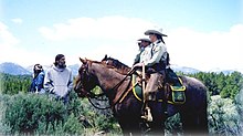
A horse patrol of the Law Enforcement & Investigations unit
 
The U.S. Forest Service Law Enforcement & Investigations unit (LEI), headquartered in Washington, D.C., is a federal law enforcement agency of the U.S. government. It is responsible for enforcement of federal laws and regulations governing national forest lands and resources. All Law Enforcement Officers and Special Agents Receive their training through Federal Law Enforcement Training Center (FLETC). 

Operations are divided into two major functional areas:
  • Law enforcement: uniformed, high-visibility enforcement of laws
  • Investigations: special agents who investigate crimes against property, visitors, and employees
Uniformed Law Enforcement Officers (LEOs) enforce federal laws and regulations governing national forest lands and resources. LEOs also enforce some or all state laws on National Forest Lands. As part of that mission, LEOs carry firearms, defensive equipment, make arrests, execute search warrants, complete reports, and testify in court. They establish a regular and recurring presence on a vast amount of public lands, roads, and recreation sites. The primary focus of their jobs is the protection of natural resources, protection of Forest Service employees and the protection of visitors. To cover the vast and varied terrain under their jurisdiction, they use Ford Crown Victoria Police Interceptors, special service SUVs, horses, K-9 units, helicopters, snowmobiles, dirt bikes, and boats. 

Special Agents are criminal investigators who plan and conduct investigations concerning possible violations of criminal and administrative provisions of the Forest Service and other statutes under the United States Code. Special agents are normally plainclothes officers who carry concealed firearms, and other defensive equipment, make arrests, carry out complex criminal investigations, present cases for prosecution to U.S. Attorneys, and prepare investigative reports. All field agents are required to travel a great deal and usually maintain a case load of ten to fifteen ongoing criminal investigations at one time. Criminal investigators occasionally conduct internal and civil claim investigations.

National Forest System

Forest Service team uses a 106 mm Recoilless Rifle for avalanche control at Mammoth Mountain in the Inyo National Forest in California. Note the Minarets in background.
 
The 193 million acres (780,000 km2) of public land that are managed as national forests and grasslands are collectively known as the National Forest System. These lands are located in 44 states, Puerto Rico, and the Virgin Islands and comprise about 9% of the total land area in the United States. The lands are organized into 155 national forests and 20 national grasslands. The mission of the National Forest System is to protect and manage the forest lands so they best demonstrate the sustainable multiple-use management concept, using an ecological approach, to meet the diverse needs of people.

State and Private Forestry

The mission of the State and Private Forestry program is to provide technical and financial assistance to private landowners, state agencies, tribes, and community resource managers to help sustain the United States' urban and rural forests and to protect communities and the environment from wildland fires, insects, disease, and invasive plants. The program employs approximately 537 staff located at 17 sites throughout the country. The delivery of the State and Private Forestry program is carried out by eight National Forest System regions and the Northeastern Area.

Research and development

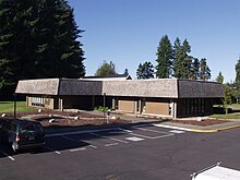
The U.S. Forest Service R&D lab in Olympia, Washington
 
The research and development (R&D) arm of the U.S. Department of Agriculture (USDA) Forest Service works to improve the health and use of the United States' forests and grasslands. Research has been part of the Forest Service mission since the agency's inception in 1905. Today, Forest Service researchers work in a range of biological, physical, and social science fields to promote sustainable management of United States' diverse forests and rangelands. Research employs about 550 scientists and several hundred technical and support staff, located at 67 sites throughout the United States and in Puerto Rico. Discovery and technology development and transfer is carried out through seven research stations. 

Research focuses on informing policy and land management decisions and includes addressing invasive insects, degraded river ecosystems, or sustainable ways to harvest forest products. The researchers work independently and with a range of partners, including other agencies, academia, nonprofit groups, and industry. The information and technology produced through basic and applied science programs is available to the public for its benefit and use. 

In addition to the Research Stations, the USFS R&D branch also leads several National Centers such as the National Genomics Center for Wildlife and Fish Conservation.

International programs

The Forest Service plays a key role in formulating policy and coordinating U.S. support for the protection and sound management of the world's forest resources. It works closely with other agencies such as USAID, the State Department, and the Environmental Protection Agency, as well as with nonprofit development organizations, wildlife organizations, universities, and international assistance organizations. The Forest Service's international work serves to link people and communities striving to protect and manage forests throughout the world. The program also promotes sustainable land management overseas and brings important technologies and innovations back to the United States. The program focuses on conserving key natural resource in cooperation with countries across the world.

Activities

More than 80% of the 193 million acres (780,000 km2) of land managed by the United States Forest Service is in the western states. This map shows USFS lands as a percentage of total land area in each state.
 
Although a large volume of timber is logged every year, not all National Forests are entirely forested. There are tidewater glaciers in the Tongass National Forest in Alaska and ski areas such as Alta, Utah in the Wasatch-Cache National Forest. In addition, the Forest Service is responsible for managing National Grasslands in the midwest. Furthermore, areas designated as wilderness by acts of Congress, prohibit logging, mining, road and building construction and land leases for purposes of farming and or livestock grazing. 

Since 1978, several Presidents have directed the USFS to administer National Monuments inside of preexisting National Forests.
The Forest Service also manages Grey Towers National Historic Site in Milford, Pennsylvania, the home and estate of its first Chief, Gifford Pinchot.

Fighting fires

Smokey Bear poster
 
In August 1944, to reduce the number of forest fires, the Forest Service and the Wartime Advertising Council began distributing fire education posters featuring a black bear. The poster campaign was a success; the black bear would later be named "Smokey Bear", and would, for decades, be the "spokesbear" for the Forest Service. Smokey Bear has appeared in innumerable TV commercials; his popular catch phrase, "Only YOU can prevent forest fires", is one of the most widely recognized slogans in the United States. A recent study found that 95% of the people surveyed could complete the phrase when given the first few words.

In September 2000, the Departments of Agriculture and the Interior developed a plan to respond to the fires of 2000, to reduce the impacts of these wildland fires on rural communities, and to ensure sufficient firefighting resources in the future. The report is entitled "Managing the Impacts of Wildfire on Communities and the Environment: A Report to the President In Response to the Wildfires of 2000"—The National Fire Plan for short. The National Fire Plan continues to be an integral part of the Forest Service today. The following are important operational features of the National Fire Plan:
  • Federal Wildland Fire Management Policy: The 1995 Federal Wildland Fire Management Policy and the subsequent 2001 Federal Wildland Fire Management Policy act as the foundation of the National Fire Plan.
  • Basic Premise of the National Fire Plan: Investing now in an optimal firefighting force, hazardous fuels reduction, and overall community protection will provide for immediate protection and future cost savings.
  • Funding: Initially (2001), the National Fire Plan provided for an additional $1,100,994,000 for the Forest Service for a total wildland fire management budget of $1,910,193,000. In 2008, the total amount for the Forest Service in wildland fire management (not including emergency fire suppression funding) is $1,974,276,000.
In August 2014, Tom Vilsack, the Secretary of Agriculture, announced that the agency will have to put $400 to $500 million in wildfire prevention projects on hold because funding for firefighting is running low as the fiscal year ends. The decision is meant to preserve resources for fighting active fires burning in California, Oregon, Washington and Idaho. Politicians of both parties have indicated that they believe the current funding structure is broken, but they have not agreed on steps to fix the funding allocation.

Popular culture

Lassie with Robert Bray as U.S. Forest Ranger Corey Stuart
 
The U.S. Forest Service achieved widespread awareness during the 1960s, as it became the setting for the long running classic TV show Lassie, with storylines focusing on Lassie's adventures with various forest rangers.

The iconic collie's association with the Forest Service led to Lassie receiving numerous awards and citations from the U.S. Senate and the Department of Agriculture, and was partly responsible for a bill regarding soil and water pollution that was signed into law in early 1968 by President Lyndon Johnson, which was dubbed by some as "The Lassie Program".

Controversies

The history of the Forest Service has been fraught with controversy, as various interests and national values have grappled with the appropriate management of the many resources within the forests. These values and resources include grazing, timber, mining, recreation, wildlife habitat, and wilderness. Because of continuing development elsewhere, the large size of National Forests have made them de facto wildlife reserves for a number of rare and common species. In recent decades, the importance of mature forest for the spotted owl and a number of other species led to great changes in timber harvest levels. 

In the 1990s, the agency was involved in scandal when it illegally provided surplus military aircraft to private contractors for use as airtankers.

Another controversial issue is the policy on road building within the National Forests. In 1999, President Clinton ordered a temporary moratorium on new road construction in the National Forests to "assess their ecological, economic, and social values and to evaluate long-term options for their management." Five and half years later, the Bush administration replaced this with a system where each state could petition the Forest Service to open forests in their territory to road building. 

Some years the agency actually loses money on its timber sales.

A 2017 draft report describing the legal basis which provides federal land managers a scope of decision making authority exceeding that of state fish and game departments has proven unexpectedly controversial.

In 2018 the Forest Service is reprimanded by the 4th U.S. Circuit Court of Appeals. The Service had issued permits for the Atlantic Coast Pipeline to build through parts of the George Washington and Monongahela National Forests and a right of way across the Appalachian Trail - in violation of both the National Forest Management Act and the National Environmental Policy Act.

World Wide Web Consortium

From Wikipedia, the free encyclopedia https://en.wikipedia.org/wiki/World_Wide_Web_Consortium World Wide We...