Search This Blog

Sunday, May 10, 2020

Cascade Range

From Wikipedia, the free encyclopedia
 
Cascade Range
Cascade Mountains (in Canada)
"The Cascades"
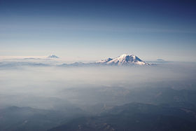
Mount Rainier and other Cascades mountains poking through clouds.jpg
The Cascades in Washington, with Mount Rainier, the range's highest mountain, standing at 14,411 ft (4,392 m). Seen in the background (left to right) are Mount Adams, Mount Hood, and Mount St. Helens.
Highest point
PeakMount Rainier,
Elevation14,411 ft (4,392 m)
Coordinates46°51′1.9″N 121°45′35.6″WCoordinates: 46°51′1.9″N 121°45′35.6″W
Dimensions
Length700 mi (1,100 km) north-south
Width80 mi (130 km)
Geography
CountriesUnited States and Canada
Provinces/StatesBritish Columbia, Washington, Oregon, and California

The Cascade Range or Cascades is a major mountain range of western North America, extending from southern British Columbia through Washington and Oregon to Northern California. It includes both non-volcanic mountains, such as the North Cascades, and the notable volcanoes known as the High Cascades. The small part of the range in British Columbia is referred to as the Canadian Cascades or, locally, as the Cascade Mountains. The latter term is also sometimes used by Washington residents to refer to the Washington section of the Cascades in addition to North Cascades, the more usual U.S. term, as in North Cascades National Park. The highest peak in the range is Mount Rainier in Washington at 14,411 feet (4,392 m).

The Cascades are part of the Pacific Ocean's Ring of Fire, the ring of volcanoes and associated mountains around the Pacific Ocean. All of the eruptions in the contiguous United States over the last 200 years have been from Cascade volcanoes. The two most recent were Lassen Peak from 1914 to 1921 and a major eruption of Mount St. Helens in 1980. Minor eruptions of Mount St. Helens have also occurred since, most recently from 2004 to 2008. The Cascade Range is a part of the American Cordillera, a nearly continuous chain of mountain ranges (cordillera) that form the western "backbone" of North America, Central America, and South America.

Geography

Map of the Cascade Range showing major volcanic peaks
 
The Cascades extend northward from Lassen Peak (also known as Mount Lassen) in northern California to the confluence of the Nicola and Thompson rivers in British Columbia. The Fraser River separates the Cascades from the Coast Mountains in Canada,  as does the Willamette Valley from the upper portion of the Oregon Coast Range. The highest volcanoes of the Cascades, known as the High Cascades, dominate their surroundings, often standing twice the height of the nearby mountains. They often have a visual height (height above nearby crestlines) of one mile or more. The highest peaks, such as the 14,411-foot (4,392 m) Mount Rainier, dominate their surroundings for 50 to 100 miles (80 to 161 km). 

The northern part of the range, north of Mount Rainier, is known as the North Cascades in the United States but is formally named the Cascade Mountains north of the Canada–United States border, reaching to the northern extremity of the Cascades at Lytton Mountain. Overall, the North Cascades and Canadian Cascades are extremely rugged; even the lesser peaks are steep and glaciated, and valleys are quite low relative to peaks and ridges, so there is great local relief. The southern part of the Canadian Cascades, particularly the Skagit Range, is geologically and topographically similar to the North Cascades, while the northern and northeastern parts are less glaciated and more plateau-like, resembling nearby areas of the Thompson Plateau.

Because of the range's proximity to the Pacific Ocean and the region's prevailing westerly winds, precipitation is substantial, especially on the western slopes due to orographic lift, with annual snow accumulations of up to 1,000 inches (2,500 cm) in some areas. Mount Baker in Washington recorded a national record single-season snowfall in the winter of 1998–99 with 1,140 inches (2,900 cm). Prior to that year, Mount Rainier held the American record for snow accumulation at Paradise in 1978. It is not uncommon for some places in the Cascades to have over 500 inches (1,300 cm) of annual snow accumulation, such as at Lake Helen, near Lassen Peak. Most of the High Cascades are therefore white with snow and ice year-round. The western slopes are densely covered with Douglas-fir (Pseudotsuga menziesii), western hemlock (Tsuga heterophylla) and red alder (Alnus rubra), while the drier eastern slopes feature mostly ponderosa pine (Pinus ponderosa), with some western larch (Larix occidentalis), mountain hemlock (Tsuga mertensiana) and subalpine fir (Abies lasiocarpa) and subalpine larch (Larix lyallii) at higher elevations. Annual rainfall is as low as 9 inches (230 mm) on the eastern foothills due to a rain shadow effect.

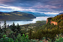
The Columbia Gorge marks where the Columbia River splits the Cascade Range between the states of Washington and Oregon.
 
Beyond the eastern foothills is an arid plateau that was largely created 17 to 14 million years ago by the many flows of the Columbia River Basalt Group. Together, these sequences of fluid volcanic rock form the 200,000-square-mile (520,000 km2) Columbia Plateau in eastern Washington, Oregon, and parts of western Idaho.

The Columbia River Gorge is the only major break of the range in the United States. When the Cascades began to rise 7 million years ago in the Pliocene, the Columbia River drained the relatively low Columbia Plateau. As the range grew, erosion from the Columbia River was able to keep pace, creating the gorge and major pass seen today. The gorge also exposes uplifted and warped layers of basalt from the plateau.

History

Indigenous peoples have inhabited the area for thousands of years and developed their own myths and legends about the Cascades. In these legends, St. Helens with its graceful, pre-1980 appearance was regarded as a beautiful maiden for whom Hood and Adams feuded. Native tribes also developed their own names for the High Cascades and many of the smaller peaks, including "Tahoma", the Lushootseed name for Mount Rainier, "Koma Kulshan" or simply "Kulshan" for Mount Baker, and "Louwala-Clough", meaning "smoking mountain" for Mount St. Helens.

In early 1792, British navigator George Vancouver explored Puget Sound and gave English names to the high mountains he saw. Mount Baker was named for Vancouver's third lieutenant, Joseph Baker, although the first European to see it was Manuel Quimper, who named it la gran montaƱa del Carmelo ("Great Mount Carmel") in 1790. Mount Rainier was named after Admiral Peter Rainier. Later in 1792, Vancouver had his lieutenant William Robert Broughton explore the lower Columbia River. He named Mount Hood after Lord Samuel Hood, an admiral of the Royal Navy. Mount St. Helens was sighted by Vancouver in May 1792, from near the mouth of the Columbia River. It was named for Alleyne FitzHerbert, 1st Baron St Helens, a British diplomat. Vancouver's expedition did not, however, name the mountain range which contained these peaks. He referred to it simply as the "eastern snowy range". Earlier Spanish explorers called it sierra nevadas, meaning "snowy mountains".

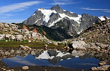
West side view of Mount Shuksan in summer as seen from Artist Point in Washington

In 1805, the Lewis and Clark Expedition passed through the Cascades on the Columbia River, which for many years was the only practical way to pass that part of the range. They were the first non-indigenous people to see Mount Adams, but they thought it was Mount St. Helens. When they later saw Mount St. Helens they thought it was Mount Rainier. On their return trip, Lewis and Clark spotted a high but distant snowy pinnacle that they named for the sponsor of the expedition, U.S. President Thomas Jefferson. Lewis and Clark called the Cascade Range the "Western Mountains".

The Lewis and Clark expedition, and the many settlers and traders that followed, met their last obstacle to their journey at the Cascades Rapids in the Columbia River Gorge, a feature on the river now submerged beneath the Bonneville Reservoir. Before long, the great white-capped mountains that loomed above the rapids were called the "mountains by the cascades" and later simply as the "Cascades". The earliest attested use of the name "Cascade Range" is in the writings of botanist David Douglas.

Mount Hood is the tallest point in the U.S. state of Oregon.

In 1814, Alexander Ross, a fur trader with the North West Company, seeking a viable route across the mountains, explored and crossed the northern Cascades between Fort Okanogan and Puget Sound. His report of the journey is vague about the route taken. He followed the lower Methow River into the mountains. He might have used Cascade Pass to reach the Skagit River. Ross was the first European-American to explore the Methow River area and likely the first to explore the Stehekin River and Bridge Creek region. Due to the difficulty of crossing the northern Cascades and the paucity of beaver, fur-trading companies made only a few explorations into the mountains north of the Columbia River after Ross.

Exploration and settlement of the Cascades region by Europeans and Americans was accelerated by the establishment of a major trading post of the Hudson's Bay Company (HBC) at Fort Vancouver near today's Portland, Oregon. From this base HBC trapping parties traveled throughout the Cascades in search of beaver and other fur-bearing animals. For example, using what became known as the Siskiyou Trail, Hudson's Bay Company trappers were the first non-natives to explore the southern Cascades in the 1820s and 1830s, establishing trails which passed near Crater Lake, Mount McLoughlin, Medicine Lake Volcano, Mount Shasta, and Lassen Peak.

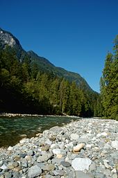
The Coquihalla River in the Canadian Cascades

The course of political history in the Pacific Northwest saw the spine of the Cascade Range being proposed as a boundary settlement during the Oregon Dispute of 1846. The United States rejected the proposal and insisted on the 49th parallel north, which cuts across the range just north of Mount Baker. Throughout the period of dispute and up to the creation of the Crown Colony of British Columbia in 1858, the Hudson's Bay Company's York Factory Express route, as well the route of fur brigades, followed the Okanogan River along the east edge of the Cascades and the Columbia River through the range. Passes across the range were not well known and little used. Naches Pass was used for driving cattle and horses to Fort Nisqually. Yakima Pass was also used by the Hudson's Bay Company.

American settlement of the flanks of the Coast Range did not occur until the early 1840s, at first only marginally. Following the Oregon Treaty the inward flux of migration from the Oregon Trail intensified and the passes and back-valleys of what is now the state of Washington were explored and populated, and it was not long after that railways followed. Despite its being traversed by several major freeways and rail lines, and its lower flanks subjected to major logging in recent decades, large parts of the range remain intense and forbidding alpine wilderness. Much of the northern half of the Cascades, from Rainier north, have been preserved by U.S. national or British Columbia provincial parks (such as E.C. Manning Provincial Park), or other forms of protected area.

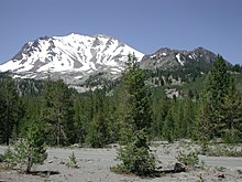
Lassen Peak in the California Cascades. Southernmost volcano in the Cascade Range and part of Lassen Volcanic National Park
 
The Canadian side of the range has a history that includes the Fraser Canyon Gold Rush of 1858–60 and its famous Cariboo Road, as well as the older Hudson's Bay Company Brigade Trail from the Canyon to the Interior, the Dewdney Trail, and older routes which connected east to the Similkameen and Okanagan valleys.

The southern mainline of the Canadian Pacific Railway penetrated the range via the passes of the Coquihalla River, along one of the steepest and snowiest routes in the entire Pacific Cordillera. Near Hope, B.C., the railway roadbed and the Othello Tunnels, now decommissioned, are popular tourist recreation destinations for hiking and bicycling. The pass is used by the Coquihalla Highway, a government megaproject built as part of the Expo 86 spending boom of the 1980s, which is now the main route from the Coast to the British Columbia interior. Traffic formerly went via the Fraser Canyon, to the west, or via Allison Pass and Manning Park along Highway 3 to the south, near the border.

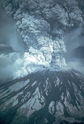
The 1980 eruption of Mount St. Helens

The Barlow Road was the first established land path for U.S. settlers through the Cascade Range in 1845, and formed the final overland link for the Oregon Trail (previously, settlers had to raft down the treacherous rapids of the Columbia River). The Road left the Columbia at what is now Hood River and passed along the south side of Mount Hood at what is now Government Camp, terminating in Oregon City. There is an interpretive site there now at "The End of The Oregon Trail". The road was constructed as a toll road – $5 per wagon – and was very successful.

In addition, the Applegate Trail was created to allow settlers to avoid rafting down the Columbia River. The Trail used the path of the California Trail to north-central Nevada. From there, the Trail headed northwest into northern California, and continued northwest towards today's Ashland, Oregon. From there, settlers would head north along the established Siskiyou Trail into the Willamette Valley.

With the exception of the 1915 eruption of remote Lassen Peak in Northern California, the range was quiet for more than a century. Then, on May 18, 1980, the dramatic eruption of Mount St. Helens shattered the quiet and brought the world's attention to the range. Geologists were also concerned that the St. Helens eruption was a sign that long-dormant Cascade volcanoes might become active once more, as in the period from 1800 to 1857 when a total of eight erupted. None have erupted since St. Helens, but precautions are being taken nevertheless, such as the Mount Rainier Volcano Lahar Warning System in Pierce County, Washington.

Geology

Geology of the Cascade Range-related plate tectonics.
 
The Cascade Range is made up of a band of thousands of very small, short-lived volcanoes that have built a platform of lava and volcanic debris. Rising above this volcanic platform are a few strikingly large volcanoes, like Mount St. Helens, that dominate the landscape.

The Cascade volcanoes define the Pacific Northwest section of the Ring of Fire, an array of volcanoes that rim the Pacific Ocean. The Ring of Fire is also known for its frequent earthquakes. The volcanoes and earthquakes arise from a common source: subduction, where the dense Juan de Fuca oceanic plate plunges beneath the North American Plate. As the oceanic slab sinks deep into the Earth's interior beneath the continental plate, high temperatures and pressures allow water molecules locked in the minerals of solid rock to escape. The water vapor rises into the pliable mantle above the subducting plate, causing some of the mantle to melt. This newly formed magma rises toward the Earth's surface to erupt, forming a chain of volcanoes (the Cascade Volcanic Arc) above the subduction zone.

Human uses

Soil conditions for farming are generally good, especially downwind of volcanoes. This is largely because volcanic rocks are often rich in potassium bearing minerals such as orthoclase and decay easily. Volcanic debris, especially lahars, also have a leveling effect and the storage of water in the form of snow and ice is also important. These snow-capped mountains such as Mt. Hood and Mt. Bachelor are used as ski resorts in the late winter. Much of that water eventually flows into reservoirs, where it is used for recreation before its potential energy is captured to generate hydroelectric power before being used to irrigate crops.

Because of the abundance of powerful streams, many of the major westward rivers off the Cascades have been dammed to provide hydroelectric power. One of these, Ross Dam on the Skagit River, created a reservoir which spans the border southeast of Hope, British Columbia, extending 2 miles (3.2 km) into Canada. At the foot of the southeast flank of Mount Baker, at Concrete, Washington, the Baker River is dammed to form Lake Shannon and Baker Lake.

In addition, there is a largely untapped amount of geothermal power that can be generated from the Cascades. The U.S. Geological Survey Geothermal Research Program has been investigating this potential. Some of this energy is already being used in places like Klamath Falls, Oregon, where volcanic steam is used to heat public buildings. The highest recorded temperature found in the range is 510 °F (266 °C) at 3,075 feet (937 m) below Newberry Volcano's caldera floor.

Ecology


Forests of large, coniferous trees (western red cedars, Douglas-firs, western hemlocks, firs, pines, spruces, and others) dominate most of the Cascade Range. Cool, wet winters and warm, dry summers (largely a result of oceanic influence) favor evergreen species, whereas mild temperatures and rich soils promote fast and prolonged growth.

Mountain goat on Wallaby Peak in the North Cascades
 
As a traveler passes through the Cascade Range, the climate first gets colder, then warmer and drier east of the crest. Most of the Cascades' lower and middle elevations are covered in coniferous forest; the higher altitudes have extensive meadows as well as alpine tundra and glaciers. The southern part of the Cascades are within the California Floristic Province, an area of high biodiversity.

Black bears, coyotes, bobcats, cougars, beavers, deer, elk, moose, mountain goats and a few wolf packs returning from Canada live in the Cascades. Fewer than 50 grizzly bears reside in the Cascades of Canada and Washington.

PopocatƩpetl

From Wikipedia, the free encyclopedia
 
 
PopocatƩpetl
PopoAmeca2zoom.jpg
PopocatƩpetl from Amecameca (looking south-east)
Highest point
Elevation5,426 m (17,802 ft) 
Prominence3,020 m (9,910 ft) 
Isolation143 km (89 mi) 
Listing
Coordinates19°01′20″N 98°37′40″WCoordinates: 19°01′20″N 98°37′40″W
Geography
PopocatƩpetl is located in Mexico
PopocatƩpetl
PopocatƩpetl
Mexico
LocationMexico-Puebla-Morelos, Mexico
Geology
Mountain typeStratovolcano
Last eruption2004 to 2020 (ongoing)
Climbing
Easiest routerock/snow climb

PopocatĆ©petl is an active stratovolcano, located in the states of Puebla, Morelos and Mexico, in central Mexico, and lies in the eastern half of the Trans-Mexican volcanic belt. At 5,426 m (17,802 ft) it is the second highest peak in Mexico, after CitlaltĆ©petl (Pico de Orizaba) at 5,636 m (18,491 ft).

It is linked to the Iztaccihuatl volcano to the north by the high saddle known as the Paso de CortƩs.

PopocatĆ©petl is 70 km (43 mi) southeast of Mexico City, from where it can be seen regularly, depending on atmospheric conditions. Until recently, the volcano was one of three tall peaks in Mexico to contain glaciers, the others being Iztaccihuatl and Pico de Orizaba. In the 1990s, the glaciers such as Glaciar Norte (North Glacier) greatly decreased in size, partly due to warmer temperatures but largely due to increased volcanic activity. By early 2001, PopocatĆ©petl's glaciers were gone; ice remained on the volcano, but no longer displayed the characteristic features of glaciers such as crevasses.

Lava erupting from PopocatƩpetl has historically been predominantly andesitic, but it has also erupted large volumes of dacite. Magma produced in the current cycle of activity tends to be a mixture of the two.

Name

Popocatepetl seen from UNAM (instituto de Ecologia with Sigma 500mm), Mexico City

The name PopocatĆ©petl comes from the Nahuatl words popōca Nahuatl pronunciation: [poĖˆpoĖka] "it smokes" and tepētl Nahuatl pronunciation: [ĖˆtepeĖt͡ɬ] "mountain", meaning Smoking Mountain. The volcano is also referred to by Mexicans as El Popo. The alternate nickname Don Goyo comes from the mountain's association in the lore of the region with San Gregorio, "Goyo" being a nickname-like short form of Gregorio. Legend says that many years ago, a villager met an old man on the slopes of the mountain, who introduced himself as Gregorio Chino PopocatĆ©petl. Gregorio was a personification of the spirit of the volcano, and communicates with the locals to warn them if an eruption is about to happen. Thus, every March 12, the day of San Gregorio, the locals bring flowers and food to the volcano to celebrate the saint.

Geology

The stratovolcano contains a steep-walled, 400 m × 600 m (1,300 ft × 2,000 ft) wide crater. The generally symmetrical volcano is modified by the sharp-peaked Ventorrillo on the NW, a remnant of an earlier volcano. At least three previous major cones were destroyed by gravitational failure during the Pleistocene, producing massive debris avalanche deposits covering broad areas south of the volcano. The modern volcano was constructed to the south of the late-Pleistocene to Holocene El Fraile cone. Three major Plinian eruptions, the most recent of which took place about 800 AD, have occurred from PopocatĆ©petl since the mid-Holocene, accompanied by pyroclastic flows and voluminous lahars that swept basins below the volcano.

According to paleomagnetic studies, the volcano is about 730,000 years old. It is cone shaped with a diameter of 25 km (16 mi) at its base, with a peak elevation of 5,450 m (17,880 ft). The crater is elliptical with an orientation northeast-southwest. The walls of the crater vary from 600 to 840 m (1,970 to 2,760 ft) in height. PopocatĆ©petl is currently active after being dormant for about half of last century. Its activity increased in 1991 and smoke has been seen constantly emanating from the crater since 1993. The volcano is monitored by the Deep Earth Carbon Degassing Project.

History

The geological history of PopocatĆ©petl began with the formation of the ancestral volcano Nexpayantla. About 200,000 years ago, Nexpayantla collapsed in an eruption, leaving a caldera, in which the next volcano, known as El Fraile, began to form. Another eruption about 50,000 years ago caused that to collapse, and PopocatĆ©petl rose from that. Around 23,000 years ago, a lateral eruption (believed to be larger than the 1980 eruption of Mount St. Helens) destroyed the volcano's ancient cone and created an avalanche that reached up to 70 kilometres (43 mi) from the summit. The debris field from that is one of four around the volcano, and it is also the youngest.

Three Plinian eruptions are known to have taken place: 3,000 years ago (3195–2830 BC), 2,150 years ago (800–215 BC), and 1,100 years ago (likely 823 AD). The latter two buried the nearby village of Tetimpa, preserving evidence of preclassical culture.

The first known ascent of the volcano was made by an expedition led by Diego de Ordaz in 1519. The early-16th-century monasteries on the slopes of the mountain are a World Heritage Site.

Eruptions

PopocatƩpetl viewed from Puebla, Puebla, January 2004 eruption
 
PopocatƩpetl is one of the most active volcanoes in Mexico and the most famous, having had more than 15 major eruptions since the arrival of the Spanish in 1519.
Timeline

  • Mid-to late first century: A violent VEI-6 eruption may have caused the large migrations that settled Teotihuacan, according to DNA analysis of teeth and bones.
  • Eruptions were observed in 1363, 1509, 1512, 1519–1528, 1530, 1539, 1540, 1548, 1562–1570, 1571, 1592, 1642, 1663, 1664, 1665, 1697, 1720, 1802, 1919, 1923, 1925, and 1933.
  • 1947: A major eruption.
  • 21 December 1994: The volcano spewed gas and ash, which was carried as far as 25 km (16 mi) away by prevailing winds. The activity prompted the evacuation of nearby towns and scientists to begin monitoring for an eruption.
  • December 2000: Tens of thousands of people were evacuated by the government, based on the warnings of scientists. The volcano then made its largest display in 1,200 years.
  • 25 December 2005: The volcano's crater produced an explosion which ejected a large column of smoke and ash about 3 km (9,800 ft) into the atmosphere and expulsion of lava.
  • January and February 2012: Scientists observed increased volcanic activity at PopocatĆ©petl. On January 25, 2012, an ash explosion occurred on the mountain, causing much dust and ash to contaminate the atmosphere around it.
  • 15 April 2012: Reports of superheated rock fragments being hurled into the air by the volcano. Ash and water vapor plumes were reported 15 times over 24 hours.
  • Wednesday 8 May 2013, at 7:28 p.m. local time: PopocatĆ©petl erupted again with a high amplitude tremor that lasted and was recorded for 3.5 hours. It began with plumes of ash that rose 3 km (9,800 ft) into the air and began drifting west at first, but later began to drift east-southeast, covering areas of the villages of San Juan Tianguismanalco, San Pedro Benito JuĆ”rez and the City of Puebla in smoke and ash. Explosions from the volcano itself subsequently ejected fragments of fiery volcanic rock to distances of 700 m (2,300 ft) from the crater.
  • July 4, 2013: Due to several eruptions of steam and ash for at least 24 hours, at least six U.S. airlines canceled more than 40 flights into and out of Mexico City International Airport and Toluca International Airport that day.
  • 27 August–September 2014: CENAPRED reported explosions, accompanied by steam-and-gas emissions with minor ash and ash plumes that rose 800-3,000 m above PopocatĆ©petl's crater and drifted west, southwest, and west-southwest. On most nights incandescence was observed, increasing during times with larger emissions.
  • 1 September 2014: Partial visibility due to cloud cover.
  • 29 and 31 August 2014: The Washington Volcanic Ash Advisory Center (VAAC) reported discrete ash emissions.
  • 7 January 2015: CENAPRED reported that ash from recent explosions coats the snow on the volcano's upper slopes.
  • 28 March 2016: An ash column 2,000 m (6,600 ft) high was released, prompting the establishment of a 12-kilometre (7.5 mi) "security ring" around the summit.
  • 3 April 2016: PopocatĆ©petl erupted, spewing lava, ash and rock.
  • August 2016: Eruptions continued, with four discrete blasts on August 17.
  • 10 November 2017 at 7:25 local time, eruption continued
  • 15 December 2018 at 18:57 local time, spewing lava, ash and rock.
  • 22 January 2019 21:06 local time, spewing ash up 4 km (13,000 ft) high
  • 19 March 2019 21:38 local time, fragments of the dome shot within 1.6–2.4-kilometre (1–1 12 mi) radius. Due to continuing activity, on March 28 2019, based on the analysis of the available information, the Scientific Advisory Committee of the PopocatĆ©petl volcano recommended changing the phase of the Yellow Volcanic Warning Light Phase 2 to Yellow Phase 3, which is a preventive measure against the observed changes.
  • June 3, 2019 PopocatĆ©petl continued its explosive uptick by firing an ash column to approximately 11 km (37,000 ft) a.s.l.
  • June 18, 2019 PopocatĆ©petl continued to erupt, spewing ash clouds to 8.5 km (28,000 ft).
  • June 24, 2019 PopocatĆ©petl erupted once more, sending a massive ash cloud some kilometres (thousands of feet) into the air.
  • July 18, 2019 PopocatĆ©petl erupts three times, sending ashes 1.5 km (4,900 ft) into the air each time.
  • July 20, 2019, volcanic ash is reported in Xochimilco after the morning's eruption.
  • October 2019, the volcano erupted multiple times in one night.
  • November 2019, an eruption partially forced a KLM flight from Amsterdam to Mexico City to turn back.
  • January 9, 2020 PopocatĆ©petl expelled lava and rock and sent ash clouds to 6.1 km (20,000 ft). 
  • January 27. 2020 PopocatĆ©petl erupted in a sensational nighttime display of rock and ash. 

Deep Earth Carbon Degassing Project

From Wikipedia, the free encyclopedia
 
Deep Earth Carbon Degassing (DECADE) project is an initiative to unite scientists around the world to make tangible advances towards quantifying the amount of carbon outgassed from the Earth's deep interior (core, mantle, crust) into the surface environment (e.g. biosphere, hydrosphere, cryosphere, atmosphere) through naturally occurring processes. DECADE is an initiative within the Deep Carbon Observatory (DCO).

Volcanoes are the main pathway in which deeply sourced volatiles, including carbon, are transferred from the Earth's interior to the surface environment. An additional, though less well understood, pathway includes along faults and fractures within the Earth's crust, often referred to as tectonic degassing. When the DCO was first formed in 2009 estimates of global carbon flux from volcanic regions ranged from 65 to 540 Mt/yr, and constraints on global tectonic degassing were virtually unknown. The order of magnitude uncertainty in current volcanic/tectonic carbon outgassing makes answering fundamental questions about the global carbon budget virtually impossible. In particular, one fundamental unknown is if carbon transferred to the Earth's interior via subduction is efficiently recycled back to the Earth's mantle lithosphere, crust and surface environment through volcanic and tectonic degassing, or if significant quantities of carbon are being subducted into the deep mantle. Because significant quantities of mantle carbon are also released through mid-ocean ridge volcanism, if carbon inputs and outputs at subduction zone settings are in balance, then the net effect will be an imbalance in the global carbon budget, with carbon being preferentially removed from the Earth's deep interior and redistributed to more shallow reservoirs including the mantle lithosphere, crust, hydrosphere and atmosphere. The implications of this may mean that carbon concentrations in the surface environment are increasing over Earth's history, which has significant implications for climate change.

Findings from the DECADE project will increase our understanding of the way carbon cycles through deep Earth, and patterns in volcanic emissions data could potentially alert scientists to an impending eruption.

Project goals

The main goal of the DECADE project is to refine estimates of global carbon outgassing using a multipronged approach. Specifically, the DECADE initiative unites scientists with expertise in geochemistry, petrology and volcanology to provide constraints on the global volcanic carbon flux by 1) establishing a database of volcanic and hydrothermal gas compositions and fluxes linked to EarthChem/PetDB and the Smithsonian Global Volcanism Program, 2) building a global monitoring network to continuously measure the volcanic carbon flux of 20 active volcanoes, 3) measure the carbon flux of remote volcanoes, for which no or only sparse data are currently available, 4) develop new field and analytical instrumentation for carbon measurements and flux monitoring, and 5) establish formal collaborations with volcano observatories around the world to support volcanic gas measurement and monitoring activities.

History

The DECADE initiative was conceived in September 2011 by the International Association of Volcanology and Chemistry of the Earth's Interior Commission on the Chemistry of Volcanic Gases during its 11th field workshop. Here the charge of the initiative was broadly defined and the governance structure established. The DECADE receives financial support from Deep Carbon Observatory to meet the project goals, with support distributed to DECADE members based on project proposal submission and external review and/or consensus by the Board of Directors. All projects are significantly matched by funding sources from the individual investigators or other funding agencies. The initiative is led by a Board of Directors that has nine members including one chair and two co-vice chairs. Currently the DECADE initiative has around 80 members from 13 countries.

Achievements

As of 2016 major achievements supported or partially supported by the DECADE initiative include:
  • Modification of the IEDA EarthChem database to include volcanic gas composition and gas flux data.
  • Instrumenting 9 volcanoes (Masaya Volcano, Turrialba Volcano, PoĆ”s Volcano, Nevado del Ruiz, Galeras, Villarrica (volcano) (instruments destroyed by eruption), PopocatĆ©petl, Mount Merapi, Whakaari / White Island) with permanent multi-component gas analyzer system (Multi-GAS) stations for near continuous CO2 and SO2 measurements and near continuous SO2 flux measurements using miniDOAS.
  • Quantification of volcanic gas emissions and compositions from remote regions such as the Aleutian, Vanuatu and Papua New Guinea volcanic arcs.
  • First measurements of gas emissions from Mount Bromo and Anak Krakatau Volcanoes, Krakatoa Indonesia.
  • Establishing volcanic gas chemical changes as eruption precursors at PoĆ”s and Turrialba Volcanoes, Costa Rica.
  • Airborne sampling of volcanic plumes for carbon isotopes and analyses using Delta Ray Infrared Isotope Spectrometer.
  • Determination of diffuse CO2 degassing in the Azores.

Volcanoes

The following volcanoes are currently monitored by the DECADE initiative: 

Volcano Country Notes
Masaya Volcano Nicaragua
PopocatƩpetl Mexico
Galeras Colombia
Nevado del Ruiz Colombia
Villarrica Volcano Chile Equipment was destroyed by Villarrica's 2015 eruption.
Turrialba Costa Rica
PoƔs Costa Rica
Mount Merapi Indonesia
White Island New Zealand

Map of the DCO DECADE project volcano installations

DCO Decade Volcano Monitoring Installations, September 2016.jpg

Prediction of volcanic activity

Mount St. Helens erupted explosively on May 18, 1980 at 8:32 a.m. PDT

Seismic waves (seismicity)

General principles of volcano seismology

  • Seismic activity (earthquakes and tremors) always occurs as volcanoes awaken and prepare to erupt and are a very important link to eruptions. Some volcanoes normally have continuing low-level seismic activity, but an increase may signal a greater likelihood of an eruption. The types of earthquakes that occur and where they start and end are also key signs. Volcanic seismicity has three major forms: short-period earthquake, long-period earthquake, and harmonic tremor.
  • Short-period earthquakes are like normal fault-generated earthquakes. They are caused by the fracturing of brittle rock as magma forces its way upward. These short-period earthquakes signify the growth of a magma body near the surface and are known as 'A' waves. These type of seismic events are often also referred to as Volcano-Tectonic (or VT) events or earthquakes.
  • Long-period earthquakes are believed to indicate increased gas pressure in a volcano's plumbing system. They are similar to the clanging sometimes heard in a house's plumbing system, which is known as "water hammer". These oscillations are the equivalent of acoustic vibrations in a chamber, in the context of magma chambers within the volcanic dome and are known as 'B' waves. These are also known as resonance waves and long period resonance events.
  • Harmonic tremors are often the result of magma pushing against the overlying rock below the surface. They can sometimes be strong enough to be felt as humming or buzzing by people and animals, hence the name.
Patterns of seismicity are complex and often difficult to interpret; however, increasing seismic activity is a good indicator of increasing eruption risk, especially if long-period events become dominant and episodes of harmonic tremor appear. 

Using a similar method, researchers can detect volcanic eruptions by monitoring infra-sound—sub-audible sound below 20 Hz. The IMS Global Infrasound Network, originally set up to verify compliance with nuclear test ban treaties, has 60 stations around the world that work to detect and locate erupting volcanoes.

Seismic case studies

A relation between long-period events and imminent volcanic eruptions was first observed in the seismic records of the 1985 eruption of Nevado del Ruiz in Colombia. The occurrence of long-period events were then used to predict the 1989 eruption of Mount Redoubt in Alaska and the 1993 eruption of Galeras in Colombia. In December 2000, scientists at the National Center for Prevention of Disasters in Mexico City predicted an eruption within two days at PopocatƩpetl, on the outskirts of Mexico City. Their prediction used research that had been done by Bernard Chouet, a Swiss volcanologist who was working at the United States Geological Survey and who first observed a relation between long-period events and an imminent eruption. The government evacuated tens of thousands of people; 48 hours later, the volcano erupted as predicted. It was PopocatƩpetl's largest eruption for a thousand years, yet no one was hurt.

Iceberg tremors

Similarities between iceberg tremors, which occur when they run aground, and volcanic tremors may help experts develop a better method for predicting volcanic eruptions. Although icebergs have much simpler structures than volcanoes, they are physically easier to work with. The similarities between volcanic and iceberg tremors include long durations and amplitudes, as well as common shifts in frequencies.

Gas emissions

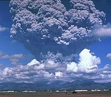
Gas and ash plume erupted from Mount Pinatubo, Philippines.
 
As magma nears the surface and its pressure decreases, gases escape. This process is much like what happens when you open a bottle of fizzy drink and carbon dioxide escapes. Sulfur dioxide is one of the main components of volcanic gases, and increasing amounts of it herald the arrival of increasing amounts of magma near the surface. For example, on May 13, 1991, an increasing amount of sulfur dioxide was released from Mount Pinatubo in the Philippines. On May 28, just two weeks later, sulfur dioxide emissions had increased to 5,000 tonnes, ten times the earlier amount. Mount Pinatubo later erupted on June 12, 1991. On several occasions, such as before the Mount Pinatubo eruption and the 1993 Galeras, Colombia eruption, sulfur dioxide emissions have dropped to low levels prior to eruptions. Most scientists believe that this drop in gas levels is caused by the sealing of gas passages by hardened magma. Such an event leads to increased pressure in the volcano's plumbing system and an increased chance of an explosive eruption. A multi-component gas analyzer system (Multi-GAS) is an instrument package used to take real-time high-resolution measurements of volcanic gas plumes. Multi-GAS measurements of CO2/SO2 ratios can allow detection of the pre-eruptive degassing of rising magmas, improving prediction of volcanic activity.

Ground deformation

Swelling of a volcano signals that magma has accumulated near the surface. Scientists monitoring an active volcano will often measure the tilt of the slope and track changes in the rate of swelling. An increased rate of swelling, especially if accompanied by an increase in sulfur dioxide emissions and harmonic tremors is a high probability sign of an impending event. The deformation of Mount St. Helens prior to the May 18, 1980 eruption was a classic example of deformation, as the north side of the volcano was bulging upwards as magma was building up underneath. Most cases of ground deformation are usually detectable only by sophisticated equipment used by scientists, but they can still predict future eruptions this way. The Hawaiian Volcanoes show significant ground deformation; there is inflation of the ground prior to an eruption and then an obvious deflation post-eruption. This is due to the shallow magma chamber of the Hawaiian Volcanoes; movement of the magma is easily noticed on the ground above.

Thermal monitoring

Both magma movement, changes in gas release and hydrothermal activity can lead to thermal emissivity changes at the volcano's surface. These can be measured using several techniques:

Hydrology

There are 4 main methods that can be used to predict a volcanic eruption through the use of hydrology:
  • Borehole and well hydrologic and hydraulic measurements are increasingly used to monitor changes in a volcanoes subsurface gas pressure and thermal regime. Increased gas pressure will make water levels rise and suddenly drop right before an eruption, and thermal focusing (increased local heat flow) can reduce or dry out aquifers.
  • Detection of lahars and other debris flows close to their sources. USGS scientists have developed an inexpensive, durable, portable and easily installed system to detect and continuously monitor the arrival and passage of debris flows and floods in river valleys that drain active volcanoes.
  • Pre-eruption sediment may be picked up by a river channel surrounding the volcano that shows that the actual eruption may be imminent. Most sediment is transported from volcanically disturbed watersheds during periods of heavy rainfall. This can be an indication of morphological changes and increased hydrothermal activity in absence of instrumental monitoring techniques.
  • Volcanic deposit that may be placed on a river bank can easily be eroded which will dramatically widen or deepen the river channel. Therefore, monitoring of the river channels width and depth can be used to assess the likelihood of a future volcanic eruption.

Remote sensing

Remote sensing is the detection by a satellite's sensors of electromagnetic energy that is absorbed, reflected, radiated or scattered from the surface of a volcano or from its erupted material in an eruption cloud.
  • 'Cloud sensing: Scientists can monitor the unusually cold eruption clouds from volcanoes using data from two different thermal wavelengths to enhance the visibility of eruption clouds and discriminate them from meteorological clouds
  • 'Gas sensing: Sulfur dioxide can also be measured by remote sensing at some of the same wavelengths as ozone. Total Ozone Mapping Spectrometers (TOMS) can measure the amount of sulfur dioxide gas released by volcanoes in eruptions. Carbon dioxide emissions from volcanoes have been detected in the short-wave infrared using NASA's Orbiting Carbon Observatory 2.
  • Thermal sensing: The presence of new significant thermal signatures or 'hot spots' may indicate new heating of the ground before an eruption, represent an eruption in progress or the presence of a very recent volcanic deposit, including lava flows or pyroclastic flows.
  • Deformation sensing: Satellite-borne spatial radar data can be used to detect long-term geometric changes in the volcanic edifice, such as uplift and depression. In this method, interferometric synthetic aperture radar (InSAR), digital elevation models generated from radar imagery are subtracted from each other to yield a differential image, displaying rates of topographic change.
  • Forest monitoring: In recent period it has been demonstrated the location of eruptive fractures could be predicted, months to years before the eruptions, by the monitoring of forest growth. This tool based on the monitoring of the trees growth has been validated at both Mt. Niyragongo and Mt. Etna during the 2002–2003 volcano eruptive events.
  • Infrasound sensing: A relatively new approach to detecting volcanic eruptions involves using infrasound sensors from the International Monitoring System (IMS) infrasound network. This method of detection takes signals from multiple sensors and uses triangulation to determine the location of the eruption.

Mass movements and mass failures

Monitoring mass movements and -failures uses techniques lending from seismology (geophones), deformation, and meteorology. Landslides, rock falls, pyroclastic flows, and mud flows (lahars) are example of mass failures of volcanic material before, during, and after eruptions.

The most famous volcanic landslide was probably the failure of a bulge that built up from intruding magma before the Mt. St. Helens eruption in 1980, this landslide "uncorked" the shallow magmatic intrusion causing catastrophic failure and an unexpected lateral eruption blast. Rock falls often occur during periods of increased deformation and can be a sign of increased activity in absence of instrumental monitoring. Mud flows (lahars) are remobilized hydrated ash deposits from pyroclastic flows and ash fall deposits, moving downslope even at very shallow angles at high speed. Because of their high density they are capable of moving large objects such as loaded logging trucks, houses, bridges, and boulders. Their deposits usually form a second ring of debris fans around volcanic edifices, the inner fan being primary ash deposits. Downstream of the deposition of their finest load, lahars can still pose a sheet flood hazard from the residual water. Lahar deposits can take many months to dry out, until they can be walked on. The hazards derived from lahar activity can exist several years after a large explosive eruption.

A team of US scientists developed a method of predicting lahars. Their method was developed by analyzing rocks on Mt. Rainier in Washington. The warning system depends on noting the differences between fresh rocks and older ones. Fresh rocks are poor conductors of electricity and become hydrothermically altered by water and heat. Therefore, if they know the age of the rocks, and therefore the strength of them, they can predict the pathways of a lahar. A system of Acoustic Flow Monitors (AFM) has also been emplaced on Mount Rainier to analyze ground tremors that could result in a lahar, providing an earlier warning.

Local case studies

Nyiragongo

The eruption of Mt. Nyiragongo on January 17, 2002 was predicted a week earlier by a local expert who had been studying the volcanoes for years. He informed the local authorities and a UN survey team was dispatched to the area; however, it was declared safe. Unfortunately, when the volcano erupted, 40% of the city of Goma was destroyed along with many people's livelihoods. The expert claimed that he had noticed small changes in the local relief and had monitored the eruption of a much smaller volcano two years earlier. Since he knew that these two volcanoes were connected by a small fissure, he knew that Mt. Nyiragongo would erupt soon. 

Mt. Etna

British geologists have developed a method of predicting future eruptions of Mt. Etna. They have discovered that there is a time lag of 25 years between events. Monitoring of deep crust events can help predict accurately what will happen in the years to come. So far they have predicted that between 2007 and 2015, volcanic activity will be half of what it was in 1972.

Sakurajima, Japan

Sakurajima is possibly one of the most monitored areas on earth. The Sakurajima Volcano lies near Kagoshima City, which has a population of over 500,000 people. Both the Japanese Meteorological Agency (JMA) and Kyoto University's Sakurajima Volcanological Observatory (SVO) monitors the volcano's activity. Since 1995, Sakurajima has only erupted from its summit with no release of lava.
Monitoring techniques at Sakurajima:
  • Likely activity is signalled by swelling of the land around the volcano as magma below begins to build up. At Sakurajima, this is marked by a rise in the seabed in Kagoshima Bay – tide levels rise as a result.
  • As magma begins to flow, melting and splitting base rock can be detected as volcanic earthquakes. At Sakurajima, they occur two to five kilometres beneath the surface. An underground observation tunnel is used to detect volcanic earthquakes more reliably.
  • Groundwater levels begin to change, the temperature of hot springs may rise and the chemical composition and amount of gases released may alter. Temperature sensors are placed in bore holes which are used to detect ground water temp. Remote sensing is used on Sakurajima since the gases are highly toxic – the ratio of HCl gas to SO2 gas increases significantly shortly before an eruption.
  • As an eruption approaches, tiltmeter systems measure minute movements of the mountain. Data is relayed in real-time to monitoring systems at SVO.
  • Seismometers detect earthquakes which occur immediately beneath the crater, signaling the onset of the eruption. They occur 1 to 1.5 seconds before the explosion.
  • With the passing of an explosion, the tiltmeter system records the settling of the volcano.

Ecuador

The Geophysics Institute at the National Polytechnic School in Quito houses an international team of seismologists and volcanologists  whose responsibility is to monitor Ecuadors numerous active volcanoes in the Andes Mountains of Ecuador and in the GalĆ”pagos Islands. Ecuador is located in the Ring of Fire where about 90% of the world's earthquakes and 81% of the world's largest earthquakes occur. The geologists study the eruptive activity for the volcanoes in the country, especially Tungurahua whose volcanic activity restarted on 19 August 1999, and several major eruptions since that period, the last starting on 1 February 2014.

Mitigations

Going beyond predicting volcanic activity, there are highly speculative proposals to prevent explosive volcanic activity by cooling the magma chambers using geothermal power generation techniques.

1947–1948 civil war in Mandatory Palestine

From Wikipedia, the free encyclopedia During the civil war, the Jewish and Arab communities of Palestine clashed (the latter supported b...