The InSight lander with solar panels deployed in a cleanroom
The steam engine, a major driver in the Industrial Revolution, underscores the importance of engineering in modern history. This beam engine is on display in the Technical University of Madrid.
Engineering is the study of using scientific principles to
design and build machines, structures, and other things, including
bridges, roads, vehicles, and buildings. The discipline of engineering encompasses a broad range of more specialized fields of engineering, each with a more specific emphasis on particular areas of applied mathematics, applied science, and types of application.
The term engineering is derived from the Latin ingenium, meaning "cleverness" and ingeniare, meaning "to contrive, devise".
Definition
The American Engineers' Council for Professional Development (ECPD, the predecessor of ABET) has defined "engineering" as:
The creative application of scientific principles to design or develop structures, machines, apparatus, or manufacturing processes, or works utilizing them singly or in combination; or to construct or operate the same with full cognizance of their design; or to forecast their behavior under specific operating conditions; all as respects an intended function, economics of operation and safety to life and property.
History
Relief map of the Citadel of Lille, designed in 1668 by Vauban, the foremost military engineer of his age.
Engineering has existed since ancient times, when humans devised inventions such as the wedge, lever, wheel and pulley.
The term engineering is derived from the word engineer, which itself dates back to 1390 when an engine'er (literally, one who builds or operates a siege engine) referred to "a constructor of military engines." In this context, now obsolete, an "engine" referred to a military machine, i.e., a mechanical contraption used in war (for example, a catapult). Notable examples of the obsolete usage which have survived to the present day are military engineering corps, e.g., the U.S. Army Corps of Engineers.
The word "engine" itself is of even older origin, ultimately deriving from the Latin ingenium (c. 1250), meaning "innate quality, especially mental power, hence a clever invention."
Later, as the design of civilian structures, such as bridges and buildings, matured as a technical discipline, the term civil engineering
entered the lexicon as a way to distinguish between those specializing
in the construction of such non-military projects and those involved in
the discipline of military engineering.
Ancient era
The Ancient Romans built aqueducts to bring a steady supply of clean and fresh water to cities and towns in the empire.
The pyramids in Egypt, the Acropolis and the Parthenon in Greece, the Roman aqueducts, Via Appia and the Colosseum, Teotihuacán, the Brihadeeswarar Temple of Thanjavur,
among many others, stand as a testament to the ingenuity and skill of
ancient civil and military engineers. Other monuments, no longer
standing, such as the Hanging Gardens of Babylon, and the Pharos of Alexandria were important engineering achievements of their time and were considered among the Seven Wonders of the Ancient World.
The earliest civil engineer known by name is Imhotep. As one of the officials of the Pharaoh, Djosèr, he probably designed and supervised the construction of the Pyramid of Djoser (the Step Pyramid) at Saqqara in Egypt around 2630–2611 BC.
Ancient Greece developed machines in both civilian and military domains. The Antikythera mechanism, the first known mechanical computer, and the mechanical inventions of Archimedes
are examples of early mechanical engineering. Some of Archimedes'
inventions as well as the Antikythera mechanism required sophisticated
knowledge of differential gearing or epicyclic gearing, two key principles in machine theory that helped design the gear trains of the Industrial Revolution, and are still widely used today in diverse fields such as robotics and automotive engineering.
Ancient Chinese, Greek, Roman and Hungarian armies employed military machines and inventions such as artillery which was developed by the Greeks around the 4th century BC, the trireme, the ballista and the catapult. In the Middle Ages, the trebuchet was developed.
Renaissance era
A water-powered mine hoist used for raising ore, ca. 1556
Before the development of modern engineering, mathematics was used by artisans and craftsmen, such as millwrights, clockmakers,
instrument makers and surveyors. Aside from these professions,
universities were not believed to have had much practical significance
to technology.
A standard reference for the state of mechanical arts during the Renaissance is given in the mining engineering treatise De re metallica (1556), which also contains sections on geology, mining and chemistry. De re metallica was the standard chemistry reference for the next 180 years.
Modern era
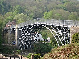
The
application of the steam engine allowed coke to be substituted for
charcoal in iron making, lowering the cost of iron, which provided
engineers with a new material for building bridges. This bridge was
made of cast iron, which was soon displaced by less brittle wrought iron as a structural material
The science of classical mechanics, sometimes called Newtonian mechanics, formed the scientific basis of much of modern engineering. With the rise of engineering as a profession
in the 18th century, the term became more narrowly applied to fields in
which mathematics and science were applied to these ends. Similarly, in
addition to military and civil engineering, the fields then known as
the mechanic arts became incorporated into engineering.
Canal building was an important engineering work during the early phases of the Industrial Revolution.
John Smeaton
was the first self-proclaimed civil engineer and is often regarded as
the "father" of civil engineering. He was an English civil engineer
responsible for the design of bridges, canals, harbours, and
lighthouses. He was also a capable mechanical engineer and an eminent physicist. Using a model water wheel, Smeaton conducted experiments for seven years, determining ways to increase efficiency. Smeaton introduced iron axles and gears to water wheels. Smeaton also made mechanical improvements to the Newcomen steam engine. Smeaton designed the third Eddystone Lighthouse (1755–59) where he pioneered the use of 'hydraulic lime' (a form of mortar
which will set under water) and developed a technique involving
dovetailed blocks of granite in the building of the lighthouse. He is
important in the history, rediscovery of, and development of modern cement,
because he identified the compositional requirements needed to obtain
"hydraulicity" in lime; work which led ultimately to the invention of Portland cement.
Applied science lead to the development of the steam engine. The sequence of events began with the invention the barometer and the measurement of atmospheric pressure by Evangelista Torricelli in 1643, demonstration of the force of atmospheric pressure by Otto von Guericke using the Magdeburg hemispheres in 1656, laboratory experiments by Denis Papin, who built experimental model steam engines and demonstrated the use of a piston, which he published in 1707. Edward Somerset, 2nd Marquess of Worcester published a book of 100 inventions containing a method for raising waters similar to a coffee percolator. Samuel Morland, a mathematician and inventor who worked on pumps, left notes at the Vauxhall Ordinance Office on a steam pump design that Thomas Savery read. In 1698 Savery built a steam pump called “The Miner’s Friend.” It employed both vacuum and pressure. Iron merchant Thomas Newcomen, who built the first commercial piston steam engine in 1712, was not known to have any scientific training.
The application of steam powered cast iron blowing cylinders for providing pressurized air for blast furnaces
lead to a large increase in iron production in the late 18th century.
The higher furnace temperatures made possible with steam powered blast
allowed for the use of more lime in blast furnaces, which enabled the transition from charcoal to coke. These innovations lowered the cost of iron, making horse railways and iron bridges practical. The puddling process, patented by Henry Cort in 1784 produced large scale quantities of wrought iron. Hot blast, patented by James Beaumont Neilson
in 1828, greatly lowered the amount of fuel needed to smelt iron. With
the development of the high pressure steam engine, the power to weight
ratio of steam engines made practical steamboats and locomotives
possible. New steel making processes, such as the Bessemer process and the open hearth furnace, ushered in an area of heavy engineering in the late 19th century.
One of the most famous engineers of the mid 19th century was Isambard Kingdom Brunel, who built railroads, dockyards and steamships.
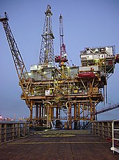
Offshore platform, Gulf of Mexico
The Industrial Revolution created a demand for machinery with metal parts, which led to the development of several machine tools. Boring cast iron cylinders with precision was not possible until John Wilkinson invented his boring machine, which is considered the first machine tool. Other machine tools included the screw cutting lathe, milling machine, turret lathe and the metal planer.
Precision machining techniques were developed in the first half of the
19th century. These included the use of gigs to guide the machining
tool over the work and fixtures to hold the work in the proper position.
Machine tools and machining techniques capable of producing interchangeable parts lead to large scale factory production by the late 19th century.
The United States census of 1850 listed the occupation of "engineer" for the first time with a count of 2,000.
There were fewer than 50 engineering graduates in the U.S. before
1865. In 1870 there were a dozen U.S. mechanical engineering graduates,
with that number increasing to 43 per year in 1875. In 1890, there were
6,000 engineers in civil, mining, mechanical and electrical.
There was no chair of applied mechanism and applied mechanics at
Cambridge until 1875, and no chair of engineering at Oxford until 1907.
Germany established technical universities earlier.
The foundations of electrical engineering in the 1800s included the experiments of Alessandro Volta, Michael Faraday, Georg Ohm and others and the invention of the electric telegraph in 1816 and the electric motor in 1872. The theoretical work of James Maxwell and Heinrich Hertz in the late 19th century gave rise to the field of electronics. The later inventions of the vacuum tube and the transistor
further accelerated the development of electronics to such an extent
that electrical and electronics engineers currently outnumber their
colleagues of any other engineering specialty.
Chemical engineering developed in the late nineteenth century.
Industrial scale manufacturing demanded new materials and new processes
and by 1880 the need for large scale production of chemicals was such
that a new industry was created, dedicated to the development and large
scale manufacturing of chemicals in new industrial plants. The role of the chemical engineer was the design of these chemical plants and processes.
The solar furnace at Odeillo in the Pyrénées-Orientales in France can reach temperatures up to 3,500 °C (6,330 °F)
Aeronautical engineering deals with aircraft design process design while aerospace engineering is a more modern term that expands the reach of the discipline by including spacecraft design. Its origins can be traced back to the aviation pioneers around the start of the 20th century although the work of Sir George Cayley
has recently been dated as being from the last decade of the 18th
century. Early knowledge of aeronautical engineering was largely
empirical with some concepts and skills imported from other branches of
engineering.
The first PhD in engineering (technically, applied science and engineering) awarded in the United States went to Josiah Willard Gibbs at Yale University in 1863; it was also the second PhD awarded in science in the U.S.
Only a decade after the successful flights by the Wright brothers, there was extensive development of aeronautical engineering through development of military aircraft that were used in World War I. Meanwhile, research to provide fundamental background science continued by combining theoretical physics with experiments.
Main branches of engineering
Engineering is a broad discipline which is often broken down into
several sub-disciplines. Although an engineer will usually be trained in
a specific discipline, he or she may become multi-disciplined through
experience. Engineering is often characterized as having four main
branches: chemical engineering, civil engineering, electrical engineering, and mechanical engineering.
Chemical engineering
Chemical engineering is the application of physics, chemistry,
biology, and engineering principles in order to carry out chemical
processes on a commercial scale, such as the manufacture of commodity chemicals, specialty chemicals, petroleum refining, microfabrication, fermentation, and biomolecule production.
Civil engineering
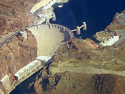
Civil engineering is the design and construction of public and private works, such as infrastructure (airports, roads, railways, water supply, and treatment etc.), bridges, tunnels, dams, and buildings. Civil engineering is traditionally broken into a number of sub-disciplines, including structural engineering, environmental engineering, and surveying. It is traditionally considered to be separate from military engineering.
Electrical engineering
Electrical engineering is the design, study, and manufacture of various electrical and electronic systems, such as Broadcast engineering, electrical circuits, generators, motors, electromagnetic/electromechanical devices, electronic devices, electronic circuits, optical fibers, optoelectronic devices, computer systems, telecommunications, instrumentation, controls, and electronics.
Mechanical engineering
Mechanical engineering is the design and manufacture of physical or mechanical systems, such as power and energy systems, aerospace/aircraft products, weapon systems, transportation products, engines, compressors, powertrains, kinematic chains, vacuum technology, vibration isolation equipment, manufacturing, and mechatronics.
Interdisciplinary engineering
Interdisciplinary engineering draws from more than one of the principle branches of the practice. Historically, naval engineering and mining engineering were major branches. Other engineering fields are manufacturing engineering, acoustical engineering, corrosion engineering, instrumentation and control, aerospace, automotive, computer, electronic, information engineering, petroleum, environmental, systems, audio, software, architectural, agricultural, biosystems, biomedical, geological, textile, industrial, materials, and nuclear engineering. These and other branches of engineering are represented in the 36 licensed member institutions of the UK Engineering Council.
New specialties sometimes combine with the traditional fields and form new branches – for example, Earth systems engineering and management involves a wide range of subject areas including engineering studies, environmental science, engineering ethics and philosophy of engineering.
Practice
One who practices engineering is called an engineer, and those licensed to do so may have more formal designations such as Professional Engineer, Chartered Engineer, Incorporated Engineer, Ingenieur, European Engineer, or Designated Engineering Representative.
Methodology
Design of a turbine
requires collaboration of engineers from many fields, as the system
involves mechanical, electro-magnetic and chemical processes. The blades, rotor and stator as well as the steam cycle all need to be carefully designed and optimized.
In the engineering design
process, engineers apply mathematics and sciences such as physics to
find novel solutions to problems or to improve existing solutions. More
than ever, engineers are now required to have a proficient knowledge of
relevant sciences for their design projects. As a result, many engineers
continue to learn new material throughout their career.
If multiple solutions exist, engineers weigh each design choice
based on their merit and choose the solution that best matches the
requirements. The crucial and unique task of the engineer is to
identify, understand, and interpret the constraints on a design in order
to yield a successful result. It is generally insufficient to build a
technically successful product, rather, it must also meet further
requirements.
Constraints may include available resources, physical,
imaginative or technical limitations, flexibility for future
modifications and additions, and other factors, such as requirements for
cost, safety, marketability, productivity, and serviceability. By understanding the constraints, engineers derive specifications for the limits within which a viable object or system may be produced and operated.
Problem solving
A drawing for a booster engine for steam locomotives. Engineering is applied to design, with emphasis on function and the utilization of mathematics and science.
Engineers use their knowledge of science, mathematics, logic, economics, and appropriate experience or tacit knowledge to find suitable solutions to a problem. Creating an appropriate mathematical model of a problem often allows them to analyze it (sometimes definitively), and to test potential solutions.
Usually, multiple reasonable solutions exist, so engineers must evaluate the different design choices on their merits and choose the solution that best meets their requirements. Genrich Altshuller, after gathering statistics on a large number of patents, suggested that compromises are at the heart of "low-level"
engineering designs, while at a higher level the best design is one
which eliminates the core contradiction causing the problem.
Engineers typically attempt to predict how well their designs
will perform to their specifications prior to full-scale production.
They use, among other things: prototypes, scale models, simulations, destructive tests, nondestructive tests, and stress tests. Testing ensures that products will perform as expected.
Engineers take on the responsibility of producing designs that
will perform as well as expected and will not cause unintended harm to
the public at large. Engineers typically include a factor of safety in their designs to reduce the risk of unexpected failure.
The study of failed products is known as forensic engineering and can help the product designer in evaluating his or her design in the light of real conditions. The discipline is of greatest value after disasters, such as bridge collapses, when careful analysis is needed to establish the cause or causes of the failure.
Computer use
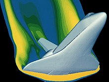
A computer simulation of high velocity air flow around a Space Shuttle orbiter during re-entry. Solutions to the flow require modelling of the combined effects of fluid flow and the heat equations.
As with all modern scientific and technological endeavors, computers
and software play an increasingly important role. As well as the typical
business application software there are a number of computer aided applications (computer-aided technologies)
specifically for engineering. Computers can be used to generate models
of fundamental physical processes, which can be solved using numerical methods.
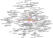
Graphic representation of a minute fraction of the WWW, demonstrating hyperlinks
One of the most widely used design tools in the profession is computer-aided design (CAD) software. It enables engineers to create 3D models, 2D drawings, and schematics of their designs. CAD together with digital mockup (DMU) and CAE software such as finite element method analysis or analytic element method
allows engineers to create models of designs that can be analyzed
without having to make expensive and time-consuming physical prototypes.
These allow products and components to be checked for flaws;
assess fit and assembly; study ergonomics; and to analyze static and
dynamic characteristics of systems such as stresses, temperatures,
electromagnetic emissions, electrical currents and voltages, digital
logic levels, fluid flows, and kinematics. Access and distribution of
all this information is generally organized with the use of product data management software.
There are also many tools to support specific engineering tasks such as computer-aided manufacturing (CAM) software to generate CNC machining instructions; manufacturing process management software for production engineering; EDA for printed circuit board (PCB) and circuit schematics for electronic engineers; MRO applications for maintenance management; and Architecture, engineering and construction (AEC) software for civil engineering.
In recent years the use of computer software to aid the development of goods has collectively come to be known as product lifecycle management (PLM).
Social context
The engineering profession engages in a wide range of activities,
from large collaboration at the societal level, and also smaller
individual projects. Almost all engineering projects are obligated to
some sort of financing agency: a company, a set of investors, or a
government. The few types of engineering that are minimally constrained
by such issues are pro bono engineering and open-design engineering.
By its very nature engineering has interconnections with society,
culture and human behavior. Every product or construction used by
modern society is influenced by engineering. The results of engineering
activity influence changes to the environment, society and economies,
and its application brings with it a responsibility and public safety.
Engineering projects can be subject to controversy. Examples from different engineering disciplines include the development of nuclear weapons, the Three Gorges Dam, the design and use of sport utility vehicles and the extraction of oil. In response, some western engineering companies have enacted serious corporate and social responsibility policies.
Engineering is a key driver of innovation and human development.
Sub-Saharan Africa, in particular, has a very small engineering capacity
which results in many African nations being unable to develop crucial
infrastructure without outside aid. The attainment of many of the Millennium Development Goals
requires the achievement of sufficient engineering capacity to develop
infrastructure and sustainable technological development.
Radar, GPS, lidar, ... are all combined to provide proper navigation and obstacle avoidance (vehicle developed for 2007 DARPA Urban Challenge)
All overseas development and relief NGOs make considerable use of
engineers to apply solutions in disaster and development scenarios. A
number of charitable organizations aim to use engineering directly for
the good of mankind:
- Engineers Without Borders
- Engineers Against Poverty
- Registered Engineers for Disaster Relief
- Engineers for a Sustainable World
- Engineering for Change
- Engineering Ministries International
Engineering companies in many established economies are facing
significant challenges with regard to the number of professional
engineers being trained, compared with the number retiring. This
problem is very prominent in the UK where engineering has a poor image
and low status. There are many negative economic and political issues that this can cause, as well as ethical issues. It is widely agreed that the engineering profession faces an "image crisis",
rather than it being fundamentally an unattractive career. Much work
is needed to avoid huge problems in the UK and other western economies.
Code of ethics
Many engineering societies have established codes of practice and codes of ethics to guide members and inform the public at large. The National Society of Professional Engineers code of ethics states:
Engineering is an important and learned profession. As members of this profession, engineers are expected to exhibit the highest standards of honesty and integrity. Engineering has a direct and vital impact on the quality of life for all people. Accordingly, the services provided by engineers require honesty, impartiality, fairness, and equity, and must be dedicated to the protection of the public health, safety, and welfare. Engineers must perform under a standard of professional behavior that requires adherence to the highest principles of ethical conduct.
In Canada, many engineers wear the Iron Ring as a symbol and reminder of the obligations and ethics associated with their profession.
Relationships with other disciplines
Science
Scientists study the world as it is; engineers create the world that has never been.
Engineers, scientists and technicians at work on target positioner inside National Ignition Facility (NIF) target chamber
There exists an overlap between the sciences and engineering
practice; in engineering, one applies science. Both areas of endeavor
rely on accurate observation of materials and phenomena. Both use
mathematics and classification criteria to analyze and communicate
observations.
Scientists may also have to complete engineering tasks, such as
designing experimental apparatus or building prototypes. Conversely, in
the process of developing technology engineers sometimes find themselves
exploring new phenomena, thus becoming, for the moment, scientists or
more precisely "engineering scientists".
The International Space Station is used to conduct science experiments of outer space
In the book What Engineers Know and How They Know It,
Walter Vincenti asserts that engineering research has a character
different from that of scientific research. First, it often deals with
areas in which the basic physics or chemistry are well understood, but the problems themselves are too complex to solve in an exact manner.
There is a "real and important" difference between engineering
and physics as similar to any science field has to do with technology.
Physics is an exploratory science that seeks knowledge of principles
while engineering uses knowledge for practical applications of
principles. The former equates an understanding into a mathematical
principle while the latter measures variables involved and creates
technology. For technology, physics is an auxiliary and in a way technology is considered as applied physics.
Though physics and engineering are interrelated, it does not mean that a
physicist is trained to do an engineer's job. A physicist would
typically require additional and relevant training. Physicists and engineers engage in different lines of work. But PhD physicists who specialize in sectors of engineering physics and applied physics are titled as Technology officer, R&D Engineers and System Engineers.
An example of this is the use of numerical approximations to the Navier–Stokes equations to describe aerodynamic flow over an aircraft, or the use of Miner's rule to calculate fatigue damage. Second, engineering research employs many semi-empirical methods that are foreign to pure scientific research, one example being the method of parameter variation.
As stated by Fung et al. in the revision to the classic engineering text Foundations of Solid Mechanics:
Engineering is quite different from science. Scientists try to understand nature. Engineers try to make things that do not exist in nature. Engineers stress innovation and invention. To embody an invention the engineer must put his idea in concrete terms, and design something that people can use. That something can be a complex system, device, a gadget, a material, a method, a computing program, an innovative experiment, a new solution to a problem, or an improvement on what already exists. Since a design has to be realistic and functional, it must have its geometry, dimensions, and characteristics data defined. In the past engineers working on new designs found that they did not have all the required information to make design decisions. Most often, they were limited by insufficient scientific knowledge. Thus they studied mathematics, physics, chemistry, biology and mechanics. Often they had to add to the sciences relevant to their profession. Thus engineering sciences were born.
Although engineering solutions make use of scientific principles,
engineers must also take into account safety, efficiency, economy,
reliability, and constructability or ease of fabrication as well as the
environment, ethical and legal considerations such as patent
infringement or liability in the case of failure of the solution.
Medicine and biology
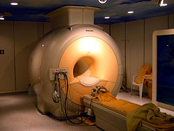
A 3 tesla clinical MRI scanner.
The study of the human body, albeit from different directions and for
different purposes, is an important common link between medicine and
some engineering disciplines. Medicine aims to sustain, repair, enhance and even replace functions of the human body, if necessary, through the use of technology.
Genetically engineered mice expressing green fluorescent protein, which glows green under blue light. The central mouse is wild-type.
Modern medicine can replace several of the body's functions through
the use of artificial organs and can significantly alter the function of
the human body through artificial devices such as, for example, brain implants and pacemakers. The fields of bionics and medical bionics are dedicated to the study of synthetic implants pertaining to natural systems.
Conversely, some engineering disciplines view the human body as a
biological machine worth studying and are dedicated to emulating many
of its functions by replacing biology with technology. This has led to fields such as artificial intelligence, neural networks, fuzzy logic, and robotics. There are also substantial interdisciplinary interactions between engineering and medicine.
Both fields provide solutions to real world problems. This often
requires moving forward before phenomena are completely understood in a
more rigorous scientific sense and therefore experimentation and
empirical knowledge is an integral part of both.
Medicine, in part, studies the function of the human body. The
human body, as a biological machine, has many functions that can be
modeled using engineering methods.
The heart for example functions much like a pump, the skeleton is like a linked structure with levers, the brain produces electrical signals etc.
These similarities as well as the increasing importance and application
of engineering principles in medicine, led to the development of the
field of biomedical engineering that uses concepts developed in both disciplines.
Newly emerging branches of science, such as systems biology,
are adapting analytical tools traditionally used for engineering, such
as systems modeling and computational analysis, to the description of
biological systems.
Art
Leonardo da Vinci, seen here in a self-portrait, has been described as the epitome of the artist/engineer. He is also known for his studies on human anatomy and physiology.
There are connections between engineering and art, for example, architecture, landscape architecture and industrial design (even to the extent that these disciplines may sometimes be included in a university's Faculty of Engineering).
The Art Institute of Chicago, for instance, held an exhibition about the art of NASA's aerospace design. Robert Maillart's bridge design is perceived by some to have been deliberately artistic. At the University of South Florida, an engineering professor, through a grant with the National Science Foundation, has developed a course that connects art and engineering.
Among famous historical figures, Leonardo da Vinci is a well-known Renaissance artist and engineer, and a prime example of the nexus between art and engineering.
Business
Business Engineering deals with the relationship between professional engineering, IT systems, business administration and change management. Engineering management or "Management engineering" is a specialized field of management
concerned with engineering practice or the engineering industry sector.
The demand for management-focused engineers (or from the opposite
perspective, managers with an understanding of engineering), has
resulted in the development of specialized engineering management
degrees that develop the knowledge and skills needed for these roles.
During an engineering management course, students will develop industrial engineering
skills, knowledge, and expertise, alongside knowledge of business
administration, management techniques, and strategic thinking.
Engineers specializing in change management must have in-depth knowledge
of the application of industrial and organizational psychology principles and methods. Professional engineers often train as certified management consultants in the very specialized field of management consulting applied to engineering practice or the engineering sector. This work often deals with large scale complex business transformation or Business process management
initiatives in aerospace and defence, automotive, oil and gas,
machinery, pharmaceutical, food and beverage, electrical &
electronics, power distribution & generation, utilities and
transportation systems. This combination of technical engineering
practice, management consulting practice, industry sector knowledge, and
change management expertise enables professional engineers who are also
qualified as management consultants to lead major business
transformation initiatives. These initiatives are typically sponsored by
C-level executives.
Other fields
In political science, the term engineering has been borrowed for the study of the subjects of social engineering and political engineering, which deal with forming political and social structures using engineering methodology coupled with political science principles. Financial engineering has similarly borrowed the term.


