Search This Blog

Monday, February 10, 2020

Farthest South

From Wikipedia, the free encyclopedia
https://en.wikipedia.org/wiki/Farthest_South
 
In an icebound landscape four figures stand, left, facing a small pointed tent from which two triangular flags are flying.
Amundsen's Norwegian party stand at the South Pole, 17 December 1911. They had reached 90°S two days earlier.

Farthest South refers the most southerly latitude reached by explorers before the conquest of the South Pole in 1911. Significant steps on the road to the pole were the discovery of lands south of Cape Horn in 1619, Captain James Cook's crossing of the Antarctic Circle in 1773, and the earliest confirmed sightings of the Antarctic mainland in 1820. From the late 19th century onward, the quest for Farthest South latitudes became in effect a race to reach the pole, which culminated in Roald Amundsen's success in December 1911.

In the years before reaching the pole was a realistic objective, other motives drew adventurers southward. Initially, the driving force was the discovery of new trade routes between Europe and the Far East. After such routes had been established and the main geographical features of the earth had been broadly mapped, the lure for mercantile adventurers was the great fertile continent of "Terra Australis" which, according to myth, lay hidden in the south. Belief in the existence of this supposed land of plenty persisted well into the 18th century; explorers were reluctant to accept the truth that slowly emerged, of a cold, harsh environment in the lands of the Southern Ocean

James Cook's voyages of 1771–74 demonstrated conclusively the likely hostile nature of any hidden lands. This caused a shift of emphasis in the first half of the 19th century, away from trade and towards sealing and whaling, and then exploration and discovery. After the first overwintering on continental Antarctica in 1898–99 (Adrien de Gerlache), the prospect of reaching the South Pole appeared realistic, and the race for the pole began. The British were pre-eminent in this endeavour, which was characterised by the rivalry between Robert Falcon Scott and Ernest Shackleton during the Heroic Age of Antarctic Exploration. Shackleton's efforts fell short; Scott reached the pole in January 1912 only to find that he had been beaten by the Norwegian Amundsen.

Early voyagers

Antarctica and surrounding islands, showing Tierra del Fuego and the Auckland Islands
 
In 1494, the principal maritime powers, Portugal and Spain, signed a treaty which drew a line down the middle of the Atlantic Ocean and allocated all trade routes to the east of the line to Portugal. That gave Portugal dominance of the only known route to the east—via the Cape of Good Hope and Indian Ocean, which left Spain, and later other countries, to seek a western route to the Pacific. The exploration of the south began as part of the search for such a route.

Unlike the Arctic, there is no evidence of human visitation or habitation in Antarctica or the islands around it prior to European exploration. However, the most southerly parts of South America were already inhabited by tribes such as the Selk'nam/Ona, the Yagán/Yámana, the Alacaluf and the Haush. The Haush in particular made regular trips to Isla de los Estados, which was 29 kilometres (18 mi) from the main island of Tierra del Fuego, suggesting that some of them may have been capable of reaching the islands near Cape Horn. Fuegian Indian artefacts and canoe remnants have also been discovered on the Falkland Islands, suggesting the capacity for even longer sea journeys.

While the natives of Tierra del Fuego were not capable of true oceanic travel, there is some evidence of Polynesian visits to some of the sub antarctic islands to the south of New Zealand, although these are further from Antarctica than South America. There are also remains of a Polynesian settlement dating back to the 13th century on Enderby Island in the Auckland Islands. According to ancient legends, around the year 650 the Polynesian traveller Ui-te-Rangiora led a fleet of Waka Tīwai south until they reached "a place of bitter cold where rock-like structures rose from a solid sea". It is unclear from the legends how far south Ui-te-Rangiora penetrated, but it appears that he observed ice in large quantities. A shard of undated, unidentified pottery, reported as found in 1886 in the Antipodes Islands, has been associated with this expedition.

Ferdinand Magellan

Head and shoulders of a heavily-bearded man wearing a cloak and a soft hat
Ferdinand Magellan

Although Portuguese by birth, Ferdinand Magellan transferred his allegiance to King Charles I of Spain, on whose behalf he left Seville on 10 August 1519, with a squadron of five ships, in search of a western route to the Spice Islands in the East Indies. Success depended on finding a strait or passage through the South American land masses, or finding the southern tip of the continent and sailing around it. The South American coast was sighted on 6 December 1519, and Magellan moved cautiously southward, following the coast to reach latitude 49°S on 31 March 1520. Little if anything was known of the coast south of this point, so Magellan decided to wait out the southern winter here, and established the settlement of Puerto San Julian.

In September 1520, the voyage continued down the uncharted coast, and on 21 October reached 52°S. Here Magellan found a deep inlet which proved to be the strait he was seeking, later to be known by his name. Early in November 1520, as the squadron navigated through the strait, they reached its most southerly point at approximate latitude 54°S. This was a record Farthest South for a European navigator, though not the farthest southern penetration by man; the position was north of the Tierra del Fuego archipelago, where there is evidence of human settlement dating back thousands of years.

Francisco de Hoces

The first sighting of an ocean passage to the Pacific south of Tierra del Fuego is sometimes attributed to Francisco de Hoces of the Loaisa Expedition. In January 1526 his ship San Lesmes was blown south from the Atlantic entrance of the Magellan Strait to a point where the crew thought they saw a headland, and water beyond it, which indicated the southern extremity of the continent. It is speculation as to which headland they saw; conceivably it was Cape Horn. In parts of the Spanish-speaking world it is believed that de Hoces may have discovered the strait later known as the Drake Passage more than 50 years before Sir Francis Drake, the British privateer.

Sir Francis Drake

Man with high forehead and short pointed beard, in dark clothing which incorporates a shining leather or metallic collar. His right hand is resting on a globe of the world.
Sir Francis Drake

Sir Francis Drake sailed from Plymouth on 15 November 1577, in command of a fleet of five ships under his flagship Pelican, later renamed the Golden Hinde. His principal objective was plunder, not exploration; his initial targets were the unfortified Spanish towns on the Pacific coasts of Chile and Peru. Following Magellan's route, Drake reached Puerto San Julian on 20 June. After nearly two months in harbour, Drake left the port with a reduced fleet of three ships and a small pinnace. His ships entered the Magellan Strait on 23 August and emerged in the Pacific Ocean on 6 September.

Drake set a course to the north-west, but on the following day a gale scattered the ships. The Marigold was sunk by a giant wave; the Elizabeth managed to return into the Magellan Strait, later sailing eastwards back to England; the pinnace was lost later. The gales persisted for more than seven weeks. The Golden Hinde was driven far to the west and south, before clawing its way back towards land. On 22 October, the ship anchored off an island which Drake named "Elizabeth Island", where wood for the galley fires was collected and seals and penguins captured for food.

According to Drake's Portuguese pilot, Nuno da Silva, their position at the anchorage was 57°S. However, there is no island at that latitude. The as yet undiscovered Diego Ramírez Islands, at 56°30'S, are treeless and cannot have been the islands where Drake's crew collected wood. This indicates that the navigational calculation was faulty, and that Drake landed at or near the then unnamed Cape Horn, possibly on Horn Island itself. His final southern latitude can only be speculated as that of Cape Horn, at 55°59'S. In his report, Drake wrote: "The Uttermost Cape or headland of all these islands stands near 56 degrees, without which there is no main island to be seen to the southwards but that the Atlantic Ocean and the South Sea meet." This open sea south of Cape Horn became known as the Drake Passage even though Drake himself did not traverse it.

Willem Schouten

On 14 June 1615, Willem Schouten, with two ships Eendracht and Hoorn, set sail from Texel in the Netherlands in search of a western route to the Pacific. Hoorn was lost in a fire, but Eendracht continued southward. On 29 January 1616, Schouten reached what he discerned to be the southernmost cape of the South American continent; he named this point Kaap Hoorn (Cape Horn) after his hometown and his lost ship. Schouten's navigational readings are inaccurate—he placed Cape Horn at 57°48' south, when its actual position is 55°58'. His claim to have reached 58° south is unverified, although he sailed on westward to become the first European navigator to reach the Pacific via the Drake Passage.

Garcia de Nodal expedition

The next recorded navigation of the Drake Passage was achieved in February 1619, by the brothers Bartolome and Gonzalo Garcia de Nodal. The Garcia de Nodal expedition discovered a small group of islands about 60 nautical miles (100 km; 70 mi) south-west of Cape Horn, at latitude 56°30'S. They named these the Diego Ramirez Islands after the expedition's pilot. The islands remained the most southerly known land on earth until Captain James Cook's discovery of the South Sandwich Islands in 1775.

Other discoveries

Other voyages brought further discoveries in the southern oceans; in August 1592, the English seaman John Davis had taken shelter "among certain Isles never before discovered"—presumed to be the Falkland Islands. In 1675, the English merchant voyager Anthony de la Roché visited South Georgia (the first Antarctic land discovered); in 1739 the Frenchman Jean-Baptiste Bouvet de Lozier discovered the remote Bouvet Island, and in 1772 his compatriot, Yves-Joseph de Kerguelen de Trémarec, found the Kerguelen Islands.

Early Antarctic explorers


Captain James Cook

Severe-looking man, clean-shaven and with a high forehead, wearing an open coat, white shirt and embroidered waistcoat. A legend in the top left corner identifies him as "Capt. James Cook of the Endeavor".
Captain James Cook
 
The second of James Cook's historic voyages, 1772–1775, was primarily a search for the elusive Terra Australis Incognita that was still believed to lie somewhere in the unexplored latitudes below 40°S. Cook left England in September 1772 with two ships, HMS Resolution and HMS Adventure. After pausing at Cape Town, on 22 November the two ships sailed due south, but were driven to the east by heavy gales. They managed to edge further south, encountering their first pack ice on 10 December. This soon became a solid barrier, which tested Cook's seamanship as he manoeuvered for a passage through. Eventually, he found open water, and was able to continue south; on 17 January 1773, the expedition reached the Antarctic Circle at 66°20'S, the first ships to do so. Further progress was barred by ice, and the ships turned north-eastwards and headed for New Zealand, which they reached on 26 March.

During the ensuing months, the expedition explored the southern Pacific Ocean before Cook took Resolution south again—Adventure had retired back to South Africa after a fracas with the New Zealand native population. This time Cook was able to penetrate deep beyond the Antarctic Circle, and on 30 January 1774 reached 71°10'S, his Farthest South, but the state of the ice made further southward travel impossible. This southern record would hold for 49 years.

In the course of his voyages in Antarctic waters, Cook had encircled the world at latitudes generally above 60°S, and saw nothing but bleak inhospitable islands, without a hint of the fertile continent which some still hoped lay in the south. Cook wrote that if any such continent existed it would be "a country doomed by nature", and that "no man will venture further than I have done, and the land to the South will never be explored". He concluded: "Should the impossible be achieved and the land attained, it would be wholly useless and of no benefit to the discoverer or his nation".

Searching for land

Despite Cook's prediction, the early 19th century saw numerous attempts to penetrate southward, and to discover new lands. In 1819, William Smith, in command of the brigantine Williams, discovered the South Shetland Islands, and in the following year Edward Bransfield, in the same ship, sighted the Trinity Peninsula at the northern extremity of Graham Land. A few days before Bransfield's discovery, on 27 January 1820, the Russian captain Fabian von Bellingshausen, in another Antarctic sector, had come within sight of the coast of what is now known as Queen Maud Land. He is thus credited as the first person to see the continent's mainland, although he did not make this claim himself. Bellingshausen made two circumnavigations mainly in latitudes between 60 and 67°S, and in January 1821 reached his most southerly point at 70°S, in a longitude close to that in which Cook had made his record 47 years earlier. In 1821 the American sealing captain John Davis led a party which landed on an uncharted stretch of land beyond the South Shetlands. "I think this Southern Land to be a Continent", he wrote in his ship's log. If his landing was not on an island, his party were the first to set foot on the Antarctic continent.

James Weddell

James Weddell was an Anglo-Scottish seaman who saw service in both the Royal Navy and the merchant marine before undertaking his first voyages to Antarctic waters. In 1819, in command of the 160-ton brigantine Jane which had been adapted for whaling, he set sail for the newly discovered whaling grounds of the South Sandwich Islands. His chief interest on this voyage was in finding the "Aurora Islands", which had been reported at 53°S, 48°W by the Spanish ship Aurora in 1762. He failed to discover this non-existent land, but his sealing activities showed a handsome profit.

Stylized drawing of two sailing ships caught in rough seas, surrounded by towering icebergs.
Weddell's ships, Jane and Beaufoy, under full sail

In 1822 Weddell, again in command of Jane and this time accompanied by a smaller ship, the cutter Beaufoy, set sail for the south with instructions from his employers that, should the sealing prove barren, he was to "investigate beyond the track of former navigators". This suited Weddell's exploring instincts, and he equipped his vessel with chronometers, thermometers, compasses, barometers and charts. In January 1823 he probed the waters between the South Sandwich Islands and the South Orkney Islands, looking for new land. Finding none, he turned southward down the 40°W meridian, deep into the sea that now bears his name. The season was unusually calm, and Weddell reported that "not a particle of ice of any description was to be seen". On 20 February 1823, he reached a new Farthest South of 74°15'S, three degrees beyond Cook's former record. Unaware that he was close to land, Weddell decided to return northward from this point, convinced that the sea continued as far as the South Pole. Another two days' sailing would likely have brought him within sight of Coats Land, which was not discovered until 1904, by William Speirs Bruce during the Scottish National Antarctic Expedition, 1902–04. On his return to England, Weddell's claim to have exceeded Cook's record by such a margin "caused some raised eyebrows", but was soon accepted.

Benjamin Morrell

In November 1823, the American sealing captain Benjamin Morrell reached the South Sandwich Islands in the schooner Wasp. According to his own later account he then sailed south, unconsciously following the track taken by James Weddell a month previously. Morrell claimed to have reached 70°14'S, at which point he turned north because the ship's stoves were running short of fuel—otherwise, he says, he could have "reached 85° without the least doubt". After turning, he claimed to have encountered land which he described in some detail, and which he named New South Greenland. This land proved not to exist. Morrell's reputation as a liar and a fraud means that most of his geographical claims have been dismissed by scholars, although attempts have been made to rationalise his assertions.

James Clark Ross

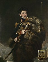
James Clark Ross's 1839–43 Antarctic expedition in HMS Erebus and HMS Terror was a full-scale Royal Naval enterprise, the principal function of which was to test current theories on magnetism, and to try to locate the South Magnetic Pole. The expedition had first been proposed by leading astronomer Sir John Herschel, and was supported by the Royal Society and the British Association for the Advancement of Science. Ross had considerable past experience in magnetic observation and Arctic exploration; in May 1831 he had been a member of a party that had reached the location of the North Magnetic Pole, and he was an obvious choice as commander.

A man in ceremonial naval uniform looks right, gaping a large sword in his right hand. A navigational instrument stands on a table, lower right.
Captain Sir James Clark Ross

The expedition left England on 30 September 1839, and after a voyage that was slowed by the many stops required to carry out work on magnetism, it reached Tasmania in August 1840. Following a three-month break imposed by the southern winter, they sailed south-east on 12 November 1840, and crossed the Antarctic Circle on 1 January 1841. On 11 January a long mountainous coastline that stretched to the south was sighted. Ross named the land Victoria Land, and the mountains the Admiralty Range. He followed the coast southwards and passed Weddell's Farthest South point of 74°15'S on 23 January. A few days later, as they moved further eastward to avoid shore ice, they were met by the sight of twin volcanoes (one of them active), which were named Mount Erebus and Mount Terror, in honour of the expedition's ships.

The Great Ice Barrier (later to be called the "Ross Ice Shelf") stretched away east of these mountains, forming an impassable obstacle to further southward progress. In his search for a strait or inlet, Ross explored 300 nautical miles (560 km; 350 mi) along the edge of the barrier, and reached an approximate latitude of 78°S on or about 8 February 1841. He failed to find a suitable anchorage that would have allowed the ships to over-winter, so he returned to Tasmania, arriving there in April 1841.

The following season Ross returned and located an inlet in the Barrier face that enabled him, on 23 January 1842, to extend his Farthest South to 78°09'30"S, a record which would remain unchallenged for 58 years. Although Ross had not been able to land on the Antarctic continent, nor approach the location of the South Magnetic Pole, on his return to England in 1843 he was knighted for his achievements in geographical and scientific exploration.

Explorers of the Heroic Age

The oceanographic research voyage known as the Challenger Expedition, 1872–76, explored Antarctic waters for several weeks, but did not approach the land itself; its research, however, proved the existence of an Antarctic continent beyond reasonable doubt.

The impetus for what would become known as the Heroic Age of Antarctic Exploration came in 1895, when in an address to the Sixth International Geographical Congress in London, Professor Sir John Murray called for a resumption of Antarctic exploration: "a steady, continuous, laborious and systematic exploration of the whole southern region". He followed this call with an appeal to British patriotism: "Is the last great piece of maritime exploration on the surface of our Earth to be undertaken by Britons, or is it to be left to those who may be destined to succeed or supplant us on the Ocean?" During the following quarter-century, fifteen expeditions from eight different nations rose to this challenge. In the patriotic spirit engendered by Murray's call, and under the influence of RGS president Sir Clements Markham, British endeavours in the following years gave particular weight to the achievement of new Farthest South records, and began to develop the character of a race for the South Pole.

Carsten Borchgrevink

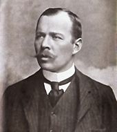
Head and shoulders portrait of a man with receding hair, heavy moustache, looking left from the image. He wears a high white collar, black necktie, dark waistcoat and jacket.
Carsten Borchgrevink, who led the Southern Cross Expedition, 1898–1900

The Norwegian-born Carsten Egeberg Borchgrevink had emigrated to Australia in 1888, where he worked on survey teams in Queensland and New South Wales before accepting a schoolteaching post. In 1894 he joined a sealing and whaling expedition to the Antarctic, led by Henryk Bull. In January 1895 Borchgrevink was one of a group from that expedition that claimed the first confirmed landing on the Antarctic continent, at Cape Adare. Borchgrevink determined to return with his own expedition, which would overwinter and explore inland, with the location of the South Magnetic Pole as an objective.

Borchgrevink went to England, where he was able to persuade the publishing magnate Sir George Newnes to finance him to the extent of £40,000, equivalent to £4.2 million in 2016, with the sole stipulation that, despite the shortage of British participants, the venture be styled the "British Antarctic Expedition". This was by no means the grand British expedition envisaged by Markham and the geographical establishment, who were hostile and dismissive of Borchgrevink. On 23 August 1898 the expedition ship Southern Cross left London for the Ross Sea, reaching Cape Adare on 17 February 1899. Here a shore party was landed and was the first to over-winter on the Antarctic mainland, in a prefabricated hut.

In January 1900, Southern Cross returned, picked up the shore party and, following the route which Ross had taken 60 years previously, sailed southward to the Great Ice Barrier, which they discovered had retreated some 30 miles (48 km) south since the days of Ross. A party consisting of Borchgrevink, William Colbeck and a Sami named Per Savio landed with sledges and dogs. This party ascended the Barrier and made the first sledge journey on the barrier surface; on 16 February 1900 they extended the Farthest South record to 78°50'S. On its return to England later in 1900, Borchgrevink's expedition was received without enthusiasm, despite its new southern record. Historian David Crane commented that if Borchgrevink had been a British naval officer, his contribution to Antarctic knowledge might have been better received, but "a Norwegian seaman/schoolmaster was never going to be taken seriously".

Robert Falcon Scott

The Discovery Expedition of 1901–04 was Robert Falcon Scott's first Antarctic command. Although according to Edward Wilson the intention was to "reach the Pole if possible, or find some new land", there is nothing in Scott's writings, nor in the official objectives of the expedition, to indicate that the pole was a definite goal. However, a southern journey towards the pole was within Scott's formal remit to "explore the ice barrier of Sir James Ross ... and to endeavour to solve the very important physical and geographical questions connected with this remarkable ice formation".

The southern journey was undertaken by Scott, Wilson and Ernest Shackleton. The party set out on 1 November 1902 with various teams in support, and one of these, led by Michael Barne, passed Borchgrevink's Farthest South mark on 11 November, an event recorded with great high spirits in Wilson's diary. The march continued, initially in favourable weather conditions, but encountered increasing difficulties caused by the party's lack of ice travelling experience and the loss of all its dogs through a combination of poor diet and overwork. The 80°S mark was passed on 2 December, and four weeks later, on 30 December 1902, Wilson and Scott took a short ski trip from their southern camp to set a new Farthest South at (according to their measurements) 82°17'S. Modern maps, correlated with Shackleton's photograph and Wilson's drawing, put their final camp at 82°6'S, and the point reached by Scott and Wilson at 82°11'S, 200 nautical miles (370 km; 230 mi) beyond Borchgrevink's mark.

Ernest Shackleton

Three men in heavy clothing stand in line on an icy surface, next to a flagstaff from which flies the flag of the United Kingdom of Great Britain and Ireland
From left to right: Jameson Adams, Frank Wild and Eric Marshall (photographed by Shackleton) plant the Union flag at their southernmost position, 88°23', on 9 January 1909.
 
After his share in the Farthest South achievement of the Discovery Expedition, Ernest Shackleton suffered a physical collapse on the return journey, and was sent home with the expedition's relief vessel on orders from Scott; he bitterly resented it, and the two became rivals. Four years later, Shackleton organised his own polar venture, the Nimrod Expedition, 1907–09. This was the first expedition to set the definite objective of reaching the South Pole, and to have a specific strategy for doing so.

To assist his endeavour, Shackleton adopted a mixed transport strategy, involving the use of Manchurian ponies as pack animals, as well as the more traditional dog-sledges. A specially adapted motor car was also taken. Although the dogs and the car were used during the expedition for a number of purposes, the task of assisting the group that would undertake the march to the pole fell to the ponies. The size of Shackleton's four-man polar party was dictated by the number of surviving ponies; of the ten that were embarked in New Zealand, only four had survived the 1908 winter.

Ernest Shackleton and three companions (Frank Wild, Eric Marshall and Jameson Adams) began their march on 29 October 1908. On 26 November they surpassed the farthest point reached by Scott's 1902 party. "A day to remember", wrote Shackleton in his journal, noting that they had reached this point in far less time than on the previous march with Scott. Shackleton's group continued southward, discovering and ascending the Beardmore Glacier to the polar plateau, and then marching on to reach their Farthest South point at 88°23'S, a mere 97 nautical miles (180 km; 112 mi) from the pole, on 9 January 1909. Here they planted the Union Jack presented to them by Queen Alexandra, and took possession of the plateau in the name of King Edward VII, before shortages of food and supplies forced them to turn back north. This was, at the time, the closest convergence on either pole. The increase of more than six degrees south from Scott's previous record was the greatest extension of Farthest South since Captain Cook's 1773 mark. Shackleton was treated as a hero on his return to England. His record was to stand for less than three years, being passed by Amundsen on 7 December 1911.

Polar conquest

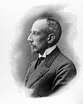
Head and shoulders profile of a man, facing left. His most prominent feature is his large hawk-like nose. He is dressed formally, with a stiff white wing collar.
Roald Amundsen, leader of the first expedition to reach the South Pole, 15 December 1911

In the wake of Shackleton's near miss, Robert Scott organised the Terra Nova Expedition, 1910–13, in which securing the South Pole for the British Empire was an explicitly stated prime objective. As he planned his expedition, Scott saw no reason to believe that his effort would be contested. However, the Norwegian explorer Roald Amundsen, who had been developing plans for a North Pole expedition, changed his mind when, in September 1909, the North Pole was claimed in quick succession by the Americans Frederick Cook and Robert Peary. Amundsen resolved to go south instead.

Amundsen concealed his revised intentions until his ship, Fram, was in the Atlantic and beyond communication. Scott was notified by telegram that a rival was in the field, but had little choice other than to continue with his own plans. Meanwhile, Fram arrived at the Ross Ice Shelf on 11 January 1911, and by 14 January had found the inlet, or "Bay of Whales", where Borchgrevink had made his landing eleven years earlier. This became the location of Amundsen's base camp, Framheim.

After nine months' preparation, Amundsen's polar journey began on 20 October 1911. Avoiding the known route to the polar plateau via the Beardmore Glacier, Amundsen led his party of five due south, reaching the Transantarctic Mountains on 16 November. They discovered the Axel Heiberg Glacier, which provided them with a direct route to the polar plateau and on to the pole. Shackleton's Farthest South mark was passed on 7 December, and the South Pole was reached on 14 December 1911. The Norwegian party's greater skills with the techniques of ice travel, using ski and dogs, had proved decisive in their success. Scott's five-man team reached the same point 33 days later, and perished during their return journey. Since Cook's journeys, every expedition that had held the Farthest South record before Amundsen's conquest had been British; however, the final triumph indisputably belonged to the Norwegians.

Later history

A long, large building consisting of several sections stands behind a line of flags flying on poles. The ground surface is ice-covered; in the middle foreground is a short striped pole which indicates the position of the South Pole
The Amundsen–Scott South Pole Station, photographed in 2006

After Scott's retreat from the pole in January 1912, the location remained unvisited for nearly 18 years. On 28 November 1929, US Navy Commander (later Rear-Admiral) Richard E. Byrd and three others completed the first aircraft flight over the South Pole. Twenty-seven years later, Rear-Admiral George J. Dufek became the first person to set foot on the pole since Scott, when on 31 October 1956 he and the crew of R4D-5 Skytrain "Que Sera Sera" landed at the pole. Between November 1956 and February 1957, the first permanent South Pole research station was erected and christened the Amundsen–Scott South Pole Station in honour of the pioneer explorers. Since then the station had been substantially extended, and in 2008 was housing up to 150 scientific staff and support personnel. Dufek gave considerable assistance to the Commonwealth Trans-Antarctic Expedition, 1955–58, led by Vivian Fuchs, which on 19 January 1958 became the first party to reach the pole overland since Scott.

Arctic exploration

From Wikipedia, the free encyclopedia
https://en.wikipedia.org/wiki/Arctic_exploration
 
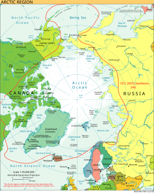
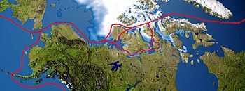
The Arctic region is within the red line
 
Arctic exploration is the physical exploration of the Arctic region of the Earth. It refers to the historical period during which mankind has explored the region north of the Arctic Circle. Historical records suggest that humankind have explored the northern extremes since 325 BC, when the ancient Greek sailor Pytheas reached a frozen sea while attempting to find a source of the metal tin. Dangerous oceans and poor weather conditions often fetter explorers attempting to reach polar regions and journeying through these perils by sight, boat, and foot has proven difficult.

Ancient Greece

Some scholars believe that the first attempts to penetrate the Arctic Circle can be traced to ancient Greece and the sailor Pytheas, a contemporary of Aristotle and Alexander the Great, who, in c. 325 BC, attempted to find the source of the tin that would sporadically reach the Greek colony of Massilia (now Marseille) on the Mediterranean coast. Sailing past the Pillars of Hercules, he reached Brittany and then Cornwall, eventually circumnavigating the British Isles. From the local population, he heard news of the mysterious land of Thule, even farther to the north. After six days of sailing, he reached land at the edge of a frozen sea (described by him as "curdled"), and described what is believed to be the aurora and the midnight sun. Some historians claim that this new land of Thule was either the Norwegian coast or the Shetland Islands based on his descriptions and the trade routes of early British sailors. While no one knows exactly how far Pytheas sailed, he may have crossed the Arctic Circle. Nevertheless, his tales were regarded as fantasy by later Greek and Roman authorities, such as the geographer Strabo.

The Middle Ages

Viking sailors reached the White Sea and Greenland and North America

The first Viking to sight Iceland was Gardar Svavarsson, who lost his route due to harsh conditions when sailing from Norway to the Faroe Islands. This quickly led to a wave of colonization. Not all the settlers were successful however in the attempts to reach the island. In the 10th century, Gunnbjörn Ulfsson got lost in a storm and ended up within sight of the Greenland coast. His report spurred Erik the Red, an outlawed chieftain, to establish a settlement there in 985. While they flourished initially, these settlements eventually foundered due to changing climatic conditions (see Little Ice Age). They are believed to have survived until around 1450. 

Greenland's early settlers sailed westward, in search of better pasturage and hunting grounds. Modern scholars debate the precise location of the new lands of Vinland, Markland, and Helluland that they discovered.

The Scandinavian peoples also pushed farther north into their own peninsula by land and by sea. As early as 880, the Viking Ohthere of Hålogaland rounded the Scandinavian Peninsula and sailed to the Kola Peninsula and the White Sea. The Pechenga Monastery on the north of Kola Peninsula was founded by Russian monks in 1533; from their base at Kola, the Pomors explored the Barents Region, Spitsbergen, and Novaya Zemlya—all of which are in the Arctic Circle. They also explored north by boat, discovering the Northern Sea Route, as well as penetrating to the trans-Ural areas of northern Siberia. They then founded the settlement of Mangazeya east of the Yamal Peninsula in the early 16th century. In 1648 the Cossack Semyon Dezhnyov opened the now famous Bering Strait between America and Asia. 

Russian settlers and traders on the coasts of the White Sea, the Pomors, had been exploring parts of the northeast passage as early as the 11th century. By the 17th century they established a continuous sea route from Arkhangelsk as far east as the mouth of Yenisey. This route, known as Mangazeya seaway, after its eastern terminus, the trade depot of Mangazeya, was an early precursor to the Northern Sea Route. 

Age of Discovery

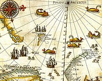
Mercator's map of the North Pole (1606)

Exploration to the north of the Arctic Circle in the Renaissance was both driven by the rediscovery of the Classics and the national quests for commercial expansion, and hampered by limits in maritime technology, lack of stable food supplies, and insufficient insulation for the crew against extreme cold. 

Renaissance advancements in cartography

Patent from King Henry VII, authorizing John Cabot and his sons to explore new lands in the west
 
A seminal event in Arctic exploration occurred in 1409, when Ptolemy's Geographia was translated into Latin, thereby introducing the concepts of latitude and longitude into Western Europe. Navigators were better able to chart their positions, and the European race to China, sparked by interest in the writings of Marco Polo, commenced. The Inventio Fortunata, a lost book, describes in a summary written by Jacobus Cnoyen but only found in a letter from Gerardus Mercator, voyages as far as the North Pole. One widely disputed claim is that two brothers from Venice, Niccolo and Antonio Zeno, allegedly made a map of their journeys to that region, which were published by their descendants in 1558.

Northwest Passage


The Northwest Passage connects the Atlantic and Pacific Oceans via the Arctic Ocean. Since the discovery of the American continent was the product of the search for a route to Asia, exploration around the northern edge of North America continued for the Northwest Passage. John Cabot's initial failure in 1497 to find a Northwest Passage across the Atlantic led the British to seek an alternative route to the east.

Interest re-kindled in 1564 after Jacques Cartier's discovery of the mouth of the Saint Lawrence River. Martin Frobisher had formed a resolution to undertake the challenge of forging a trade route from England westward to India. From 1576 to 1578, he took three trips to what is now the Canadian Arctic in order to find the passage. Frobisher Bay is named after him. In July 1583, Sir Humphrey Gilbert, who had written a treatise on the discovery of the passage and was a backer of Frobisher's, claimed the territory of Newfoundland for the English crown.

In 1585, under the employ of Elizabeth I, the English explorer John Davis entered Cumberland Sound, Baffin Island. Davis rounded Greenland before dividing his four ships into separate expeditions to search for a passage westward. Though he was unable to pass through the icy Arctic waters, he reported to his sponsors that the passage they sought is "a matter nothing doubtfull [sic]," and secured support for two additional expeditions, reaching as far as Hudson Bay.

Though England's efforts were interrupted in 1587 because of the Anglo-Spanish War, Davis's favorable reports on the region and its people would inspire explorers in the coming century. In 1609, while in the service of the Dutch East India Company, the English explorer Henry Hudson sailed up what is now called the Hudson River in search of the Passage; he reached present-day Albany, New York, before giving up. He later explored further north into the Arctic and Hudson Bay for the Passage.

The Northeast Passage

Jan Jansson's map of the "Poli Arctici" from 1644.

The Northeast Passage is a broad term for any route lying above the Eurasian continent and stretching between the waters north of the Norwegian Sea to the Bering Strait. The "Northern Sea Route" is defined as a specific portion of such routes. The Northern Sea Route (capitalized) as currently officially defined by Russian Federation law includes shipping lanes falling within Russia's EEZ and extending from the Kara Sea to the Bering Strait along the Russian northern coast.

The idea to explore this region was initially economic, and was first put forward by Russian diplomat Dmitry Gerasimov in 1525. The entire route lies in Arctic waters and parts are only totally free of ice for about two months per year, making it a very perilous journey.

In the mid-16th century, John Cabot's son Sebastian helped organize just such an expedition, led by Sir Hugh Willoughby and Richard Chancellor. Willoughby's crew was shipwrecked off the Kola Peninsula, where they eventually died of scurvy. Chancellor and his crew made it to the mouth of the Dvina River and the town of Arkhangelsk, where they were met by a delegation from the Tsar, Ivan the Terrible. Brought back to Moscow, he launched the Muscovy Company, promoting trade between England and Russia. This diplomatic course allowed British Ambassadors such as Sir Francis Cherry the opportunity to consolidate geographic information developed by Russian merchants into maps for British exploration of the region. Some years later, Steven Borough, the master of Chancellor's ship, made it as far as the Kara Sea, when he was forced to turn back because of icy conditions.

Spitsbergen and Svalbard during the Golden Age of Dutch exploration and discovery (ca. 1590s–1720s). Portion of 1599 map of Arctic exploration by Willem Barentsz. Spitsbergen, here mapped for the first time, is indicated as "Het Nieuwe Land" (Dutch for "the New Land"), center-left. This is a typical map from the Golden Age of Netherlandish cartography.
 
A Dutch map of Jan Mayen during the Golden Age of Dutch exploration and discovery (ca. 1590s–1720s). The Dutch were the first to undisputedly explore and chart coastlines of Jan Mayen and the Svalbard archipelago in the Arctic Ocean.
 
Western parts of the passage were simultaneously being explored by Northern European countries like England, the Netherlands, Denmark and Norway, looking for an alternative seaway to China and India. Although these expeditions failed, new coasts and islands were discovered. Most notable is the 1596 expedition led by Dutch navigator Willem Barentsz who discovered Spitsbergen and Bear Island

Fearing English and Dutch penetration into Siberia, Russia closed the Mangazeya seaway in 1619. Pomor activity in Northern Asia declined and the bulk of exploration in the 17th century was carried out by Siberian Cossacks, sailing from one river mouth to another in their Arctic-worthy kochs. In 1648 the most famous of these expeditions, led by Fedot Alekseev and Semyon Dezhnev, sailed east from the mouth of Kolyma to the Pacific and doubled the Chukchi Peninsula, thus proving that there was no land connection between Asia and North America. Eighty years after Dezhnev, in 1728, another Russian explorer, Danish-born Vitus Bering on Sviatoy Gavriil made a similar voyage in reverse, starting in Kamchatka and going north to the passage that now bears his name (Bering Strait). It was Bering who gave their current names to Diomede Islands, discovered and first described by Dezhnev.

It was not until in 1878 that Finnish-Swedish explorer Adolf Erik Nordenskiöld made the first complete passage of the North East Passage from west to east, in the Vega expedition. The ship's captain on this expedition was Lieutenant Louis Palander of the Swedish Royal Navy.

Northwest Passage

Sailing Ship in Arctic Regions
 
Roald Amundsen led the first expedition to reach the South Pole, was the first person to reach both poles, and was the first person to traverse the Northwest Passage.
 
In the first half of the 19th century, parts of the Northwest Passage were explored separately by a number of different expeditions, including those by John Ross, William Edward Parry, James Clark Ross; and overland expeditions led by John Franklin, George Back, Peter Warren Dease, Thomas Simpson, and John Rae. Sir Robert McClure was credited with the discovery of the Northwest Passage by sea in 1851 when he looked across M'Clure Strait from Banks Island and viewed Melville Island. However, the strait was blocked by young ice at this point in the season, and not navigable to ships. The only usable route, linking the entrances of Lancaster Sound and Dolphin and Union Strait was first used by John Rae in 1851. Rae used a pragmatic approach of traveling by land on foot and dog sled, and typically employed less than ten people in his exploration parties.

The Northwest Passage was not completely conquered by sea until 1906, when the Norwegian explorer Roald Amundsen, who had sailed just in time to escape creditors seeking to stop the expedition, completed a three-year voyage in the converted 47-ton herring boat Gjøa. At the end of this trip, he walked into the city of Eagle, Alaska, and sent a telegram announcing his success. His route was not commercially practical; in addition to the time taken, some of the waterways were extremely shallow.

Knud Rasmussen (1879 - 1933) led several Arctic expeditions. He grew up in Greenland speaking Greenlandic and Danish, and has been called the "father of Eskimology" and was the first Greenlander of Inuit and European descent to cross the Northwest Passage via dog sled. Rasmussen and his friend Peter Freuchen participated in seven Thule Expeditions, named after ultima Thule, and wrote numerous books on their Arctic experiences.

The North Pole

Robert Peary and sledge party with flags at North Pole. Peary has been claimed to be the first person to reach the North Pole.

On April 6, 1909, Robert Peary claimed to be the first person in recorded history to reach the North Pole (although whether he actually reached the Pole is disputed). He traveled with the aid of dogsleds and three separate support crews who turned back at successive intervals before reaching the Pole. Many modern explorers, including Olympic skiers using modern equipment, contend that Peary could not have reached the pole on foot in the time he claimed.

A number of previous expeditions set out with the intention of reaching the North Pole but did not succeed; that of British naval officer William Edward Parry in 1827, the tragic American Polaris expedition under Charles Francis Hall in 1871, the ill-fated Jeannette Expedition commanded by US Navy Lt Cmdr George W. DeLong in 1879, and the Norwegian Fram Expedition of Fridtjof Nansen in 1895. American Frederick Cook claimed to have reached the North Pole in 1908, but this has not been widely accepted.

On May 9, 1926, Americans Richard E. Byrd and Floyd Bennett claimed to have flown over the North Pole in a Fokker F.VIIa/3m Tri-motor monoplane. However, their claim to have reached the Pole is disputed.

The crew of the airship Norge (including Roald Amundsen and the American sponsor Lincoln Ellsworth) flew over the Pole on May 12, 1926. This is the first undisputed sighting of the Pole. Norge was designed and piloted by the Italian Umberto Nobile, who overflew the Pole a second time on May 24, 1928. Nobile’s second trip was in the airship Italia that ran into a storm on the return trip and crashed on the ice. Survivors were eventually recovered. Amundsen disappeared, with the crew of his sea plane, during the rescue operations.

The first people to have without doubt walked on the North Pole were the Soviet party of 1948 under the command of Alexander Kuznetsov, who landed their aircraft nearby and walked to the pole.

On August 3, 1958, the American submarine USS Nautilus (SSN-571) reached the North Pole without surfacing. It then proceeded to travel under the entire Polar ice cap. On March 17, 1959 the USS Skate (SSN-578) surfaced on the North Pole and dispersed the ashes of explorer Sir Hubert Wilkins. These journeys were part of military explorations stimulated by the Cold War context.

On April 19, 1968, Ralph Plaisted reached the North Pole via snowmobile, the first surface traveler known with certainty to have done so. His position was verified independently by a US Air Force meteorological overflight. In 1969 Wally Herbert, on foot and by dog sled, became the first man to reach the North Pole on muscle power alone, on the 60th anniversary of Robert Peary's famous but disputed expedition.

The first persons to reach the North Pole on foot (or skis) and return with no outside help, no dogs, air planes, or re-supplies were Richard Weber (Canada) and Misha Malakhov (Russia) in 1995. No one has completed this journey since.

U.S. Air Force Lieutenant Colonel Joseph O. Fletcher and Lieutenant William Pershing Benedict landed a plane at the Pole on May 3, 1952, accompanied by the scientist Albert P. Crary.

On 2 May 2007, BBC's Top Gear got to the 1996 position of the magnetic north pole (78°35.7′N 104°11.9′W) in modified Toyota Hilux.

On 2 August 2007, during Arktika 2007 Russian manned submersibles were the first to descend to the sea-bed below the pole. 

On April 26, 2009, Vassily Elagin, Afanassi Makovnev, Vladimir Obikhod, Sergey Larin, Alexey Ushakov, Alexey Shkrabkin and Nikolay Nikulshin after 38 days and over 2,000 km (1,200 mi) (starting from Sredniy Island, Severnaya Zemlya) drove two Russian built cars "Yemelya-1" and "Yemelya-2" to the North Pole.

Vegan organic gardening

From Wikipedia, the free encyclopedia
https://en.wikipedia.org/wiki/Vegan_organic_gardening

Vegan organic gardening and farming is the organic cultivation and production of food crops and other crops with a minimal amount of exploitation or harm to any animal. Vegan gardening and stock-free farming methods use no animal products or by-products, such as bloodmeal, fish products, bone meal, feces, or other animal-origin matter, because the production of these materials is viewed as either harming animals directly, or being associated with the exploitation and consequent suffering of animals. Some of these materials are by-products of animal husbandry, created during the process of cultivating animals for the production of meat, milk, skins, furs, entertainment, labor, or companionship; the sale of by-products decreases expenses and increases profit for those engaged in animal husbandry, and therefore helps support the animal husbandry industry, an outcome most vegans find unacceptable.

Types


Veganiculture


Forest gardening

Robert Hart's forest garden in Shropshire, England.
 
Forest gardening is a fully plant-based organic food production system based on woodland ecosystems, incorporating fruit and nut trees, shrubs, herbs, vines and perennial vegetables. Making use of companion planting, these can be intermixed to grow in a succession of layers, to replicate a woodland habitat. Forest gardening can be viewed as a way to recreate the Garden of Eden. The three main products from a forest garden are fruit, nuts and green leafy vegetables.

Robert Hart adapted forest gardening for temperate zones during the early 1960s. Robert Hart began with a conventional smallholding at Wenlock Edge in Shropshire. However, following his adoption of a raw vegan diet for health and personal reasons, Hart replaced his farm animals with plants. He created a model forest garden from a small orchard on his farm and intended naming his gardening method ecological horticulture or ecocultivation. Hart later dropped these terms once he became aware that agroforestry and forest gardens were already being used to describe similar systems in other parts of the world.

Vegan permaculture

Vegan permaculture (also known as veganic permaculture, veganiculture, or vegaculture) avoids the use of domesticated animals. It is essentially the same as permaculture except for the addition of a fourth core value; "Animal Care." Zalan Glen, a raw vegan, proposes that vegaculture should emerge from permaculture in the same way veganism split from vegetarianism in the 1940s. Vegan permaculture recognizes the importance of free-living animals, not domesticated animals, to create a balanced ecosystem.

Veganic gardening

The veganic gardening method is a distinct system developed by Rosa Dalziell O'Brien, Kenneth Dalziel O'Brien and May E. Bruce, although the term was originally coined by Geoffrey Rudd as a contraction of vegetable organic in order to "denote a clear distinction between conventional chemical based systems and organic ones based on animal manures". The O'Brien system's principal argument is that animal manures are harmful to soil health rather than that their use involves exploitation of and cruelty to animals.

The system employs very specific techniques including the addition of straw and other vegetable wastes to the soil in order to maintain soil fertility. Gardeners following the system use soil-covering mulches, and employ non-compacting surface cultivation techniques using any short-handled, wide-bladed, hand hoe. They kneel when surface cultivating, placing a board under their knees to spread out the pressure, and prevent soil compaction. Kenneth Dalziel O'Brien published a description of his system in Veganic Gardening, the Alternative System for Healthier Crops:
The veganic method of clearing heavily infested land is to take advantage of a plant's tendencies to move its roots nearer to the soil's surface when it is deprived of light. To make use of this principle, aided by a decaying process of the top growth of weeds, etc., it is necessary to subject such growth to heat and moisture in order to speed up the decay, and this is done by applying lime, then a heavy straw cover, and then the herbal compost activator…The following are required: Sufficient new straw to cover an area to be cleared to a depth of 3 to 4 inches.
The O'Brien method also advocates minimal disturbance of the soil by tilling, the use of cover crops and green manures, the creation of permanent raised beds and permanent hard-packed paths between them, the alignment of beds along a north–south axis, and planting in double rows or more so that not every row has a path on both sides. Use of animal manure is prohibited.

Vegan biodynamic agriculture

The German agricultural researcher Maria Thun (1922 - 2012) developed vegan equivalents to the traditional, animal based biodynamic preparations. As a reaction to the BSE scandal in Europe, she started researching plant based preparations, using tree barks as replacement for animal organs as sheath for the preparations.

In particular in Italy, there is a movement of vegan biodynamic farming, represented by farmers such as Sebastiano Cossia Castiglioni  and Cristina Menicocci.

There are many other methods currently used and under development. However, to be certified DEMETER BIODYNAMIC the regular BD preparations must be used. Because the BD preparations require the slaughtering of deer and cows and BD preps must be used in the compost for soil amendments, sprayed on the fields, the DEMETER certified products cannot claim to be vegan or vegetarian.

Practices

Soil fertility is maintained by the use of green manures, cover crops, green wastes, composted vegetable matter, and minerals. Some vegan gardeners may supplement this with human urine from vegans (which provides nitrogen) and 'humanure' from vegans, produced from compost toilets.[2] Generally only waste from vegans is used because of the expert recommendation that the risks associated with using composted waste are acceptable only if the waste is from animals or humans having a largely herbivorous diet.

Veganic gardeners may prepare soil for cultivation using the same method used by conventional and organic gardeners of breaking up the soil with hand tools and power tools and allowing the weeds to decompose.

History of soil science

From Wikipedia, the free encyclopedia
https://en.wikipedia.org/wiki/History_of_soil_science

The early concepts of soil were based on ideas developed by a German chemist, Justus von Liebig (1803–1873), and modified and refined by agricultural scientists who worked on samples of soil in laboratories, greenhouses, and on small field plots. The soils were rarely examined below the depth of normal tillage. These chemists held the "balance-sheet" theory of plant nutrition. Soil was considered a more or less static storage bin for plant nutrients—the soils could be used and replaced. This concept still has value when applied within the framework of modern soil science, although a useful understanding of soils goes beyond the removal of nutrients from soil by harvested crops and their return in manure, lime, and fertilizer.

The early geologists generally accepted the balance-sheet theory of soil fertility and applied it within the framework of their own discipline. They described soil as disintegrated rock of various sorts—granite, sandstone, glacial till, and the like. They went further, however, and described how the weathering processes modified this material and how geologic processes shaped it into landforms such as glacial moraines, alluvial plains, loess plains, and marine terraces. Geologist Nathaniel Shaler (1841–1906) monograph (1891) on the origin and nature of soils summarized the late 19th century geological concept of soils.

Early soil surveys were made to help farmers locate soils responsive to different management practices and to help them decide what crops and management practices were most suitable for the particular kinds of soil on their farms. Many of the early workers were geologists because only geologists were skilled in the necessary field methods and in scientific correlation appropriate to the study of soils. They conceived soils as mainly the weathering products of geologic formations, defined by landform and lithologic composition. Most of the soil surveys published before 1910 were strongly influenced by these concepts. Those published from 1910 to 1920 gradually added greater refinements and recognized more soil features but retained fundamentally geological concepts.

The balance-sheet theory of plant nutrition dominated the laboratory and the geological concept dominated field work. Both approaches were taught in many classrooms until the late 1920s. Although broader and more generally useful concepts of soil were being developed by some soil scientists, especially Eugene W. Hilgard (1833–1916) and George Nelson Coffey (1875-1967) in the United States and soil scientists in Russia, the necessary data for formulating these broader concepts came from the field work of the soil survey.

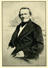
Friedrich Albert Fallou

F.A. Fallou before his death in 1877

In his two books "First Principles of Soil Science" (1857, 2nd ed. 1865) and "Pedology or General and Special Soil Science" (1862) Friedrich Albert Fallou developed his collected field observations of soil into a systematic approach. He explained why soil formation was worthy of study and appealed for recognition of soil science as a discipline. In the 1862 work, he presented a proposal for soil profile description, discussed the physical and chemical properties of soils, and proposed classification of soils based on mineral properties.

Vasily Dokuchaev is recognized today as more influential than Fallou, however in the years closely following Dokuchaev's death, Fallou was regarded as the founder of modern soil science by Dokuchaev's student, influential Russian pedologist Konstantin Dmitrievich Glinka (1867-1927). Fallou's historical status as founder is supported by Moscow soil scientist and bibliographer of Russian soil science, Arseny Yarilov, Editor of “Pochvovedenie” (means soil science). Yarilov titled his 1904 article about Fallou in Pochvovedenie Friedrich Albert Fallou, Founder of Soil Science

Vasily Dokuchaev

V. Dokuchaev with chernozem
The scientific basis of soil science as a natural science was established by the classical works of Vasily V. Dokuchaev. Previously, soil had been considered a product of physicochemical transformations of rocks, a dead substrate from which plants derive nutritious mineral elements. Soil and bedrock were in fact equated.
Dokuchaev considers the soil as a natural body having its own genesis and its own history of development, a body with complex and multiform processes taking place within it. The soil is considered as different from bedrock. The latter becomes soil under the influence of a series of soil-forming factors—climate, vegetation, country, relief and age. According to him, soil should be called the "daily" or outward horizons of rocks regardless of the type; they are changed naturally by the common effect of water, air and various kinds of living and dead organisms.
Source: Krasil'nikov, N.A. (1958) Soil Microorganisms and Higher Plants. 
Beginning in 1870, the Russian school of soil science under the leadership of V. V. Dokuchaev (1846–1903) and N. M. Sibirtsev (1860–1900) was developing a new concept of soil. The Russian workers conceived of soils as independent natural bodies, each with unique properties resulting from a unique combination of climate, living matter, parent material, relief, and time. They hypothesized that properties of each soil reflected the combined effects of the particular set of genetic factors responsible for the soil's formation. Hans Jenny later emphasized the functionally relatedness of soil properties and soil formation. The results of this work became generally available to Americans through the publication in 1914 of K.D. Glinka's textbook in German and especially through its translation into English by C.F. Marbut in 1927.

The Russian concepts were revolutionary. Properties of soils no longer were based wholly on inferences from the nature of the rocks or from climate or other environmental factors, considered singly or collectively; rather, by going directly to the soil itself, the integrated expression of all these factors could be seen in the morphology of the soils. This concept required that all properties of soils be considered collectively in terms of a completely integrated natural body. In short, it made possible a science of soil. 

The early enthusiasm for the new concept and for the rising new discipline of soil science led some to suggest the study of soil could proceed without regard to the older concepts derived from geology and agricultural chemistry. Certainly the reverse is true. Besides laying the foundation for a soil science with its own principles, the new concept makes the other sciences even more useful. Soil morphology provides a firm basis on which to group the results of observation, experiments, and practical experience and to develop integrated principles that predict the behavior of the soils.

Curtis Marbut

Under the leadership of C. F. Marbut, the Russian concept was broadened and adapted to conditions in the United States. This concept emphasized individual soil profiles to the subordination of external soil features and surface geology. By emphasizing soil profiles, however, soil scientists at first tended to overlook the natural variability of soils which can be substantial even within a small area. Overlooking the variability of soils seriously reduced the value of the maps which showed the location of the soils.

Furthermore, early emphasis on genetic soil profiles was so great as to suggest that material lacking a genetic profile, such as recent alluvium, was not soil. A sharp distinction was drawn between rock weathering and soil formation. Although a distinction between these sets of processes is useful for some purposes, rock and mineral weathering and soil formation are commonly indistinguishable. 

The concept of soil was gradually broadened and extended during the years following 1930, essentially through consolidation and balance. The major emphasis had been on the soil profile. After 1930, morphological studies were extended from single pits to long trenches or a series of pits in an area of a soil. The morphology of a soil came to be described by ranges of properties deviating from a central concept instead of by a single "typical" profile. The development of techniques for mineralogical studies of clays also emphasized the need for laboratory studies.

Marbut emphasized strongly that classification of soils should be based on morphology instead of on theories of soil genesis, because theories are both ephemeral and dynamic. He perhaps overemphasized this point to offset other workers who assumed that soils had certain characteristics without examining the soils. Marbut tried to make clear that examination of the soils themselves was essential in developing a system of Soil Classification and in making usable soil maps. In spite of this, Marbut's work reveals his personal understanding of the contributions of geology to soil science. His soil classification of 1935 depends heavily on the concept of a "normal soil," the product of equilibrium on a landscape where downward erosion keeps pace with soil formation.

Clarification and broadening of the concept of a soil science also grew out of the increasing emphasis on detailed soil mapping. Concepts changed with increased emphasis on predicting crop yields for each kind of soil shown on the maps. Many of the older descriptions of soils had not been quantitative enough and the units of classification had been too heterogeneous for making yield and management predictions needed for planning the management of individual farms or fields. 

During the 1930s, soil formation was explained in terms of loosely conceived processes, such as "podzolization," "laterization," and "calcification." These were presumed to be unique processes responsible for the observed common properties of the soils of a region.

Hans Jenny

In 1941 Hans Jenny's (1899–1992) Factors of Soil Formation, a system of quantitative pedology, concisely summarized and illustrated many of the basic principles of modern soil science to that date. Since 1940, time has assumed much greater significance among the factors of soil formation, and geomorphological studies have become important in determining the time that soil material at any place has been subjected to soil-forming processes. Meanwhile, advances in soil chemistry, soil physics, soil mineralogy, and soil biology, as well as in the basic sciences that underlie them, have added new tools and new dimensions to the study of soil formation. As a consequence, the formation of soil has come to be treated as the aggregate of many interrelated physical, chemical, and biological processes. These processes are subject to quantitative study in soil physics, soil chemistry, soil mineralogy, and soil biology. The focus of attention also has shifted from the study of gross attributes of the whole soil to the co-varying detail of individual parts, including grain-to-grain relationships. (Soil Survey Staff 1993

Guy Smith

In both the classification of Marbut and the 1938 classification developed by the U.S. Department of Agriculture, the classes were described mainly in qualitative terms. Classes were not defined in quantitative terms that would permit consistent application of the system by different scientists. Neither system definitely linked the classes of its higher categories, largely influenced by genetic concepts initiated by the Russian soil scientists, to the soil series and their subdivisions that were used in soil mapping in the United States. Both systems reflected the concepts and theories of soil genesis of the time, which were themselves predominantly qualitative in character. Modification of the 1938 system in 1949 corrected some of its deficiencies but also illustrated the need for a reappraisal of concepts and principles. More than 15 years of work under the leadership of Guy D. Smith culminated in a new soil classification system. This became the official classification system of the U.S. National Cooperative Soil Survey in 1965 and was published in 1975 as Soil Taxonomy: A Basic System of Soil Classification for Making and Interpreting Soil Surveys. The Smith system was adopted in the U.S. and many other nations for their own classification system.

Another factor has had an immense impact on soil survey, especially during the 1960s. Before 1950, the primary applications of soil surveys were farming, ranching, and forestry. Applications for highway planning were recognized in some States as early as the late 1920s, and soil interpretations were placed in field manuals for highway engineers of some States during the 1930s and 1940s. Nevertheless, the changes in soil surveys during this period were mainly responses to the needs of farming, ranching, and forestry. During the 1950s and 1960s nonfarm uses of the soil increased rapidly. This created a great need for information about the effects of soils on those nonfarm uses. (Soil Survey Staff 1993

Bioturbation

A major re-evaluation of soil formation and the role of biota commenced in the 1980s, as soil-geomorphologists began to re-evaluate Charles Darwin's and Nathaniel Shaler's early ideas on the role of bioturbation in soil formation. There is now ample evidence to support Darwin's conclusions, and in many areas biota that burrow in soil are major agents of pedogenesis.

Lie point symmetry

From Wikipedia, the free encyclopedia https://en.wikipedia.org/wiki/Lie_point_symmetry     ...