Search This Blog

Friday, November 18, 2022

Transit-oriented development

From Wikipedia, the free encyclopedia

The local government of Arlington County, Virginia encourages transit-oriented development within 14 to 12 mile (400 to 800 m) from the county's Washington Metro rapid transit stations, with mixed-use development, bikesharing and walkability.
 
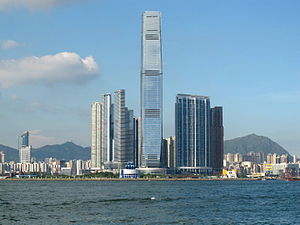
Union Square, a transit-oriented development centred on Kowloon station, Hong Kong

In urban planning, transit-oriented development (TOD) is a type of urban development that maximizes the amount of residential, business and leisure space within walking distance of public transport. It promotes a symbiotic relationship between dense, compact urban form and public transport use. In doing so, TOD aims to increase public transport ridership by reducing the use of private cars and by promoting sustainable urban growth.

TOD typically includes a central transit stop (such as a train station, or light rail or bus stop) surrounded by a high-density mixed-use area, with lower-density areas spreading out from this center. TOD is also typically designed to be more walkable than other built-up areas, by using smaller block sizes and reducing the land area dedicated to automobiles.

The densest areas of TOD are normally located within a radius of 14 to 12 mile (400 to 800 m) around the central transit stop, as this is considered to be an appropriate scale for pedestrians, thus solving the last mile problem.

Description

Transit Oriented Development

Many of the new towns created after World War II in Japan, Sweden, and France have many of the characteristics of TOD communities. In a sense, nearly all communities built on reclaimed land in the Netherlands or as exurban developments in Denmark have had the local equivalent of TOD principles integrated in their planning, including the promotion of bicycles for local use.

In the United States, a half-mile-radius circle has become the de facto standard for rail-transit catchment areas for TODs. A half mile (800 m) corresponds to the distance someone can walk in 10 minutes at 3 mph (4.8 km/h) and is a common estimate for the distance people will walk to get to a rail station. The half-mile ring is a little more than 500 acres (2.0 km2) in size.

Transit-oriented development is sometimes distinguished by some planning officials from "transit-proximate development" (see, e.g., comments made during a Congressional hearing) because it contains specific features that are designed to encourage public transport use and differentiate the development from urban sprawl. A few examples of these features include mixed-use development that will use transit at all times of day, excellent pedestrian facilities such as high quality pedestrian crossings, narrow streets, and tapering of buildings as they become more distant from the public transport node. Another key feature of transit-oriented development that differentiates it from "transit-proximate development" is reduced amounts of parking for personal vehicles.

Transit-oriented development has many benefits including but not limited to:

-       Easy access to transit, making it easy to get around without a car.

-       Dense, due to TODs being made for getting around transportation, other than private vehicles, allowing access to stores and private business.

-       Improved access to jobs and city services.

-       Increased population near transit stops, such as a commuter rail stop, which ultimately increases transit ridership across the board.

Opponents of compact, or transit oriented development typically argue that Americans, and persons throughout the world, prefer low-density living, and that any policies that encourage compact development will result in substantial utility decreases and hence large social welfare costs. Proponents of compact development argue that there are large, often unmeasured benefits of compact development or that the American preference for low-density living is a misinterpretation made possible in part by substantial local government interference in the land market.

TOD in cities

Many cities throughout the world are developing TOD policy. Toronto, Portland, Montreal, San Francisco, and Vancouver among many other cities have developed, and continue to write policies and strategic plans, which aim to reduce automobile dependency and increase the use of public transit.

Latin America

Example of Curitiba's RIT in Praça do Japão

Curitiba, Brazil

One of the earliest and most successful examples of TOD is Curitiba, Brazil. Curitiba was organized into transport corridors very early on in its history. Over the years, it has integrated its zoning laws and transportation planning to place high-density development adjacent to high-capacity transportation systems, particularly its BRT corridors. Since the failure of its first rather grandiose city plan due to lack of funding, Curitiba has focused on working with economical forms of infrastructure, so it has arranged unique adaptations, such as bus routes (inexpensive infrastructure) with routing systems, limited access and speeds similar to subway systems. The source of innovation in Curitiba has been a unique form of participatory city planning that emphasizes public education, discussion and agreement.

Guatemala City, Guatemala

In an attempt to control the rapid growth of Guatemala City, the long-time mayor, Álvaro Arzú, implemented a plan to control growth based on transects along important arterial roads and exhibiting transit-oriented development (TOD) characteristics. The plan adopted POT (Plan de Ordenamiento Territorial) aims to allow the construction of taller mixed-use building structures right by large arterial roads. The buildings would gradually decrease in height and density as distance would increase from arterial roads. That is being implemented simultaneously with a bus rapid transit (BRT) system, called Transmetro.

Mexico City, Mexico

Mexico City has battled pollution for years. Many attempts have been made to orient citizens towards public transportation. Expansion of metro line, both subway and bus, have been instrumental. Following the example of Curtiba, many bus-lines were created on many of Mexico City's most important streets. The bus-line has taken two lanes from cars to be used only by the bus-line, increasing the flow for bus transit.

The city has also made great attempts at increasing the number of bike lanes, including shutting down entire roads on certain days to be used only by bikers.

Car regulations have also increased in the city. New regulations prevent old cars from driving in the city, other cars from driving on certain days. Electric cars are allowed to be driven everyday and have free parking. Decreasing the public space allocated to cars and increasing regulations have become a great annoyance among daily car users. The city hopes to push people to use more public transport.

North America

Canada

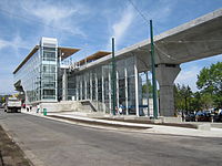
Marine Drive station in Vancouver on opening day (2009)
 
High-rises have since been built around the station (2018).
Calgary, Alberta

Calgary's Transit Oriented Development (TOD) has been evolving largely around stations along Calgary's Light Rail Transit (LRT) system, also known as the CTrain network. Although Calgary's CTrain system has been around since 1981, TOD activity has been fairly recent, with much of development taking place since 2010. Most of the transit oriented development has taken place along the LRT system's Red Line especially around stations of the northwest leg with areas around stations at Brentwood, Dalhousie, and Banff Trail having seen the most development. Brentwood Station for example, with multi-building developments such as University City, has seen almost 900 residential units built in the last eight years within the 600m radius of Brentwood station, as well as proposed developments that are in the works. On the south leg of the Red Line the massive Midtown Station proposal is a reversal from previous TOD builds where development is built around existing stations. In the case of Midtown Station, the proposal is along the CTrain line, but includes building a new station solely for the purpose of serving the development.

For The City of Calgary, TOD's are an ongoing process, but the city has published policy guidelines and implementation strategies for Transit Oriented Development.

Edmonton, Alberta

Most of the suburban high rises were not along major rail lines like other cities until recently, when there has been incentive to do so. Century Park is a growing condo community in southern Edmonton at the south end of Edmonton's LRT. It will include low to high rise condos, recreational services, shops, restaurants, and a fitness centre. Edmonton has also had a transit-proximate development for some time in the northeastern suburbs at Clareview which includes a large park and ride, and low rise apartments among big box stores and associated power center parking. Edmonton is also looking into some new TODs in various parts of the city. In the northeast, there are plans to redevelop underutilized land at two sites around existing LRT, Fort Road and Stadium station. In the west, there is plans to have some medium density condos in the Glenora neighbourhood along a future LRT route as well as a TOD in the southeast in the Strathearn neighbourhood along the same future LRT on existing low rise apartments.

Montreal, Quebec

According to the Metropolitan Development and Planning Regulation as of late 2011, 40% of new households will be built as TOD neighbourhoods.

Ottawa, Ontario

Ottawa's City Council has established transit-oriented development (TOD) priority areas in proximity to Ottawa's Light Rail Transit. These priority areas are a mix of moderate to high-density transit-supportive developments within a 600-metre walking distance of rapid transit stations.

Toronto, Ontario

Toronto has a longstanding policy of encouraging new construction along the route of its primary Yonge Street subway line. Most notable are the development of the Yonge and Eglinton area in the 1960s and 1970s; and the present development of the 2 km of the Yonge Street corridor north of Sheppard Avenue, which began in the late 1980s. In the period since 1997 alone the latter stretch has seen the appearance of a major new shopping centre and the building and occupation of over twenty thousand new units of condominium housing. Since the opening of the Sheppard subway line in 2002, there is a condominium construction boom along the route on Sheppard Avenue East between Yonge Street and Don Mills Road.

Vancouver, British Columbia

Vancouver has a strong history of creating new development around its SkyTrain lines and building regional town centres at major stations and transit corridors. Of note is the Metrotown area of the suburb of Burnaby, British Columbia near the Metrotown SkyTrain Station. The areas around stations have spurred the development of billions of dollars of high-density real estate, with multiple high-rises near the many stations, prompting concerns about rapid gentrification.

Winnipeg, Manitoba

There is currently one TOD being built in Winnipeg beside the rapid transit corridor. It is known as The Yards at Fort Rouge, and was spearheaded by the developer Gem Equities. In phase two of the southwest rapid transit corridor, there will be four more TODs. This phase is an interesting example of the use of fine arts in parallel with transit planning, making several of the stations sites for public art related to the social history of the area.

United States

Arlington County, Virginia
Aerial view of Rosslyn-Ballston corridor in Arlington, Virginia. High density, mixed use development is concentrated within ¼–½ mile from the Rosslyn, Court House and Clarendon Washington Metro stations (shown in red), with limited density outside that area.
 
Street-level view of the area around the Ballston Metro Station — also in Arlington, Virginia. Note the mixed-use development (from left to right: ground floor retail under apartment building, office buildings, shopping mall (at the end of the street), apartment building, office building with ground floor retail), pedestrian oriented facilities including wide sidewalk, and bus stop facility in the center distance. Parking in this location is limited, relatively expensive, and located underground.

For over 30 years, the government has pursued a development strategy of concentrating much of its new development within 14 to 12 mile (400 to 800 m) from the county's Washington Metro rapid transit stations and the high-volume bus lines of Columbia Pike. Within the transit areas, the government has a policy of encouraging mixed-use and pedestrian- and transit-oriented development. Some of these "urban village" communities include Rosslyn, Ballston, Clarendon, Courthouse, Pentagon City, Crystal City, Lyon Village, Shirlington, Virginia Square, and Westover.

In 2002, Arlington received the EPA's National Award for Smart Growth Achievement for "Overall Excellence in Smart Growth" — the first ever granted by the agency.

In September 2010, Arlington County, Virginia, in partnership with Washington, D.C., opened Capital Bikeshare, a bicycle sharing system. By February 2011, Capital Bikeshare had 14 stations in the Pentagon City, Potomac Yard, and Crystal City neighborhoods in Arlington. Arlington County also announced plans to add 30 stations in fall 2011, primarily along the densely populated corridor between the Rosslyn and Ballston neighborhoods, and 30 more in 2012.

New Jersey

New Jersey has become a national leader in promoting transit oriented development. The New Jersey Department of Transportation established the Transit Village Initiative in 1999, offering multi-agency assistance and grants from the annual $1 million fund to any municipality with a ready-to-go project specifying appropriate mixed land-use strategy, available property, station-area management, and commitment to affordable housing, job growth, and culture. Transit village development must also preserve the architectural integrity of historically significant buildings. Since 1999 the state has numerous Transit Village designations, which are in different stages of development:

Pleasantville (1999), Morristown (1999), Rutherford (1999), South Amboy (1999), South Orange (1999), Riverside (2001), Rahway (2002), Metuchen (2003), Belmar (2003), Bloomfield (2003), Bound Brook (2003), Collingswood (2003), Cranford (2003) Matawan (2003), New Brunswick (2005), Journal Square/Jersey City (2005), Netcong (2005), Midtown Elizabeth (2007), Burlington City (2007), Orange (2009), Montclair (2010), Somerville (2010), Linden (2010), West Windsor (2012), Dunellen (2012), Plainfield (2014), Park Ridge (2015), Irvington (2015), Hackensack (2015), Long Branch (2016), Asbury Park (2017), and Newark (2021).

Long Island City, a transit-oriented community with the Queensboro Plaza subway station shown, one of the many subway stations in Long Island City.
New York City

Many neighborhoods in New York City are close to a New York City Subway station, this allows easy transport throughout the cities’ neighborhoods and central business districts. To maximize the usage of the New York City Subway, many subway stations are surrounded by transit-oriented development, with high-density residential and commercial buildings surrounding the subway station. Neighborhoods include, but are not limited to, Downtown Brooklyn, Midtown Manhattan, Long Island City, and Sunnyside. Many downtowns in the Greater New York Area also are walkable with a central regional rail station.

Pittsburgh, Pennsylvania

The East Liberty neighborhood is nearing completion of a $150 million Transit Oriented Development centered around the reconfigured East Liberty Station on the city's Martin Luther King Jr. East Busway. The development included improved access to the station with a new pedestrian bridge and pedestrian walkways that increase the effective walkshed of the station. The East Busway is a fixed guideway route that offers riders an 8-minute ride from East Liberty to Pittsburgh's Downtown.

Salt Lake City Metro Area, Utah

The Salt Lake City Metro Area has seen a strong proliferation of transit-oriented developments due to the construction of new transit lines within the Utah Transit Authority's TRAX, FrontRunner and streetcar lines. New developments in West Valley, Farmington, Murray, Provo, Kaysville, Sugarhouse and downtown Salt Lake City have seen rapid growth and construction despite the economic downturn. The population along the Wasatch Front has reached 2.5 million and is expected to grow 50% over the next two decades. At 29.8%, Utah's population growth more than doubled the population growth of the nation (13.2%), with a vast majority of this growth occurring along the Wasatch Front.

Transportation infrastructure has been vastly upgraded in the past decade as a result of the 2002 Olympic Winter Games and the need to support the growth in population. This has created a number of transit-oriented commercial and residential projects to be proposed and completed.

San Francisco Bay Area, California

The San Francisco Bay Area includes nine counties and 101 cities, including San Jose, San Francisco, Oakland and Fremont. Local and regional governments encourage transit-oriented development to decrease traffic congestion, protect natural areas, promote public health and increase housing options. The region has designated Priority Development Areas and Priority Conservation Areas. Current population forecasts for the region predict that it will grow by 2 million people by 2035 due to both the natural birth rate and job creation, and estimate that 50% of this growth can be accommodated in Priority Development Areas through transit-oriented development.

Major transit village projects have been developed over the past 20 years at several stations linked to the Bay Area Rapid Transit (BART) system. In their 1996 book, Transit Villages in the 21st Century, Michael Bernick and Robert Cervero identified emerging transit villages at several BART stations, including Pleasant Hill / Contra Costa Centre, Fruitvale, Hayward and Richmond. MacArthur Station is a relatively new development, with construction beginning in 2011 and scheduled for completion after 2019.

Chicago

Chicago passed its first TOD ordinances in 2013. The city of Chicago started building TODs around rail stations throughout the metropolitan area. There have been concerns that these TODs were excluding minorities since most of the TODs were built in mainly white areas therefore leaving minorities out of the picture when it came to access to transit oriented development neighborhoods. The 2020 eTOD Policy Plan was created to fix the issues from the previous TOD plans, by creating more TOD developments in minority areas.

Asia and Oceania

Hong Kong

Sha Tin town centre, built around the Sha Tin railway station

Compared to other developed economies, the car ownership rate in Hong Kong is very low, and approximately 90% of all trips are made by public transport.

In the mid-20th century, no railway was built until an area was well developed. However, in recent decades, Hong Kong has started to have some TODs, where a railway is built simultaneously with residential development above or nearby, dubbed the "Rail plus Property" (R+P) Model. Examples include:

Malaysia

Bandar Malaysia is an upcoming development by 1Malaysia Development Berhad (1MDB).

Indonesia

Many TOD are now being constructed in Greater Jakarta metro area such as Citra Sentul Raya and Dukuh Atas TOD. TOD are also being constructed in cities like Surabaya, Medan, and Palembang.

Melbourne, Victoria

Chatswood Station in Sydney. Trains run through the integrated station, shopping and apartment complex.
 

Melbourne, Victoria is expected to reach a population of 5 million by 2030 with the overwhelming majority of its residents relying on private automobiles. Since the turn of the century, sporadic efforts have been made by various levels of government to implement transit-oriented development principles. However, a lack of commitment to funding public transport infrastructure, resulting to overcrowding and amending zoning laws has dramatically slowed progress toward sustainable development for the city.

Milton, Queensland

Milton, an inner suburb of Brisbane, has been identified as Queensland's first transit-oriented development under the Queensland Government's South East Queensland Regional Plan. Milton railway station will undergo a multimillion-dollar revamp as part of the development of The Milton Residences to promote and encourage residents to embrace rail travel. This will include a new ticketing office, new public amenities, increased visibility across platforms and new and improved access points off Milton Road and Railway Terrace.

Sydney, New South Wales

The New South Wales state government has actively encouraged developments around stations on the Sydney Trains and Sydney Metro networks through its Priority Precincts plan. Several stations such as Chatswood, Burwood, Parramatta and Rhodes have large scale apartment developments built within close proximity within the past decade. New apartment and office tower developments along the future Sydney Metro stations are being planned as integrated developments with the stations themselves. Examples of this include Victoria Cross Station and Crows Nest Station whilst existing stations such as Castle Hill and Epping have also had intensified development.

Europe

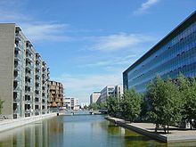
Karen Blixen Park, Ørestad (Copenhagen), Denmark

The term transit-oriented development, as a US-born concept, is rarely used in Europe, although many of the measures advocated in US transit-oriented development are also stressed in Europe. Many European cities have long been built around transit systems and there has thus often been little or no need to differentiate this type of development with a special term as has been the case in the US. An example of this is Copenhagen's Finger Plan from 1947, which embodied many transit-oriented development aspects and is still used as an overall planning framework today. Recently, scholars and technicians have taken interest in the concept, however.

Paris, France

La Défense district, west of central Paris

Whereas the city of Paris has a centuries-long history, its main frame dates to the 19th century. The subway network was made to solve both linkage between the five main train stations and local transportation assets for citizens. The whole area of Paris City has metro stations no more than 500 metres apart. Recent bicycle and car rental systems (Velib and Autolib) also ease travel, in the very same way that TOD emphasizes. So do the new trams linking suburbs close to Paris proper, and tramline 3 around the edge of the city of Paris.

The La Défense area is an example of a large scale transit-oriented district.

Stedenbaan, Netherlands

In the southern part of the Randstad a neighbourhood according to the principles of TOD will be built.

Various Impacts of TOD

Environmental Impacts

TOD has been shown to reduce multiple types of emissions in Los Angeles during life-cycle assessments; greenhouse gasses, respiratory irritants, and smog forming emissions can be reduced by approximately 30% in TOD when compared to lower density areas. This is attributed to various factors including residents having more travel options, reduced travel distances for everyday activities, and higher density housing reducing energy use per residence. In Dhaka TOD can also aid in reducing travel related CO2 emissions on a community level, specifically for work and school trips, due to residents traveling less distance to these locations. And it is suggested that the improvements in public transportation, pedestrian, and bicycle infrastructure that are associated with TOD and related policies may improve these reductions within Dhaka and other developing cities. However, TOD has also been found to be a major contributor to the urban heat island effect in Brisbane both having higher temperature and more rapidly increasing temperatures than non-TOD areas. This difference has been linked to TOD having a larger portion of non-porous land and less natural spaces, which must be considered when planning TOD.

Economic Impacts

TOD, specifically along light rail transit lines, have been seen to increase the amount of new businesses in Phoenix within one mile of a station, with businesses in the knowledge, service, and retail industries experiencing 88%, 40%, and 24% more new starts respectively than non-TOD areas. However, a decrease in manufacturing facilities has also been noted in TOD; similar results are likely to be seen in other U.S. cities. The value of condominiums in San Diego generally increases with decreasing distance from light rail transit stations, increasing walkability of neighborhoods, and increasing available services. This points to TOD as a preferable style of neighborhood to people, showing that market-driven creation of TOD neighborhoods may be possible in U.S. metropolitan areas. Resident expenses in TOD have been shown to be lower in well developed areas in spite of the generally higher rental costs due to lower energy use and travel costs, in Los Angeles the savings are around $3100 per year for one household.

Receptions

One criticism of transit-oriented development is that it has the potential to spur gentrification in low-income areas. In some cases, TOD can raise the housing costs of formerly affordable neighborhoods, pushing low- and moderate-income residents farther away from jobs and transit. When this happens, TOD projects can disrupt low-income neighborhoods. This can be very concerning due to the fact that lower income people tend to use (and need) transit more than higher income people.

When executed with equity in mind, however, TOD has the potential to benefit low- and moderate-income (LMI) communities: it can link workers to employment centers, create construction and maintenance jobs, and has the potential to encourage investment in areas that have suffered neglect and economic depression. Moreover, it is well recognized that neighborhood development restrictions, while potentially in the immediate neighborhood's best interest, contribute to regional undersupply of housing and drive up the cost of housing in general across a region. TOD reduces the overall cost of housing in a region by contributing to the housing supply, and therefore generally improves equity in the housing market. TOD also reduces transportation costs, which can have a greater impact on LMI households since they spend a larger share of their income on transportation relative to higher-income households. This frees up household income that can be used on food, education, or other necessary expenses. Low-income people are also less likely to own personal vehicles and therefore more likely to depend exclusively on public transportation to get to and from work, making reliable access to transit a necessity for their economic success.

History

TOD began in 1993 with the publication of Peter Calthorpe's book The Next American Metropolis. Calthorpe and his colleagues based their theory on the ideals of the Garden city movement.

Theories of urban planning

From Wikipedia, the free encyclopedia
 
Urban planning designs settlements, from the smallest towns to the largest cities. Shown here is Hong Kong from Western District overlooking Kowloon, across Victoria Harbour.

Planning theory is the body of scientific concepts, definitions, behavioral relationships, and assumptions that define the body of knowledge of urban planning. There are nine procedural theories of planning that remain the principal theories of planning procedure today: the Rational-Comprehensive approach, the Incremental approach, the Transformative Incremental (TI) approach, the Transactive approach, the Communicative approach, the Advocacy approach, the Equity approach, the Radical approach, and the Humanist or Phenomenological approach.

Background

Urban planning can include urban renewal, by adapting urban planning methods to existing cities suffering from decline. Alternatively, it can concern the massive challenges associated with urban growth, particularly in the Global South. All in all, urban planning exists in various forms and addresses many different issues. The modern origins of urban planning lie in the movement for urban reform that arose as a reaction against the disorder of the industrial city in the mid-19th century. Many of the early influencers were inspired by anarchism, which was popular in the turn of the 19th and 20th centuries. The new imagined urban form was meant to go hand-in-hand with a new society, based upon voluntary co-operation within self-governing communities.

In the late 20th century, the term sustainable development has come to represent an ideal outcome in the sum of all planning goals. Sustainable architecture involves renewable materials and energy sources and is increasing in importance as an environmentally friendly solution.

Blueprint planning

Since at least the Renaissance and the Age of Enlightenment, urban planning had generally been assumed to be the physical planning and design of human communities. Therefore, it was seen as related to architecture and civil engineering, and thereby to be carried out by such experts. This kind of planning was physicalist and design-orientated, and involved the production of masterplans and blueprints which would show precisely what the 'end-state' of land use should be, similar to architectural and engineering plans. Similarly, the theory of urban planning was mainly interested in visionary planning and design which would demonstrate how the ideal city should be organised spatially.

Sanitary movement

Although it can be seen as an extension of the sort of civic pragmatism seen in Oglethorpe's plan for Savannah or William Penn's plan for Philadelphia, the roots of the rational planning movement lie in Britain's Sanitary movement (1800–1890). During this period, advocates such as Charles Booth argued for central organized, top-down solutions to the problems of industrializing cities. In keeping with the rising power of industry, the source of the planning authority in the Sanitary movement included both traditional governmental offices and private development corporations. In London and its surrounding suburbs, cooperation between these two entities created a network of new communities clustered around the expanding rail system.

Garden city movement

A diagram of Howard's planned Social City.

The Garden city movement was founded by Ebenezer Howard (1850-1928). His ideas were expressed in the book Garden Cities of To-morrow (1898). His influences included Benjamin Walter Richardson, who had published a pamphlet in 1876 calling for low population density, good housing, wide roads, an underground railway and for open space; Thomas Spence who had supported common ownership of land and the sharing of the rents it would produce; Edward Gibbon Wakefield who had pioneered the idea of colonizing planned communities to house the poor in Adelaide (including starting new cities separated by green belts at a certain point); James Silk Buckingham who had designed a model town with a central place, radial avenues and industry in the periphery; as well as Alfred Marshall, Peter Kropotkin and the back-to-the-land movement, which had all called for the moving of masses to the countryside.

Howards' vision was to combine the best of both the countryside and the city in a new environment called Town-Country. To make this happen, a group of individuals would establish a limited-dividend company to buy cheap agricultural land, which would then be developed with investment from manufacturers and housing for the workers. No more than 32,000 people would be housed in a settlement, spread over 1,000 acres. Around it would be a permanent green belt of 5,000 acres, with farms and institutions (such as mental institutions) which would benefit from the location. After reaching the limit, a new settlement would be started, connected by an inter-city rail, with the polycentric settlements together forming the "Social City". The lands of the settlements would be jointly owned by the inhabitants, who would use rents received from it to pay off the mortgage necessary to buy the land and then invest the rest in the community through social security. Actual garden cities were built by Howard in Letchworth, Brentham Garden Suburb, and Welwyn Garden City. The movement would also inspire the later New towns movement.

Linear city

Arturo Soria's blueprint concept of the Linear city.

Arturo Soria y Mata's idea of the Linear city (1882) replaced the traditional idea of the city as a centre and a periphery with the idea of constructing linear sections of infrastructure - roads, railways, gas, water, etc.- along an optimal line and then attaching the other components of the city along the length of this line. As compared to the concentric diagrams of Ebenezer Howard and other in the same period, Soria's linear city creates the infrastructure for a controlled process of expansion that joins one growing city to the next in a rational way, instead of letting them both sprawl. The linear city was meant to ‘ruralize the city and urbanize the countryside’, and to be universally applicable as a ring around existing cities, as a strip connecting two cities, or as an entirely new linear town across an unurbanized region. The idea was later taken up by Nikolay Alexandrovich Milyutin in the planning circles of the 1920s Soviet Union. The Ciudad Lineal was a practical application of the concept.

Regional planning movement

An archetypical example of a Valley Section.

Patrick Geddes (1864-1932) was the founder of regional planning. His main influences were the geographers Élisée Reclus and Paul Vidal de La Blache, as well as the sociologist Pierre Guillaume Frédéric le Play. From these he received the idea of the natural region. According to Geddes, planning must start by surveying such a region by crafting a "Valley Section" which shows the general slope from mountains to the sea that can be identified across scale and place in the world, with the natural environment and the cultural environments produced by it included. This was encapsulated in the motto "Survey before Plan". He saw cities as being changed by technology into more regional settlements, for which he coined the term conurbation. Similar to the garden city movement, he also believed in adding green areas to these urban regions. The Regional Planning Association of America advanced his ideas, coming up with the 'regional city' which would have a variety of urban communities across a green landscape of farms, parks and wilderness with the help of telecommunication and the automobile. This had major influence on the County of London Plan, 1944.

City Beautiful movement

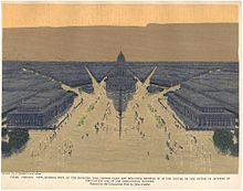
The Civic Centre Plaza planned (but never realized) in Burnham's plan for Chicago.

The City Beautiful movement was inspired by 19th century European capital cities such as Georges-Eugène Haussmann's Paris or the Vienna Ring Road. An influential figure was Daniel Burnham (1846-1912), who was the chief of construction of the World's Columbian Exposition in 1893. Urban problems such as the 1886 Haymarket affair in Chicago had created a perceived need to reform the morality of the city among some of the elites. Burnham's greatest achievement was the Chicago plan of 1909. His aim was "to restore to the city a lost visual and aesthetic harmony, thereby creating the physical prerequisite for the emergence of a harmonious social order", essentially creating social reform through new slum clearance and creating public space, which also endeared it the support of the Progressivist movement. This was also believed to be economically advantageous by drawing in tourists and wealthy migrants. Because of this it has been referred to as "trickle-down urban development" and as "centrocentrist" for focusing only on the core of the city. Other major cities planned according to the movement principles included British colonial capitals in New Delhi, Harare, Lusaka Nairobi and Kampala, as well as that of Canberra in Australia, and Albert Speer's plan for the Nazi capital Germania.

Towers in the park

Le Corbusier's Plan Voisin (1925) for Paris.

Le Corbusier (1887–1965) pioneered a new urban form called towers in the park. His approach was based on defining the house as 'a machine to live in'. The Plan Voisin he devised for Paris, which was never fulfilled, would have involved the demolition of much of historic Paris in favour of 18 uniform 700-foot tower blocks. Ville Contemporaine and the Ville Radieuse formulated his basic principles, including decongestion of the city by increased density and open space by building taller on a smaller footprint. Wide avenues should also be built to the city centre by demolishing old structures, which was criticized for lack of environmental awareness. His generic ethos of planning was based on the rule of experts who would "work out their plans in total freedom from partisan pressures and special interests" and that "once their plans are formulated, they must be implemented without opposition". His influence on the Soviet Union helped inspire the 'urbanists' who wanted to build planned cities full of massive apartment blocks in Soviet countryside. The only city which he ever actually helped plan was Chandigarh in India. Brasília, planned by Oscar Niemeyer, also was heavily influenced by his thought. Both cities suffered from the issue of unplanned settlements growing outside them.

Decentralised planning

Wright's sketches of Broadacre City.

In the United States, Frank Lloyd Wright similarly identified vehicular mobility as a principal planning metric. Car-based suburbs had already been developed in the Country Club District in 1907-1908 (including later the world's first car-based shopping centre of Country Club Plaza), as well as in Beverly Hills in 1914 and Palos Verdes Estates in 1923. Wright began to idealise this vision in his Broadacre City starting in 1924, with similarities to the garden city and regional planning movements. The fundamental idea was for technology to liberate individuals. In his Usonian vision, he described the city as

"spacious, well-landscaped highways, grade crossings eliminated by a new kind of integrated by-passing or over- or under-passing all traffic in cultivated or living areas … Giant roads, themselves great architecture, pass public service stations . . . passing by farm units, roadside markets, garden schools, dwelling places, each on its acres of individually adorned and cultivated ground".

This was justified as a democratic ideal, as "“Democracy is the ideal of reintegrated decentralization … many free units developing strength as they learn by function and grow together in spacious mutual freedom.” This vision was however criticized by Herbert Muschamp as being contradictory in its call for individualism while relying on the master-architect to design it all.

After World War II, suburbs similar to Broadacre City spread throughout the US, but without the social or economic aspects of his ideas. A notable example was that of Levittown, built 1947 to 1951. The suburban design was criticized for their lack of form by Lewis Mumford as it lacked clear boundaries, and by Ian Nairn because "Each building is treated in isolation, nothing binds it to the next one".

In the Soviet Union too, the so-called deurbanists (such as Moisei Ginzburg and Mikhail Okhitovich) advocated for the use of electricity and new transportation technologies (especially the car) to disperse the population from the cities to the countryside, with the ultimate aim of a "townless, fully decentralized, and evenly populated country". However, in 1931 the Communist Party ruled such views as forbidden.

Opposition to blueprint planning

Throughout both the United States and Europe, the rational planning movement declined in the latter half of the 20th century. The reason for the movement's decline was also its strength. By focusing so much on a design by technical elites, rational planning lost touch with the public it hoped to serve. Key events in this decline in the United States include the demolition of the Pruitt-Igoe housing project in St. Louis and the national backlash against urban renewal projects, particularly urban expressway projects. An influential critic of such planning was Jane Jacobs, who wrote The Death and Life of Great American Cities in 1961, claimed to be "one of the most influential books in the short history of city planning". She attacked the garden city movement because its "prescription for saving the city was to do the city in" and because it "conceived of planning also as essentially paternalistic, if not authoritarian". The Corbusians on the other hand were claimed to be egoistic. In contrast, she defended the dense traditional inner-city neighborhoods like Brooklyn Heights or North Beach, San Francisco, and argued that an urban neighbourhood required about 200-300 people per acre, as well as a high net ground coverage at the expense of open space. She also advocated for a diversity of land uses and building types, with the aim of having a constant churn of people throughout the neighbourhood across the times of the day. This essentially meant defending urban environments as they were before modern planning had aimed to start changing them. As she believed that such environments were essentially self-organizing, her approach was effectively one of laissez-faire, and has been criticized for not being able to guarantee "the development of good neighbourhoods".

The most radical opposition was declared in 1969 in a manifesto on the New Society, with the words that:

The whole concept of planning (the town-and-country kind at least) has gone cockeyed … Somehow, everything must be watched; nothing must be allowed simply to “happen.” No house can be allowed to be commonplace in the way that things just are commonplace: each project must be weighed, and planned, and approved, and only then built, and only after that discovered to be commonplace after all.

Another form of opposition came from the advocacy planning movement, opposes to traditional top-down and technical planning.

Modernist planning

Cybernetics and modernism inspired the related theories of rational process and systems approaches to urban planning in the 1960s. They were imported into planning from other disciplines. The systems approach was a reaction to the issues associated with the traditional view of planning. It did not understand the social and economic sides of cities, the complexity and interconnectedness of urban life, as well as lacking in flexibility. The 'quantitative revolution' of the 1960s also created a drive for more scientific and precise thinking, while the rise of ecology made the approach more natural.

Systems theory

Systems theory is based on the conception of phenomena as 'systems', which are themselves coherent entities composed of interconnected and interdependent parts. A city can in this way be conceptualised as a system with interrelated parts of different land uses, connected by transport and other communications. The aim of urban planning thereby becomes that of planning and controlling the system. Similar ideas had been put forward by Geddes, who had seen cities and their regions as analogous to organisms, though they did not receive much attention while planning was dominated by architects.

The idea of the city as a system meant that it became critical for planners to understand how cities functioned. It also meant that a change to one part in a city would have effects on others parts as well. There were also doubts raised about the goal of producing detailed blueprints of how cities should look like in the end, instead suggesting the need for more flexible plans with trajectories instead of fixed futures. Planning should also be an ongoing process of monitoring and taking action in the city, rather than just producing the blueprint at one time. The systems approach also necessitated taking into account the economic and social aspects of cities, beyond just the aesthetic and physical ones.

Rational process approach

The focus on the procedural aspect of planning had already been pioneered by Geddes in his Survey-Analysis-Plan approach. However, this approach had several shortfalls. It did not consider the reasons for doing a survey in the first place. It also suggested that there should be simply a single plan to be considered. Finally, it did not take into account the implementation stage of the plan. There should also be further action in monitoring the outcomes of the plan after that. The rational process, in contrast, identified five different stages: (1) the definition of problems and aims; (2) the identification of alternatives; (3) the evaluation of alternatives; (4) implementation: (5) monitoring. This new approach represented a rejection of blueprint planning.

Incrementalism

Beginning in the late 1950s and early 1960s, critiques of the rational paradigm began to emerge and formed into several different schools of planning thought. The first of these schools is Lindblom's incrementalism. Lindblom describes planning as "muddling through" and thought that practical planning required decisions to be made incrementally. This incremental approach meant choosing from small number of policy approaches that can only have a small number consequences and are firmly bounded by reality, constantly adjusting the objectives of the planning process and using multiple analyses and evaluations.

Mixed scanning model

The mixed scanning model, developed by Etzioni, takes a similar, but slightly different approach. Etzioni (1968) suggested that organizations plan on two different levels: the tactical and the strategic. He posited that organizations could accomplish this by essentially scanning the environment on multiple levels and then choose different strategies and tactics to address what they found there. While Lindblom's approach only operated on the functional level Etzioni argued, the mixed scanning approach would allow planning organizations to work on both the functional and more big-picture oriented levels.

Political planning

In the 1960s, a view emerged of planning as an inherently normative and political activity. Advocates of this approach included Norman Dennis, Martin Meyerson, Edward C. Banfield, Paul Davidoff, and Norton E. Long, the latter remarking that:

Plans are policies and policies, in a democracy at any rate, spell politics. The question is not whether planning will reflect politics but whose politics it will reflect. What values and whose values will planners seek to implement? . . . No longer can the planner take refuge in the neutrality of the objectivity of the personally uninvolved scientist.

The choices between alternative end points in planning was a key issue which was seen as political.

Participatory planning

A public consultation event about urban planning in Helsinki

Participatory planning is an urban planning paradigm that emphasizes involving the entire community in the strategic and management processes of urban planning; or, community-level planning processes, urban or rural. It is often considered as part of community development. Participatory planning aims to harmonize views among all of its participants as well as prevent conflict between opposing parties. In addition, marginalized groups have an opportunity to participate in the planning process.

Patrick Geddes had first advocated for the "real and active participation" of citizens when working in the British Raj, arguing against the "Dangers of Municipal Government from above" which would cause "detachment from public and popular feeling, and consequently, before long, from public and popular needs and usefulness". Further on, self-build was researched by Raymond Unwin in the 1930s in his Town Planning in Practice. The Italian anarchist architect Giancarlo De Carlo then argued in 1948 that "“The housing problem cannot be solved from above. It is a problem of the people, and it will not be solved, or even boldly faced, except by the concrete will and action of the people themselves", and that planning should exist "as the manifestation of communal collaboration". Through the Architectural Association School of Architecture, his ideas caught John Turner, who started working in Peru with Eduardo Neira. He would go on working in Lima from the mid-'50s to the mid-'60s. There he found that the barrios were not slums, but were rather highly organised and well-functioning. As a result, he came to the conclusion that:

"When dwellers control the major decisions and are free to make their own contributions in the design, construction or management of their housing, both this process and the environment produced stimulate individual and social well-being. When people have no control over nor responsibility for key decisions in the housing process, on the other hand, dwelling environments may instead become a barrier to personal fulfillment and a burden on the economy."

The role of the government was to provide a framework within which people would be able to work freely, for example by providing them the necessary resources, infrastructure and land. Self-build was later again taken up by Christopher Alexander, who led a project called People Rebuild Berkeley in 1972, with the aim to create "self-sustaining, self-governing" communities, though it ended up being closer to traditional planning.

Synoptic planning

After the "fall" of blueprint planning in the late 1950s and early 1960s, the synoptic model began to emerge as a dominant force in planning. Lane (2005) describes synoptic planning as having four central elements:

"(1) an enhanced emphasis on the specification of goals and targets; (2) an emphasis on quantitative analysis and predication of the environment; (3) a concern to identify and evaluate alternative policy options; and (4) the evaluation of means against ends (page 289)."

Public participation was first introduced into this model and it was generally integrated into the system process described above. However, the problem was that the idea of a single public interest still dominated attitudes, effectively devaluing the importance of participation because it suggests the idea that the public interest is relatively easy to find and only requires the most minimal form of participation.

Transactive planning

Transactive planning was a radical break from previous models. Instead of considering public participation as a method that would be used in addition to the normal training planning process, participation was a central goal. For the first time, the public was encouraged to take on an active role in the policy-setting process, while the planner took on the role of a distributor of information and a feedback source. Transactive planning focuses on interpersonal dialogue that develops ideas, which will be turned into action. One of the central goals is mutual learning where the planner gets more information on the community and citizens to become more educated about planning issues.

Advocacy planning

Formulated in the 1960s by lawyer and planning scholar Paul Davidoff, the advocacy planning model takes the perspective that there are large inequalities in the political system and in the bargaining process between groups that result in large numbers of people unorganized and unrepresented in the process. It concerns itself with ensuring that all people are equally represented in the planning process by advocating for the interests of the underprivileged and seeking social change. Again, public participation is a central tenet of this model. A plurality of public interests is assumed, and the role of the planner is essentially the one as a facilitator who either advocates directly for underrepresented groups directly or encourages them to become part of the process.

Radical planning

Radical planning is a stream of urban planning which seeks to manage development in an equitable and community-based manner. The seminal text to the radical planning movement is Foundations for a Radical Concept in Planning (1973), by Stephen Grabow and Allen Heskin. Grabow and Heskin provided a critique of planning as elitist, centralizing and change-resistant, and proposed a new paradigm based upon systems change, decentralization, communal society, facilitation of human development and consideration of ecology. Grabow and Heskin were joined by Head of Department of Town Planning from the Polytechnic of the South Bank Shean McConnell, and his 1981 work Theories for Planning.

In 1987 John Friedmann entered the fray with Planning in the Public Domain: From Knowledge to Action, promoting a radical planning model based on "decolonization", "democratization", "self-empowerment" and "reaching out". Friedmann described this model as an "Agropolitan development" paradigm, emphasizing the re-localization of primary production and manufacture. In "Toward a Non-Euclidian Mode of Planning" (1993) Friedmann further promoted the urgency of decentralizing planning, advocating a planning paradigm that is normative, innovative, political, transactive and based on a social learning approach to knowledge and policy.

Bargaining model

The bargaining model views planning as the result of giving and take on the part of a number of interests who are all involved in the process. It argues that this bargaining is the best way to conduct planning within the bounds of legal and political institutions. The most interesting part of this theory of planning is that it makes public participation the central dynamic in the decision-making process. Decisions are made first and foremost by the public, and the planner plays a more minor role.

Communicative approach

The communicative approach to planning is perhaps the most difficult to explain. It focuses on using communication to help different interests in the process to understand each other. The idea is that each individual will approach a conversation with his or her own subjective experience in mind and that from that conversation shared goals and possibilities will emerge. Again, participation plays a central role in this model. The model seeks to include a broad range of voice to enhance the debate and negotiation that is supposed to form the core of actual plan making. In this model, participation is actually fundamental to the planning process happening. Without the involvement of concerned interests, there is no planning. Bent Flyvbjerg and Tim Richardson have developed a critique of the communicative approach and an alternative theory based on an understanding of power and how it works in planning. Looking at each of these models it becomes clear that participation is not only shaped by the public in a given area or by the attitude of the planning organization or planners that work for it. In fact, public participation is largely influenced by how planning is defined, how planning problems are defined, the kinds of knowledge that planners choose to employ and how the planning context is set. Though some might argue that is too difficult to involve the public through transactive, advocacy, bargaining and communicative models because transportation is some ways more technical than other fields, it is important to note that transportation is perhaps unique among planning fields in that its systems depend on the interaction of a number of individuals and organizations.

Process

Blight may sometimes cause communities to consider redeveloping and urban planning.

Changes to the planning process

Strategic Urban Planning over past decades have witnessed the metamorphosis of the role of the urban planner in the planning process. More citizens calling for democratic planning & development processes have played a huge role in allowing the public to make important decisions as part of the planning process. Community organizers and social workers are now very involved in planning from the grassroots level. The term advocacy planning was coined by Paul Davidoff in his influential 1965 paper, "Advocacy and Pluralism in Planning" which acknowledged the political nature of planning and urged planners to acknowledge that their actions are not value-neutral and encouraged minority and underrepresented voices to be part of planning decisions. Benveniste argued that planners had a political role to play and had to bend some truth to power if their plans were to be implemented.

Developers have also played huge roles in development, particularly by planning projects. Many recent developments were results of large and small-scale developers who purchased land, designed the district and constructed the development from scratch. The Melbourne Docklands, for example, was largely an initiative pushed by private developers to redevelop the waterfront into a high-end residential and commercial district.

Recent theories of urban planning, espoused, for example by Salingaros see the city as an adaptive system that grows according to process similar to those of plants. They say that urban planning should thus take its cues from such natural processes. Such theories also advocate participation by inhabitants in the design of the urban environment, as opposed to simply leaving all development to large-scale construction firms.

In the process of creating an urban plan or urban design, carrier-infill is one mechanism of spatial organization in which the city's figure and ground components are considered separately. The urban figure, namely buildings, is represented as total possible building volumes, which are left to be designed by architects in the following stages. The urban ground, namely in-between spaces and open areas, are designed to a higher level of detail. The carrier-infill approach is defined by an urban design performing as the carrying structure that creates the shape and scale of the spaces, including future building volumes that are then infilled by architects' designs. The contents of the carrier structure may include street pattern, landscape architecture, open space, waterways, and other infrastructure. The infill structure may contain zoning, building codes, quality guidelines, and Solar Access based upon a solar envelope. Carrier-Infill urban design is differentiated from complete urban design, such as in the monumental axis of Brasília, in which the urban design and architecture were created together.

In carrier-infill urban design or urban planning, the negative space of the city, including landscape, open space, and infrastructure is designed in detail. The positive space, typically building a site for future construction, is only represented in unresolved volumes. The volumes are representative of the total possible building envelope, which can then be infilled by individual architects.

Introduction to entropy

From Wikipedia, the free encyclopedia https://en.wikipedia.org/wiki/Introduct...