Search This Blog

Saturday, April 18, 2020

Danube Delta

From Wikipedia, the free encyclopedia
 
Danube Delta
UNESCO World Heritage Site
Danube delta satelite.png
LocationTulcea County, Romania and Odessa Oblast, Ukraine
CriteriaNatural: vii, x
Reference588
Inscription1991 (15th session)
Area312,440 ha
Coordinates45°5′0″N 29°30′0″E

Designated21 May 1991
Reference no.521
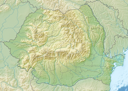
Danube Delta is located in Romania
Danube Delta
Location of Danube Delta in Romania

The Danube Delta (NASA Goddard image)
 
The Danube Delta is the second largest river delta in Europe, after the Volga Delta, and is the best preserved on the continent. The greater part of the Danube Delta lies in Romania (Tulcea County), with a small part in Ukraine (Odessa Oblast). Its approximate surface area is 4,152 km2 (1,603 sq mi), of which 3,446 km2 (1,331 sq mi) is in Romania. With the lagoons of Razim–Sinoe (1,015 km2 (392 sq mi) with 865 km2 (334 sq mi) water surface), located south of the main delta, the total area of the Danube Delta is 5,165 km2 (1,994 sq mi). The Razim–Sinoe lagoon complex is geologically and ecologically related to the delta proper and the combined territory is listed as a World Heritage Site.

Danube Delta near Tulcea (2010)

Geography and geology

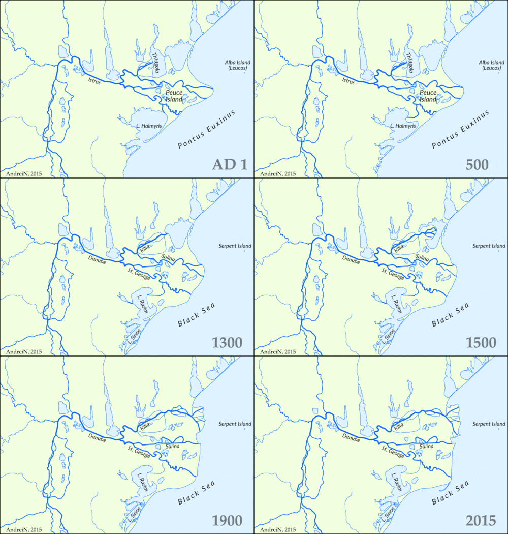
Historical evolution of the Danube Delta (AD 1 – 2015)

The modern Danube Delta began to form after 4000 BCE in a bay of the Black Sea when the sea rose to its present level. A sandy barrier blocked the Danube bay where the river initially built its delta. Upon filling the bay with sediment, the delta advanced outside this barrier-blocked estuary after 3500 BCE, building several successive lobes: the St. George I (3500–1600 BCE), the Sulina (1600–0 BCE), the St. George II (0 BC–present) and the Chilia or Kilia (1600 CE–present). Several other internal lobes were constructed in the lakes and lagoons bordering the Danube Delta to the north (Chilia I and II) and toward the south (Dunavatz). Much of the alluvium in the delta and major expansion of its surface area in the form of lobes resulted from soil erosion associated with the clearing of forests in the Danube basin during the 1st and 2nd millennium. Geologist Liviu Giosan told The New York Times:
Probably 40 percent of the Delta was built in the last 1000 years. Finding that was like a eureka moment.
At present, the delta suffers from a large sediment deficit, after the construction of dams on the Danube and its tributaries in the later half of the 20th century. However, construction of a dense network of shallow channels in the delta over the same period attenuated the deficit on the delta plain but increased erosion along the coast The Danube Delta is a low alluvial plain, mostly covered by wetlands and water. It consists of an intricate pattern of marshes, channels, streamlets and lakes. The average altitude is 0.52 m, with 20% of the territory below sea level, and more than half not exceeding one meter in altitude. Dunes on the most extensive strand plains of the delta (Letea and Caraorman strand plains) stand higher (12.4 m and 7 m respectively). The largest lakes are lakes Dranov (21.7 km2), Roșu (14.5 km2) and Gorgova (13.8 km2). 

Danube Delta – Dalmatian pelican and great cormorant

Distributaries of the Danube

The Danube branches into three main distributaries into the delta, Chilia, Sulina, and Sfântul Gheorghe (Saint George). The last two branches form the Tulcea channel, which continues as a single body for several kilometers after the separation from the Chilia. At the mouths of each channel gradual formation of new land takes place, as the delta continues to expand.

Main distributaries of the Danube
Danube arm Length (km) Flow (m3/s)
(1921–1990)
Chilia 120 3800
Sulina 64 1250
Sfântul Gheorghe (Saint George)
70 1500

Chilia, in the north, the longest, youngest, and most vigorous, with two secondary internal deltas and one microdelta in full process of formation at its mouth (to Ukraine).

Sulina, the central and thus the shortest arm, which consequently led to its extensive use for traffic and severe transformation. At its mouth is located the main port and a single settlement with urban characteristics of the Romanian part of the delta. Because of the alluvium deposited at its mouth, a channel gradually advancing into the sea (presently it has 10 km) was built in order to protect navigation.

Sfântul Gheorghe (Saint George in English), in the south, is the oldest and most sparsely populated. Its alluvium has led to the creation, beginning in 1897, of the Sacalin Islands, which today measure 19 km in length. 

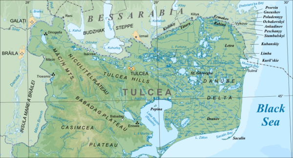
Map created in 2010
 
Danube Delta in Romania

Climate

The climate of the Danube Delta is continental, with strong influences from the vicinity of the Black Sea and its prevalent amphibian environment. It is the driest and sunniest region of Romania. The mean annual temperature is 11 °C (−1 °C in January and 22 °C in July), with mean precipitation between 400 mm/year and 300 mm/year, decreasing from west to east. Evaporation is around 1,000 mm/year, amplified by strong and frequent winds, resulting in long periods of drought in the summer. The northwest winds cause frequent storms in spring and autumn. In the interior of the delta, the continental character of the climate is very pronounced.

Main ecosystems

Danube Delta in Romania
 
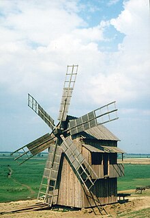
Danube Delta: old mill in Letea
 
The Danube Delta falls within the Pannonian steppe ecosystem of eastern Europe, with Mediterranean influences. As a young region in full process of consolidation, the Danube Delta represents a very favourable place for the development of highly diverse flora and fauna, unique in Europe, with numerous rare species. It hosts 23 natural ecosystems, but due to the extent of wetlands an aquatic environment is prevalent; a terrestrial environment is also present on the higher grounds of the continental levees, where xerophile ecosystems have developed. Between the aquatic and terrestrial environments is interposed a swampy, easily flooded strip of original flora and fauna, with means of adaptation to water or land, depending on the season or hydrological regime. At the contact between freshwater and sea water, some special physical, chemical and biological processes take place, which have led biologists to consider this area as a very different ecosystem called beforedelta. Musura Gulf, north of Sulina, and Saint George Gulf are considered the most representative of this type of ecosystem. 

Situated on major migratory routes, and providing adequate conditions for nesting and hatching, the Danube Delta is a magnet for birds from six major ecoregions of the world, including the Mongolian, Arctic and Siberian. There are over 320 species of birds found in the delta during summer, of which 166 are hatching species and 159 are migratory. Over one million individual birds (swans, wild ducks, coots, etc.) winter here.

Ecosystem of running water

This comprises the arms of the Danube, and a series of its more important streamlets and channels. It is an environment rich in plankton, worms, molluscs, grubs, and sponges, with numerous species of fish, such as the carp, pike, pike perch, sheat-fish, and freshwater sturgeons (sterlet, Vyza and Danube mackerel).

Ecosystem of stagnant water

This environment includes the lakes, and various ponds, streamlets and channels. It is characterized by a rich floating and submerse flora (Myriophyllum, Ceratophyllum, Vallisneria etc., under the water; Nymphaea alba, Nuphar lutea, Trapa natans, Alisma plantago etc., floating plants with roots near the lakes' borders; and Salvinia natans, Stratiotes aloides, Spirogyra etc., floating plants without roots, having negative effect for aquatic bioproductivity). Of the fish, the most important are Tench (Tinca tinca), common bream (Abramis brama), common rudd (Scardinius erythropthalmus), Prussian carp (Carassius auratus gibelio), wels catfish (Silurus glanis), European perch (Perca fluviatilis), and northern pike (Esox lucius).

Ecosystem of marshy and flooding areas

Pelicans in Danube Delta
 
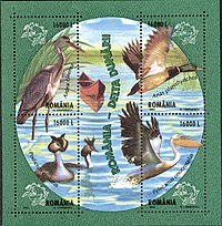
The Danube Delta birds: grey heron (Ardea cinerea), mallard or wild duck (Anas platyrhynchos), great white pelican (Ardea cinerea), great crested grebe (Podiceps cristatus). Stamp of Romania, 2004
 
Reed plants and floating reed islands (called plaur in Romania) are the most common and well known components of the Danube Delta. Vegetation of this ecosystem consists of the common reed (Phragmites communis) and, on near river banks, mace reed/cattail (Typha latifolia, Typha angustifolia), sedge (Carex dioica, Carex stricta), Dutch rush (Scirpus radicans, Schoenoplectus lacustris), and brook mint (Mentha aquatica), etc. They provide ideal spawning and nesting grounds. The plaur are a mixture of reed roots, grass and soil, usually floating or anchored to the riverbed. As a rule, the reed surrounds the lakes and ponds, and slowly invades the water surface.

This type of ecosystem is noted for its variety and large population of birds, some of them very rare. The most important are the tufted duck (Aythya fuligula, red-crested pochard (Netta rufina), mallard (Anas platyrhynchos), greylag goose (Anser anser), pygmy cormorant (Microcarbo pygmeus), purple heron (Ardea purpurea), great white egret (Egretta alba), little egret (Egretta garzetta), eurasian spoonbill(Platalea leucorodia), great white pelican (Pelecanus onocrotalus), Dalmatian pelican (Pelecanus crispus), mute swan (Cygnus olor), and glossy ibis (Plegadis falcinellus). A recent and welcomed newcomer is the pheasant (Phasianus colchicus). 

Among the mammals, there is the Eurasian otter (Lutra lutra), European mink (Mustela lutreola), little ermine (Mustela erminea aestiva), wild boar (Sus scrofa), and wild cat (Felis silvestris), in winter the hare (Lepus europaeus) and, on the brink of disappearing from the delta, the wolf and the fox. The East Asian raccoon dog (Nyctereutes procyonoides), bizam/introduced muskrat (Ondatra zibethica), and to some extent South American nutria (Myocastor coypus), are recent species that have successfully adapted.

River bank and levee ecosystems

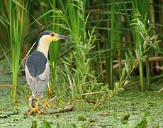
Black-crowned night heron
 
The firm land of the delta used to be covered with large groves of willow trees, which have been cut down almost entirely and replaced with Canadian poplars. On the river banks kept in their natural state, small groves of willow trees (Salix alba, Salix fragilis, Salix purpurea, Salix petandra, Salix triandra etc.) can still be found, mixed with white poplar (Populus alba). Occasionally, the willow trees form corridors along the arms and bigger channels of the Danube. On the levees of Letea and Caraorman, mixed forests of oak (Quercus robur, Quercus pedunculiflora) with various trees (Fraxinus pallisae, Ulmus foliacea, Populus tremula), shrubs (Prunus spinosa, Crataegus monogyna, Rosa canina, Berberis vulgaris etc.), and vines (Vitis sylvestris, Hedera helix, Humulus lupulus, Periploca graeca, which reaches up to 25m) grow on sand dune areas. On the Letea levee, these exotic-looking forests grow especially in the depressions between the sand dunes, in small groves called hasmace. Fauna of this region include the meadow viper (Vipera ursinii), osprey (Pandion haliaetus), and Eurasian eagle owl (Bubo bubo), etc.

Inhabitants

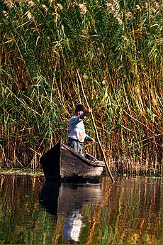
Lipovan fisherman of Chilia Veche
 
Vylkove (Ukraine), 1962
 
Dyked and dried areas in the communist time
 
The "M&B" natural reservations of the Danube delta (red: in Ukraine; yellow: in Romania)
 
The Danube Delta is perhaps the least inhabited region of temperate Europe. On the Romanian side live about 20,000 people, of whom 4,600 live in the port of Sulina, which gives an average density of approx. two inhabitants per km2. The rest of the population is scattered among 27 villages, of which only three, all situated marginally, had more than 500 people in 2002. The city of Tulcea, at the western edge of the delta, has a population of 92,000 (in 2002); it represents the node of the region and the gate to the delta. 

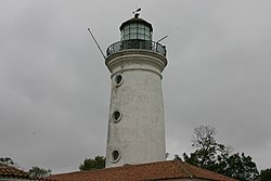
Sulina City – 1870 lighthouse
 
Its acute isolation and harsh conditions of living, based mainly on subsistence, made the Danube Delta a place of emigration, or transit at least. Very few of those born in the region stay there through adulthood; at the same time, the origins of its inhabitants vary widely, as people from many parts of Romania can be found in the delta. The total population has remained more or less constant throughout the 20th century; there were 12,000 inhabitants in the 1890s, and 14,000 before the Second World War. Romanians account for approximately 80% of the population, and Ukrainians for 10%. Other people living in the delta include ethnic minorities such as Greeks, Turks and Bulgarians (in 1992). Distinctive to the region, but very rare as an ethnic entity, are the Lipovans, descendants of the Orthodox Old Rite followers who fled from religious persecution in Russia during the 18th century.

On the Ukrainian side, located at the northern edge of the delta, the town of Izmail has a population of 85,000, Kiliya a population of 21,800, and Vilkovo, the main center of the Lipovan community, a population of 9,300.

History

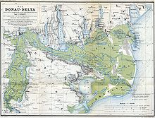
The Danube Delta in 1867, as a part of the Ottoman Empire
 
Recorded history notes that the Dacians lived in the Danube Delta before it was conquered by the Romans. After later invasion by the Goths, the region changed hands many times. During the 15th century, the Danube Delta became part of the Ottoman Empire. In 1812, following the Russo-Turkish War, the borders of the Ottoman and Russian Empires were set by the Kilia and Old Stambul Channels of the Danube, and in 1829 by the St George Channel. The Treaty of Paris of 1856, which ended the Crimean War, assigned the Danube Delta to the Ottoman Empire and established an international commission which undertook a series of works to help navigation. In 1878, following the defeat of Ottoman Empire by Russia and Romania, the border between the two countries was set by the Kilia and Old Stambul Channels.

Territorial losses of Romania in the Danube delta since 1948
 
In 1991, the Romanian part of the Danube Delta became part of UNESCO's list of World Heritage Sites. Around 2,733 km2 of the delta are strictly protected areas.

In 1998, under UNESCO's Programme on Man and the Biosphere, the 6,264.03 km2 of the Danube Delta were established as a biosphere reserve, shared by Romania and Ukraine.

Historically, in Romania, part of the Danube Delta was marked as a reserve in 1938.

In Ukraine, the Danube branch of the Black Sea State Reserve was established in 1973. In 1981, it was reorganized into the Natural Reserve "Danube Fluxes", and in 1998, it was extended into the Danube biosphere reserve.

Environmental issues

Reeds growing in the Danube Delta
 
Large-scale works began in the Danube Delta as early as the second half of the 19th century. First corrections of the Sulina arm began in 1862, and they continued throughout the 20th century. As a result, the length of the Sulina arm was reduced from 92 to 64 km, and its flow more than doubled, thus making it suitable for large-vessel navigation. Correcting the six large meanders on its course thereby reduced the length of the Sfântu Gheorghe from 108  to 108 km, and its flow also increased somewhat. Both these increases were made to the detriment of the Chilia arm, which at present remains the most unspoiled arm of the main three. These corrections, as well as the digging of various secondary channels throughout the body of the delta, have had a serious impact on the ecosystem. Natural environments have been altered, the breeding pattern of fish has been disrupted, and the flows in the main arms have increased, with serious consequences regarding the discharge of alluvia and the erosion of banks. 

Danube Delta, fisherman.jpg

Reed was intensively harvested during the Communist era. The regime had plans to transform the delta into a large agro-industrial zone. Although the first modern agricultural exploitation dates from 1939 (Ostrovul Tãtaru), only after 1960 were large areas drained and converted, to the detriment of the wetlands. In 1991 agricultural land in the delta surpassed 100,000 hectares, and more than a third of its surface has been affected by crop cultivation, forest plantation, or pisciculture. As a result of these changes, along with the increasing pollution and eutrophication of the waters of the Danube, and decades of exploitation and poor fishing regulations, the fish population has been visibly reduced. 

In 2004, Ukraine inaugurated work on the Bistroe Channel that would provide an additional navigable link from the Black Sea to the populous Ukrainian section of the Danube Delta. However, because of the negative impact which this new channel might have on the fragile ecosystem of the delta, the European Union advised Ukraine to shut down the works. Romanian officials threatened to sue Ukraine at the International Court of Justice. Under the presidency of Kuchma, Ukraine had responded that Romania was only afraid of the competition that the new channel would bring, and continued working on the channel. Under the presidency of Yuschenko, who visited Romania in 2005, both sides agree that professionals should decide the fate of the channel. In the long run, Ukraine plans to build a navigation channel, if not through Bistroe Channel, then through another channel.

Wildlife crossing

From Wikipedia, the free encyclopedia
 
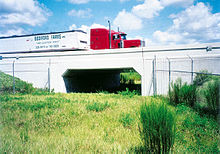
Florida State Route 46 was elevated over this underpass. Notice the channeling fences on either side of the crossing.

Wildlife crossings are structures that allow animals to cross human-made barriers safely. Wildlife crossings may include underpass tunnels or wildlife tunnels, viaducts, and overpasses or green bridges (mainly for large or herd-type animals); amphibian tunnels; fish ladders; canopy bridge (especially for monkeys and squirrels), tunnels and culverts (for small mammals such as otters, hedgehogs, and badgers); and green roofs (for butterflies and birds).

Wildlife crossings are a practice in habitat conservation, allowing connections or reconnections between habitats, combating habitat fragmentation. They also assist in avoiding collisions between vehicles and animals, which in addition to killing or injuring wildlife may cause injury to humans and property damage

Similar structures can be used for domesticated animals, such as cattle creeps.

Roads and habitat fragmentation

Camel Crossing in Kuwait
 
Habitat fragmentation occurs when human-made barriers such as roads, railroads, canals, electric power lines, and pipelines penetrate and divide wildlife habitat (Primack 2006). Of these, roads have the most widespread and detrimental effects (Spellerberg 1998). Scientists estimate that the system of roads in the United States affects the ecology of at least one-fifth of the land area of the country (Forman 2000). For many years ecologists and conservationists have documented the adverse relationship between roads and wildlife. Jaeger et al. (2005) identify four ways that roads and traffic detrimentally affect wildlife populations: (1) they decrease habitat amount and quality, (2) they increase mortality due to wildlife-vehicle collisions (road kill), (3) they prevent access to resources on the other side of the road, and (4) they subdivide wildlife populations into smaller and more vulnerable sub-populations (fragmentation). Habitat fragmentation can lead to extinction or extirpation if a population's gene pool is restricted enough.

The first three effects (loss of habitat, road kill, and isolation from resources) exert pressure on various animal populations by reducing available resources and directly killing individuals in a population. For instance, Bennett (1991) found that road kills do not pose a significant threat to healthy populations but can be devastating to small, shrinking, or threatened populations. Road mortality has significantly affected a number of prominent species in the United States, including white-tailed deer (Odocoileus virginianus), Florida panthers (Puma concolor coryi), and black bears (Ursus americanus) (Clevenger et al. 2001). In addition, habitat loss can be direct, if habitat is destroyed to make room for a road, or indirect, if habitat quality close to roads is compromised due to emissions from the roads (e.g. noise, light, runoff, pollution, etc.) (Jaeger et al. 2005). Finally, species that are unable to migrate across roads to reach resources such as food, shelter and mates will experience reduced reproductive and survival rates, which can compromise population viability (Noss et al., 1996).

In addition to the first three factors, numerous studies have shown that the construction and use of roads is a direct source of habitat fragmentation (Spellerberg 1998). As mentioned above, populations surrounded by roads are less likely to receive immigrants from other habitats and as a result, they suffer from a lack of genetic diversity. These small populations are particularly vulnerable to extinction due to demographic, genetic, and environmental stochasticity because they do not contain enough alleles to adapt to new selective pressures such as changes in temperature, habitat, and food availability (Primack 2006).

The relationship between roads and habitat fragmentation is well documented. One study found that roads contribute more to fragmentation in forest habitats than clear cuts (Reed et al. 1996). Another study concluded that road fragmentation of formerly contiguous forest in eastern North America is the primary cause for the decline of forest bird species and has also significantly harmed small mammals, insects, and reptiles in the United States (Spellerberg 1998). After years of research, biologists agree that roads and traffic lead to habitat fragmentation, isolation and road kill, all of which combine to significantly compromise the viability of wildlife populations throughout the world.

Wildlife-vehicle collisions

In addition to conservation concerns, wildlife-vehicle collisions have a significant cost for human populations because collisions damage property and injure and kill passengers and drivers. Bruinderink & Hazebroek (1996) estimated the number of collisions with ungulates in traffic in Europe at 507,000 per year, resulting in 300 people killed, 30,000 injured, and property damage exceeding $1 billion. In parallel, 1.5 million traffic accidents involving deer in the United States cause an estimated $1.1 billion in vehicle damage each year (Donaldson 2005). On a larger scale, research indicates that wildlife-vehicle collisions in the United States result in 29,000 injuries and more than 200 fatalities per year.

The conservation issues associated with roads (wildlife mortality and habitat fragmentation) coupled with the substantial human and economic costs resulting from wildlife-vehicle collisions have caused scientists, engineers, and transportation authorities to consider a number of mitigation tools for reducing the conflict between roads and wildlife. Of the currently available options, structures known as wildlife crossings have been the most successful at reducing both habitat fragmentation and wildlife-vehicle collisions caused by roads (Knapp et al. 2004, Clevenger, 2006).

"Animals' Bridge," on the Flathead Indian Reservation in Montana, used by grizzly and black bears, deer, elk, mountain lions, and others
 
Wildlife crossings are structural passages beneath or above roadways that are designed to facilitate safe wildlife movement across roadways (Donaldson 2005). In recent years, conservation biologists and wildlife managers have advocated wildlife crossings coupled with roadside fencing as a way to increase road permeability and habitat connectivity while decreasing wildlife-vehicle collisions. Wildlife crossing is the umbrella term encompassing underpasses, overpasses, ecoducts, green bridges, amphibian/small mammal tunnels, and wildlife viaducts (Bank et al. 2002). All of these structures are designed to provide semi-natural corridors above and below roads so that animals can safely cross without endangering themselves and motorists.

History and location

Written reports of rough fish ladders date to 17th-century France, where bundles of branches were used to create steps in steep channels to bypass obstructions. A version was patented in 1837 by Richard McFarlan of Bathurst, New Brunswick, Canada, who designed a fishway to bypass a dam at his water-powered lumber mill.[8] In 1880, the first fish ladder was built in Rhode Island, United States, on the Pawtuxet Falls Dam. As the Industrial Age advanced, dams and other river obstructions became larger and more common, leading to the need for effective fish by-passes.

The first overland wildlife crossings were constructed in France during the 1950s (Chilson 2003). European countries including the Netherlands, Switzerland, Germany, and France have been using various crossing structures to reduce the conflict between wildlife and roads for several decades and use a variety of overpasses and underpasses to protect and re-establish wildlife such as: amphibians, badgers, ungulates, invertebrates, and other small mammals (Bank et al. 2002).

The Humane Society of the United States reports that the more than 600 tunnels installed under major and minor roads in the Netherlands have helped to substantially increase population levels of the endangered European badger. The longest "ecoduct" viaduct, near Crailo in the Netherlands, runs 800 m and spans a highway, railway and golf course

A terrapin crossing sign and a highway barrier designed for crossing at the end of the F.J. Torras causeway at St. Simons Island, Georgia, US (2015)
 
Wildlife crossings are becoming increasingly common in Canada and the United States. Recognizable wildlife crossings are found in Banff National Park in Alberta, where vegetated overpasses provide safe passage over the Trans-Canada Highway for bears, moose, deer, wolves, elk, and many other species (Clevenger 2007). The 24 wildlife crossings in Banff were constructed as part of a road improvement project in 1978 (Clevenger 2007). In the United States, thousands of wildlife crossings have been built in the past 30 years, including culverts, bridges, and overpasses. These have been used to protect mountain goats in Montana, spotted salamanders in Massachusetts, bighorn sheep in Colorado, desert tortoises in California, and endangered Florida panthers in Florida (Chilson 2003). 

The first wildlife crossing in the Canadian province of Ontario was built in 2010, along Ontario Highway 69 between Sudbury and Killarney, as part of the route's ongoing freeway conversion.

Costs and benefits

The benefits derived from constructing wildlife crossings to extend wildlife migration corridors over and under major roads appear to outweigh the costs of construction and maintenance. One study estimates that adding wildlife crossings to a road project is a 7-8% increase in the total cost of the project (Bank et al. 2002). Theoretically, the monetary costs associated with constructing and maintaining wildlife crossings in ecologically important areas are trumped by the benefits associated with protecting wildlife populations, reducing property damage to vehicles, and saving the lives of drivers and passengers by reducing the number of collisions caused by wildlife.

A study completed for the Virginia Department of Transportation estimated that underpasses for wildlife become cost effective, in terms of property damage, when they prevent between 2.6 and 9.2 deer-vehicle collisions per year, depending on the cost of the underpass. Approximately 300 deer crossed through the underpasses in the year the study took place (Donaldson 2005).

Effectiveness

A number of studies have been conducted to determine the effectiveness of wildlife corridors at providing habitat connectivity (by providing viable migration corridors) and reducing wildlife-vehicle collisions. The effectiveness of these structures appears to be highly site-specific (due to differences in location, structure, species, habitat, etc.) but crossings have been beneficial to a number of species in a variety of locations. Some of the wildlife crossing success stories are detailed below.

Banff National Park

Banff National Park offers one of the best opportunities to study the effectiveness of wildlife crossings because the park contains a wide variety of species and is bisected by a large commercial road called the Trans-Canada Highway (TCH). To reduce the effects of the four-lane TCH, 24 wildlife crossings (22 underpasses and two overpasses) were built to ensure habitat connectivity and protect motorists (Clevenger 2007). In 1996, Parks Canada developed a contract with university researchers to assess the effectiveness of the crossings. The past decade has produced a number of publications that analyze the crossings' effect on various species and overall wildlife mortality (see Clevenger & Waltho 2000, Clevenger et al. 2001, and Clevenger 2007). 

Wildlife overpass in Banff National Park, Canada
 
Using a variety of techniques to monitor the crossings over the last 25 years, scientists report that 10 species of large mammals (including deer, elk, black bear, grizzly bear, mountain lion, wolf, moose, and coyote) have used the 24 crossings in Banff a total of 84,000 times as of January 2007 (Clevenger 2007). The research also identified a "learning curve" such that animals need time to acclimate to the structures before they feel comfortable using them. For example, grizzly bear crossings increased from seven in 1996 to more than 100 in 2006, although the actual number of individual bears using the structures remained constant over this time at between two and four bears (Parks Canada, unpublished results). A similar set of observations was made for wolves, with crossings increasing from two to approximately 140 over the same 10-year period. However, in this case the actual number of wolves in the packs using the crossings increased dramatically, from a low of two up to a high of over 20 individuals. In continuation with these positive results, Clevenger et al. (2001) reported that the use of wildlife crossings and fencing reduced traffic-induced mortality of large ungulates on the TCH by more than 80 percent. Recent analysis for carnivores showed results were not as positive however, with bear mortality increasing by an average of 116 percent in direct parallel to an equal doubling of traffic volumes on the highway, clearly showing no effect of fencing to reduce bear mortality (Hallstrom, Clevenger, Maher and Whittington, in prep). Research on the crossings in Banff has thus shown mixed value of wildlife crossings depending on the species in question. 

Parks Canada is currently planning to build 17 additional crossing structures across the TCH to increase driver safety near the hamlet of Lake Louise. Lack of effectiveness of standard fencing in reducing bear mortality demonstrates that additional measures such as wire 'T-caps' on the fence may be needed for fencing to mitigate effectively for bears (Hallstrom, Clevenger, Maher and Whittington, in prep).

Collier and Lee counties in Florida

Twenty-four wildlife crossings (highway underpasses) and 12 bridges modified for wildlife have been constructed along a 40-mile stretch of Interstate 75 in Collier and Lee counties in Florida (Scott 2007). These crossings are specifically designed to target and protect the endangered Florida panther, a subspecies of mountain lion found in the southeastern United States. Scientists estimate that there are only 80-100 Florida panthers alive in the wild, making them one of the most endangered large mammals in North America (Foster and Humphrey, 1995). The Florida panther is particularly vulnerable to wildlife-vehicle collisions, which claimed 11 panthers in 2006 and 14 in 2007 (Scott 2007). 

The Florida Fish and Wildlife Conservation Commission (FWC) has used a number of mitigation tools in an effort to protect Florida panthers and the combination of wildlife crossings and fences have proven the most effective (Scott 2007). As of 2007, no panthers have been killed in areas equipped with continuous fencing and wildlife crossings and the FWC is planning to construct many more crossing structures in the future. The underpasses on I-75 also appeared to benefit bobcats, deer, and raccoons, and significantly reduced wildlife-vehicle collisions along the interstate (Foster and Humphrey, 1995).

Underpasses in southern California

Wildlife crossings have also been important for protecting biodiversity in several areas of southern California. In San Bernardino County, biologists have erected fences along State Route 58 to complement underpasses (culverts) that are being used by the threatened desert tortoise. Tortoise deaths on the highway declined by 93% during the first four years after the introduction of the fences, proving that even makeshift wildlife crossings (storm-drainage culverts in this case) have the ability to increase highway permeability and protect sensitive species (Chilson 2003). Additionally, studies by Haas (2000) and Lyren (2001) report that underpasses in Orange, Riverside, and Los Angeles Counties have drawn significant use from a variety of species including bobcats, coyotes, gray fox, mule deer, and long-tailed weasels. These results could be extremely important for wildlife conservation efforts in the region's Puente Hills and Chino Hills links, which have been increasingly fragmented by road construction (Haas 2000) Los Angeles County's first wildlife-purpose built underpass is at Harbor Boulevard. It was built in partnership between Los Angeles County, California State Parks and the Puente Hills Habitat Preservation Authority.

Ecoducts, Netherlands

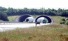
One of the two wildlife crossings spanning the A50 highway on the Veluwe in the Netherlands

The Netherlands has over 66 wildlife crossings (overpasses and ecoducts) that have been used to protect the endangered European badger, as well as populations of wild boar, red deer, and roe deer. As of 2012, the Veluwe, 1000 square kilometers of woods, heathland and drifting sands, the largest lowland nature area in North Western Europe, contains nine ecoducts, 50 meters wide on average, that are used to shuttle wildlife across highways that transect the Veluwe. The first two ecoducts on the Veluwe were built in 1988 across the A50 when the highway was constructed. Five of the other ecoducts on the Veluwe were built across existing highways, one was built across a two lane provincial road. The two ecoducts across the A50 were used by nearly 5,000 deer and wild boar during a one-year period (Bank et al. 2002). The Netherlands also boasts the world's longest ecoduct-wildlife overpass called the Natuurbrug Zanderij Crailoo (sand quarry nature bridge at Crailo) (Danby 2004). The massive structure, completed in 2006, is 50 m wide and over 800 m long and spans a railway line, business park, river, roadway, and sports complex (Danby 2004). Monitoring is currently underway to examine the effectiveness of this innovative project combining wildlife protection with urban development. The oldest wildlife passage is Zeist West - A 28, opened in 1988.

Slaty Creek Wildlife Underpass, Calder Freeway, Black Forest, Australia

Another case study of the effectiveness of wildlife crossings comes from an underpass built to minimize the ecological effect of the Calder Freeway as it travels through the Black Forest in Victoria, Australia. In 1997, the Victorian Government Roads Corporation built Slaty Creek wildlife underpass at a cost of $3 million (Abson & Lawrence 2003). Scientists used 14 different techniques to monitor the underpass for 12 months in order to determine the abundance and diversity of species using the underpass (Abson & Lawrence 2003). During the 12-month period, 79 species of fauna were detected in the underpass (compared with 116 species detected in the surrounding forest) including amphibians, bats, birds, koalas, wombats, gliders, reptiles, and kangaroos (Abson & Lawrence 2003). The results indicate that the underpass could be useful to a wide array of species but the authors suggest that Slaty Creek could be improved by enhanced design and maintenance of fencing to minimise road kill along the Calder Freeway and by attempting to exclude introduced predators such as cats and foxes from the area.

The ARC International Wildlife Crossing Infrastructure Design Competition

In 2010, ARC Solutions - an interdisciplinary partnership - initiated the International Wildlife Crossing Infrastructure Design Competition for a wildlife crossing over Interstate 70 near Denver, Colorado., and designers had to account for many challenges unique to the area, including snow and severe weather, high elevation and steep grades, a six-lane roadway, a bike path, and high traffic volumes, as well as multiple species of wildlife, including lynx.

After receiving 36 submissions from nine countries, a jury of internationally acclaimed experts in landscape architecture, engineering, architecture, ecology and transportation selected five finalists in November 2010 to further develop their conceptual designs for a wildlife crossing structure. In January 2011, the team led by HNTB with Michael Van Valkenburgh & Associates (New York) were selected as the winners. The design features a single 100 m (328 ft) concrete span across the highway that is planted with a variety of vegetation types, including a pine-tree forest and meadow grasses, to attract different species to cross. A modular precast concrete design means that much of the bridge can be constructed offsite and moved into place.

Canopy Bridge in Anamalai Tiger Reserve

Many endangered lion-tailed macaques used to be killed while crossing the highway at Puduthotam in Valparai, South India. Thanks to the efforts of NGOs and the forest department, several canopy bridges were installed, connecting trees on either side of the road. This helped to lower the numbers of lion-tailed macaques killed in the region. The Environment Conservation Group had initiated a national mission to increase awareness on the importance of adopting roadkill mitigation methods through their mission PATH traveling more than 17,000 kilometers across 22 states.

Wildlife corridor

From Wikipedia, the free encyclopedia
 
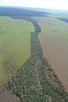
A green forest corridor in Brazil

A wildlife corridor, habitat corridor, or green corridor is an area of habitat connecting wildlife populations separated by human activities or structures (such as roads, development, or logging). This allows an exchange of individuals between populations, which may help prevent the negative effects of inbreeding and reduced genetic diversity (via genetic drift) that often occur within isolated populations. Corridors may also help facilitate the re-establishment of populations that have been reduced or eliminated due to random events (such as fires or disease)

This may potentially moderate some of the worst effects of habitat fragmentation, wherein urbanization can split up habitat areas, causing animals to lose both their natural habitat and the ability to move between regions to use all of the resources they need to survive. Habitat fragmentation due to human development is an ever-increasing threat to biodiversity, and habitat corridors are a possible mitigation.

Purpose

The main goal of implementing habitat corridors is to increase biodiversity. When areas of land are broken up by human interference, population numbers become unstable and many animal and plant species become endangered. By re-connecting the fragments, the population fluctuations can decrease dramatically. Corridors can contribute to three factors that stabilize a population:
  • Colonization—animals are able to move and occupy new areas when food sources or other natural resources are lacking in their core habitat.
  • Migration—species that relocate seasonally can do so more safely and effectively when it does not interfere with human development barriers.
  • Interbreeding—animals can find new mates in neighbouring regions so that genetic diversity can increase and thus have a positive impact on the overall population.
Rosenberg et.al. (1995)  were among the first to define what constitutes a wildlife corridor. The definitions of "biological corridor" (i.e., wildlife corridor) had, in the early years of studying corridors, been "vague and inconsistent, and often they confound form and function" Rosenberg et.al. developed a conceptual model that emphasized the role of a wildlife corridor as a facilitator of movement that is not restricted by requirements of native vegetation or intermediate target patches of habitat. Their definition simply required that movement to a target patch via the corridor be greater that if the corridor were absent. 

Although corridors had originally been implemented with the assumption that they would increase biodiversity, not enough research had been done to come to a solid conclusion. The case for corridors has been built more on intuition and much less on empirical evidence (Tewksbury et al. 2002). Tewksbury et. al. claimed that the early controversies had arisen because most studies had been limited in that they had a narrow taxonomic focus and, that if corridors facilitate animal movement, they should also have strong indirect effects on plant populations due to increased pollen and seed by animals. Results of their 2002 experiment provided a large-scale experimental demonstration that habitat (or wildlife) corridors facilitate movement of disparate taxa between otherwise isolated patches even after controlling for area effects (Tewksbury et al, 2002). Another factor that needs to be taken into account is what species the corridor is intended for. Some species have reacted more positively to corridors than others.

A habitat corridor could be considered as a possible solution in an area where the destruction of a natural area has greatly affected its native species. Development such as roads, buildings, and farms can interrupt plants and animals in the region being destroyed. Furthermore, natural disasters such as wildfires and floods can leave animals with no choice but to evacuate. If the habitat is not connected to a safer one, it will ultimately lead to death. A remaining portion of natural habitat is called a remnant, and such portions need to be connected because when migration decreases, extinction increases (Fleury 1997). 

Corridors can be made in two distinct areas—either water or land. Water corridors are called riparian ribbons and usually come in the form of rivers and streams. Land corridors come on a scale as large as wooded strips connecting larger woodland areas. However, they can also be as simple as a line of shrubs along a sidewalk (Fleury 1997). Such areas can facilitate the movement of small animals, especially birds, from tree to tree, until they find a safe habitat to rest in. Not only do minimal corridors aid in the movement of animals, they are also aesthetically pleasing, which can sometimes encourage the community to accept and support them.

Users

Species can be categorized in one of two groups; passage users and corridor dwellers. 

Passage users occupy corridors for brief periods of time. These animals use corridors for such events as seasonal migration, dispersal of a juvenile, or moving between parts of a large home range. Usually large herbivores, medium to large carnivores, and migratory species are passage users (Beier & Loe 1992). One common misconception is that the corridor only needs to be wide enough for the passage users to get through. However, the corridor still must be wide enough to be safe and also encourage the animals to use it, even though they do not live out their entire lives in it. 

Corridor dwellers can occupy the passage anywhere from several days to several years. Species such as plants, reptiles, amphibians, birds, insects, and small mammals can spend their entire lives in linear habitats. In this case, the corridor must include everything that a species needs to live and breed, such as soil for germination, burrowing areas, and multiple other breeding adults (Beier & Loe 1992).

Types

Habitat corridors can be categorized according to their width. Typically the wider the corridor, the more use it will get from species. However, the width-length ratio, as well as design and quality play just as important of a role in creating the perfect corridor (Fleury 1997). The strip of land will suffer less from edge effects such as weeds, predators, and chemicals if it is constructed properly. The following are three divisions in corridor widths:
  • Regional – (>500m wide); connect major ecological gradients such as migratory pathways.
  • Sub-regional – (>300m wide); connect larger vegetated landscape features such as ridgelines and valley floors.
  • Local – (some <50m connect="" etc.="" gullies="" li="" of="" patches="" remnant="" ridgelines="" wetlands="">
Habitat corridors can also be divided according to their continuity. Continuous corridors are strips that are not broken up, while “stepping stone” corridors are small patches of suitable habitat. When stepping stones are arranged in a line, they form a strip of land connecting two areas, just like a continuous corridor. 

Some kinds provide linkages between protected core areas and stimulate or allow species to migrate.
Finally, corridors can come in the form of underpasses or overpasses, which can be very safe for both animals and humans. Many busy highways cross through natural habitats that native species occupy, as well. Large animals such as deer become a hazard when they cross in front of traffic and get hit. An overpass or an underpass serves as a bridge to facilitate the movement of animals across a busy road. Observations have shown that underpasses are actually more successful than overpasses because many times animals are too timid to cross over a bridge in front of traffic and would prefer to be more hidden (Dole et al. 2003).

Costs

Corridors can be expensive to plan out and put into action. For example, Daniel Simberloff et al. states that “a bridge that would maintain a riparian corridor costs about 13 times as much per lane-mile as would a road that would sever the corridor.” He also states that maintenance of a corridor would be much more costly than refuges for endangered species. It would simply be easier to move animals between refuges than to buy land, install a corridor, and maintain it. However, where the goal is not just to preserve a few large animal species but to protect biodiversity among all plants and animals, then habitat corridors may be the only option. Corridors are going to be expensive to implement no matter what, but it does depend on the type, location, and size, which can all vary to a great degree. With the lack of field data on the effectiveness, many agencies are not willing to consider putting in corridors.

Monitoring use

It is extremely important for researchers to pay attention to the population changes in animals after a corridor has been implemented to ensure that there are no harmful effects. Researchers can use both mark-recapture techniques and evaluate genetic flow in order to observe how much a corridor is being used. Marking and recapturing animals is more useful when keeping a close eye on individual movement (Mech & Hallet 2001). The only problem is that tagging animals and watching them does not tell anyone whether the migrating individuals are successfully mating with other populations in connected areas of land. On the other hand, genetic techniques can be more effective in evaluating migration and mating patterns. 

One of the most important goals of developing a corridor is to increase migration in certain animal species. By looking at a population’s gene flow, researchers can understand the genetic consequences of corridors (Mech & Hallett 2001). The migration patterns of an entire population are much more important than the movements of a few individuals. From these techniques, researchers will better understand whether or not habitat corridors are increasing biodiversity. 

Stephen Mech and James Hallett introduce an additional reason genetic techniques are more useful; they “measure average migration rates over time, which reveals the effects of fragmentation of several generations and is not as sensitive to current population sizes as mark-recapture studies are.” For example, when a population is extremely small, mark-recapture is almost impossible. Clearly, genetic analysis of a species is the best way to determine if animals are actually using corridors to move and reproduce.

Design

According to new research, wildlife corridors are best built with a certain degree of randomness or asymmetry, rather than built symmetrically. The research was conducted at UC Davis.

Wildlife corridors are susceptible to edge effects; habitat quality along the edge of a habitat fragment is often much lower than in core habitat areas. Wildlife corridors are important for large species requiring significant sized ranges; however, they are also vital as connection corridors for smaller animals and plants as well as ecological connectors to provide a rescue effect.

Examples

Both the safety of animals and humans can be achieved through the creation of corridors. For example, deer commonly cross roads in order to get to other grazing land. When they are faced with a car coming at them, they freeze; this puts both the deer and the human’s life in danger. In Alberta, Canada, an overpass was constructed to keep animals off of the busy highway; the area is part of a national park, so many different creatures roam the area. The top of the bridge is covered in the native grass of the area so that it blends in better and animals will not know the difference. Gates were also put of on either side of the overpass to help guide animals in the right direction (Semrad 2007). 

In Southern California, 15 underpasses and drainage culverts were observed to see how many animals used them as corridors. They proved to be especially effective on wide-ranging species such as carnivores, mule deer, small mammals, and reptiles, even though the corridors were not intended specifically for animals. Researchers also learned that factors such as surrounding habitat, underpass dimensions, and human activity also played a role in how much use they got. From this experiment, much was learned about what would constitute a successful habitat corridor (Dole et al. 2003). 

In South Carolina, five remnant areas of land were monitored; one was put in the center and four were surrounding it. Then, a corridor was put between one of the remnants and the center. Butterflies that were placed in the center habitat were two to four times more likely to move to the connected remnant rather than the disconnected ones. Furthermore, male holly plants were placed in the center region, and female holly plants in the connected region increased by 70 percent in seed production compared to those plants in the disconnected region. The most impressive dispersal into the connected region, though, was through bird droppings. Far more plant seeds were dispersed through bird droppings in the corridor-connected patch of land (M. 2002). 

There have also been positive effects on the rates of transfer and interbreeding in vole populations. A control population in which voles were confined to their core habitat with no corridor was compared to a treatment population in their core habitat with passages that they could use to move to other regions. Females typically stayed and mated within their founder population, but the rate of transfer through corridors in the males was very high. Researchers are not sure why the females did not move about as much, but it is apparent that the corridor effectively transferred at least some of the species to another location for breeding (Aars 1999). 

In 2001, a wolf corridor was restored through a golf course in Jasper National Park, Alberta, which enabled wolves to pass through the course. After this restoration, wolves passed through the corridor frequently. This is one of the first demonstrations that corridors are used by wildlife, and can be effective in decreasing fragmentation. Earlier studies had been criticised for failing to demonstrate that corridor restoration leads to a change in wildlife behaviour.

Elephant corridor

Elephant corridors are narrow strips of land that allow elephants to move from one habitat patch to another. There are 88 identified elephant corridors in India. 

In Africa, Botswana houses the largest number of free-roaming elephant herds. Elephants Without Borders (EWB) studies the movement of elephants is working to gain community support of local community corridors, so that elephants and humans can co-exist.

Major wildlife corridors

Several artificial wildlife corridors have been planned or created, these include:
  • the Paséo Pantera (also known as the MesoAmerican Biological corridor or Paséo del Jaguar)
  • the Eastern Himalayan Corridor
  • China-Russia Tiger Corridor
  • Tandai Tiger Corridor
  • the European Green Belt
  • The Siju-Rewak Corridor, located in the Garo Hills of India, protects an important population of elephants(thought to be approximately 20% of all the elephants that survive in the country).This corridor project links together the Siju Wildlife Sanctuary and the Rewak Reserve Forest in Meghalaya State, close to the India-Bangladesh border. This area lies within the meeting place of the Himalayan Mountain Range and the Indian Peninsula and contains at least 139 other species of mammal, including tiger, clouded leopard and the Himalayan black bear.
  • the Ecologische Hoofdstructuur is a network of corridors and habitats created for wildlife in the Netherlands

Evaluation

Some animal species are much more apt to use habitat corridors than others depending on what their migration and mating patterns are like. For example, many cases of birds and butterflies successfully using corridors have been observed. Less successful stories have come out of mammals such as deer. How effective a corridor is may simply rely on what species it is directed towards (Tewskbury 2002). Corridors created with birds in mind may be more successful because they are highly migratory to begin with.

Human interference is almost inevitable with the quickly increasing population. The goal behind habitat corridors shows the most hope for solving habitat fragmentation and restoring biodiversity as much as possible. Although there are many positives and negatives, there may be enough positives to continue studying and improving corridors. It is truly difficult to say whether corridors are the solution to increasing biodiversity, because each one must be judged on its own. Each corridor has its own set of standards and goals that may set it apart from another one.

Negatives

A major downfall to habitat corridors is that not much information has been gathered about their success. Due to the lack of positive data, many agencies will not allow corridors to be established because they are unsure of their effectiveness. Another problem with corridors is that they are not as useful as simply preserving land so that it cannot be fragmented. However, it is becoming very difficult to set aside land for nature reserves when road-building, industry, and urban sprawl are all competing for space.

Even if corridors are sought as a solution, it does not necessarily mean that animals will use them. Especially in the case of overpasses, research shows that animals do not like to use them to get to another remnant area of land. Usually overpasses are built over busy highways, and many species are too timid to expose themselves in front of all of the traffic. As more roads and buildings arise, there becomes less space to try to preserve.

Habitat corridors need to be species-specific (not every kind of animal will use every kind of corridor) and corridors can be barriers to some species. For instance plants may use road verges as corridors however some mammals will not cross roads to reach a suitable habitat.

When a corridor is implemented, many times development is so close by, that it becomes difficult to build a wide enough passage. There is usually a very limited amount of space available for corridors, so buffers are not usually added in (Rosenberg 1997). Without a buffer zone, corridors become susceptible to harmful outside factors from city streets, suburb development, rural homes, forestry, cropland, and feedlots. 

Unfortunately, another limiting factor to the implementation of corridors is money. With such inconclusive data about the effectiveness of connecting land, it is difficult to get the proper funding. Those who would be in charge of the corridor design and construction would ask such questions as, “What if the corridors affect species negatively?” and “What if they actually aid in the spread of disease and catastrophic events?” Furthermore, there is a possibility that corridors could not only aid in the dispersal of native organisms, but invasive ones, as well (Beier & Loe 1998). If invasive species take over an area they could potentially threaten another species, even to the point of extinction. 

Although wildlife corridors have been proposed as solutions to habitat and wildlife population fragmentation, there is little evidence that they are broadly useful as a conservation strategy for all biodiversity in non-developed or less-developed areas, compared to protecting connectivity as the relevant ecological attribute. In other words, corridors may be a useful meme for conservation planning/ers, but the concept has less meaning to wildlife species themselves. Very few wildlife follow easily identified "corridors" or "linkages" (e.g., using computer modeling), instead most species meander and opportunistically move through landscapes during daily, seasonal, and dispersal movement behavior. Wildlife corridors may be useful in highly developed landscapes where they are easily identified as the last remaining and available habitat.

Positives

Habitat corridors may be defenseless against a number of outside influences, but they are still an efficient way of increasing biodiversity. Strips of land aid in the movement of various animal species and pollen and seed dispersal, which is an added benefit to the intended one (M. 2002). For example, when insects carrying pollen or birds carrying seeds travel to another area, plant species effectively get transported, as well. 

Another positive aspect of corridors is that they allow both animals and humans to occupy virtually the same areas of land, and thus co-exist where without the corridor this would not be possible. Large animals such as bears can be attracted to residential areas in search of food due to lack of natural resources because of habitat fragmentation. A corridor would provide a passage for the bears to forage in other locations, so that they would not pose as much of a threat to humans.

Representation of a Lie group

From Wikipedia, the free encyclopedia https://en.wikipedia.org/wiki/Representation_of_a_Lie_group...