Search This Blog

Monday, April 27, 2020

Northeastern United States

From Wikipedia, the free encyclopedia
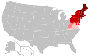
The states shown in the two darkest red shades are included in the United States Census Bureau Northeast Region. The Bureau subdivides the Northeast into: 
 
New Jersey, New York, Pennsylvania. States in lighter shades are included in other regional definitions.

The Northeastern United States, also referred to as the Northeast, is a geographical region of the United States bordered to the north by Canada, to the east by the Atlantic Ocean, to the south by the southern United States, and to the west by the midwestern United States. The Northeast is one of the four regions defined by the United States Census Bureau for the collection and analysis of statistics.

The Census Bureau–defined region has a total area of 181,324 sq mi (469,630 km2) with 162,257 sq mi (420,240 km2) of that being land mass. Although it lacks a unified cultural identity, the Northeastern region is the nation's most economically developed, densely populated, and culturally diverse region. Of the nation's four census regions, the Northeast has the second-largest percentage of residents living in an urban setting, with 85 percent, and is home to the nation's largest metropolitan area. The Northeast is home to most of the Northeast megalopolis, the most economically significant and second most-populated of eleven megaregions within the United States, accounting for 20% of US GDP.

Composition

Geographically there has always been some debate as to where the Northeastern United States begins and ends. The vast area from central Virginia to northern Maine, and from western Pennsylvania (Pittsburgh) to the Atlantic Ocean, have all been loosely grouped into the Northeast at one time or another. Much of the debate has been what the cultural, economic, and urban aspects of the Northeast are, and where they begin or end as one reaches the borders of the region.

Using the Census Bureau's definition of the Northeast, the region includes nine states: they are Maine, New York, New Jersey, Vermont, Massachusetts, Rhode Island, Connecticut, New Hampshire, and Pennsylvania. The region is often subdivided into New England (the six states east of New York) and the Mid-Atlantic states (New York, New Jersey, and Pennsylvania). This definition has been essentially unchanged since 1880 and is widely used as a standard for data tabulation. However, the Census Bureau has acknowledged the obvious limitations of this definition and the potential merits of a proposal created after the 1950 census that would include changing regional boundaries to include Delaware, Maryland, and the District of Columbia, with the Mid-Atlantic states, but ultimately decided that "the new system did not win enough overall acceptance among data users to warrant adoption as an official new set of general-purpose State groupings. The previous development of many series of statistics, arranged and issued over long periods of time on the basis of the existing State groupings, favored the retention of the summary units of the current regions and divisions." The Census Bureau confirmed in 1994 that it would continue to "review the components of the regions and divisions to ensure that they continue to represent the most useful combinations of States and State equivalents."

Many organizations and reference works follow the Census Bureau's definition for the region; however, other entities define the Northeastern United States in significantly different ways for various purposes. The Association of American Geographers divides the Northeast into two divisions: "New England", which consists of Maine, Vermont, New Hampshire, Massachusetts, Rhode Island, and Connecticut; and the "Middle States", which consists of New York, Pennsylvania, New Jersey, and Delaware. Similarly, the Geological Society of America defines the Northeast as these same states but with the addition of Maryland and the District of Columbia. The narrowest definitions include only the states of New England. Other more restrictive definitions include New England and New York as part of the Northeast United States, but exclude Pennsylvania and New Jersey.

Major Cities
City City Population Metro Population U.S. Rank
New York City 8,398,748 19,979,477 1
Philadelphia 1,584,138 6,096,120 6
Washington 705,749 6,216,589 20
Boston 694,583 4,628,910 21
Baltimore 602,495 2,802,789 30
Pittsburgh 301,048 2,362,453 66

States beyond the Census Bureau definition are included in Northeast Region by various other entities:
  • Various organizations include: Delaware, Maryland, and District of Columbia.
  • The US EPA and NOAA include in their Northeast Region: Delaware, Maryland, and West Virginia.
  • The National Fish and Wildlife Service includes in their Northeast Region: Delaware, Maryland, District of Columbia, West Virginia, and Virginia.
  • The National Park Service includes in their Northeast Region: Delaware, Maryland, West Virginia, and Virginia (though small parts are also in the National Capital Region).

History

Indigenous peoples

Anthropologists recognize the "Northeastern Woodlands" as one of the cultural regions that existed in the Western Hemisphere at the time of European colonists in the 15th and later centuries. Most did not settle in North America until the 17th century. The cultural area, known as the "Northeastern Woodlands", in addition to covering the entire Northeast U.S., also covered much of what is now Canada and others regions of what is now the eastern United States. Among the many tribes that inhabited this area were those that made up the Iroquois nations and the numerous Algonquian peoples. In the United States of the 21st century, 18 federally recognized tribes reside in the Northeast. For the most part, the people of the Northeastern Woodlands, on whose lands European fishermen began camping to dry their codfish in the early 1600s, lived in villages, especially after being influenced by the agricultural traditions of the Ohio and Mississippi valley societies.

Colonial history

All of the states making up the Northeastern region were among the original Thirteen Colonies, though Maine, Vermont, and Delaware were part of other colonies before the United States became independent in the American Revolution. The two cultural and geographic regions that form parts of the Northeastern region have distinct histories.

New England

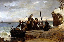
The Landing of the Pilgrims, Henry A. Bacon (1877)

The first Europeans to settle New England were Pilgrims from England, who landed in present-day Massachusetts in 1620. The Pilgrims arrived on the ship Mayflower and founded Plymouth Colony so they could practice religion freely. Ten years later, a larger group of Puritans settled north of Plymouth Colony in Boston to form Massachusetts Bay Colony. In 1636, colonists established Connecticut Colony and Providence Plantations. Providence was founded by Roger Williams, who was banished by Massachusetts for his beliefs in freedom of religion, and it was the first colony to guarantee all citizens freedom of worship. Anne Hutchinson, who was also banished by Massachusetts, formed the town of Portsmouth. Providence, Portsmouth, and two other towns (Newport and Warwick) consolidated to form the Colony of Rhode Island and Providence Plantations.

Although the first settlers of New England were motivated by religion, in more recent history, New England has become one of the least religious parts of the United States. In a 2009 Gallup survey, less than half of residents in Vermont, New Hampshire, Maine, and Massachusetts reported religion as an important part of their daily life. In a 2010 Gallup survey, less than 30% of residents in Vermont, New Hampshire, Maine, and Massachusetts reported attending church weekly, giving them the lowest church attendance among U.S. states.

New England played a prominent role in early American education. Starting in the 17th century, the larger towns in New England opened grammar schools, the forerunner of the modern high school. The first public school in the English colonies was the Boston Latin School, founded in 1635. In 1636, the colonial legislature of Massachusetts founded Harvard College, the oldest institution of higher learning in the United States.

Mid-Atlantic

The first European explorer known to have explored the Atlantic shoreline of the Northeast since the Norse was Giovanni da Verrazzano in 1524. His ship La Dauphine explored the coast from what is now known as Florida to New Brunswick. Henry Hudson explored the area of present-day New York in 1609 and claimed it for the Netherlands. His journey stimulated Dutch interest, and the area became known as New Netherland. In 1625, the city of New Amsterdam (the location of present-day New York City) was designated the capital of the province. The Dutch New Netherland settlement along the Hudson River and, for a time, the New Sweden settlement along the Delaware River divided the English settlements in the north and the south. In 1664, Charles II of England formally annexed New Netherland and incorporated it into the English colonial empire. The territory became the colonies of New York and New Jersey. New Jersey was originally split into East Jersey and West Jersey until the two were united as a royal colony in 1702.

In 1681, William Penn, who wanted to give Quakers a land of religious freedom, founded Pennsylvania and extended freedom of religion to all citizens.

Penn strongly desired access to the sea for his Pennsylvania Province and leased what then came to be known as the "Lower Counties on the Delaware" from the Duke. 

Penn established representative government and briefly combined his two possessions under one General Assembly in 1682. However, by 1704 the Province of Pennsylvania had grown so large that their representatives wanted to make decisions without the assent of the Lower Counties and the two groups of representatives began meeting on their own, one at Philadelphia, and the other at New Castle. Penn and his heirs remained proprietors of both and always appointed the same person Governor for their Province of Pennsylvania and their territory of the Lower Counties. The fact that Delaware and Pennsylvania shared the same governor was not unique. From 1703 to 1738, New York and New Jersey shared a governor. Massachusetts and New Hampshire also shared a governor for some time.

Environment

High Point Monument as seen from Lake Marcia at High Point, Sussex County, the highest elevation in New Jersey at 1,803 feet (550 m) above sea level
 
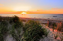
Cape Cod Bay, a leading tourist destination in Massachusetts
 
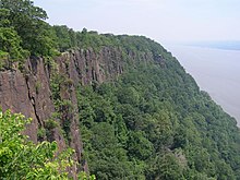
The Palisades along the Hudson River, New Jersey
 
U.S. Route 220 as it passes through Lamar Township, Pennsylvania

Topography

While most of the Northeastern United States lie in the Appalachian Highlands physiographic region, some are also part of the Atlantic coastal plain which extends south to the southern tip of Florida. The coastal plain areas (including Cape Cod in Massachusetts, Long Island in New York, most of New Jersey, Delaware, and the Chesapeake Bay in Maryland and Virginia) are generally low and flat, with sandy soil and marshy land. The highlands, including the Piedmont and the Appalachian Mountains, are generally heavily forested, ranging from rolling hills to summits greater than 6,000 feet (1,800 m), and pocked with many lakes. The highest peak in the Northeast is Mount Washington (New Hampshire), at 6,288 feet (1,917 m).

Land use

As of 2007, forest-use covered approximately 60% of the Northeastern states (including Delaware, Maryland, and the District of Columbia), about twice the national average. About 12% was cropland and another 4% grassland pasture or range. There is also more urbanized land in the Northeast (11%) than any other region in the U.S.

Climate

The climate of the Northeastern United States varies from northernmost Maine to southernmost Maryland. The climate of the region is created by the position of the general west to east flow of weather in the middle latitudes that much of the USA is controlled by and the position and movement of the subtropical highs. Summers are normally warm in northern areas to hot in southern areas. In summer, the building Bermuda High pumps warm and sultry air toward the Northeast, and frequent (but brief) thundershowers are common on hot summer days. In winter the subtropical high retreats southeastward, and the polar jet stream moves south bringing colder air masses from up in Canada and more frequent storm systems to the region. Winter often brings both rain and snow as well as surges of both warm and cold air.

The basic climate of the Northeast can be divided into a colder and snowier interior (Pennsylvania, New York State, and New England), and a milder coast and coastal plain from southern Rhode Island southward, including, New Haven, CT, New York City, Philadelphia, Trenton, Wilmington, Baltimore...etc.). Annual mean temperatures range from the low 50s F from Maryland to southern Connecticut, to the 40s F in most of New York State, New England, and northern Pennsylvania.

Wildlife

The Northeast has 72 National Wildlife Refuges, encompassing more than 500,000 acres (780 sq mi; 2,000 km2) of habitat, and designed to protect some of the 92 different threatened and endangered species living in the region.

Demographics

New York City, the most populous city in the Northeast and all of the United States
 
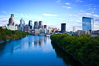
Philadelphia, the second most populous city in the Northeast and the sixth most populated city in the United States
 
Washington, D.C., the third most populous city in the Northeast and the capital of the United States
 
Boston, the most populated city in Massachusetts and New England and the fourth most populated city in the Northeast
 
As of the July 2013 U.S. Census Bureau estimate, the population of the region totaled 55,943,073. With an average of 345.5 people per square mile, the Northeast is 2.5 times as densely populated as the second-most dense region, the South. Since the last century, the U.S. population has been shifting away from the Northeast (and Midwest) toward the South and West.

The two U.S. Census Bureau divisions in the Northeast (New England and Mid-Atlantic) rank #2 and #1 among the 9 divisions in population density according to the 2013 population estimate. The South Atlantic region (233.1) was very close behind New England (233.2). Due to the faster growth of the South Atlantic region, it will take over the #2 division rank in population density in the next estimate, dropping New England to 3rd position. New England is projected to retain the number 3 rank for many, many years, as the only other lower-ranked division with even half the population density of New England is the East North Central division (192.1) and this region's population is projected to grow slowly.

State 2017 Estimate 2010 Census Change Area Density
Connecticut 3,588,184 3,574,097 +0.39% 4,842.35 sq mi (12,541.6 km2) 741/sq mi (286/km2)
Maine 1,335,907 1,328,361 +0.57% 30,842.90 sq mi (79,882.7 km2) 43/sq mi (17/km2)
Massachusetts 6,859,819 6,547,629 +4.77% 7,800.05 sq mi (20,202.0 km2) 879/sq mi (340/km2)
New Hampshire 1,342,795 1,316,470 +2.00% 8,952.64 sq mi (23,187.2 km2) 150/sq mi (58/km2)
Rhode Island 1,059,639 1,052,567 +0.67% 1,033.81 sq mi (2,677.6 km2) 1,025/sq mi (396/km2)
Vermont 623,657 625,741 −0.33% 9,216.65 sq mi (23,871.0 km2) 68/sq mi (26/km2)
New England 14,810,001 14,444,865 +2.53% 62,688.4 sq mi (162,362 km2) 236/sq mi (91/km2)
New Jersey 9,005,644 8,791,894 +2.43% 7,354.21 sq mi (19,047.3 km2) 1,225/sq mi (473/km2)
New York 19,849,399 19,378,102 +2.43% 47,126.36 sq mi (122,056.7 km2) 421/sq mi (163/km2)
Pennsylvania 12,805,537 12,702,379 +0.81% 44,742.67 sq mi (115,883.0 km2) 286/sq mi (111/km2)
Middle Atlantic 41,660,580 40,872,375 +1.93% 99,223.24 sq mi (256,987.0 km2) 420/sq mi (162/km2)
Total 56,470,581 55,317,240 +2.08% 161,911.64 sq mi (419,349.2 km2) 349/sq mi (135/km2)
Delaware 961,939 897,936 +7.13% 1,948.54 sq mi (5,046.7 km2) 494/sq mi (191/km2)
Maryland 6,052,177 5,773,785 +4.82% 9,707.24 sq mi (25,141.6 km2) 623/sq mi (241/km2)
District of Columbia 693,972 601,767 +15.32% 61.05 sq mi (158.1 km2) 11,367/sq mi (4,389/km2)
Total (Census + DE/MD/DC) 64,178,669 62,590,728 +2.54% 173,628.47 sq mi (449,695.7 km2) 370/sq mi (143/km2)

Economy

As of 2012, the Northeast accounts for approximately 23% of U.S. gross domestic product.

The Nuclear Regulatory Commission oversees 34 nuclear reactors, eight for research or testing and 26 for power production in the Northeastern United States.

New York City, considered a global financial center, is in the Northeast. 

The Federal Bureau of Prisons maintains 17 federal prisons and two affiliated private facilities in the region.

Transportation

The following table includes all eight airports categorized by the FAA as large hubs located in the Northeastern states (New England and Eastern regions):

Rank Metro area served Airport
code
Airport name Largest airline
1 New York JFK John F Kennedy International JetBlue (37%)
2 New York EWR Newark Liberty International United (49%)
3 Philadelphia PHL Philadelphia International American (80%)
4 Boston BOS General Edward Lawrence Logan International JetBlue (29%)
5 New York LGA La Guardia Delta (21%)
6 Baltimore/Washington BWI Baltimore/Washington International Thurgood Marshall Southwest (65%)
7 Washington IAD Washington Dulles International United (41%)
8 Washington DCA Ronald Reagan Washington National American (50%)

Culture

One geographer, Wilbur Zelinsky, asserts that the Northeast region lacks a unified cultural identity, but has served as a "culture hearth" for the rest of the nation. Several much smaller geographical regions within the Northeast have distinct cultural identities.

Landmarks

Almost half of the National Historic Landmarks maintained by the National Park Service are located in the Northeastern United States.

Religion

According to a 2009 Gallup poll, the Northeastern states differ from most of the rest of the U.S. in religious affiliation, generally reflecting the descendants of immigration patterns of the late 19th and early 20th centuries, with many Catholics arriving from Ireland, Italy, Canada, and eastern Europe. Massachusetts, Rhode Island, New York, and New Jersey are the only states in the nation where Catholics outnumber Protestants and other Christian denominations. More than 20% of respondents in Maine, New Hampshire, and Vermont declared no religious identity. Compared to other U.S. regions, the Northeast, along with the Pacific Northwest, has the lowest regular religious service attendance and the fewest people for whom religion is an important part of their daily lives.

Sports

The Northeast region is home to numerous professional sports franchises in the "Big Four" leagues (NFL, NBA, NHL, and MLB), with more than 100 championships collectively among them.

Notable golf tournaments in the Northeastern United States include the Deutsche Bank Championship, The Barclays, Quicken Loans National, and Atlantic City LPGA Classic. The US Open, held at New York City, is one of the four Grand Slam tennis tournaments, whereas the Washington Open is part of the ATP World Tour 500 series.

Notable Northeastern motorsports tracks include Watkins Glen International, Dover International Speedway, Pocono Raceway, New Hampshire Motor Speedway, and Lime Rock Park, which have hosted Formula One, IndyCar, NASCAR, and International Motor Sports Association races. Also, drag strips such as Englishtown, Epping, and Reading have hosted NHRA national events. Pimlico Race Course at Baltimore and Belmont Park at New York host the Preakness Stakes and Belmont Stakes horse races, which are part of the Triple Crown of Thoroughbred Racing.

The region has also been noted for the prevalence of the traditionally Northeastern sports of ice hockey and lacrosse.

Health

The rate of potentially preventable hospitalizations in the Northeastern United States fell from 2005 to 2011 for overall conditions, acute conditions, and chronic conditions.

Politics

The Northeastern United States tended to vote Republican in federal elections through the first half of the 20th century, but the region has since the 1990s shifted to become the most Democratic in the nation. Results from a 2008 Gallup poll indicated that eight of the top ten Democratic states were located in the region, with every Northeastern state having a Democratic party affiliation advantage of at least ten points. The following table demonstrates Democratic support in the Northeast as compared to the remainder of the nation.

Year % President vote % Senate seats % House seats
Northeast Remainder Northeast Remainder Northeast Remainder
2000 57.6 47.5 60.0 46.3 59.6 45.7
2002     60.0 45.0 58.3 44.7
2004 57.1 47.3 60.0 40.0 59.5 43.0
2006     75.0 45.0 73.8 48.3
2008 60.7 52.0 80.0 52.5 81.0 52.9
2010     75.0 47.5 67.9 38.5


Guadalupe Mountains

From Wikipedia, the free encyclopedia

Guadalupe Mountains
GuadalupeMtns 2006 cropped.jpg
Guadalupe Mountains
Highest point
PeakGuadalupe Peak
Elevation8,751 ft (2,667 m)
Coordinates31°53′28″N 104°51′36″WCoordinates: 31°53′28″N 104°51′36″W
Dimensions
Length65 mi (105 km) 
Width20 mi (32 km)
Geography
Guadalupe Mountains is located in Texas
Guadalupe Mountains
Guadalupe Mountains
Country United States
States Texas and  New Mexico
Borders onSacramento Mountains and Brokeoff Mountains
Geology
Age of rockPermian
Type of rockCarbonate sponge reef complex

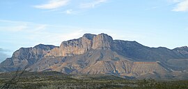
The Guadalupe Mountains (Spanish: Sierra de Guadalupe) are a mountain range located in West Texas and southeastern New Mexico. The range includes the highest summit in Texas, Guadalupe Peak, 8,751 ft (2,667 m), and the "signature peak" of West Texas, El Capitan, both of which are located within Guadalupe Mountains National Park. The Guadalupe Mountains are bordered by the Pecos River valley and Llano Estacado to the east and north, Delaware Mountains to the south, and Sacramento Mountains to the west.

History

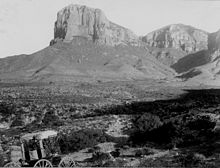
Guadalupe Mountains in 1899

Archaeological evidence has shown that people lived over 10,000 years ago in and among the many caves and alcoves. The first humans to live here were hunter-gatherers who followed large game and collected edible vegetation. Artifacts that support this include projectile points, baskets, pottery, and rock art.

The first Europeans to arrive in the area were the Spaniards in the 16th century, but they did not make serious attempts to settle in the Guadalupe Mountains. The Spanish introduced horses into the area, and nomadic indigenous tribes of the area such as the Apaches soon found horses to be an asset for hunting and migrating. Mescalero Apaches were nomadic and followed the game and harvested the agave (or mescal) for food and fiber. Mescalero is Spanish for mescal-maker. Agave-roasting pits and other artifacts of Mescalero culture can be found in the park.

Guadalupe Mountains in 2006
 
The Mescalero Apaches remained in the mountains through the mid-19th century, but they were challenged by an American transportation route at the end of the American Civil War. During the 1840s and 1850s, many people immigrating west crossed the area. In 1858, Pinery station was constructed near Pine Springs for the Butterfield Overland Mail. The Butterfield Overland Mail traveled over Guadalupe Pass located at 5,534 ft (1,687 m) above sea level. A cavalry was known as the Buffalo Soldiers was ordered to the area to stop Indian raids on settlements and mail stage routes. During the winter of 1869, Lt. H.B. Cushing led his troops into the Guadalupe Mountains and destroyed two Mescalero Apache camps. The Mescalero Apache were eventually driven out of the area and into US Indian reservations.

Felix McKittrick was one of the first European settlers in the Guadalupe Mountains; he worked cattle during the 1870s. McKittrick Canyon is thought to be named after him. Frijole Ranch was the first permanent ranch house; it was constructed in 1876 by the Rader brothers. Frijole Ranch House was the only major building in the region; it served as a community center and regional post office from 1916-1942. Today, the Frijole Ranch House has been restored and operates as a cultural museum. In 1908, Williams Ranch House was built, and it was named after one of its inhabitants, James Adolphus Williams. Judge J.C. Hunter from Van Horn consolidated most of the smaller ranches in the area into the Guadalupe Mountain Ranch. In 1921, Wallace Pratt, a geologist for Humble Oil and Refining Company, was impressed by the beauty of McKittrick Canyon and bought the land to build two homes in the canyon. Both constructions were used as summer homes by Pratt and his family until 1960. Wallace Pratt donated about 6,000 acres (24 km2) of McKittrick Canyon which became part of Guadalupe Mountains National Park. In 1978, the United States Congress designated 46,850 acres (190 km2) of the Texan side of the range as a U.S. Wilderness area, managed by the National Park Service.

Geography

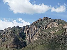
Hunter Peak
 
The Guadalupe Mountains reach their highest point at Guadalupe Peak, the highest point in Texas, with an elevation of 8,751 feet (2,667 m). The range lies southeast of the Sacramento Mountains and east of the Brokeoff Mountains. The mountain range extends north-northwest and northeast from Guadalupe Peak in Texas into New Mexico. The northeastern extension ends about 10 miles (16 km) southwest of Carlsbad, near White's City and Carlsbad Caverns National Park; the southwest tip ends with El Capitan about 90 miles (140 km) east of El Paso. The mountains rise more than 3,000 feet (910 m) above the arid floor of the Chihuahuan Desert. The Guadalupe Mountains are surrounded by the South Plains to the east and north, Delaware Mountains to the south, and Sacramento Mountains to the west. 

The Chihuahuan Desert surrounds the Guadalupe Mountains.
 
View of McKittrick Canyon from the Guadalupe Mountains.
 
The northwestern extension, bounded by a dramatic escarpment known as "The Rim", extends much further into New Mexico, to near the Sacramento Mountains. The range is bounded on the north by Four Mile Canyon; on the east by the valley of the Pecos River; and on the west by Piñon Creek, Big Dog Canyon, Valley Canyon, Middle Dog Canyon, and West Dog Canyon. Much of the range is built from the ancient Capitán Reef that formed at the margins of a shallow sea during the Permian period. The Guadalupian epoch of the Permian period is named for these mountains, and the Capitanian age within this epoch is named for the Capitan reef. For details on the area's geology, see Delaware Basin. As the range is built up almost entirely of limestone, upland areas have little or no surface water. The only significant surface water is McKittrick Creek, in McKittrick Canyon, which emerges from the eastern side of the massif, just south of the New Mexico border. Elevations at the base of the range vary from 4,000 feet (1,200 m) above sea level on the western side to 5,000 feet (1,500 m) on the east. Several peaks on the southern end exceed 8,000 feet (2,400 m).

The Guadalupe Mountains experience relatively hot summers, calm, mild autumn weather, and cool to cold weather in winter and early spring. Snow storms, freezing rain, or fog may occur in winter or early spring. Frequent high-wind warnings are issued during winter through spring. Late summer monsoons produce thunderstorms. The nights are cool, even in summer.

Ecology

Three major ecosystems are contained within the mountain range. First, deserts exhibit salt flats on the western side of the national park and creosote desert, with low elevations on the east covered with grassland, pinyon pine, and junipers such as alligator juniper and one-seeded juniper. Secondly, canyon interiors such as McKittrick, Bear, and Pine Springs Canyon on the southeast end exhibit maple, ash, chinquapin oak, and other deciduous trees. These trees are able to grow in the desert due to springs of water recharged by wet uplands. Finally, alpine uplands known as "the Bowl" exceeding elevations of 7,000 ft (2,100 m) are covered with denser forests of ponderosa pine, southwestern white pine, and douglas-fir, with small stands of aspen.

The range contains many world-class caves, including Carlsbad Caverns (the best known) and Lechuguilla Cave, discovered in 1986. The history of the range includes occupation by ancient Pueblo and Mogollon peoples, and by the Apache and various Anglo outlaws in the 19th century.

Big Bend National Park

From Wikipedia, the free encyclopedia

Big Bend
IUCN category II (national park)
Canyon, Rio Grande, Texas.jpeg
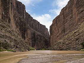
The Rio Grande runs through Cañón de Santa Elena. Mexico on the left and Big Bend National Park, U.S. on the right.
Map showing the location of Big Bend
Location in the United States
LocationChihuahuan Desert, Texas, United States
Nearest cityAlpine
Coordinates29°15′0″N 103°15′0″WCoordinates: 29°15′0″N 103°15′0″W
Area801,163 acres (3,242.19 km2)
EstablishedJune 12, 1944
Visitors440,091 (in 2018)
OperatorNational Park Service
WebsiteOfficial website 

Big Bend National Park is an American national park located in West Texas, bordering Mexico. The park has national significance as the largest protected area of Chihuahuan Desert topography and ecology in the United States. The park protects more than 1,200 species of plants, more than 450 species of birds, 56 species of reptiles, and 75 species of mammals.

Geological features in the park include sea fossils and dinosaur bones, as well as volcanic dikes. The area has a rich cultural history, from archeological sites dating back nearly 10,000 years to more recent pioneers, ranchers, and miners.

The park encompasses an area of 801,163 acres (1,251.8 sq mi; 3,242.2 km2). For more than 1,000 miles (1,600 km), the Rio Grande/Río Bravo forms the boundary between Mexico and the United States, and Big Bend National Park administers approximately 118 miles (190 km) along that boundary. The park was named after a large bend in the river, and the Texas—Mexico border.

Because the Rio Grande serves as an international boundary, the park faces unusual constraints while administering and enforcing park rules, regulations, and policies. In accordance with the Treaty of Guadalupe Hidalgo, the park's territory extends only to the center of the deepest river channel as the river flowed in 1848. The rest of the land south of that channel, and the river, lies within Mexican territory. The park is bordered by the protected areas of Parque Nacional Cañon de Santa Elena and Maderas del Carmen in Mexico.

Geography and climate

Park ranger on a horseback patrol near Santa Elena Canyon

According to the Köppen climate classification system, Big Bend National Park has a hot semi-arid climate (Bsh).

The park exhibits dramatic contrasts and its climate may be characterized as one of extremes. Dry and hot late spring and summer days often exceed 100 °F (38 °C) in the lower elevations. Winters are normally mild but subfreezing temperatures occasionally occur. Because of the range in altitude from about 1,800 feet (550 m) along the river to Emory Peak in the Chisos Mountains at 7,832 feet (2,387 m), a wide variation in available moisture and temperature exists throughout the park. These variations contribute to an exceptional diversity in plant and animal habitats. Some species in the park, such as the Chisos oak (Quercus graciliformis), are found nowhere else in the United States.

The 118 mi (190 km) of river that form the southern park boundary include the spectacular canyons of Santa Elena, Mariscal, and Boquillas. The Rio Grande, which meanders through this portion of the Chihuahuan Desert, has cut deep canyons with nearly vertical walls through three uplifts made primarily of limestone. Throughout the open desert areas, the highly productive Rio Grande riparian zone includes numerous plant and animal species and significant cultural resources. The vegetative belt extends into the desert along creeks and arroyos.

South of the border lie the Mexican states of Chihuahua and Coahuila and newly protected areas for flora and fauna, which are regions known as the Maderas del Carmen and the Cañón de Santa Elena.

Geology

Big Bend from space, 2002
 
Aerial view, 3D computer generated image
 
The oldest recorded tectonic activity in the park is related to the Paleozoic Marathon orogeny, although Proterozoic events (over 550 Mya) possibly have some deep control. The Marathon orogeny (part of the Ouachita-Marathon-Sonora orogenic belt) is part of thrusting of rocks from the South American Plate over the North American Plate. This can be best seen in the Persimmon Gap area of the park. This orogenic event is linked to the lack of Triassic- and Jurassic-age rocks in the park.

Between the Triassic and the Cretaceous, the South American Plate rifted from the North American Plate, resulting in the deposition of the Glen Rose Limestone, Del Carmen Limestone, Sue Peaks Formation, Santa Elena Limestone, Del Rio Clay, Buda Limestone, and Boquillas formations (preserved in the Sierra del Carmen–Santiago Mountains, Nine Point Mesa, Mariscal Mountain, and Mesa de Anguila areas). Also during this time, the Chihuahua trough formed as the Gulf of Mexico opened, which resulted in east-west striking normal faulting. As a result of this depositional time, dinosaur, forest and other fossils are preserved in the park.

Following the ending of rifting in the Late Cretaceous to the early Cenozoic, the Big Bend area was subjected to the Laramide orogeny. This period of (now east-west) compression caused the northeast-facing Mesa de Anguila (an uplifted monocline on the park's southwest margin), the southwest-facing Sierra del Carmen–Santiago Mountains (an uplifted and thrust-faulted monocline that forms the park's boundary on the east) and the Tornillo Basin. During the middle Cenozoic, most of the volcanic rocks, including the Chisos group, the Pine Canyon caldera complex, and the Burro Mesa Formation, formed.

The most recent tectonic activity in the park is basin and range faulting from the Neogene to Quaternary. This period of east-west extension has resulted in Estufa and Dehalo bolsons in the Chisos Mountains, as well as the Terlingua and Sierra del Carmen, Chalk Draw, and Burro Mesa faults. The Rio Grande has entered the Big Bend area roughly 2 million years ago, and since then, extensive erosion and downcutting have occurred.

Cultural resources

Cultural resources in the park range from the Paleo-Indian period 10,500 years ago through the historic period represented by Native American groups, such as the Chisos, Mescaleros, and Comanche. More recently, Spanish, Mexican, Anglo, and Irish settlers farmed, ranched, and mined in the area. 

Throughout the prehistoric period, humans found shelter and maintained open campsites throughout the park. The archeological record reveals an Archaic-period desert culture, whose inhabitants developed a nomadic hunting and gathering lifestyle that remained virtually unchanged for several thousand years. 

The historic cultural landscape centers upon various subsistence or commercial land uses. The riparian and tributary environments were used for subsistence and irrigation farming. Transportation networks, irrigation structures, simple domestic residences and outbuildings, and planed and terraced farm land lining the stream banks characterize these landscapes.

Human history

Pine Canyon Falls

During the early historic period (before 1535) several Indian groups were recorded as inhabiting the Big Bend. The Chisos Indians were a loosely organized group of nomadic hunters and gatherers who probably practiced limited agriculture on a seasonal basis. The origin of the Chisos Indians is not known. Linguistically, they were associated with the Conchos Indians of northern Chihuahua and northwestern Coahuila. Their language group spoke a variation of Uto-Aztecan, a language whose speakers ranged from central Mexico to the Great Basin of the U.S.

The Jumano was a nomadic group that traveled and traded throughout West Texas and southeastern New Mexico, but some historic records indicate they were enemies of the Chisos. Around the beginning of the 18th century, the Mescalero Apaches began to invade the Big Bend region and displaced the Chisos Indians. One of the last Native American groups to use the Big Bend was the Comanches, who passed through the park along the Comanche Trail on their way to and from periodic raids into the Mexican interior. These raids continued until the mid-19th century. The last of the great military leaders of the native peoples of the region was an Apache of Spanish ancestry named Alzate, who was active as late as the late 1860s.

The European presence in the region begins circa 1535 AD with the first Spanish explorations into this portion of North America. The expedition of Álvar Núñez Cabeza de Vaca passed near the Big Bend and was followed by other expeditions. Some of these expeditions were searching for gold and silver, or farm and ranch land. Others, such as those by the Franciscan missionaries, were intended to establish centers in which the natives could be evangelized. In an attempt to protect the northern frontier of the New Spain, from which emerged present-day Mexico, a line of presidios, or forts, was established along the Rio Grande in the late 18th century. The Presidio de San Vicente was built near present-day San Vicente, Coahuila, and the Presidio de San Carlos was built near present-day Manuel Benavides, Chihuahua. Some of the presidios were soon abandoned, because of financial difficulties and because they could not effectively stop Indian intrusions into Mexico. The soldiers and settlers of these presidios moved to newer presidios where the interests of the Spanish Empire were more defensible. Such was the case of Santa Rosa Maria del Sacramento, now Muzquiz, Coahuila. 

Very little study has been made of the Spanish occupation of the Big Bend following the abandonment of the presidios. In 1805, a Spanish settlement called Altares existed 30 mi (48 km) south of the Rio Grande. The region became a part of Mexico when it achieved its independence from Spain in 1821. Mexican families lived in the area when English-speaking settlers began arriving following the secession of Texas during the latter half of the 19th century. 

Following the end of the Mexican–American War in 1848, the U.S. Army made military surveys of the uncharted land of the Big Bend. Forts and outposts were established across Trans-Pecos Texas to protect migrating settlers from Indian attacks. A significant proportion of the soldiers in the late 1800s were African American and came to be called the "buffalo soldiers", a name apparently given to them by the Native Americans. Lieutenant Henry Flipper, the first American of African ancestry to graduate from West Point, served in Shafter, Texas, near the end of the 19th century. (Shafter, named for General William R. Shafter, lies west of the Big Bend along the highway from Presidio to Marfa.) Ranchers began to settle in the Big Bend about 1880, and by 1900, sheep, goat, and cattle ranches occupied most of the area. The delicate desert environment was soon overgrazed

In the late 19th and early 20th century, valuable mineral deposits were discovered and brought settlers who worked in the mines or supported the mines by farming or by cutting timber for the mines and smelters. Communities sprang up around the mines. Boquillas and Terlingua both resulted from mining operations. During this period, the Rio Grande flood plain was settled by farmers. Settlements developed with names like Terlingua Abajo, San Vicente, La Coyota, and Castolon. Often, no more than clusters of families were living and farming in the same area, and they were successful only to the degree that the land was able to support them. 

In the 1930s, many people who loved the Big Bend country saw that it was a land of unique contrast and beauty that was worth preserving for future generations. In 1933, the Texas Legislature passed legislation to establish Texas Canyons State Park. Later that year, the park was redesignated Big Bend State Park. In 1935, the United States Congress passed legislation that would enable the acquisition of the land for a national park. The State of Texas deeded the land that it had acquired to the federal government, and on June 12, 1944, Big Bend National Park became a reality. The park opened to visitors on July 1, 1944.

Flora and fauna

Despite its harsh desert environment, Big Bend has more than 1,200 species of plants (including 60 cactus species), over 600 species of vertebrates, and about 3,600 insect species. The variety of life is largely due to the diverse ecology and changes in elevation between the dry, hot desert, the cool mountains, and the fertile river valley. 

Most of the animals are not visible in the day, particularly in the desert. The park comes alive at night, with many of the animals foraging for food. About 150 cougar (Puma concolor) sightings are reported per year, despite the fact that only two dozen cougars live in the park. Other species that inhabit the park include coyote (Canis latrans), kangaroo rat (Dipodomys spp.), greater roadrunner (Geococcyx californianus), golden eagle (Aquila chrysaetos), gray fox (Urycon cinereoargenteus), collared peccary (Pecari tajacu), and black-tailed jackrabbit (Lepus californicus). Mexican black bears (Ursus americanus eremicus) are also present in the mountain areas. 

Pink bluebonnets
 
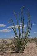
The variety of cactus and other plant life add color to the Big Bend region. Cactus species in the park include prickly pear (Opuntia spp.), claretcup (Echinocereus coccineus), and pitaya (E. enneacanthus). In the spring, the wildflowers are in full bloom and the yucca flowers display bright colors. Bluebonnets (Lupinus spp.) are prevalent in Big Bend, and white and pink bluebonnets are sometimes visible by the road. Other flowering plants such as the desert marigold (Baileya multiradiata), desert willow (Chilopsis linearis), ocotillo (Fouquieria splendens), rock nettle (Eucnide urens), and lechuguilla (Agave lechuguilla) abound in Big Bend. 

The first U.S. record of the northern tufted flycatcher (Mitrephanes phaeocercus), a Central American species, was from this site in November 1991. Birders also flock to the park, as it is home to the only area in the United States within the breeding range of the Colima warbler (Vermivora crissalis). 

Plans to reintroduce the Mexican wolf to Big Bend National Park were rejected in the late 1980s by the state of Texas. Disagreement over the reintroduction included the question of whether the park contained enough prey animals, such as deer and javelinas, to sustain a wolf population.

Tourism

Big Bend is one of the largest, most remote, and one of the least-visited national parks in the contiguous United States. In the 10 year period from 2007 to 2016, an average of about 352,000 visitors entered the park annually.

Balanced Rock in the Grapevine Hills
 
Big Bend's primary attraction is its hiking and backpacking trails. Particularly notable among these are the Chimneys Trail, which visits a rock formation in the desert; the Marufo Vega trail, a loop trail that passes through scenic canyons on the way to and from the Rio Grande; the South Rim trail which circles the high mountains of the Chisos; and the Outer Mountain Loop trail in the Chisos, which incorporates parts of the South Rim loop, descends into the desert along the Dodson Trail, and then returns to the Chisos Basin, completing a 30-mile loop. Other notable locations include Santa Elena Canyon, Grapevine Hills, and the Mule Ears, two imposing rock towers in the middle of the desert. Professional backpacking guide services provide trips in the park.

The park administers 118 miles (190 km) of the Rio Grande for recreational use. Professional river outfitters provide tours of the river. Use of a personal boat is permitted, but a free river float permit is required. In June 2009, the Department of Homeland Security began treating all float trips as trips that had left the country and required participants to have an acceptable form of identification such as a passport to re-enter the country.

Visitors often cross the Rio Grande to visit the Mexican village of Boquillas. The Department of Homeland Security closed the border crossing in 2002 due to increased security following the September 11 attacks, but in April 2013, the Boquillas crossing reopened as an official Class B Port of Entry between the U.S. and Mexico. It is open Wednesday through Sunday between 9 am and 6 pm.

With more than 450 species of birds recorded in the park, a widely popular activity is birdwatching. Many species stop in the park during their annual migrations.

Five paved roads are in Big Bend. Persimmon Gap to Panther Junction is a 28-mile (45 km) road from the north entrance of the park to park headquarters at Panther Junction. Panther Junction to Rio Grande Village is a 21-mile (34 km) road that descends 2,000 feet (610 m) from the park headquarters to the Rio Grande. Maverick Entrance Station to Panther Junction is a 23-mile (37 km) route from the western entrance of the park to the park headquarters. Chisos Basin Road is 6 miles (10 km) long and climbs to 5,679 feet (1,731 m) above sea level at Panther Pass before descending into the Chisos Basin. The 30-mile (48 km) Ross Maxwell Scenic Drive leads to the Castolon Historic District and Santa Elena Canyon.

Certified dark-sky park

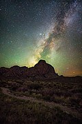
In 2012, the park was designated an international dark-sky park by the International Dark-Sky Association. The association also recognized the park with its Gold Tier designation as "free from all but the most minor impacts of light pollution." Measurements made by the National Park Service show that Big Bend has the darkest skies in the contiguous United States. Thousands of stars, bright planets, and the Milky Way are visible on clear nights.

Gallery

Emory Peak's summit, the highest point in Big Bend National Park

Lie group

From Wikipedia, the free encyclopedia https://en.wikipedia.org/wiki/Lie_group In mathematics , a Lie gro...